Items Similar to Antique Map of the City of Leuven, Belgium, with Original Coloring, 1609


Want more images or videos?
Request additional images or videos from the seller
1 of 7
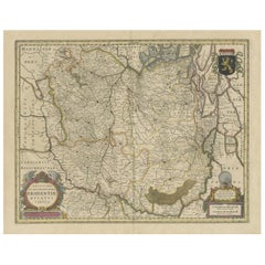
Antique Map of the City of Leuven, Belgium, with Original Coloring, 1609
About the Item
An original antique map titled "Lovanium Brabantiarum," which depicts the city of Leuven in Belgium in old hand-colouring. The map is notable for its circular layout of the city, detailed illustration of streets, buildings, and the surrounding landscape, which includes fields divided into geometric shapes, possibly indicating farmland.
At the bottom left, there is a decorative cartouche with the inscription: “LOVANIUM Brabantiarum / urbium caput unica Musarum / ac prestantissimarum artium / sedes optantissimumque domiciliu”. This can be translated to "Leuven, the capital of Brabant, the unique seat of the Muses and of the most excellent arts, and a most desirable residence." The phrase underscores Leuven's importance as a cultural and artistic hub.
On the bottom right of the map, there are three figures dressed in elegant attire of the era, standing on a hill and seemingly observing the city. Their presence might be symbolic, representing the city's welcoming nature or its appeal to travelers and scholars.
The top corners of the map feature the coats of arms of the city, adding a heraldic element to the map that emphasizes its status and identity.
This map is a product of the work by Lodovico Guicciardini, an Italian writer and merchant from Florence, who resided mostly in Antwerp. Guicciardini was born on August 19, 1521, and died on March 22, 1589. He was also the nephew of the historian and diplomat Francesco Guicciardini.
The map is from "Beschryvinghe van alle de Nederlanden (...)" by Lodovico Guicciardini and was published by Willem Janszoon Blaeu in 1609. Blaeu was a notable Dutch cartographer, atlas maker, and publisher from the Dutch Golden Age of cartography.
The level of detail in the map and its features would have made it not just a navigational tool but also a piece of artwork, capturing the essence of Leuven at the time of its creation. It’s a fascinating snapshot of urban geography and a testament to the craftsmanship of cartography in the early modern period.
- Dimensions:Height: 11.74 in (29.8 cm)Width: 13.94 in (35.4 cm)Depth: 0.02 in (0.5 mm)
- Materials and Techniques:
- Period:Early 17th Century
- Date of Manufacture:1609
- Condition:Repaired: repair on the folding line. Original/contemporary hand coloring. Shows toning and signs of previous framing. Repair on folding line, blank verso. A map rich with patina. Please study image carefully.
- Seller Location:Langweer, NL
- Reference Number:
About the Seller
5.0
Platinum Seller
These expertly vetted sellers are 1stDibs' most experienced sellers and are rated highest by our customers.
Established in 2009
1stDibs seller since 2017
1,916 sales on 1stDibs
Typical response time: <1 hour
- ShippingRetrieving quote...Ships From: Langweer, Netherlands
- Return PolicyA return for this item may be initiated within 14 days of delivery.
More From This SellerView All
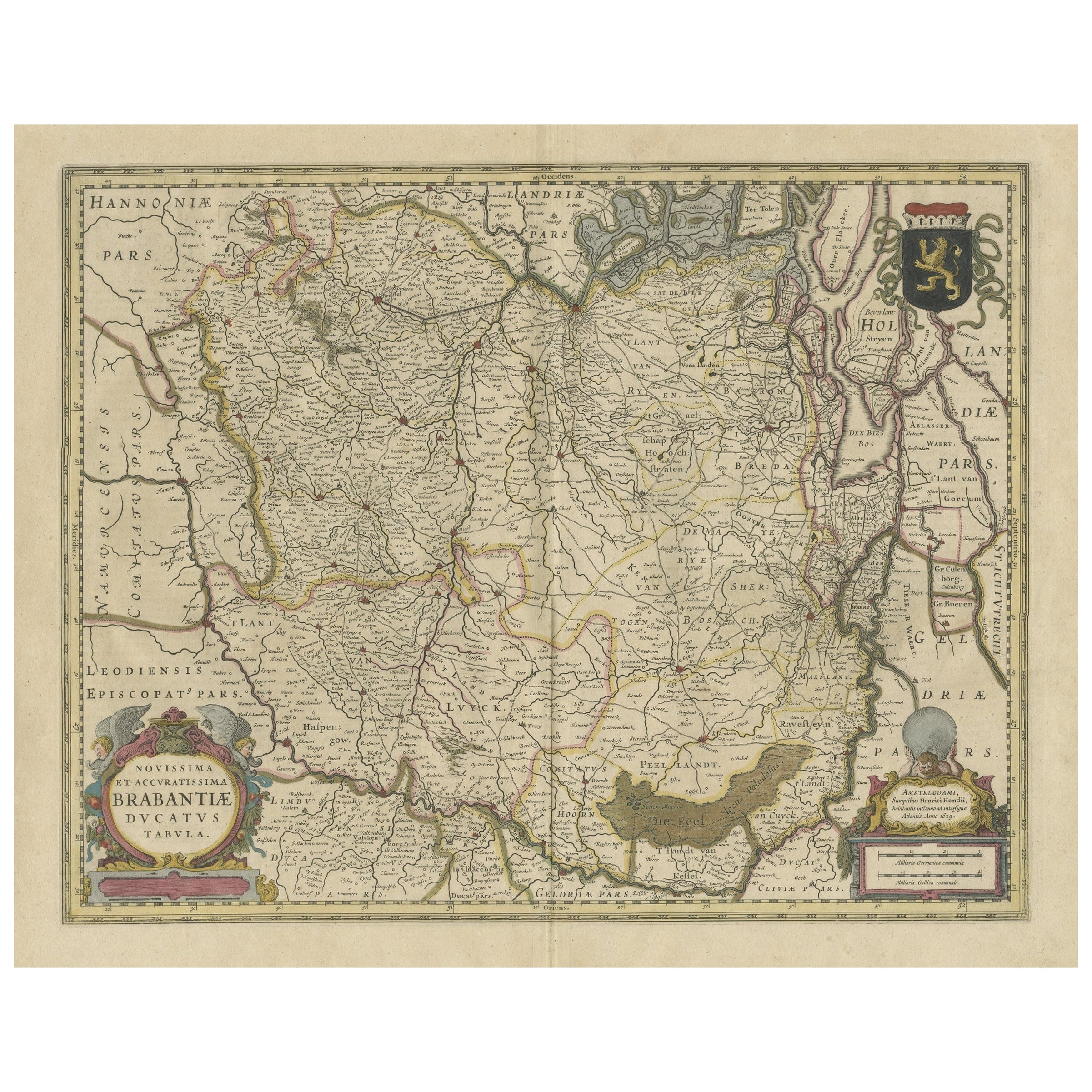
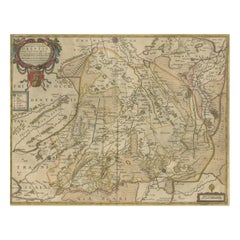
- Antique Map of Brabant, the Netherlands, with Original Hand ColoringLocated in Langweer, NLOriginal antique map titled 'Novissima et Accuratissima Brabantiae Ducatus Tabula'. Old map of Brabant, the Netherlands. North is to the right. Like all other maps of Brabantiae Duca...Category
Antique Mid-17th Century Maps
MaterialsPaper
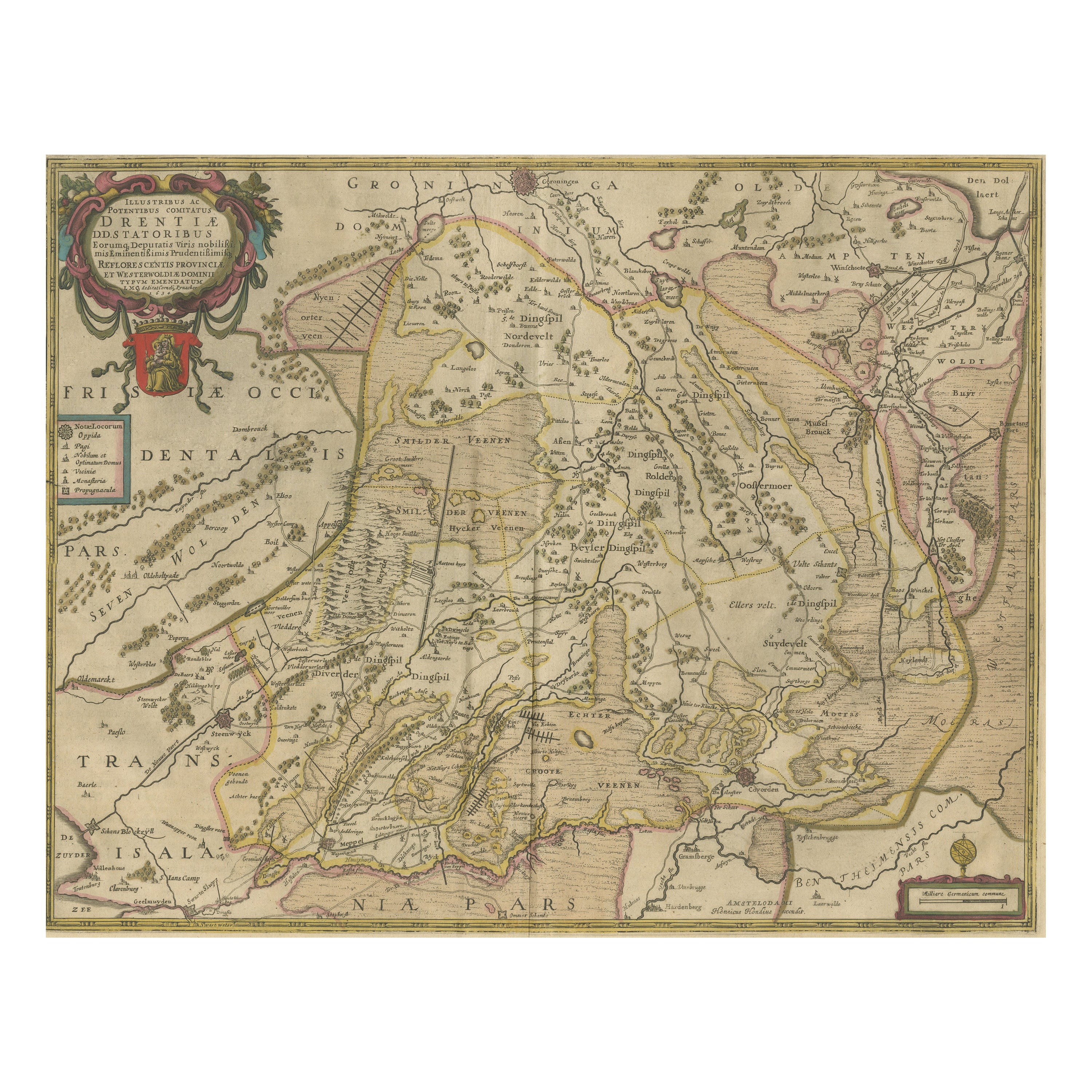
- Antique Map of Drenthe, the Netherlands, with Original Hand ColoringLocated in Langweer, NLOriginal antique map titled 'Illustribus ac Potentibus Comitatus Drentiae (..)'. Old map of the province of Drenthe, the Netherlands. Published by H. Hondius circa 1639. Hendrik ...Category
Antique Mid-17th Century Maps
MaterialsPaper
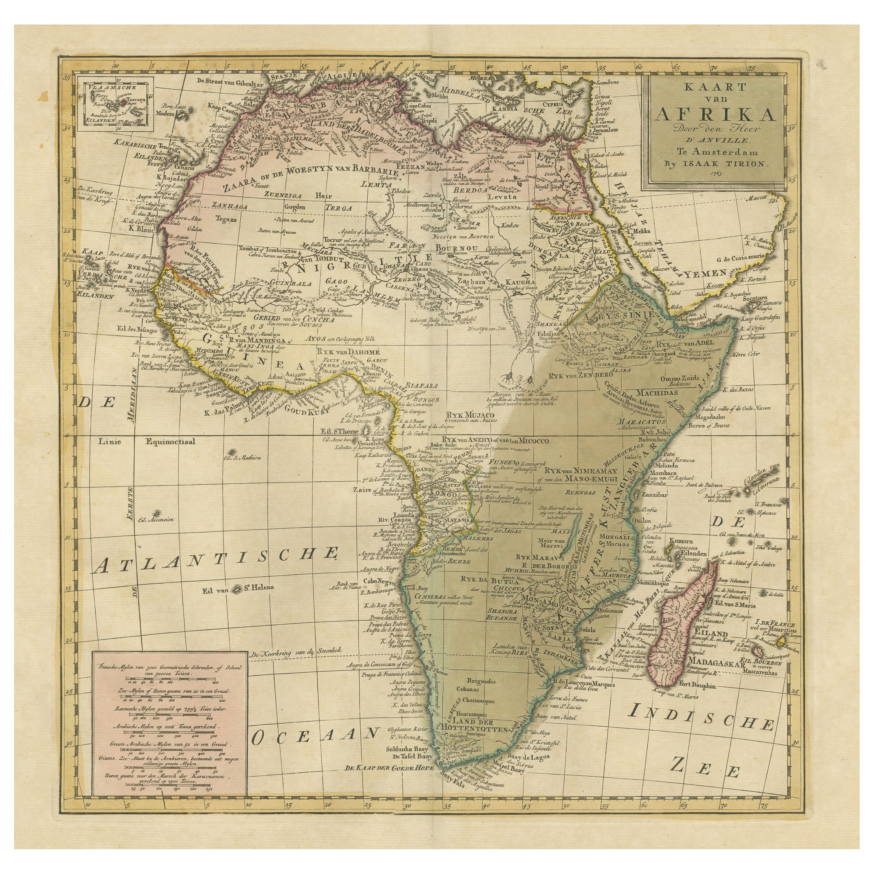
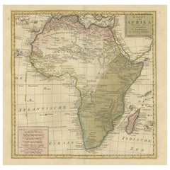
- Antique Map of Africa with Original Hand ColoringLocated in Langweer, NLAntique map titled 'Kaart van Afrika door den Heer d'Anville'. Detailed original old map of Africa, with very small inset map titled 'Vlaamsche Eilanden', which shows the Azores. Pub...Category
Antique Mid-18th Century Maps
MaterialsPaper
- Original Antique Map of England with Hand ColoringLocated in Langweer, NLAntique map titled 'Engand'. Original old map of England. Engraved by W. Milton. Published by John Mc. Gowan, circa 1829.Category
Antique Mid-19th Century Maps
MaterialsPaper
- Original Antique Map of England with Outline ColoringLocated in Langweer, NLAntique map titled 'Angleterre'. Original old map of England with outline coloring. Source unknown, to be determined. Published circa 1830.Category
Antique Mid-19th Century Maps
MaterialsPaper
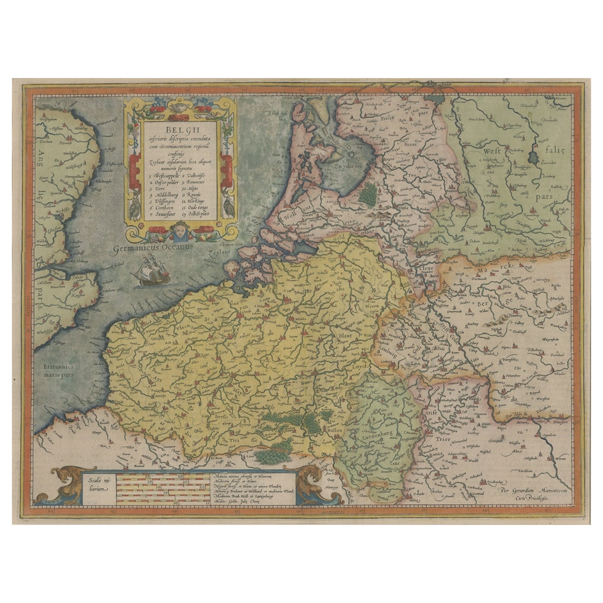
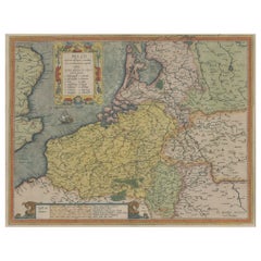
- Original Antique Map the Imperial States of the Habsburg Netherlands, 1609Located in Langweer, NLAntique map titled 'Belgii inferioris descriptio (..)'. Old map of the Seventeen Provinces, the Imperial states of the Habsburg Netherlands in the 16th century. They roughly cove...Category
Antique Early 1600s Maps
MaterialsPaper


You May Also Like
- Original Antique Map of Belgium by Tallis, Circa 1850Located in St Annes, LancashireGreat map of Belgium Steel engraving Many lovely vignettes Published by London Printing & Publishing Co. ( Formerly Tallis ), C.1850 Origin...Category
Antique 1850s English Maps
MaterialsPaper
- Original Antique Map / City Plan of Brussels by Tallis, circa 1850Located in St Annes, LancashireGreat map of Brussels. Steel engraving. Published by London Printing & Publishing Co. (Formerly Tallis), C.1850 Free shipping.Category
Antique 1850s English Maps
MaterialsPaper
- Large Original Antique Map of The World, Fullarton, C.1870Located in St Annes, LancashireGreat map of the World. Showing both hemispheres From the celebrated Royal Illustrated Atlas Lithograph. Original color. Published by Fullarton, Edinburgh, C.1870 Unframed. Rep...Category
Antique 1870s Scottish Maps
MaterialsPaper
- Original Antique Map of the American State of Nevada, 1889Located in St Annes, LancashireGreat map of Nevada Drawn and Engraved by W. & A.K. Johnston Published By A & C Black, Edinburgh. Original colour Unframed.Category
Antique 1880s Scottish Victorian Maps
MaterialsPaper
- Original Antique Map of the American State of Oregon, 1889Located in St Annes, LancashireGreat map of Oregon Drawn and Engraved by W. & A.K. Johnston Published By A & C Black, Edinburgh. Original colour Unframed.Category
Antique 1880s Scottish Victorian Maps
MaterialsPaper
- Original Antique Map of the American State of Pennsylvania, 1889Located in St Annes, LancashireGreat map of Pennsylvania Drawn and Engraved by W. & A.K. Johnston Published By A & C Black, Edinburgh. Original colour Unframed. Repair to a minor tear on bottom edge.Category
Antique 1880s Scottish Victorian Maps
MaterialsPaper


