Items Similar to Antique Map Depicting Sydney and Surrounding Areas, Known as Port Jackson, c1889

Want more images or videos?
Request additional images or videos from the seller
1 of 9
Antique Map Depicting Sydney and Surrounding Areas, Known as Port Jackson, c1889
About the Item
An antique map depicting Sydney and its surrounding areas, known as Port Jackson, dating from around 1889. It was produced by E. Reclus and is part of the "Nouvelle géographie universelle : la terre et les hommes," which translates to "New Universal Geography: The Earth and Its Inhabitants," published in Paris.
The map is a color-printed engraving, a common technique of the time, which allowed for both detailed cartographic information and attractive presentation. As noted, the map is in good condition with a center fold, which is typical for maps that were included in books or atlases.
The level of detail is significant, showing individual bays, points, and natural features, which suggests it was made for both navigational purposes and to provide a comprehensive overview of the Sydney region during the late 19th century. It extends from Manly in the north, Bondi in the south, and west to Ironstone Bay, which is not a commonly referenced area today and might be an historical name or a translation of a local name from that time.
The map is also an interesting artifact for those studying the historical geography of Sydney, as it shows the city before major 20th-century developments.
- Dimensions:Height: 10.16 in (25.8 cm)Width: 13.39 in (34 cm)Depth: 0 in (0.02 mm)
- Materials and Techniques:
- Period:
- Date of Manufacture:circa 1889
- Condition:In good condition, with centre fold as issued.
- Seller Location:Langweer, NL
- Reference Number:
About the Seller
5.0
Platinum Seller
These expertly vetted sellers are 1stDibs' most experienced sellers and are rated highest by our customers.
Established in 2009
1stDibs seller since 2017
1,919 sales on 1stDibs
Typical response time: <1 hour
- ShippingRetrieving quote...Ships From: Langweer, Netherlands
- Return PolicyA return for this item may be initiated within 14 days of delivery.
More From This SellerView All
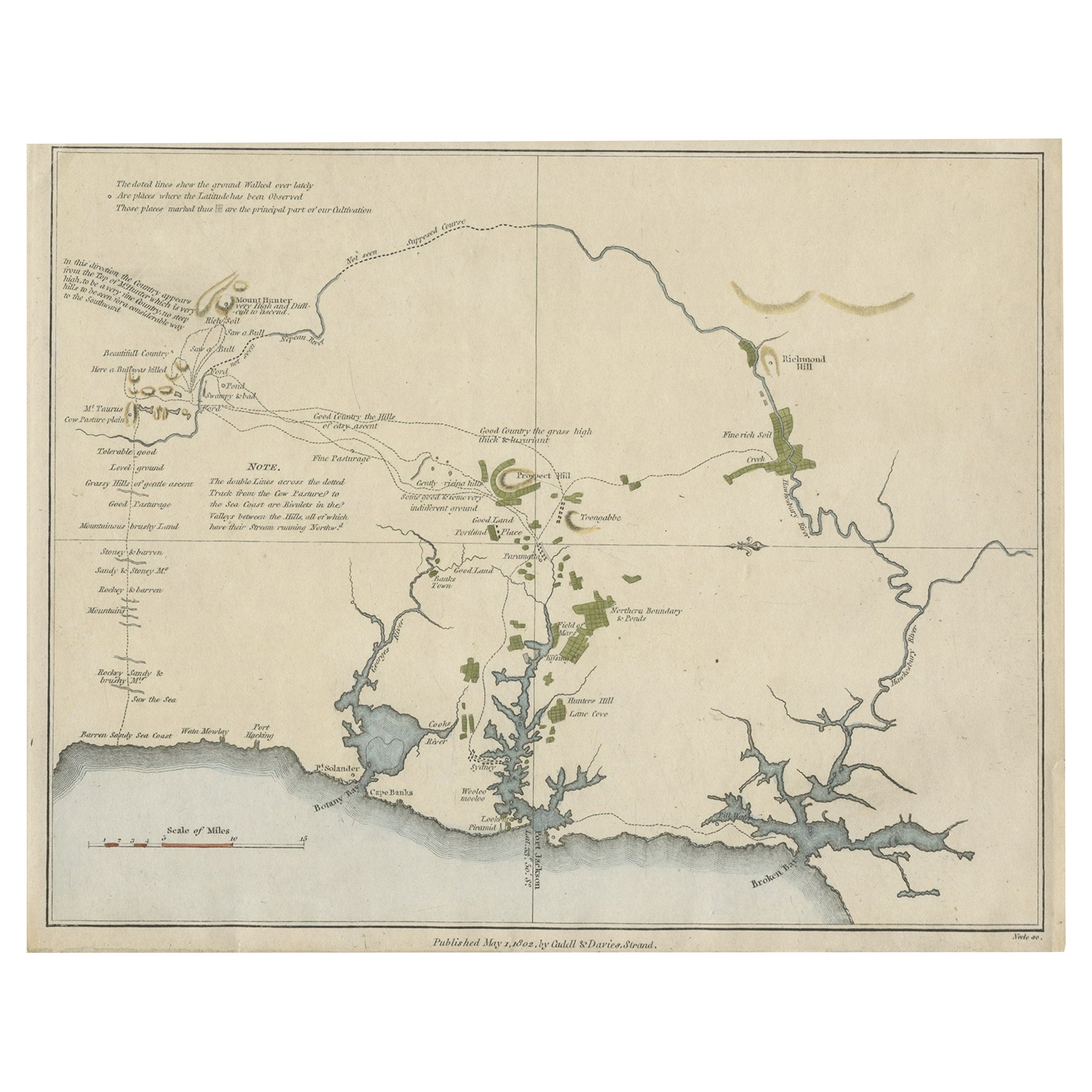
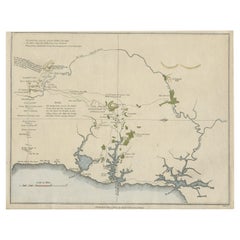
- Early Map of Sydney with Botany Bay, Port Jackson & Broken Bay, Australia, 1802Located in Langweer, NLInteresting chart of the three harbours of Botany Bay, Port Jackson, and Broken Bay showing the ground cultivated by the colonists. In the early days of the settlement in Australia t...Category
Antique Early 1800s Maps
MaterialsPaper
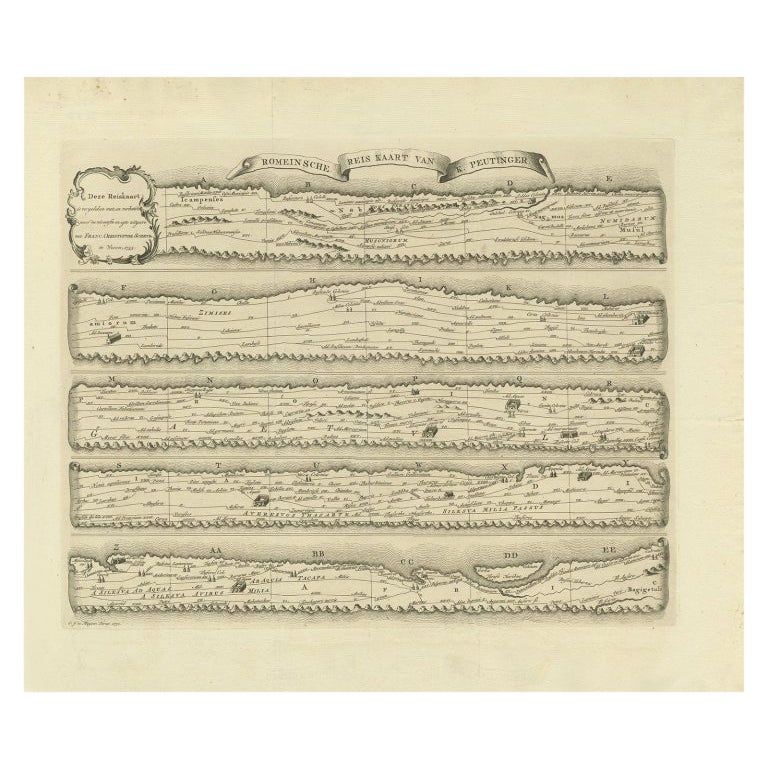
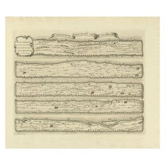
- Antique Map Made After a Roman Papyrus Travel Map, Known as Peutinger Map, 1773Located in Langweer, NLOld Dutch engraving with title: 'Romeinsche Reis Kaart van K. Peutinger'. Rare antique map based on the original 'Peutinger' map, the map has the shape of papyrus scrolls. Originat...Category
Antique 18th Century Maps
MaterialsPaper
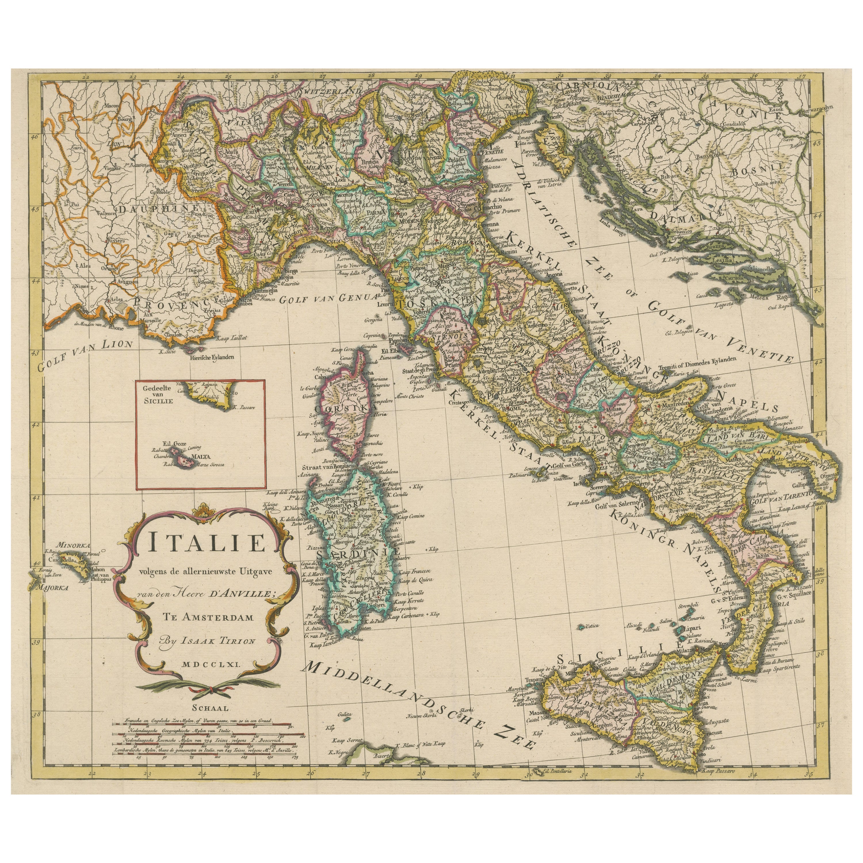
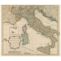
- Detailed Antique Map of Italy and surrounding IslandsLocated in Langweer, NLAntique map titled 'Italie volgens de allernieuwste Uitgave van den Heere d'Anville'. Very detailed antique map, based on D'Anville's important map of It...Category
Antique Mid-18th Century Maps
MaterialsPaper
- Antique Map of Champagne and surrounding Regions, FranceLocated in Langweer, NLAntique map titled 'Carte de la Champagne et des Pays Voisins (..)'. Detailed map of Champagne and surrounding regions of Chalons and Soissons, Reims, Vedun, Mouzon, Sean, Charlemont...Category
Antique Mid-18th Century Maps
MaterialsPaper
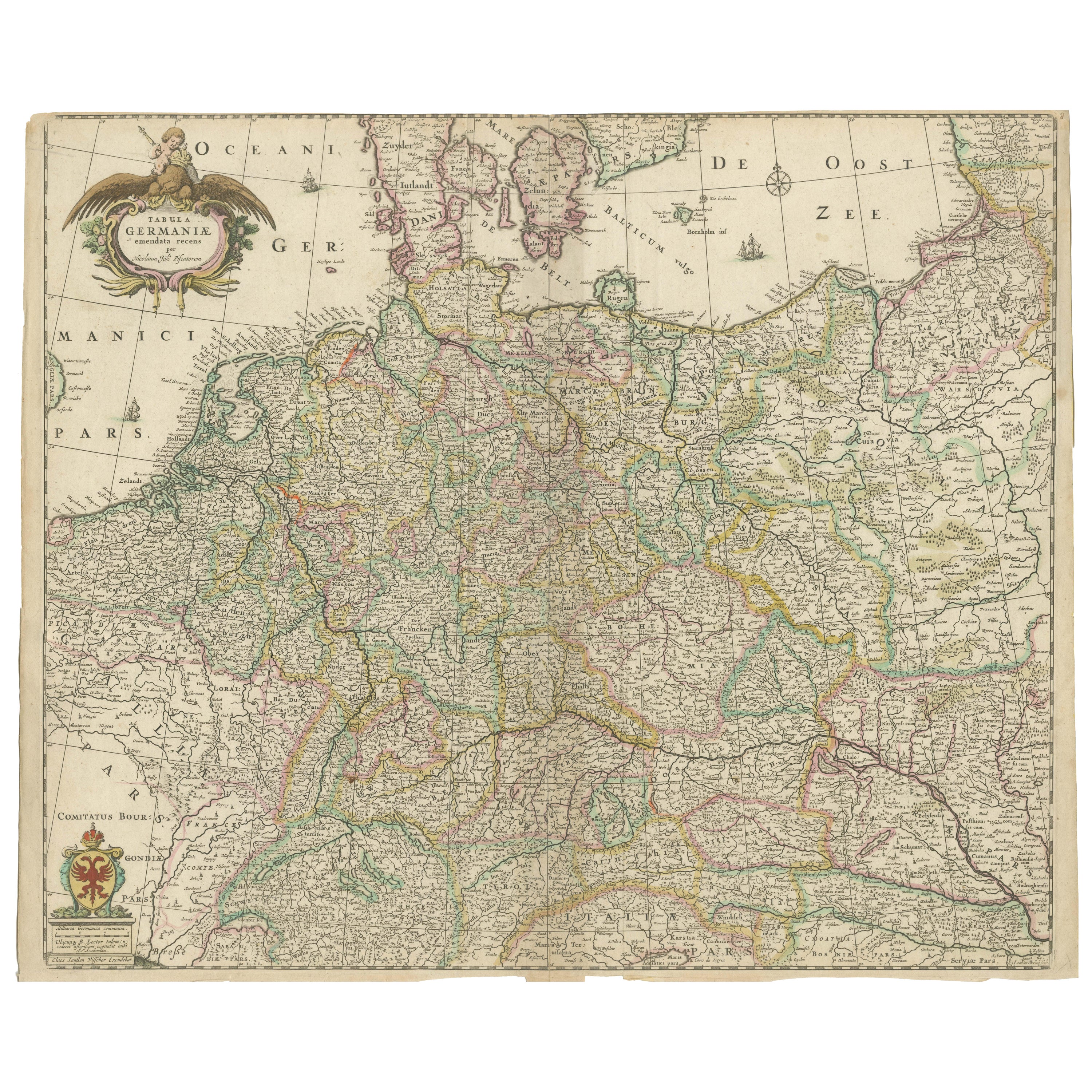
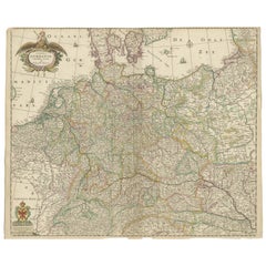
- Antique Map of Germany including surrounding countriesLocated in Langweer, NLAntique map titled 'Tabula Germaniae'. Orginal antique map of Germany by Claes Jansz. Visscher. Published circa 1650. including the Low Countries, Switze...Category
Antique Mid-17th Century Maps
MaterialsPaper
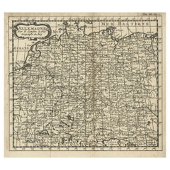
- French Antique Miniature Map of Germany and Surrounding Countries, 1721Located in Langweer, NLAntique map Germany titled 'Allemagne Par N. Sanson le Fils Geographe du Roy'. Minitaure map of Germany and surroundings. Originates from 'Introduc...Category
Antique 18th Century Maps
MaterialsPaper

You May Also Like
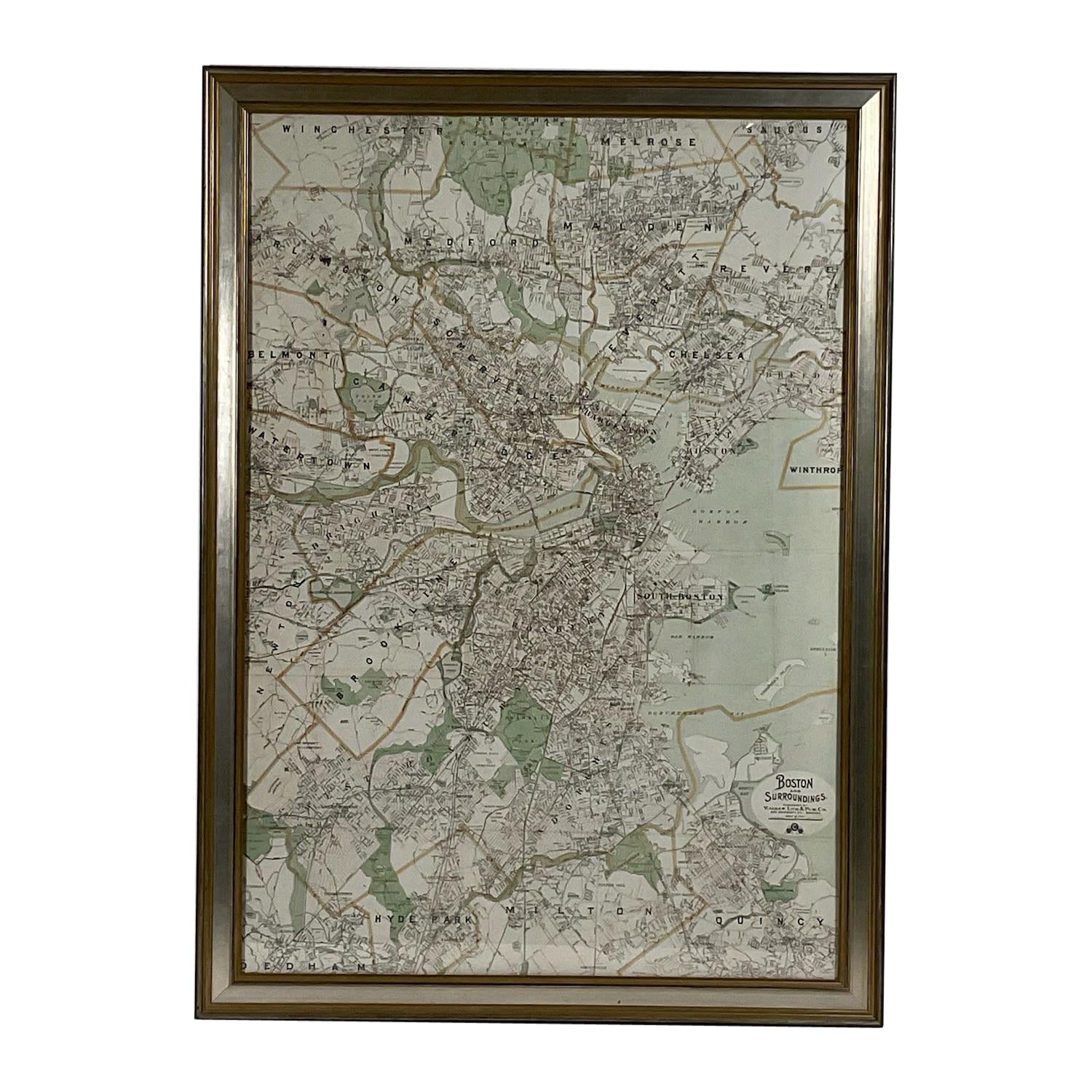
- Map of Boston and Surrounding TownsLocated in Norwell, MALater copy of a nineteenth century map of Boston and surrounding towns. Showing parts of Quincy, Milton, Hyde Park, Winthrop and Revere. Showing all of B...Category
Antique 19th Century North American Maps
MaterialsPaper
- Original Antique Map of Missouri, 1889Located in St Annes, LancashireGreat map of Missouri Drawn and Engraved by W. & A.K. Johnston Published By A & C Black, Edinburgh. Original colour Unframed.Category
Antique 1880s Scottish Victorian Maps
MaterialsPaper

- Original Antique Map of New Brunswick and Nova Scotia, 1889Located in St Annes, LancashireGreat map of New Brunswick and Nova Scotia Drawn and Engraved by W. & A.K. Johnston Published By A & C Black, Edinburgh. Original colour Unfr...Category
Antique 1880s Scottish Victorian Maps
MaterialsPaper
- Original Antique Map of the American State of Pennsylvania, 1889Located in St Annes, LancashireGreat map of Pennsylvania Drawn and Engraved by W. & A.K. Johnston Published By A & C Black, Edinburgh. Original colour Unframed. Repair to a minor tear on bottom edge.Category
Antique 1880s Scottish Victorian Maps
MaterialsPaper
- Original Antique Map of the American State of Washington, 1889Located in St Annes, LancashireGreat map of Washington Drawn and Engraved by W. & A.K. Johnston Published By A & C Black, Edinburgh. Original colour Unframed.Category
Antique 1880s Scottish Victorian Maps
MaterialsPaper
- Original Antique Map of the American State of Nevada, 1889Located in St Annes, LancashireGreat map of Nevada Drawn and Engraved by W. & A.K. Johnston Published By A & C Black, Edinburgh. Original colour Unframed.Category
Antique 1880s Scottish Victorian Maps
MaterialsPaper


Recently Viewed
View AllMore Ways To Browse
Greek Map 1920
Marne Map
Antique Slovenia
Galicia Map
Antique Maps Sumatra
Santa Cruz Solomon Islands
Georg Barque
F V Hayden
Original Antique Map Of World
Map Zanzibar
Matthew Seutter On Sale
Minature Map
Vincenzo Coronelli On Sale
1681 Moses Pitt
Anguilla Map
Antique Cabbage Cutter
Antique Maps Denver
Antique Maps Washington Dc