Items Similar to French Antique Miniature Map of Germany and Surrounding Countries, 1721

Want more images or videos?
Request additional images or videos from the seller
1 of 6
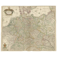
French Antique Miniature Map of Germany and Surrounding Countries, 1721
About the Item
Antique map Germany titled 'Allemagne Par N. Sanson le Fils Geographe du Roy'. Minitaure map of Germany and surroundings. Originates from 'Introduction a l'Histoire de l'Univers' by S. Pufedorff's. Artists and Engravers: Published by H. Chatelain, Amsterdam.
Artist: Published by H. Chatelain, Amsterdam.
Condition: Good, age-related toning. Please study image carefully.
Date: 1721
Overall size: 0.001 x 18.5 x 16.5 cm.
Image size: 16 x 14 cm.
We sell original antique maps to collectors, historians, educators and interior decorators all over the world. Our collection includes a wide range of authentic antique maps from the 16th to the 20th centuries. Buying and collecting antique maps is a tradition that goes back hundreds of years. Antique maps have proved a richly rewarding investment over the past decade, thanks to a growing appreciation of their unique historical appeal. Today the decorative qualities of antique maps are widely recognized by interior designers who appreciate their beauty and design flexibility. Depending on the individual map, presentation, and context, a rare or antique map can be modern, traditional, abstract, figurative, serious or whimsical. We offer a wide range of authentic antique maps for any budget.
- Dimensions:Height: 6.5 in (16.5 cm)Width: 7.29 in (18.5 cm)Depth: 0 in (0.01 mm)
- Materials and Techniques:
- Period:
- Date of Manufacture:1721
- Condition:
- Seller Location:Langweer, NL
- Reference Number:
About the Seller
5.0
Platinum Seller
These expertly vetted sellers are 1stDibs' most experienced sellers and are rated highest by our customers.
Established in 2009
1stDibs seller since 2017
1,929 sales on 1stDibs
Typical response time: <1 hour
- ShippingRetrieving quote...Ships From: Langweer, Netherlands
- Return PolicyA return for this item may be initiated within 14 days of delivery.
More From This SellerView All
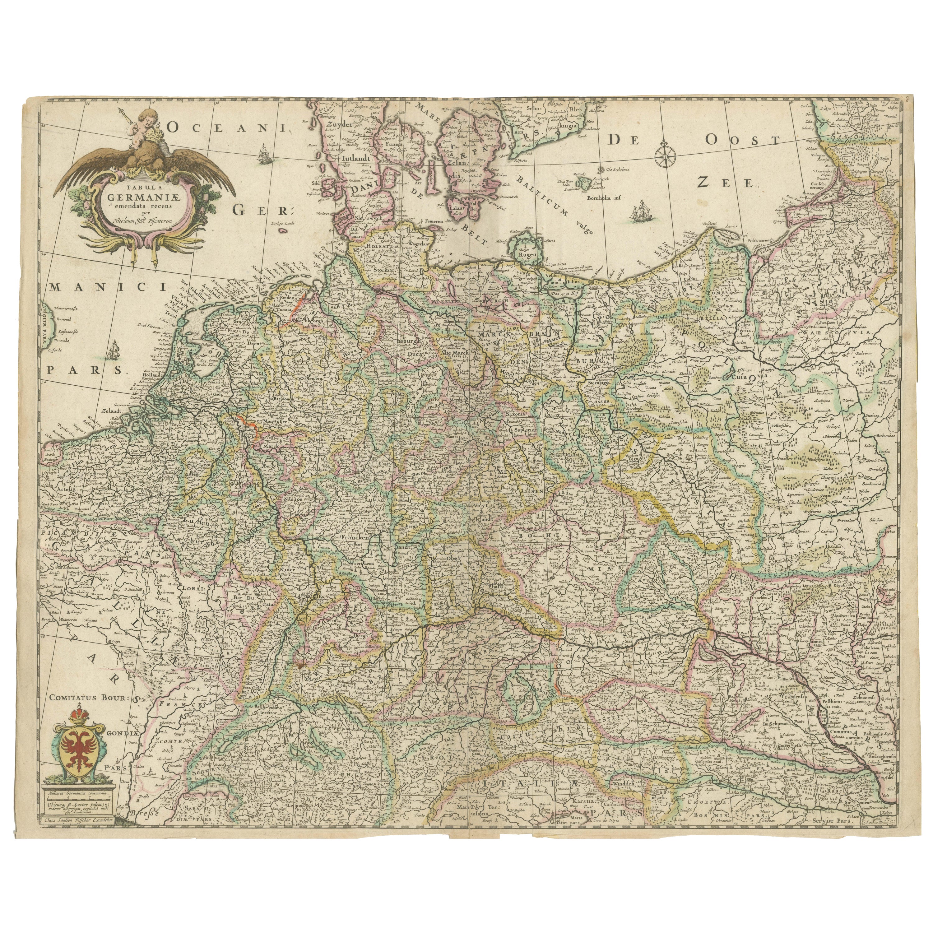
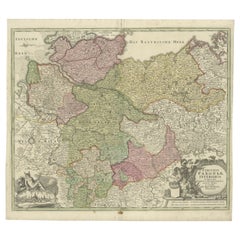
- Antique Map of Germany including surrounding countriesLocated in Langweer, NLAntique map titled 'Tabula Germaniae'. Orginal antique map of Germany by Claes Jansz. Visscher. Published circa 1650. including the Low Countries, Switze...Category
Antique Mid-17th Century Maps
MaterialsPaper
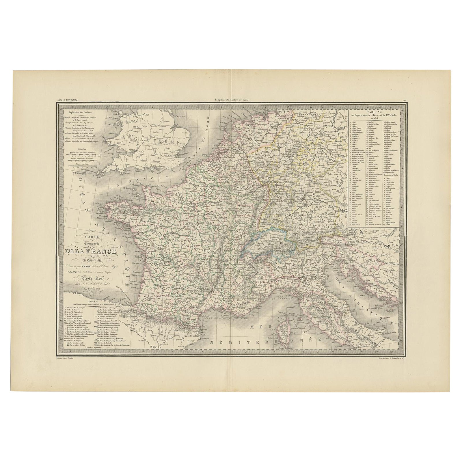
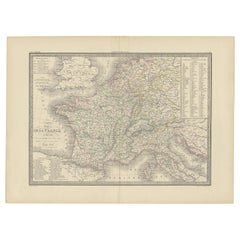
- Antique Map of France with Surrounding Countries, 1842Located in Langweer, NLAntique map titled 'Carte comparée de la France en 1789 et 1813'. Map of France. This map originates from 'Atlas universel de géographie ancienne et moderne (..)' by Pierre M. Lapie ...Category
Antique 19th Century Maps
MaterialsPaper
- Antique Map of Champagne and surrounding Regions, FranceLocated in Langweer, NLAntique map titled 'Carte de la Champagne et des Pays Voisins (..)'. Detailed map of Champagne and surrounding regions of Chalons and Soissons, Reims, Vedun, Mouzon, Sean, Charlemont...Category
Antique Mid-18th Century Maps
MaterialsPaper
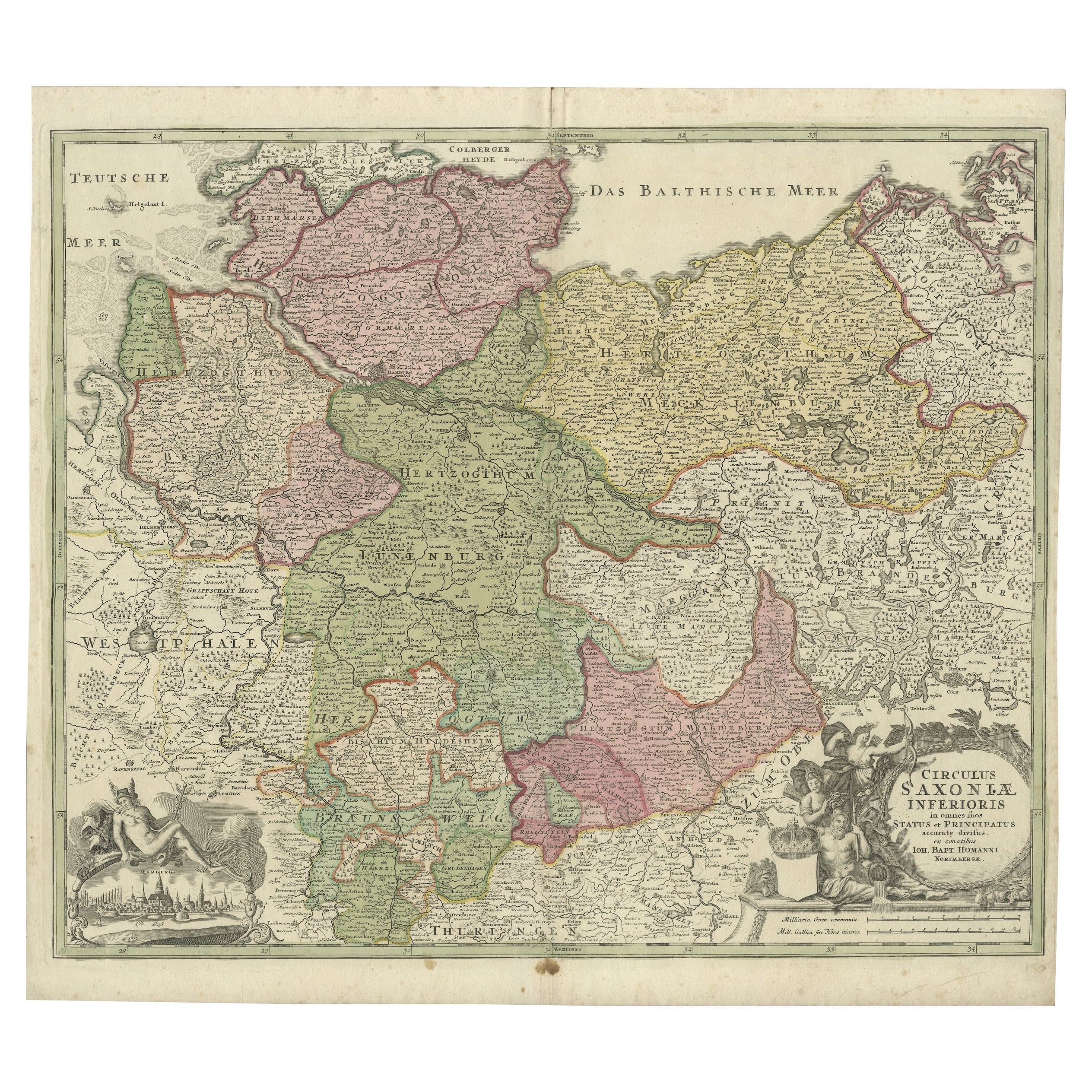
- Antique Engraved Map of Saxonia in Northern Germany, ca.1721-1750Located in Langweer, NLDuitsland, Sassonia; Johannes Baptist Homann - Circulus Saxoniae Inferioris in omnes suos Status et Principatus accurate divisus ex conatibus - A large map of Lower Saxony, exten...Category
Antique Mid-18th Century Maps
MaterialsPaper
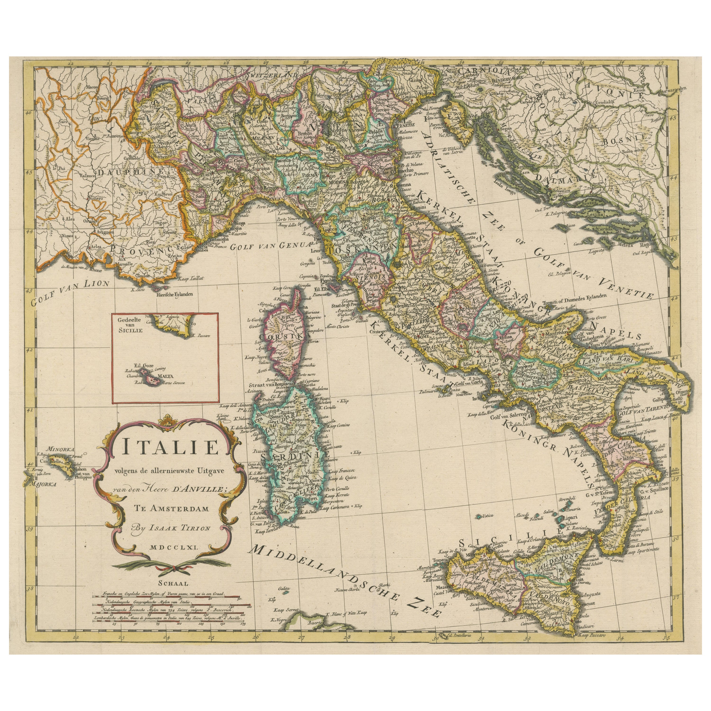
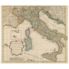
- Detailed Antique Map of Italy and surrounding IslandsLocated in Langweer, NLAntique map titled 'Italie volgens de allernieuwste Uitgave van den Heere d'Anville'. Very detailed antique map, based on D'Anville's important map of It...Category
Antique Mid-18th Century Maps
MaterialsPaper
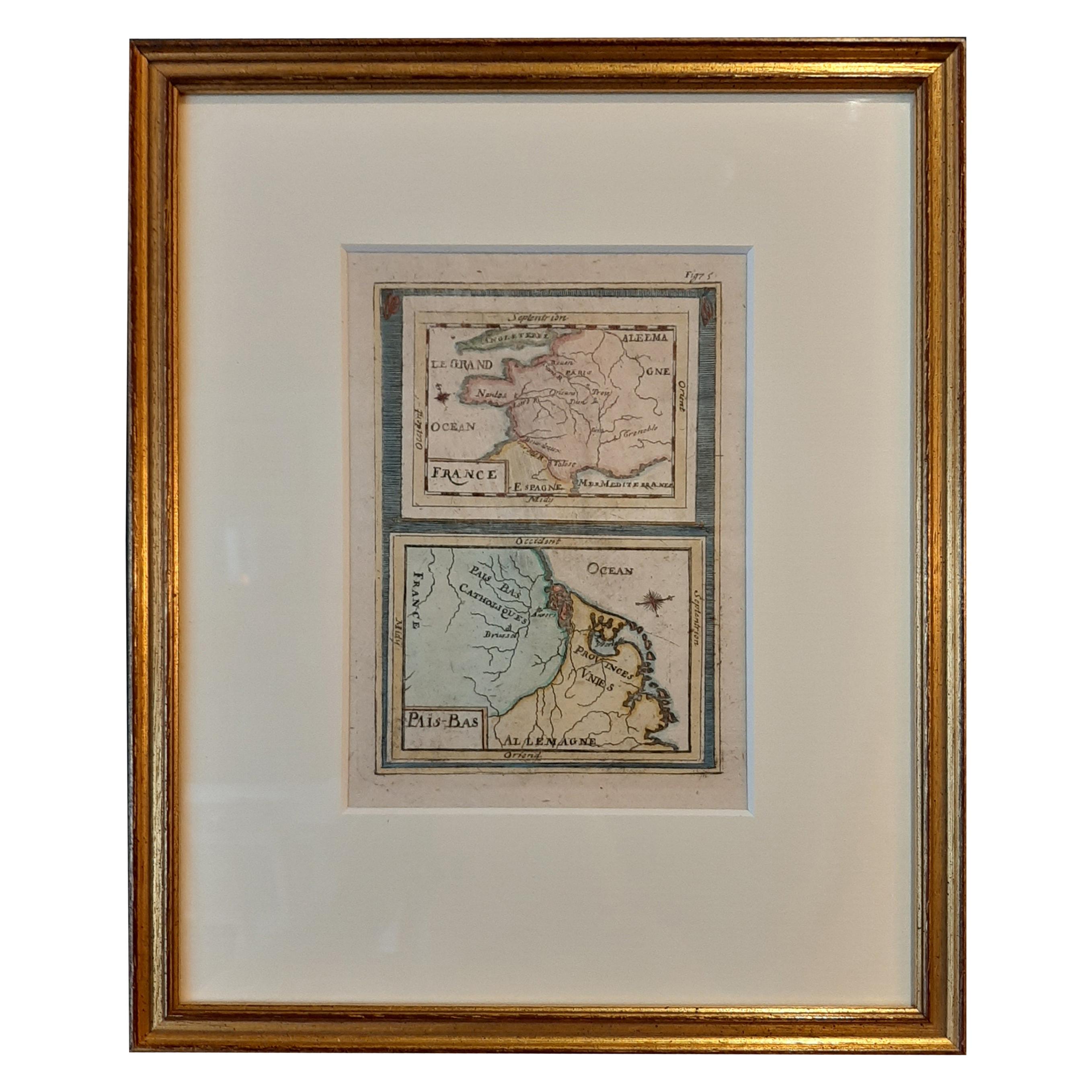
- Antique Miniature Map of France and the Low Countries by Mallet, circa 1719Located in Langweer, NLAntique map titled 'France - Païs-Bas'. Miniature Map of France and the Low Countries. Published by A.M. Mallet, circa 1719. Frame included. We carefully pack our framed items to ...Category
Antique Early 18th Century Maps
MaterialsPaper

You May Also Like
- Map of Boston and Surrounding TownsLocated in Norwell, MALater copy of a nineteenth century map of Boston and surrounding towns. Showing parts of Quincy, Milton, Hyde Park, Winthrop and Revere. Showing all of B...Category
Antique 19th Century North American Maps
MaterialsPaper
- Set of 4 Antique Geographical Maps French-German War 1870-71Located in Casale Monferrato, ITElegant late 19th century set of four antique geographical maps relating to the positioning of the armies in the Franco-German War 1870-71. A...Category
Antique 1890s Italian Maps
MaterialsPaper
- East German MapBy VEB Hermann HaackLocated in Baltimore, MDA brilliantly colourful map of the Leipzig, Karl Marx Stadt and Dresden area in the former German Democratic Republic by VEB Hermann Haack of Gotha.Category
Vintage 1970s German Maps
- Lot of Eight Miniature Antique German Dollhouse Toys Accessories 1900sLocated in Nuernberg, DEThis rare and exquisite miniature set of 8 antique German Dollhouse Miniatures is a must-have for Dollhouse and Doll collectors and enthusiasts al...Category
Antique Early 1900s German Folk Art Toys and Dolls
MaterialsPewter
- Original Antique Map of France, Arrowsmith, 1820Located in St Annes, LancashireGreat map of France Drawn under the direction of Arrowsmith. Copper-plate engraving. Published by Longman, Hurst, Rees, Orme and Brown, 1820 Unframed.Category
Antique 1820s English Maps
MaterialsPaper
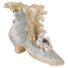
- 1980s French Antique Handmade Miniature Shoe Made of Silk and FabricLocated in Marbella, ES1980s French antique handmade miniature shoe made of silk and fabric Atelier Jean Claude.Category
Vintage 1980s Models and Miniatures
MaterialsFabric, Silk


Recently Viewed
View AllMore Ways To Browse
Modern French Country
Country French Provence
Amsterdam Map
Antique French Miniature
Historical Maps Germany
Miniature Maps
Miniature Map
Fils Unique
Map Of France Miniature
Roy And Fils
Le Roy Fils
Antique Maps Of United States
Antique Collectible Bears
United States Map Vintage
United States Vintage Map
Amsterdam Map
Map Of Amsterdam
Antique Old World Map