Items Similar to Large Antique Map of Guadeloupe and Antigua with Adjacent Isles, 19th Century
Want more images or videos?
Request additional images or videos from the seller
1 of 6
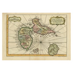
Large Antique Map of Guadeloupe and Antigua with Adjacent Isles, 19th Century
About the Item
Title: "Antique Map of Guadeloupe and Antigua with Adjacent Isles, 19th Century"
Source: New General Atlas (circa 1817), published in Edinburgh
Description: This detailed antique map presents a late 18th or early 19th-century depiction of two major Caribbean islands, Guadeloupe and Antigua, along with the smaller surrounding islets, including Marie-Galante. The mapmaker, John Thomson, has meticulously rendered the islands' topographical features such as mountain ranges, valleys, and coastline details, with hand coloring to enhance the visual distinction between land and sea.
Guadeloupe is shown in two main parts, Basse-Terre to the west and Grande-Terre to the east, reflecting its butterfly-like shape. Marie-Galante appears to the southeast of Guadeloupe, smaller in size but still detailed. To the northeast, Antigua is depicted with its intricate coastline and elevation changes.
The cartographer's craft is evident in the precision of the engraving and the careful application of color. While the specific creator is not mentioned, the quality suggests it could be the work of a prominent mapmaker or publisher from the period, known for producing accurate and detailed charts for navigation and general education about the West Indies.
The condition of the map appears to be good, with the paper showing signs of aging and foxing that contribute to its antique character. The folds and creases are typical of maps that were used or stored in atlases. Collectors and enthusiasts of cartographic history would value this piece for both its aesthetic appeal and its representation of Caribbean geography as understood in the era it was created.
- Dimensions:Height: 21.07 in (53.5 cm)Width: 29.34 in (74.5 cm)Depth: 0 in (0.02 mm)
- Materials and Techniques:Paper,Engraved
- Period:
- Date of Manufacture:1817
- Condition:Good condition considering its age. The paper showing signs of aging and foxing that contribute to its antique character. The yellowish offset, folds and creases are typical of maps that were used or stored in atlases.
- Seller Location:Langweer, NL
- Reference Number:Seller: BG-31618-31stDibs: LU3054337731592
About the Seller
5.0
Platinum Seller
These expertly vetted sellers are 1stDibs' most experienced sellers and are rated highest by our customers.
Established in 2009
1stDibs seller since 2017
1,922 sales on 1stDibs
Typical response time: <1 hour
- ShippingRetrieving quote...Ships From: Langweer, Netherlands
- Return PolicyA return for this item may be initiated within 14 days of delivery.
Auctions on 1stDibs
Our timed auctions are an opportunity to bid on extraordinary design. We do not charge a Buyer's Premium and shipping is facilitated by 1stDibs and/or the seller. Plus, all auction purchases are covered by our comprehensive Buyer Protection. Learn More
More From This SellerView All
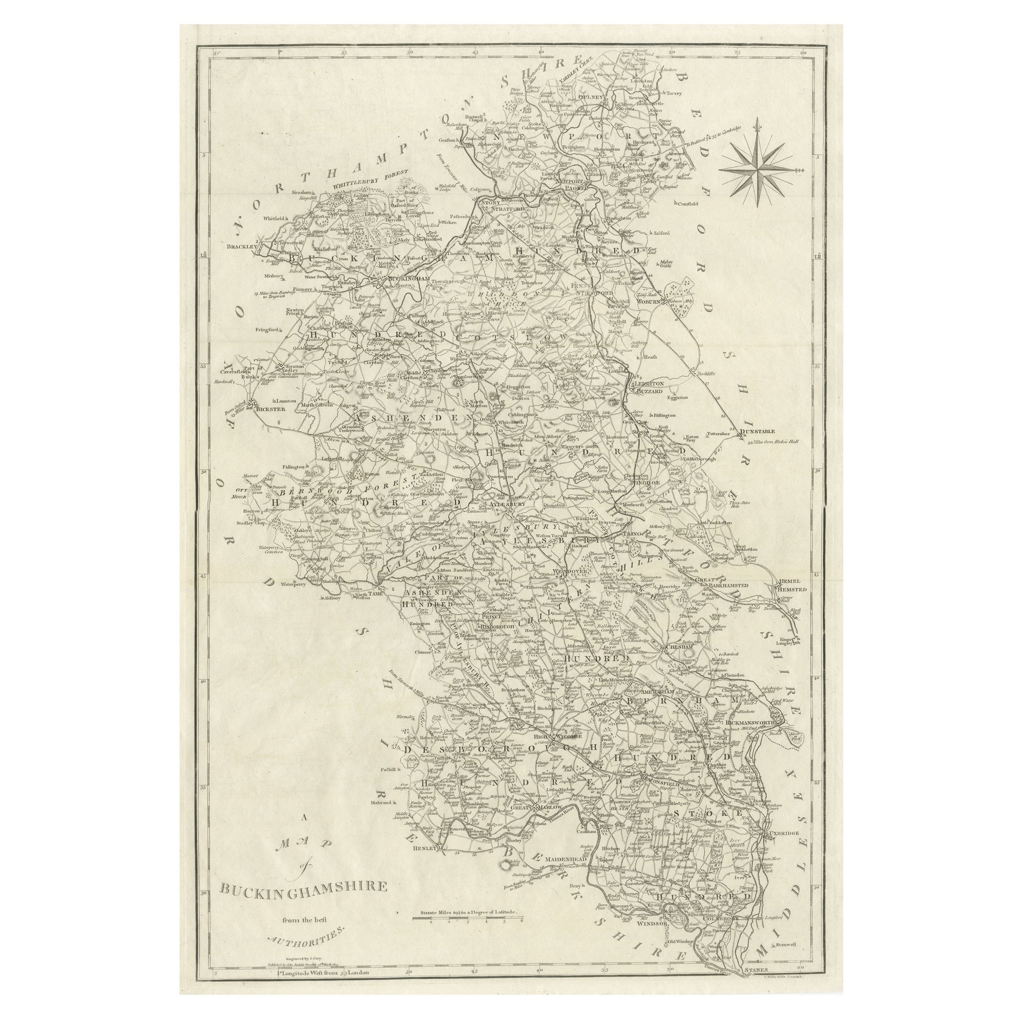
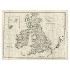
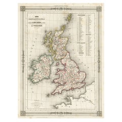
- Large Antique Map of the British Isles, with inset of the Orkneys and ShetlandsLocated in Langweer, NLAntique map titled 'A Map of Great Britain and Ireland (..)'. Large antique map of the British Isles, with part of the French and Dutch coasts, and an inset of the Orkneys and Shetla...Category
Antique Late 18th Century Maps
MaterialsPaper
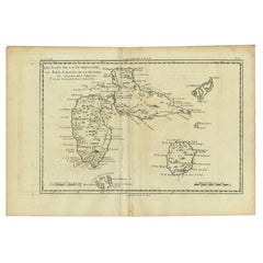
- Antique Map of Guadeloupe with Les Saintes, Grand Bourg and La Désirade, c.1780Located in Langweer, NLAntique map titled 'Les Isles de la Guadeloupe (..).' Map of the Caribbean Island of Guadeloupe with the surrounding islands Les Saintes, Grand Bourg and La Désirade. Source unknow...Category
Antique 18th Century Maps
MaterialsPaper
- Antique Map of Guadeloupe, Island in the Caribbean, c.1757Located in Langweer, NLAntique map titled 'Carte de L'Isle de la Guadeloupe'. A very decorative map of Guadeloupe in the Caribbean, adorned with rhumb lines, fleur-de-lys, and two decorative rococo-style...Category
Antique 18th Century Maps
MaterialsPaper
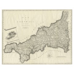
- Large Antique County Map of Cornwall and the Isles of Scilly, EnglandLocated in Langweer, NLAntique map titled 'A Map of Cornwall from the best Authorities'. Original old county map of Cornwall, England. With inset map of the Scilly Islands. Engraved by John Cary. Originate...Category
Antique Early 19th Century Maps
MaterialsPaper
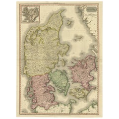
- 19th Century Large Original Antique Map of Denmark by J. Pinkerton, 1812By PinkertonLocated in Langweer, NLHighly detailed map of Denmark. One of the best large format English atlas maps of the period. Pinkerton's maps reflect the fine copperplate engraving work being done in the Britain...Category
Antique Early 19th Century Maps
MaterialsPaper
- Antique Map of the British Isles with Outline ColoringLocated in Langweer, NLAntique map titled 'Iles Britanniques'. Attractive map of the British Isles. Details England, Scotland and Ireland as well as parts of neighboring France. Upper right corner features...Category
Antique Mid-19th Century Maps
MaterialsPaper
You May Also Like
- Northwest Coast and Isle of Man MapLocated in Cheshire, GBGreenville Collins Northwest Coast and Isle of Man. hand coloured chart, encased in an ebonised frame. Dimensions Height 26.5 Inches Width 30 Inches Depth 1 InchesCategory
Early 20th Century British Maps
MaterialsPaper
- Large 17th Century Hand Colored Map of England and the British Isles by de WitBy Frederick de WitLocated in Alamo, CAA large hand colored 17th century map of England and the British Isles by Frederick de Wit entitled "Accuratissima Angliæ Regni et Walliæ Principatus", published in Amsterdam in 1680. It is a highly detailed map of England, Scotland, the Scottish Isles...Category
Antique Late 17th Century Dutch Maps
MaterialsPaper
- Antique Framed Pen and Ink on Fabric Map of Cornwall from Early 19th CenturyLocated in Los Angeles, CAEarly 19th-century English pen-and-ink fabric map of Cornwall. With beautiful hand-drawn details and faded sepia tones, this framed piece turns history into art. England, circa 181...Category
Antique Early 19th Century English Drawings
MaterialsFabric, Walnut
- Antique Lithography Map, Isle of Wight, English, Framed, Engraving, CartographyLocated in Hele, Devon, GBThis is an antique lithography map of the Isle of Wight. An English, framed atlas engraving of cartographic interest, dating to the early 19th century and later. Superb lithography ...Category
Antique Early 19th Century British Regency Maps
MaterialsWood
- Antique Lithography Map, Isle of Thanet, Kent, English, Cartography, VictorianLocated in Hele, Devon, GBThis is an antique lithography map of The Isle of Thanet in Kent. An English, framed atlas engraving of cartographic interest, dating to the mid 19th century and later. Superb litho...Category
Antique Mid-19th Century British Victorian Maps
MaterialsWood
- Antique Box With Coat Of Arms 19th centuryBy Europa AntiquesLocated in Madrid, ESAntique Box With Coat Of Arms 19th century ANTIQUE BOX WITH CREST ELEGANT LEATHER BOX WITH CENTRAL SHIELD.THE INTERIOR IS LINED IN RED.IT HAS ITS ORI...Category
Antique 19th Century French Baroque Historical Memorabilia
MaterialsLeather


Recently Viewed
View AllMore Ways To Browse
18th Century Revolutionary
Wenceslas Hollar
Bad Bentheim
English County Maps By Blaeu
Von Meer
Minature Map
Anguilla Map
James Calvert Smith
Montenegro Antique Map
Mozambique Antique Map
Nottinghamshire Antique Map
Panama Antique Map
Wisconsin Map
Antique Map Sydney
Historical Balkan Map
Map Of Majorca
Yorkshire Ridings Map
Antique Map Dordogne