Items Similar to Large Antique County Map of Buckinghamshire, England


Want more images or videos?
Request additional images or videos from the seller
1 of 6
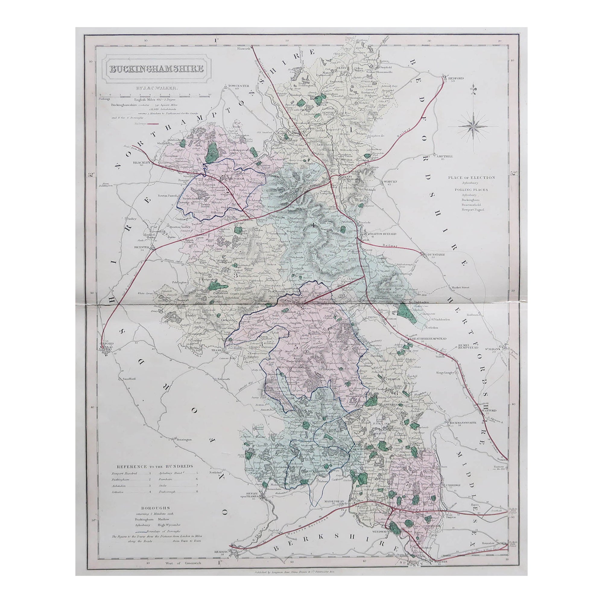
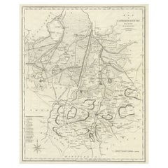
Large Antique County Map of Buckinghamshire, England
About the Item
Antique map titled 'A Map of Buckinghamshire from the best Authorities'. Original old county map of Buckinghamshire, England. Engraved by John Cary. Originates from 'New British Atlas' by John Stockdale, published 1805.
John Cary (1755-1835) was a British cartographer and publisher best known for his clean engraving and distinct style which influenced the entire map industry.
- Dimensions:Height: 21.54 in (54.7 cm)Width: 15.6 in (39.6 cm)Depth: 0.02 in (0.5 mm)
- Materials and Techniques:
- Period:
- Date of Manufacture:1805
- Condition:General age-related toning. Original folding lines. Minor wear and soiling, narrow margins. Please study image carefully.
- Seller Location:Langweer, NL
- Reference Number:Seller: BG-13394-141stDibs: LU3054334062472
About the Seller
5.0
Platinum Seller
These expertly vetted sellers are 1stDibs' most experienced sellers and are rated highest by our customers.
Established in 2009
1stDibs seller since 2017
1,916 sales on 1stDibs
Typical response time: <1 hour
- ShippingRetrieving quote...Ships From: Langweer, Netherlands
- Return PolicyA return for this item may be initiated within 14 days of delivery.
Auctions on 1stDibs
Our timed auctions are an opportunity to bid on extraordinary design. We do not charge a Buyer's Premium and shipping is facilitated by 1stDibs and/or the seller. Plus, all auction purchases are covered by our comprehensive Buyer Protection. Learn More
More From This SellerView All
- Antique Map of Buckinghamshire in England, 1743Located in Langweer, NLAntique map titled 'Buckingham both shyre and shire towne describ'. Map of Buckinghamshire, England. With town plans of Buckingham and Redding. This map originates from Overton's atl...Category
Antique 18th Century Maps
MaterialsPaper
- Large Antique County Map of Cambridgeshire, EnglandLocated in Langweer, NLAntique map titled 'A Map of Cambridgeshire from the best Authorities'. Original old county map of Cambridgeshire, England. Engraved by John Cary. Originates from 'New British Atlas'...Category
Antique Early 19th Century Maps
MaterialsPaper
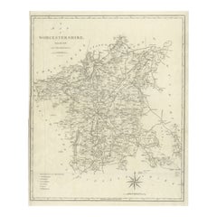
- Large Antique County Map of Worcestershire, EnglandLocated in Langweer, NLAntique map titled 'A Map of Worcestershire from the best Authorities'. Original old county map of Worcestershire, England. Engraved by John Cary. Originates from 'New British Atlas'...Category
Antique Early 19th Century Maps
MaterialsPaper
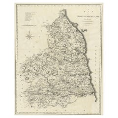
- Large Antique County Map of Northumberland, EnglandLocated in Langweer, NLAntique map titled 'A Map of Northumberland from the best Authorities'. Original old county map of Northumberland, England. Engraved by John Cary. Originates from 'New British Atlas'...Category
Antique Early 19th Century Maps
MaterialsPaper
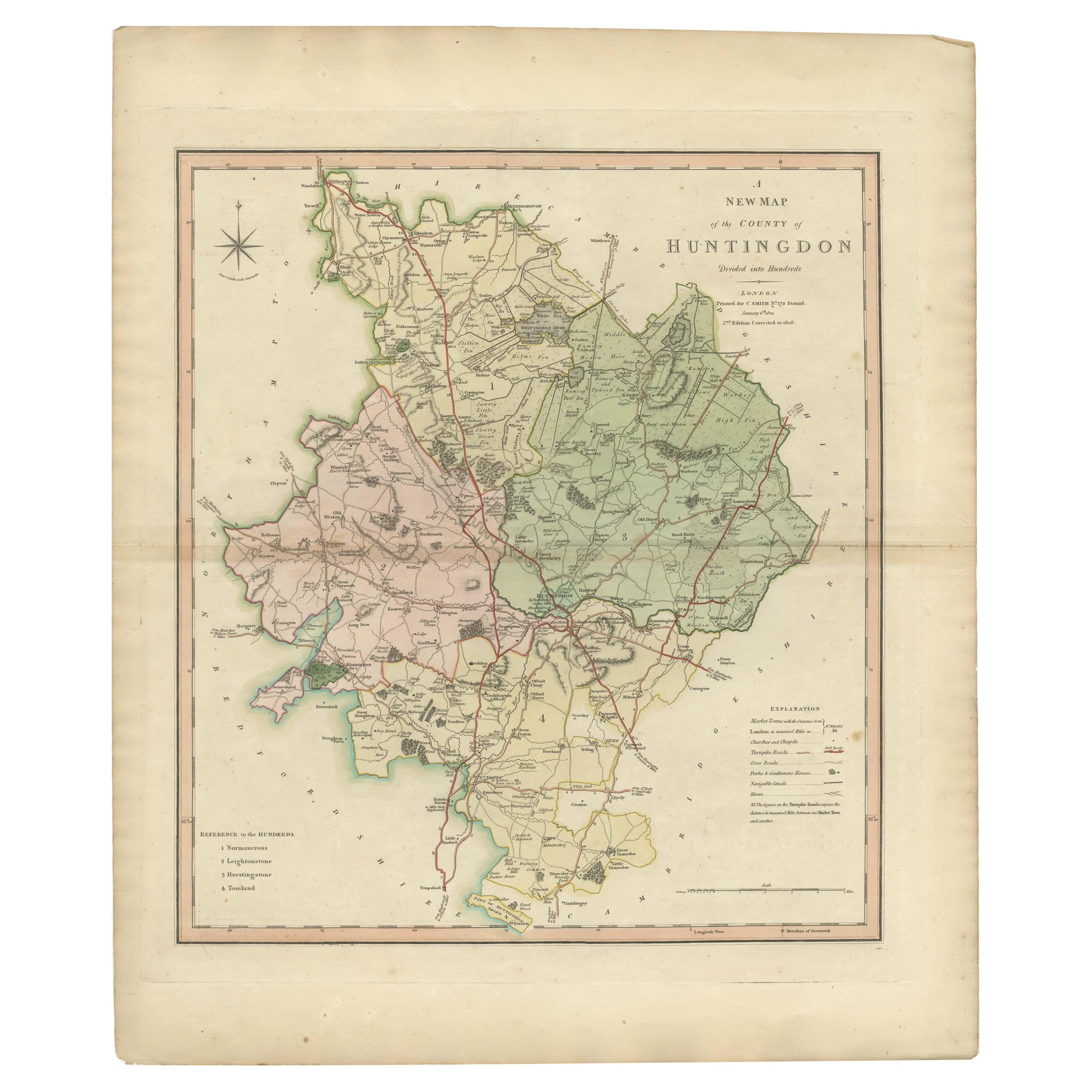
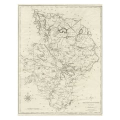
- Large Antique County Map of Huntingdonshire, EnglandLocated in Langweer, NLAntique map titled 'A Map of Huntingdonshire from the best Authorities'. Original old county map of Huntingdonshire, England. Engraved by John Cary. Originates from 'New British Atla...Category
Antique Early 19th Century Maps
MaterialsPaper
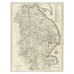
- Large Antique County Map of Lincolnshire, EnglandLocated in Langweer, NLAntique map titled 'A Map of Lincolnshire from the best Authorities'. Original old county map of Lincolnshire, England. Engraved by John Cary. Originates from 'New British Atlas' by ...Category
Antique Early 19th Century Maps
MaterialsPaper

You May Also Like
- Hampshire County, Britain/England: A Map from Camden's" Britannia" in 1607By John NordenLocated in Alamo, CAAn early hand-colored map of Britain's Hampshire county, published in the 1607 edition of William Camden's great historical description of the British Isles, "Britannia". This map was drawn by cartographer John Norden (c. 1547-1625) and engraved by William Hole (active 1607-1624) and William Kip...Category
Antique Early 17th Century English Maps
MaterialsPaper
- Old Horizontal Map of EnglandBy TassoLocated in Alessandria, PiemonteST/520 - Old rare Italian map of England, dated 1826-1827 - by Girolamo Tasso, editor in Venise, for the atlas of M.r Le-Sage.Category
Antique Early 19th Century Italian Other Prints
MaterialsPaper
- Large Antique 1859 Map of North AmericaLocated in Sag Harbor, NYThis Map was made by Augustus Mitchell in 1859 It is in amazing condition for being 163 years old. This price is for the rolled up easy to ship version of this piece. I will be Frami...Category
Antique Mid-19th Century American Maps
MaterialsCanvas, Paper

- Antique Map of Principality of MonacoBy Antonio Vallardi EditoreLocated in Alessandria, PiemonteST/619 - "Old Geographical Atlas of Italy - Topographic map of ex-Principality of Monaco" - ediz Vallardi - Milano - A somewhat special edition ---Category
Antique Late 19th Century Italian Other Prints
MaterialsPaper
- Large 17th Century Hand Colored Map of England and the British Isles by de WitBy Frederick de WitLocated in Alamo, CAA large hand colored 17th century map of England and the British Isles by Frederick de Wit entitled "Accuratissima Angliæ Regni et Walliæ Principatus", published in Amsterdam in 1680. It is a highly detailed map of England, Scotland, the Scottish Isles...Category
Antique Late 17th Century Dutch Maps
MaterialsPaper
- England, Scotland & Ireland: A Hand Colored Map of Great Britain by TirionBy Isaak TirionLocated in Alamo, CAThis is a hand-colored double page copperplate map of Great Britain entitled "Nieuwe Kaart van de Eilanden van Groot Brittannien Behelzende de Kon...Category
Antique Mid-18th Century Dutch Maps
MaterialsPaper


Recently Viewed
View AllMore Ways To Browse
Buckinghamshire Antique Map
Pakistan Antique Map
Armenia Map
Armenian Map
Antique Maps Uk
Antique Uk Map
Antique Uk Maps
Northumberland Map
Uk Antique Map
Ancient Map Of Jerusalem
Antique Jamaica Map
Antique Map Brooklyn
Antique Map Of Brooklyn
Antique Map Of Jamaica
Corse Antique
Map Of The Bahamas
Old Sicily Map
Saudi Arabia Antique Map