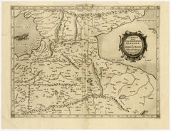
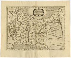
Armenian Map

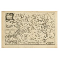
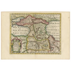
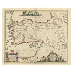
Original Antique Map of Canaan, Armenia, Syria, Mesopotamia and Arabia, 1709
Located in Langweer, NL
Antique map titled 'Descriptio Paradisi et Terrae Canaan'. Original antique map of Canaan
Category

Antique Early 1700s Maps

Materials

Paper

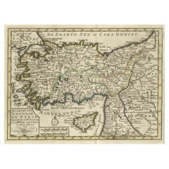
Old Map of Anatolia, part of modern-day Turkey, Armenia and Syria, 1745
Located in Langweer, NL
andere auteuren" translates to "Map of Anatolia and Syria compiled by Mr. Lucas and Mr. Guillaume de
Category

Antique 1740s Maps

Materials

Paper

Persia, Armenia & Adjacent Regions: A 17th Century Hand-colored Map by De Wit
By Frederick de Wit
Located in Alamo, CA
A large 17th century hand colored copperplate engraved map entitled "Novissima nec non
Category

Antique Late 17th Century Dutch Maps

Materials

Paper

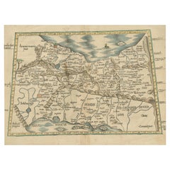
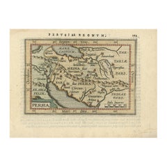
Original Antique Woodcut Map of Persia
Located in Langweer, NL
Antique map titled 'Tabula V Asiae'. Important early woodcut map of Persia, depicting the area of
Category

Antique 16th Century Maps

Materials

Paper

Original Antique Woodcut Map of Persia
H 14.97 in W 19.02 in D 0.02 in
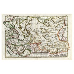
Antique Map of Persia, Georgia and Kazakhstan, ca.1780
Located in Langweer, NL
Persia, Georgia and Kazakhstan. This map shows current days Georgia, Iran, Irak, Kazakhstan, Armenia
Category

Antique 1780s Maps

Materials

Paper

Cartographic Tapestry: Antique Map of Asia Minor, circa 1640
Located in Langweer, NL
Title: "Historical Tapestry: Antique Map of Asia Minor, circa 1640" Description: This authentic
Category

Antique Mid-17th Century Maps

Materials

Paper

Historical Map of the Black Sea and Surrounding Regions, 1705
Located in Langweer, NL
Title: "Map of Turcomania, Georgia, and Comania" This print presents an intricately detailed map
Category

Antique Early 1700s Maps

Materials

Paper

Antique Map of Persia, Georgia and Kazakhstan by Bonne, c.1780
Located in Langweer, NL
Persia, Georgia and Kazakhstan. This map shows current days Georgia, Iran, Irak, Kazakhstan, Armenia
Category

Antique 18th Century Maps

Materials

Paper

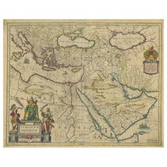
Imperial Splendor: Antique Map of the Ottoman Empire by Blaeu, circa 1640
Located in Langweer, NL
the map include Armenia and George (Giorgia), highlighting the extent of the Ottoman Empire's
Category

Antique Mid-17th Century Maps

Materials

Paper

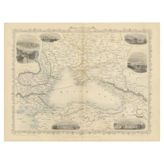
Mid 19th Century Map of the Black Sea with Decorative Vignettes, 1851
Located in Langweer, NL
Map of the Black Sea and contingent lands, including Turkey, Russia, Georgia, Azerbaijan, Bulgaria
Category

Antique Mid-19th Century Maps

Materials

Paper

Antique Map of the Region involved in the Conquest of Cyrus the Great
Located in Langweer, NL
Antique map titled 'Tabula Itineris Decies Mille (..)'. This historical map illustrates the region
Category

Antique Mid-17th Century Maps

Materials

Paper

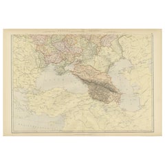
Imperial Frontiers: A 19th Century Map of Southern Russia and the Caucasus, 1882
Located in Langweer, NL
This map, sourced from the comprehensive 1882 atlas by Blackie & Son, delineates the southern part
Category

Antique 1880s Maps

Materials

Paper

Exploring Ancient Persia: Ptolemaic Map of Iran and Iraq by Ptolemy and Mercator
Located in Langweer, NL
Ptolemaic map depicting much of modern-day Iran, Iraq and part of Armenia. The map stretches from the
Category

Antique 1610s Maps

Materials

Paper

Hand-Colored 18th Century Homann Map of the Black Sea, Turkey and Asia Minor
By Johann Baptist Homann
Located in Alamo, CA
An attractive original early 18th century hand-colored map of the Black Sea and Turkey entitled
Category

Antique Early 18th Century German Maps

Materials

Paper

Ancient Crossroads: Albania to Assyria in Antiquity, Published in 1880
Located in Langweer, NL
The map titled "ALBANIA, IBERIA, COLCHIS, ARMENIA, MESOPOTAMIA, BABYLONIA, ASSYRIA" portrays the
Category

Antique 1880s Maps

Materials

Paper

Persia, Armenia & Adjacent Regions: A Hand-colored 17th Century Map by De Wit
By Frederick de Wit
Located in Alamo, CA
This colorful and detailed 17th century copperplate map by Frederick De Wit was published in
Category

Late 17th Century Old Masters More Prints

Materials

Engraving

Persiae, Armeniae, Natoliae et Arabiae Descriptio per Frederick deWit 1666 map
Located in Paonia, CO
Map of Persiae, Armeniae, Natoliae et Arabiae Descriptio per F de Wit 1688 engraving from
Category

1660s Realist Landscape Prints

Materials

Engraving

Mid-19th Century Persian Tribal Bidjar Rug
Located in Los Angeles, US
when the region was annexed with Armenia by Safavid forces, archaeological evidence of domestic
Category

Antique 19th Century Tribal Russian and Scandinavian Rugs

Materials

Wool, Cotton

Mid-19th Century Persian Tribal Bidjar Rug
Free Shipping
W 50 in L 78 in
Antique Bidjar Rug with Floral Design 17'8''x11'7''
Located in Los Angeles, US
when the region was annexed with Armenia by Safavid forces, archaeological evidence of domestic
Category

Antique Early 1900s Asian Other Russian and Scandinavian Rugs

Materials

Wool, Cotton

People Also Browsed

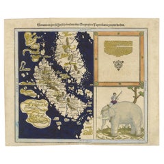
Renaissance Mapping of Sumatra: Featuring Singapore in Münster’s Woodcut, c.1590
Located in Langweer, NL
Description: Antique map titled 'Sumatra ein grosse Insel / so von den alten Geographen Taprobana genennt worden'. Beautiful map of Sumatra and the southern part of Malaysia, with Si...
Category

Antique 16th Century Maps

Materials

Paper

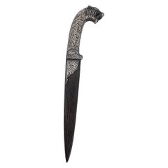
A 19th century Indian silver inlaid dagger with a Damascus steel blade, C 1870
Located in Central England, GB
A fine 19th-century ornate Indian dagger superbly made from hand forged folded steel known as Damascus which shows on the blade with a pattern almost like wood grain. The whole knif...
Category

Antique Late 19th Century Indian Anglo Raj Metalwork

Materials

Silver, Steel

Early 20th Century Toy Noah's Ark, German
Located in Incline Village, NV
Toy Noah’s Arks for children to play with were very popular in the late 19th and early 20th century, and Germany was very prolific in their production. This particular ark is all ori...
Category

Early 20th Century German Folk Art Toys

Materials

Wood

19th Century German Erzgebirge Noah’s Ark
Located in London, GB
19th Century German Erzgebirge Noah’s Ark A 19th Century German Erzgebirge Noah’s ark toy set, with aged ark that shows remnants of typical straw work decorative in sections, fade p...
Category

Antique 1850s German Early Victorian Toys and Dolls

Materials

Pine

Late 19th Century Flat Bottom Toy Noah's Ark with 34 Figures. German Circa 1880
Located in Incline Village, NV
Offered for sale is a very traditional Folk Art item; a handcrafted Noah's Ark toy with 34 hand-painted and hand-carved animals (includes Noah and Naamah). The flat bottom ark indica...
Category

Antique 1880s German Folk Art Toys

Materials

Wood

Beheading of St John Woodcut After Albrecht Durer
By Albrecht Dürer
Located in New York, NY
Woodcut print on paper, a reproduction of an original 1510 artwork titled Beheading of John the Baptist by Albrecht Durer, 1471 to 1528, a German painter and printmaker of the Northe...
Category

Antique 16th Century German Renaissance Prints

Materials

Paper

Antique Pair of Syrian Parquetry Inlaid Armchairs C1900
Located in London, GB
A superb pair of Syrian Damascus armchairs, Circa 1900 in date. The stunning pair of parquetry armchairs are exquisitely crafted in hardwood with wonderful inlaid decoration compri...
Category

Antique Early 1900s Armchairs

Materials

Wood

Joh. Jak. Scheuchzer, Bible Engraving, Noah’s Ark, Folio, Hand Coloured
Located in Norwich, GB
Johann Jakob Scheuchzer (1672-1733); engraved by P.A. Kilian. Bible engraving, Noah’s Ark Folio. Dimensions: 38 x 24 cm. Hand coloured This fascinating folio engraving...
Category

Antique Early 18th Century German Prints

Materials

Paper

1543 Boneset, Comfrey, Leonhart Fuchs, folio woodcut, 34 x 22 cm, first state
Located in Norwich, GB
Fine hand colour woodcut to recto of FOLIO from: Leonhart Fuchs New Kreüterbuch, Heinrich Füllmaurer, Albert Meyer (draughtsmen), and Veit Rudolf Speckle (woodcutter) Basel, Ise...
Category

Antique 16th Century German Prints

Materials

Paper

Early 19th Century American Double Sided Games Board
Located in Incline Village, NV
Very early American wooden games board; probably the oldest I have handled, this dates to about circa 1835 and exhibits the markings of a typical cottage industry type manufacture (n...
Category

Antique 1830s American Folk Art Game Boards

Materials

Wood

View of Emden, Germany: A 16th Century Hand-colored Map by Braun & Hogenberg
By Franz Hogenberg
Located in Alamo, CA
This is a 16th century original hand-colored copperplate engraved map of a bird's-eye View of Embden, Germany entitled " Emuda, vulgo Embden vrbs Frisia orientalis primaria" by Georg...
Category

16th Century Old Masters Landscape Prints

Materials

Engraving

Antique Traditional Armenian Ladies Silver and Niello Belt
Located in Braintree, GB
Antique traditional Armenian ladies silver and niello belt Made in Imperial Russia, possibly Caucasus region (Armenia) Made 1897-1910 Maker: ?? (Cyrillic) Hallmarked in multiple ...
Category

Antique 1890s Armenian Sterling Silver

Materials

Silver

Antique Traditional Armenian Ladies Silver and Niello Belt
Free Shipping
H 0.4 in W 0.4 in D 0.4 in
Salome And Herod Woodcut After Albrecht Durer
By Albrecht Dürer
Located in New York, NY
Woodcut print on paper, a reproduction of an original 1511 artwork titled The Head of Saint John the Baptist Brought to Herod by Albrecht Durer, 1471 to 1528, a German painter and pr...
Category

Antique 16th Century German Renaissance Prints

Materials

Paper

Ó/L France "Romantic landscape" Leo Deschamps, 1871 - Signed
By French House & Garden
Located in Valladolid, ES
Gorgeous Oil on canvas signed and dated by Leo Deschamps, 1871. The work shows a clear romantic component, with the representation of the dark forest, the mysterious character lookin...
Category

Antique 1870s French Romantic Paintings

Materials

Canvas, Wood, Paint

Ó/L France "Romantic landscape" Leo Deschamps, 1871 - Signed
No Reserve
H 29.93 in W 33.86 in D 2.37 in
Middle Eastern Moorish 19th Century Folding Chair
Located in North Hollywood, CA
Antique Middle Eastern Egyptian Moorish walnut wood folding chair with intricate foliate carving and mother of pearl, shell inlays. Arabian Syrian style folding chair inlaid with mo...
Category

Antique 19th Century Egyptian Moorish Side Chairs

Materials

Shell, Mother-of-Pearl, Wood

Original Map of The Northern Arabian Peninsula, Palestine, Iraq & Iran, 1732
Located in Langweer, NL
Antique map titled 'Nieuwe kaart van Irak Arabi, Kurdistan, Diarbek (..).' Detailed map including the northern part of the Arabian peninsula, Palestine, Iraq, Iran and the eastern ...
Category

Antique 1730s Maps

Materials

Paper

Recent Sales

Old map of Georgia, Armenia and Azerbaijan by Mercator - Engraving - 17th c.
By Gerard Mercator
Located in Zeeland, Noord-Brabant
. (…).' - A beautiful Ptolemaic map of the Caucasus region and what is now Georgia, Armenia, Azerbaijan
Category

1690s Old Masters More Prints

Materials

Engraving

Ptolemaic map - Persian Gulf to the Caspian Sea by Mercator - Engraving - 17th c
By Gerard Mercator
Located in Zeeland, Noord-Brabant
, ac Persidem. (…).' - A beautiful Ptolemaic map of much of modern-day Iran, Iraq and part of Armenia
Category

1690s Old Masters More Prints

Materials

Engraving

Beautiful Early Map of Region Around Canaan and Paradise with Bible Scenes, 1669
Located in Langweer, NL
Description: Antique map titled 'Situation Du Paradis Et Du Pais De Canaan, Comme Aussi Des
Category

Antique 1660s Maps

Materials

Paper

Antique Print of an Armenian Bishop, 1845
Located in Langweer, NL
Antique print titled 'Évèque Arménien'. Print of an Armenian Bishop. This print originates from
Category

Antique 19th Century Prints

Materials

Paper

Important giant Map of Asia, for the King of France, 1696
By Nicolas de Fer
Located in Amsterdam, NL
le Quay de l’Horloge, à la Sphere Royal. Avec le Privilege du Roy, 1696 (See also his Giant Map of
Category

Late 17th Century Old Masters More Prints

Materials

Watercolor, Engraving

Framed Hand Colored Map of Asia by Nicolas de Fer for Le Dauphine
Located in Amsterdam, NL
, Armenians, Georgians, people from Golconda, Malaysia, Siam, Cochin and Tonkin. Some detail maps show Arctic
Category

Antique Late 17th Century French Decorative Art

Materials

Other

Antique Tribal Bidjar Persian Rug
Located in New York, NY
when the region was annexed with Armenia by Safavid forces, archeological evidence of domestic
Category

Antique Late 19th Century Persian Tribal Persian Rugs

Materials

Wool

Antique Copper Engraved Battle Map of Nicopolis, Armenia, ca.1753
Located in Langweer, NL
Antique battle map of Nicopolis, Armenia. With detailed legend explaining the various elements of
Category

Antique 1750s Maps

Materials

Paper

Antique Map of the Caucasus and Armenia by W. G. Blackie, 1859
Located in Langweer, NL
Antique map titled 'the Isthmus of Caucasus and Armenia'. Original antique map of the Caucasus and
Category

Antique Mid-19th Century Maps

Materials

Paper

Antique Map of Modern-Day Armenia, Iran, Iraq, Syria, Israel and Surroundings
Located in Langweer, NL
Antique map titled 'Persia sive Sophorum Regnum cum Armenia, Assyria, Mesopotamia et Babilonia
Category

Antique Late 17th Century Maps

Materials

Paper

Antique Ptolemaic Map of Modern-Day Iran, Iraq and Part of Armenia
By Gerard Mercator
Located in Langweer, NL
'. Ptolemaic map of much of modern-day Iran, Iraq and part of Armenia. The map stretches from the Persian Gulf
Category

Antique Late 17th Century Maps

Materials

Paper

Antique Map of Armenia, Turkey and Persia by A.M. Mallet, circa 1684
Located in Langweer, NL
wide variety of information, including star maps, maps of the ancient and modern world, and a synopsis
Category

Antique Late 17th Century Maps

Original Antique Map of Turkey in Asia, 1880
Located in Langweer, NL
Antique map titled 'Turquie d'Asie et les Provinces du Caucase'. This map covers from the
Category

Antique 1880s Maps

Materials

Paper

Antique Map of Persia, Georgia and Tartary, Ca.1780
Located in Langweer, NL
'. This map shows current days Georgia, Iran, Irak, Kazakhstan, Armenia, Azerbaijan, Afghanistan
Category

Antique 1780s Maps

Materials

Paper

Antique Map of Central Africa by J.B. Elwe, 1792
Located in Langweer, NL
Striking and highly detailed map of the region between Tunis, Guinea, Ethopia, Abyssinia, Saudi
Category

Antique Late 19th Century Maps

Materials

Paper

Antique Map of the Eastern Mediterranean by N. Visscher, circa 1680
Located in Langweer, NL
'. Decorative map of the Eastern Mediterranean, from Italy and Sicily to Asia Minor, Armenia, Iraq and the Red
Category

Antique Late 17th Century Maps

Materials

Paper

Antique Map of the Turkish Empire by C.T. Lotter, circa 1750
Located in Langweer, NL
A spectacular map of the Turkish Empire, including Greece, Turkey, Persia, Egypt and Arabia
Category

Antique Mid-18th Century Maps

Materials

Paper

Antique Map Covering the Mid-19th Century Claims of The Ottoman Empire, 1884
Located in Langweer, NL
Antique map of Turkey titled 'Turquie d'Asie et les Provinces du Caucase'. This map covers from
Category

Antique 1880s Maps

Materials

Paper

Antique Map of the Region East from Cyprus to Iran ‘Asia’ by F. De Wit, 1680
Located in Langweer, NL
. One of the few available Dutch maps to mention Armenia in the title of the map and one of the most
Category

Antique Late 17th Century Maps

Materials

Paper

Get Updated with New Arrivals
Save "Armenian Map", and we’ll notify you when there are new listings in this category.

Armenian Map For Sale on 1stDibs

With a vast inventory of beautiful furniture at 1stDibs, we’ve got just the armenian map you’re looking for. A armenian map — often made from paper — can elevate any home. There are many kinds of the armenian map you’re looking for, from those produced as long ago as the 18th Century to those made as recently as the 19th Century. Frederick de Wit, Gerard Mercator and Johann Baptist Homann each produced at least one beautiful armenian map that is worth considering.

How Much is a Armenian Map?

The average selling price for a armenian map at 1stDibs is $481, while they’re typically $85 on the low end and $1,875 for the highest priced.

Read More

Pamela Shamshiri Shares the Secrets behind Her First-Ever Book and Its Effortlessly Cool Interiors

The sought-after designer worked with the team at Hoffman Creative to produce a monograph that beautifully showcases some of Studio Shamshiri's most inspiring projects.

Moroccan Artworks and Objects Take Center Stage in an Extraordinary Villa in Tangier

Italian writer and collector Umberto Pasti opens the doors to his remarkable cave of wonders in North Africa.

Montecito Has Drawn Royalty and Celebrities, and These Homes Are Proof of Its Allure

Hollywood A-listers, ex-pat aristocrats and art collectors and style setters of all stripes appreciate the allure of the coastal California hamlet — much on our minds after recent winter floods.

Whaam! Blam! Pow! — a New Book on Pop Art Packs a Punch

Publishing house Assouline and writer Julie Belcove have teamed up to trace the history of the genre, from Roy Lichtenstein, Andy Warhol and Yayoi Kusama to Mickalene Thomas and Jeff Koons.

The Sparkling Legacy of Tiffany & Co. Explained, One Jewel at a Time

A gorgeous new book celebrates — and memorializes — the iconic jeweler’s rich heritage.

What Makes a Gem-Encrusted Chess Set Worth $4 Million?

The world’s most opulent chess set, weighing in at 513 carats, is literally fit for a king and queen.

Tauba Auerbach’s Geometric Pop-Up Book Is Mighty Rare, Thanks to a Hurricane

This sculptural art book has an epic backstory of its own.

Step inside the Storied Mansions of Palm Beach’s Most Effervescent Architect

From Spanish-style courtyards to fanciful fountains, these acclaimed structures abound in surprising and elegant details.