Items Similar to Original Antique Woodcut Map of Persia


Want more images or videos?
Request additional images or videos from the seller
1 of 6
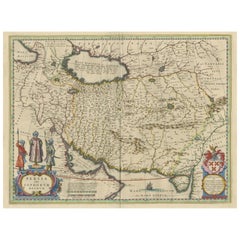
Original Antique Woodcut Map of Persia
About the Item
Antique map titled 'Tabula V Asiae'. Important early woodcut map of Persia, depicting the area of Mesopotamia, Armenia and the Gulf, to the Caspian and Carmania (Iran). Includes names of places and natural features. In margins: climatic and latitudinal notes. Descriptive text within ornamental borders on verso.
This map originates from 'Claudii Ptolemaei Geograhicae' by Claudius Ptolemy (Latin: Ptolemaeus).
- Dimensions:Height: 14.97 in (38 cm)Width: 19.02 in (48.3 cm)Depth: 0.02 in (0.5 mm)
- Materials and Techniques:
- Period:
- Date of Manufacture:1525
- Condition:Repaired: Repairs on and next to folding line. Age-related toning. Shows wear and soiling. Repairs on and next to folding line. Vertical tear in top margin (next to folding line), sl. affecting image. Latin text on verso. Please study image carefully.
- Seller Location:Langweer, NL
- Reference Number:
About the Seller
5.0
Platinum Seller
These expertly vetted sellers are 1stDibs' most experienced sellers and are rated highest by our customers.
Established in 2009
1stDibs seller since 2017
1,933 sales on 1stDibs
Typical response time: <1 hour
- ShippingRetrieving quote...Ships From: Langweer, Netherlands
- Return PolicyA return for this item may be initiated within 14 days of delivery.
More From This SellerView All
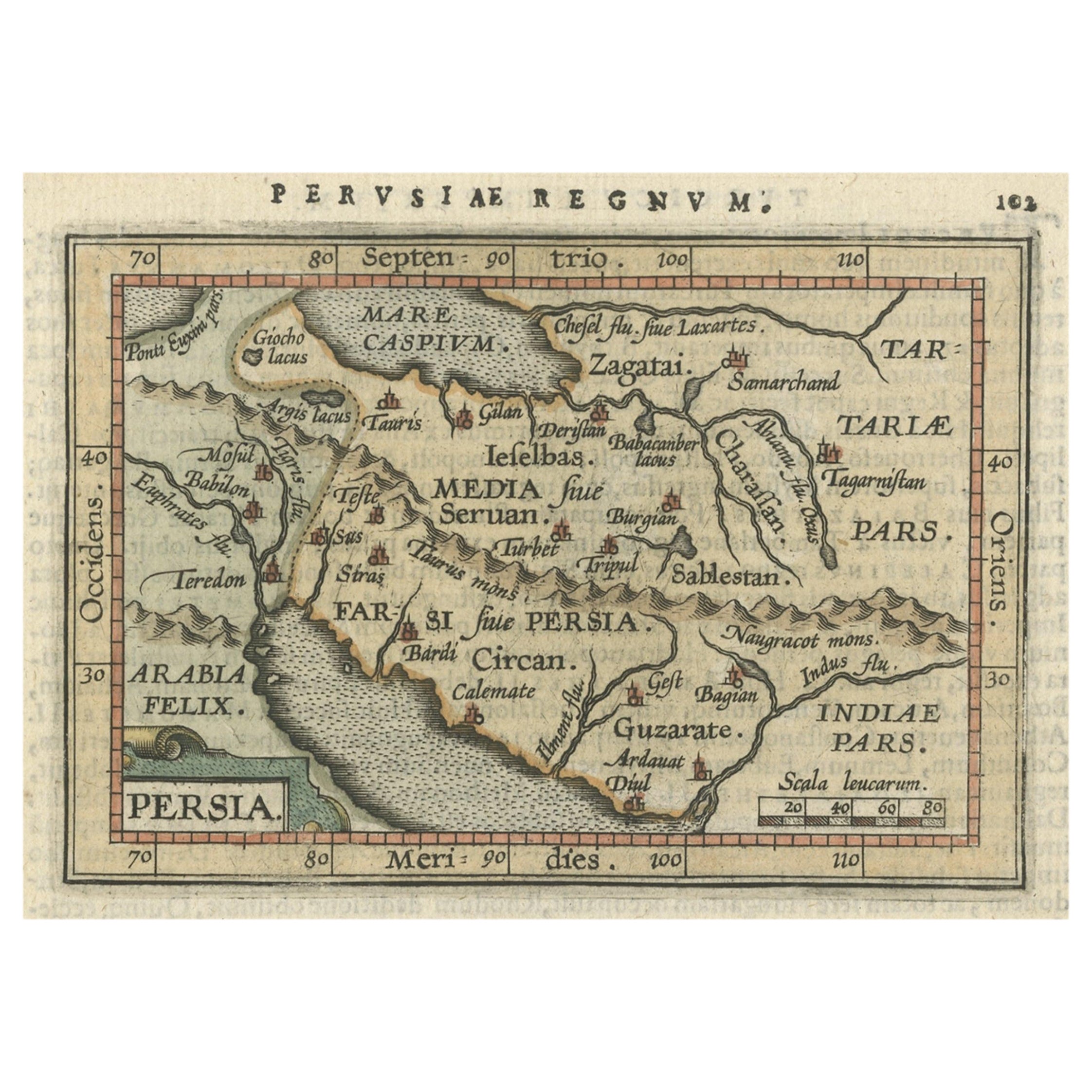
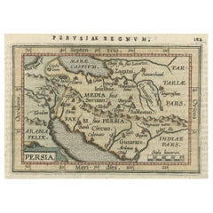
- Original Antique Miniature Map of Persia, Published, ca.1601Located in Langweer, NLAntique miniature map titled 'Persia'. Small map of Persia published in the Epitome, or pocket-edition of the "Theatrum Orbis Terrarum". Artists and e...Category
Antique Early 1600s Maps
MaterialsPaper
- Antique Map of Eastern Persia, 1852Located in Langweer, NLAntique map titled 'Eastern Persia'. Original map of Eastern Persia. This map originates from 'Lowry's Table Atlas constructed and engraved from the most recent Authorities' by J.W. ...Category
Antique Mid-19th Century Maps
MaterialsPaper
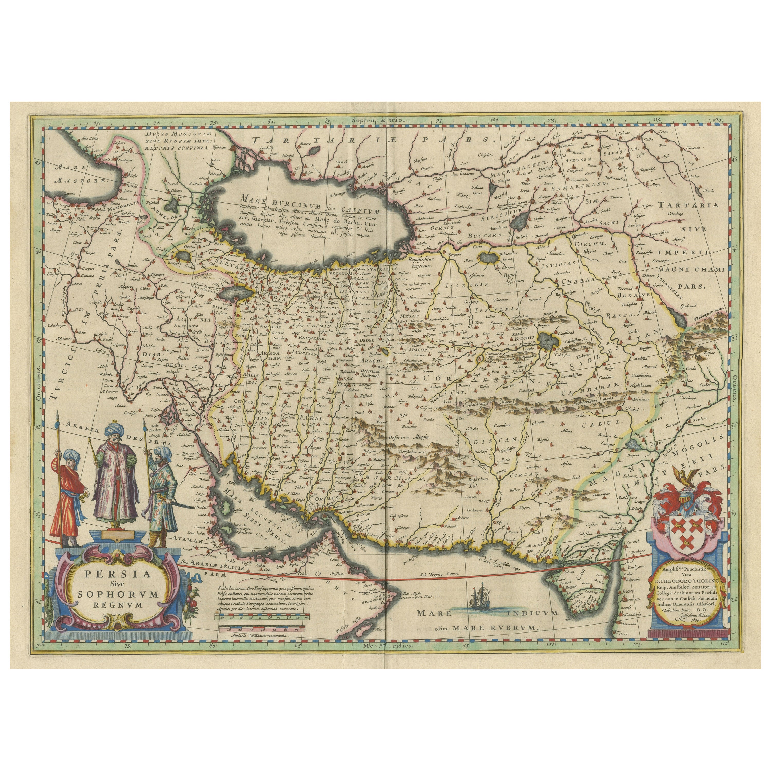
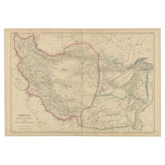
- Antique Map of Persia with Dedication CartoucheLocated in Langweer, NLAntique map titled 'Persia sive Sophorum Regnum'. Original old map of Persia. The map extends from the Eastern Mediteranian to Tacalistan and the Indus River and the Dalanguer Mounta...Category
Antique Mid-17th Century Maps
MaterialsPaper
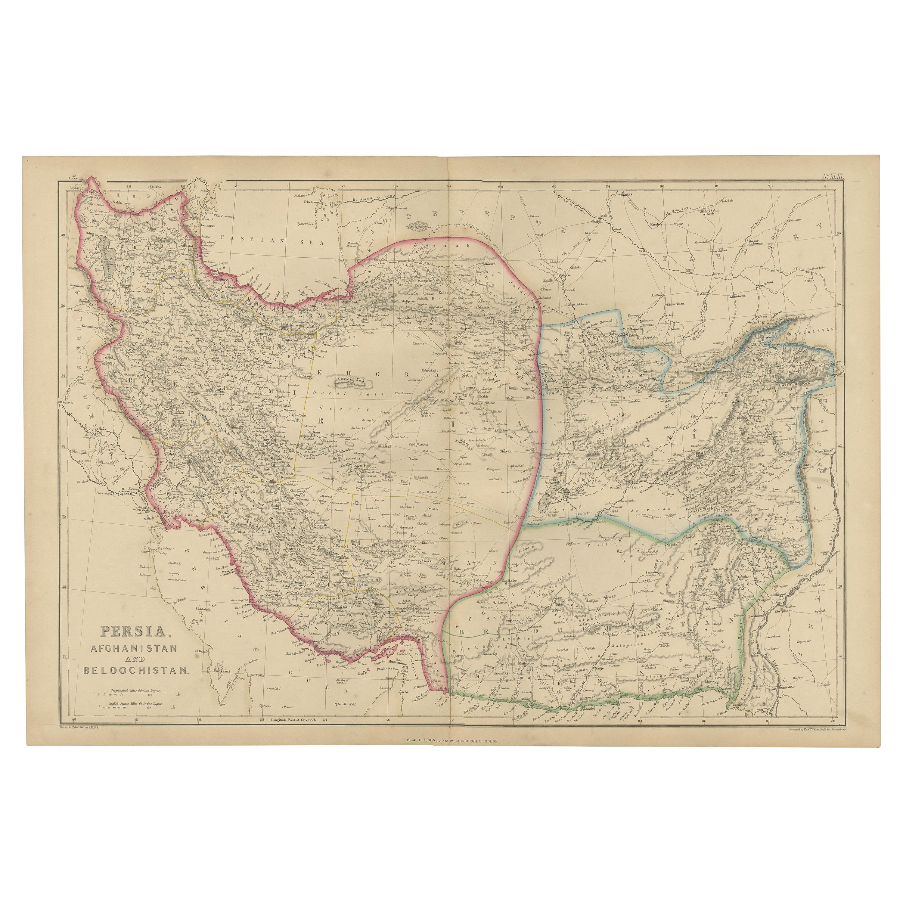
- Antique Map of Persia, Afghanistan and Balochistan, 1859Located in Langweer, NLThe antique map titled "Persia, Afghanistan and Beloochistan" is a remarkable historical document originating from 'The Imperial Atlas of Modern Geography', published by W. G. Blacki...Category
Antique Mid-19th Century Maps
MaterialsPaper
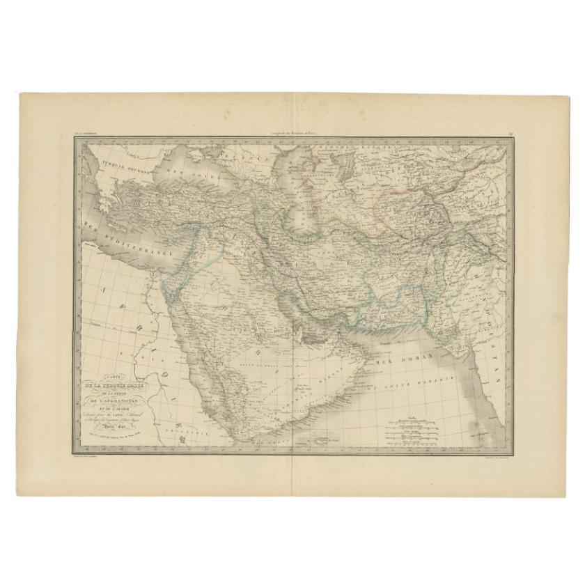
- Antique Map of Turkey, Persia and Afghanistan, 1842By Pierre M. LapieLocated in Langweer, NLAntique map titled 'Carte de la Turquie d'Asia, de la Perse, de l'Afghanistan'. Map of Turkey, Persia and Afghanistan. This map originates from 'Atlas universel de géographie ancienn...Category
Antique 19th Century Maps
MaterialsPaper
- Antique Map of Persia by A. Zatta, circa 1785Located in Langweer, NLAntique map titled 'L'Impero della Persia diviso ne suoi Stati'. The Empire of Persia divided into its states. Originates from 'Atlante Novissimo, illustrato ed accresciuto sulle oss...Category
Antique Late 18th Century Maps
MaterialsPaper


You May Also Like
- Large Original Vintage Map of Persia / Iran, circa 1920Located in St Annes, LancashireGreat maps of Persia. Unframed. Original color. By John Bartholomew and Co. Edinburgh Geographical Institute. Published, circa 1920. Free shipping.Category
Vintage 1920s British Maps
MaterialsPaper
- Original Antique Map of Italy. C.1780Located in St Annes, LancashireGreat map of Italy Copper-plate engraving Published C.1780 Unframed.Category
Antique Early 1800s English Georgian Maps
MaterialsPaper

- Original Antique Map of Asia. C.1780Located in St Annes, LancashireGreat map of Asia Copper-plate engraving Published C.1780 Two small worm holes to right side of map Unframed.Category
Antique Early 1800s English Georgian Maps
MaterialsPaper

- Original Antique Map of India. C.1780Located in St Annes, LancashireGreat map of India Copper-plate engraving Published C.1780 Three small worm holes to right side of map and one bottom left corner Unframed.Category
Antique Early 1800s English Georgian Maps
MaterialsPaper

- Original Antique Map of Indonesia, 1861Located in St Annes, LancashireGreat map of Indonesia Drawn and engraved by Edward Weller Original color Published in The Weekly Dispatch Atlas, 1861 Repairs to minor e...Category
Antique 1860s English Victorian Maps
MaterialsPaper

- Original Antique Map of Italy. Arrowsmith. 1820Located in St Annes, LancashireGreat map of Italy Drawn under the direction of Arrowsmith Copper-plate engraving Published by Longman, Hurst, Rees, Orme and Brown, 1820 Unframed.Category
Antique 1820s English Maps
MaterialsPaper

Recently Viewed
View AllMore Ways To Browse
Map Of The Netherlands
Italian Maps
Antique Old World Maps
Paris Antique Map
Vintage Map World
Vintage Maps World
Furniture From Portugal Antique
Map Of Indonesia
United States Antique Map
Antique Map Coats Of Arms
Antique North American Map
Antique North American Maps
New York Antique Maps
Old Compass
Antique Book Map France
Antique Map Of South Of France
Office Depot
Old Maps England