Items Similar to Original Antique Miniature Map of Persia, Published, ca.1601


Want more images or videos?
Request additional images or videos from the seller
1 of 5
Original Antique Miniature Map of Persia, Published, ca.1601
About the Item
Antique miniature map titled 'Persia'. Small map of Persia published in the Epitome, or pocket-edition of the "Theatrum Orbis Terrarum".
Artists and engravers: Abraham Ortelius (1527 -1598) was a Flemish cartographer, cosmographer, geographer and publisher and a contemporary of Gerard Mercator, with whom he travelled through Italy and France. Although it is Mercator who first used the word "Atlas" as a name for a collection of maps, it is Ortelius who is remembered as the creator of the first modern atlas. Theatrum Orbis Terrarum was the first systematically collated set of maps by different map makers in a uniform format. Three Latin editions as well as a Dutch, French and German edition of Theatrum Orbis Terrarum were published by 1572 and a further 25 editions printed before Ortelius' death in 1598. Several more were subsequently printed until around 1612. Ortelius is said to have been the first person to pose the question of the continents once being a single land mass before separating into their current positions.
- Dimensions:Height: 5.12 in (13 cm)Width: 6.7 in (17 cm)Depth: 0 in (0.02 mm)
- Materials and Techniques:
- Period:1600-1609
- Date of Manufacture:circa 1601
- Condition:Wear consistent with age and use. Condition: Very good, Latin text on verso. Please study image carefully.
- Seller Location:Langweer, NL
- Reference Number:
About the Seller
5.0
Platinum Seller
These expertly vetted sellers are 1stDibs' most experienced sellers and are rated highest by our customers.
Established in 2009
1stDibs seller since 2017
1,916 sales on 1stDibs
Typical response time: <1 hour
- ShippingRetrieving quote...Ships From: Langweer, Netherlands
- Return PolicyA return for this item may be initiated within 14 days of delivery.
More From This SellerView All
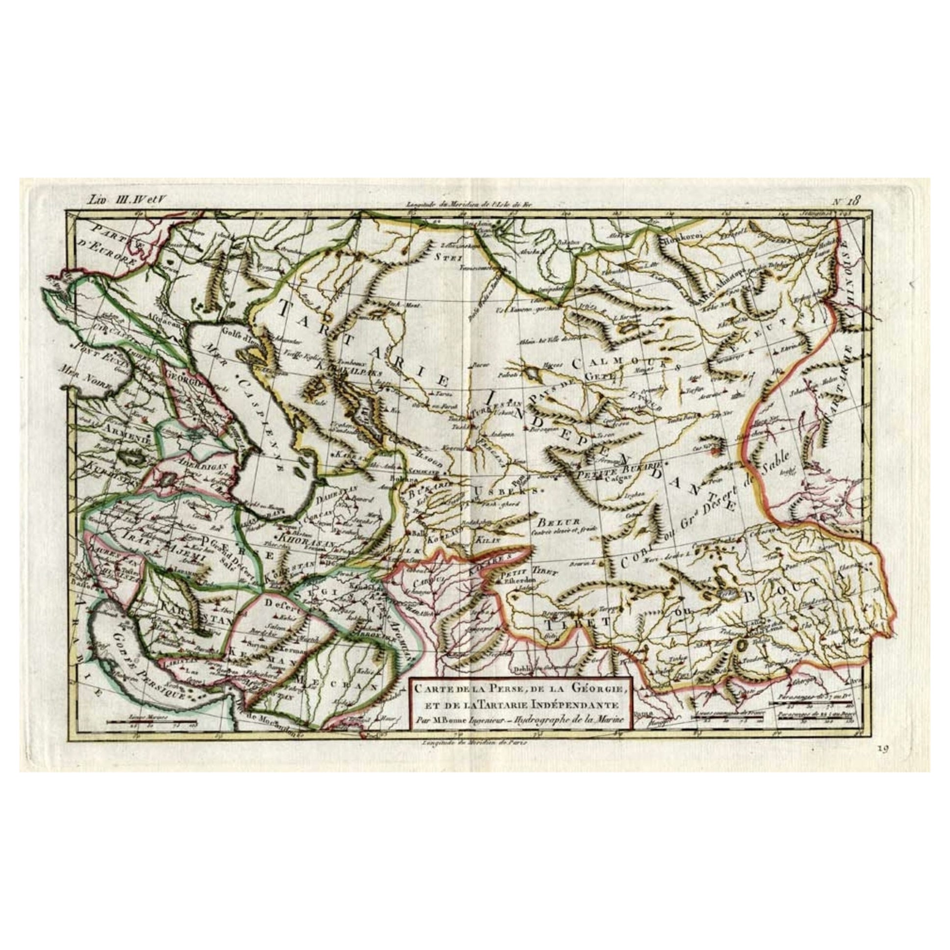
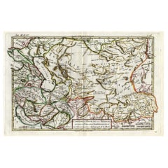
- Antique Map of Persia, Georgia and Kazakhstan, ca.1780Located in Langweer, NLAntique map titled 'Carte de la Perse, de la Georgie, et de la Tartarie Independante'. Map of Persia, Georgia and Kazakhstan. This map shows current days Georgia, Iran, Irak, Kaz...Category
Antique 1780s Maps
MaterialsPaper
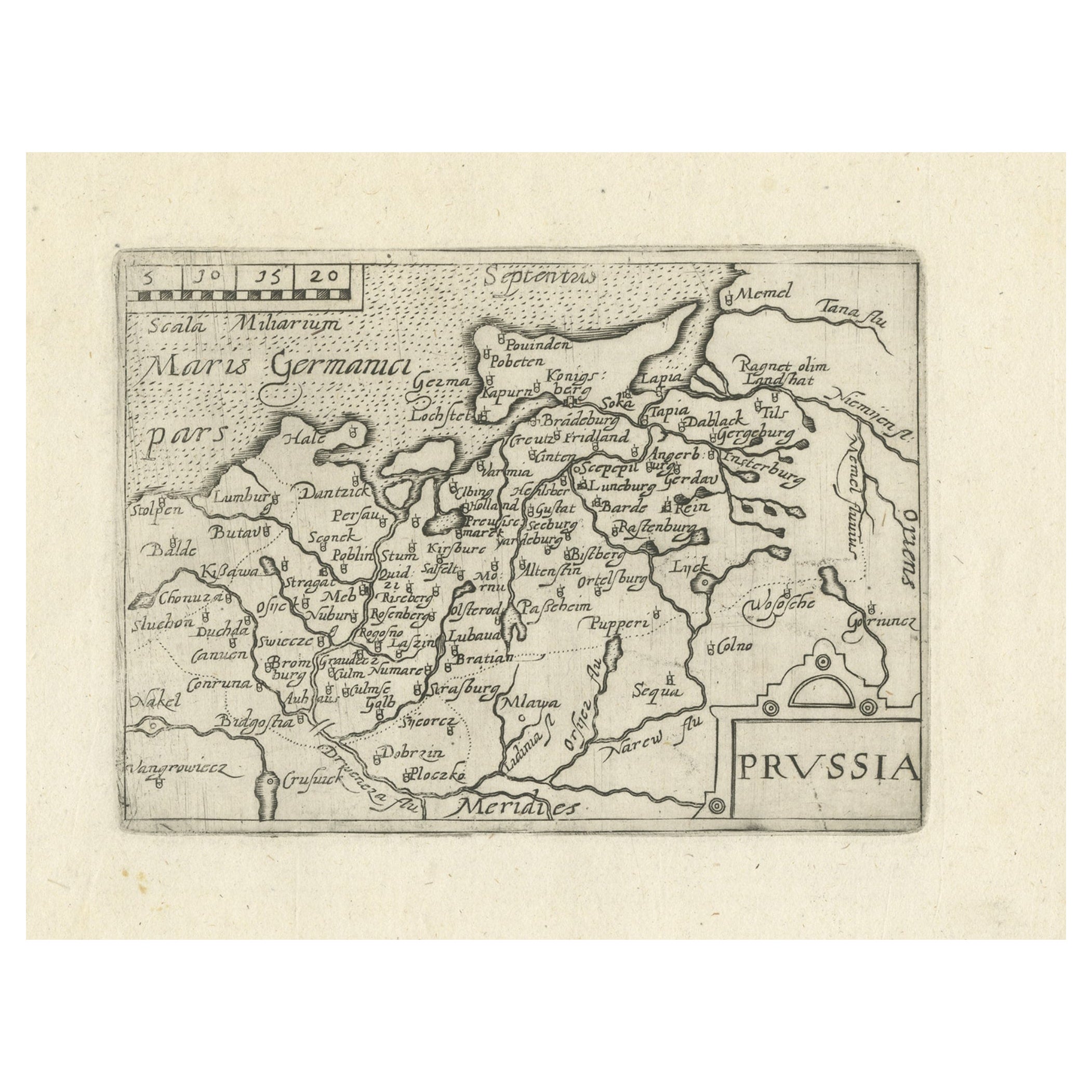
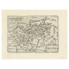
- Extremele Rare, Original Miniature Map of Prussia, ca.1640Located in Langweer, NLAntique map titled 'Prussia'. Extremele rare, original miniature map of Prussia, a historically prominent German state that originated in 1525 with a du...Category
Antique 1640s Maps
MaterialsPaper
- Antique Map of Eastern Persia, 1852Located in Langweer, NLAntique map titled 'Eastern Persia'. Original map of Eastern Persia. This map originates from 'Lowry's Table Atlas constructed and engraved from the most recent Authorities' by J.W. ...Category
Antique Mid-19th Century Maps
MaterialsPaper
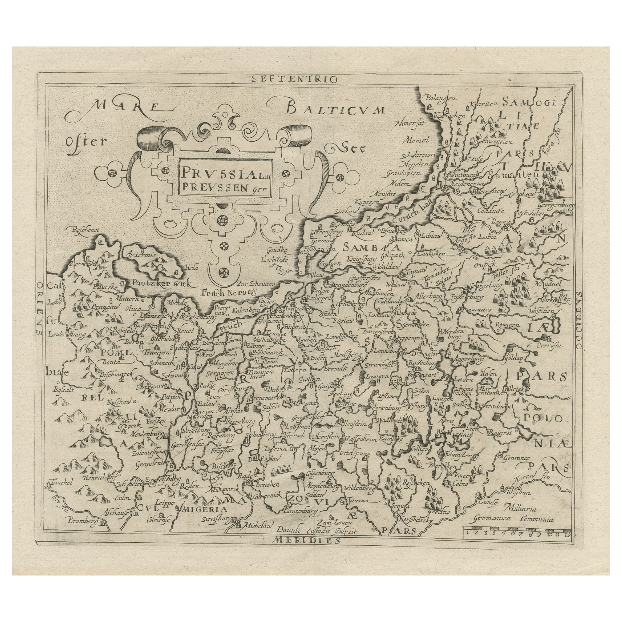
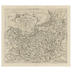
- Original Antique Map of Prussia, ca.1630Located in Langweer, NLAntique map titled 'Prussia - Preussen'. Original map of Prussia, a historically prominent German state that originated in 1525 with a duchy centered on...Category
Antique 1630s Maps
MaterialsPaper
- Original Antique Map of Southern Asia, Published in 1833Located in Langweer, NLAntique map titled 'Carte de l'Inde'. Detailed map extending from India in the west to Vietnam and the Malay Peninsula in the east. This map originates from 'Atlas universel de geogr...Category
Antique Mid-19th Century Maps
MaterialsPaper
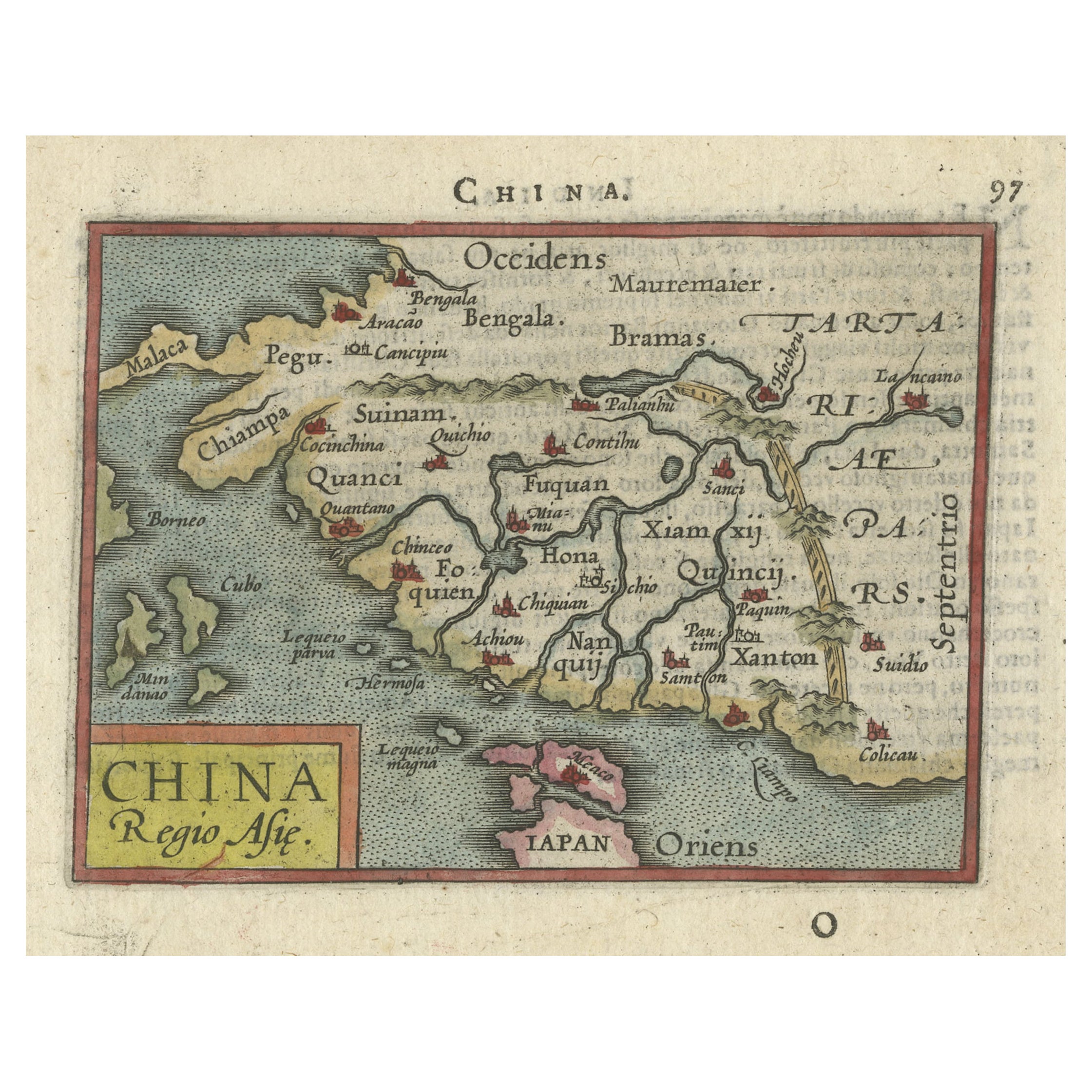
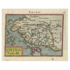
- Rare 16th Century Original Handcolored Miniature Map of China, Published in 1593Located in Langweer, NLVery handsome original old coloured copper engraving of China. The northern part of Japan is projected as well. Many cities and areas are mentioned in the old spelling, incl Malacca,...Category
Antique 16th Century Maps
MaterialsPaper


You May Also Like
- Original Antique Map of Italy. C.1780Located in St Annes, LancashireGreat map of Italy Copper-plate engraving Published C.1780 Unframed.Category
Antique Early 1800s English Georgian Maps
MaterialsPaper

- Original Antique Map of Asia. C.1780Located in St Annes, LancashireGreat map of Asia Copper-plate engraving Published C.1780 Two small worm holes to right side of map Unframed.Category
Antique Early 1800s English Georgian Maps
MaterialsPaper

- Original Antique Map of India. C.1780Located in St Annes, LancashireGreat map of India Copper-plate engraving Published C.1780 Three small worm holes to right side of map and one bottom left corner Unframed.Category
Antique Early 1800s English Georgian Maps
MaterialsPaper

- Original Antique Map of Hungary, Arrowsmith, 1820Located in St Annes, LancashireGreat map of Hungary Drawn under the direction of Arrowsmith. Copper-plate engraving. Published by Longman, Hurst, Rees, Orme and Brown, 1820 Unframed.Category
Antique 1820s English Maps
MaterialsPaper
- Original Antique Map of France, Arrowsmith, 1820Located in St Annes, LancashireGreat map of France Drawn under the direction of Arrowsmith. Copper-plate engraving. Published by Longman, Hurst, Rees, Orme and Brown, 1820 Unframed.Category
Antique 1820s English Maps
MaterialsPaper
- Original Antique Map of Canada, Arrowsmith, 1820Located in St Annes, LancashireGreat map of Canada. Drawn under the direction of Arrowsmith. Copper-plate engraving. Published by Longman, Hurst, Rees, Orme and Brown, 1820 ...Category
Antique 1820s English Maps
MaterialsPaper


