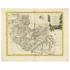
Antique Maps Persia

10
to
26
94
20
65
44
42
17
17
12
12
11
11
10
7
7
5
5
5
4
4
4
3
2
2
2
2
2
2
1
1
1
1
1
1
1
1
1
1
1
2
1
1
1
1
Sort By
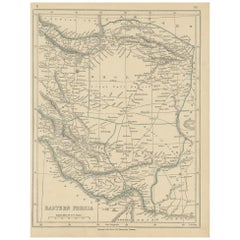
Antique Map of Eastern Persia, 1852
Located in Langweer, NL
Antique map titled 'Eastern Persia'. Original map of Eastern Persia. This map originates from
Category

Mid-19th Century Antique Maps Persia

Materials

Paper

Antique Map of Eastern Persia, 1852
H 12.21 in W 9.45 in D 0.02 in
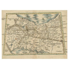
Original Antique Woodcut Map of Persia
Located in Langweer, NL
Antique map titled 'Tabula V Asiae'. Important early woodcut map of Persia, depicting the area of
Category

16th Century Antique Maps Persia

Materials

Paper

Original Antique Woodcut Map of Persia
H 14.97 in W 19.02 in D 0.02 in
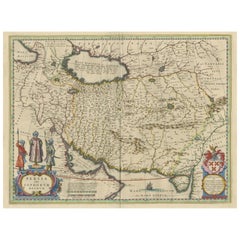
Antique Map of Persia with Dedication Cartouche
Located in Langweer, NL
Antique map titled 'Persia sive Sophorum Regnum'. Original old map of Persia. The map extends from
Category

Mid-17th Century Antique Maps Persia

Materials

Paper

Antique Map of Persia with Dedication Cartouche
Free Shipping
H 20.01 in W 24.02 in D 0.02 in
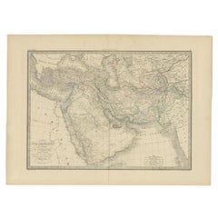
Antique Map of Turkey, Persia and Afghanistan, 1842
By Pierre M. Lapie
Located in Langweer, NL
, Persia and Afghanistan. This map originates from 'Atlas universel de géographie ancienne et moderne
Category

19th Century Antique Maps Persia

Materials

Paper

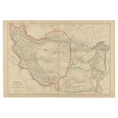
Antique Map of Persia, Afghanistan and Balochistan, 1859
Located in Langweer, NL
The antique map titled "Persia, Afghanistan and Beloochistan" is a remarkable historical document
Category

Mid-19th Century Antique Maps Persia

Materials

Paper

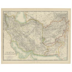
Antique Map of Persia and Afghanistan by Johnston '1909'
Located in Langweer, NL
Antique map titled 'Persia and Afghanistan'. Original antique map of Persia and Afghanistan. This
Category

Early 20th Century Antique Maps Persia

Materials

Paper

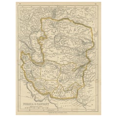
Antique Map of Persia and Tartary by Lowry, '1852'
Located in Langweer, NL
Antique map titled 'Persia and Tartary'. Original map of Persia and Tartary. This map originates
Category

Mid-19th Century Antique Maps Persia

Materials

Paper

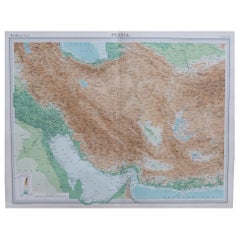
Large Original Vintage Map of Persia / Iran, circa 1920
Located in St Annes, Lancashire
Great maps of Persia. Unframed. Original color. By John Bartholomew and Co. Edinburgh
Category

1920s British Antique Maps Persia

Materials

Paper

Antique Map of Persia by A. Zatta, circa 1785
Located in Langweer, NL
Antique map titled 'L'Impero della Persia diviso ne suoi Stati'. The Empire of Persia divided into
Category

Late 18th Century Antique Maps Persia

Materials

Paper

Antique Map of Persia by A. Zatta, circa 1785
H 14.97 in W 19.3 in D 0.02 in
Original Antique Miniature Map of Persia, Published, ca.1601
Located in Langweer, NL
Antique miniature map titled 'Persia'. Small map of Persia published in the Epitome, or pocket
Category

Early 1600s Antique Maps Persia

Materials

Paper

Antique Map of Persia, Georgia and Kazakhstan, ca.1780
Located in Langweer, NL
Persia, Georgia and Kazakhstan. This map shows current days Georgia, Iran, Irak, Kazakhstan, Armenia
Category

1780s Antique Maps Persia

Materials

Paper

Antique Map of Persia and Afghanistan by Johnston, 1882
Located in Langweer, NL
Antique map titled 'Persia and Afghanistan'. Old map of Persia and Afghanistan. This map
Category

19th Century Antique Maps Persia

Materials

Paper

Authentic Old Map of Persia with Original Border Coloring, 1745
Located in Langweer, NL
Lat Creator: Keizer, Jacob, active 1706-1750 Map of Persia with parts of Persia, Egypt and Abyssinia
Category

1740s Antique Maps Persia

Materials

Paper

Persia Unveiled: Antique Map of Iran, Afghanistan, and Beyond, 1852
Located in Langweer, NL
The antique map titled 'Royaumes de Perse Herat & Kaboul' is an attractive map of Persia. Here are
Category

Mid-19th Century Antique Maps Persia

Materials

Paper

Antique Map of the Turkish Empire and Persia, circa 1890
By J. Migeon
Located in Langweer, NL
Empire and Persia. With vignette depicting Damascus. This map originates from 'Nouvel Atlas Illustre
Category

19th Century Antique Maps Persia

Materials

Paper

Antique Map of Ancient Persia, Assyria and surroundings, c.1760
Located in Langweer, NL
, Persische, Grieksche en daarna Romeinsche Heerschappy.' Map of ancient Persia, Assyria etc. Source unknown
Category

18th Century Antique Maps Persia

Materials

Paper

Antique Map of Persia, Also Showing the Indus River, circa 1673
By Joan (Johannes) Blaeu
Located in Langweer, NL
Antique map titled 'Persia sive Sophorum Regnum'. Original old map of Persia. The map extends from
Category

Late 17th Century Antique Maps Persia

Materials

Paper

Oriental Realms: A Detailed Map of Persia, Afghanistan, and Beloochistan, 1882
Located in Langweer, NL
This historical map from the 1882 atlas published by Blackie & Son is a comprehensive depiction of
Category

1880s Antique Maps Persia

Materials

Paper

Antique Map of Persia, Georgia and Kazakhstan by Bonne, c.1780
Located in Langweer, NL
Persia, Georgia and Kazakhstan. This map shows current days Georgia, Iran, Irak, Kazakhstan, Armenia
Category

18th Century Antique Maps Persia

Materials

Paper

Old Map Depicting Turkey, Persia, Arab and Black Sea Etc, 1778
Located in Langweer, NL
Antique map titled 'Turquie d'Asie, Arabie, Perse, Tartarie Independante'. Old map of Turkey in
Category

1770s Antique Maps Persia

Materials

Paper

Safavid Splendor: Antique Map of Persia During the Safavid Dynasty, circa 1645
Located in Langweer, NL
The antique map of Persia titled 'Persia sive Sophorum Regnum' is a remarkable historical document
Category

Mid-17th Century Antique Maps Persia

Materials

Paper

Antique Map of Southeast Asia from Persia to the Timor Island, 1712
Located in Langweer, NL
Antique map titled 'A New Map of the East Indies'. Old map covering all of Southeast Asia from
Category

1710s Antique Maps Persia

Materials

Paper

Antique Map of the Caspian Sea, Uzbekistan, Northern Persia Etc, C.1735
Located in Langweer, NL
Antique map titled 'Nova Maris Caspii et Regions Usbeck (..).' Detailed map of Central Asia
Category

18th Century Antique Maps Persia

Materials

Paper

Old Map of Tartary with Persia, Siberia, the Mogul Territories & China, ca.1717
Located in Langweer, NL
, Tibet, Lassa & c'. Old map depicting east of the Caspian Sea with parts of Persia, Siberia, the Mogul
Category

1710s Antique Maps Persia

Materials

Paper

Exploring Ancient Persia: Ptolemaic Map of Iran and Iraq by Ptolemy and Mercator
Located in Langweer, NL
number of editions of his Geographia beginning in 1477. These early editions contained maps based on his
Category

1610s Antique Maps Persia

Materials

Paper

Persia, Armenia & Adjacent Regions: A 17th Century Hand-colored Map by De Wit
By Frederick de Wit
Located in Alamo, CA
A large 17th century hand colored copperplate engraved map entitled "Novissima nec non
Category

Late 17th Century Dutch Antique Maps Persia

Materials

Paper

Rare Antique Map of Persia, Incl the Caspian Sea and the Arabian Peninsula, 1726
Located in Langweer, NL
Rare untitled antique map of Persia. It covers from the Gulf of Suez eastward to Ahmedabad
Category

1720s Antique Maps Persia

Materials

Paper

Wonderful Small Map of the Coasts of Arabia, Persia and Western India, ca. 1710
Located in Langweer, NL
Wonderful small map covering the coasts of Arabia, Persia and western India. It illustrates the
Category

Early 18th Century European Antique Maps Persia

Materials

Paper

Old Map Covering All of Southeast Asia from Persia to the Timor Island, 1712
Located in Langweer, NL
Description: Antique map titled 'A New Map of the East Indies'. Old map covering all of Southeast
Category

1710s Antique Maps Persia

Materials

Paper

Old Map of Persia, incl the Caspian Sea and Part of the Arabian Peninsula, 1726
Located in Langweer, NL
Antique map of Persia. It covers from the Gulf of Suez eastward to Ahmedabad (Amadabad) in modern
Category

1720s Antique Maps Persia

Materials

Paper

Old Map of the Mughal Empire, Persia in the West to Lake Chimay etc., ca.1685
Located in Langweer, NL
Antique map titled 'L'Empire du Grand Mogol'. Old map of India and Central Asia. The map
Category

1680s Antique Maps Persia

Materials

Paper

Antique Map Made After a Roman Papyrus Travel Map, Known as Peutinger Map, 1773
Located in Langweer, NL
, Persia, and India. According to one hypothesis, the existing map is based on a document of the 4th or 5th
Category

18th Century Antique Maps Persia

Materials

Paper

Panoramic Antique View of Bandar-Abbas 'Formerly Gamron, Persia' in Iran, 1714
Located in Langweer, NL
/ Persia. This print originates from 'Reizen over Moskovie, door Persie en Indie' by C. de Bruyn
Category

1710s Antique Maps Persia

Materials

Paper

Decorative Antique Map of Central Asia
Located in Langweer, NL
Antique map titled 'Carte de la Tartarie Indépendante (..)'. Decorative map of Central Asia
Category

Late 18th Century Antique Maps Persia

Materials

Paper

Decorative Antique Map of Central Asia
H 14.57 in W 19.69 in D 0.02 in
Original Antique Plan of the Fortress of Charedsch in Persia or Iran, ca.1780
Located in Langweer, NL
extensively in Arabia, Persia, Palestine and Asia Minor, and became by his descriptions and maps and the
Category

1780s Antique Maps Persia

Materials

Paper

Antique Map of Afghanistan and Surroundings, '1845'
Located in Langweer, NL
Antique map titled 'Map of Persia and Caubul'. Original antique map of Afghanistan and surroundings
Category

Mid-19th Century Antique Maps Persia

Materials

Paper

Antique Map of West Asia, circa 1900
Located in Langweer, NL
Antique map titled 'Persia, Afghanistan and Beloochistan'. Folding map on linen. Published
Category

Early 20th Century Antique Maps Persia

Materials

Paper

Antique Map of West Asia, circa 1900
H 20.67 in W 25.4 in D 0.02 in
Antique Map of the Region of the Arabian Sea
Located in Langweer, NL
Antique map titled 'A Chart of the Coast of Persia, Guzarat & Malabar'. Old map centered on the
Category

Mid-18th Century Antique Maps Persia

Materials

Paper

Antique Map of the Region of the Arabian Sea
H 11.03 in W 8.39 in D 0.02 in
Antique Map of Turkey in Asia by Lowry '1852'
Located in Langweer, NL
Antique map titled 'Turkey in Asia, Georgia & Western Persia'. Two individual sheets of Turkey in
Category

Mid-19th Century Antique Maps Persia

Materials

Paper

Antique Map of Turkey in Asia by Lowry '1852'
H 12.21 in W 9.65 in D 0.02 in
Antique Map of the East Indies by Moll '1745'
Located in Langweer, NL
Antique map titled 'A Chart of ye East-Indies. With the Coast of Persia, China also the Philipina
Category

Mid-18th Century Antique Maps Persia

Materials

Paper

Antique Map of the East Indies by Moll '1745'
H 13.98 in W 16.93 in D 0.02 in
Authentic Old Map of Arabia with Original Border Coloring, 1745
Located in Langweer, NL
Lat Creator: Keizer, Jacob, active 1706-1750 Map of Arabia with parts of Persia, Egypt and Abyssinia
Category

1740s Antique Maps Persia

Materials

Paper

Antique Map of the Province of Kilan by Olearius '1662'
Located in Langweer, NL
Antique map titled 'A Map of ye Province of Kilan as it lies on ye Caspian Sea'. Rare map of the
Category

Mid-17th Century Antique Maps Persia

Materials

Paper

Antique Map of the Middle East with a Large Arabia, 1799
Located in Langweer, NL
Antique map titled 'Perse, Turquie Asiatique et Arabie (..)'. Map of the Middle East with a large
Category

Late 18th Century Antique Maps Persia

Materials

Paper

Antique Map of the Middle East with a Large Arabia, 1799
Free Shipping
H 11.03 in W 15.63 in D 0.02 in
Antique Map of The Kingdom of Alexander the Great, Published in 1880
Located in Langweer, NL
The map is titled "ALEXANDRI MAGNI REGNUM," which translates to "The Kingdom of Alexander the Great
Category

1880s Antique Maps Persia

Materials

Paper

Original Copper Engraving of a Map of Syria and Lebanon, 1698
Located in Langweer, NL
Antique map titled 'Syriae, sive Soriae, Nova et Accurata Descriptio.' Map of Syria and Lebanon
Category

1690s Antique Maps Persia

Materials

Paper

Original Copper Engraving of a Map of Syria and Lebanon, 1698
Free Shipping
H 12.41 in W 14.45 in D 0 in
Antique Map of the Coast of Southwest Asia by Kitchin, c.1770
By Thomas Kitchin
Located in Langweer, NL
Antique map titled 'Chart of the Coast of Persia, Malabar & c'. Antique map of the coast of
Category

18th Century Antique Maps Persia

Materials

Paper

Empire's Crossroads: An 1882 Map of Turkey in Asia by Blackie & Son
Located in Langweer, NL
Mediterranean Sea to the borders of Persia and from the Black Sea down to the Arabian Peninsula. The map is a
Category

1880s Antique Maps Persia

Materials

Paper

Imperial Frontiers: A 19th Century Map of Southern Russia and the Caucasus, 1882
Located in Langweer, NL
precision. To the south, the map also encompasses parts of the Ottoman Empire and Persia (modern-day Turkey
Category

1880s Antique Maps Persia

Materials

Paper

Old Ptolemaic Map of the Region Between the Persian Gulf and Caspian Sea, 1598
Located in Langweer, NL
"Tabula Asiae V", Ptolemy/Ruscelli Subject: Persia - Iran Period: 1598 (published) Publication
Category

16th Century Antique Maps Persia

Materials

Paper

Antique Detailed Map of Jerusalem in Israël with Extensive Key and Scale, 1698
Located in Langweer, NL
Antique map titled 'Jerusalem.' Plan of the ancient city of Jerusalem. With extensive key and
Category

17th Century Antique Maps Persia

Materials

Paper

1718 Ides & Witsen Map "Route D'amsterdam a Moscow Et De La Ispahan Et Gamron
Located in Norton, MA
1718 Ides & Witsen map, entitled "Route D'Amsterdam A Moscow Et De La Ispahan Et Gamron
Category

Early 18th Century Dutch Antique Maps Persia

Materials

Paper

Empires of Antiquity: The Persian Realm and Beyond Engraved, Published in 1880
Located in Langweer, NL
The map is titled "ORBIS TERRARUM regni Persici tempore," which translates from Latin to "The World
Category

1880s Antique Maps Persia

Materials

Paper

Persia & Afghanistan: A Framed Hand-colored 17th Century Map by John Cary
By John Cary
Located in Alamo, CA
This colorful and detailed early 18th century copperplate map by John Cary entitled "A New Map of
Category

Early 19th Century Old Masters Antique Maps Persia

Materials

Engraving

Bonne, Map of Middle East, Persia, Red Sea, Egypt, Nubia Hand Coloured
Located in Norwich, GB
cartographic documents in Paris, Bonne was able to compile maps containing some of the most up-to-date
Category

1780s French Antique Maps Persia

Materials

Paper

Persia, Armenia & Adjacent Regions: A Hand-colored 17th Century Map by De Wit
By Frederick de Wit
Located in Alamo, CA
This colorful and detailed 17th century copperplate map by Frederick De Wit was published in
Category

Late 17th Century Old Masters Antique Maps Persia

Materials

Engraving

Map of the East Indies: An Original 18th Century Hand-colored Map by E. Bowen
Located in Alamo, CA
This is an original 18th century hand-colored map entitled "An Accurate Map of the East Indies
Category

Mid-18th Century Old Masters Antique Maps Persia

Materials

Engraving

Asia Declineatio: A 17th Century Hand-colored Map of Asia by Justus Danckerts
Located in Alamo, CA
This is a scarce 17th century beautifully hand-colored copperplate engraved map of Asia entitled
Category

Late 17th Century Old Masters Antique Maps Persia

Materials

Engraving

Antique Print of Broitschia/Bharuch, Suratte/Gujarat, India, 1727
Located in Langweer, NL
, who wrote about his travels through Persia and India. Condition: Good, general age-related toning
Category

18th Century Antique Maps Persia

Materials

Paper

Original Antique View of the City of Damietta, Egypt, 1774
Located in Langweer, NL
(1733-1815) travelled extensively in Arabia, Persia, Palestine and Asia Minor, and became by his
Category

1770s Antique Maps Persia

Materials

Paper

Wonderful and extremely rare Dutch pocketglobe
By Dementz Family DEUR Art Company
Located in ZWIJNDRECHT, NL
Persia covers much of today’s Pakistan, Afghanistan, Iran, Iraq, etc. Tartary Magna covers Russian
Category

Early 18th Century Dutch Dutch Colonial Antique Maps Persia

Materials

Hardwood, Paper

Wonderful and extremely rare Dutch pocketglobe
Free Shipping
H 2.5 in Dm 2.5 in
  • 1
Get Updated with New Arrivals
Save "Antique Maps Persia", and we’ll notify you when there are new listings in this category.

Antique Maps Persia For Sale on 1stDibs

Find many varieties of an authentic antique maps persia available at 1stDibs. An antique maps persia — often made from paper — can elevate any home. Your living room may not be complete without an antique maps persia — find older editions for sale from the 18th Century and newer versions made as recently as the 19th Century. An antique maps persia is a generally popular piece of furniture, but those created in styles are sought with frequency. You’ll likely find more than one antique maps persia that is appealing in its simplicity, but Herman Moll produced versions that are worth a look.

How Much is a Antique Maps Persia?

An antique maps persia can differ in price owing to various characteristics — the average selling price 1stDibs is $148, while the lowest priced sells for $67 and the highest can go for as much as $618.

Read More

Pamela Shamshiri Shares the Secrets behind Her First-Ever Book and Its Effortlessly Cool Interiors

The sought-after designer worked with the team at Hoffman Creative to produce a monograph that beautifully showcases some of Studio Shamshiri's most inspiring projects.

Moroccan Artworks and Objects Take Center Stage in an Extraordinary Villa in Tangier

Italian writer and collector Umberto Pasti opens the doors to his remarkable cave of wonders in North Africa.

Montecito Has Drawn Royalty and Celebrities, and These Homes Are Proof of Its Allure

Hollywood A-listers, ex-pat aristocrats and art collectors and style setters of all stripes appreciate the allure of the coastal California hamlet — much on our minds after recent winter floods.

Whaam! Blam! Pow! — a New Book on Pop Art Packs a Punch

Publishing house Assouline and writer Julie Belcove have teamed up to trace the history of the genre, from Roy Lichtenstein, Andy Warhol and Yayoi Kusama to Mickalene Thomas and Jeff Koons.

The Sparkling Legacy of Tiffany & Co. Explained, One Jewel at a Time

A gorgeous new book celebrates — and memorializes — the iconic jeweler’s rich heritage.

What Makes a Gem-Encrusted Chess Set Worth $4 Million?

The world’s most opulent chess set, weighing in at 513 carats, is literally fit for a king and queen.

Tauba Auerbach’s Geometric Pop-Up Book Is Mighty Rare, Thanks to a Hurricane

This sculptural art book has an epic backstory of its own.

Step inside the Storied Mansions of Palm Beach’s Most Effervescent Architect

From Spanish-style courtyards to fanciful fountains, these acclaimed structures abound in surprising and elegant details.