Items Similar to Old Map of Tartary with Persia, Siberia, the Mogul Territories & China, ca.1717

Want more images or videos?
Request additional images or videos from the seller
1 of 5
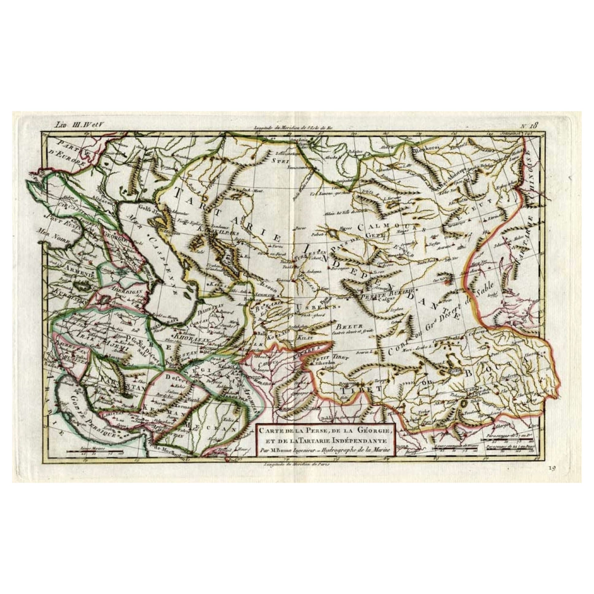
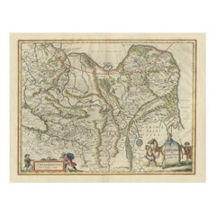
Old Map of Tartary with Persia, Siberia, the Mogul Territories & China, ca.1717
About the Item
Antique map titled 'A Map of Independent Tartary, containing the territories of Usbeck, Gasgar, Tibet, Lassa & c'.
Old map depicting east of the Caspian Sea with parts of Persia, Siberia, the Mogul territories and on to western China. This map originates from 'Atlas geographus, or, A Compleat system of geography, ancient and modern'.
Artists and Engravers: Herman Moll (1654 - 1732), was a London cartographer, engraver, and publisher.
- Dimensions:Height: 8.27 in (21 cm)Width: 11.03 in (28 cm)Depth: 0 in (0.02 mm)
- Materials and Techniques:
- Period:1710-1719
- Date of Manufacture:circa 1717
- Condition:Wear consistent with age and use. Condition: Very good, few marginal tears and small spots. Please study image carefully.
- Seller Location:Langweer, NL
- Reference Number:
About the Seller
5.0
Platinum Seller
These expertly vetted sellers are 1stDibs' most experienced sellers and are rated highest by our customers.
Established in 2009
1stDibs seller since 2017
1,933 sales on 1stDibs
Typical response time: <1 hour
- ShippingRetrieving quote...Ships From: Langweer, Netherlands
- Return PolicyA return for this item may be initiated within 14 days of delivery.
More From This SellerView All
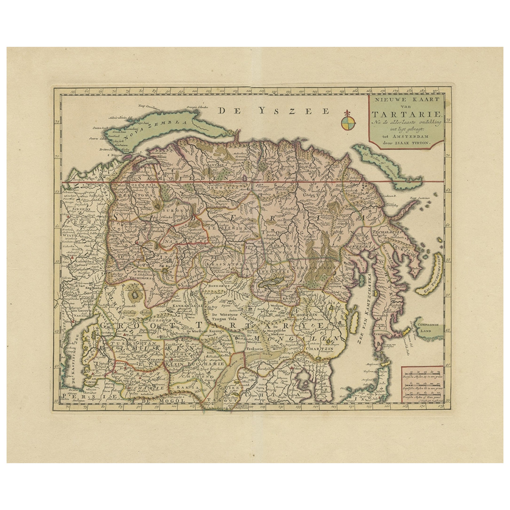
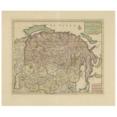
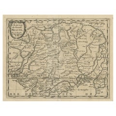
- Antique Map of Siberia and Chinese Tartary, Incl Nova Zembla, ca.1732Located in Langweer, NLAntique map of Tartary titled 'Nieuwe Kaart van Tartarie na de alderlaatste ondekking int ligt gebracht tot Amsterdam door Isaak Tirion'. Map op Siberia and Chinese tartary. In t...Category
Antique 1730s Maps
MaterialsPaper
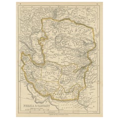
- Antique Map of Persia and Tartary by Lowry, '1852'Located in Langweer, NLAntique map titled 'Persia and Tartary'. Original map of Persia and Tartary. This map originates from 'Lowry's Table Atlas constructed and engraved from the most recent Authorities' ...Category
Antique Mid-19th Century Maps
MaterialsPaper
- Rare Hand-Colored Antique Map of Tartary, China and Korea, ca.1741Located in Langweer, NLAntique map titled 'A General Map of Eastern and Western Tatary, commonly call'd Tartary; drawn from the Particular Maps of the Jesuit Missionaries'. Rare antique map of Tartary, C...Category
Antique 1740s Maps
MaterialsPaper
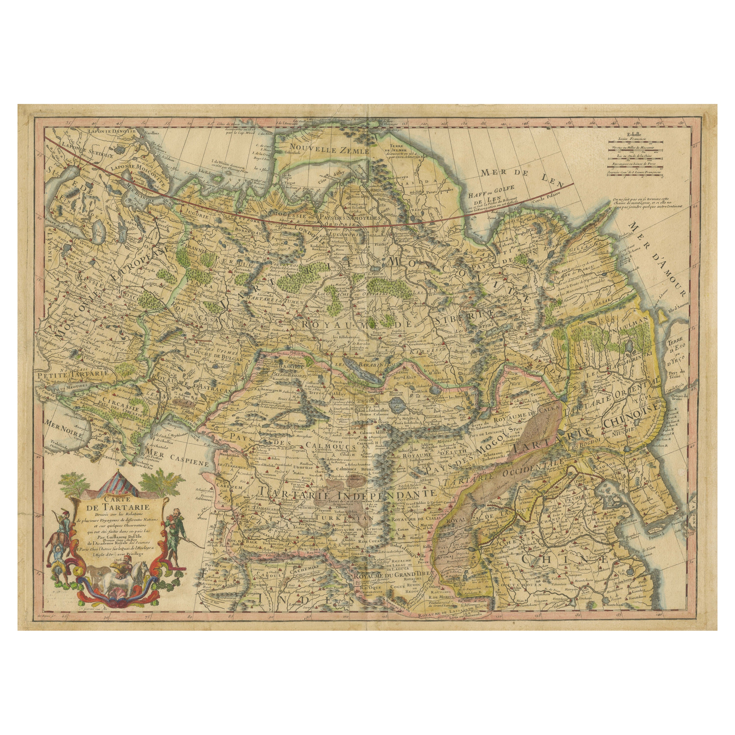
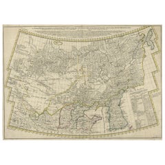
- Antique Map of Tartary, Also Showing the Great Wall of ChinaLocated in Langweer, NLAntique map titled 'Carte de Tartarie'. Detailed map of Tartary, consisting of the Eastern part of Russia, Central Asia, China and Korea, first published by Guillaume De L'Isle in 1706. The map extends from the Peninsula of Korea in the east to the Caspian and Black Seas. The Great Wall of China...Category
Antique Early 18th Century Maps
MaterialsPaper
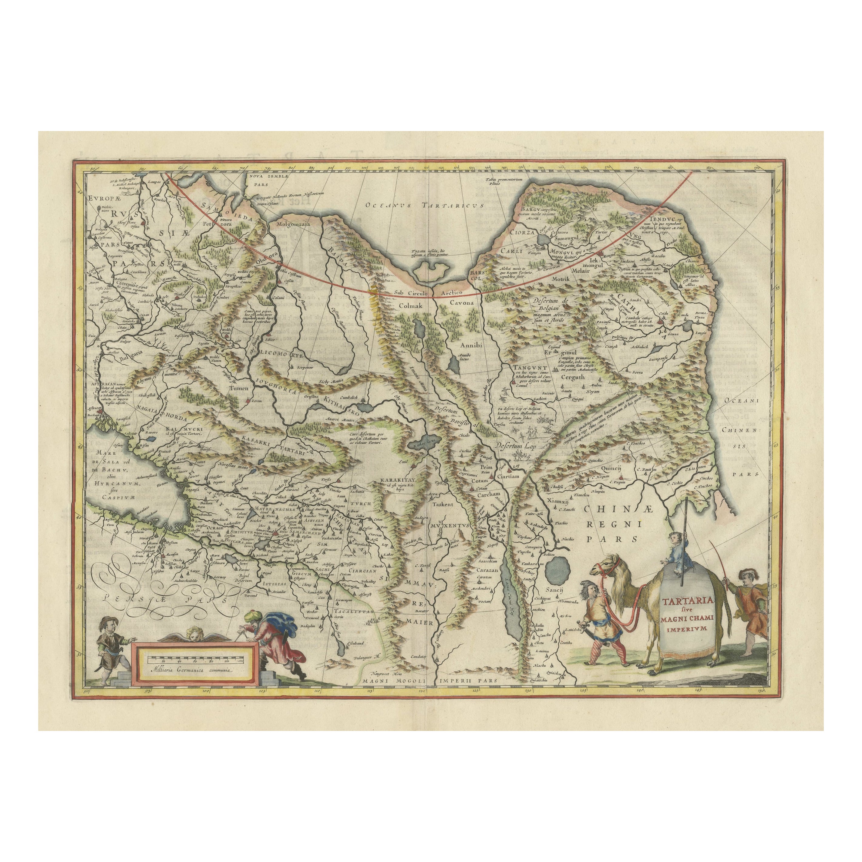
- Old Genuine Antique Map of Tartary in the Russian Far EastLocated in Langweer, NLOriginal antique map titled 'Tartaria sive Magni Chami Imperium'. This great map of Tartary covers all of eastern Asia between the Caspian Sea and northern China and Manchuria. Being...Category
Antique Mid-17th Century Maps
MaterialsPaper
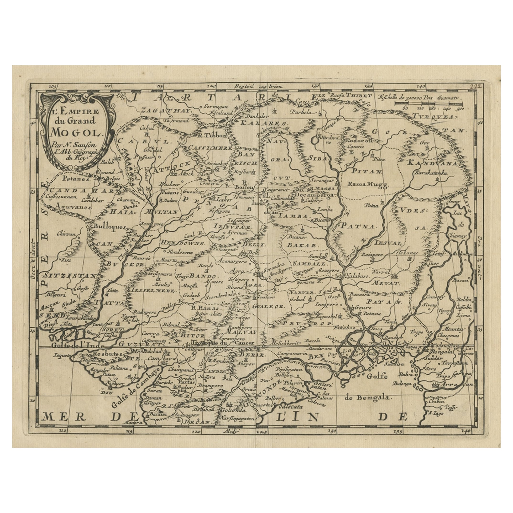
- Old Map of the Mughal Empire, Persia in the West to Lake Chimay etc., ca.1685Located in Langweer, NLAntique map titled 'L'Empire du Grand Mogol'. Old map of India and Central Asia. The map extends from Persia in the West to Lake Chimay and the Bay of Bengal...Category
Antique 1680s Maps
MaterialsPaper

You May Also Like
- Old Nautical Map of CorsicaLocated in Alessandria, PiemonteST/556/1 - Old map of Corsica isle, surveyed by Captain Hell, of the French Royal Navy in 1824, engraved and published on 1874, with additions and corre...Category
Antique Early 19th Century English Other Prints
MaterialsPaper
- Old Horizontal Map of EnglandBy TassoLocated in Alessandria, PiemonteST/520 - Old rare Italian map of England, dated 1826-1827 - by Girolamo Tasso, editor in Venise, for the atlas of M.r Le-Sage.Category
Antique Early 19th Century Italian Other Prints
MaterialsPaper
- Map of the Republic of GenoaLocated in New York, NYFramed antique hand-coloured map of the Republic of Genoa including the duchies of Mantua, Modena, and Parma. Europe, late 18th century. Dimension: 25...Category
Antique Late 18th Century European Maps
- Original Antique Map of China, Arrowsmith, 1820Located in St Annes, LancashireGreat map of China Drawn under the direction of Arrowsmith Copper-plate engraving Published by Longman, Hurst, Rees, Orme and Brown, 1820 Unfr...Category
Antique 1820s English Maps
MaterialsPaper
- Map "Estuary- Mouth of the Thames"Located in Alessandria, PiemonteST/426 - Antique French Map of the estuary of the Thames, map dated 1769 - "Mape of the entrance of the Thames. Designed by filing of Navy cards fo...Category
Antique Mid-18th Century French Other Prints
MaterialsPaper
- Vintage "View of the Center of Paris Taken from the Air" Lithograph MapLocated in San Diego, CAA very stylish "View of the Center of Paris Taken from the Air" lithograph map published by the Paris Ministry of Tourism, circa early 1950s. The piece measures 27" x 43" and shows...Category
20th Century French Mid-Century Modern Prints
MaterialsPaper


Recently Viewed
View AllMore Ways To Browse
Antique And Modern
Antique Persia
Antique Chinese Furniture London
Chinese Antiques London
Caspian Sea
Antique China Map
Antique Map China
Antique Chinese Maps
Antique Map Of China
Antique Maps Of China
Chinese Antique Map
Tibet Old
C Moll
Atlas China
Map Of Persia
Persia Map
Antique Map Of Persia
Antique Maps Persia