Items Similar to Old Map Covering All of Southeast Asia from Persia to the Timor Island, 1712


Want more images or videos?
Request additional images or videos from the seller
1 of 5
Old Map Covering All of Southeast Asia from Persia to the Timor Island, 1712
About the Item
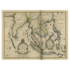
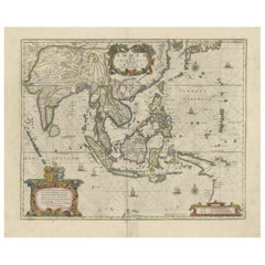
Description: Antique map titled 'A New Map of the East Indies'. Old map covering all of Southeast Asia from Persia to the Timor Island, inclusive of the modern day nations of India, Ceylon, Thailand, Burma (Myanmar), Malaysia, Cambodia, Vietnam, Laos, Indonesia, Borneo, and the Philippines.
Based on Nicholas De Fer's map of Asia, the map renders the region in detail offering both topographical and political information with mountains beautifully rendered in profile. The Island of Singapore is shown but not labeled. Bali (Baly) and Lombok (Lombock) as well as Batavia are identified. Most of the Great Sunda Islands as well as the Lesser Sunda Islands, which were largely unexplored well into the 19th century, are mapped speculatively. Depicts a fairly narrow India and a misshaped Taiwan. This map originates from 'A New Sett of Maps both of Ancient and Present Geography' by E. Wells.
Artists and Engravers: Edward Wells (1667 - 1727) was an English mathematician, geographer, and classical scholar based at Christ Church College, Oxford. Well's was trained for the ministry but quickly found himself unsuited to religious life and instead applied for an academic position at Oxford, where he authored numerous well respected works on a wide range of mathematical and scientific topics. He was chosen to tutor the young Prince William, the sickly son of Queen Anne. The two must have been quite close for Well's dedicated nearly all of the maps in his most important atlas, A New Sett of Maps both of Ancient and Present Geography. Sadly, he young prince died in July of 1700 shortly before the atlas was published. Nonetheless, Wells' geography proved popular and was published in number editions well into the 1730s.
Condition: Good, general age-related toning. Minor wear, small defects outside image and two vertical tears, but nevertheless a very decorative map. Blank verso, please study image carefully.
- Dimensions:Height: 17.33 in (44 cm)Width: 22.45 in (57 cm)Depth: 0 in (0.02 mm)
- Materials and Techniques:
- Period:1710-1719
- Date of Manufacture:1712
- Condition:Wear consistent with age and use. Condition: Good, general age-related toning. Minor wear, small defects outside image and two vertical tears, but nevertheless a very decorative map. Blank verso, please study image carefully.
- Seller Location:Langweer, NL
- Reference Number:
About the Seller
5.0
Platinum Seller
These expertly vetted sellers are 1stDibs' most experienced sellers and are rated highest by our customers.
Established in 2009
1stDibs seller since 2017
1,922 sales on 1stDibs
Typical response time: <1 hour
- ShippingRetrieving quote...Ships From: Langweer, Netherlands
- Return PolicyA return for this item may be initiated within 14 days of delivery.
More From This SellerView All
- Antique Map of Southeast Asia from Persia to the Timor Island, 1712Located in Langweer, NLAntique map titled 'A New Map of the East Indies'. Old map covering all of Southeast Asia from Persia to the Timor Island, inclusive of the modern day nations of India, Ceylon, T...Category
Antique 1710s Maps
MaterialsPaper
- Antique Map of India to Southeast AsiaLocated in Langweer, NLAntique map titled 'Indes en-decà et au-delà du Gange'. Original old map of India to Southeast Asia, showing India, Nepal, Bhutan, Sri Lanka (Ceylon), Myanmar (Birma), part of Indone...Category
Antique Mid-19th Century Maps
MaterialsPaper
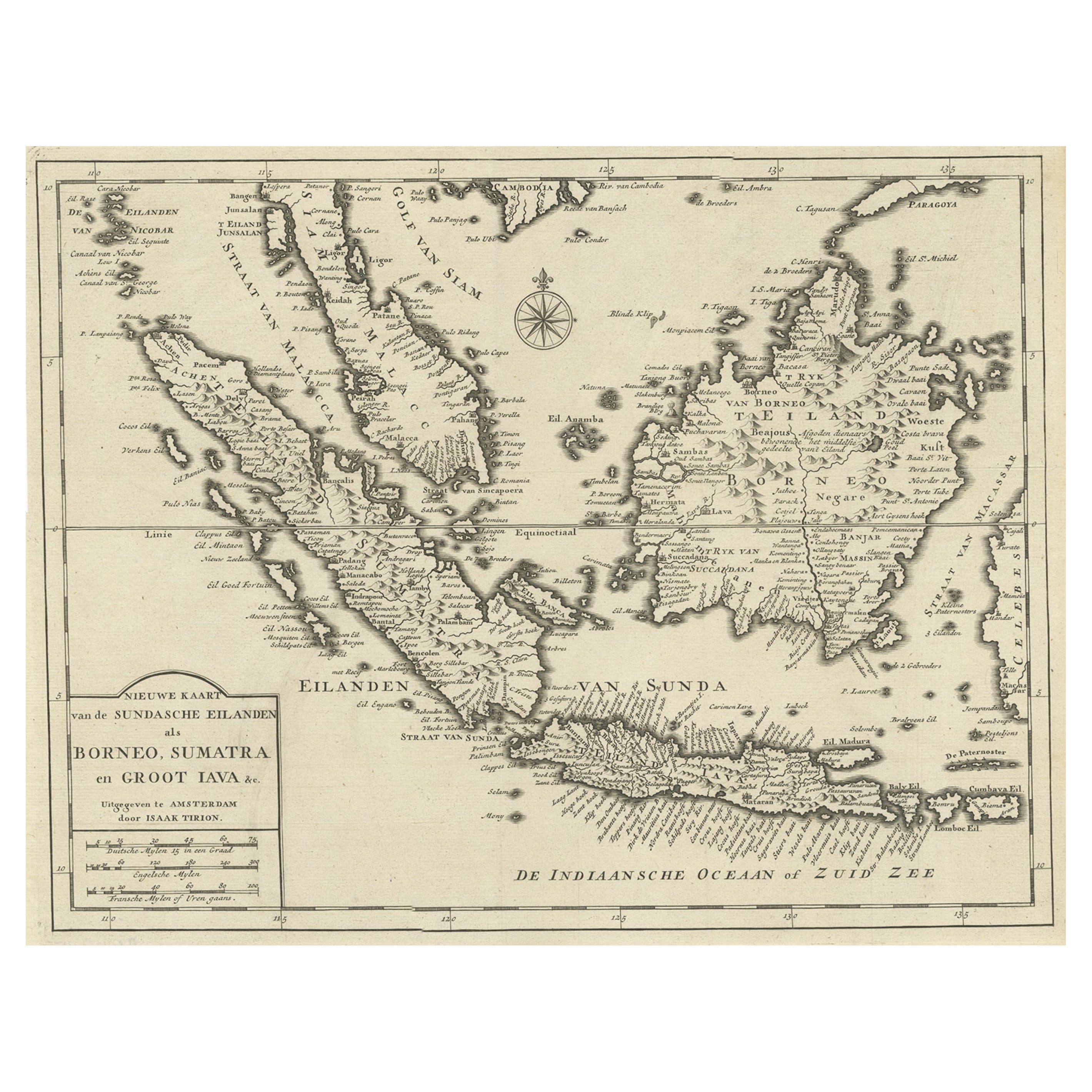
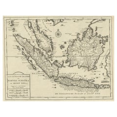
- Detailed Map of Southeast Asia From the Tip of Cambodia to Java, 1739Located in Langweer, NLAntique map titled 'Nieuwe kaart van de Sundasche Eilanden als Borneo, Sumatra en Groot Iava & c'. Detailed map of Southeast Asia, extending from the tip of Cambodia to Java. Thi...Category
Antique 1730s Maps
MaterialsPaper
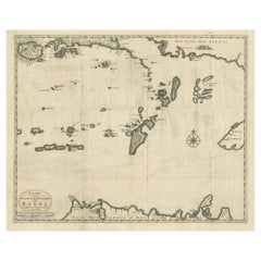
- Old Antique Map of the Banda Islands (Southeast), Indonesia & Northern AustraliaBy F. ValentijnLocated in Langweer, NLOriginal antique map titled 'Kaart van de Zuyd-Ooster Eylanden van Banda'. Important map of the seas and islands surrounding the Banda Islands, Indonesia, extending south to northern Australia, east to Papua New Guinea and north to Ceram. Published 1724-1726 by Joannes van Braam...Category
Antique Early 18th Century Maps
MaterialsPaper
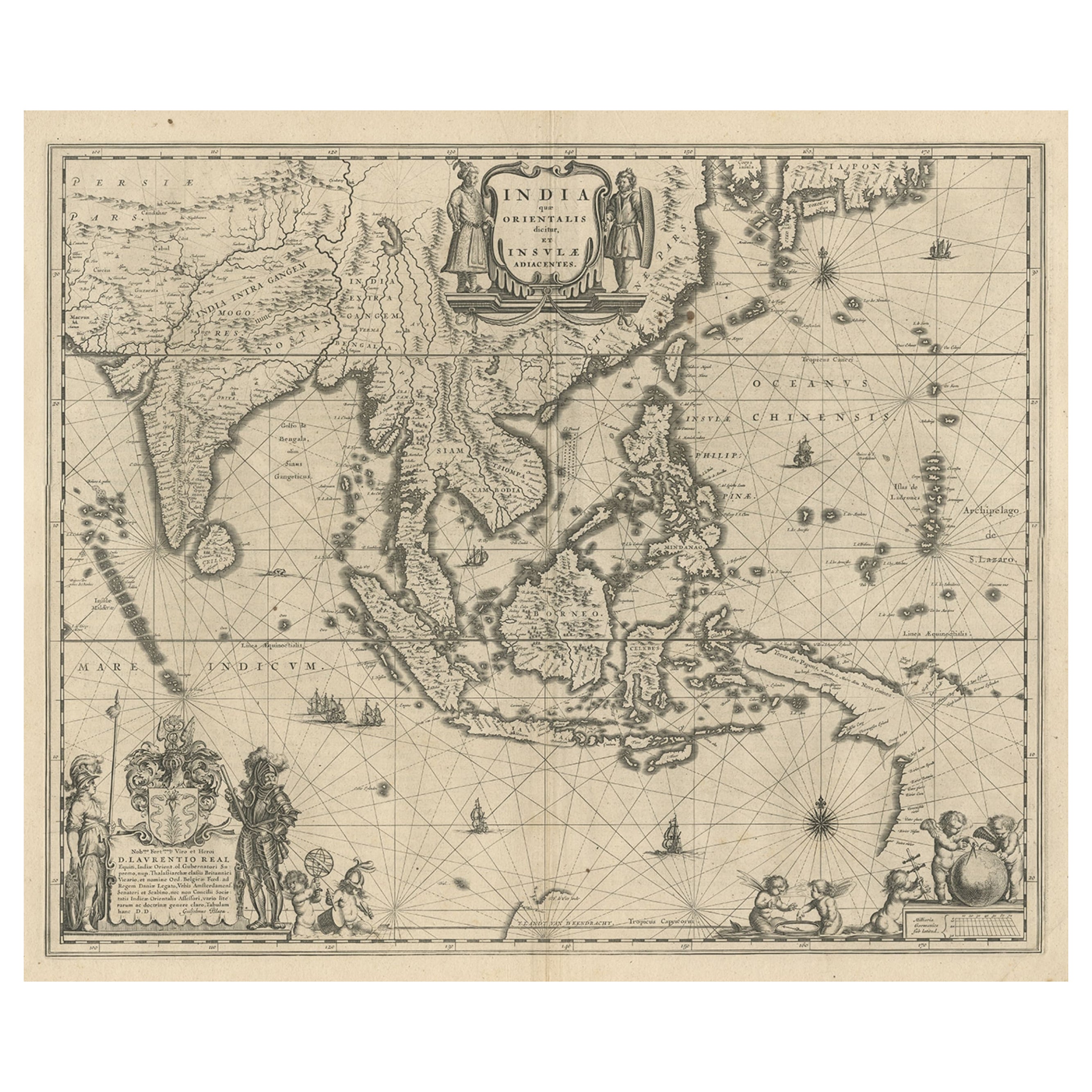
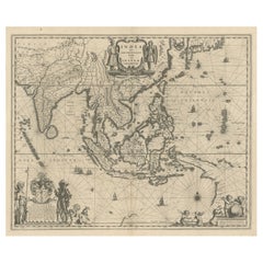
- Map of Southeast Asia, Extending from India to Tibet & Japan to New Guinea, 1640Located in Langweer, NLAntique map titled 'India quae Orientalis dicitur et Insulae adiacentes'. Map of Southeast Asia, extending from India to Tibet to Japan to New Guinea. This map is one of the firs...Category
Antique 1640s Maps
MaterialsPaper
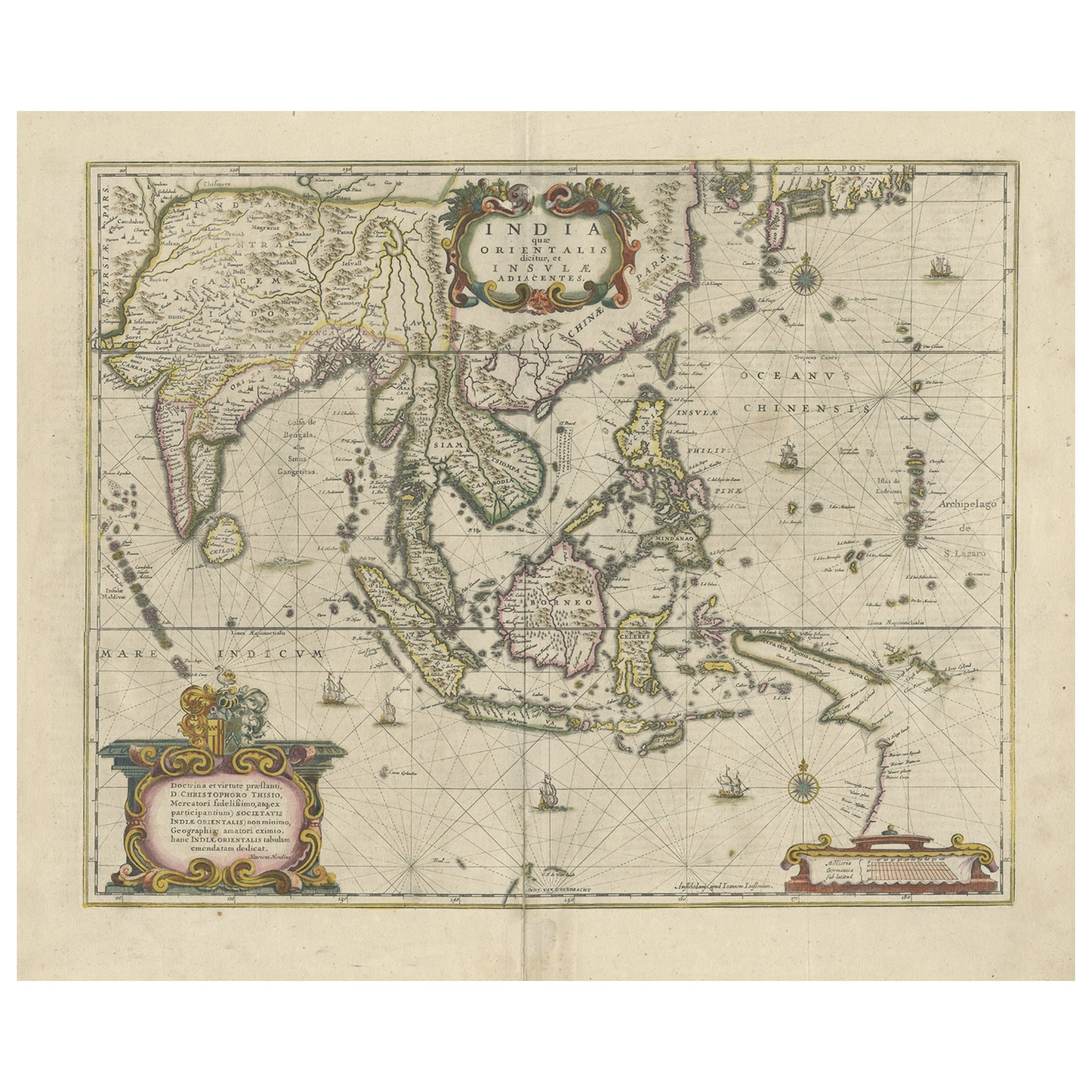
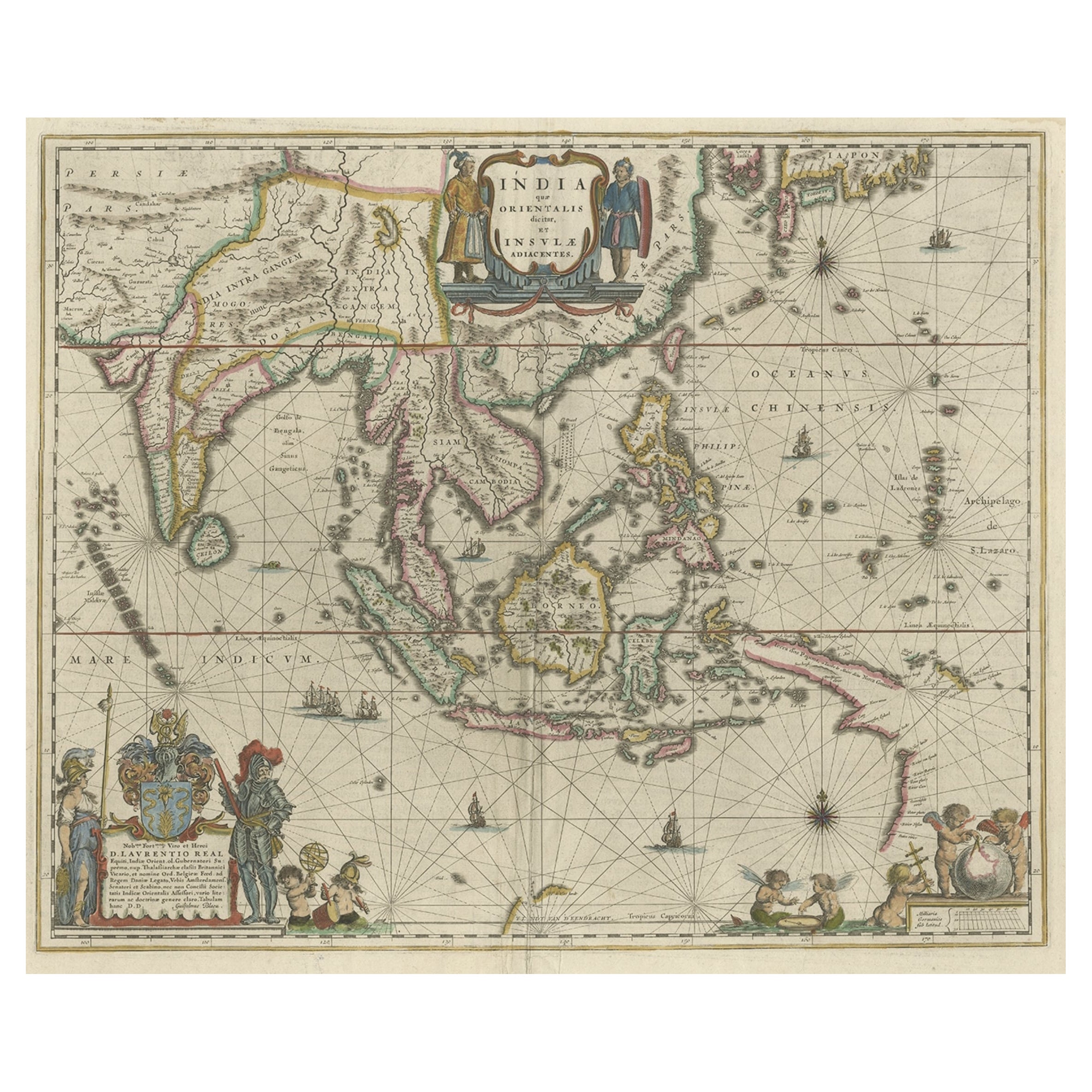
- Old Antique Map of the East Indies and Southeast Asia, ca.1644Located in Langweer, NLAntique map titled 'India quae Orientalis dicitur, et Insulae adiacentes'. Old map of the East Indies and Southeast Asia showing the area between India in the West and parts of Japan, the Marianas and New Guinea/Australia in the East. This map is dedicated to D. Christophorus Thisius by Henricus...Category
Antique 1640s Maps
MaterialsPaper

You May Also Like
- Original Antique Map of Asia. C.1780Located in St Annes, LancashireGreat map of Asia Copper-plate engraving Published C.1780 Two small worm holes to right side of map Unframed.Category
Antique Early 1800s English Georgian Maps
MaterialsPaper

- Old Nautical Map of CorsicaLocated in Alessandria, PiemonteST/556/1 - Old map of Corsica isle, surveyed by Captain Hell, of the French Royal Navy in 1824, engraved and published on 1874, with additions and corre...Category
Antique Early 19th Century English Other Prints
MaterialsPaper
- Old Horizontal Map of EnglandBy TassoLocated in Alessandria, PiemonteST/520 - Old rare Italian map of England, dated 1826-1827 - by Girolamo Tasso, editor in Venise, for the atlas of M.r Le-Sage.Category
Antique Early 19th Century Italian Other Prints
MaterialsPaper
- New Map of North America from the Latest Discoveries, 1763Located in Philadelphia, PAA fine antique 18th century map of the North American seaboard. Entitled "A New Map of North America from the Latest Discoveries 1763". By the Cartographer/Engraver - John Spil...Category
Antique Mid-18th Century English Georgian Maps
MaterialsPaper
- Vintage "View of the Center of Paris Taken from the Air" Lithograph MapLocated in San Diego, CAA very stylish "View of the Center of Paris Taken from the Air" lithograph map published by the Paris Ministry of Tourism, circa early 1950s. The piece measures 27" x 43" and shows...Category
20th Century French Mid-Century Modern Prints
MaterialsPaper
- The Holy Land at the Time of Jesus: A 17th Century Dutch Map by VisscherBy Nicolaes Visscher IILocated in Alamo, CAThis detailed Dutch map entitled "Het Beloofe de Landt Canaan door wandelt van onsen Salichmaecker Iesu Christo, nessens syne Apostelen" by Nicolaes Visscher was published in Amsterd...Category
Antique Mid-17th Century Dutch Maps
MaterialsPaper


Recently Viewed
View AllMore Ways To Browse
Antique Persia
Antique Church Collectibles
Christ Church
Furniture From Singapore
Topographical Map
Old Ceylon
Furniture From Bali
Philippines Antique
Filipino Antique
Antique Philippines
Dior Oxford
Christion Dior
Dior Christal
Antique Filipino Furniture
Vietnam Antique
Antique Vietnam
Fer Antique
Antique Furniture Vietnam