Items Similar to Map of Southeast Asia, Extending from India to Tibet & Japan to New Guinea, 1640


Want more images or videos?
Request additional images or videos from the seller
1 of 5
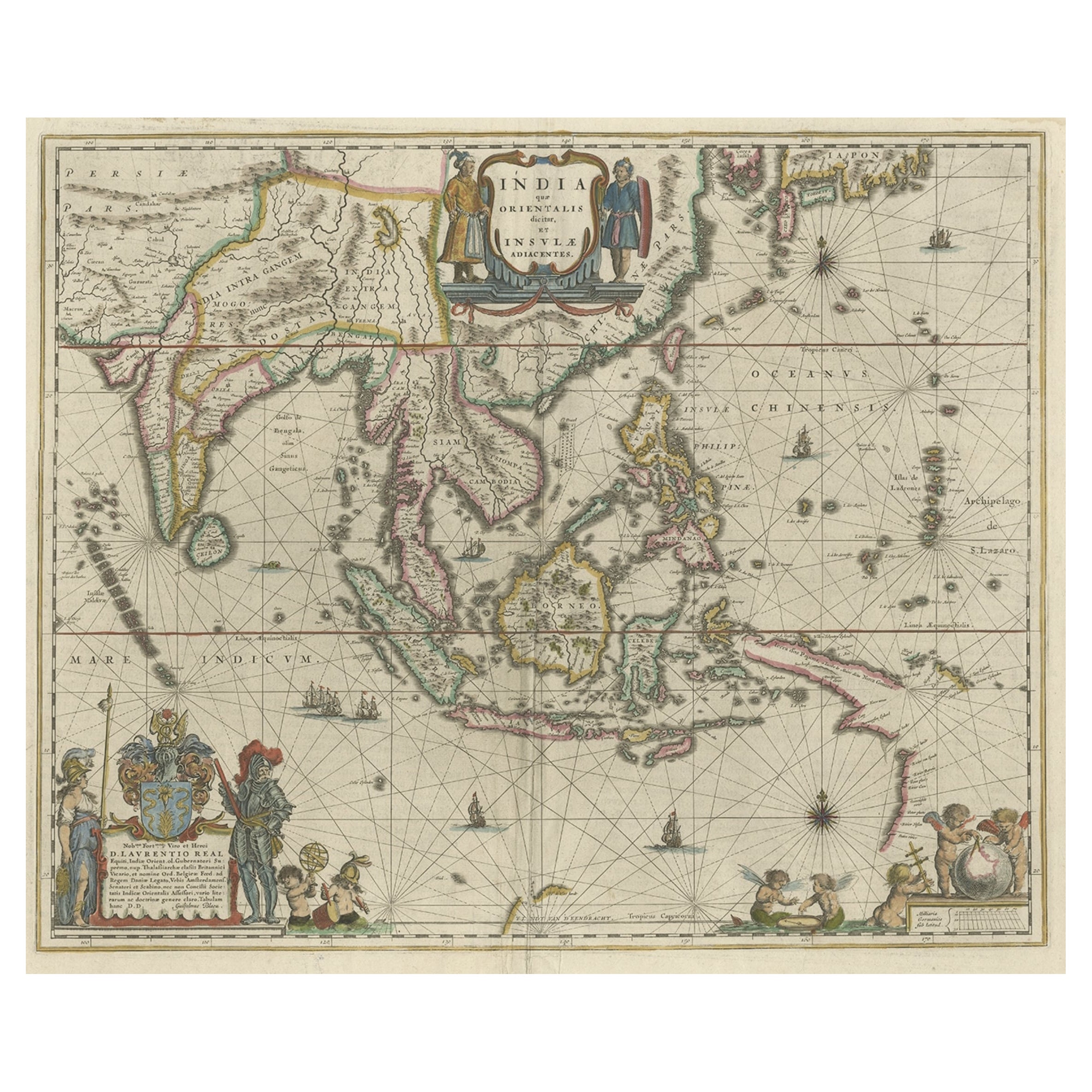
Map of Southeast Asia, Extending from India to Tibet & Japan to New Guinea, 1640
About the Item
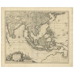
Antique map titled 'India quae Orientalis dicitur et Insulae adiacentes'.
Map of Southeast Asia, extending from India to Tibet to Japan to New Guinea. This map is one of the first to show a number of the early Dutch discoveries in Australia.
Artists and Engravers: Willem Janszoon (or Jansz.) Blaeu (1571 - 1638) was the founder of a large publishing firm that became famous in the field of cartography under the name Blaeu.
- Dimensions:Height: 19.89 in (50.5 cm)Width: 23.63 in (60 cm)Depth: 0 in (0.02 mm)
- Materials and Techniques:
- Period:1640-1649
- Date of Manufacture:circa 1640
- Condition:Wear consistent with age and use. Condition: Good, general age-related toning. Minor foxing, Latin text on verso. Please study image carefully.
- Seller Location:Langweer, NL
- Reference Number:
About the Seller
5.0
Platinum Seller
These expertly vetted sellers are 1stDibs' most experienced sellers and are rated highest by our customers.
Established in 2009
1stDibs seller since 2017
1,916 sales on 1stDibs
Typical response time: <1 hour
- ShippingRetrieving quote...Ships From: Langweer, Netherlands
- Return PolicyA return for this item may be initiated within 14 days of delivery.
More From This SellerView All
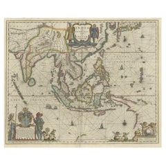
- Original Blaeu Map of Southeast Asia from India to Tibet and Japan to New GuineaLocated in Langweer, NLAntique map titled 'India quae Orientalis dicitur et Insulae Adiacentes'. Beautiful map of Southeast Asia, extending from India to Tibet to Japan to New Guinea. It was the first po...Category
Antique 1640s Maps
MaterialsPaper
- Antique Map of India to Southeast AsiaLocated in Langweer, NLAntique map titled 'Indes en-decà et au-delà du Gange'. Original old map of India to Southeast Asia, showing India, Nepal, Bhutan, Sri Lanka (Ceylon), Myanmar (Birma), part of Indone...Category
Antique Mid-19th Century Maps
MaterialsPaper
- Antique Map of India and Southeast Asia by Sanson '1654'Located in Langweer, NLAntique map titled 'Partie Meridionale de l'Inde'. Early map of India and Southeast Asia. The map shows most of modern India, Bangladesh and Burma, the whole of Sri Lanka, Thailand, ...Category
Antique Mid-17th Century Maps
MaterialsPaper
- Antique Map of India and Southeast Asia by Balbi '1847'Located in Langweer, NLAntique map titled 'India en deçà et au delà du Gange'. Original antique map of India and Souteast Asia. This map originates from 'Abrégé de Géographie (..)' by Adrien Balbi. Publish...Category
Antique Mid-19th Century Maps
MaterialsPaper
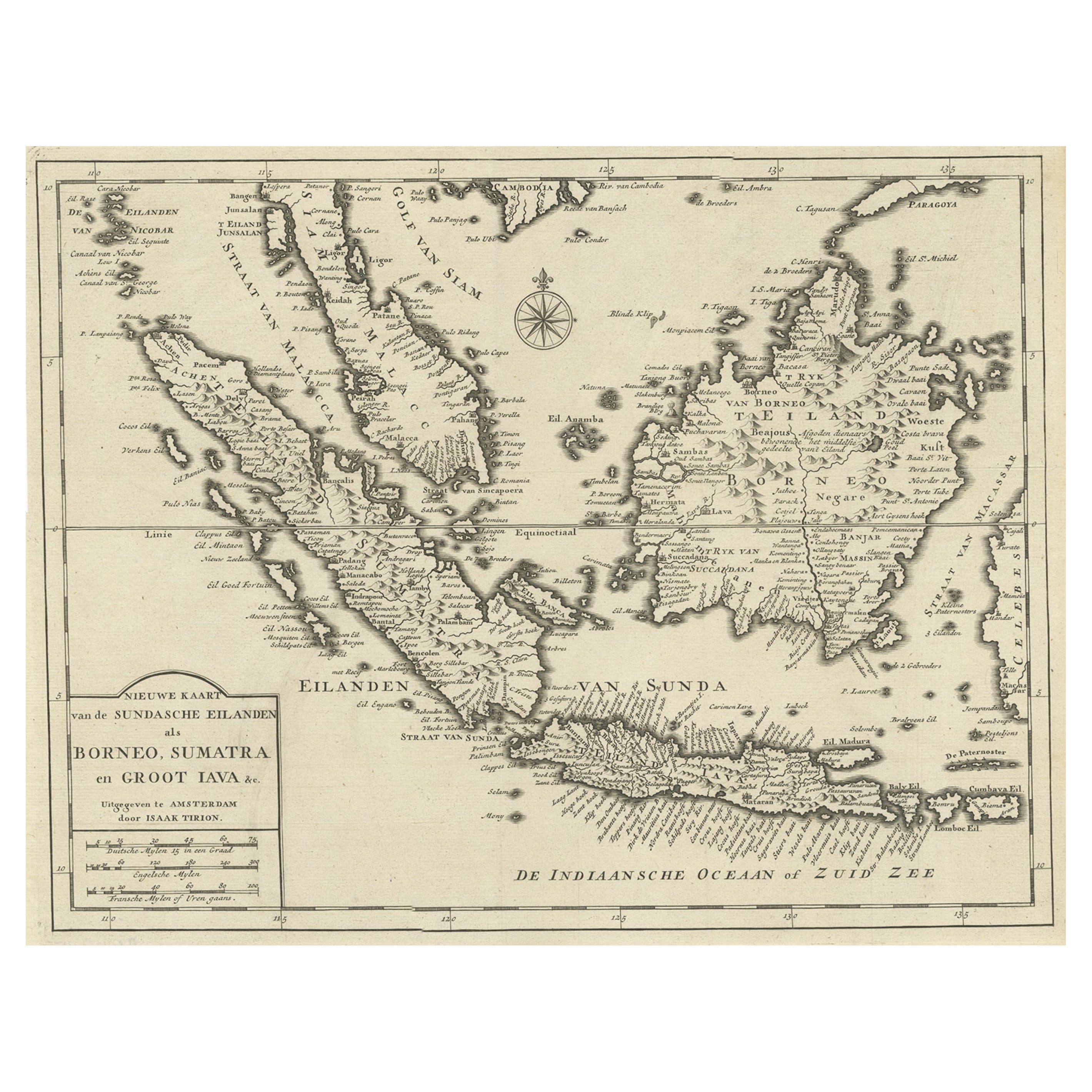
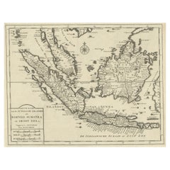
- Detailed Map of Southeast Asia From the Tip of Cambodia to Java, 1739Located in Langweer, NLAntique map titled 'Nieuwe kaart van de Sundasche Eilanden als Borneo, Sumatra en Groot Iava & c'. Detailed map of Southeast Asia, extending from the tip of Cambodia to Java. Thi...Category
Antique 1730s Maps
MaterialsPaper
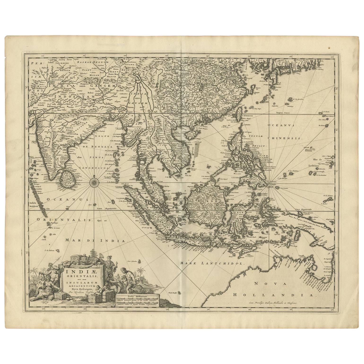
- Antique Map of Southeast Asia 'India, Indonesia' by N. Visscher, circa 1670Located in Langweer, NLAntique map titled 'Indiae Orientalis, nec non Insularum Adiacentium Nova Descriptio.' The map centers on the Strait of Malacca and Malay Peninsula. It extends from India and the Mal...Category
Antique Mid-17th Century Maps
MaterialsPaper


You May Also Like
- Original Antique Map of India. C.1780Located in St Annes, LancashireGreat map of India Copper-plate engraving Published C.1780 Three small worm holes to right side of map and one bottom left corner Unframed.Category
Antique Early 1800s English Georgian Maps
MaterialsPaper

- Original Antique Map of Asia. C.1780Located in St Annes, LancashireGreat map of Asia Copper-plate engraving Published C.1780 Two small worm holes to right side of map Unframed.Category
Antique Early 1800s English Georgian Maps
MaterialsPaper

- New Map of North America from the Latest Discoveries, 1763Located in Philadelphia, PAA fine antique 18th century map of the North American seaboard. Entitled "A New Map of North America from the Latest Discoveries 1763". By the Cartographer/Engraver - John Spil...Category
Antique Mid-18th Century English Georgian Maps
MaterialsPaper
- Original Antique Map of South East Asia, Arrowsmith, 1820Located in St Annes, LancashireGreat map of South East Asia Drawn under the direction of Arrowsmith Copper-plate engraving Published by Longman, Hurst, Rees, Orme and Brown, 1820 Unframed.Category
Antique 1820s English Maps
MaterialsPaper
- West Coast of Africa, Guinea & Sierra Leone: An 18th Century Map by BellinBy Jacques-Nicolas BellinLocated in Alamo, CAJacques Bellin's copper-plate map entitled "Partie de la Coste de Guinee Dupuis la Riviere de Sierra Leona Jusquau Cap das Palmas", depicting the coast of Guinea and Sierra Leone in ...Category
Antique Mid-18th Century French Maps
MaterialsPaper
- Original Antique Map of South East Asia by Becker, circa 1840Located in St Annes, LancashireGreat map of South East Asia Steel engraving with original color outline Engraved by Becker Published by Virtue, circa 1840. Unframed.Category
Antique 1840s English Other Maps
MaterialsPaper


Recently Viewed
View AllMore Ways To Browse
Antique Cartography
Tibet Antiques
Map Of India
India Antique Map
Antique Maps India
Antique Map India
Antique India Map
Antique Maps Of India
Antique Map Of India
Japan Maps
Map Japan
Map Of Japan
Antique Collectables Australia
Antique Japanese Map
Antique Japanese Maps
Antique Map Of Japan
Antique Southeast Asia
Antique Maps Australia