Items Similar to Antique Map of the Turkish Empire and Persia, circa 1890


Want more images or videos?
Request additional images or videos from the seller
1 of 6
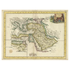
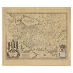
Antique Map of the Turkish Empire and Persia, circa 1890
About the Item
Antique map Turkish Emprie titled 'Turquie d'Asie et Perse'. Beautiful map depicting the Turkish Empire and Persia. With vignette depicting Damascus. This map originates from 'Nouvel Atlas Illustre Geographie Universelle'.
Artists and Engravers: J. Migeon (fl. c. 1855 - 1899) was a late 19th century map publisher based in Paris, France. His most prominent publications are the Geographie Universal in 1854 (updated through 1874) and the Nouvel Atlas Illustré de Géographie Universelle in 1891. Little is known of Migeon's life and even his first name is uncertain.
Condition: Very good, general age-related toning. Small splits on folding line, please study image carefully.
Date: circa 1890
Overall size: 51 x 39 cm.
Image size: 42 x 31 cm.
We sell original antique maps to collectors, historians, educators and interior decorators all over the world. Our collection includes a wide range of authentic antique maps from the 16th to the 20th centuries. Buying and collecting antique maps is a tradition that goes back hundreds of years. Antique maps have proved a richly rewarding investment over the past decade, thanks to a growing appreciation of their unique historical appeal. Today the decorative qualities of antique maps are widely recognized by interior designers who appreciate their beauty and design flexibility. Depending on the individual map, presentation, and context, a rare or antique map can be modern, traditional, abstract, figurative, serious or whimsical. We offer a wide range of authentic antique maps for any budget.
- Creator:J. Migeon (Artist)
- Dimensions:Height: 15.36 in (39 cm)Width: 20.08 in (51 cm)Depth: 0 in (0.01 mm)
- Materials and Techniques:
- Period:
- Date of Manufacture:circa 1890
- Condition:Condition: Very good, general age-related toning. Small splits on folding line, please study image carefully.
- Seller Location:Langweer, NL
- Reference Number:
About the Seller
5.0
Platinum Seller
These expertly vetted sellers are 1stDibs' most experienced sellers and are rated highest by our customers.
Established in 2009
1stDibs seller since 2017
1,928 sales on 1stDibs
Typical response time: <1 hour
- ShippingRetrieving quote...Ships From: Langweer, Netherlands
- Return PolicyA return for this item may be initiated within 14 days of delivery.
More From This SellerView All
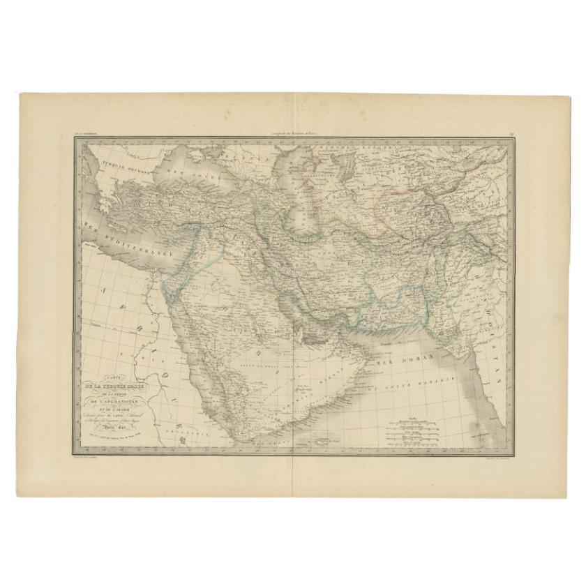
- Antique Map of Turkey, Persia and Afghanistan, 1842By Pierre M. LapieLocated in Langweer, NLAntique map titled 'Carte de la Turquie d'Asia, de la Perse, de l'Afghanistan'. Map of Turkey, Persia and Afghanistan. This map originates from 'Atlas universel de géographie ancienn...Category
Antique 19th Century Maps
MaterialsPaper
- Antique Map of the Turkish Empire by Tirion 'c.1760'Located in Langweer, NLAntique map titled 'Nieuwe Kaart van het Turksche Ryk gelegen in Europa, Asia en Africa'. Original antique map of the Turkish Empire. The map is centered on the Mediterranean Sea but...Category
Antique Mid-18th Century Maps
MaterialsPaper
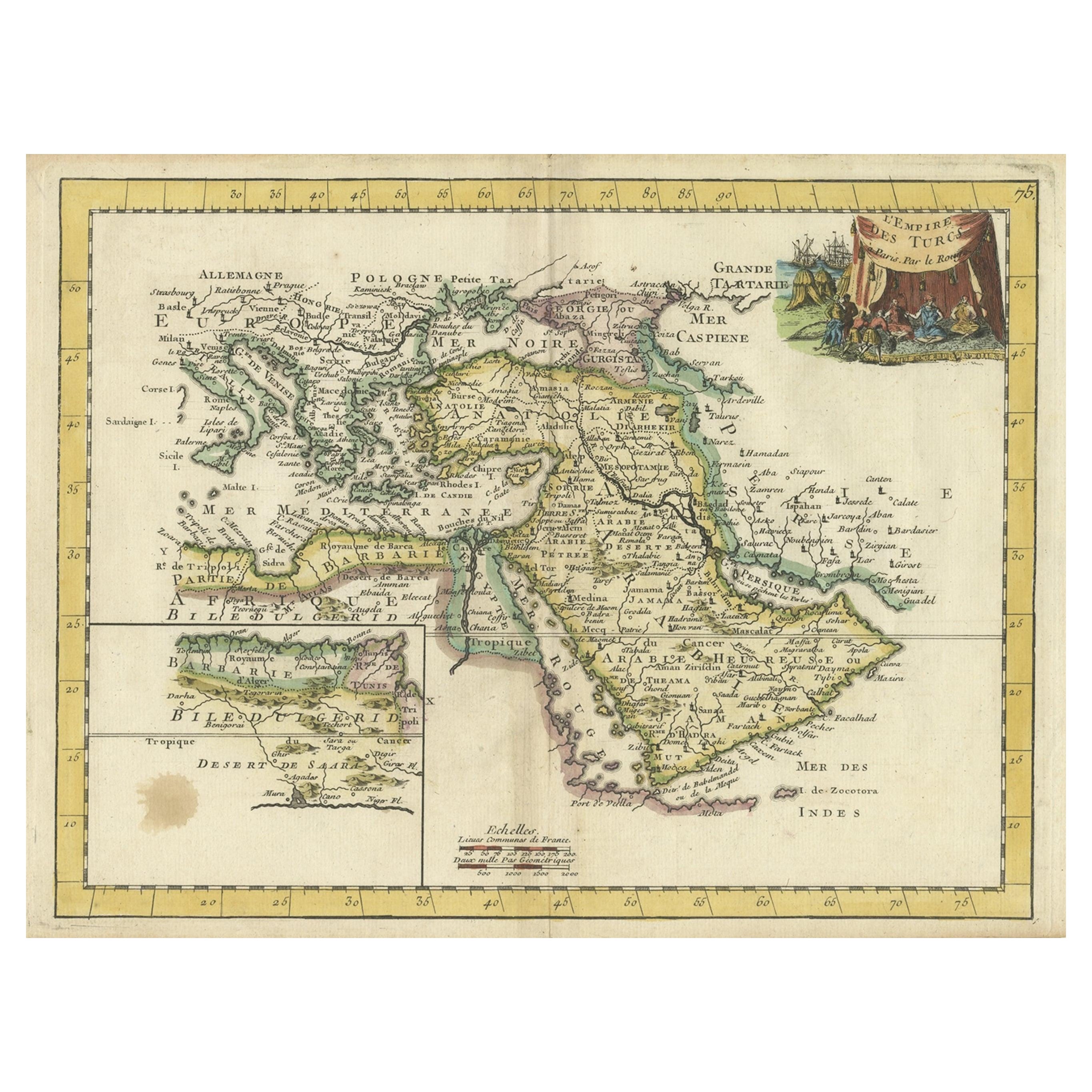
- Orginal Antique Handcolored Map of the Turkish Empire, 1748Located in Langweer, NLAntique map titled 'L'Empire des Turcs'. Old map of the Turkish Empire with an inset of the North African regions. Originates from 'Atlas Nouveau Portatif' by G.L. le Rouge. Artis...Category
Antique 18th Century Maps
MaterialsPaper
- Antique Map of Persia by A. Zatta, circa 1785Located in Langweer, NLAntique map titled 'L'Impero della Persia diviso ne suoi Stati'. The Empire of Persia divided into its states. Originates from 'Atlante Novissimo, illustrato ed accresciuto sulle oss...Category
Antique Late 18th Century Maps
MaterialsPaper
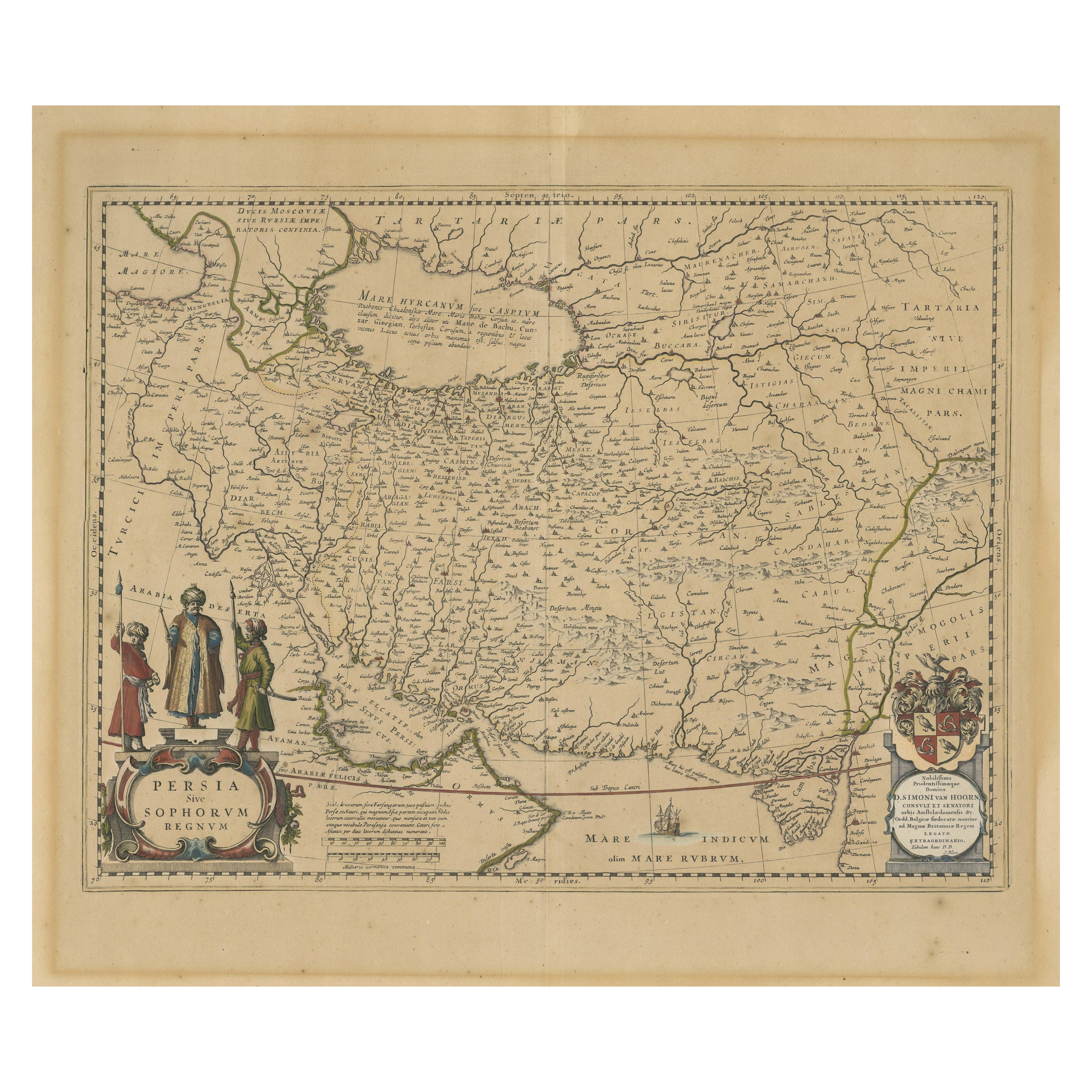
- Antique Map of Persia, Also Showing the Indus River, circa 1673By Joan (Johannes) BlaeuLocated in Langweer, NLAntique map titled 'Persia sive Sophorum Regnum'. Original old map of Persia. The map extends from the Eastern Mediterranean to Tacalistan and the Indus River and the Dalanguer Mount...Category
Antique Late 17th Century Maps
MaterialsPaper
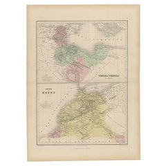
- Antique Map of Tunis and Tripoli in Northern Africa, circa 1880By J. MigeonLocated in Langweer, NLAntique map titled 'Tunis et Tripoli & Empire de Maroc'. Old map of Tunis and Tripoli and the Empire of Morocco. This map originates from 'Géographie Universelle Atlas-Migeon' by J. ...Category
Antique 19th Century Maps
MaterialsPaper


You May Also Like
- Original Antique Map of The United States of America, circa 1890Located in St Annes, LancashireGreat map of the USA By The Stanford's Geographical Establishment Original colour Unframed.Category
Antique 1890s English Victorian Maps
MaterialsPaper
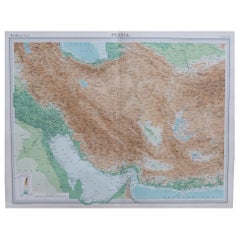
- Large Original Vintage Map of Persia / Iran, circa 1920Located in St Annes, LancashireGreat maps of Persia. Unframed. Original color. By John Bartholomew and Co. Edinburgh Geographical Institute. Published, circa 1920. Free shipping.Category
Vintage 1920s British Maps
MaterialsPaper
- Super Rare Antique French Map of Chine and the Chinese Empire, 1780Located in Amsterdam, Noord HollandSuper Rare Antique French Map of Chine and the Chinese Empire, 1780 Very nice map of Asia. 1780 Made by Bonne. Additional information: Type: Map ...Category
Antique 18th Century European Maps
MaterialsPaper
- Large Original Antique Map of the World, Fullarton, circa 1870Located in St Annes, LancashireGreat map of the World. From the celebrated Royal Illustrated Atlas Lithograph. Original color. Published by Fullarton, Edinburgh, circa 1870. Unframed.Category
Antique 1870s Scottish Maps
MaterialsPaper
- Original Antique Map of Spain and Portugal, circa 1790Located in St Annes, LancashireSuper map of Spain and Portugal Copper plate engraving by A. Bell Published, circa 1790. Unframed.Category
Antique 1790s English Other Maps
MaterialsPaper
- Large Original Antique Map of The Environs of Dublin, Ireland, circa 1880Located in St Annes, LancashireGreat map of The Environs of Dublin Published circa 1880 Unframed Free shipping.Category
Antique 1880s Scottish Maps
MaterialsPaper


Recently Viewed
View AllMore Ways To Browse
Vintage Butcher Shop Posters
Papua New Guinea Antique Map
Montenegro Antique Map
Australasia Antique Map
Buenos Ayres
Carte Egypte Antique
Charlotte Reine
The Grand Mogol
Antique Map Colorado
William Dampier
Antique Map Of Lapland
Mauritius Antique Map
Dan Rizzi
Antique Map Austro Hungarian
Formosa Vintage Map
Georgetown Map
Guatemala Antique Map
Manchester Antique Map