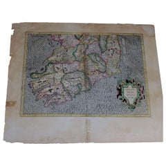
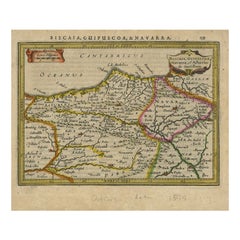
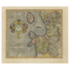
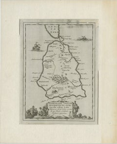
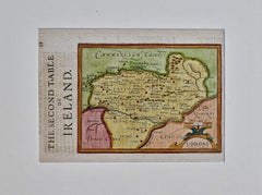
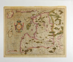
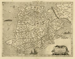
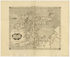
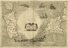
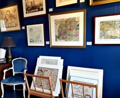
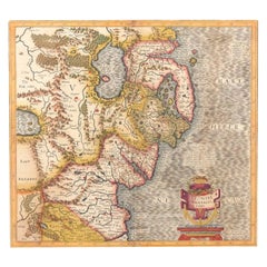
1585 Mercator Map of Ireland, Entitled "Irlandiae Regnvm, " Hand Colored Ric0006
Located in Norton, MA
1585 Mercator map of Ireland, entitled "Irlandiae Regnvm."
Category
Antique 16th Century Dutch Maps
Materials
Paper
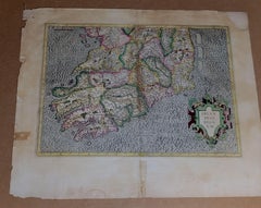
1585 Mercator Map of Ireland, Entitled "Irlandiae Regnvm, " Hand Colored Ric0006
Located in Norton, MA
1585 Mercator map of Ireland, entitled "Irlandiae Regnvm."
Paper

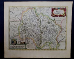
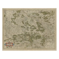
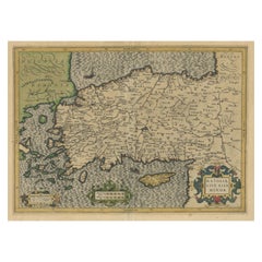
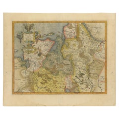
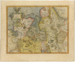
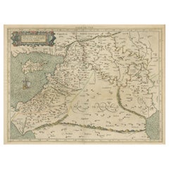
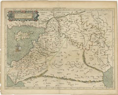
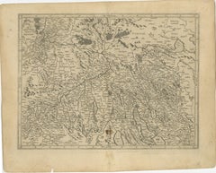
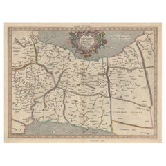
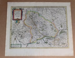
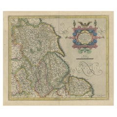
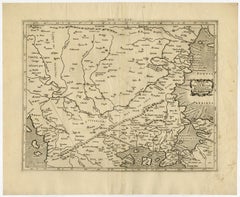
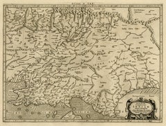
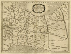
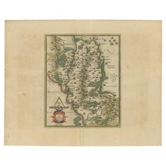
1625 Mercator Map of the Provenience of Quercy, "Quercy Cadvrcivm Ric.0013
Located in Norton, MA
1625 Mercator map of the provenience of Quercy, entitled "Quercy Cadvrcivm," Ric.0013 " Authentic" - Map of the provenience of Quercy Cadvrcivm Description: Antique map titl...
Paper

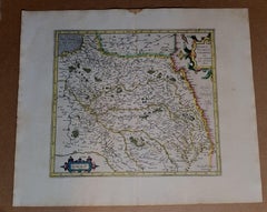
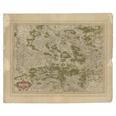
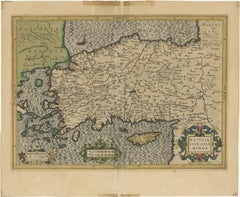
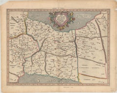
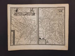
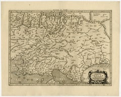
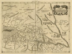
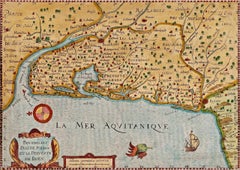
1590 Mercator Map Entitled "France Picardie Champaigne, Ric.0001
Located in Norton, MA
Description: Published in Amsterdam by Mercator/Hondius ca. 1590. Ric.0001 Artists and Engravers: Map : 'France Picardie Champaigne cum regionibus adiacentibus'.
Paper


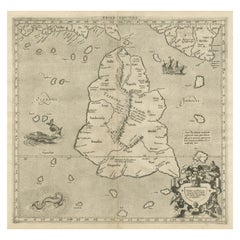
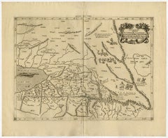
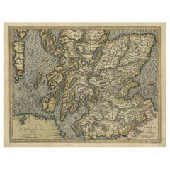
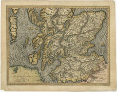
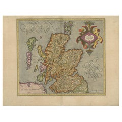
Northern Scotland: A 17th Century Hand-colored Map by Mercator
By Gerard Mercator
Located in Alamo, CA
This is a framed hand-colored 17th century map of Northern Scotland by Gerard Mercator entitled "Scotiae pars Septentrionalis", published in Amsterdam in 1636.
Paper
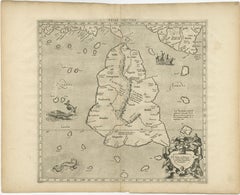
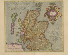
Northern Scotland: A 16th Century Hand-colored Map by Mercator
By Gerard Mercator
Located in Alamo, CA
A framed hand-colored 16th century map of Northern Scotland by Gerard Mercator entitled "Scotiae pars Septentrionalis", published in Amsterdam in 1636.
Paper
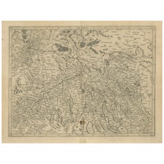
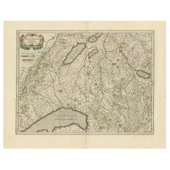
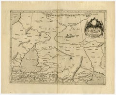
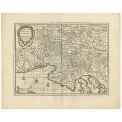
Antique Map of the Southern Lorraine Region by Mercator, c.1625
By Gerard Mercator
Located in Langweer, NL
In 1552 he moved to Duisburg, Germany where he published his famous 18-sheet world map in 1569 with his own new projection, today called Mercator projection.
Paper

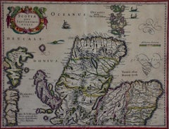
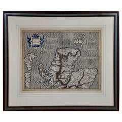
Northern Scotland: 17th Century Hand-colored Map by Mercator
By Gerard Mercator
Located in Alamo, CA
This is a framed hand-colored 17th century map of Northern Scotland by Gerard Mercator entitled "Scotiae pars Septentrionalis", published in Amsterdam in 1636.
Engraving


Southeastern Ireland: A 17th Century Hand Colored Map by Mercator and Hondius
By Gerard Mercator
Located in Alamo, CA
This has become known as Mercator projection on maps produced by subsequent cartographers to this day.
Paper

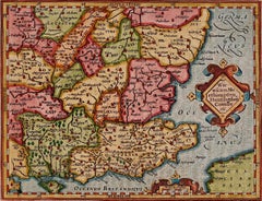
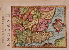
17th Century Hand-Colored Map of Southeastern England by Mercator and Hondius
By Gerard Mercator
Located in Alamo, CA
A 17th century copperplate hand-colored map entitled "The Sixt Table of England" by Gerard Mercator and Jodocus Hondius, published in Amsterdam in 1635 in 'Cosmographicall Descriptio...
Paper

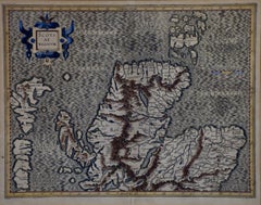
Northern Scotland: 16th Century Hand-colored Map by Mercator
By Gerard Mercator
Located in Alamo, CA
This is a framed hand-colored 16th century map of Northern Scotland by Gerard Mercator entitled "Scotiae pars Septentrionalis", published in Amsterdam in 1636.
Engraving
$780Sale Price|20% Off
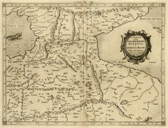
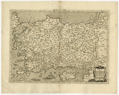
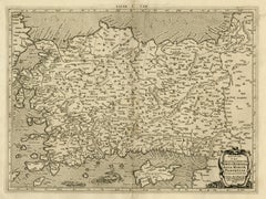
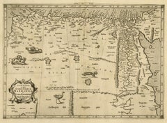
Original Antique Map of Turkey, Asia Minor and Cyprus
By Gerard Mercator
Located in Langweer, NL
Antique map titled 'Natoliae sive Asia Minor'. Original old map of Turkey, Asia Minor and Cyprus.
Paper
$538Sale Price|20% Off
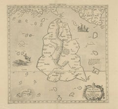
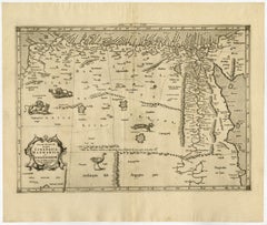
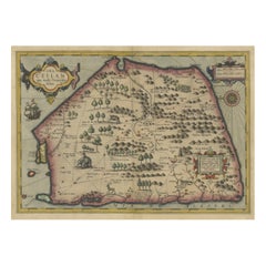
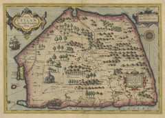
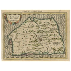
Mercator's Ptolemaic map of Taprobana, (Ceylon) Sri Lanka
Located in Langweer, NL
Antique map titled 'Asiae XII Tab'. Mercator's Ptolemaic map of Taprobana.
Paper

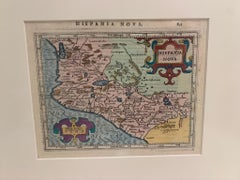
Framed Mercator Hondius Hispania Nova Atlas Minor Map
Located in Stamford, CT
The maps were copied from those of the great cartographer Mercator of circa 1580-1590 or were reductions of Hondius’ own maps of 1606.
Glass, Wood, Paper


$417Sale Price|20% Off
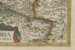
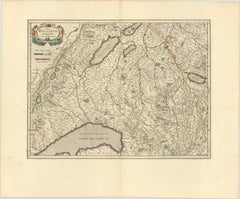
Antique Map of Styria by Mercator 'circa 1650'
Located in Langweer, NL
Antique map titled 'Stiria'. Original antique map of Styria, Austria.
Paper

$129Sale Price|20% Off
Antique Map of Northeastern Spain by Mercator, 1634
Located in Langweer, NL
This map originates from 'Atlas Minor' by G. Mercator.
Paper
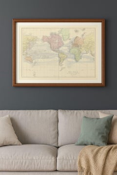
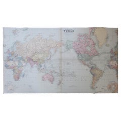
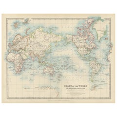
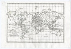
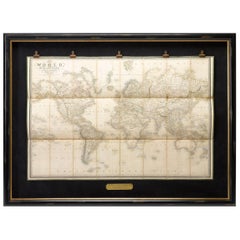
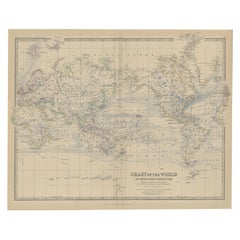
Antique World Map on Mercator Projection – Lapie, Paris, 1838
Located in Langweer, NL
Antique World Map on Mercator Projection – Lapie, Paris, 1838 This elegant and finely engraved world map was published in Paris in 1838 as part of the renowned Atlas Universel de Gé...
Paper
$1,058Sale Price|20% Off
Mercator's Ptolemaic Map of Ancient Assyria, Media, and Persia
Located in Langweer, NL
This map, "Asiae I Tab:", features the region corresponding to modern-day Iran and Iraq, intricately depicted in Gerard Mercator's edition of Claudius Ptolemy's "Tabulae Geographicae...
Paper

Antique Map of England by Mercator/Hondius, circa 1600
Located in Langweer, NL
On Mercator projection maps, all parallels and meridians are drawn at right angles to each other, with the distance between the parallels extending towards the poles.
Paper


$697Sale Price|20% Off
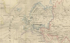
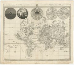
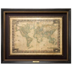
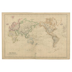
Antique Map of the World on Mercator's Projection, 1788
Located in Langweer, NL
Antique map titled 'Kaart van de Geheele Wereld (..)'. Uncommon small world map on Mercator's projection.
Paper


Antique Mercator Projection World Map by Petri, c.1873
Located in Langweer, NL
Antique world map titled 'Wereldkaart naar Mercator's Projectie'.
Paper

Map of Avenches Region Switzerland by Mercator, Original 1585 Engraving
Located in Langweer, NL
Map of Wiflispurgergov by Gerardus Mercator, Avenches Region, 1585 This rare and finely engraved map, titled *Das Wiflispurgergov*, was produced by Gerardus Mercator and published i...
Paper
World Map in Mercator’s Projection – Nieuwe Hand-Atlas, Leiden 1876
Located in Langweer, NL
World Map in Mercator’s Projection – Nieuwe Hand-Atlas, Leiden 1876 This 19th-century Dutch world map, titled “Wereld-Kaart in Mercator’s Projectie,” was published in 1876 in the Ni...
Paper
$520Sale Price|20% Off
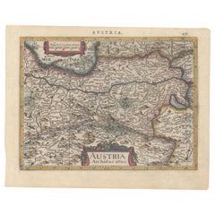
1634 Mercator/Jansson Map: Eastern Austria with Vienna, Hand-Colored
Located in Langweer, NL
1634 Mercator/Jansson Map: Eastern Austria with Vienna, Hand-Colored This hand-colored map from 1634, titled "Austria Archiducatus," by Mercator and Jansson, depicts the eastern reg...
Paper

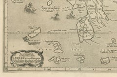
1698 Mercator Ptolemaic Map of Asia East of the Ganges
Located in Langweer, NL
In 1552, Mercator relocated to Duisburg, Germany, where he published his famous 18-sheet world map in 1569, introducing the Mercator projection.
Paper

1884 Antique Decorative World Map – Mercator Projection, Victorian Era Print
Located in Langweer, NL
Antique World Map on Mercator’s Projection – Black’s Atlas, 1884 This finely engraved and colored map, titled The World on Mercator’s Projection, was published in the New and Revise...
Paper
$882Sale Price|20% Off
Antique Map of Westfalia, Germany by Mercator/Hondius, circa '1620'
Located in Langweer, NL
Published by Mercator/Hondius, circa '1620' 17th Century antique detailled map of Westphalia, East Friesland showing the Hanseatic towns Oldenburg, and Bremen.
Paper


$325Sale Price|20% Off
Antique Map of the World, Mercator Projection, by Wyld, '1845'
Located in Langweer, NL
Antique map titled 'The World'. Original antique world map, on Mercator's projection.
Paper
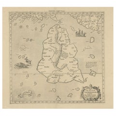
Antique Map of Sri Lanka – Taprobanae Insulae Descriptio by Mercator, 1607
Located in Langweer, NL
Taprobanae Insulae Descriptio ex Ptolemaeo – Antique Map of Sri Lanka by Mercator, c.1607 This fine original copperplate engraving, titled Taprobanae Insulae Descriptio ex Ptolemaeo...
Paper

World Map – Mercator Projection with Global Sea Routes, Published in 1857
Located in Langweer, NL
World Map – Mercator Projection with Global Sea Routes 1857 This attractive antique print shows a world map titled “Planiglob in Mercators Projection zur Übersicht der Erdfläche und...
Paper
$232Sale Price|20% Off
Colorful Detailed Antique Map of The World on Mercators Projection, 1882
Located in Langweer, NL
The 'World of Mercator's Projection' is a map with a stunning portrayal of global geography and maritime navigation from an era steeped in exploration and discovery.
Paper


Antique Map of the Northeast of England by Mercator 'circa 1620'
Located in Langweer, NL
Mercator.
Paper

Large Original Antique Map of The World On Mercator's Projection. 1894
Located in St Annes, Lancashire
Superb Antique map of The World Published Edward Stanford, Charing Cross, London 1894 Original colour Good condition Unframed. Free shipping
Paper

$273Sale Price|51% Off
Antique Map of the World on Mercator Projection by Anson, 1749
Located in Langweer, NL
Anson rondsom de Wereld'. Original antique map of the world on Mercator's Projection from a Dutch edition of Anson's voyages.
Paper
$641Sale Price|20% Off
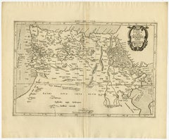
Mercator's Ptolemaic Map of the Holy Land, Cyprus and Syria, circa 1580
Located in Langweer, NL
Antique map titled 'Asiae IIII Tab'. Beautiful map of Mercator's Ptolemaic map of the Holy Land, Cyprus, Syria, etc.
Paper
Map of Zurich and Basel Region by Mercator, Uncolored Engraving c.1600
Located in Langweer, NL
Map of Zurich and Basel Region by Mercator, Uncolored Engraving c.1600 This original uncolored copperplate engraving, titled *Zurichgow et Basiliensis Provincia*, was created by the...
Paper
Antique World Map on Mercator's Projection, Ocean Currents and Trade Routes 1903
Located in Langweer, NL
Title: Antique World Map on Mercator's Projection, 1903, Showing Ocean Currents and Trade Routes Description: This antique map, titled "Chart of the World on Mercator's Projection,"...
Paper
$455Sale Price|20% Off
Exploring Ancient Persia: Ptolemaic Map of Iran and Iraq by Ptolemy and Mercator
Located in Langweer, NL
Latin text on verso with an alternate title: Asiae Tabula Quinta. Mercator originally published this map in his 1578 edition of Ptolemy's great Geography.
Paper
$1,058Sale Price|20% Off
Ancient Course of the Ganges: A First Ptolemaic Map of India by Mercator, c.1584
Located in Langweer, NL
Created by Gerard Mercator and based on the geographical insights of Claudius Ptolemy, this map is part of the rare first issue published in Brussels in 1578.
Paper
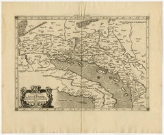
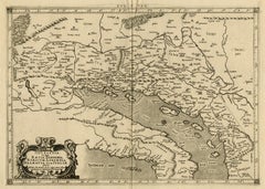
Antique Map of the Area Around Venice in Italy by H. Hondius, circa 1606
By Gerard Mercator, Jodocus Hondius
Located in Langweer, NL
In the upper right corner with ornamental scale of miles cartouche. This map originates from the German atlas „Abbildung der gantzen Welt ..." by Gerard Mercator and Jodocus Hondius.
Paper
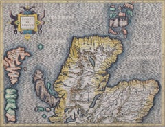

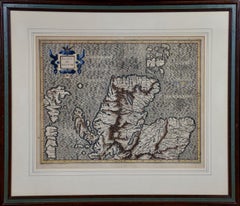
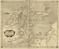
Map of the North of Scotland 17th century hand-coloured map by Gerardus Mercator
Located in London, GB
Gerardus Mercator (1512 - 1594) Map of the North of Scotland (1683) Engraving with later hand colouring 35 x 45 cm A fantastically characterful and detailed map engraving of the Nor...
Engraving

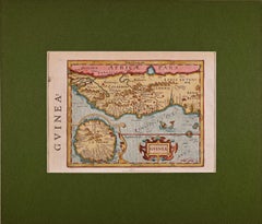
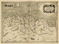
West Africa: A 17th Century Hand-Colored Map by Mercator/Hondius
By Gerard Mercator
Located in Alamo, CA
This has become know as Mercator projection on maps produced by subsequent cartographers to this day.
Engraving

$675
Southeastern Ireland: A 17th Century Hand Colored Map by Mercator and Hondius
By Gerard Mercator
Located in Alamo, CA
This has become known as Mercator projection on maps produced by subsequent cartographers to this day.
Engraving

Rugen Island, Germany: An Early 17th Century Map by Mercator and Hondius
By Gerard Mercator
Located in Alamo, CA
Hondius bought the plates of Gerard Mercator in 1604 and added around 40 of his own maps in an atlas that he first published in 1606, preserving Mercator's name.
Engraving

$675
Southeastern England: A 17th Century Hand-Colored Map by Mercator and Hondius
By Gerard Mercator
Located in Alamo, CA
A 17th century copperplate hand-colored map entitled "The Sixt Table of England" by Gerard Mercator and Jodocus Hondius, published in Amsterdam in 1635 in 'Cosmographicall Descriptio...
Engraving

$919Sale Price|20% Off
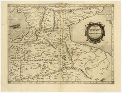
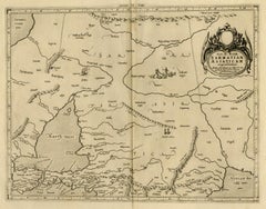
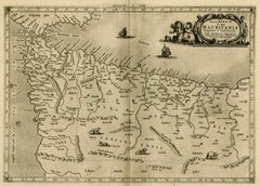
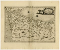
Original Antique Map of the Northern Baltic Region
Located in Langweer, NL
Notably, Stockholm and Gotland are also featured on the map. Published by the renowned cartographer Gerardus Mercator circa 1620, this map offers valuable insights into the geographi...
Paper

1633 Map Entitled "Beauvaisis Comitatus Belova Cium, Ric.0002
Located in Norton, MA
Summaries of these issues are given under the entry for Gerard Mercator. Jodocus Hondius the Elder * 1588 Maps in The Mariner\\\\\\\\\\\\\\\'s Mirrour (Waghenaer/Ashley) * 1590 World...
Paper
$1,151Sale Price|20% Off
Circa 1659 Willem Blaeu Map: Southwestern Switzerland with Geneva & Lakes
Located in Langweer, NL
Based on the work of Gerard Mercator, this map is published with Spanish text on the verso, dating from the period between 1659 and 1672.
Paper


1592 Abraham Ortelius Map "Lorraine: Lotharingiae Nova Descripti, Ric.A005
Located in Norton, MA
This particular impression is from a 1592 Latin text edition. This map of Lorraine is based on maps found in Mercator's "Galliae tabulae Geographicae."
Paper
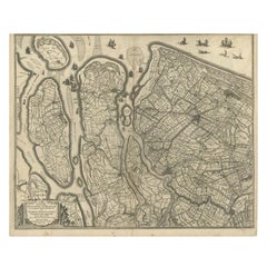

Antique Map of Delfland and Schieland by Hondius, c.1630
Located in Langweer, NL
He was born in Amsterdam, the son of the famous cartographer Jodocus Hondius who had started a map-making business in the city. Henricus obtained the original plates of the Mercator ...
Paper

1597 Abraham Ortelius Map Burgundy, France Entitled "Bvrgvndiae dvcatvs Ric.a010
Located in Norton, MA
This particular impression is from a 1592 Latin text edition. This map of Lorraine is based on maps found in Mercator's "Galliae tabulae Geographicae."
Paper
$715Sale Price|20% Off
Rare Original Antique Ptolemy Map of Ceylon, Present Day Sri Lanka
Located in Langweer, NL
The stipple engraved sea contains an oriental ship and two great sea monsters. Mercator originally published this map in his 1578 edition of Ptolemy's great Geography; this is from t...
Paper

Decorative Early Hand-Colored Map of the Northeast of England, ca.1620
Located in Langweer, NL
On Mercator projection maps, all parallels and meridians are drawn at right angles to each other, with the distance between the parallels extending towards the poles.
Paper
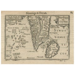
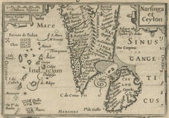
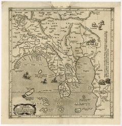
1616 Petrus Kaerius Map of Southern India and Ceylon – Narsinga et Ceylon
Located in Langweer, NL
His 'Caert-Thresoor' pocket maps were among the earliest affordable atlas maps available to merchants and scholars, preceding Blaeu’s and Mercator’s popular works.
Paper

$1,306Sale Price|25% Off
Attractive Antique Map of the World as Planisphere, Shows Cook's Voyages, 1799
Located in Langweer, NL
Antique map titled 'Chart of the World, according to Mercators Projection'.
Paper

North & South America: A 17th Century Hand-colored Map by Jansson & Goos
By Johannes Janssonius
Located in Alamo, CA
It was engraved by Abraham Goos. The map is based on an earlier map by Gerardus Mercator.
Paper

$853Sale Price|25% Off
Antique World Map with Astronomical Spheres by Pierre Mortier, Amsterdam, c.1700
Located in Langweer, NL
It is a richly detailed and ambitious map engraved on Mercator’s projection, combining geographic knowledge with early scientific and cosmographic understanding.
Paper
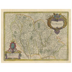
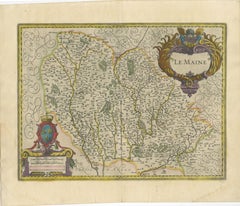
Map of Le Maine by H. Hondius, 1633, Hand-Colored, Decorative and Historic
Located in Langweer, NL
Produced by Henricus Hondius, a leading figure in Dutch cartography and successor to Jodocus Hondius and Gerard Mercator, this map belongs to the famous 'Atlas Novus'.
Paper
Circa 1620 Map of Livonia Baltic States
By Gerard Mercator
Located in Seguin, TX
Circa 1620 map of Livonia the Baltic states of Estonia and Latvia.
Paper
Unavailable
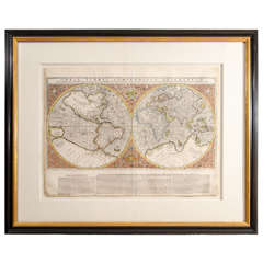
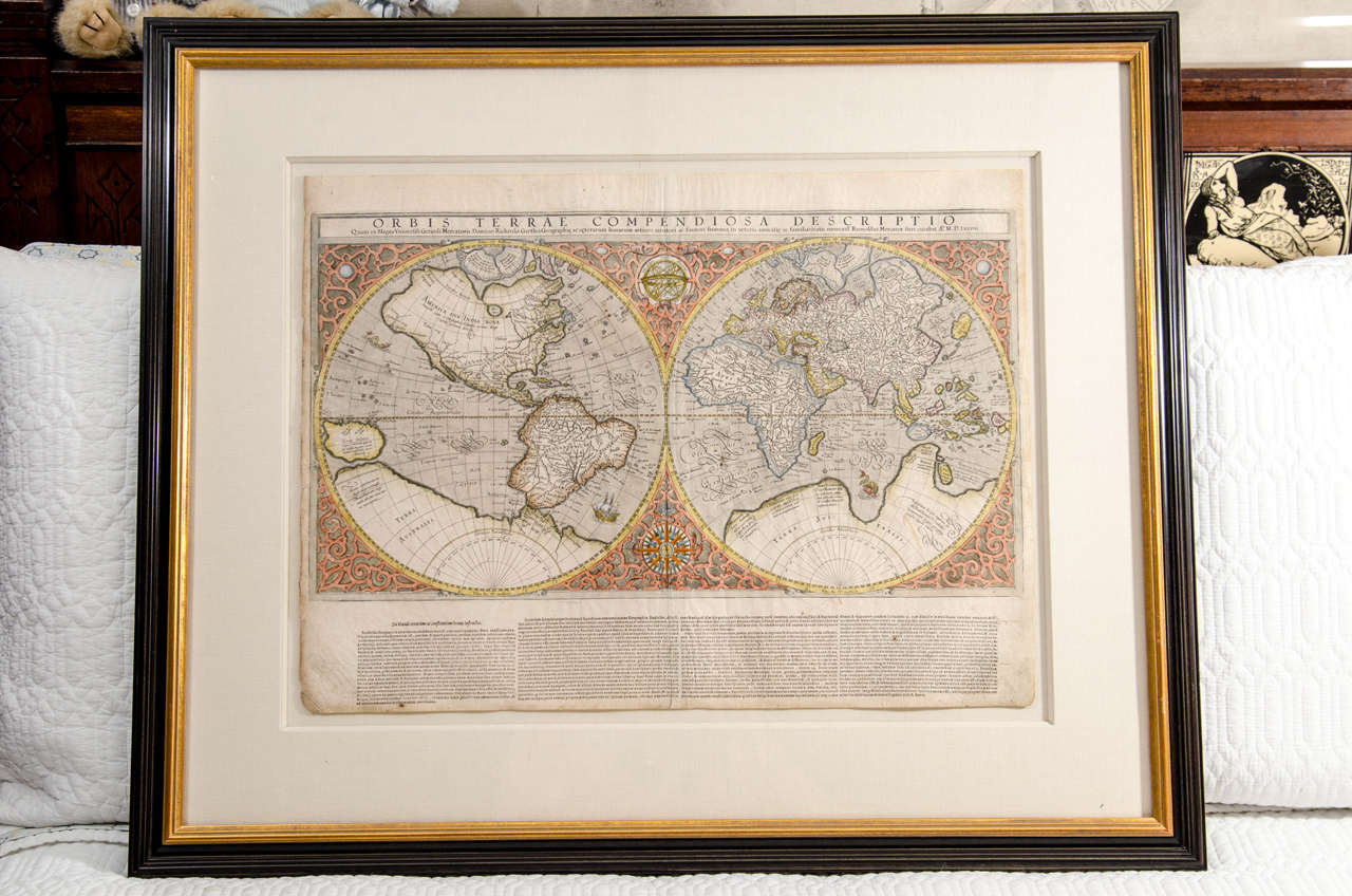
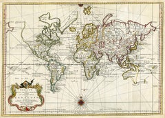
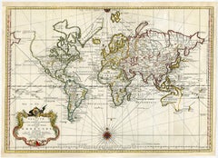
Mercator's Double Hemisphere World Map
By Gerard Mercator
Located in New York, NY
Gerard (1512 - 1594) and Rumold (1545 - 1599) Mercator Orbis Terrae Compendiosa Descriptio. . . Engraving with original hand-color from Strabonis Rerum Geographicarum 15 1/2 x 2...
Unavailable
H 17.33 in W 21.66 in
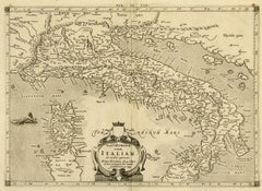
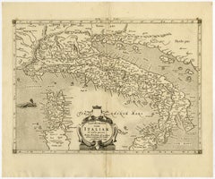
Ptolemaic map of Italy by Mercator - Engraving - 17th c.
By Gerard Mercator
Located in Zeeland, Noord-Brabant
Totam Italiam (…).' - Nice example of Mercator's Ptolemaic map of Italy. Description: From the 1698 ed. of Mercator's Ptolemy Atlas: 'Claudii Ptolemaei Tabulae Geographicae Orbis Te...
Engraving
Unavailable
H 17.33 in W 21.26 in
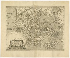
Ptolemaic map - Balkan Peninsula, Greece, Crete by Mercator - Engraving - 17th c
By Gerard Mercator
Located in Zeeland, Noord-Brabant
In 1552 he moved to Duisburg, Germany where he published his famous 18-sheet world map in 1569 with his own new projection, today called Mercator projection.
Engraving
Unavailable
H 17.33 in W 21.26 in
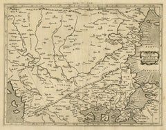
Ptolemaic map of Bulgaria, Rumania, Bosporus by Mercator - Engraving - 17th c
By Gerard Mercator
Located in Zeeland, Noord-Brabant
In 1552 he moved to Duisburg, Germany where he published his famous 18-sheet world map in 1569 with his own new projection, today called Mercator projection.
Engraving
Unavailable
H 16.93 in W 20.87 in
Ptolemaic map of ancient Spain and Portugal by Mercator - Engraving - 17th c.
By Gerard Mercator
Located in Zeeland, Noord-Brabant
In 1552 he moved to Duisburg, Germany where he published his famous 18-sheet world map in 1569 with his own new projection, today called Mercator projection.
Engraving
Unavailable
H 17.33 in W 20.87 in
Ptolemaic map of ancient Tunesia, Malta, Lybia by Mercator - Engraving - 17th c.
By Gerard Mercator
Located in Zeeland, Noord-Brabant
In 1552 he moved to Duisburg, Germany where he published his famous 18-sheet world map in 1569 with his own new projection, today called Mercator projection.
Engraving
Unavailable
H 17.33 in W 21.26 in
Ptolemaic map of Balkan coast extending north by Mercator - Engraving - 17th c.
By Gerard Mercator
Located in Zeeland, Noord-Brabant
In 1552 he moved to Duisburg, Germany where he published his famous 18-sheet world map in 1569 with his own new projection, today called Mercator projection.
Engraving
Unavailable
H 17.33 in W 20.87 in
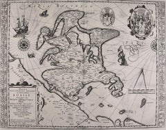
Map of ancient Great Britain, Scotland, Ireland by Mercator - Engraving - 17th c
By Gerard Mercator
Located in Zeeland, Noord-Brabant
In 1552 he moved to Duisburg, Germany where he published his famous 18-sheet world map in 1569 with his own new projection, today called Mercator projection.
Engraving
Unavailable
H 17.33 in W 20.87 in
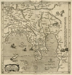
Ptolemaic map of India and Himalayan mountains by Mercator - Engraving - 17th c.
By Gerard Mercator
Located in Zeeland, Noord-Brabant
In 1552 he moved to Duisburg, Germany where he published his famous 18-sheet world map in 1569 with his own new projection, today called Mercator projection.
Engraving
Unavailable
H 15.75 in W 20.87 in
Old map of Georgia, Armenia and Azerbaijan by Mercator - Engraving - 17th c.
By Gerard Mercator
Located in Zeeland, Noord-Brabant
In 1552 he moved to Duisburg, Germany where he published his famous 18-sheet world map in 1569 with his own new projection, today called Mercator projection.
Engraving
Unavailable
H 17.33 in W 21.26 in
Map of Syria, Libanon, Palestine, Iraq, Israel by Mercator - Engraving - 17th c.
By Gerard Mercator
Located in Zeeland, Noord-Brabant
In 1552 he moved to Duisburg, Germany where he published his famous 18-sheet world map in 1569 with his own new projection, today called Mercator projection.
Engraving
Unavailable
H 17.33 in W 20.87 in
Ptolemaic map of North Africa, Libya, Egypt by Mercator - Engraving - 17th c
By Gerard Mercator
Located in Zeeland, Noord-Brabant
In 1552 he moved to Duisburg, Germany where he published his famous 18-sheet world map in 1569 with his own new projection, today called Mercator projection.
Engraving
Unavailable
H 16.93 in W 20.87 in
Ancient map of South Russia and Black Sea by Mercator - Engraving - 17th c
By Gerard Mercator
Located in Zeeland, Noord-Brabant
In 1552 he moved to Duisburg, Germany where he published his famous 18-sheet world map in 1569 with his own new projection, today called Mercator projection.
Engraving
Unavailable
H 17.72 in W 21.26 in
Ptolemaic map - Persian Gulf to the Caspian Sea by Mercator - Engraving - 17th c
By Gerard Mercator
Located in Zeeland, Noord-Brabant
In 1552 he moved to Duisburg, Germany where he published his famous 18-sheet world map in 1569 with his own new projection, today called Mercator projection.
Engraving
Unavailable
H 17.33 in W 21.26 in
Old map of Himalayas, N. India and Afghanistan by Mercator - Engraving - 17th c.
By Gerard Mercator
Located in Zeeland, Noord-Brabant
In 1552 he moved to Duisburg, Germany where he published his famous 18-sheet world map in 1569 with his own new projection, today called Mercator projection.
Engraving
Unavailable
H 17.33 in W 20.87 in
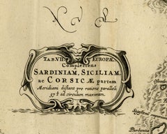
Map of Sardinia, Sicily and part of Corsica by Mercator - Engraving - 17th c.
By Gerard Mercator
Located in Zeeland, Noord-Brabant
In 1552 he moved to Duisburg, Germany where he published his famous 18-sheet world map in 1569 with his own new projection, today called Mercator projection.
Engraving
Unavailable
H 16.93 in W 20.87 in
Ptolemaic map of NW Africa, Morocco and Algeria by Mercator - Engraving - 17th c
By Gerard Mercator
Located in Zeeland, Noord-Brabant
In 1552 he moved to Duisburg, Germany where he published his famous 18-sheet world map in 1569 with his own new projection, today called Mercator projection.
Engraving
Unavailable
H 17.33 in W 20.87 in
Ptolemaic map of Turkey and Cyprus - Tab I - by Mercator - Engraving - 17th c.
By Gerard Mercator
Located in Zeeland, Noord-Brabant
In 1552 he moved to Duisburg, Germany where he published his famous 18-sheet world map in 1569 with his own new projection, today called Mercator projection.
Engraving
Unavailable
H 17.72 in W 20.48 in
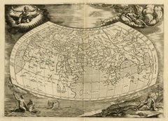
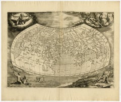
Very decorative world map of the ancient world by Mercator - Engraving - 17th c.
By Gerard Mercator
Located in Zeeland, Noord-Brabant
In 1552 he moved to Duisburg, Germany where he published his famous 18-sheet world map in 1569 with his own new projection, today called Mercator projection.
Engraving
Unavailable
H 14.97 in W 14.57 in
Ptolemaic map of Asia east of the river Ganges by Mercator - Engraving - 17th c.
By Gerard Mercator
Located in Zeeland, Noord-Brabant
In 1552 he moved to Duisburg, Germany where he published his famous 18-sheet world map in 1569 with his own new projection, today called Mercator projection.
Engraving


Unavailable
H 16.93 in W 21.26 in
Map of Vistula river, Sea of Azov, Baltic Sea by Mercator - Engraving - 17th c
By Gerard Mercator
Located in Zeeland, Noord-Brabant
In 1552 he moved to Duisburg, Germany where he published his famous 18-sheet world map in 1569 with his own new projection, today called Mercator projection.
Engraving
Unavailable
H 17.33 in W 20.87 in
Ptolemaic map of east Libya, Egypt and the Nile by Mercator - Engraving - 17th c
By Gerard Mercator
Located in Zeeland, Noord-Brabant
In 1552 he moved to Duisburg, Germany where he published his famous 18-sheet world map in 1569 with his own new projection, today called Mercator projection.
Engraving
Unavailable
H 19 in W 24 in D 0.2 in
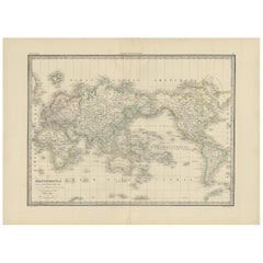
Nova Totius Terrarum Orbis Geographica Ac Hydrographica Tabula, 1638
By Willem Blaeu
Located in Houston, TX
This is a particularly fine copy of Blaeu's world map based on Mercator's projection first published on its own in 1606 as a reduced version of his large world map of 1605.
Unavailable
H 11.03 in W 16.26 in
World map on Mercator's projection by Bonne - Engraving - 18th Century
Located in Zeeland, Noord-Brabant
Subject: Antique print, titled: 'Carte Generale de Toutes les Parties Connues de la Surface de la Terre (…).' - World map on Mercator's projection. Greenland and the Arctic are attac...
Engraving
Unavailable
H 20.56 in W 28.55 in
Antique world map - Erdkugel and compass by Bellin - Handcol. engraving - 18th c
By Jacques-Nicolas Bellin
Located in Zeeland, Noord-Brabant
His career, spanning over 50 years, caused an enormous outpt in maps, particular of maritime interest. Subject: Antique print, titled: 'Versuch von einer kurzgefassen Karte welche d...
Engraving

Antique World Map 'Mercator Projection' by Lapie, 1842
Located in Langweer, NL
Antique map titled 'Mappe-Monde sur la Projection de Mercator'.
Paper
Sold
H 6.75 in W 8.63 in D 0.13 in
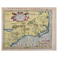
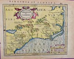
Florida and Virginia: A 17th Century Hand-colored Map by Hondius after Mercator
By Gerard Mercator
Located in Alamo, CA
Jodocus Hondius reprinted Mercator's atlas in 1606, after Mercator's death, adding 38 maps of his own.
Paper

Sold
H 12 in W 16 in D 0.13 in
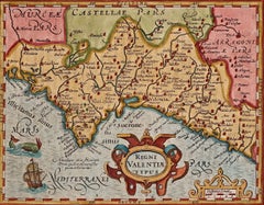
17th Century Hand-Colored Map of Valencia and Murcia, Spain by Mercator/Hondius
By Gerard Mercator
Located in Alamo, CA
This has become know as Mercator projection on maps produced by subsequent cartographers to this day.
Paper
Antique Map of Mexico by G. Mercator, 1637
Located in Langweer, NL
Relief shown pictorially. This map originates from 'Historia mundi: or Mercator's atlas.
Paper
Stunning Antique Map of the Island Ceylon or Sri Lanka
By Gerard Mercator
Located in Langweer, NL
Antique map titled 'Ins. Ceilan quae incolis Tenarisin dicitur'.
Paper
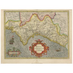

Antique Map of Valencia 'Spain' by Mercator/Hondius '1633'
Located in Langweer, NL
Antique map titled 'Regni Valentiae Typus'. Original antique map of Valencia, Spain.
Paper
1837 "Mercator Projection" Map of the World by James Wyld
Located in Colorado Springs, CO
This Mercator style projection world map was published in London by James Wyld in 1837.

Sold
H 47.5 in W 60.5 in D 4 in
1844 Map of the World on Mercator's Projection by Atwood and Ensign, Antique Map
Located in Colorado Springs, CO
This 1844 large format world map is surrounded by several decorative elements including 91 flags of countries around the world, vignettes of the four continents depicting natives and...
Paper

Sold
H 38.25 in W 50.75 in D 0.5 in
1842 Mercator Projection Map of the World, Texas as an Independent Republic
Located in Colorado Springs, CO
Folding wall map of the world, showing Texas as an independent republic, in publisher's portfolio A new chart of the world on Mercator’s projection by cartographer Henry Teesdale...
Sold
H 10.75 in W 13.5 in D 0.13 in
17th Century Hand-Colored Map of Bordeaux Region of France by Mercator/Hondius
Located in Alamo, CA
This has become know as Mercator projection on maps produced by subsequent cartographers to this day.
Paper

Antique Map of Captain Cook's Voyages, 1824
Located in Langweer, NL
Antique map titled 'Pacific Ocean on Mercator's Projection'.
Paper
Original Antique Hand-Colored Map of Southern Scotland, ca.1600
Located in Langweer, NL
Mercator, he also published a map of Northern Scotland titled 'Scotiae Regnum'.
Paper
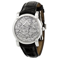
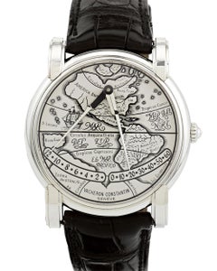
Vacheron Constantin Mercator Watch
By Vacheron Constantin
Located in New Orleans, LA
The 16th-century cartographer is renowned for creating the first flat maps of the globe for navigators. Thus, the watch's dial is enameled with Mercator’s navigational hemisphere maps.
18k Gold, White Gold
Antique Map of Scotland by Mercator, circa 1605
By Gerard Mercator
Located in Langweer, NL
Antique map titled 'Scotia Regnum'. One of the earliest obtainable maps of Scotland.
Paper

Sold
H 18.12 in W 21.66 in D 0.02 in
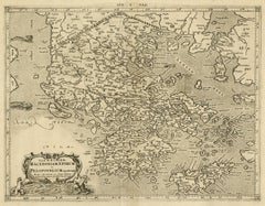
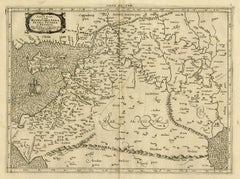
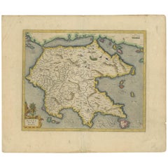
Antique Map of the Peloponnesos peninsula by Mercator, circa 1620
By Gerard Mercator
Located in Langweer, NL
Antique map titled 'Morea olim Peloponnesus'. A beautiful and decorative map of the Peloponnesos peninsula in southern Greece. This region was called Morea well into the 19th century...
Paper

Sold
H 42.5 in W 59.5 in D 2.5 in
Large-Scale Map of the World After Mercator, 1569, 20th Century Printing
By Gerard Mercator
Located in West Palm Beach, FL
Large-scale map of the world after Mercator, 1569, 20th century printing, in 2.5 deep walnut and gilt frame.
Plexiglass, Walnut, Paper

Antique World Map on Mercator's Projection, 1782
Located in Langweer, NL
World map on Mercator's projection. Greenland and the Arctic are attached to North America.
Paper
Sold
H 15.87 in W 20.36 in D 0.02 in
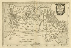
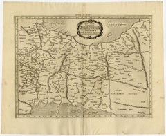
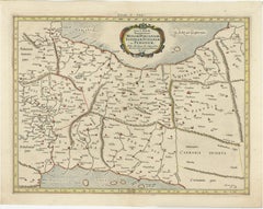
Antique Ptolemaic Map of Modern-Day Iran, Iraq and Part of Armenia
By Gerard Mercator
Located in Langweer, NL
Ptolemaic map of much of modern-day Iran, Iraq and part of Armenia.
Paper
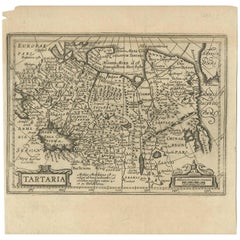
Antique Map of Tartary "Asia" by Mercator/Hondius, 1606
Located in Langweer, NL
The maps were copied from those of the great cartographer Mercator of circa 1580-1590 or were reductions of Hondius' own maps of 1606.
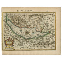

Antique Map of Lake Geneva by Mercator/Hondius '1610'
Located in Langweer, NL
Antique map titled 'Lacus Lemanus'. Old map of Lake Geneva with good detail of surrounding towns and villages. Decorated with a large compass rose with two sailing boats and a sea mo...
Paper

Sold
H 18.71 in W 24.02 in D 0.02 in
Antique World Map on Mercator Projection by Levasseur, circa 1860
Located in Langweer, NL
Antique map titled 'Planisphère sur la Projection de Mercator'.
Paper

Sold
H 18.12 in W 21.66 in D 0.02 in
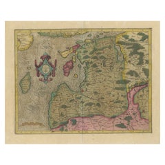
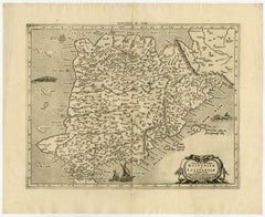
Antique Map of Northern Ireland by Mercator/Hondius, Early 1600's
Located in Langweer, NL
This was one of five Irish maps Gerard Mercator designed for the second part of his Atlas.
Paper


17th Century Hand-Colored Map of West Africa by Mercator/Hondius
Located in Alamo, CA
This has become know as Mercator projection on maps produced by subsequent cartographers to this day.
Paper

Sold
H 18.12 in W 22.45 in D 0.02 in
Antique Map of Ireland in Original Handcoloring by Mercator 'circa 1610'
Located in Langweer, NL
Original handcol. engraved map of Ireland, highlighted with gold. Published by Mercator, 'circa 1610'.
Paper

Sold
H 16.54 in W 25.01 in D 0.4 in
1864 Johnson's Map of the World on Mercator's Projection, Ric.B009
Located in Norton, MA
An 1864 Johnson's map of the World on Mercator's Projection Ric.b009 About this Item "This antique map came from Johnson's New Illustrated (Steel Plate) Family Atlas, publ...
Paper

Sold
H 13.59 in W 18.71 in D 0 in
Antique Map of the World on Mercator’s Projection with Mountain Details, 1880
Located in Langweer, NL
Antique world map titled 'Planisphère'. Antique map of the World on Mercator’s Projection.
Paper

Sold
H 14.57 in W 21.26 in D 0.02 in
Antique Map of the World on Mercator's Projection by W. G. Blackie, 1859
Located in Langweer, NL
Antique map titled 'The World on Mercator's Projection'.
Paper
Sold
H 20.67 in W 25.04 in D 0.02 in
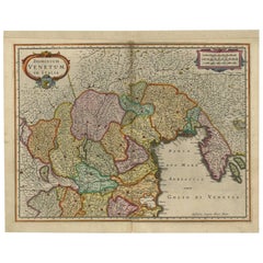
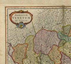
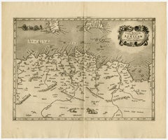
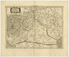
Antique Map of Italy, Slovenia and Croatia by G. Mercator, circa 1600
Located in Langweer, NL
Antique map of northeastern Italy, Slovenia and Croatia, on laid paper without color, good impression, with ornate title cartouche upper left and figurative scale lower left, having ...
Sold
H 8.47 in W 11.03 in D 0.01 in
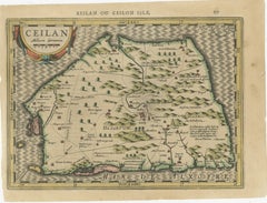
17th-Century Map of Sri Lanka (Ceylon) by Mercator & van den Keere, 1630
Located in Langweer, NL
This captivating 17th-century map titled "Zeilan ou Ceilon Isle" (Ceylon/Sri Lanka) was engraved by Petrus Kaerius (van den Keere) and published in Mercator's "Atlas Minor," edited b...
Paper

Sold
H 16.74 in W 24.14 in D 0 in
Antique Chart of the World Map on Mercators Projection with Currents Etc, 1882
Located in Langweer, NL
Antique map titled 'Chart of the World on Mercators Projection'.
Paper

Sold
H 6.75 in W 8.63 in
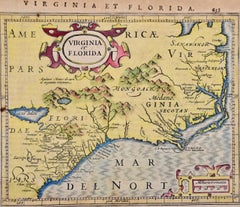
Florida and Virginia: A 17th Century Hand-colored Map by Hondius after Mercator
By Gerard Mercator
Located in Alamo, CA
Jodocus Hondius reprinted Mercator's atlas in 1606, after Mercator's death, adding 38 maps of his own.
Engraving
It's hard to resist the allure of a beautiful pool. So, go ahead and daydream about whiling away your summer in paradise.
It’s never too early for good design. These interiors combine elevated furnishings and a youthful spirit, resulting in spaces that are at once elegant and whimsical.
Produced in 1843, the well-preserved volume is evidence of the author's exacting specifications.
New or old, the coverlets add old-time charm to any space.
Get into the games! These items celebrate the events, athletes, host countries and sporting spirit.
French trendsetter and serial collector Daniel Rozensztroch tells us about his obsession with objects related to seafaring men.
The sought-after designer worked with the team at Hoffman Creative to produce a monograph that beautifully showcases some of Studio Shamshiri's most inspiring projects.
Italian writer and collector Umberto Pasti opens the doors to his remarkable cave of wonders in North Africa.