Items Similar to 1625 Mercator Map of the Provenience of Quercy, "Quercy Cadvrcivm Ric.0013
Want more images or videos?
Request additional images or videos from the seller
1 of 13
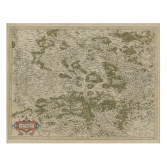
1625 Mercator Map of the Provenience of Quercy, "Quercy Cadvrcivm Ric.0013
About the Item
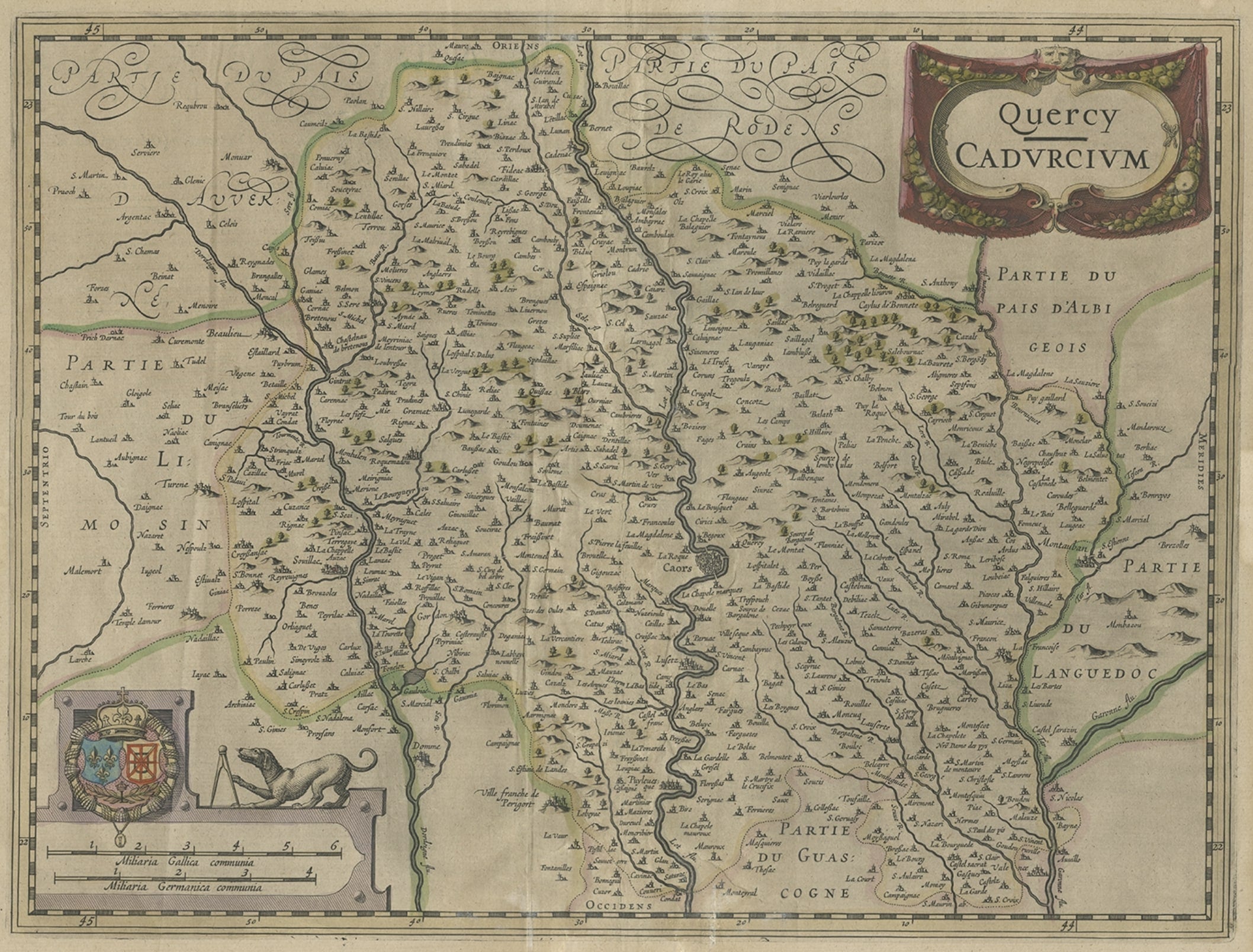
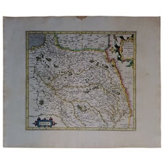
1625 Mercator map of the provenience of Quercy, entitled
"Quercy Cadvrcivm,"
Ric.0013
" Authentic" - Map of the provenience of Quercy Cadvrcivm
Description: Antique map titled 'Quercy Cadurcium'. Old map of the region of Quercy, France. Quercy is a former province of France, the present-day department of Lot, the northern half of the department of Tarn-et-Garonne, and a few communities in the departments of Dordogne, Corrèze, and Aveyron.
Artists and Engravers: Gerard Mercator (Kremer) was born in Rupelmonde in Flanders and studied in Louvain. He drawn his first map in 1537 and became a cartographer and globe maker. In 1552 he moved to Duisburg, Germany where he published his famous 18-sheet world map in 1569 with his own new projection, today called Mercator projection. Later he decided to publish a new edition of Ptolemy's Geographia. Followed by his major work, a 3 volume collection of maps to which the word "Atlas" was applied the first time. The first volume was published 1585, followed by the second in 1589 and the third one after his death in 1595 by his son Rumold. A second edition of all three parts was published 1602. 1604 Jodocus Hondius acquired the plates and published several edition together with his sons Jodocus II and Henricus until 1633. More editions followed until 1666 by Janssonius who was in partnership with Henricus. Some of the plated where also used in W.J. Blaeu in 1630.
Dimension: Paper: 57 cm W x 48 cm H ; Sight: 49cm W x 37 cm H
Condition: Good Condition with aged toning, please see photos.
- Dimensions:Height: 18.9 in (48 cm)Width: 22.45 in (57 cm)Depth: 0.4 in (1 cm)
- Materials and Techniques:
- Place of Origin:
- Period:
- Date of Manufacture:1625
- Condition:
- Seller Location:Norton, MA
- Reference Number:1stDibs: LU5848230077082
About the Seller
5.0
Platinum Seller
These expertly vetted sellers are 1stDibs' most experienced sellers and are rated highest by our customers.
Established in 2000
1stDibs seller since 2021
85 sales on 1stDibs
Typical response time: <1 hour
- ShippingRetrieving quote...Ships From: Norton, MA
- Return PolicyA return for this item may be initiated within 3 days of delivery.
More From This SellerView All
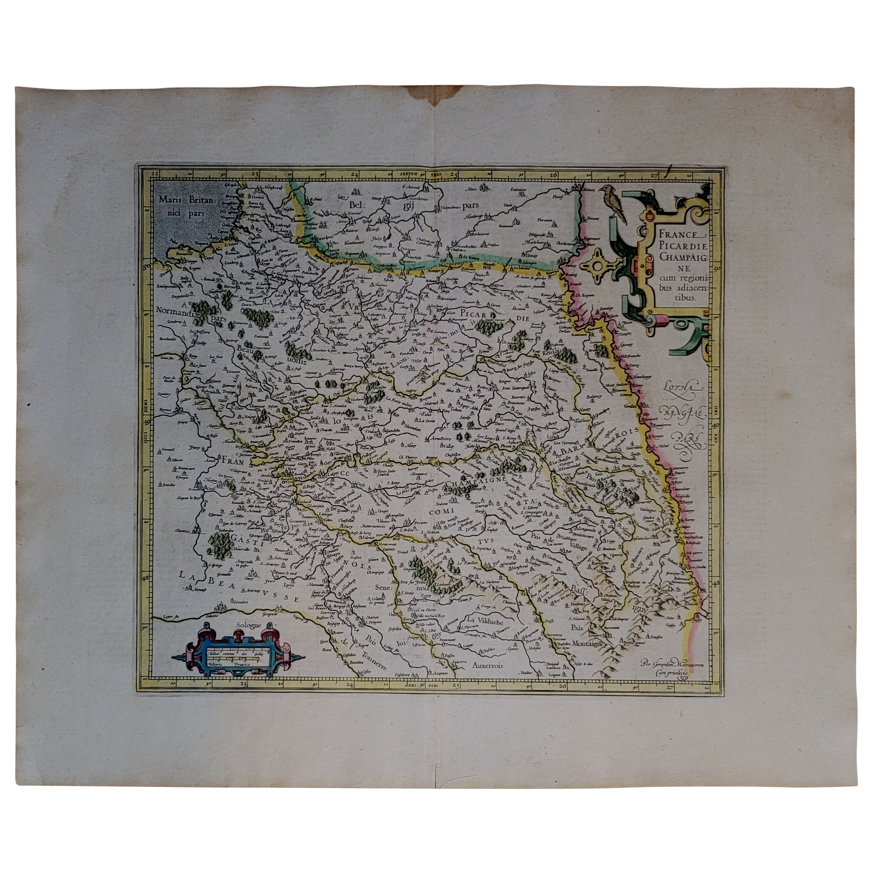
- 1864 Johnson's Map of the World on Mercator's Projection, Ric.B009Located in Norton, MAAn 1864 Johnson's map of the World on Mercator's Projection Ric.b009 About this Item "This antique map came from Johnson's New Illustrated (Steel Plate) Family Atlas, publ...Category
Antique 19th Century Dutch Maps
MaterialsPaper
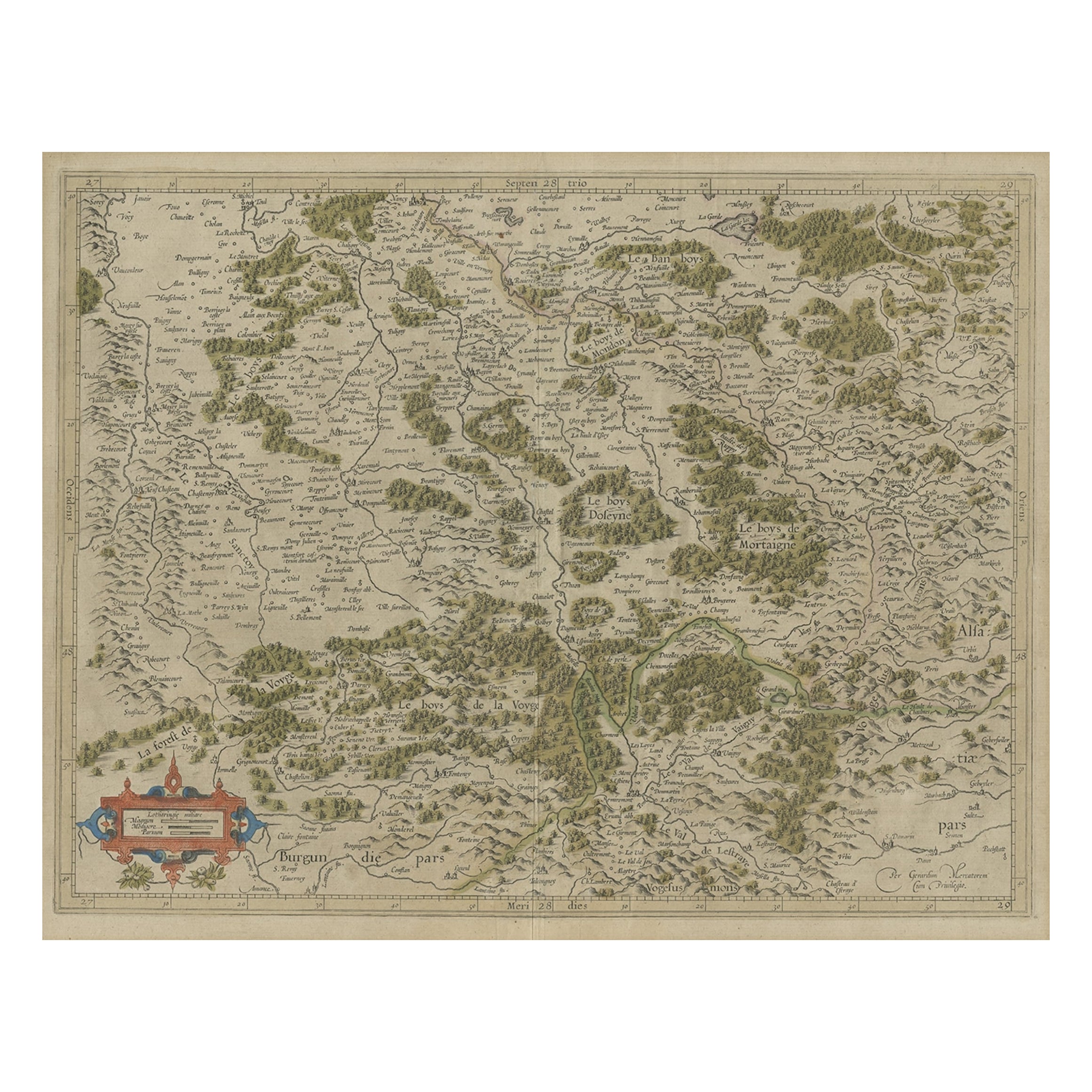
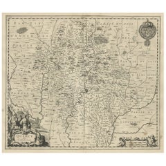
- 1590 Mercator Map Entitled "France Picardie Champaigne, Ric.0001Located in Norton, MADescription: Published in Amsterdam by Mercator/Hondius ca. 1590. Ric.0001 Artists and Engravers: Map : 'France Picardie Champaigne cum regionibus adiacentibus'. (Map of the french provinces of Picardie and Champagne.) Copper engraved map of the french provinces of Picardie and Champagne, showing the cities of Caen, Paris, Melun, Auxerre, Verdun, etc. Copperplate engraving on verge type hand laid paper with watermark. Description: Published in Amsterdam by Mercator/Hondius ca. 1600.Artists and Engravers: Mercator was born in Rupelmonde in Flanders and studied in Louvain under Gemma Frisius, Dutch writer, astronomer and mathematician. The excellence of his work brought him the patronage of Charles V, but in spite of his favor with the Emperor he was caught up in the persecution of Lutheran protestants and charged with heresy, fortunately without serious consequences. No doubt the fear of further persecution influenced his move in 1552 to Duisburg, where he continued the production of maps, globes and instruments. Mercator's sons and grandsons, were all cartographers and made their contributions in various ways to his atlas. Rumold, in particular, was responsible for the complete edition in 1595. The map plates...Category
Antique 16th Century Dutch Maps
MaterialsPaper
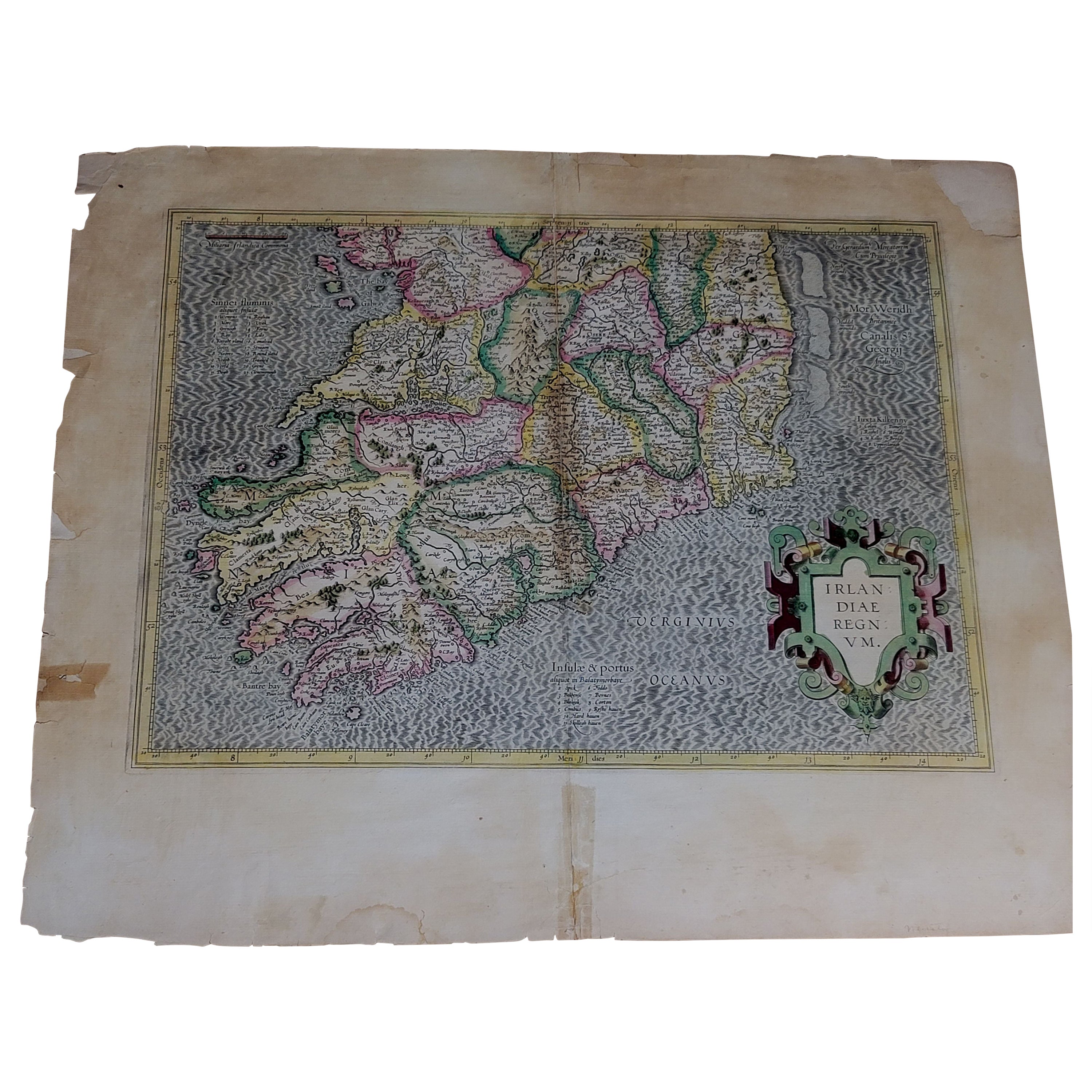
- 1585 Mercator Map of Ireland, Entitled "Irlandiae Regnvm, " Hand Colored Ric0006Located in Norton, MA1585 Mercator map of Ireland, entitled "Irlandiae Regnvm." Hand Colored Description: Published in Amsterdam by Mercator/Hondius ca. 1585. Artists and Engravers: 1585 Mercator map of Ireland, entitled "Irlandiae Regnvm." Copperplate engraving on verge type hand laid paper with watermark. Description: Published in Amsterdam by Mercator/Hondius ca. 1585.Artists and Engravers: Mercator was born in Rupelmonde in Flanders and studied in Louvain under Gemma Frisius, Dutch writer, astronomer and mathematician. The excellence of his work brought him the patronage of Charles V, but in spite of his favor with the Emperor he was caught up in the persecution of Lutheran protestants and charged with heresy, fortunately without serious consequences. No doubt the fear of further persecution influenced his move in 1552 to Duisburg, where he continued the production of maps, globes and instruments. Mercator's sons and grandsons, were all cartographers and made their contributions in various ways to his atlas. Rumold, in particular, was responsible for the complete edition in 1595. The map plates...Category
Antique 16th Century Dutch Maps
MaterialsPaper
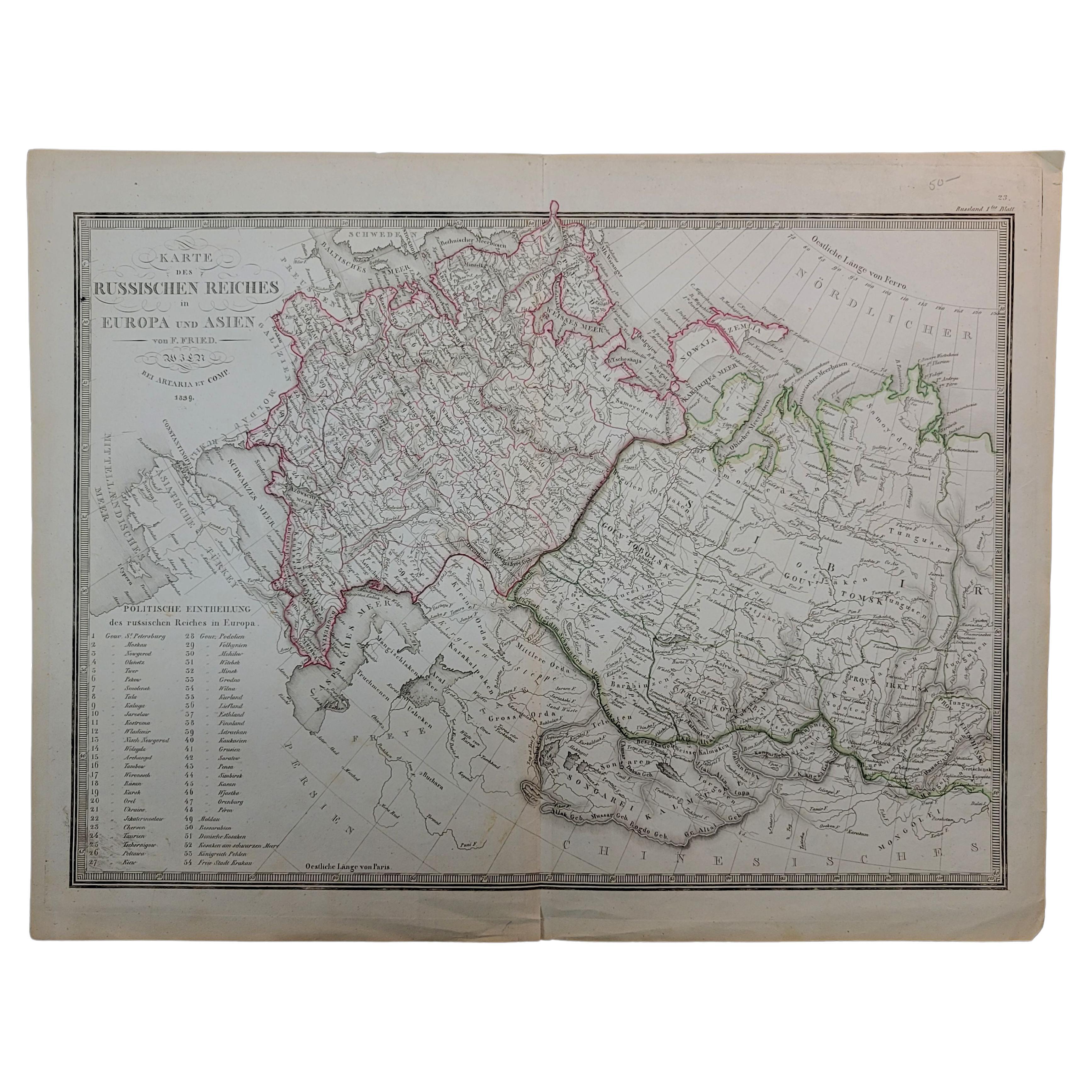
- 1839 Map of Karte Des "Russischen Reiches in Europa Und Asien" Ric.R0013Located in Norton, MA1839 map of Karte Des "Russischen Reiches in Europa and Asien" Ric.r013 Map of the European and Asian parts of Russian Empire. Karte der Russischen Reiches in Europa und Asien...Category
Antique 19th Century Unknown Maps
MaterialsPaper
- 1814 Map of "Russian Empire" Ric.r032Located in Norton, MA1814 Map of "Russian Empire" Ric.r032 Russian Empire. Description: This is an 1814 John Thomson map of the Russian Empire. The map depicts the region from the Baltic Sea, Prussia, and Sweden to the Aleutian Islands and from the Arctic Ocean to the Yellow River. Highly detailed, myriad cities, towns, and villages are labeled throughout, including St. Petersburg, Moscow, Minsk, Kiev, and Kharkov. Rivers and mountain ranges are also identified, as are islands and numerous locations along the coastlines. It is important to note that the long-disputed sea between Korea and Japan is identified as the 'Sea of Japan. Historical Context: In 1815, Tsarist Russia emerged from the Napoleonic Wars economically insolvent and politically fearful of the Revolutionary fervor that had just swept through Europe. In order to shore up Russia's economic position, the Tsars began an aggressive series of expansions into the Caucuses and Central Asia that would vastly increase the landmass of the Russian Empire. Publication History Thomson maps are known for their stunning color, awe inspiring size, and magnificent detail. Thomson's work, including this map, represents some of the finest cartographic art...Category
Antique 19th Century Unknown Maps
MaterialsPaper
- 1594 Maurice Bouguereau Map of the Region Limoges, France, Ric0015Located in Norton, MA1594 Maurice Bouguereau map of the region Limoges, France, entitled "Totivs Lemovici et Confinium Pro Uinciarum Quantum ad Dioecefin Lemo Uicenfen Fpectant," Hand Colored Ric0015 Jean IV Le Clerc...Category
Antique 16th Century Dutch Maps
MaterialsPaper


You May Also Like
- Antique Map of the French Province of Quercy, ca.1625Located in Langweer, NLAntique map titled 'Quercy Cadurcium'. Old map of the region of Quercy, France. Quercy is a former province of France, the present-day department of Lot, the northern half of the dep...Category
Antique 17th Century Maps
MaterialsPaper
- Antique Map of the Southern Lorraine Region by Mercator, c.1625By Gerard MercatorLocated in Langweer, NLAntique map titled 'Lotharingiae Ducatus'. Old map of the southern portion of the Lorraine region, France. Lorraine is a cultural and historical region in north-eastern France, now l...Category
Antique 17th Century Maps
MaterialsPaper
- Decorative Antique Map of the Quercy Region in France, 1657Located in Langweer, NLAntique map of France titled 'Quercy olim Cadurcium'. Decorative map of the Quercy region. Quercy is a former province of France located in the country's southwest, bounded on th...Category
Antique 1650s Maps
MaterialsPaper
- Antique Map of the World on Mercator's Projection, 1788Located in Langweer, NLAntique map titled 'Kaart van de Geheele Wereld (..)'. Uncommon small world map on Mercator's projection. Nice detail of the islands throughout the wor...Category
Antique Late 18th Century Maps
MaterialsPaper
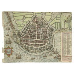
- Antique Map of the City of Enkhuizen by Guicciardini, 1625Located in Langweer, NLAntique map titled 'Die Stadt Enchuijsen, La ville denchuijsen'. Map of Enkhuizen, Noord-Holland, The Netherlands. Oiginates from the 1625 edition of 'Discrittione di tutti i Paesi B...Category
Antique 17th Century Maps
MaterialsPaper
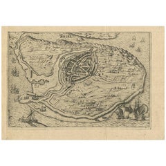
- Antique Map of the City of Brielle 'The Netherlands' by L. Guicciardini, 1625Located in Langweer, NLPlan of Brielle, Briel, Den Briel in the Province of Zuid-Holland, The Netherlands, Holland. This map originates from the 1625 edition of 'Discrittione di tutti i Paesi Bassi', by L....Category
Antique Early 17th Century Maps
MaterialsPaper

Recently Viewed
View AllMore Ways To Browse
J And H Used Furniture And Antique
Dordogne France
Northern France Map
Antique Old World Globe
Antique World Globe Map
Blaeu World Map
Henricus Hondius
Ptolemy Map
Antique Map Dordogne
Antique Style Atlas
Nautical Map
Nautical Maps
Antique Ship Decor
Pacific Map
Coastal Maps
Antique Roman Map
Antique Sea Chart
Mexico Antique Map