Blaeu World Map
5
to
16
105
19
122
100
28
22
21
20
7
5
4
4
3
2
2
1
1
1
1
22
11
9
1
1
Sort By
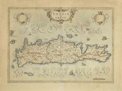
Map of Crete - Etching by Johannes Blaeu - 1650s
Located in Roma, IT
born in Alkmaar, the son of cartographer Willem Blaeu. Blaeu's world map, Nova et Accuratissima
Category
1650s Modern Figurative Prints
Materials
Etching
H 18.51 in W 24.22 in D 0.08 in
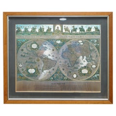
World Map Silver Leaf Print Based on Original Willem Blaeu Wall Map 1571-1638
Located in GB
We are delighted to offer for sale this lovely Antique style pictorial plan map of the globe based
Category
20th Century English Campaign Maps
Materials
Silver Leaf
H 22.05 in W 25.6 in D 0.99 in
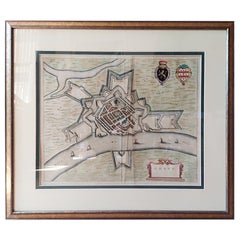
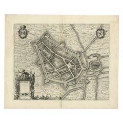
Antique Map of the City of Grave by Blaeu, 1649
Located in Langweer, NL
Company. Around 1649 Joan Blaeu published a collection of Dutch city maps named Tooneel der Steeden (Views
Category
Antique 17th Century Maps
Materials
Paper
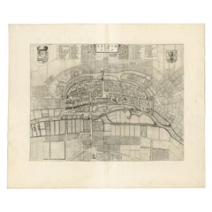
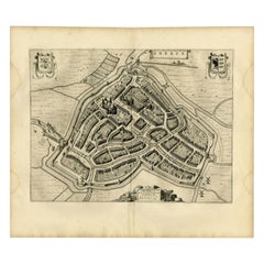
Antique Map of the City of Goch by Blaeu, 1649
Located in Langweer, NL
the world. Our collection includes a wide range of authentic antique maps from the 16th to the 20th
Category
Antique 17th Century Maps
Materials
Paper
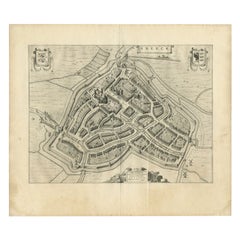
Antique Map of the City of Geldern by Blaeu, 1649
Located in Langweer, NL
cartographer of the Dutch East India Company. Around 1649 Joan Blaeu published a collection of Dutch city maps
Category
Antique 17th Century Maps
Materials
Paper
Antique Map of the City of Sneek by Blaeu, 1652
Located in Langweer, NL
interior decorators all over the world. Our collection includes a wide range of authentic antique maps from
Category
Antique 17th Century Maps
Materials
Paper
Antique Map of the City of Sneek by Blaeu, 1649
Located in Langweer, NL
cartographer of the Dutch East India Company. Around 1649 Joan Blaeu published a collection of Dutch city maps
Category
Antique 17th Century Maps
Materials
Paper
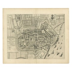
Antique Map of the City of Tiel by Blaeu, 1649
Located in Langweer, NL
Blaeu published a collection of Dutch city maps named Tooneel der Steeden (Views of Cities). In 1651 he
Category
Antique 17th Century Maps
Materials
Paper
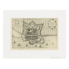
Antique Map of the City of Workum by Blaeu, 1649
Located in Langweer, NL
Antique map titled 'Worckum'. Old map of the city of Workum, Friesland. Originates from J. Blaeu
Category
Antique 17th Century Maps
Materials
Paper
Antique Map of the Maluku Islands by Blaeu, c.1640
Located in Langweer, NL
skills. Blaeu set up shop in Amsterdam, where he sold instruments and globes, published maps, and edited
Category
Antique 17th Century Maps
Materials
Paper
Antique Map of the Province of Groningen by Blaeu, 1635
Located in Langweer, NL
maps to collectors, historians, educators and interior decorators all over the world. Our collection
Category
Antique 17th Century Maps
Materials
Paper
Antique Map of Macedonia by the Famous Mapmaker Blaeu, c.1650
Located in Langweer, NL
started producing map and sea charts, including his first world map in 1605. His most famous work was the
Category
Antique 17th Century Maps
Materials
Paper
Antique Map of the Hesse Region of Germany by Blaeu, 1665
Located in Langweer, NL
. Around 1649 Joan Blaeu published a collection of Dutch city maps named Tooneel der Steeden (Views of
Category
Antique 17th Century Maps
Materials
Paper
Antique Map of Guinea in West Africa by Blaeu, c.1638
Located in Langweer, NL
world map in 1605. His most famous work was the "Atlas Novus" or "Theatrum Orbis Terrarum sive Atlas
Category
Antique 17th Century Maps
Materials
Paper
1643 Willem&Joan Blaeu Map NW Flanders "Flandriae Teutonicae Pars Prientalior
Located in Norton, MA
1643 Willem and Joan Blaeu map of northwest Flanders, entitled
"Flandriae Teutonicae Pars
Category
Antique 17th Century Dutch Maps
Materials
Paper
H 19.3 in W 22.45 in D 0.4 in
Antique Map of China, Tartary and Central Asia by Blaeu, c.1645
Located in Langweer, NL
Blaeu drew this map this part of the world was almost entirely unknown. Blaeu relied on the journals of
Category
Antique 17th Century Maps
Materials
Paper
Original Antique Map of Utrecht in the Netherlands by Blaeu, C.1645
Located in Langweer, NL
and sea charts, including his first world map in 1605. His most famous work was the "Atlas Novus" or
Category
Antique 17th Century Maps
Materials
Paper
Original Antique Map of Zuid-Holland in the Netherlands by Blaeu, C.1645
Located in Langweer, NL
map and sea charts, including his first world map in 1605. His most famous work was the "Atlas Novus
Category
Antique 17th Century Maps
Materials
Paper
H 20.48 in W 24.81 in D 0 in
Handsome Old Detailed Map of the Low Countries by Famous Mapmaker Blaeu, ca.1635
Located in Langweer, NL
sought after- detailed map of the Low Countries by the world most famous map maker Blaeu. With beautiful
Category
Antique 1630s Maps
Materials
Paper
H 17.72 in W 23.12 in D 0 in
Antique Map of the Siege of Breda, City in the Netherlands by Blaeu, 1649
Located in Langweer, NL
cartographer of the Dutch East India Company. Around 1649 Joan Blaeu published a collection of Dutch city maps
Category
Antique 17th Century Maps
Materials
Paper
H 20.87 in W 24.02 in D 0 in
Antique Map of Artois in the North of France by Famous Mapmaker Blaeu, c.1640
Located in Langweer, NL
. Later he started producing map and sea charts, including his first world map in 1605. In 1633 he was
Category
Antique 17th Century Maps
Materials
Paper
No Reserve
H 19.69 in W 23.43 in D 0 in
Burgundy's Viticultural Landscape: A 1640 Cartographic Engraving by Willem Blaeu
Located in Langweer, NL
An hand-colored original antique map with the title "Utriusque Burgundiae tum Ducatus tum Comitatus
Category
Antique 1640s Maps
Materials
Paper
Free Shipping
H 18.51 in W 23.43 in D 0 in
Champagne: The Sparkling Heart of France - A Blaeu Cartographic Engraving, c1650
Located in Langweer, NL
of the map is indicated on the cartouche, which reads "Amstelodami Apud Guilielmum et Ioannem Blaeu
Category
Antique 1650s Maps
Materials
Paper
Free Shipping
H 20.08 in W 23.82 in D 0 in
Map of Scotland - Etching by Johannes Blaeu - 1650s
Located in Roma, IT
Map of Scotland is an geographic map realized by Johannes Blaeu.
Etching, printed in 1660 ca
Category
1650s Modern Figurative Prints
Materials
Etching
H 18.51 in W 23.82 in D 0.08 in
Antique Plan of the Fortress of Greetsiel, Germany, by Blaeu, c.1650
Located in Langweer, NL
interior decorators all over the world. Our collection includes a wide range of authentic antique maps from
Category
Antique 17th Century Maps
Materials
Paper
Original Antique Bird's Eye View Plan of Hoorn, The Netherlands by Blaeu, c.1700
Located in Langweer, NL
out with ""English County Maps"", a year after a similar issue by Willem Blaeu. Janssonius' maps are
Category
Antique Early 1700s Maps
Materials
Paper
H 17.92 in W 22.52 in D 0 in
Antique Map of Buckinghamshire in England, 1743
Located in Langweer, NL
tradition by using the prints of other publishers, notably the maps of Blaeu and Jansson. Only when these
Category
Antique 18th Century Maps
Materials
Paper
1633 Map Entitled "Beauvaisis Comitatus Belova Cium, Ric.0002
Located in Norton, MA
/Ashley) * 1590 World Map in two hemispheres illustrating Drake\\\\\\\\\\\\\\\'s circumnavigation * c
Category
Antique 17th Century Dutch Maps
Materials
Paper
Antique Map of Friesland by De Wit, c.1690
Located in Langweer, NL
world. Our collection includes a wide range of authentic antique maps from the 16th to the 20th
Category
Antique 17th Century Maps
Materials
Paper
Antique Map of the City of Zutphen by Guicciardini, 1612
Located in Langweer, NL
Antique map Zutphen titled 'Zutphen'. This map depicts the city of Zutphen, Gelderland, The
Category
Antique 17th Century Maps
Materials
Paper
Antique Map of the County of Devon by Overton, 1713
Located in Langweer, NL
Dutch tradition by using the prints of other publishers, notably the maps of Blaeu and Jansson. Only
Category
Antique 18th Century Maps
Materials
Paper
Antique Map of Drenthe, a Province in The Netherlands, 1658
Located in Langweer, NL
original antique maps to collectors, historians, educators and interior decorators all over the world. Our
Category
Antique 17th Century Maps
Materials
Paper
Antique Map of the French Province of Quercy, ca.1625
Located in Langweer, NL
he published his famous 18-sheet world map in 1569 with his own new projection, today called Mercator
Category
Antique 17th Century Maps
Materials
Paper
Old Map of the Bourbonnais Region of France, ca.1630
Located in Langweer, NL
famous 18-sheet world map in 1569 with his own new projection, today called Mercator projection. Later he
Category
Antique 1630s Maps
Materials
Paper
Antique Map of the Gulf of Cambay, Gujarat, India, 1725
By Pieter Van Der Aa
Located in Langweer, NL
original antique maps to collectors, historians, educators and interior decorators all over the world. Our
Category
Antique 18th Century Maps
Materials
Paper
Antique Map of Germany of German in Roman Times, c.1660
Located in Langweer, NL
Antique map Germany titled 'Germaniae Veteris Typus'. Antique map probably by Blaeu or based on an
Category
Antique 17th Century Maps
Materials
Paper
Antique Map of The Dutch Provinces of Gelderland and Overijssel, 1623
Located in Langweer, NL
world map in 1569 with his own new projection, today called Mercator projection. Later he decided to
Category
Antique 17th Century Maps
Materials
Paper
Antique Map of the Maluku Islands by Van der Aa, 1725
By Pieter Van Der Aa
Located in Langweer, NL
maps to collectors, historians, educators and interior decorators all over the world. Our collection
Category
Antique 18th Century Maps
Materials
Paper
Map of East Friesland, The Netherlands & the Area Emden & Norden, Germany, 1635
Located in Langweer, NL
globe maker. Later he started producing map and sea charts, including his first world map in 1605. In
Category
Antique 1630s Maps
Materials
Paper
H 20.48 in W 24.34 in D 0 in
Original Antique Map of the Dutch Provinces of Overijssel and Drenthe, 1635
Located in Langweer, NL
first world map in 1605. In 1633 he was appointed Hydrographer for the Dutch East India Company (VOC
Category
Antique 1630s Maps
Materials
Paper
H 19.41 in W 23.23 in D 0 in
Map of the Duchy Clivia & Ravestein, Brabant in The Netherlands & Germany, 1635
Located in Langweer, NL
date of this map.
Artists and Engravers: Willem Janszoon Blaeu was born 1571 in Alkmaar. He was
Category
Antique 1630s Maps
Materials
Paper
H 16.86 in W 22.05 in D 0 in
Antique Map of the Southern Lorraine Region by Mercator, c.1625
By Gerard Mercator
Located in Langweer, NL
, Germany where he published his famous 18-sheet world map in 1569 with his own new projection, today called
Category
Antique 17th Century Maps
Materials
Paper
Antique Map of the Moluccas in Indonesia by Janssonius, C.1650
By Johannes Janssonius
Located in Langweer, NL
Century, is the focus of this exquisite map. Similar to Blaeu's map, except that it extends further south
Category
Antique 17th Century Maps
Materials
Paper
Original Antique Map the Imperial States of the Habsburg Netherlands, 1609
Located in Langweer, NL
famous 18-sheet world map in 1569 with his own new projection, today called Mercator projection. Later he
Category
Antique Early 1600s Maps
Materials
Paper
H 20.08 in W 25.2 in D 0 in
1620 Map of Artois Entitled "Artesia Comitatvs Artois, " by Bleau, Ric.a012
Located in Norton, MA
, decorative, title cartouche with two putti and the coat of arms of Artois. From the Blaeu world atlas
Category
Antique 17th Century Dutch Maps
Materials
Paper
H 14.97 in W 19.69 in D 0.4 in
Antique Map of Dutch & Belgium Provinces Limburg, Namen and Ardennes, ca.1635
Located in Langweer, NL
maker. Later he started producing map and sea charts, including his first world map in 1605. In 1633 he
Category
Antique 1630s Maps
Materials
Paper
H 19.97 in W 23.51 in D 0 in
Antique Map of the Region of Zutphen in Overijssel, The Netherlands, 1683
Located in Langweer, NL
world. Our collection includes a wide range of authentic antique maps from the 16th to the 20th
Category
Antique 17th Century Maps
Materials
Paper
H 20.08 in W 24.41 in D 0 in
Antique Hand-Colored Map of the Frisian City of IJlst, The Netherlands, 1649
Located in Langweer, NL
Antique hand-colored map titled 'Ylst'. Original antique map of the city of IJlst, Friesland, the
Category
Antique 17th Century Maps
Materials
Paper
H 12.21 in W 9.65 in D 0 in
Early Antique Map of Gelderland and Overijssel in the Netherlands, c.1625
Located in Langweer, NL
world map in 1569 with his own new projection, today called Mercator projection. Later he decided to
Category
Antique 17th Century Maps
Materials
Paper
H 15.75 in W 21.46 in D 0 in
Antique Map of the Island of Java by Van Der Aa, 1725
By Pieter Van Der Aa
Located in Langweer, NL
antique maps to collectors, historians, educators and interior decorators all over the world. Our
Category
Antique 18th Century Maps
Materials
Paper
1625 Mercator Map of the Provenience of Quercy, "Quercy Cadvrcivm Ric.0013
Located in Norton, MA
globe maker. In 1552 he moved to Duisburg, Germany where he published his famous 18-sheet world map in
Category
Antique 17th Century French Maps
Materials
Paper
H 18.9 in W 22.45 in D 0.4 in
Antique Map of the Duchy of Saxony by De Wit, c.1680
Located in Langweer, NL
Antique map titled 'Circuli Saxoniae Superior Pars Meridionalis in qua sunt Ducatus Saxoniae
Category
Antique 17th Century Maps
Materials
Paper
Antique Map of the Roadstead of Batavia by Van der Aa, 1725
By Pieter Van Der Aa
Located in Langweer, NL
all over the world. Our collection includes a wide range of authentic antique maps from the 16th to
Category
Antique 18th Century Maps
Materials
Paper
Antique Map of the Roadstead of Bantam by Van der Aa, 1725
By Pieter Van Der Aa
Located in Langweer, NL
print / map book ever published. Van der Aa incorporated plates by other publishers such as Blaeu
Category
Antique 18th Century Maps
Materials
Paper
Early Antique Map of the Dutch Provinces of Friesland and Groningen, 1604
Located in Langweer, NL
. In 1552 he moved to Duisburg, Germany where he published his famous 18-sheet world map in 1569 with
Category
Antique Early 1600s Maps
Materials
Paper
H 16.93 in W 21.07 in D 0 in
Extremely Scarce Antique Map of The Island of Borneo, Indonesia, c. 1725
Located in Langweer, NL
decorators all over the world. Our collection includes a wide range of authentic antique maps from the 16th
Category
Antique 18th Century Maps
Materials
Paper
H 10.44 in W 16.15 in D 0 in
Antique Map of the Mughal Empire by Van der Aa, C.1725
By Pieter Van Der Aa
Located in Langweer, NL
decorators all over the world. Our collection includes a wide range of authentic antique maps from the 16th
Category
Antique 18th Century Maps
Materials
Paper
"Nova Barbariae Descriptio", a 17th Century Hand-Colored Map of North Africa
By Johannes Janssonius
Located in Alamo, CA
expanding their company, publishing several world and city atlases in competition with the Blaeu publishing
Category
Antique Mid-17th Century Dutch Maps
Materials
Paper
H 22.38 in W 29 in D 0.13 in
Scarce Antique Map of Greece, the Aegean, Crete and part of Asia Minor
Located in Langweer, NL
second only to the Blaeus among Dutch map-makers for the high quality of engraving and decoration and the
Category
Antique Late 17th Century Maps
Materials
Paper
H 21.15 in W 24.49 in D 0.02 in
One of the Earliest Maps of Gelderland and Overijssel in the Netherlands, 1623
Located in Langweer, NL
world map in 1569 with his own new projection, today called Mercator projection. Later he decided to
Category
Antique 1620s Maps
Materials
Paper
H 18.31 in W 22.05 in D 0 in
- 1
Get Updated with New Arrivals
Save "Blaeu World Map", and we’ll notify you when there are new listings in this category.
Blaeu World Map For Sale on 1stDibs
Choose from an assortment of styles, material and more with respect to the blaeu world map you’re looking for at 1stDibs. A blaeu world map — often made from paper, metal and silver leaf — can elevate any home. Whether you’re looking for an older or newer blaeu world map, there are earlier versions available from the 18th Century and newer variations made as recently as the 20th Century. Many designers have produced at least one well-made blaeu world map over the years, but those crafted by Pieter Van Der Aa, Johannes Janssonius and Gerard Mercator are often thought to be among the most beautiful.
How Much is a Blaeu World Map?
Prices for a blaeu world map start at $119 and top out at $36,609 with the average selling for $798.
More Ways To Browse
Afghanistan Map
Antique Maps Caribbean Islands
John Speed Map
John Speed Antique Maps
John Speed Maps
Antique Pocket Globe
Atlantic Ocean Antique Map
Antique Sri Lanka Map
Dutch Monkey
Japanese Hirado
Petrus Van
Antique Great Lakes Map
Map Central Asia
Antique Map Of Israel
Antique Maps Of Israel
Antique Map Sicily
Antique Sicily Map
Sea Monkey
