Items Similar to Original Antique Map of the Dutch Provinces of Overijssel and Drenthe, 1635


Want more images or videos?
Request additional images or videos from the seller
1 of 5
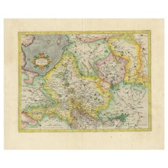
Original Antique Map of the Dutch Provinces of Overijssel and Drenthe, 1635
About the Item
Antique map titled 'Transiselania Dominium vernacule Over-Yssel.' - Map of the Dutch Provinces of Overijssel and Drenthe. Dedicated to Mr. Bartold Wicheringe by Joan and Cornelis Blaeu. With many coats of arms and two beautiful cartouches. Source unknown, to be determined.
Artists and Engravers: Made by 'Joan and Cornelis Blaeu' after an anonymous artist. Willem Janszoon Blaeu was born 1571 in Alkmaar. He was trained from 1594 to 1596 by the famous danish astronomer Tycho Brahe. 1599 he went to Amsterdam and founded a business as globe maker. Later he started producing map and sea charts, including his first world map in 1605. In 1633 he was appointed Hydrographer for the Dutch East India Company (VOC). His most famous work was the "Atlas Novus" or "Theatrum Orbis Terrarum sive Atlas Novus" of 1635, which was published until 1655 in total six volumes. After Blaeu's death in 1638 his sons Joan and Cornelis continued the businees and finished the "Atlas Novus" and started an even larger work, the "Atlas Maior", which reached 12 volumes. In 1672 a fire destroyed the printing house and a year later Joan died. Some of the surviving plates where bought by F. de Wit and Schenk & Valk. The business was closed finally in 1695.
- Dimensions:Height: 19.41 in (49.3 cm)Width: 23.23 in (59 cm)Depth: 0 in (0.02 mm)
- Materials and Techniques:
- Period:1630-1639
- Date of Manufacture:1635
- Condition:Condition: Good/Fair. Slightly browned. A few spots. Closed wormholes in the lower margin. Top margin with a small tear in the middle fold, just outside image. Minor paper loss lower left margin. Middle fold as issued. Study image carefully.
- Seller Location:Langweer, NL
- Reference Number:
About the Seller
5.0
Platinum Seller
These expertly vetted sellers are 1stDibs' most experienced sellers and are rated highest by our customers.
Established in 2009
1stDibs seller since 2017
1,932 sales on 1stDibs
Typical response time: <1 hour
- ShippingRetrieving quote...Ships From: Langweer, Netherlands
- Return PolicyA return for this item may be initiated within 14 days of delivery.
More From This SellerView All
- Antique Map of The Dutch Provinces of Gelderland and Overijssel, 1623Located in Langweer, NLAntique map titled 'Geldria et Transysulana'. One of the earliest maps of Gelderland and Overijssel in the Netherlands, prepared by Gerard Mercator. Artists and Engravers: Gerard Mer...Category
Antique 17th Century Maps
MaterialsPaper
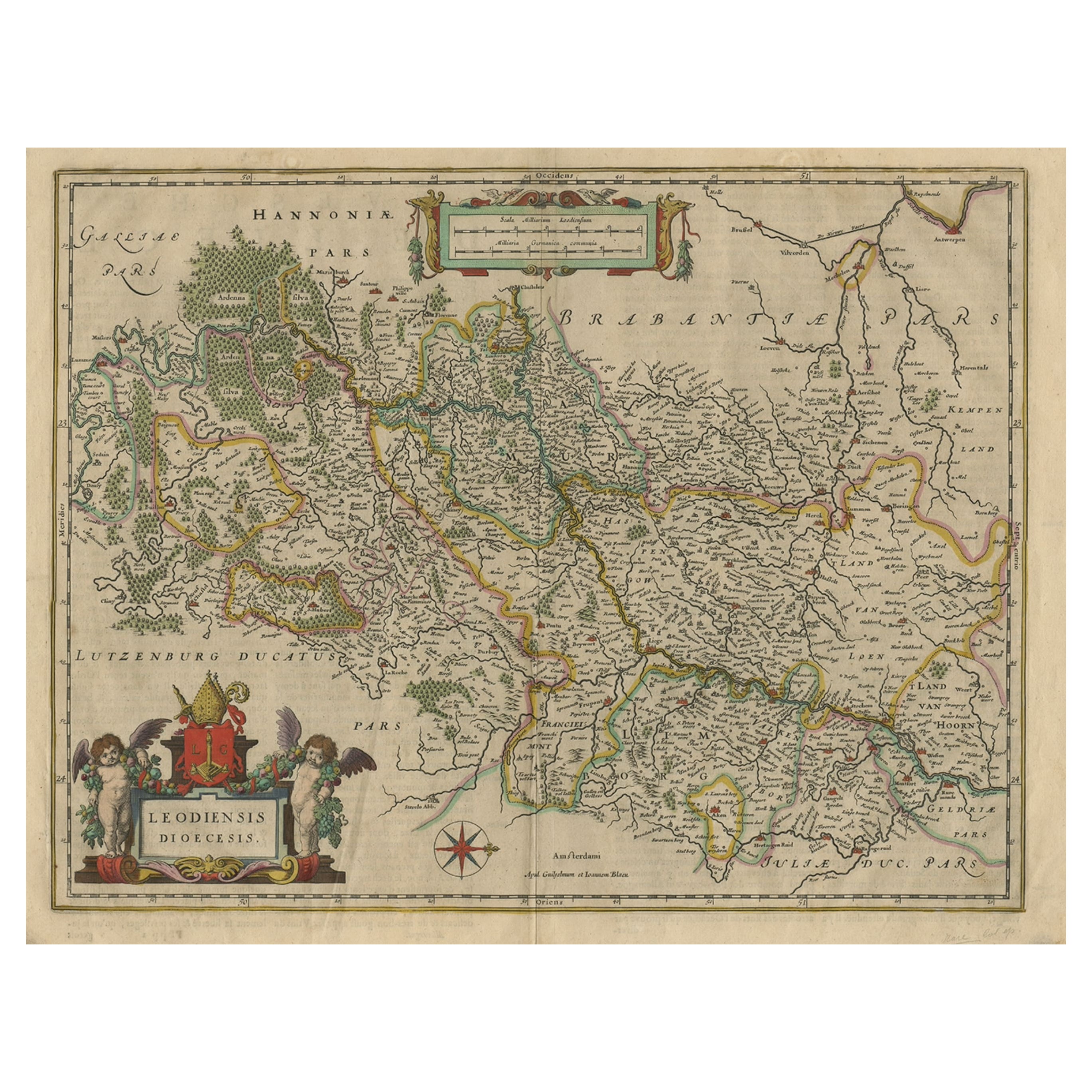
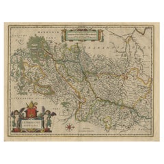
- Antique Map of Dutch & Belgium Provinces Limburg, Namen and Ardennes, ca.1635Located in Langweer, NLAntique print, titled: 'Leodiensis Dioecesis.' Detailed map including the Dutch and Belgium provinces Limburg and the Belgium province of Namen and Ardennes. Exquisitely engraved...Category
Antique 1630s Maps
MaterialsPaper
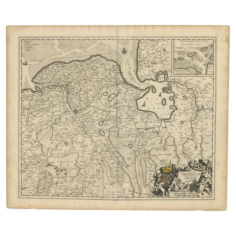
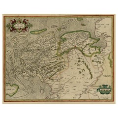
- Antique Map of the Dutch Provinces Groningen and Drenthe, C.1660Located in Langweer, NLAntique map titled 'Dominii Groningae nec non maximae partis Drentiae (..)'. Map of Groningen and Drenthe in the north-east part of the Netherlands. Inset upper right corner of the "...Category
Antique 17th Century Maps
MaterialsPaper
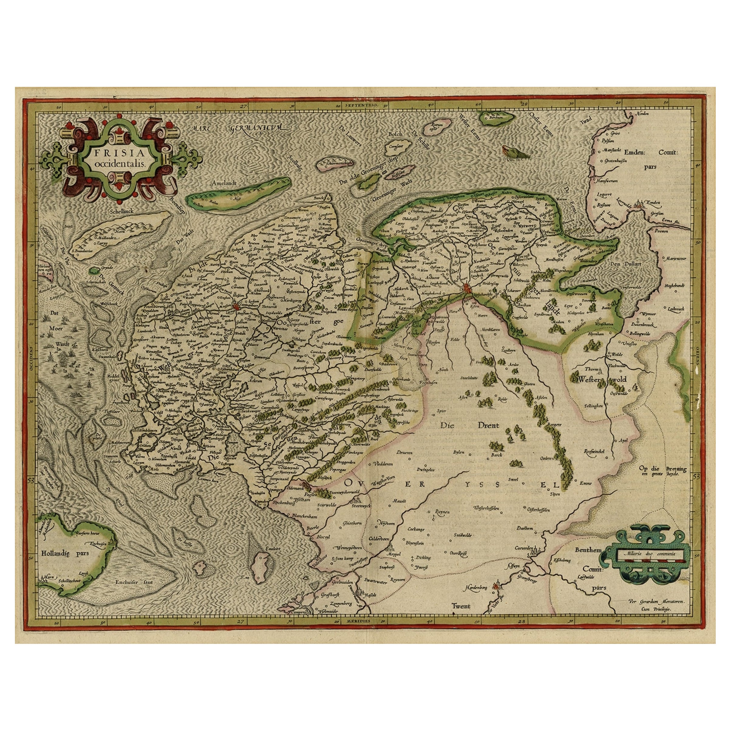
- Early Antique Map of the Dutch Provinces of Friesland and Groningen, 1604Located in Langweer, NLAntique map titled 'Frisiae Occidentalis.' This attractive map shows the Dutch Provinces of Friesland and Groningen. Embellished with strapwork tit...Category
Antique Early 1600s Maps
MaterialsPaper
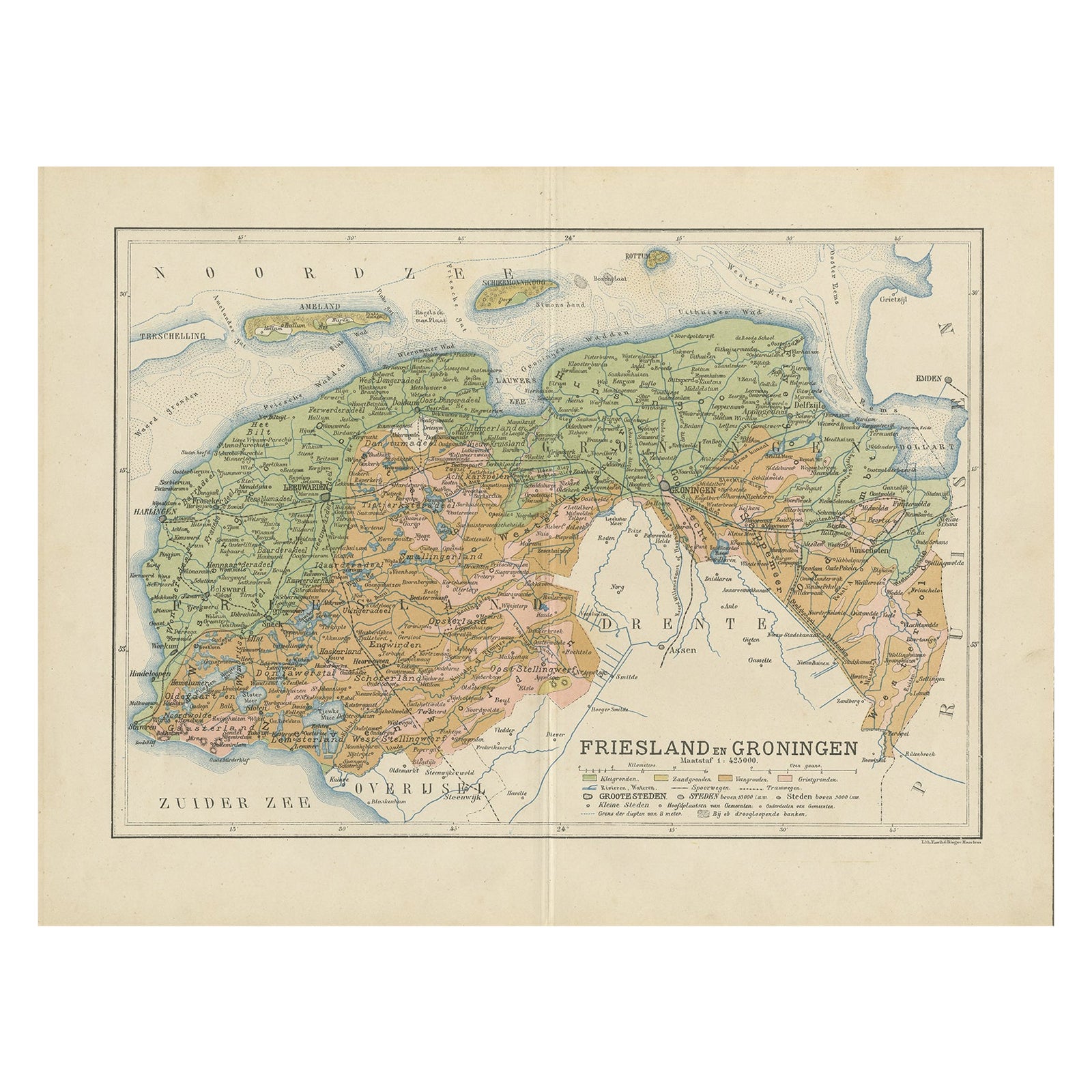
- Antique Map of the Dutch Most Northern Provinces Friesland and Groningen, 1883Located in Langweer, NLAntique map titled 'Friesland en Groningen'. Map of Friesland and Groningen, provinces of the Netherlands. This map originates from 'Atlas van Nederland volgens de nieuwe spelregels'...Category
Antique 19th Century Maps
MaterialsPaper
- Antique Map of the Province of Overijssel, the NetherlandsLocated in Langweer, NLOriginal antique map titled 'Ditio Trans-Isulana'. Original old map of the province of Overijssel, the Netherlands. With coat of arms and two decorative cartouches. Published by J. J...Category
Antique Mid-17th Century Maps
MaterialsPaper


You May Also Like
- Original Antique Map of The World by Thomas Clerk, 1817Located in St Annes, LancashireGreat map of The Eastern and Western Hemispheres On 2 sheets Copper-plate engraving Drawn and engraved by Thomas Clerk, Edinburgh. Published by Mackenzie And Dent, 1817 ...Category
Antique 1810s English Maps
MaterialsPaper
- Original Antique Map of Spain and Portugal, circa 1790Located in St Annes, LancashireSuper map of Spain and Portugal Copper plate engraving by A. Bell Published, circa 1790. Unframed.Category
Antique 1790s English Other Maps
MaterialsPaper
- Original Antique Map of Ireland- Tipperary and Waterford. C.1840Located in St Annes, LancashireGreat map of Tipperary and Waterford Steel engraving Drawn under the direction of A.Adlard Published by How and Parsons, C.1840 Unframed.Category
Antique 1840s English Maps
MaterialsPaper
- Original Antique Map of Italy. Arrowsmith. 1820Located in St Annes, LancashireGreat map of Italy Drawn under the direction of Arrowsmith Copper-plate engraving Published by Longman, Hurst, Rees, Orme and Brown, 1820 Unframed.Category
Antique 1820s English Maps
MaterialsPaper
- Original Antique Map of China, Arrowsmith, 1820Located in St Annes, LancashireGreat map of China Drawn under the direction of Arrowsmith Copper-plate engraving Published by Longman, Hurst, Rees, Orme and Brown, 1820 Unfr...Category
Antique 1820s English Maps
MaterialsPaper
- Original Antique Map of Canada, Arrowsmith, 1820Located in St Annes, LancashireGreat map of Canada. Drawn under the direction of Arrowsmith. Copper-plate engraving. Published by Longman, Hurst, Rees, Orme and Brown, 1820 ...Category
Antique 1820s English Maps
MaterialsPaper


Recently Viewed
View AllMore Ways To Browse
House Of Holland
Holland And Company
Antique Globes Of The World
Holland And Sons Furniture
Holland And Sons
Holland And Son
Cornelis Hollander
Coat Of Arms Plates
Antique Globes And Maps
Antique Maps And Globes
Large World Map
Dutch East India Company
World Map Globe
Dutch East India
Large Antique World Map
Antique World Map Large
Large Antique World Maps
Large Antique Map Of The World