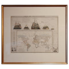
Large World Map
20
431
52
11
to
68
326
160
494
490
492
26
24
7
6
4
3
2
2
2
2
2
2
2
1
184
113
134
63
22
68
18
9
7
1
15
10
15
10
6
4
2
335
52
51
30
24
180
76
67
67
35
25
10
9
8
4
Sort By
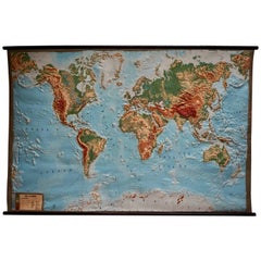
World Relief Map
Located in Antwerp, BE
Large world relief map.
Measures: Width 232 cm.
Height 158 cm.
Category
Mid-20th Century German Mid-Century Modern Maps
Materials
Acrylic
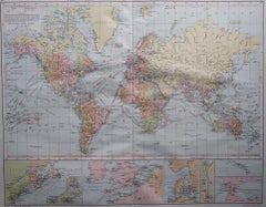
Large Original Vintage Map of The World, circa 1920
Located in St Annes, Lancashire
Great map of The World
Original color.
Good condition / minor foxing
Published by
Category
Vintage 1920s English Maps
Materials
Paper
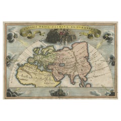
Decorative Ancient World Map with Large Parts of the World Still Unknown, c 1731
Located in Langweer, NL
Interesting ancient map of the world, based upon Strabo. The Southern tip of Africa is undiscovered
Category
Antique 1730s Maps
Materials
Paper
H 9.45 in W 14.57 in D 0 in
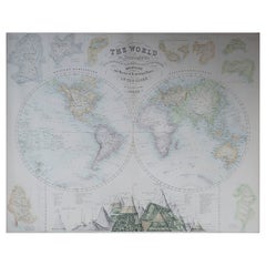
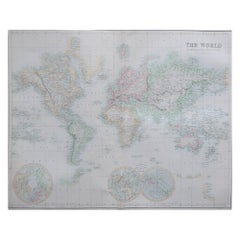
Large Original Antique Map of The World, Fullarton, C.1870
Located in St Annes, Lancashire
Great map of the World. Showing both hemispheres
From the celebrated Royal Illustrated Atlas
Category
Antique 1870s Scottish Maps
Materials
Paper
Large Original Antique Map of the World, Fullarton, circa 1870
Located in St Annes, Lancashire
Great map of the World.
From the celebrated Royal Illustrated Atlas
Lithograph. Original color
Category
Antique 1870s Scottish Maps
Materials
Paper
No Reserve
H 18.5 in W 22.5 in D 0.07 in
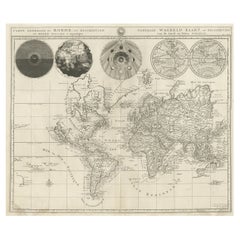
Antique Detailed World Map Drawn on Mercator's Projection, 1700
Located in Langweer, NL
Antique world map titled 'Carte generale du monde, ou description du monde terrestre & Aquatique
Category
Antique 17th Century Maps
Materials
Paper
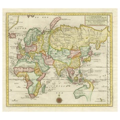
Antique Map of the Eastern Part of the World
Located in Langweer, NL
Antique map titled 'Nieuwe Kaart van het Oostelykste Deel der Weereld, diendende tot aanwyzing van
Category
Antique Mid-18th Century Maps
Materials
Paper
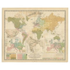
Antique Map Showing the Religions Around the World by Johnston '1854'
Located in Langweer, NL
According to Religious Belief'. Rare large-size thematic map on the distribution of religions around the
Category
Antique Mid-19th Century Maps
Materials
Paper
No Reserve
H 21.66 in W 26.38 in D 0.02 in
Antique Map of the Distribution of Vegetation throughout the World '1851'
Located in Langweer, NL
of vegetation throughout the world. Five drawings above the map show the vegetation in numerous areas
Category
Antique Mid-19th Century Maps
Materials
Paper
H 19.69 in W 21.86 in D 0.79 in
Two Impressive and Huge Midcentury World Map Wall Globes, Austria, 1950s
Located in Vienna, AT
We proudly offer this outstanding pair of very large wall-mounted modernist globes / world maps
Category
Mid-20th Century Austrian Mid-Century Modern Maps
Materials
Aluminum, Iron
Very Attractive Antique Map of the World as Planisphere, Shows Cook's Voyages
Located in Langweer, NL
Antique map titled 'Chart of the World, according to Mercators Projection'. This world map shows
Category
Antique Late 18th Century Maps
Materials
Paper
No Reserve
H 16.15 in W 20.08 in D 0.02 in
Antique Map of the World in Hemispheres by Keizer & de Lat, 1788
Located in Langweer, NL
double hemisphere world map on polar projections. In North America, there is a large Island of California
Category
Antique Late 18th Century Maps
Materials
Paper
Large Scale Map of Greece with Inset Map of Macedonia, c.1786
Located in Langweer, NL
Antique map titled 'Graeciae Antiquae'. Large scale map of Greece, extends south to the island of
Category
Antique 18th Century Maps
Materials
Paper
Antique Hemisphere Map of the World 'Two on One Sheet' by Levasseur, '1875'
Located in Langweer, NL
la projection polaire'. Large map with two hemisphere world maps on one sheet. This map originates
Category
Antique Late 19th Century Maps
Materials
Paper
H 24.02 in W 18.71 in D 0.02 in
Antique Map of the World with Polar Projections by Keizer & de Lat, 1788
Located in Langweer, NL
Antique map titled 'Schuine Ronde Aard-Klooten (..)'. Interesting double hemisphere world map with
Category
Antique Late 18th Century Maps
Materials
Paper
H 8.08 in W 11.03 in D 0.02 in
1832 Large Map "Russian & Poland" Ric. R0012
Located in Norton, MA
Large map 1832
"Russian & Poland"
Ric.r0012
Russia & Poland, by J. Arrowsmith. London, pubd
Category
Antique 19th Century Unknown Maps
Materials
Paper
Large Antique Map of Delfland by Cruquius, 1712
Located in Langweer, NL
Map no. 20 of a large wall map of Delfland, The Netherlands. The map covers the region of Pijnacker
Category
Antique 18th Century Maps
Materials
Paper
Large Antique County Map of Leicestershire, England, 1805
Located in Langweer, NL
Explore Leicestershire's Past: Antique Map by John Cary
Step into the history of Leicestershire
Category
Antique Early 19th Century Maps
Materials
Paper
Large Antique Map of the Asian Continent, 1814
Located in Langweer, NL
Antique map titled 'Asia'. Large antique map of the Asian continent. Drawn under the direction of
Category
Antique 19th Century Maps
Materials
Paper
Large Antique Map of Denmark by Bowles, c.1780
By Thomas
Located in Langweer, NL
Antique map titled 'Bowles's new pocket map of the Kingdom of Denmark (..)' Large map of Denmark
Category
Antique 18th Century Maps
Materials
Paper
Large Detailed Map of Australia Wint Inset of Tasmania, 1937
Located in Langweer, NL
Antique map titled 'Australia'. Large folding map of Australia. With inset map of Tasmania. Printed
Category
20th Century Maps
Materials
Paper
Large Antique Map of France by De Wit, c.1680
By Frederick de Wit
Located in Langweer, NL
Antique map titled 'Accuratissima Galliae Tabula vulgo Royaume de France'. Detailed map of France
Category
Antique 17th Century Maps
Materials
Paper
Large Antique Map of Bass Strait, Tasmania, Australia by Cook, 1803
Located in Langweer, NL
Antique map Australia titled 'Kaart van Basses Straat tusschen Nieuw Zuid Wales en van Diemensland
Category
Antique 19th Century Maps
Materials
Paper
Large Antique Wall Map of Friesland by Vegelin van Claerbergen, 1739
Located in Langweer, NL
. Heeren Gedeputeerde Staeten'.
Rare and large attractive wall map of Friesland, the so-called 'Vegelin
Category
Antique 18th Century Maps
Materials
Paper
Free Shipping
H 46.07 in W 50.01 in D 0 in
Large Antique Map of Asia including All of Southeast Asia, c.1792
Located in Langweer, NL
Antique map titled 'L' Asie Divisee en ses Empires, Royaumes, et Etats'. Attractive, large map of
Category
Antique 18th Century Maps
Materials
Paper
No Reserve
H 20.67 in W 25.4 in D 0 in
Rare Authentic Engraved Map of Large Part of Indonesia by Stavorinus, 1779
Located in Langweer, NL
Antique map titled 'Carte de la Navigation de Batavia a Amboina'. Rare chart of Indonesia including
Category
Antique 18th Century Maps
Materials
Paper
H 29.34 in W 9.06 in D 0 in
Antique Map of Denmark with an Inset Map of Iceland, 1832
Located in Langweer, NL
Antique map titled 'Denmark'. Large map of Denmark with an inset map of Iceland.
Artists and
Category
Antique 19th Century Maps
Materials
Paper
Antique Map of England and London with Two Large Allegorical Views, c.1720
Located in Langweer, NL
, with map of England and two large allegorical views. This map originates from Chatelain's 'Atlas
Category
Antique 18th Century Maps
Materials
Paper
No Reserve
H 16.54 in W 19.69 in D 0 in
Large and Rare Antique Map of Northern India in Original Coloring, c.1825
Located in Langweer, NL
Antique map titled 'No. 82 Pays d'Ajemeer d'Agra'. Detailed map of Northern India. Originates from
Category
Antique 19th Century Maps
Materials
Paper
H 21.26 in W 29.34 in D 0 in
Large Antique Map of the Lower Nile Valley Including Egypt and Nubia, 1842
Located in Langweer, NL
maps to collectors, historians, educators and interior decorators all over the world. Our collection
Category
Antique 19th Century Maps
Materials
Paper
H 26.78 in W 19.89 in D 0 in
Antique Map of Asia, 1846
Located in Langweer, NL
decorators all over the world. Our collection includes a wide range of authentic antique maps from the 16th
Category
Antique 19th Century Maps
Materials
Paper
Large Antique Map of Asia The Royal Atlas of Modern Geography by Johnston, 1882
Located in Langweer, NL
Antique map titled 'Asia'. Old map of the Asian continent. This map originates from 'The Royal
Category
Antique 19th Century Maps
Materials
Paper
H 19.53 in W 24.22 in D 0 in
Beautiful Large Scale Map of Spain and Portugal Published by Herman Moll in 1711
Located in Langweer, NL
issued quatrefolds, surface dirt, minor creasing throughout,. Large engraved map on two conjoined sheets
Category
Antique 1710s Maps
Materials
Paper
H 24.81 in W 39.38 in D 0.02 in
Old Map of Southern Australia, with an Inset Map of Cape York Peninsula, 1882
Located in Langweer, NL
Antique map titled 'South Australia, New South Wales, Victoria & Queensland'.
Old map of
Category
Antique 1880s Maps
Materials
Paper
H 24.22 in W 19.53 in D 0 in
Antique Map of New Zealand, 1895
Located in Langweer, NL
Antique map titled 'Neu-Seeland.' Map of New Zealand. With inset maps of the large cities. This
Category
Antique 19th Century Maps
Materials
Paper
Antique Map of Greece with an Inset Map of the Upper Danube Region, c.1720
Located in Langweer, NL
on map publishing in Germany. Apart from the atlases the firm published a very large number of
Category
Antique 18th Century Maps
Materials
Paper
H 21.07 in W 25.2 in D 0 in
Antique Map of Delfland by Cruquius, 1712
Located in Langweer, NL
Map no. 25 of a large wall map of Delfland, The Netherlands. The map covers the region of Polder
Category
Antique 18th Century Maps
Materials
Paper
Antique Map of Belgium and Surroundings, 1692
Located in Langweer, NL
over the world. Our collection includes a wide range of authentic antique maps from the 16th to the
Category
Antique 17th Century Maps
Materials
Paper
German Antique Map of Australia, Meyers, 1885
Located in Langweer, NL
Australien.' (Map of Australia. With inset maps of the large cities and Tasmania.) This attractive
Category
Antique 19th Century Maps
Materials
Paper
German Antique Map of Southeastern Australia, 1904
Located in Langweer, NL
This large antique map is taken from; 'Andrees Allgemeiner Handatlas in 126 Haupt-Und 139
Category
20th Century Maps
Materials
Paper
Antique Map of Turkey in Europe, c.1780
Located in Langweer, NL
Antique map titled 'Bowles's new pocket map of Turky in Europe divided into its Provinces'. Large
Category
Antique 18th Century Maps
Materials
Paper
Antique Map of the Holy Land, c.1710
Located in Langweer, NL
the world. Our collection includes a wide range of authentic antique maps from the 16th to the 20th
Category
Antique 18th Century Maps
Materials
Paper
Antique Map of Central Asia and India, 1904
Located in Langweer, NL
Antique map titled 'Zentralasien und Vorderindien'. Map of Central Asia and India. This large
Category
20th Century Maps
Materials
Paper
Antique Map of New Zealand and Tasmania, 1904
Located in Langweer, NL
This large antique map is taken from; 'Andrees Allgemeiner Handatlas in 126 Haupt-Und 139
Category
20th Century Maps
Materials
Paper
Antique Decorative French Map of Java, Indonesia, 1718
Located in Langweer, NL
tout Nouvellement (..)'.
Decorative large format map map of Java, with an inset of the bay of Batavia
Category
Antique 18th Century Maps
Materials
Paper
Antique Map of South Australia by Johnston, 1882
By Thomas Kitchin
Located in Langweer, NL
Antique map titled 'South Australia, New South Wales, Victoria & Queensland'. Old map of Southern
Category
Antique 19th Century Maps
Materials
Paper
Antique Map of Northern Scotland by Johnston, 1882
Located in Langweer, NL
Antique map titled 'Scotland'. Old map of Northern Scotland. This map originates from 'The Royal
Category
Antique 19th Century Maps
Materials
Paper
Antique Map of Zeeland, The Netherlands, by Jaillot, 1693
Located in Langweer, NL
decorators all over the world. Our collection includes a wide range of authentic antique maps from the 16th
Category
Antique 17th Century Maps
Materials
Paper
Antique Map of the Eastern Hemisphere by Wyld, 1842
Located in Langweer, NL
Antique map titled 'Eastern Hemisphere'. Large map depicting the continents Europe, Asia, Afrika
Category
Antique 19th Century Maps
Materials
Paper
Original Antique Map of Malabar, Coromandel 'India' and Ceylon
Located in Langweer, NL
(..)'. Large and attractive original hand colored map of Sri Lanka and the Southern part of the Indian
Category
Antique Mid-18th Century Maps
Materials
Paper
Antique Map of the German Empire by Johnston, 1882
By Alexander Keith Johnston
Located in Langweer, NL
Antique map titled 'Empire of Germany'. Old map of the German Empire with an inset map of Berlin
Category
Antique 19th Century Maps
Materials
Paper
Antique Map of the Pacific Ocean by Renneville, 1725
Located in Langweer, NL
Rare map of the Southern Pacific, illustrating Le Maire's tracks, extending from the La Maire
Category
Antique 18th Century Maps
Materials
Paper
Old German Antique Map of Iran and Arabia, 1866
Located in Langweer, NL
'. Large map centered on Iran. It shows the area from Turkey to Mumbai in India. Includes Arabia, the
Category
Antique 19th Century Maps
Materials
Paper
Antique Map of the Low Countries by Cary, 1813
Located in Langweer, NL
all over the world. Our collection includes a wide range of authentic antique maps from the 16th to
Category
Antique 19th Century Maps
Materials
Paper
German Antique Map of Australia and New Zealand, 1857
Located in Langweer, NL
interior decorators all over the world. Our collection includes a wide range of authentic antique maps from
Category
Antique 19th Century Maps
Materials
Paper
1633 Map Entitled "Beauvaisis Comitatus Belova Cium, Ric.0002
Located in Norton, MA
/Ashley) * 1590 World Map in two hemispheres illustrating Drake\\\\\\\\\\\\\\\'s circumnavigation * c
Category
Antique 17th Century Dutch Maps
Materials
Paper
Antique Map of the Low Countries by Brué, 1822
Located in Langweer, NL
Antique map titled 'Carte du Royaume des Pays-Bas'. Large format map of the Low Countries. This map
Category
Antique 19th Century Maps
Materials
Paper
Antique Map of the Middle East by Mortier, 1700
Located in Langweer, NL
Antique map titled 'Carte de la Situation du Paradis Terrestre (..)'. Detailed map of the Holy Land
Category
Antique 18th Century Maps
Materials
Paper
Antique Map of Persia and Afghanistan by Johnston, 1882
Located in Langweer, NL
Antique map titled 'Persia and Afghanistan'.
Old map of Persia and Afghanistan. This map
Category
Antique 19th Century Maps
Materials
Paper
Road Map, John Ogilby, No 54, London, Yarmouth, Britannia
By John Ogilby
Located in BUNGAY, SUFFOLK
English countryside. Fortunately, his maps were printed in relatively large numbers for the period, so
Category
Antique 1670s English Baroque Maps
Materials
Paper
- 1
Get Updated with New Arrivals
Save "Large World Map", and we’ll notify you when there are new listings in this category.
Large World Map For Sale on 1stDibs
Find many varieties of an authentic large world map available at 1stDibs. Frequently made of paper, metal and wood, every large world map was constructed with great care. Find 221 options for an antique or vintage large world map now, or shop our selection of 30 modern versions for a more contemporary example of this long-cherished piece. Whether you’re looking for an older or newer large world map, there are earlier versions available from the 18th Century and newer variations made as recently as the 21st Century. When you’re browsing for the right large world map, those designed in modern, mid-century modern and Baroque styles are of considerable interest. A well-made large world map has long been a part of the offerings for many furniture designers and manufacturers, but those produced by Nic Parnell, Maarten Vrolijk and Morrison Thomas are consistently popular.
How Much is a Large World Map?
Prices for a large world map start at $49 and top out at $275,000 with the average selling for $715.
More Ways To Browse
Map Of Luxembourg
Van Cleef 48
Used Office Furniture Vancouver
Printer Stand
Joan Blaeu
Norton Ma
Chinese Emperor Print
G Plan Antique Furniture
G Plan Furniture Antique Furniture
Large Original Antique City Plan
G Plan Antique Furniture Antique Furniture
Dutch Ships On The River
Antique Kangaroo
British Empire Map
Map Of Persia
Map Bavaria
Persia Map
Antique German Compass
