Items Similar to Antique Map of England and London with Two Large Allegorical Views, c.1720


Want more images or videos?
Request additional images or videos from the seller
1 of 5
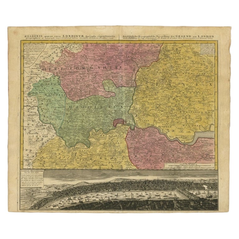
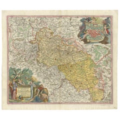
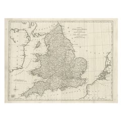
Antique Map of England and London with Two Large Allegorical Views, c.1720
About the Item
Antique map titled 'Nouvelle Carte du gouvernement civil d'Angleterre (..)'. Old plan of London, with map of England and two large allegorical views. This map originates from Chatelain's 'Atlas Historique'.
Artists and Engravers: Henri Abraham Chatelain (1684-1743), his father Zacharie Chatelain (d.1723) and Zacharie Junior (1690-1754), worked as a partnership publishing the Atlas Historique, Ou Nouvelle Introduction A L'Histoire under several different Chatelain imprints, depending on the Chatelain family partnerships at the time of publication.
Condition: Good, general age-related toning. Some creasing, repair on folding line. Blank verso. Please study image carefully.
Date: c.1720
Overall size: 50 x 42 cm.
Image size:46 x 35 cm.
We sell original antique maps to collectors, historians, educators and interior decorators all over the world. Our collection includes a wide range of authentic antique maps from the 16th to the 20th centuries. Buying and collecting antique maps is a tradition that goes back hundreds of years. Antique maps have proved a richly rewarding investment over the past decade, thanks to a growing appreciation of their unique historical appeal. Today the decorative qualities of antique maps are widely recognized by interior designers who appreciate their beauty and design flexibility. Depending on the individual map, presentation, and context, a rare or antique map can be modern, traditional, abstract, figurative, serious or whimsical. We offer a wide range of authentic antique maps for any budget.
- Dimensions:Height: 16.54 in (42 cm)Width: 19.69 in (50 cm)Depth: 0 in (0.01 mm)
- Materials and Techniques:
- Period:
- Date of Manufacture:circa 1720
- Condition:Condition: Good, general age-related toning. Some creasing, repair on folding line. Blank verso. Please study image carefully.
- Seller Location:Langweer, NL
- Reference Number:Seller: BG-12279-31stDibs: LU3054326172752
About the Seller
5.0
Platinum Seller
These expertly vetted sellers are 1stDibs' most experienced sellers and are rated highest by our customers.
Established in 2009
1stDibs seller since 2017
1,916 sales on 1stDibs
Typical response time: <1 hour
- ShippingRetrieving quote...Ships From: Langweer, Netherlands
- Return PolicyA return for this item may be initiated within 14 days of delivery.
Auctions on 1stDibs
Our timed auctions are an opportunity to bid on extraordinary design. We do not charge a Buyer's Premium and shipping is facilitated by 1stDibs and/or the seller. Plus, all auction purchases are covered by our comprehensive Buyer Protection. Learn More
More From This SellerView All
- Antique Map of Silesia, Southwest Poland and a City View of Wroclaw, c 1720By Johann Baptist HomannLocated in Langweer, NLAntique map titled 'Superioris et Inferioris ducatus Silesiae (..)'. Detailed map of Silesia by Johann Baptist Homann. Shows the Southwestern part of Poland between Frankfurt Oder ...Category
Antique Early 18th Century Maps
MaterialsPaper
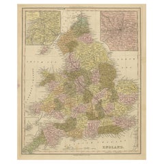
- Antique Map of England with Inset Maps of the Region of Liverpool and LondonLocated in Langweer, NLAntique map titled 'England'. Original antique map of England, with two inset maps of the region of Liverpool and London. This map originates from Tanner's 'Universal Atlas'. Publish...Category
Antique Mid-19th Century Maps
MaterialsPaper
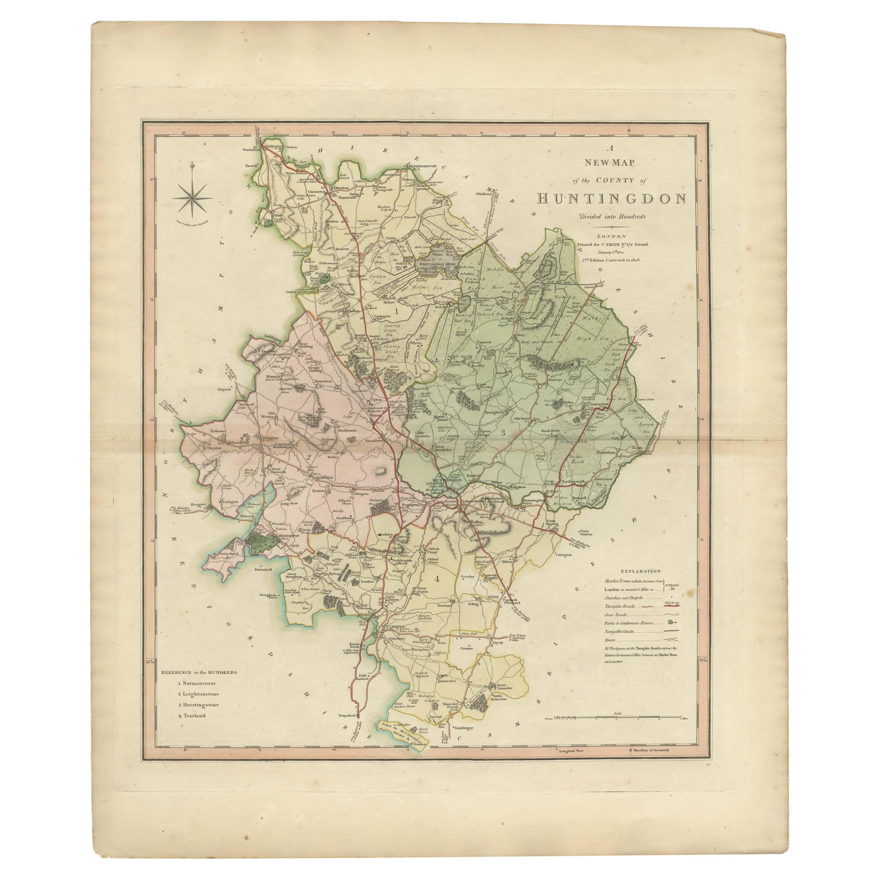
- Large Antique Map of England and WalesLocated in Langweer, NLAntique map titled 'An Accurate Map of England and Wales'. Original old map of England and Wales. Engraved by John Cary. Originates from 'New British Atlas' by John Stockdale, publis...Category
Antique Early 19th Century Maps
MaterialsPaper
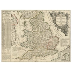
- Original Antique Map of England and Wales with Large CartoucheLocated in Langweer, NLAntique map titled 'Le Royaume d'Angleterre divisé en plusieurs Parties (..)'. Large and rare map of England and Wales by J.B. Nolin after Coronelli. With decorative cartouche, table...Category
Antique Late 17th Century Maps
MaterialsPaper
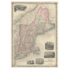
- Large Antique Map of New England with decorative VignettesLocated in Langweer, NLAntique map titled 'Johnson's New England'. Large map of New England, comprising the states Connecticut, Maine, Massachusetts, New Hampshire, Rhode ...Category
Antique Mid-19th Century Maps
MaterialsPaper
- Large Antique Map England and Wales, with Part of the CoastlinesLocated in Langweer, NLAntique map titled 'A Map of England and Wales (..)'. Large antique map of England and Wales, with part of the continental and Irish coasts. Published J. Blair, circa 1779.Category
Antique Late 18th Century Maps
MaterialsPaper

You May Also Like
- Large Scale Antique Scroll Map of Lincolnshire, England, Dated 1778Located in St Annes, LancashireWonderful scroll map of Lincolnshire By Captain Armstrong, 1778 Copper plate engraving on paper laid on canvas Original ebonized wood frame with lo...Category
Antique 1770s English Georgian Maps
MaterialsWood, Paper
- Large Original Antique Folding Map of Manchester, England, Dated 1793Located in St Annes, LancashireSuperb map of Manchester and Salford Folding map. Printed on paper laid on to the original canvas Unframed. Published by C. Laurent, 1793. ...Category
Antique 1790s English Georgian Maps
MaterialsCanvas, Paper
- Old Horizontal Map of EnglandBy TassoLocated in Alessandria, PiemonteST/520 - Old rare Italian map of England, dated 1826-1827 - by Girolamo Tasso, editor in Venise, for the atlas of M.r Le-Sage.Category
Antique Early 19th Century Italian Other Prints
MaterialsPaper
- Antique Coaching Road Map, Devon, English, Regional Cartography, Georgian, 1720Located in Hele, Devon, GBThis is an antique coaching road map of Devon. An English, framed lithograph engraving of regional interest, dating to the early 18th century and later. Fascinating 18th century hig...Category
Antique Early 18th Century British Georgian Maps
MaterialsWood
- London AA MapLocated in Alton, GBLondon AA map.Category
20th Century Maps
MaterialsPaper
- Illustrated Map of London from ExhibtionLocated in Alton, GBDetailed illustrated map of London from the great exhibition of industry of all nations 1851.Category
Antique 19th Century Maps
MaterialsPaper


Recently Viewed
View AllMore Ways To Browse
Antique Furniture London England
Two By London
Maps London
Map London
London Map
Map Of London
England 16th
16th Century England
The Fold London
Large Map Of The World
1720 England
London Antique Maps
London Map Antique
Antique Maps Of London
Antique Map Of London
Antique Map England
Antique Maps England
Antique England Map