Antique Maps Of London
24
to
109
639
303
463
410
287
204
88
81
73
73
67
60
59
40
36
27
25
23
20
19
17
17
17
15
13
13
12
12
11
11
11
11
9
9
9
8
8
7
7
7
5
5
4
3
3
3
2
1
14
11
10
8
8
Sort By
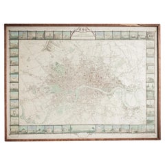
Illustrated Map of London from Exhibtion
Located in Alton, GB
Detailed illustrated map of London from the great exhibition of industry of all nations 1851.
Category
19th Century Antique Maps Of London
Materials
Paper
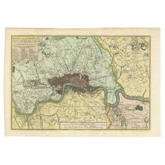
Antique Map of London by Tirion '1754'
Located in Langweer, NL
Antique map titled 'Kaart van Londen enz. en van het naby gelegen land ruim een Uur gaans rondsom
Category
Mid-18th Century Antique Maps Of London
Materials
Paper
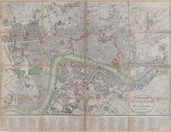
1800 'Map of London, Southwark, and parts adjacent' by Darton and Harvey
Located in London, GB
Darton and Harvey (publisher)
Map of London, Southwark, and parts adjacent (1800)
Engraving
42 x 56
Category
Early 1800s Antique Maps Of London
Materials
Paper, Engraving
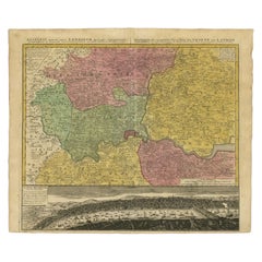
Antique Map of London Showing the Area from Essex to Surrey, England, 1741
Located in Langweer, NL
map showing the area from Essex to Surrey and shows a lovely view of London with a high level of
Category
18th Century Antique Maps Of London
Materials
Paper
No Reserve
H 24.89 in W 21.11 in D 0 in
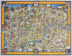
Wonderground Map of London by MacDonald 'Max' Gill c. 1924 original poster
By "Leslie MacDonald ""Max"" Gill"
Located in London, GB
Map of London Town.’
In 1917 he joined the Imperial War Graves Commission’s headstone design
Category
1920s Modern Antique Maps Of London
Materials
Lithograph
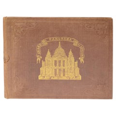
Grand Panorama of London, the City Seen from the Thames, Evans & Whitelaw, 1849
Located in Milan, IT
Grand Panorama of London, a very special map of London seen from the Thames, published by Charles
Category
1840s British Antique Maps Of London
Materials
Paper
H 6.03 in W 7.09 in D 0.28 in
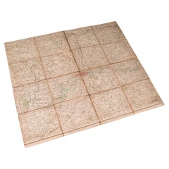
Antique Folding London Map, English, Cartography, Historic, Georgian, Dated 1783
Located in Hele, Devon, GB
This is an antique folding London map. An English, paper on linen cartographical study of the
Category
Late 18th Century British Georgian Antique Maps Of London
Materials
Linen, Paper
H 6.3 in W 6.11 in D 0.6 in
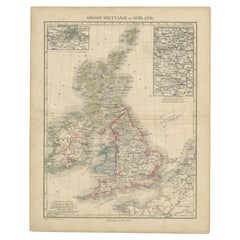
Antique Map of the United Kingdom and Ireland, c.1873
Located in Langweer, NL
, with inset maps of London and factory districts of the UK. This map originates from 'School-Atlas van
Category
19th Century Antique Maps Of London
Materials
Paper
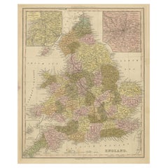
Antique Map of England with Inset Maps of the Region of Liverpool and London
Located in Langweer, NL
Liverpool and London. This map originates from Tanner's 'Universal Atlas'. Published by Carey & Hart, 1842.
Category
Mid-19th Century Antique Maps Of London
Materials
Paper
H 17.33 in W 13.86 in D 0.02 in
Antique Map of the City of London by Balbi '1847'
Located in Langweer, NL
Antique map titled 'London'. Original antique map of the city of London. This map originates from
Category
Mid-19th Century Antique Maps Of London
Materials
Paper
Road Map, John Ogilby, No 54, London, Yarmouth, Britannia
By John Ogilby
Located in BUNGAY, SUFFOLK
& Maldon). Of the sixth volume, on London, only the general map appeared in print, and that after Ogilby's
Category
1670s English Baroque Antique Maps Of London
Materials
Paper
Original Antique Map of the Road from London to Bensington
Located in Langweer, NL
Antique map titled 'The Road from London to St. Davids in com: Pembroke (..)'. A strip map of the
Category
Late 17th Century Antique Maps Of London
Materials
Paper
Road Map Britannia 1675/6 No 5 Road London to Barwick, London Stilton Grey Frame
By John Ogilby
Located in BUNGAY, SUFFOLK
sixth volume, on London, only the general map appeared in print, and that after Ogilby's death. In fact
Category
Late 17th Century British Charles II Antique Maps Of London
Materials
Paper
H 22.84 in W 25.99 in D 0.4 in
Antique "New Plan of London" Map by John Bartholomew, 1900
Located in Bridgeport, CT
Produced for the W.H. Smith guide, folded in the original. The map here is unfolded and framed flat
Category
Early 1900s English Victorian Antique Maps Of London
Materials
Paper
London 1744 Published Watercolour Antique Map of East Africa by Eman Bowen
Located in GB
We are delighted to offer for sale this New and Accurate Map of Nubia & Abissinia, together with
Category
1740s English George III Antique Maps Of London
Materials
Paper
H 17.52 in W 21.07 in D 0.79 in
Map Road Strip Britannia Sheet 2 John Ogilby London Aberistwith Islip Bramyard
By John Ogilby
Located in BUNGAY, SUFFOLK
encouraged to continue the projects. Morgan completed the map of London, but despite attempts to Revive the
Category
17th Century English Baroque Antique Maps Of London
Materials
Paper
H 14.38 in W 19.3 in D 0.79 in
Road Map No43 London to Kings Lynn, Royston to Downham, John Ogilby, Britannia
By John Ogilby
Located in BUNGAY, SUFFOLK
). Of the sixth volume, on London, only the general map appeared in print, and that after Ogilby's death
Category
Late 17th Century British Charles II Antique Maps Of London
Materials
Paper
H 20.48 in W 24.41 in D 0.4 in
Road Map John Ogilby London St David's Britannia No 15 Abingdon Monmouth Framed
By John Ogilby
Located in BUNGAY, SUFFOLK
). Of the sixth volume, on London, only the general map appeared in print, and that after Ogilby's death
Category
1670s English Baroque Antique Maps Of London
Materials
Paper
H 20.48 in W 24.41 in D 0.6 in
Antique Map of England and London with Two Large Allegorical Views, c.1720
Located in Langweer, NL
Antique map titled 'Nouvelle Carte du gouvernement civil d'Angleterre (..)'. Old plan of London
Category
18th Century Antique Maps Of London
Materials
Paper
No Reserve
H 16.54 in W 19.69 in D 0 in
Original Old Map of South East England Incl London, Oxford, Cambridge, Etc, 1633
Located in Langweer, NL
'.
Old map of south east England. Includes London, Salisbury, Oxford, Cambridge, Leicester and Norwich
Category
1630s Antique Maps Of London
Materials
Paper
H 16.15 in W 21.26 in D 0 in
Map Wiltshire Joshua Archer Pentonville London framed 35cm 14" high
Located in BUNGAY, SUFFOLK
Map of Wiltshire Drawn & Engraved by Joshua Archer Pentonville London
Window Parts of Wiltshire in
Category
19th Century English Georgian Antique Maps Of London
Materials
Paper
Road Map Britannia No 32 the Road from London to Barnstable John Ogilby Framed
By John Ogilby
Located in BUNGAY, SUFFOLK
collector with no 15 London to St Davids. Framed as a pair.
Measures: Black Linear Border around Map
Category
Late 17th Century English Charles II Antique Maps Of London
Materials
Paper
H 20.48 in W 24.41 in D 0.6 in
Road Map Britannia No 15 London to St Davids John Ogilby Brown Gilt Frame
By John Ogilby
Located in BUNGAY, SUFFOLK
). Of the sixth volume, on London, only the general map appeared in print, and that after Ogilby's death
Category
Late 17th Century British Charles II Antique Maps Of London
Materials
Paper
H 22.05 in W 26.19 in D 0.6 in
Road Map Britannia No 25 London to the Lands End, John Ogilby Brown Gilded Frame
By John Ogilby
Located in BUNGAY, SUFFOLK
). Of the sixth volume, on London, only the general map appeared in print, and that after Ogilby's death
Category
Late 17th Century British Charles II Antique Maps Of London
Materials
Paper
H 22.05 in W 26.19 in D 0.6 in
Antique Map of Denmark with an Inset Map of Iceland, 1832
Located in Langweer, NL
Antique map titled 'Denmark'. Large map of Denmark with an inset map of Iceland.
Artists and
Category
19th Century Antique Maps Of London
Materials
Paper
Road Map, John Ogilby, London, Barwick, York, Chester, Darlington, Durham Framed
By John Ogilby
Located in BUNGAY, SUFFOLK
The continuation of the road from London to Barwick beginning at York and extending to Chester in
Category
1670s English Baroque Antique Maps Of London
Materials
Paper
H 18.12 in W 23.04 in D 0.6 in
Antique Map of West Russia, with Title a New Map of Moskovy, 1741
Located in Langweer, NL
engraver and map publisher in 18th century London who became a Fellow of The Royal Society and Geographer
Category
1740s Antique Maps Of London
Materials
Paper
Small Steel Engraved Map of England
Located in Langweer, NL
Antique map titled 'England'. Original steel engraved map of England. Drawn by A. Arrowsmith
Category
Mid-19th Century Antique Maps Of London
Materials
Paper
Antique Map of Gambia, West Africa
Located in Langweer, NL
Antique map titled 'Carte du Cours de la Riviere de Gambra ou Gambie (..)'. Detailed map of Gambia
Category
Mid-18th Century Antique Maps Of London
Materials
Paper
Antique Map of New South Wales with Inset Maps of Australia and Swan River, 1854
Located in Langweer, NL
Antique map titled 'Colony of New South Wales'. Map of New South Wales with inset maps of Australia
Category
19th Century Antique Maps Of London
Materials
Paper
H 18.31 in W 14.57 in D 0 in
A Decorative Detailed Map of the Crimea, with an Inset Map of Sebastopol, c 1851
Located in Langweer, NL
(London: London Publishing Co, 1858). This map was published at the time of the Crimean War with the main
Category
1850s Antique Maps Of London
Materials
Paper
H 10.83 in W 14.18 in D 0 in
Framed 1838 Mexico & Gulf of Mexico Map
Located in Stamford, CT
Framed 1838 Mexico & Gulf of Mexico map. Printed by Fisher, Son & Co. of London in 1838. As found
Category
1830s English American Classical Antique Maps Of London
Materials
Glass, Wood, Paper
Original Antique Map of Cyprus. Circa 1880
Located in St Annes, Lancashire
Great map of Cyprus
Drawn and Engraved by R.Walker
Published W.Mackenzie, London
Original colour
Category
1880s English Antique Maps Of London
Materials
Paper
Miniature Antique Map of England and Wales
Located in Langweer, NL
Miniature map titled 'England & Wales'. Original antique map of England & Wales. This map
Category
Early 19th Century Antique Maps Of London
Materials
Paper
Original Antique Map of England and Wales
Located in Langweer, NL
Improvements'. Original antique map of England and Wales. Printed by Alex Hogg, London for George Henry
Category
Late 18th Century Antique Maps Of London
Materials
Paper
1851 Map of "Independent Tartary", Ric. R018
Located in Norton, MA
colored antique map.
Publisher: The London Printing and Publishing Company – Limited.
(active circa 1800
Category
19th Century Unknown Antique Maps Of London
Materials
Paper
Antique Map of the Coromandel Peninsula, 1754
Located in Langweer, NL
Coromandel printed for the London Magazine.
Artists and Engravers: This map is not attributed, so it may
Category
18th Century Antique Maps Of London
Materials
Paper
Antique County Map of Derbyshire, England, 1804
Located in Langweer, NL
in London from circa 1800. His maps were finely engraved on copper and featured beautiful hand
Category
Early 1800s Antique Maps Of London
Materials
Paper
Antique Map of Asia by Guthrie, 1787
Located in Langweer, NL
Antique map titled 'Asia from the best Authorities'. Old map of the Asian continent. This map
Category
18th Century Antique Maps Of London
Materials
Paper
Antique Map of Russia by Tyrer, 1821
Located in Langweer, NL
Antique map titled 'Russia'. Beautiful antique map of Russia engraved by Tyrer. Artists and
Category
19th Century Antique Maps Of London
Materials
Paper
1814 Map of "Russian Empire" Ric.r032
Located in Norton, MA
1814 Map of
"Russian Empire"
Ric.r032
Russian Empire. Description: This is an 1814 John
Category
19th Century Unknown Antique Maps Of London
Materials
Paper
Antique Map of Portugal by Moll, 1727
Located in Langweer, NL
Antique map Portugal titled 'Portugal Agreeable to Modern History'. Detailed map of Portugal
Category
18th Century Antique Maps Of London
Materials
Paper
Antique Map of France by Faden, 1792
Located in Langweer, NL
Antique map titled 'France divided into Metropolitan Circles (..)'. Large, original antique map of
Category
18th Century Antique Maps Of London
Materials
Paper
Antique County Map of Leicestershire, England, 1804
Located in Langweer, NL
working in London from circa 1800. His maps were finely engraved on copper and featured beautiful hand
Category
Early 1800s Antique Maps Of London
Materials
Paper
Antique Map of Part of the Korean Archipelago, 1798
Located in Langweer, NL
Antique map titled 'Plan of Part of the Islands or Archipellago of Corea'. This map depicts part of
Category
Late 18th Century Antique Maps Of London
Materials
Paper
Antique Map of Suffren Island by Cook, 1784
Located in Langweer, NL
Antique map titled 'View of Sulphur Island (..)'. Antique map and view of Suffren Island
Category
18th Century Antique Maps Of London
Materials
Paper
Antique Map of Christmas Island by Cook, 1784
Located in Langweer, NL
Antique map Kiribati titled 'Christmas Island (..)'. Antique map of Christmas Island, also known as
Category
18th Century Antique Maps Of London
Materials
Paper
Antique Map of Holland with Colorful Vignettes, 1851
Located in Langweer, NL
skilled artisan. The maps were later reissued by the London Printing & Publishing Company, who left the
Category
19th Century Antique Maps Of London
Materials
Paper
Antique Map of Turkey in Europe, c.1780
Located in Langweer, NL
Antique map titled 'Bowles's new pocket map of Turky in Europe divided into its Provinces'. Large
Category
18th Century Antique Maps Of London
Materials
Paper
Antique Map of South Australia by Tallis, 1851
By Thomas Kitchin
Located in Langweer, NL
British map publisher. Born in the Midlands, Tallis came to London in the 1840s. Tallis began his London
Category
19th Century Antique Maps Of London
Materials
Paper
Antique County Map of Monmouthshire, England, circa 1804
Located in Langweer, NL
in London from circa 1800. His maps were finely engraved on copper and featured beautiful hand
Category
Early 1800s Antique Maps Of London
Materials
Paper
Antique Steel Engraved Map of Asia, c.1860
Located in Langweer, NL
Antique map titled 'Asia'. Steel engraved map of Asia by F. P. Becker & Co.
Artists and
Category
19th Century Antique Maps Of London
Materials
Paper
Large Antique Map of the Asian Continent, 1814
Located in Langweer, NL
Antique map titled 'Asia'. Large antique map of the Asian continent. Drawn under the direction of
Category
19th Century Antique Maps Of London
Materials
Paper
Antique Map of the Port of Acapulco in Mexico, 1749
Located in Langweer, NL
and at 108°.22'. western longitude from London. This map originates from 'Reize rondsom de Werreld
Category
18th Century Antique Maps Of London
Materials
Paper
London (England)
Located in Florham Park, NJ
Late 19th Century map of London highlighting the city's marvels. Serving also as a mundane street
Category
Late 19th Century Academic Antique Maps Of London
Materials
Lithograph
Antique Map of Denmark by Hall, circa 1820
Located in Langweer, NL
Antique map titled 'Denmark'. A map of Denmark and the direct surroundings (northern Germany
Category
19th Century Antique Maps Of London
Materials
Paper
Antique Map of South America by Tyrer, 1821
By Thomas Kitchin
Located in Langweer, NL
Antique map titled 'South America'. Beautiful antique map of South America engraved by Tyrer
Category
19th Century Antique Maps Of London
Materials
Paper
Antique Map of Northern Asia by Arrowsmith, 1834
Located in Langweer, NL
Antique map titled 'Northern Asia, from the Himalaya Mountains to the Arctic Ocean'. Large and
Category
19th Century Antique Maps Of London
Materials
Paper
Antique Decorative French Map of Java, Indonesia, 1718
Located in Langweer, NL
Antique map of Java titled 'Carte de l'Ile de Java: Partie Occidentale, Partie Orientale, Dressee
Category
18th Century Antique Maps Of London
Materials
Paper
Antique Map of South America by Kelly, 1835
Located in Langweer, NL
Antique map titled 'South America'. Old map of South America engraved by A. Findley. With
Category
19th Century Antique Maps Of London
Materials
Paper
- 1
- ...
Get Updated with New Arrivals
Save "Antique Maps Of London", and we’ll notify you when there are new listings in this category.
Antique Maps Of London For Sale on 1stDibs
At 1stDibs, there are many versions of the ideal antique maps of london for your home. An antique maps of london — often made from paper, wood and fabric — can elevate any home. Your living room may not be complete without an antique maps of london — find older editions for sale from the 18th Century and newer versions made as recently as the 20th Century. An antique maps of london made by Victorian designers — as well as those associated with Georgian — is very popular. A well-made antique maps of london has long been a part of the offerings for many furniture designers and manufacturers, but those produced by John Senex, Edward Weller and Emanuel Bowen are consistently popular.
How Much is a Antique Maps Of London?
An antique maps of london can differ in price owing to various characteristics — the average selling price 1stDibs is $1,750, while the lowest priced sells for $146 and the highest can go for as much as $42,500.
More Ways To Browse
Antique Maps Of Russian Empire
Antique Map Fabric
Bermuda Antique
Original Antique Map Of Persia
Malabar Map
Antique Bermuda Furniture
Antique Surveyor Compass
Mitchell Antique Maps
Speed Antique Map
Colombia Map
Antique Map Boston
Arabian Peninsula
E Fletcher
Richard Wentworth
Map Panama
Map Danube
Afghanistan Antique Map
Antique Furniture Farnham
