Items Similar to Antique Map of Asia by Guthrie, 1787


Want more images or videos?
Request additional images or videos from the seller
1 of 6
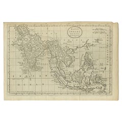
Antique Map of Asia by Guthrie, 1787
About the Item
Antique map titled 'Asia from the best Authorities'. Old map of the Asian continent. This map originates from 'A New Geographical, Historical and Commercial Grammar; and Present State of the several Kingdoms of the World' 10th ed. by W. Guthrie.
Artists and Engravers: Published by Ch.Dilly; GGJ. and J. Robinson, London, 1787.
Condition: Very good, minor wear. Please study image carefully.
Date: 1787
Overall size: 25.5 x 21.5 cm.
Image size: 23 x 19 cm.
We sell original antique maps to collectors, historians, educators and interior decorators all over the world. Our collection includes a wide range of authentic antique maps from the 16th to the 20th centuries. Buying and collecting antique maps is a tradition that goes back hundreds of years. Antique maps have proved a richly rewarding investment over the past decade, thanks to a growing appreciation of their unique historical appeal. Today the decorative qualities of antique maps are widely recognized by interior designers who appreciate their beauty and design flexibility. Depending on the individual map, presentation, and context, a rare or antique map can be modern, traditional, abstract, figurative, serious or whimsical. We offer a wide range of authentic antique maps for any budget.
- Dimensions:Height: 8.47 in (21.5 cm)Width: 10.04 in (25.5 cm)Depth: 0 in (0.01 mm)
- Materials and Techniques:
- Period:
- Date of Manufacture:1787
- Condition:
- Seller Location:Langweer, NL
- Reference Number:
About the Seller
5.0
Platinum Seller
These expertly vetted sellers are 1stDibs' most experienced sellers and are rated highest by our customers.
Established in 2009
1stDibs seller since 2017
1,928 sales on 1stDibs
Typical response time: <1 hour
- ShippingRetrieving quote...Ships From: Langweer, Netherlands
- Return PolicyA return for this item may be initiated within 14 days of delivery.
More From This SellerView All
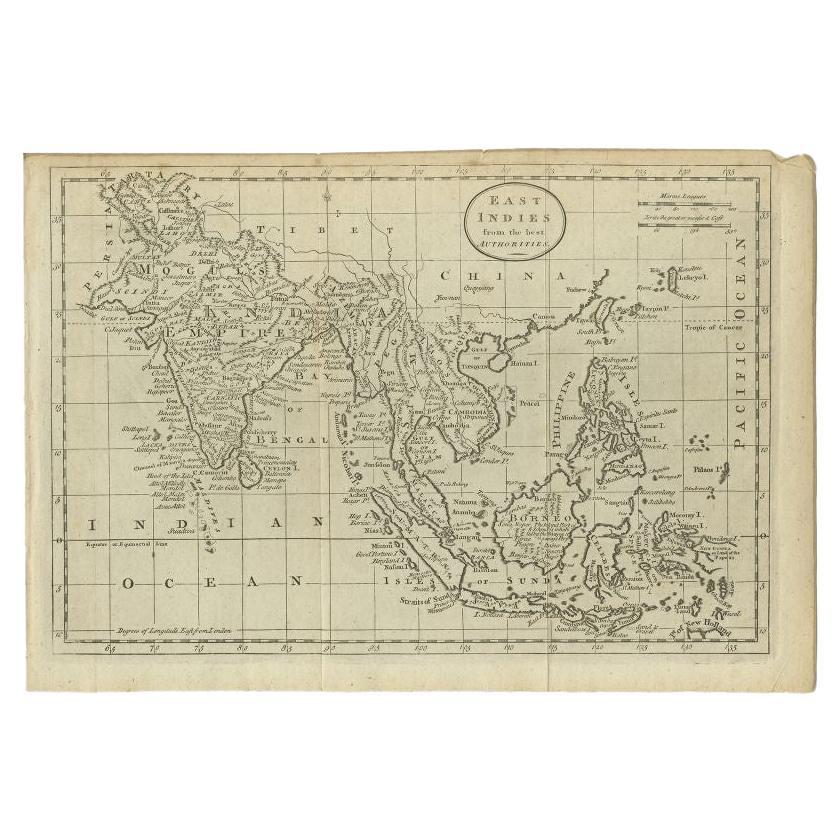
- Antique Map of the East Indies by Guthrie, 1787Located in Langweer, NLAntique map titled 'East Indies from the best Authorities'. Old map of the East Indies, depicts the region of the Caucasus Mountains to New Guinea and from Timor to the Himalayas. Or...Category
Antique 18th Century Maps
MaterialsPaper
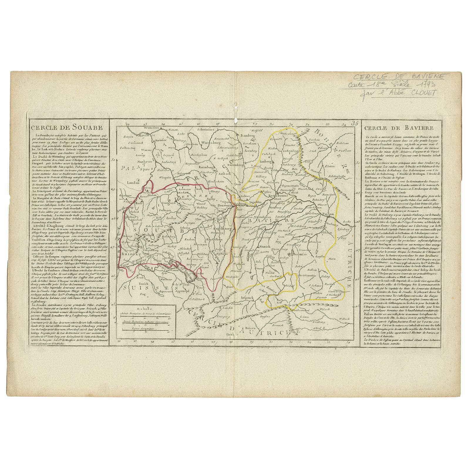
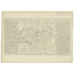
- Antique Map of Swabia by Clouet, '1787'Located in Langweer, NLAntique map titled 'Cercle de Souabe'. Antique map of Swabia, Germany. Originates from 'Geographie moderne avec une introduction' by J.B.L. Clouet.Category
Antique Late 18th Century Maps
MaterialsPaper
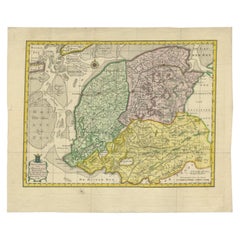
- Antique Map of Germany by Clouet, 1787Located in Langweer, NLAntique map titled 'L'Allemagne'. Antique map of Germany. Originates from 'Geographie moderne avec une introduction' by J.B.L. Clouet.Category
Antique Late 18th Century Maps
MaterialsPaper
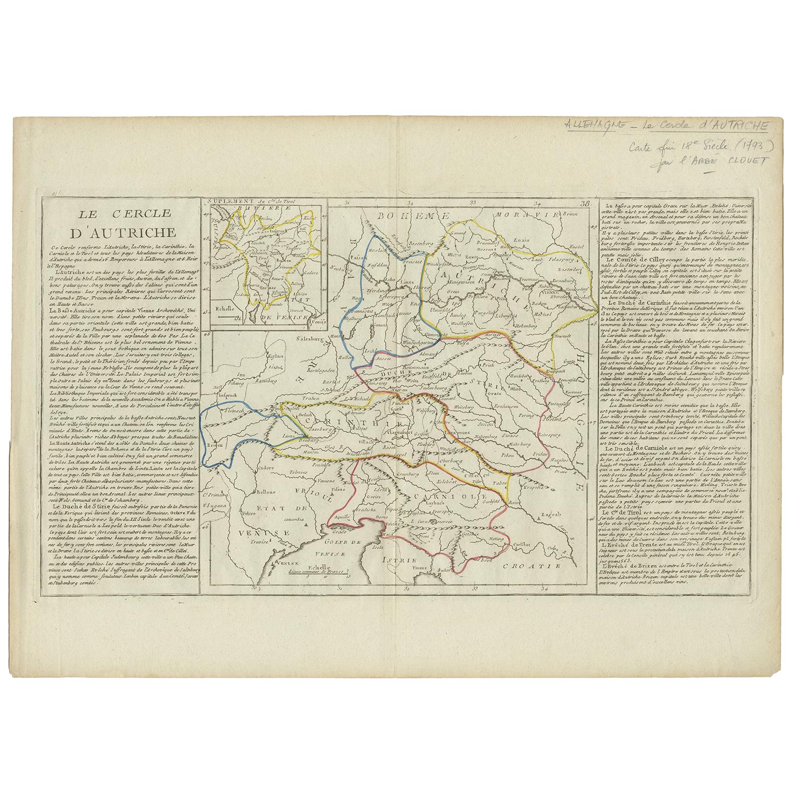
- Antique Map of Austria by Clouet '1787'Located in Langweer, NLAntique map titled 'Le Cercle d'Autriche'. Antique map of Austria. Originates from 'Geographie moderne avec une introduction' by J.B.L. Clouet.Category
Antique Late 18th Century Maps
MaterialsPaper
- Antique Map of Lower Saxony by Clouet, 1787Located in Langweer, NLAntique map titled 'Basse Saxe'. Antique map of Lower Saxony, Germany. Originates from 'Geographie moderne avec une introduction' by J.B.L. Clouet.Category
Antique Late 18th Century Maps
MaterialsPaper
- Antique Map of Friesland by Van Krevelt, 1787Located in Langweer, NLAntique map titled 'Nieuwe Kaart van Friesland behoorende tot het Vaderlandsch Woordenboek van Jacobus Kok'. Original antique map of the province of Friesland, the Netherlands. This ...Category
Antique 18th Century Maps
MaterialsPaper


You May Also Like
- Original Antique Map of Ancient Greece- Boeotia, Thebes, 1787Located in St Annes, LancashireGreat map of Ancient Greece. Showing the region of Boeotia, including Thebes Drawn by J.D. Barbie Du Bocage Copper plate engraving by P.F T...Category
Antique 1780s French Other Maps
MaterialsPaper
- Original Antique Map of Ancient Greece, Phocis, Gulf of Corinth, 1787Located in St Annes, LancashireGreat map of Ancient Greece. Showing the region of Phocis, including the Gulf of Corinth Drawn by J.D. Barbie Du Bocage Copper plate engraving by P.F Tardieu Original hand c...Category
Antique 1780s French Other Maps
MaterialsPaper
- Original Antique Map of Asia. C.1780Located in St Annes, LancashireGreat map of Asia Copper-plate engraving Published C.1780 Two small worm holes to right side of map Unframed.Category
Antique Early 1800s English Georgian Maps
MaterialsPaper

- Original Antique Map of South East Asia by Becker, circa 1840Located in St Annes, LancashireGreat map of South East Asia Steel engraving with original color outline Engraved by Becker Published by Virtue, circa 1840. Unframed.Category
Antique 1840s English Other Maps
MaterialsPaper
- Original Antique Map of South East Asia by Thomas Clerk, 1817Located in St Annes, LancashireGreat map of South East Asia Copper-plate engraving Drawn and engraved by Thomas Clerk, Edinburgh. Published by Mackenzie And Dent, 1817 Unframed.Category
Antique 1810s English Maps
MaterialsPaper
- Original Antique Map of South East Asia, Arrowsmith, 1820Located in St Annes, LancashireGreat map of South East Asia Drawn under the direction of Arrowsmith Copper-plate engraving Published by Longman, Hurst, Rees, Orme and Brown, 1820 Unframed.Category
Antique 1820s English Maps
MaterialsPaper


Recently Viewed
View AllMore Ways To Browse
New World Map
New World Maps
Map London
Maps London
London Map
Map Of London
London Antique Map
London Map Antique
Antique Maps London
Antique London Maps
Antique London Map
Antique Map London
London Antique Maps
Antique Maps Of London
Antique Map Of London
Old World Antique Maps
Antique Old World Map
Old Antique World Map