Items Similar to Antique Map of London Showing the Area from Essex to Surrey, England, 1741

Want more images or videos?
Request additional images or videos from the seller
1 of 5
Antique Map of London Showing the Area from Essex to Surrey, England, 1741
About the Item
Antique map titled 'Regionis quae est circa Londinum specialis repraesentatio (..)'
Very detailed map showing the area from Essex to Surrey and shows a lovely view of London with a high level of detail, stretching from Old London Bridge and Docklands to the farmlands in the west. The London view is uncolored as issued. Source unknown, to be determined. Artists and Engravers: Made by 'Homann Heirs' after an anonymous artist. Made by an anonymous engraver after 'Homann Heirs'. Following the long period of Dutch domination, the Homann family became the most important map publishers in Germany in the eighteenth century, the business being founded by J.B. Homann in Nuremberg about the year 1702. Soon after publishing his first atlas in 1707 he became a member of the Berlin academy of Sciences and in 1715 he was appointed Geographer to the Emperor. After the founder's death in 1724, the firm was continued under the direction of his son until 1730 and was then bequeathed to his heirs on the condition that it trades under the name of Homann Heirs. The firm remained in being until the next century and had a wide influence on map publishing in Germany. Apart from the atlases the firm published a very large number of individual maps. The Homanns produced a Neuer Atlas in 1714, a Grosser Atlas in 1737, and an Atlas Maior with about 300 maps in 1780. They also issued a special Atlas of Germany with full sized plans of principal cities, school atlases and an Atlas of Silesia in 1750 with 20 maps.
Artist: Made by 'Homann Heirs' after an anonymous artist. Made by an anonymous engraver after 'Homann Heirs'. Following the long period of Dutch domination, the Homann family became the most important map publishers in Germany in the eighteenth century, the business being founded by J.B. Homann in Nuremberg about the year 1702. Soon after publishing his first atlas in 1707 he became a member of the Berlin academy of Sciences and in 1715 he was appointed Geographer to the Emperor. After the founder's death in 1724, the firm was continued under the direction of his son until 1730 and was then bequeathed to his heirs on the condition that it trades under the name of Homann Heirs. The firm remained in being until the next century and had a wide influence on map publishing in Germany. Apart from the atlases the firm published a very large number of individual maps. The Homanns produced a Neuer Atlas in 1714, a Grosser Atlas in 1737, and an Atlas Maior with about 300 maps in 1780. They also issued a special Atlas of Germany with full sized plans of principal cities, school atlases and an Atlas of Silesia in 1750 with 20 maps.
Condition: Good, given age. Top edge with a few tiny tears. Small neatly repaired tear bottom edge, extending 1 cm into image. Light staining and soiling in the margins. Original middle fold as issued. General age-related toning and/or occasional minor defects from handling. Please study image carefully.
Date: 1741
- Dimensions:Height: 24.89 in (63.2 cm)Width: 21.11 in (53.6 cm)Depth: 0 in (0.01 mm)
- Materials and Techniques:
- Period:
- Date of Manufacture:1741
- Condition:Repaired: Small neatly repaired tear bottom edge, extending 1 cm into image. Condition: Good, given age. Top edge with a few tiny tears. Light staining and soiling in the margins. Original middle fold as issued. General age-related toning and/or occasional minor defects from handling. Please study image carefully.
- Seller Location:Langweer, NL
- Reference Number:Seller: PCT-598541stDibs: LU3054326363222
About the Seller
5.0
Platinum Seller
These expertly vetted sellers are 1stDibs' most experienced sellers and are rated highest by our customers.
Established in 2009
1stDibs seller since 2017
1,919 sales on 1stDibs
Typical response time: <1 hour
- ShippingRetrieving quote...Ships From: Langweer, Netherlands
- Return PolicyA return for this item may be initiated within 14 days of delivery.
Auctions on 1stDibs
Our timed auctions are an opportunity to bid on extraordinary design. We do not charge a Buyer's Premium and shipping is facilitated by 1stDibs and/or the seller. Plus, all auction purchases are covered by our comprehensive Buyer Protection. Learn More
More From This SellerView All
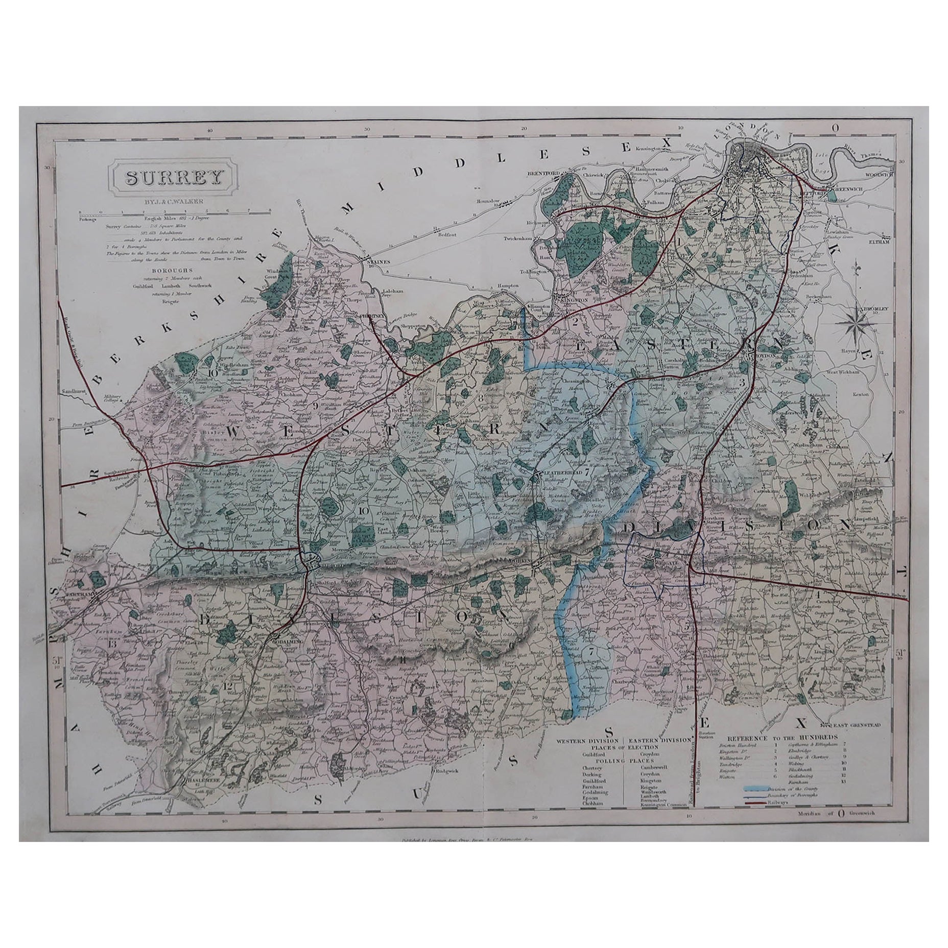
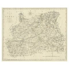
- Large Antique County Map of Surrey, EnglandLocated in Langweer, NLAntique map titled 'A Map of Surry from the best Authorities'. Original old county map of Surrey, England. Engraved by John Cary. Originates from 'New British Atlas' by John Stockdal...Category
Antique Early 19th Century Maps
MaterialsPaper
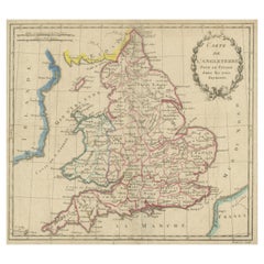
- Antique Map of England, Also Showing CalaisLocated in Langweer, NLAntique map titled 'Carte de l'Angleterre pour le Voyage dans les trois Royaumes'. Original old map of England, also showing Calais. This map originates from 'Voyage dans les trois r...Category
Antique Late 18th Century Maps
MaterialsPaper
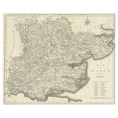
- Large Antique County Map of Essex, EnglandLocated in Langweer, NLAntique map titled 'A Map of Essex from the best Authorities'. Original old county map of Essex, England. Engraved by John Cary. Originates from 'New Brit...Category
Antique Early 19th Century Maps
MaterialsPaper
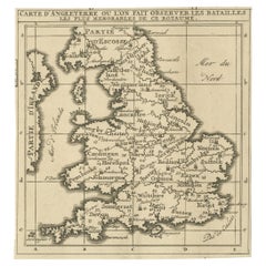
- Original Antique Map of England, Showing the Most Memorable BattlesLocated in Langweer, NLAntique map titled 'Carte d'Angleterre ou l'on fait observer les Batailes les plus Memorables de ce Royaume'. Original antique map of England, showing the most memorable battles. Thi...Category
Antique Early 18th Century Maps
MaterialsPaper
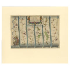
- Original Antique Map of the Road from London to BensingtonLocated in Langweer, NLAntique map titled 'The Road from London to St. Davids in com: Pembroke (..)'. A strip map of the road from London to Bensington. The map is ornamented with numerous compass roses, a...Category
Antique Late 17th Century Maps
MaterialsPaper
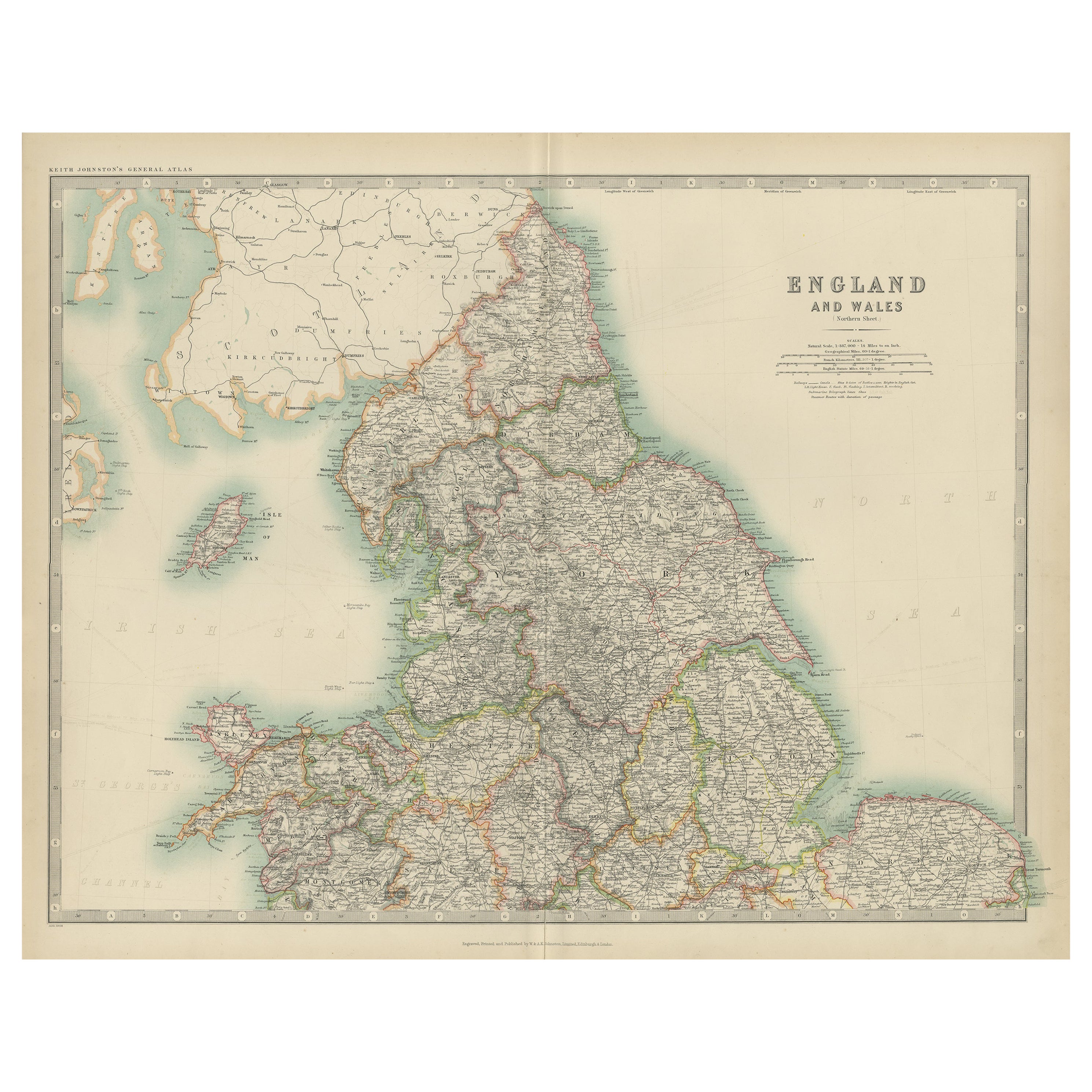
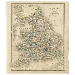
- Antique Map of England and Wales, Also Showing the English ChannelLocated in Langweer, NLAntique map titled 'England and Wales'. Original antique map of England and Wales. Drawn and engraved by J. Dower. Originates from 'A General Descriptive Atlas Of The Earth, Containi...Category
Antique Mid-19th Century Maps
MaterialsPaper
You May Also Like
- Old Horizontal Map of EnglandBy TassoLocated in Alessandria, PiemonteST/520 - Old rare Italian map of England, dated 1826-1827 - by Girolamo Tasso, editor in Venise, for the atlas of M.r Le-Sage.Category
Antique Early 19th Century Italian Other Prints
MaterialsPaper
- Hampshire County, Britain/England: A Map from Camden's" Britannia" in 1607By John NordenLocated in Alamo, CAAn early hand-colored map of Britain's Hampshire county, published in the 1607 edition of William Camden's great historical description of the British Isles, "Britannia". This map was drawn by cartographer John Norden (c. 1547-1625) and engraved by William Hole (active 1607-1624) and William Kip...Category
Antique Early 17th Century English Maps
MaterialsPaper
- Vintage "View of the Center of Paris Taken from the Air" Lithograph MapLocated in San Diego, CAA very stylish "View of the Center of Paris Taken from the Air" lithograph map published by the Paris Ministry of Tourism, circa early 1950s. The piece measures 27" x 43" and shows...Category
20th Century French Mid-Century Modern Prints
MaterialsPaper
- New Map of North America from the Latest Discoveries, 1763Located in Philadelphia, PAA fine antique 18th century map of the North American seaboard. Entitled "A New Map of North America from the Latest Discoveries 1763". By the Cartographer/Engraver - John Spil...Category
Antique Mid-18th Century English Georgian Maps
MaterialsPaper
- Map of the Republic of GenoaLocated in New York, NYFramed antique hand-coloured map of the Republic of Genoa including the duchies of Mantua, Modena, and Parma. Europe, late 18th century. Dimension: 25...Category
Antique Late 18th Century European Maps
- Antique Map of Principality of MonacoBy Antonio Vallardi EditoreLocated in Alessandria, PiemonteST/619 - "Old Geographical Atlas of Italy - Topographic map of ex-Principality of Monaco" - ediz Vallardi - Milano - A somewhat special edition ---Category
Antique Late 19th Century Italian Other Prints
MaterialsPaper


Recently Viewed
View AllMore Ways To Browse
Used Furniture In The Area
Antique Furniture London England
Map London
Maps London
London Map
Map Of London
The Fold London
London City Antiques
City Of London Antiques
London Antique Furniture Area
Antique Furniture West London
Essex Antique
Essex Used Furniture
School Maps
School Map
Used Furniture Surrey
London City Map
Antique Essex