London City Map
4
to
9
312
223
230
158
142
98
94
63
45
42
38
24
20
19
18
18
17
13
13
13
12
12
11
10
10
9
9
7
7
6
5
5
4
4
4
4
4
4
4
4
3
2
2
2
1
1
1
1
1
1
1
1
1
1
54
45
21
19
19
Sort By
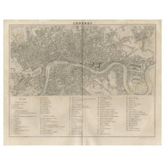
Antique Map of the City of London by Balbi '1847'
Located in Langweer, NL
Antique map titled 'London'. Original antique map of the city of London. This map originates from
Category
Antique Mid-19th Century Maps
Materials
Paper
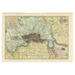
Antique Map of London by Tirion '1754'
Located in Langweer, NL
miles round the City of London was published in Amsterdam by Isaak Tirion. Based on John Rocque's survey
Category
Antique Mid-18th Century Maps
Materials
Paper
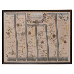
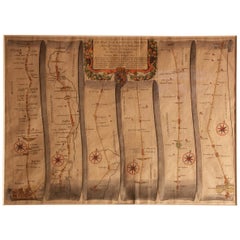
Road Map, John Ogilby, No 54, London, Yarmouth, Britannia
By John Ogilby
Located in BUNGAY, SUFFOLK
Passing Through the City of London', and a much enlarged edition the following year, which included a Fine
Category
Antique 1670s English Baroque Maps
Materials
Paper
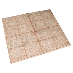
Antique Folding London Map, English, Cartography, Historic, Georgian, Dated 1783
Located in Hele, Devon, GB
sections, the map gently folds into one
City of London accentuated in red, with the Thames and other
Category
Antique Late 18th Century British Georgian Maps
Materials
Linen, Paper
H 6.3 in W 6.11 in D 0.6 in
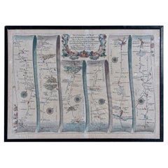
Road Map Britannia 1675/6 No 5 Road London to Barwick, London Stilton Grey Frame
By John Ogilby
Located in BUNGAY, SUFFOLK
Majesties Entertainment Passing Through the City of London', and a much enlarged edition the following year
Category
Antique Late 17th Century British Charles II Maps
Materials
Paper
H 22.84 in W 25.99 in D 0.4 in
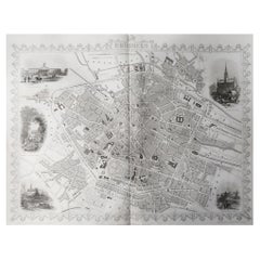
Original Antique Map / City Plan of Brussels by Tallis, circa 1850
Located in St Annes, Lancashire
Great map of Brussels.
Steel engraving.
Published by London Printing & Publishing Co
Category
Antique 1850s English Maps
Materials
Paper
No Reserve
H 13.75 in W 10.75 in D 0.07 in
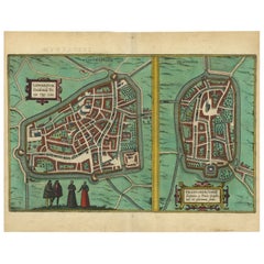
Antique Map of The Frisian Cities Leeuwarden and Franeker in Friesland, 1580
Located in Langweer, NL
-eye views and maps of cities from all around the world. He was the principal editor of the work, he
Category
Antique 16th Century Maps
Materials
Paper
H 19.69 in W 15.36 in D 0 in
Map Road Strip Britannia Sheet 2 John Ogilby London Aberistwith Islip Bramyard
By John Ogilby
Located in BUNGAY, SUFFOLK
; he later published 'The Relation of His Majesties Entertainment Passing Through the City of London
Category
Antique 17th Century English Baroque Maps
Materials
Paper
H 14.38 in W 19.3 in D 0.79 in
Antique Map of Cities of the Province of Che-Kiang in China, 1738
Located in Langweer, NL
Antique map titled 'Cities of the Province of Che-Kyang'. Old map depicting four walled cities of
Category
Antique 18th Century Maps
Materials
Paper
Antique Map of Cities of the Province of Che-Kyang in China, 1738
Located in Langweer, NL
Antique print China titled 'Cities of the Province of Che-Kyang'. Old map depicting four walled
Category
Antique 18th Century Maps
Materials
Paper
Antique Map of the City of Leeuwarden and Franeker by Braun & Hogenberg, 1580
Located in Langweer, NL
Antique map titled 'Lewardum Occidentlis Frisiae Opp: 1580, Franicher Nobiliu hominum, in Frisia
Category
Antique 16th Century Maps
Materials
Paper
H 15.56 in W 20.95 in D 0 in
Antique Map of the Cities of the Qing Dynasty Provinces in China, 1738
Located in Langweer, NL
Antique print titled 'Cities of the Province of Kyang-si, Fo-kyen, Shan-Si & Yun-nan'. Old map
Category
Antique 18th Century Maps
Materials
Paper
Antique Map of London Showing the Area from Essex to Surrey, England, 1741
Located in Langweer, NL
map showing the area from Essex to Surrey and shows a lovely view of London with a high level of
Category
Antique 18th Century Maps
Materials
Paper
No Reserve
H 24.89 in W 21.11 in D 0 in
Road Map No43 London to Kings Lynn, Royston to Downham, John Ogilby, Britannia
By John Ogilby
Located in BUNGAY, SUFFOLK
Majesties Entertainment Passing Through the City of London', and a much enlarged edition the following year
Category
Antique Late 17th Century British Charles II Maps
Materials
Paper
H 20.48 in W 24.41 in D 0.4 in
Road Map John Ogilby London St David's Britannia No 15 Abingdon Monmouth Framed
By John Ogilby
Located in BUNGAY, SUFFOLK
Passing Through the City of London', and a much enlarged edition the following year, which included a Fine
Category
Antique 1670s English Baroque Maps
Materials
Paper
H 20.48 in W 24.41 in D 0.6 in
Antique Map of the Cities of the Province of Quey-Chew by Basire, 1738
Located in Langweer, NL
Antique print titled 'Cities of the Province of Quey-Chew'. Old map depicting four walled cities of
Category
Antique 18th Century Maps
Materials
Paper
Antique Map of the Cities of the Province of Shen-Si by Basire, 1738
Located in Langweer, NL
Antique print titled 'Cities of the Province of Shen-Si'. Old map depicting four walled cities of
Category
Antique 18th Century Maps
Materials
Paper
Antique Map of the Cities of the Province of Hu-Quang by Basire, 1738
Located in Langweer, NL
Antique print titled 'Cities of the Province of Hu-Quang'. Old map depicting four walled cities of
Category
Antique 18th Century Maps
Materials
Paper
Grand Panorama of London, the City Seen from the Thames, Evans & Whitelaw, 1849
Located in Milan, IT
Grand Panorama of London, a very special map of London seen from the Thames, published by Charles
Category
Antique 1840s British Maps
Materials
Paper
H 6.03 in W 7.09 in D 0.28 in
Road Map Britannia No 32 the Road from London to Barnstable John Ogilby Framed
By John Ogilby
Located in BUNGAY, SUFFOLK
collector with no 15 London to St Davids. Framed as a pair.
Measures: Black Linear Border around Map
Category
Antique Late 17th Century English Charles II Maps
Materials
Paper
H 20.48 in W 24.41 in D 0.6 in
Road Map Britannia No 15 London to St Davids John Ogilby Brown Gilt Frame
By John Ogilby
Located in BUNGAY, SUFFOLK
Passing Through the City of London', and a much enlarged edition the following year, which included a fine
Category
Antique Late 17th Century British Charles II Maps
Materials
Paper
H 22.05 in W 26.19 in D 0.6 in
Road Map Britannia No 25 London to the Lands End, John Ogilby Brown Gilded Frame
By John Ogilby
Located in BUNGAY, SUFFOLK
Passing Through the City of London', and a much enlarged edition the following year, which included a fine
Category
Antique Late 17th Century British Charles II Maps
Materials
Paper
H 22.05 in W 26.19 in D 0.6 in
Antique County Map of Derbyshire, England, 1804
Located in Langweer, NL
Antique county map of Derbyshire first published, circa 1800. Villages, towns, and cities
Category
Antique Early 1800s Maps
Materials
Paper
1851 Map of "Independent Tartary", Ric. R018
Located in Norton, MA
colored antique map.
Publisher: The London Printing and Publishing Company – Limited.
(active circa 1800
Category
Antique 19th Century Unknown Maps
Materials
Paper
1814 Map of "Russian Empire" Ric.r032
Located in Norton, MA
1814 Map of
"Russian Empire"
Ric.r032
Russian Empire. Description: This is an 1814 John
Category
Antique 19th Century Unknown Maps
Materials
Paper
Antique County Map of Leicestershire, England, 1804
Located in Langweer, NL
Antique county map of Leicestershire first published c.1800. Villages, towns, and cities
Category
Antique Early 1800s Maps
Materials
Paper
Antique County Map of Monmouthshire, England, circa 1804
Located in Langweer, NL
Antique county map of Monmouthshire first published circa 1800. Villages, towns, and cities
Category
Antique Early 1800s Maps
Materials
Paper
Antique Decorative County Map of Lincolnshire, England, 1804
Located in Langweer, NL
Antique county map of Lincolnshire first published circa 1800 Cities illustrated include Grantham
Category
Antique Early 1800s Maps
Materials
Paper
Antique Decorative County Map of Huntingdonshire, England, 1804
Located in Langweer, NL
Antique county map of Huntingdonshire first published c.1800. Cities illustrated include Kimbolton
Category
Antique Early 1800s Maps
Materials
Paper
No Reserve
H 25.2 in W 21.26 in D 0 in
Antique Hand-Colored County Map of Rutland, England, 1804
Located in Langweer, NL
Antique county map of Rutland first published c.1800. Villages, towns, and cities illustrated
Category
Antique Early 1800s Maps
Materials
Paper
Antique Colourful and Decorative County Map of Bedfordshire, England, 1804
Located in Langweer, NL
Antique county map of Bedfordshire first published c.1800. Villages, towns, and cities illustrated
Category
Antique Early 1800s Maps
Materials
Paper
H 25.2 in W 21.26 in D 0 in
Original Antique Map of the Road from Marlborough to Huntspil
Located in Langweer, NL
Antique map titled 'The Continuation of the Road from London to Bristol (..)'. A strip map of the
Category
Antique Late 17th Century Maps
Materials
Paper
Antique Decorative Map of The County of Nottinghamshire, England, 1804
Located in Langweer, NL
Antique county map of Nottinghamshire first published c.1800. Villages, towns, and cities
Category
Antique Early 1800s Maps
Materials
Paper
H 25.2 in W 21.26 in D 0.02 in
Original Hand-Colored Antique County Map of Durham, England, 1804
Located in Langweer, NL
Antique county map of Durham first published c.1800. Villages, towns, and cities illustrated
Category
Antique Early 1800s Maps
Materials
Paper
No Reserve
H 21.26 in W 25.2 in D 0 in
Antique Decorative and Detailed County Map of Cumberland, England, 1804
Located in Langweer, NL
Antique county map of Cumberland first published c.1800. Villages, towns, and cities illustrated
Category
Antique Early 1800s Maps
Materials
Paper
Antique Map of Peru and Bolivia by J. Tallis, circa 1851
Located in Langweer, NL
A decorative and detailed mid-19th century map of Peru and Bolivia, South America which was drawn
Category
Antique Mid-19th Century Maps
Materials
Paper
1859 Vintage Maps of England and Wales: Blackie's Imperial Geographic Detail
Located in Langweer, NL
Centers**: Major cities such as London, Manchester, Liverpool, Cardiff, and Birmingham are prominently
Category
Antique Mid-19th Century Maps
Materials
Paper
H 14.57 in W 21.26 in D 0.02 in
Original Old Map Northeast India, incl Part of Himalayas and China, 1853
Located in Langweer, NL
Antique map titled 'India X'.
Old map of the the northeast region of India, including part of
Category
Antique 1850s Maps
Materials
Paper
17th Century Hand-Colored Map of Southeastern England by Mercator and Hondius
By Gerard Mercator
Located in Alamo, CA
A 17th century copperplate hand-colored map entitled "The Sixt Table of England" by Gerard Mercator
Category
Antique Mid-17th Century Dutch Maps
Materials
Paper
H 12 in W 14 in D 0.13 in
Map Road John Ogilby Britannia No 74 Ipswich to Norwich Cromer Framed
By John Ogilby
Located in BUNGAY, SUFFOLK
Majesties Entertainment Passing Through the City of London', and a much enlarged edition the following year
Category
Antique 1670s English Baroque Maps
Materials
Paper
Antique Map of Japan, the Kurile Islands and Liu Kiu Islands, 1886
Located in Langweer, NL
The map is an exquisite piece, showcasing Japan's vibrant geography. Engraved by J. Bartholomew and
Category
Antique Late 19th Century Maps
Materials
Paper
Road Map John Ogilby No 75 Kings Lyn Harwich, Britannia Framed Wallhanging
By John Ogilby
Located in BUNGAY, SUFFOLK
Passing Through the City of London', and a much enlarged edition the following year, which included a Fine
Category
Antique 1670s European Baroque Maps
Materials
Paper
H 15.75 in W 19.69 in D 0.6 in
Southeastern Ireland: A 17th Century Hand Colored Map by Mercator and Hondius
By Gerard Mercator
Located in Alamo, CA
A 17th century copperplate hand-colored map entitled "The Second Table of Ireland, Udrone" by
Category
Antique Mid-17th Century Dutch Maps
Materials
Paper
H 12 in W 14 in D 0.13 in
1863 "Lloyd's New Map of the United States, the Canadas, and New Brunswick"
Located in Colorado Springs, CO
, two shipping agents and their routes are drawn out of New York City. The map includes details of the
Category
Antique 1860s American Maps
Materials
Linen, Wood, Paper
H 37 in W 49.5 in D 1 in
Attractive Original Hand-Colored Map of the Swabia Region of Germany, 1799
Located in Langweer, NL
Antique map titled 'A New Map of the Circle of Swabia, from the Latest Authorities'.
Attractive
Category
Antique 1790s Maps
Materials
Paper
H 19.97 in W 23.23 in D 0 in
Original Hand-Colored Antique Map of the County of Hereford in England, 1804
Located in Langweer, NL
Antique county map of Herefordshire first published c.1800. Villages, towns, and cities illustrated
Category
Antique Early 19th Century Maps
Materials
Paper
H 25.2 in W 21.26 in D 0.02 in
17th Century Hand-Colored Map of Valencia and Murcia, Spain by Mercator/Hondius
By Gerard Mercator
Located in Alamo, CA
A 17th century hand-colored map entitled "Regni Valentiae Typus, Valentia and Murcia" by Gerard
Category
Antique Mid-17th Century Dutch Maps
Materials
Paper
H 12 in W 16 in D 0.13 in
Antique Chart of The Spanish Coastline from Bilbao Eastwards, C.1720
Located in Langweer, NL
coast. Published by Mount and Page, London. Based on the map by Pieter Goos included in the nautical
Category
Antique 18th Century Maps
Materials
Paper
London, City and West End. Antique Map City Plan Chromolithograph, circa 1895
Located in Melbourne, Victoria
'London (City Und Westend)'
Colour lithograph. 1895.
250mm by 305mm (sheet).
Late 19th century
Category
Late 19th Century Victorian More Prints
Materials
Lithograph
Original Vintage Poster Pictorial Map British Railways Cambridge University City
By Kerry Lee
Located in London, GB
who specialized in pictorial maps Kerry Lee (1902-1988) showing a view over the university city
Category
Vintage 1960s British Posters
Materials
Paper
H 39.97 in W 50.01 in D 0.04 in
Original Vintage Poster London Town Pictorial Map Southern Railway Underground
By Kerry Lee
Located in London, GB
Original vintage Travel By Train map poster for London Town by the British artist, illustrator and
Category
Vintage 1930s British Posters
Materials
Paper
H 40.16 in W 50.01 in D 0.04 in
Original Vintage Pictorial Travel Poster Children's Map Of London Fairytales Art
Located in London, GB
Original vintage fold-out pictorial travel map poster - Children's Map of London - featuring the
Category
Vintage 1950s British Posters
Materials
Paper
H 22.45 in W 29.53 in D 0.04 in
Original Vintage Travel By Train London Town Pictorial Map Poster Kerry Lee
By Kerry Lee
Located in London, GB
Original vintage Travel By Train map poster for London Town by the British artist, illustrator and
Category
Vintage 1950s British Posters
Materials
Paper
H 40.16 in W 50.01 in D 0.04 in
Just Keep Going Until You Find me - British Abstract oil painting city map red
By Stanza
Located in London, GB
is by London-based artist Stanza. Based on his interest in landscape, cities and surveillance this
Category
21st Century and Contemporary Abstract Abstract Paintings
Materials
Canvas, Paint, Acrylic, Oil
London
Located in Miami, FL
present - his plans of cities are an act of resistance in the era of google maps
Category
2010s Contemporary Landscape Prints
Materials
Canvas, Ink
London
Located in Miami, FL
present - his plans of cities are an act of resistance in the era of google maps
Category
2010s Contemporary Landscape Prints
Materials
Canvas, Ink
Incandescent City
By Richard Florsheim
Located in New York, NY
Richard Florsheim created this color lithograph entitled “Incandescent City” in 1960 in an edition
Category
1960s American Modern Landscape Prints
Materials
Lithograph
Glowing City
By Richard Florsheim
Located in New York, NY
Richard Florsheim created this color lithograph entitled “Glowing City” in 1969 in an edition of
Category
1960s American Modern Landscape Prints
Materials
Lithograph
London (England)
Located in Florham Park, NJ
Late 19th Century map of London highlighting the city's marvels. Serving also as a mundane street
Category
Late 19th Century Academic Prints and Multiples
Materials
Lithograph
Great Britain, Money Map Art, Map Art, Finance Artwork, Great British Artwork
By Justine Smith
Located in Deddington, GB
gallery at Wychwood Art. Justine was born in Somerset , Justine Smith moved to London to study at The City
Category
2010s Contemporary Landscape Prints
Materials
Paper, Archival Ink, Inkjet
H 23.43 in W 16.15 in D 0.04 in
- 1
Get Updated with New Arrivals
Save "London City Map", and we’ll notify you when there are new listings in this category.
London City Map For Sale on 1stDibs
At 1stDibs, there are many versions of the ideal london city map for your home. Each london city map for sale was constructed with extraordinary care, often using paper, metal and wood. If you’re shopping for a london city map, we have 71 options in-stock, while there are 5 modern editions to choose from as well. Whether you’re looking for an older or newer london city map, there are earlier versions available from the 18th Century and newer variations made as recently as the 21st Century. A london city map made by Baroque designers — as well as those associated with modern — is very popular. A well-made london city map has long been a part of the offerings for many furniture designers and manufacturers, but those produced by Gerard Mercator, Leslie MacDonald Gill and Kerry Lee are consistently popular.
How Much is a London City Map?
A london city map can differ in price owing to various characteristics — the average selling price 1stDibs is $2,000, while the lowest priced sells for $30 and the highest can go for as much as $238,935.
More Ways To Browse
Antique Map New Zealand
Constellation Clock
Miles Mcenery Gallery
Map Of Kent
Clock Constellation
Tasmania Antique
Antique Tasmania
Biblical Maps
Leather Map Case
Atlas Vintage Brass
Map Of Caribbean
British Isles Antique Map
Caribbean Map
Folding Vineyard Table
Maps Of Ireland Large
Antique Furniture Montreal
Beige Chesterfield
Montreal Antiques
