Items Similar to Original Hand-Colored Antique Map of the County of Hereford in England, 1804


Want more images or videos?
Request additional images or videos from the seller
1 of 6
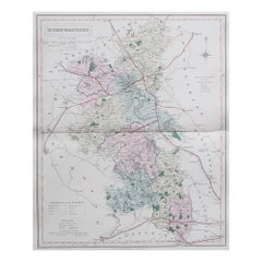
Original Hand-Colored Antique Map of the County of Hereford in England, 1804
About the Item
Antique county map of Herefordshire first published c.1800. Villages, towns, and cities illustrated Avenbury, Ashpurton, Kineton, and Bromyard.
Charles Smith was a cartographer working in London from circa 1800. His maps were finely engraved on copper and featured beautiful hand colouring. The county maps were initially issued as single sheets for travelers from 1800. These were generally laid down on cloth to prolong what would for them be a hard and generally quite a short life on the road. In 1804 they were published as an atlas, Smith's New English Atlas.
- Dimensions:Height: 25.2 in (64 cm)Width: 21.26 in (54 cm)Depth: 0.02 in (0.5 mm)
- Materials and Techniques:Paper,Engraved
- Period:
- Date of Manufacture:1804
- Condition:Wear consistent with age and use. General age-related toning. Folding line in the middle as issued, slight discoloured. Original colouring. Please study image carefully.
- Seller Location:Langweer, NL
- Reference Number:
About the Seller
5.0
Platinum Seller
These expertly vetted sellers are 1stDibs' most experienced sellers and are rated highest by our customers.
Established in 2009
1stDibs seller since 2017
1,933 sales on 1stDibs
Typical response time: <1 hour
- ShippingRetrieving quote...Ships From: Langweer, Netherlands
- Return PolicyA return for this item may be initiated within 14 days of delivery.
More From This SellerView All
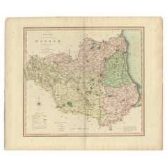
- Original Hand-Colored Antique County Map of Durham, England, 1804Located in Langweer, NLAntique county map of Durham first published c.1800. Villages, towns, and cities illustrated include Gateshead, South Shields, and Darlington. C...Category
Antique Early 1800s Maps
MaterialsPaper
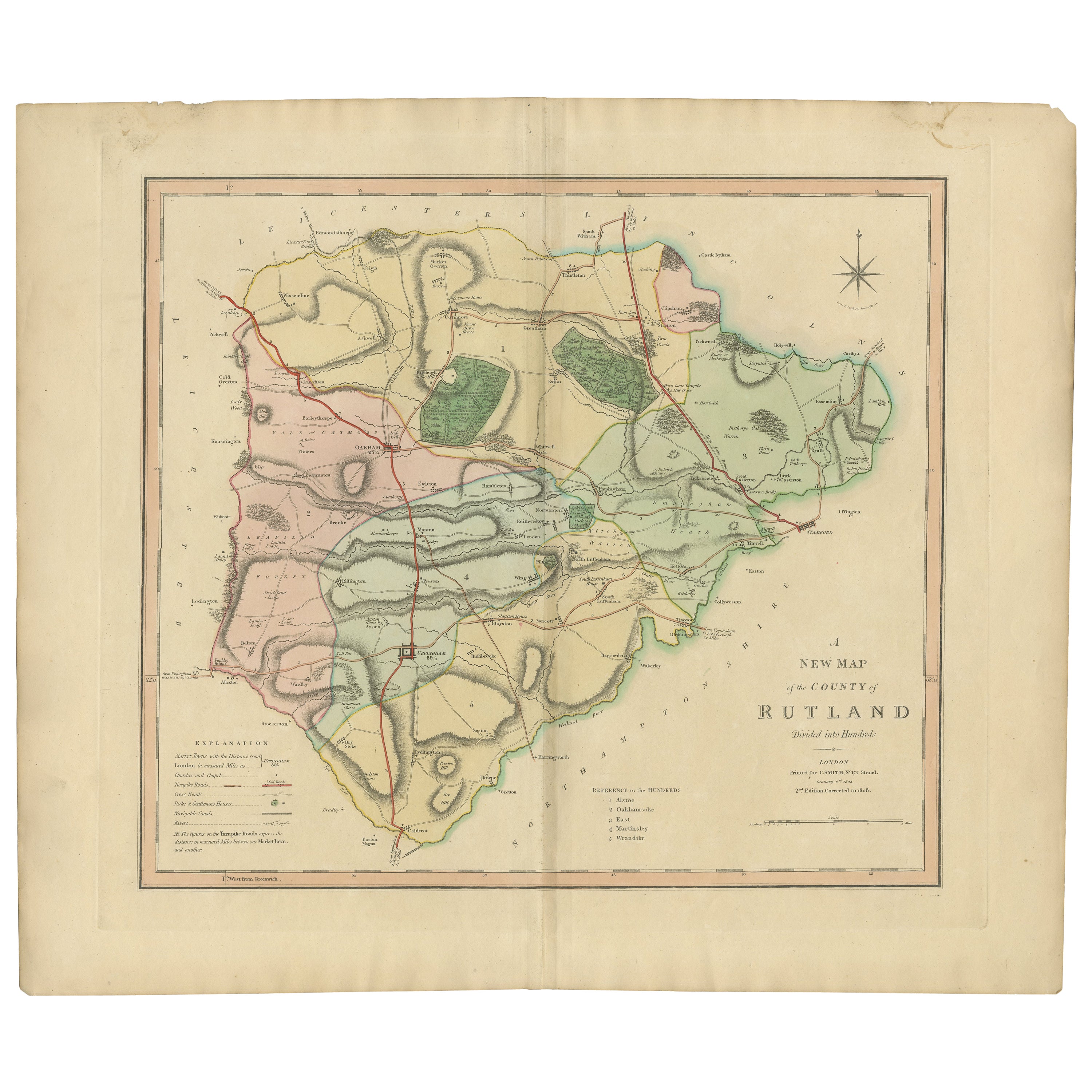
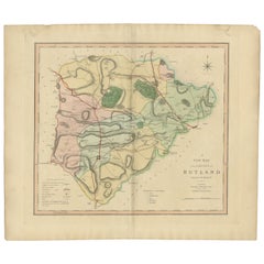
- Antique Hand-Colored County Map of Rutland, England, 1804Located in Langweer, NLAntique county map of Rutland first published c.1800. Villages, towns, and cities illustrated include Oakham, Uppingham, and Normanton. Charles ...Category
Antique Early 1800s Maps
MaterialsPaper
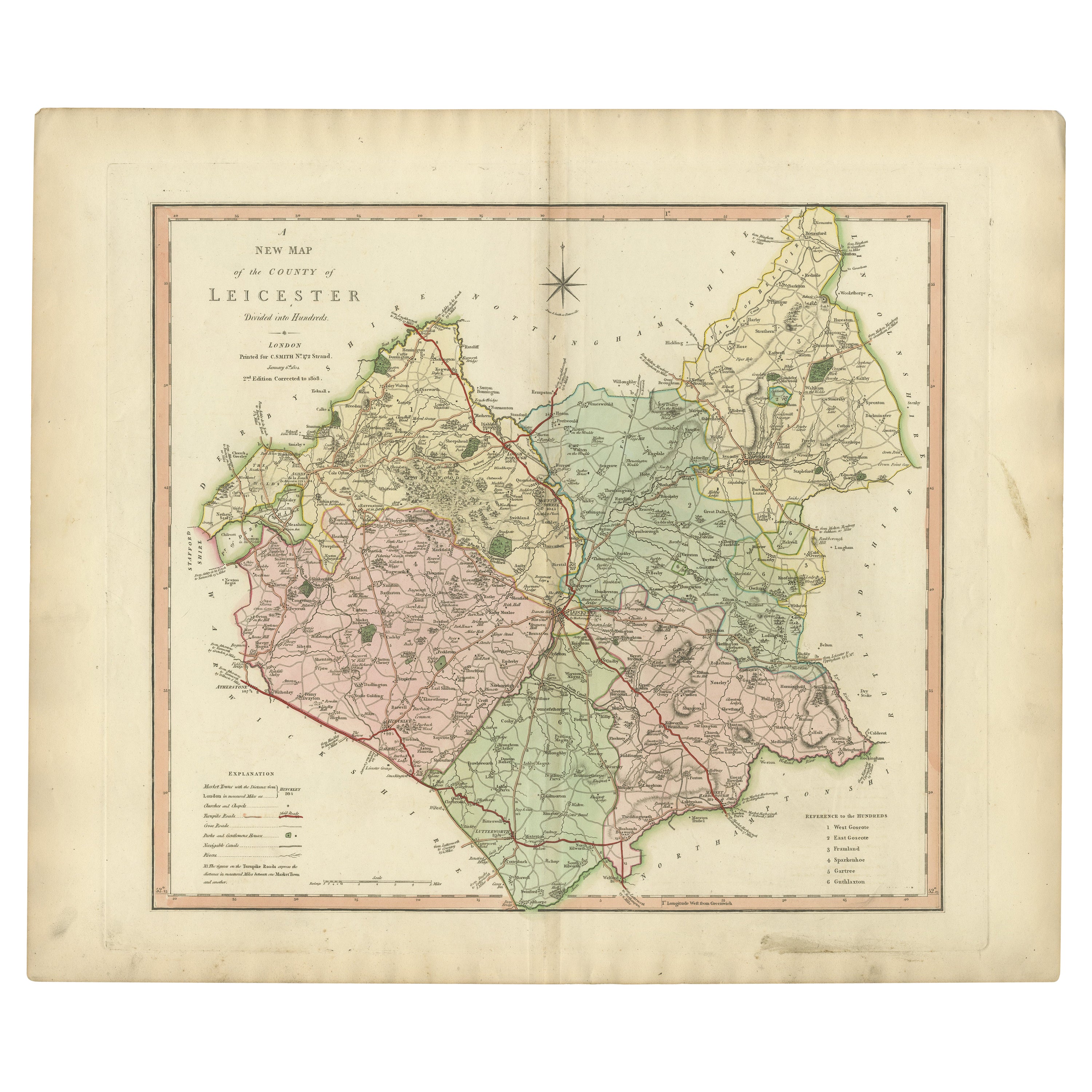
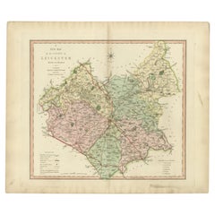
- Antique County Map of Leicestershire, England, 1804Located in Langweer, NLAntique county map of Leicestershire first published c.1800. Villages, towns, and cities illustrated include Lutterworth, Ashby, Hinkley, and Marke...Category
Antique Early 1800s Maps
MaterialsPaper
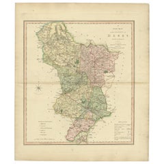
- Antique County Map of Derbyshire, England, 1804Located in Langweer, NLAntique county map of Derbyshire first published, circa 1800. Villages, towns, and cities illustrated include Chesterfield, Wirksworth, Derby, and ...Category
Antique Early 1800s Maps
MaterialsPaper
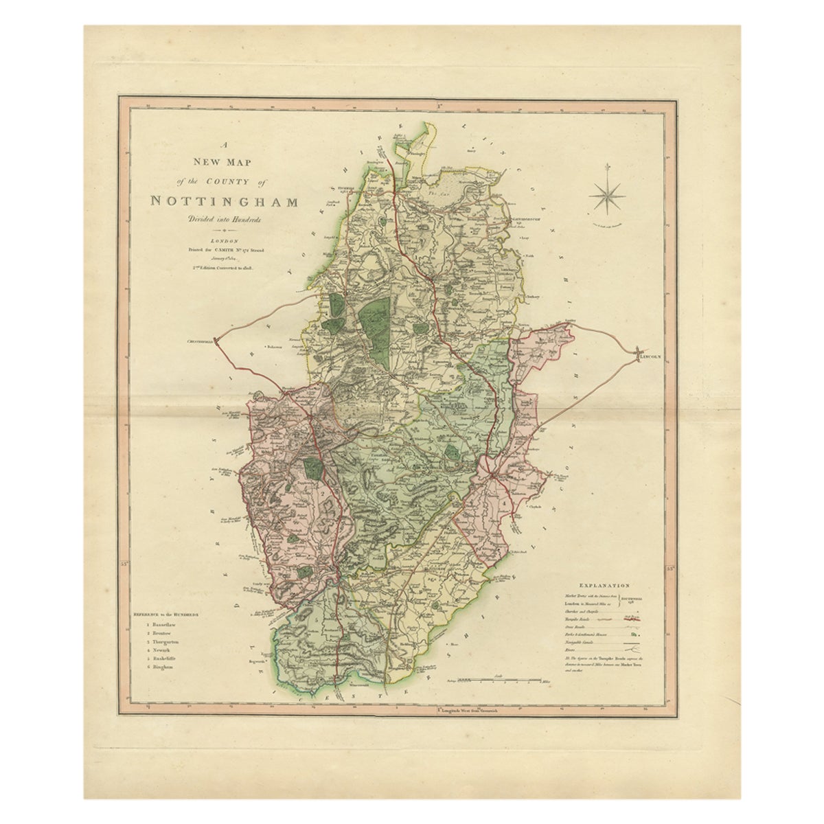
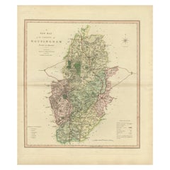
- Antique Decorative Map of The County of Nottinghamshire, England, 1804Located in Langweer, NLAntique county map of Nottinghamshire first published c.1800. Villages, towns, and cities illustrated include Worksop, Neware, Tuxford, and Maplebe...Category
Antique Early 1800s Maps
MaterialsPaper
- Antique Decorative County Map of Huntingdonshire, England, 1804Located in Langweer, NLAntique county map of Huntingdonshire first published c.1800. Cities illustrated include Kimbolton, Chesterton, Folkesworth, and Great Stewkeley. Charles Smith was a cartographer ...Category
Antique Early 1800s Maps
MaterialsPaper
You May Also Like
- Original Antique English County Map, Herefordshire, J & C Walker, 1851Located in St Annes, LancashireGreat map of Herefordshire Original colour By J & C Walker Published by Longman, Rees, Orme, Brown & Co. 1851 Unframed.Category
Antique 1850s English Other Maps
MaterialsPaper
- Original Antique English County Map, Durham, J & C Walker, 1851Located in St Annes, LancashireGreat map of Durham Original colour By J & C Walker Published by Longman, Rees, Orme, Brown & Co. 1851 Unframed.Category
Antique 1850s English Other Maps
MaterialsPaper
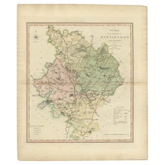
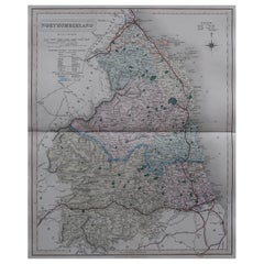
- Original Antique English County Map, Northumberland, J & C Walker, 1851Located in St Annes, LancashireGreat map of Northumberland Original colour By J & C Walker Published by Longman, Rees, Orme, Brown & Co. 1851 Unframed.Category
Antique 1850s English Other Maps
MaterialsPaper
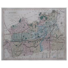
- Original Antique English County Map - Surrey. J & C Walker. 1851Located in St Annes, LancashireGreat map of Surrey Original colour By J & C Walker Published by Longman, Rees, Orme, Brown & Co. 1851 Unframed.Category
Antique 1850s English Other Maps
MaterialsPaper
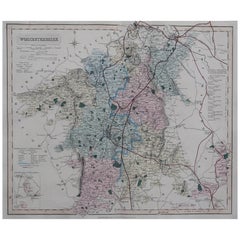
- Original Antique English County Map, Worcestershire, J & C Walker, 1851Located in St Annes, LancashireGreat map of Worcestershire Original colour By J & C Walker Published by Longman, Rees, Orme, Brown & Co. 1851 Unframed.Category
Antique 1850s English Other Maps
MaterialsPaper
- Original Antique English County Map, Buckinghamshire, J & C Walker, 1851Located in St Annes, LancashireGreat map of Buckinghamshire Original colour By J & C Walker Published by Longman, Rees, Orme, Brown & Co. 1851 Unframed.Category
Antique 1850s English Other Maps
MaterialsPaper


Recently Viewed
View AllMore Ways To Browse
Hand Colored Antique
New England Antiques
New England Early Furniture
Antique Furniture From New England
City Of London Antiques
Antique Traveler
London City Map
New England Maps
New England Map
Antique County Maps
Antique Map Of New England
Antique Maps New England
Antique Map New England
Antique New England Maps
Antique Road Maps
Antique Road Map
Antique English County Maps
Antique Furniture Herefordshire