Antique English County Maps

40
to
5
113
21
90
53
52
37
36
17
13
13
13
12
6
5
4
4
4
4
4
3
2
2
2
2
2
2
1
1
1
1
1
1
1
1
1
1
1
13
3
2
2
2
Sort By
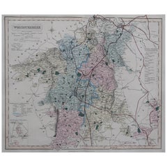
Original Antique English County Map, Worcestershire, J & C Walker, 1851
Located in St Annes, Lancashire
Great map of Worcestershire Original colour By J & C Walker Published by Longman, Rees
Category

1850s English Other Antique English County Maps

Materials

Paper

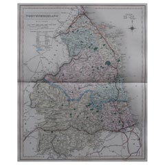
Original Antique English County Map, Northumberland, J & C Walker, 1851
Located in St Annes, Lancashire
Great map of Northumberland Original colour By J & C Walker Published by Longman, Rees
Category

1850s English Other Antique English County Maps

Materials

Paper

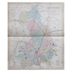
Original Antique English County Map, Cambridgeshire, J & C Walker, 1851
Located in St Annes, Lancashire
Great map of Cambridgeshire Original colour By J & C Walker Published by Longman, Rees
Category

1850s English Other Antique English County Maps

Materials

Paper

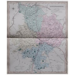
Original Antique English County Map, Huntingdonshire, J & C Walker, 1851
Located in St Annes, Lancashire
Great map of Huntingdonshire Original colour By J & C Walker Published by Longman, Rees
Category

1850s English Other Antique English County Maps

Materials

Paper

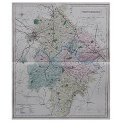
Original Antique English County Map, Warwickshire, J & C Walker, 1851
Located in St Annes, Lancashire
Great map of Warwickshire Original colour By J & C Walker Published by Longman, Rees, Orme
Category

1850s English Other Antique English County Maps

Materials

Paper

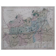
Original Antique English County Map - Surrey. J & C Walker. 1851
Located in St Annes, Lancashire
Great map of Surrey Original colour By J & C Walker Published by Longman, Rees, Orme
Category

1850s English Other Antique English County Maps

Materials

Paper

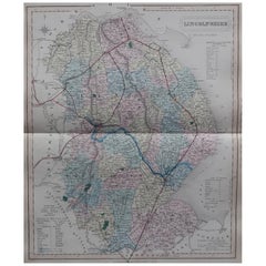
Original Antique English County Map, Lincolnshire, J & C Walker, 1851
Located in St Annes, Lancashire
Great map of Lincolnshire Original colour By J & C Walker Published by Longman, Rees, Orme
Category

1850s English Other Antique English County Maps

Materials

Paper

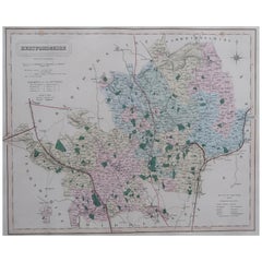
Original Antique English County Map, Hertfordshire. J & C Walker, 1851
Located in St Annes, Lancashire
Great map of Hertfordshire Original colour By J & C Walker Published by Longman, Rees
Category

1850s English Other Antique English County Maps

Materials

Paper

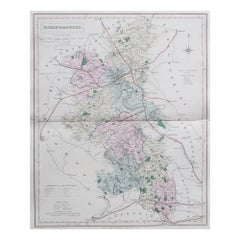
Original Antique English County Map, Buckinghamshire, J & C Walker, 1851
Located in St Annes, Lancashire
Great map of Buckinghamshire Original colour By J & C Walker Published by Longman, Rees
Category

1850s English Other Antique English County Maps

Materials

Paper

Original Antique English County Map - Monmouthshire. J & C Walker. 1851
Located in St Annes, Lancashire
Great map of Monmouthshire Original colour By J & C Walker Published by Longman, Rees
Category

1850s English Other Antique English County Maps

Materials

Paper

Original Antique English County Map, Durham, J & C Walker, 1851
Located in St Annes, Lancashire
Great map of Durham Original colour By J & C Walker Published by Longman, Rees, Orme
Category

1850s English Other Antique English County Maps

Materials

Paper

Original Antique English County Map, Leicestershire, J & C Walker, 1851
Located in St Annes, Lancashire
Great map of Leicestershire Original colour By J & C Walker Published by Longman, Rees
Category

1850s English Other Antique English County Maps

Materials

Paper

Original Antique English County Map - Middlesex. J & C Walker. 1851
Located in St Annes, Lancashire
Great map of Middlesex Original colour By J & C Walker Published by Longman, Rees, Orme
Category

1850s English Other Antique English County Maps

Materials

Paper

Original Antique English County Map, Herefordshire, J & C Walker, 1851
Located in St Annes, Lancashire
Great map of Herefordshire Original colour By J & C Walker Published by Longman, Rees
Category

1850s English Other Antique English County Maps

Materials

Paper

Original Antique English County Map, Nottinghamshire, J & C Walker, 1851
Located in St Annes, Lancashire
Great map of Nottinghamshire Original colour By J & C Walker Published by Longman, Rees
Category

1850s English Other Antique English County Maps

Materials

Paper

Original Antique English County Map, Derbyshire, J & C Walker, 1851
Located in St Annes, Lancashire
Great map of Derbyshire Original colour By J & C Walker Published by Longman, Rees, Orme
Category

1850s English Other Antique English County Maps

Materials

Paper

Original Antique English County Map, Staffordshire, J & C Walker, 1851
Located in St Annes, Lancashire
Great map of Staffordshire Original colour By J & C Walker Published by Longman, Rees
Category

1850s English Other Antique English County Maps

Materials

Paper

Original Antique English County Map, Kent. J & C Walker, 1851
Located in St Annes, Lancashire
Great map of Kent Original colour By J & C Walker Published by Longman, Rees, Orme, Brown
Category

1850s English Other Antique English County Maps

Materials

Paper

Original Antique English County Map, Kent. J & C Walker, 1851
No Reserve
H 13.75 in W 17.25 in D 0.07 in
Original Antique English County Map, Berkshire. J & C Walker, 1851
Located in St Annes, Lancashire
Great map of Berkshire Original colour By J & C Walker Published by Longman, Rees, Orme
Category

1850s English Other Antique English County Maps

Materials

Paper

Original Antique English County Map, Shropshire. J & C Walker, 1851
Located in St Annes, Lancashire
Great map of Shropshire Original colour By J & C Walker Published by Longman, Rees, Orme
Category

1850s English Other Antique English County Maps

Materials

Paper

Original Antique English County Map, Gloucestershire, J & C Walker, 1851
Located in St Annes, Lancashire
Great map of Gloucestershire Original colour By J & C Walker Published by Longman, Rees
Category

1850s English Other Antique English County Maps

Materials

Paper

Original Antique English County Map, Somerset. J & C Walker, 1851
Located in St Annes, Lancashire
Great map of Somerset Original colour By J & C Walker Published by Longman, Rees, Orme
Category

1850s English Other Antique English County Maps

Materials

Paper

Original Antique English County Map, Hampshire, J & C Walker, 1851
Located in St Annes, Lancashire
Great map of Hampshire Original colour By J & C Walker Published by Longman, Rees, Orme
Category

1850s English Other Antique English County Maps

Materials

Paper

Original Antique English County Map, Lancashire, J & C Walker, 1851
Located in St Annes, Lancashire
Great map of Lancashire Original colour By J & C Walker Published by Longman, Rees, Orme
Category

1850s English Other Antique English County Maps

Materials

Paper

Original Antique English County Map, Suffolk, J & C Walker, 1851
Located in St Annes, Lancashire
Great map of Suffolk Original colour By J & C Walker Published by Longman, Rees, Orme
Category

1850s English Other Antique English County Maps

Materials

Paper

Original Antique English County Map, Rutland, J & C Walker, 1851
Located in St Annes, Lancashire
Great map of Rutland Original colour By J & C Walker Published by Longman, Rees, Orme
Category

1850s English Other Antique English County Maps

Materials

Paper

Original Antique English County Map, North Yorkshire, J & C Walker, 1851
Located in St Annes, Lancashire
Great map of North Yorkshire Original colour By J & C Walker Published by Longman, Rees
Category

1850s English Other Antique English County Maps

Materials

Paper

Original Antique English County Map - West Yorkshire. J & C Walker. 1851
Located in St Annes, Lancashire
Great map of The West Riding of Yorkshire Original colour By J & C Walker Published by
Category

1850s English Other Antique English County Maps

Materials

Paper

Original Antique English County Map, East Yorkshire, J & C Walker, 1851
Located in St Annes, Lancashire
Great map of The East Riding of Yorkshire Original colour By J & C Walker Published by
Category

1850s English Other Antique English County Maps

Materials

Paper

Antique Hand-colored Map of Brandenburg, Germany
Located in Langweer, NL
known for his volume of English county maps, published in 1646. Janssonius died in Amsterdam in 1664
Category

Mid-17th Century Antique English County Maps

Materials

Paper

Antique Map of the Holy Land, showing the travels of Abraham, Isaac and Jacob
Located in Langweer, NL
eleven volumes. Janssonius is also well known for his volume of English county maps, published in 1646.
Category

Mid-17th Century Antique English County Maps

Materials

Paper

Antique Map of the Duchy of Lüneburg, Lower Saxony, Germany
Located in Langweer, NL
English county maps, published in 1646. Janssonius died in Amsterdam in 1664. His son-in-law, Johannes
Category

Mid-17th Century Antique English County Maps

Materials

Paper

Antique Lithography Map, County Durham, English, Framed Cartography, Victorian
Located in Hele, Devon, GB
This is an antique lithography map of County Durham. An English, framed atlas engraving of
Category

Mid-19th Century British Mid-Century Modern Antique English County Maps

Materials

Wood

Antique County Map, Norfolk, English, Framed Lithography, Cartography, Victorian
Located in Hele, Devon, GB
This is an antique lithography map of Norfolk. An English, framed atlas engraving of cartographic
Category

Mid-19th Century British Victorian Antique English County Maps

Materials

Glass, Wood

Antique County Map, Rutlandshire, English, Framed, Cartography, Victorian, 1860
Located in Hele, Devon, GB
This is an antique lithography map of Rutlandshire. An English, framed atlas engraving of
Category

Mid-19th Century British Victorian Antique English County Maps

Materials

Wood

Old Map of Ancient Times covering Egypt Towards Arabia and India to Java, c.1660
Located in Langweer, NL
dedicated to Italy. 1646 a fourth volume came out with ""English County Maps"", a year after a similar issue
Category

1660s Antique English County Maps

Materials

Paper

Antique County Map of Derbyshire, England, 1804
Located in Langweer, NL
Antique county map of Derbyshire first published, circa 1800. Villages, towns, and cities
Category

Early 1800s Antique English County Maps

Materials

Paper

Original Antique Map of the English counties Cornwall, Devon, Dorset, etc, 1633
Located in Langweer, NL
, Glamorgan, Caermarden, Penbrok, Cardigan, Radnor, Breknoke et Herfordia'. Old map of the English
Category

1630s Antique English County Maps

Materials

Paper

Antique County Map of Leicestershire, England, 1804
Located in Langweer, NL
Antique county map of Leicestershire first published c.1800. Villages, towns, and cities
Category

Early 1800s Antique English County Maps

Materials

Paper

Antique County Map of Monmouthshire, England, circa 1804
Located in Langweer, NL
Antique county map of Monmouthshire first published circa 1800. Villages, towns, and cities
Category

Early 1800s Antique English County Maps

Materials

Paper

Antique Decorative County Map of Lincolnshire, England, 1804
Located in Langweer, NL
Antique county map of Lincolnshire first published circa 1800 Cities illustrated include Grantham
Category

Early 1800s Antique English County Maps

Materials

Paper

Antique Decorative County Map of Huntingdonshire, England, 1804
Located in Langweer, NL
Antique county map of Huntingdonshire first published c.1800. Cities illustrated include Kimbolton
Category

Early 1800s Antique English County Maps

Materials

Paper

Antique Hand-Colored County Map of Rutland, England, 1804
Located in Langweer, NL
Antique county map of Rutland first published c.1800. Villages, towns, and cities illustrated
Category

Early 1800s Antique English County Maps

Materials

Paper

Antique Colourful and Decorative County Map of Bedfordshire, England, 1804
Located in Langweer, NL
Antique county map of Bedfordshire first published c.1800. Villages, towns, and cities illustrated
Category

Early 1800s Antique English County Maps

Materials

Paper

Antique Decorative Map of The County of Nottinghamshire, England, 1804
Located in Langweer, NL
Antique county map of Nottinghamshire first published c.1800. Villages, towns, and cities
Category

Early 1800s Antique English County Maps

Materials

Paper

Original Hand-Colored Antique County Map of Durham, England, 1804
Located in Langweer, NL
Antique county map of Durham first published c.1800. Villages, towns, and cities illustrated
Category

Early 1800s Antique English County Maps

Materials

Paper

Antique Decorative and Detailed County Map of Cumberland, England, 1804
Located in Langweer, NL
Antique county map of Cumberland first published c.1800. Villages, towns, and cities illustrated
Category

Early 1800s Antique English County Maps

Materials

Paper

Original Antique Engraving of a Sea Chart of the Western Mediterranean, ca.1650
Located in Langweer, NL
1638, one fully dedicated to Italy. 1646 a fourth volume came out with ""English County Maps"", a year
Category

1650s Antique English County Maps

Materials

Paper

Original Antique Bird's Eye View Plan of Hoorn, The Netherlands by Blaeu, c.1700
Located in Langweer, NL
out with ""English County Maps"", a year after a similar issue by Willem Blaeu. Janssonius' maps are
Category

Early 1700s Antique English County Maps

Materials

Paper

Hampshire County, Britain/England: A Map from Camden's" Britannia" in 1607
By John Norden
Located in Alamo, CA
An early hand-colored map of Britain's Hampshire county, published in the 1607 edition of William
Category

Early 17th Century English Antique English County Maps

Materials

Paper

Two Sheet Map of the Principality of Wales Divided into Counties, 1804
Located in Langweer, NL
first appeared in Smith's "New English Atlas Being A Complete Set of County Maps". Smith was a stationer
Category

Early 1800s Antique English County Maps

Materials

Paper

1633 Map Entitled "Beauvaisis Comitatus Belova Cium, Ric.0002
Located in Norton, MA
Maps for Caert Thresoor (Langenesi Cornelis Claesz), with Pieter van den Keere * 1602-03 - 12 English
Category

17th Century Dutch Antique English County Maps

Materials

Paper

Original Hand-Colored Antique Map of the County of Hereford in England, 1804
Located in Langweer, NL
Antique county map of Herefordshire first published c.1800. Villages, towns, and cities illustrated
Category

Early 19th Century Antique English County Maps

Materials

Paper

17th Century Map of Cumberland County in Northwest England Printed by John Speed
By John Speed
Located in Middleburg, VA
Rare extremely early map of the county of Cumberland in the Northwest of England. Printed by John
Category

Early 17th Century English Antique English County Maps

Materials

Paper

Antique Lithography Map, Buckinghamshire, English, Framed Cartography, Victorian
Located in Hele, Devon, GB
This is an antique lithography map of Buckinghamshire. An English, framed atlas engraving of
Category

Mid-19th Century British Victorian Antique English County Maps

Materials

Wood, Paper

Antique Lithography Map, Bedfordshire, English, Framed Engraving, Cartography
Located in Hele, Devon, GB
This is an antique lithography map of Bedfordshire. An English, framed atlas engraving of
Category

Mid-19th Century British Victorian Antique English County Maps

Materials

Wood

Antique Lithography Map, Hertfordshire, English, Framed Engraving, Cartography
Located in Hele, Devon, GB
This is an antique lithography map of Hertfordshire. An English, framed atlas engraving of
Category

Mid-19th Century British Victorian Antique English County Maps

Materials

Wood

Antique Lithography Map, Lincolnshire, English, Framed, Engraving, Cartography
Located in Hele, Devon, GB
This is an antique lithography map of Lincolnshire. An English, framed atlas engraving of
Category

Mid-19th Century British Victorian Antique English County Maps

Materials

Wood

Antique Lithography Map, Gloucestershire, English, Framed Engraving, Cartography
Located in Hele, Devon, GB
This is an antique lithography map of Gloucestershire. An English, framed atlas engraving of
Category

Mid-19th Century British Victorian Antique English County Maps

Materials

Wood

Antique Lithography Map, Northumberland, English, Framed, Engraving, Cartography
Located in Hele, Devon, GB
This is an antique lithography map of Northumberland. An English, framed atlas engraving of
Category

Mid-19th Century British Victorian Antique English County Maps

Materials

Wood

  • 1
Get Updated with New Arrivals
Save "Antique English County Maps", and we’ll notify you when there are new listings in this category.

Antique English County Maps For Sale on 1stDibs

On 1stDibs, there are several options of antique english county maps available for sale. There are many versions of these works for sale. These items have been produced for many years, with earlier versions available from the 17th Century and newer variations made as recently as the 19th Century. If you’re looking to add antique english county maps that pop against an otherwise neutral space in your home, the works available on 1stDibs include that feature elements of beige and more. The range of these distinct pieces — often created in engraving — can elevate any room of your home.

How Much are Antique English County Maps?

Prices for art of this kind can differ depending upon size, time period and other attributes — antique english county maps in our inventory begin at $195 and can go as high as $1,275, while the average can fetch as much as $195.

Read More

Pamela Shamshiri Shares the Secrets behind Her First-Ever Book and Its Effortlessly Cool Interiors

The sought-after designer worked with the team at Hoffman Creative to produce a monograph that beautifully showcases some of Studio Shamshiri's most inspiring projects.

Moroccan Artworks and Objects Take Center Stage in an Extraordinary Villa in Tangier

Italian writer and collector Umberto Pasti opens the doors to his remarkable cave of wonders in North Africa.

Montecito Has Drawn Royalty and Celebrities, and These Homes Are Proof of Its Allure

Hollywood A-listers, ex-pat aristocrats and art collectors and style setters of all stripes appreciate the allure of the coastal California hamlet — much on our minds after recent winter floods.

Whaam! Blam! Pow! — a New Book on Pop Art Packs a Punch

Publishing house Assouline and writer Julie Belcove have teamed up to trace the history of the genre, from Roy Lichtenstein, Andy Warhol and Yayoi Kusama to Mickalene Thomas and Jeff Koons.

The Sparkling Legacy of Tiffany & Co. Explained, One Jewel at a Time

A gorgeous new book celebrates — and memorializes — the iconic jeweler’s rich heritage.

What Makes a Gem-Encrusted Chess Set Worth $4 Million?

The world’s most opulent chess set, weighing in at 513 carats, is literally fit for a king and queen.

Tauba Auerbach’s Geometric Pop-Up Book Is Mighty Rare, Thanks to a Hurricane

This sculptural art book has an epic backstory of its own.

Step inside the Storied Mansions of Palm Beach’s Most Effervescent Architect

From Spanish-style courtyards to fanciful fountains, these acclaimed structures abound in surprising and elegant details.