Maps Of Ireland Large
6
to
9
53
16
32
20
18
16
14
12
10
8
7
6
6
4
4
3
3
2
2
2
2
2
2
2
2
2
2
1
1
1
1
1
1
1
1
1
1
2
2
2
2
1
Sort By
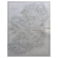
Large Original Antique Map of Ireland by Sidney Hall, 1847
Located in St Annes, Lancashire
Great map of Ireland
Drawn and engraved by Sidney Hall
Steel engraving
Original colour
Category
Antique 1840s Scottish Maps
Materials
Paper
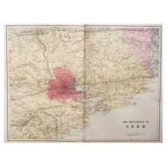
Large Original Antique Map of the Environs of Cork, Ireland, circa 1880
Located in St Annes, Lancashire
Great map of The Environs of Cork
Published circa 1880
Unframed
Free shipping.
Category
Antique 1880s Scottish Maps
Materials
Paper
No Reserve
H 13.5 in W 20 in D 0.07 in
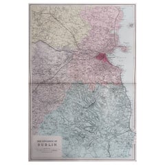
Large Original Antique Map of The Environs of Dublin, Ireland, circa 1880
Located in St Annes, Lancashire
Great map of The Environs of Dublin
Published circa 1880
Unframed
Free shipping.
Category
Antique 1880s Scottish Maps
Materials
Paper
No Reserve
H 20 in W 13.5 in D 0.07 in
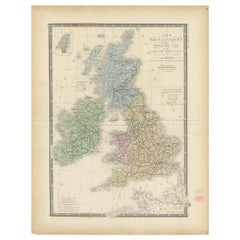
Original Antique Map of the United Kingdom and Ireland, Published in 1875
Located in Langweer, NL
Antique map titled 'Iles Britanniques ou Royaume-Uni de la Grande Bretagne (..)'. Large map of the
Category
Antique Late 19th Century Maps
Materials
Paper
H 24.02 in W 18.71 in D 0.02 in
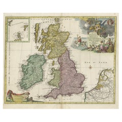
England, Scotland & Ireland: A Hand Colored Map of Great Britain by Tirion
By Isaak Tirion
Located in Alamo, CA
location of publication.
The map is printed in laid chain-linked paper with a large fleur-de-lys and
Category
Antique Mid-18th Century Dutch Maps
Materials
Paper
H 17 in W 20.75 in D 0.07 in
Antique Map of the Coast of New Ireland, Earlier Part of German New Guinea, 1833
Located in Langweer, NL
. New Ireland, also New Mecklenburg, is the Northeastern Province of Papua New Guinea. Map no. 26 from
Category
Antique 19th Century Maps
Materials
Paper
H 18.86 in W 25.44 in D 0 in
Old Map of the UK & Ireland, Insets of Orkney, Shetland and Faroe Islands, 1786
Located in Langweer, NL
".
Hand-colored engraved map with 2 (large) decorative cartouches, inset map of the Orkney, Shetland and
Category
Antique 1780s Maps
Materials
Paper
H 23.31 in W 18.59 in D 0 in
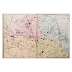
Large Original Antique City Plan of Dublin, Ireland, circa 1880
Located in St Annes, Lancashire
Great city plan of Dublin
Published circa 1880
Unframed
Free shipping.
.
Category
Antique 1880s Scottish Maps
Materials
Paper
No Reserve
H 13.5 in W 20 in D 0.07 in
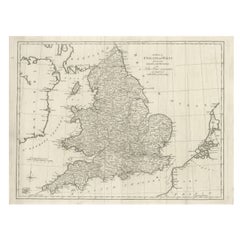
Large Antique Map England and Wales, with Part of the Coastlines
Located in Langweer, NL
Antique map titled 'A Map of England and Wales (..)'. Large antique map of England and Wales, with
Category
Antique Late 18th Century Maps
Materials
Paper
Large Antique Map of the British Isles, with inset of the Orkneys and Shetlands
Located in Langweer, NL
Antique map titled 'A Map of Great Britain and Ireland (..)'. Large antique map of the British
Category
Antique Late 18th Century Maps
Materials
Paper
H 18.43 in W 24.93 in D 0.02 in
Large Antique Map of New Guinea and New Britain Showing Capt. Cooks Tract, 1773
Located in Langweer, NL
Antique map titled 'A Chart of Captain Carteret's Discoveries at New Britain, with part of Captain
Category
Antique 18th Century Maps
Materials
Paper
H 27.96 in W 11.42 in D 0 in
Large 17th Century Hand Colored Map of England and the British Isles by de Wit
By Frederick de Wit
Located in Alamo, CA
A large hand colored 17th century map of England and the British Isles by Frederick de Wit entitled
Category
Antique Late 17th Century Dutch Maps
Materials
Paper
H 35 in W 30.5 in D 2 in
Antique Map of the British Isles by Lotter, 1764
Located in Langweer, NL
of the British Isles (main islands United Kingdom & Ireland). Features include a Fine large rococco
Category
Antique 18th Century Maps
Materials
Paper
Antique Map of the British Isles, Insets of the Shetland Islands and Hebrides
Located in Langweer, NL
Antique map titled 'Great Britain and Ireland with ye Judges Circuits'. A scarce map of the British
Category
Antique Late 18th Century Maps
Materials
Paper
H 16.82 in W 19.45 in D 0.02 in
Antique Map of the British Isles by H. Chatelain, 1719
By Henri-Abraham Chatelain
Located in Langweer, NL
Beautiful hand colored large format map of the British Isles, with large insets of the Eastern and
Category
Antique Early 18th Century Maps
Materials
Paper
1633 Map Entitled "Beauvaisis Comitatus Belova Cium, Ric.0002
Located in Norton, MA
. 1591-92 Hiberniae novissima descrzptio: Boazio\\\\\\\\\\\\\\\'s map of Ireland: Engraved by Pieter van
Category
Antique 17th Century Dutch Maps
Materials
Paper
Road Map, John Ogilby, No 54, London, Yarmouth, Britannia
By John Ogilby
Located in BUNGAY, SUFFOLK
English countryside. Fortunately, his maps were printed in relatively large numbers for the period, so
Category
Antique 1670s English Baroque Maps
Materials
Paper
Large Sea Chart of the British Islands, 1918
Located in Langweer, NL
Antique map titled 'The British Islands'.
Large sea chart of the British Islands. It shows
Category
Vintage 1910s Maps
Materials
Paper
Map Road Strip Britannia Sheet 2 John Ogilby London Aberistwith Islip Bramyard
By John Ogilby
Located in BUNGAY, SUFFOLK
. Fortunately, his maps were printed in relatively large numbers for the period, so individual sheets are
Category
Antique 17th Century English Baroque Maps
Materials
Paper
H 14.38 in W 19.3 in D 0.79 in
Road Map John Ogilby No 75 Kings Lyn Harwich, Britannia Framed Wallhanging
By John Ogilby
Located in BUNGAY, SUFFOLK
English countryside. Fortunately, his maps were printed in relatively large numbers for the period, so
Category
Antique 1670s European Baroque Maps
Materials
Paper
H 15.75 in W 19.69 in D 0.6 in
Map Road John Ogilby Britannia No 74 Ipswich to Norwich Cromer Framed
By John Ogilby
Located in BUNGAY, SUFFOLK
fascinating record of the English countryside. Fortunately, his maps were printed in relatively large numbers
Category
Antique 1670s English Baroque Maps
Materials
Paper
Road Map No43 London to Kings Lynn, Royston to Downham, John Ogilby, Britannia
By John Ogilby
Located in BUNGAY, SUFFOLK
. Fortunately, his maps were printed in relatively large numbers for the period, so individual sheets are
Category
Antique Late 17th Century British Charles II Maps
Materials
Paper
H 20.48 in W 24.41 in D 0.4 in
Road Map John Ogilby London St David's Britannia No 15 Abingdon Monmouth Framed
By John Ogilby
Located in BUNGAY, SUFFOLK
John Ogilby (British 1600-1676) Cosmographer and Geographick Printer to Charles II. A road map from
Category
Antique 1670s English Baroque Maps
Materials
Paper
H 20.48 in W 24.41 in D 0.6 in
Road Map Britannia No 32 the Road from London to Barnstable John Ogilby Framed
By John Ogilby
Located in BUNGAY, SUFFOLK
English countryside. Fortunately, his maps were printed in relatively large numbers for the period, so
Category
Antique Late 17th Century English Charles II Maps
Materials
Paper
H 20.48 in W 24.41 in D 0.6 in
Road Map Britannia No 15 London to St Davids John Ogilby Brown Gilt Frame
By John Ogilby
Located in BUNGAY, SUFFOLK
. Fortunately, his maps were printed in relatively large numbers for the period, so individual sheets are
Category
Antique Late 17th Century British Charles II Maps
Materials
Paper
H 22.05 in W 26.19 in D 0.6 in
Road Map Britannia No 25 London to the Lands End, John Ogilby Brown Gilded Frame
By John Ogilby
Located in BUNGAY, SUFFOLK
Senan in Cornwall. By John Ogilby His Majesties Cosmographer. A road map from Britannia, 1675/6. No 25
Category
Antique Late 17th Century British Charles II Maps
Materials
Paper
H 22.05 in W 26.19 in D 0.6 in
Road Map Britannia 1675/6 No 5 Road London to Barwick, London Stilton Grey Frame
By John Ogilby
Located in BUNGAY, SUFFOLK
John Ogilby (British 1600-1676) cosmographer and geographick printer to Charles II.
A road map from
Category
Antique Late 17th Century British Charles II Maps
Materials
Paper
H 22.84 in W 25.99 in D 0.4 in
Original Vintage Travel Poster Map of Ireland Showing Places of Note & Interest
Located in London, GB
Original vintage poster - Map of Ireland showing places of note and interest. Colorful illustrated
Category
Vintage 1950s British Posters
Materials
Paper
H 40.16 in W 50.01 in D 0.04 in
Mapped Location of Pronounced Situational Density
By Patricia Smith
Located in New York, NY
finish. This painting is created as psychological map that defines alliances.
Greed-Based, Guilt-Based
Category
21st Century and Contemporary Contemporary Abstract Drawings and Waterco...
Materials
Archival Ink, Archival Paper, Watercolor
England and the British Isles: A Large 17th Century Hand-colored Map by de Wit
By Frederick de Wit
Located in Alamo, CA
This is a large hand-colored 17th century map of England and the British Isles by Frederick de Wit
Category
Late 17th Century Other Art Style Landscape Prints
Materials
Engraving
Great Britain, N. France: A Large 17th C. Hand-colored Map by Sanson and Jaillot
By Nicholas Sanson d'Abbeville
Located in Alamo, CA
This large hand-colored 17th century copperplate engraved map entitled "Le Royaume D Angleterre
Category
1690s Landscape Prints
Materials
Engraving
Cambridge map 17th century engraving after John Speed
By John Speed
Located in London, GB
."
Pieter van den Keere (1571 - circa 1646) after John Speed (1551 or 1552 - 1629)
Map of Cambridgeshire
Category
1620s Landscape Prints
Materials
Engraving
Great Britain Scandinavia Northern France Netherland Germany Mural Map
Located in Berghuelen, DE
The vintage pull-down cottagecore mural map illustrates the North Sea countries with Great Britain
Category
Vintage 1970s German Country Posters
Materials
Canvas, Wood, Paper
H 81.89 in W 88.19 in D 0.79 in
Original Vintage LMS London Midland Scottish Railway Poster 5 Routes To Ireland
Located in London, GB
sailing boats near the rocky coast and a colourful map image of Ireland showing the sailing routes to or
Category
Vintage 1930s British Posters
Materials
Paper
H 40.16 in W 50.01 in D 0.04 in
Voyage to the Cape of Good Hope, First Edition, c1785
Located in valatie, NY
, Cash and Byrne, 1785, first edition leather bound hardcover. Complete with ten plates and large fold
Category
Antique 18th Century Irish Books
Materials
Leather, Paper
Original Vintage Travel Poster North Wales Map British Railways DW Burley
Located in London, GB
Original vintage British Railways travel map poster - North Wales where mountains and lakes, lovely
Category
Vintage 1960s British Posters
Materials
Paper
H 40.16 in W 50.01 in D 0.04 in
Tectonic - Cubist Abstract Large Original Artwork
By Heny Steinberg
Located in Los Angeles, CA
Mexican artist Heny Steinberg’s abstracted landscapes invite us to travel from the map to the
Category
21st Century and Contemporary Abstract Abstract Paintings
Materials
Canvas, Mixed Media, Acrylic
Portrait of William Pitt, Earl of Chatham: Rare Framed Mezzotint after Brompton
By Edward Fisher
Located in Alamo, CA
This is a large framed very rare hand-colored copperplate mezzotint engraved portrait of William
Category
Late 18th Century Old Masters Portrait Prints
Materials
Mezzotint
H 31.63 in W 26.63 in D 0.75 in
History of the War in the Peninsula by W.F.P. Napier with Lord Elgin Provenance
By W.F.P. Napier, C.B.
Located in valatie, NY
and Ireland allied with the Kingdom of Portugal, for control of the Iberian Peninsula during the
Category
Antique Early 19th Century English Books
Materials
Paper
H 8.5 in W 7.75 in D 5.75 in
19TH CENTURY TINTERN ABBEY FRANCIS NICHOLSON 1753-1844 WATERCOLOUR PAiNTING
Located in GB
Map Showing the Kingdom of Judah on the West Coast of Africa
This 1747 Negroland map identifies the
Category
Antique 19th Century English Country Decorative Art
Materials
Paper
H 16.15 in W 20.48 in D 0.6 in
Cosmgraphy and Astrology, 1686 by Richard Blome from the First Edition
By Richard Blome
Located in BUNGAY, SUFFOLK
Cosmography & Astrology
Large oval engraved plate with inscriptions outlining the various parts of
Category
Antique 1680s English Charles II Decorative Art
Materials
Paper
H 16.34 in W 10.44 in D 0.04 in
ANTIQUE VICTORIAN FULLY STAMPED MORRIS & CO CIRCA 1880 SATiNWOOD PEDESTAL DESK
By Morris & Co.
Located in GB
Navy map desks, this piece is pure quality
We have cleaned waxed and polished the piece from top to
Category
Antique 1880s English High Victorian Desks and Writing Tables
Materials
Satinwood
H 30.32 in W 48.04 in D 25.4 in
Original Vintage Travel Poster Map Of Ireland Showing Places Of Note & Interest
Located in London, GB
Original vintage poster - Map of Ireland showing places of note and interest. Colourful illustrated
Category
1950s More Prints
Materials
Paper
Original Vintage LMS London Midland Scottish Railway Poster 5 Routes To Ireland
Located in London, GB
smaller sailing boats near the rocky coast and a colourful map image of Ireland showing the sailing routes
Category
1930s More Prints
Materials
Paper
Original Vintage Travel Poster North Wales Map British Railways DW Burley
Located in London, GB
Original vintage British Railways travel map poster - North Wales where mountains and lakes, lovely
Category
1960s More Prints
Materials
Paper
H 40.16 in W 50.01 in
Sybil Connolly Couture Green Pleated Linen Dress, 1960s
By Sybil Connolly
Located in Boca Raton, FL
Life magazine, Connolly can easily be said to have put Ireland on the map in the world of fashion in
Category
1960s Irish Evening Dresses and Gowns
Sea chart of Galway Bay and Limerick river in Ireland - Engraving - 18th century
By Alexis Hubert Jaillot
Located in Zeeland, Noord-Brabant
."" (Map of the harbour of Kinsale in Ireland.) Fine large overview coastal map / seachart of parts of
Category
1690s Old Masters More Prints
Materials
Engraving
Early 19th Century Belfast Chippendale Longcase by Robert Neill, circa 1820
By Robert Neill
Located in Dublin, IE
Irish longcase by Robert Neill, Belfast, circa 1820
This Belfast Chippendale style longcase by
Category
Antique 1810s Northern Irish Grandfather Clocks and Longcase Clocks
Materials
Mahogany
McKay's Ship Yard- The Launching of Clippership "Flying Cloud" in 1851
By Paul Garnett
Located in Stonington, CT
complete fabrication.
Accurate maps of the land on both sides of the river from the period of the 1850’s
Category
21st Century and Contemporary American Realist Landscape Paintings
Materials
Oil
H 24 in W 48 in D 2 in
Petit Neptune Anglois ou Carte Marine des Cotes d'Angleterre, [...].
By Jean Lattre
Located in Zeeland, Noord-Brabant
A map of the coasts of England, Scotland and Ireland, with depth soundings and coastal towns
Category
1780s More Prints
Materials
Engraving
Carte generale des costes de l'Europe sur l'ocean [...].
By Alexis Hubert Jaillot
Located in Zeeland, Noord-Brabant
re-published many of Sanson's maps on a larger scale. His maps were admired for their beautiful
Category
Late 17th Century More Prints
Materials
Engraving
H 24.41 in W 36.03 in
Grand paysage lunatique 1
By Catherine Bolduc
Located in Montreal, Quebec
Artist statement:
“Grand paysage lunatique 1” is part of a larger project entitled “La femme dans
Category
2010s Contemporary Abstract Drawings and Watercolors
Materials
Paper, Acrylic, Watercolor
Antique Map of the British Isles by Homann Heirs, c.1749
Located in Langweer, NL
Ireland with Part of Holland, Flanders, France'. Decorative map of the British Isles, includinga large
Category
Antique 18th Century Maps
Materials
Paper
Large University Chart “Physical Map of Ireland” by Bacon
Located in Chillerton, Isle of Wight
Large University Chart “Physical Map of Ireland” by Bacon
W&A K Johnston’s Charts of Physical
Category
Early 20th Century International Style Posters
Materials
Linen
Stunning Large Lapis Lazuli Prescious Stones World Map with Time Zone Clocks
Located in GB
Lazuli precious stones map of the world with time zone clocks
Please note the delivery fee listed is
Category
21st Century and Contemporary English Modern Wall Clocks
Materials
Lapis Lazuli
H 29.93 in W 45.67 in D 1.38 in
Original Vintage Poster London Bastion Of Liberty Illustrated Map WWII Churchill
By Kerry Lee
Located in London, GB
Britain and Northern Ireland. Printed in Great Britain by Chromoworks Ltd. Large size. Horizontal. Very
Category
Vintage 1940s British Posters
Materials
Paper
H 40.16 in W 50.4 in D 0.04 in
Nest of Three Vintage Campaign Tables with Global Maps Design Brass Corners
Located in GB
campaign tables in the Military style with global maps design
Please note the delivery fee listed is
Category
20th Century English Campaign Nesting Tables and Stacking Tables
Materials
Brass
H 17.92 in W 25.01 in D 18.12 in
Oil Painting Portrait of Lord Edward Grenfell, 1st Baron St Just (1870-1941)
By Oswald Birley
Located in London, GB
parents in a large 14-room house on Circus Road, with a studio on the nearby Grove End Road. Works of this
Category
Early 20th Century Victorian Portrait Paintings
Materials
Oil
Original 1920s White Star Line Travel Advertising Poster - Transatlantic Cruises
Located in London, GB
across the Atlantic Ocean via large white star over a colorful map depicting various cities on the east
Category
Vintage 1920s British Posters
Materials
Paper
H 40.16 in W 25.01 in D 0.04 in
Captain America
By Kim Rice
Located in New Orleans, LA
wealth—the American Dream. And while there is some truth to this narrative it left out a large part of
Category
21st Century and Contemporary Contemporary Mixed Media
Materials
Magazine Paper
- 1
Get Updated with New Arrivals
Save "Maps Of Ireland Large", and we’ll notify you when there are new listings in this category.
Maps Of Ireland Large For Sale on 1stDibs
Choose from an assortment of styles, material and more with respect to the maps of ireland large you’re looking for at 1stDibs. Each maps of ireland large for sale was constructed with extraordinary care, often using paper, wood and fabric. Your living room may not be complete without a maps of ireland large — find older editions for sale from the 18th Century and newer versions made as recently as the 21st Century. Each maps of ireland large bearing Baroque, modern or Victorian hallmarks is very popular. A well-made maps of ireland large has long been a part of the offerings for many furniture designers and manufacturers, but those produced by Henri-Abraham Chatelain, Frederick de Wit and Kerry Lee are consistently popular.
How Much is a Maps Of Ireland Large?
A maps of ireland large can differ in price owing to various characteristics — the average selling price 1stDibs is $2,100, while the lowest priced sells for $100 and the highest can go for as much as $45,494.
