Items Similar to England and the British Isles: A Large 17th Century Hand-colored Map by de Wit
Want more images or videos?
Request additional images or videos from the seller
1 of 13
Frederick de WitEngland and the British Isles: A Large 17th Century Hand-colored Map by de Wit1680
1680
About the Item
This is a large hand-colored 17th century map of England and the British Isles by Frederick de Wit entitled "Accuratissima Angliæ Regni et Walliæ Principatus", published in Amsterdam in 1680. It is a highly detailed map of England, Scotland, the Scottish Isles, the Isle of Wight and eastern portions of Ireland. The colorful cartouche in the upper right includes two putti holding a banner with the title of the map and de Wit's name and additional little angels are holding a colorful royal coat of arms.
The map is presented in a large attractive brown wood frame with red interior trim and gold highlight along the forward edge. The frame measures 35" high by 10.5" wide and 2" deep. There are a few small spots and some discoloration related to color transfer occurring over its centuries within an atlas.
Frederick de Wit (c.1630-1706) moved to Amsterdam from Gouda in 1646. He learned cartography from the famous Dutch cartographer, Willem Blaeu. De Wit opened his own map and printing business in 1654. His success gradually expanded his business and by the 1670's he was publishing atlases.
- Creator:Frederick de Wit (1630 - 1706, Dutch)
- Creation Year:1680
- Dimensions:Height: 35 in (88.9 cm)Width: 30.5 in (77.47 cm)Depth: 2 in (5.08 cm)
- Medium:
- Period:Late 17th Century
- Condition:
- Gallery Location:Alamo, CA
- Reference Number:
About the Seller
5.0
Vetted Seller
These experienced sellers undergo a comprehensive evaluation by our team of in-house experts.
Established in 2011
1stDibs seller since 2019
233 sales on 1stDibs
Typical response time: 1 hour
- ShippingRetrieving quote...Ships From: Alamo, CA
- Return PolicyA return for this item may be initiated within 7 days of delivery.
More From This SellerView All
- L'Isle de France: A Hand-colored 17th Century Map by De WitBy Frederick de WitLocated in Alamo, CAThis colorful and detailed 17th century hand-colored copperplate map by Frederick De Wit was published in Amsterdam between 1666 and 1760. The map depicts the Île-de-France, which is one of the ancient provinces of France. Paris is located in the center of the map, with Versailles to the southwest The map extends from Rouen in the west to Reims in the east. The area around Paris, the Véxin Français, was the original domain of the king of France. Other areas were ruled by French feudal lords. For example, the Véxin Normand area was the domain of the Duke of Normandy...Category
Early 18th Century Old Masters More Prints
MaterialsEngraving
- Map of the Russian Empire: An Original 18th Century Hand-colored Map by E. BowenLocated in Alamo, CAThis is an original 18th century hand-colored map entitled "A New & Accurate Map of The Whole Russian Empire, As Contain'd Both In Europe and Asia, Drawn from Authentic Journals, Sur...Category
Mid-18th Century Old Masters Landscape Prints
MaterialsEngraving
- Ulysses Deriding Polyphemus: A Framed 19th C. Engraving After J. M. W. TurnerBy J.M.W. TurnerLocated in Alamo, CAThis beautiful 19th century framed hand-colored engraving/etching entitled "Ullyses Deriding Polyphemus" by Edward Goodall is based on an original 1829 painting by the renowned Briti...Category
Mid-19th Century Romantic Landscape Prints
MaterialsEngraving, Etching
- View of Emden, Germany: A 16th Century Hand-colored Map by Braun & HogenbergBy Franz HogenbergLocated in Alamo, CAThis is a 16th century original hand-colored copperplate engraved map of a bird's-eye View of Embden, Germany entitled " Emuda, vulgo Embden vrbs Frisia orientalis primaria" by Georg Braun & Franz Hogenberg, in volume II of their famous city atlas "Civitates Orbis Terrarum", published in Cologne, Germany in 1575. This is a beautifully colored and detailed map of Emden, a seaport in northwestern Germany, along the Ems River and perhaps portions of over Dollart Bay, near the border with the Netherland. The map depicts a bird's-eye view of the city from the southwest, as well as a view of the harbor and an extensive system of canals. Numerous ships of various sizes, as well as two rowboats containing numerous occupants are seen in the main waterway in the foreground and additional boats line two canals in the center of the city. Two men and two women are shown on a hill in the foreground on the right, dressed in the 16th century style of nobility. Two ornate crests are included in each corner. A title strap-work cartouche is in the upper center with the title in Latin. The crest on the right including Engelke up de Muer (The Little Angel on the Wall) was granted by Emperor Maximilian I in 1495. This is an English translation of an excerpt of Braun's description of Embden: "In Emden, the capital of East Frisia, rich merchants live in very fine houses. The city has a broad and well-situated harbour, which in my opinion is unique in Holland. Frisia and the whole of the Netherlands, for the ships can anchor here right under the city walls. They have also extended the harbour as far as the New Town, so that up to 400 ships can now find shelter here when the sea is rough." The emphasis on the harbor and waterways within the city highlights the importance of Emden's place as a seaport at this time. Embden developed from a Dutch/Flemish trading settlement in the 7th-8th centuries into a city as late as late 14th century. In 1494 it was granted staple rights, and in 1536 the harbour was extended. In the mid-16th century Emden's port was thought to have the most ships in Europe. Its population then was about 5,000, rising to 15,000 by the end of the 16th century. The Ems River flowed directly under the city walls, but its course was changed in the 17th century by the construction of a canal. Emden has canals within its city limits, a typical feature of Dutch towns, which also enabled the extension of the harbor. In 1744 Emden was annexed by Prussia and is now part of Germany. It was captured by French forces in 1757 during the Seven Years' War, but recaptured by Anglo-German forces in 1758. During the Napoleonic French era, Emden and the surrounding lands of East Frisia were part of the short-lived Kingdom of Holland. References:Van der Krogt 4, 1230, State 2; Taschen, Braun and Hogenberg...Category
16th Century Old Masters Landscape Prints
MaterialsEngraving
- Fever Nut Plant "Ban Caretti": A 17th Century Engraving by Hendrik van RheedeLocated in Alamo, CAThis is a 17th century engraving of a fever or bonduc nut plant entitled "Ban Caretti" by Hendrik van Rheede tot Drakenstein, plate 20 from his 'Hortus Indi...Category
Late 17th Century Naturalistic Landscape Prints
MaterialsEngraving
- Ireland: A Framed 17th Century Hand-colored Map by Jan JannsonBy Johannes JanssoniusLocated in Alamo, CAThis is a 17th century hand-colored map entitled "Hibernia Regnum Vulgo Ireland" by Johannes Janssonius's (Jan Jansson), published in Amsterdam in 1640. This highly detailed map depicts the Emerald Isle with an extensive display of towns, roads, mountains, rivers, lakes and county borders, etc. It includes two decorative cartouches on the left. The title cartouche includes the Irish harp and the second, in the upper left, includes a lion wearing a crown on the left, a unicorn on the right and a coat-of-arms in the middle, which includes another Irish harp. A distance scale is seen in the lower right, augmented with two putti. The map is embellished with three sailing ships and a sea monster. Western portions of Scotland and England...Category
Mid-17th Century Old Masters Landscape Prints
MaterialsEngraving


You May Also Like
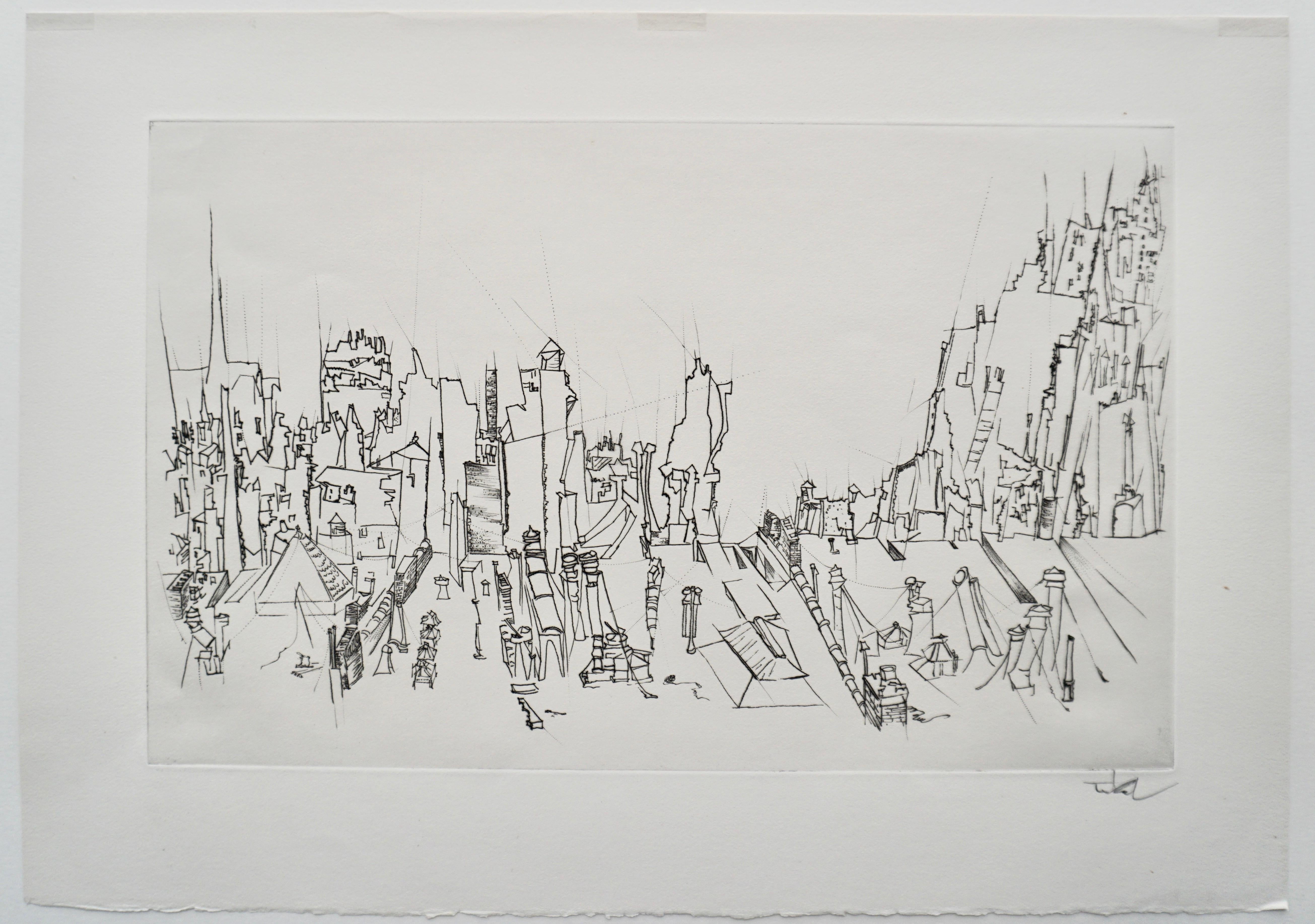
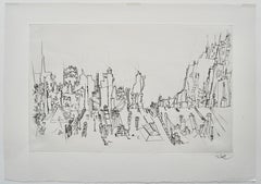
- “City Roofs” drypoint engraving by Peter TakalBy Peter TakalLocated in Berlin, MDPeter Takal’s original drypoint engraving “City Roofs” is an accomplished work of art created in 1956. It is printed upon fine laid paper with full deckled margins as published in the limited edition of two hundred and fifty impressions. This engraving bears an embossed stamp “The Print Club of Chicago” on verso. This impression is signed by Takal in pencil. “City Roofs” is a fine example of the engraved art created by the 20th century Romanian / German / American artist, Peter Takal. Peter Takal: Born in Romania in 1905, Peter Takal spent most of his youth in Berlin and was mainly self-taught. His first one-man exhibition took place in the Gurlitt Gallery, Berlin, in 1932. During the following seven years his art was frequently exhibited at galleries in Berlin, Munich, Paris and as well as Casablanca and Algiers. At the beginning of the Second World War (1939), Peter Takal came to the United States for an exhibition of his art at the Katherine Kuhe Gallery, Chicago. He decided to remain in the United States and became an American citizen in 1944. Living in New York, Peter Takal quickly established himself as a leading printmaker and a modern master of both lithography and drypoint engraving. One-man exhibitions of his art took place in New York City (1942), Chicago (1939 & 1941), Washington (1959) and Los Angeles (1966). International exhibitions of his art were held at the Galeria de Arte Mexicano, Mexico City (1959), the Palazzo Strozzi, Florence, Italy (1960) and at the Kestner-Museum in Germany (1962). Museums to date that include Peter Takal's original prints in their collections are, the Chicago Art Institute, the Library of Congress, Washington, the Los Angeles County Museum of Art, the United States State Department, UCLA, the Berlin National Museum and the Bibliotheque Nationale, Paris. Over the years, the Museum of Modern Art in New York and the Arkansas Arts Center have acquired a very extensive collection of Peter Takal's lithographs and drypoints. The artist died in 1995. The Print Club of Cleveland: Trees and Fields is an original lithograph commissioned by the Print Club of Cleveland in 1957 and published in a signed edition of 250 impressions. The Print Club of Cleveland is a non-profit adjunct organization and the country's first museum-affiliated print club devoted to the promotion of art and printmaking as a fine art for printmakers and collectors alike. With its creation in 1919, it has helped to support the growth of the department of prints and drawings at the Cleveland Museum of Fine Arts and has also been a source of great enrichment for collectors of fine prints. During the organizations long history, the club has annually commissioned one original etching engraving, lithograph, woodcut and or other form of original graphic art from such fine American artists as John Taylor Arms, Suzanne Anker, Luigi Lucioni, Will Barnet, Mark Tobey, Lyonel Feininger, Henry George Keller, Louis Lozowick, Karl Schrag, David Jansheski, Deborah Remington, and Peter Takal, as well as from leading international artists such as Henri Matisse, Edmund Blampied, Jean-Emile Laboureur, Salvador Dali, Michael di Cerbo, Phyliss Sloane, Paolo Boni, Juvenal Sanso...Category
Mid-20th Century Abstract Landscape Prints
MaterialsDrypoint
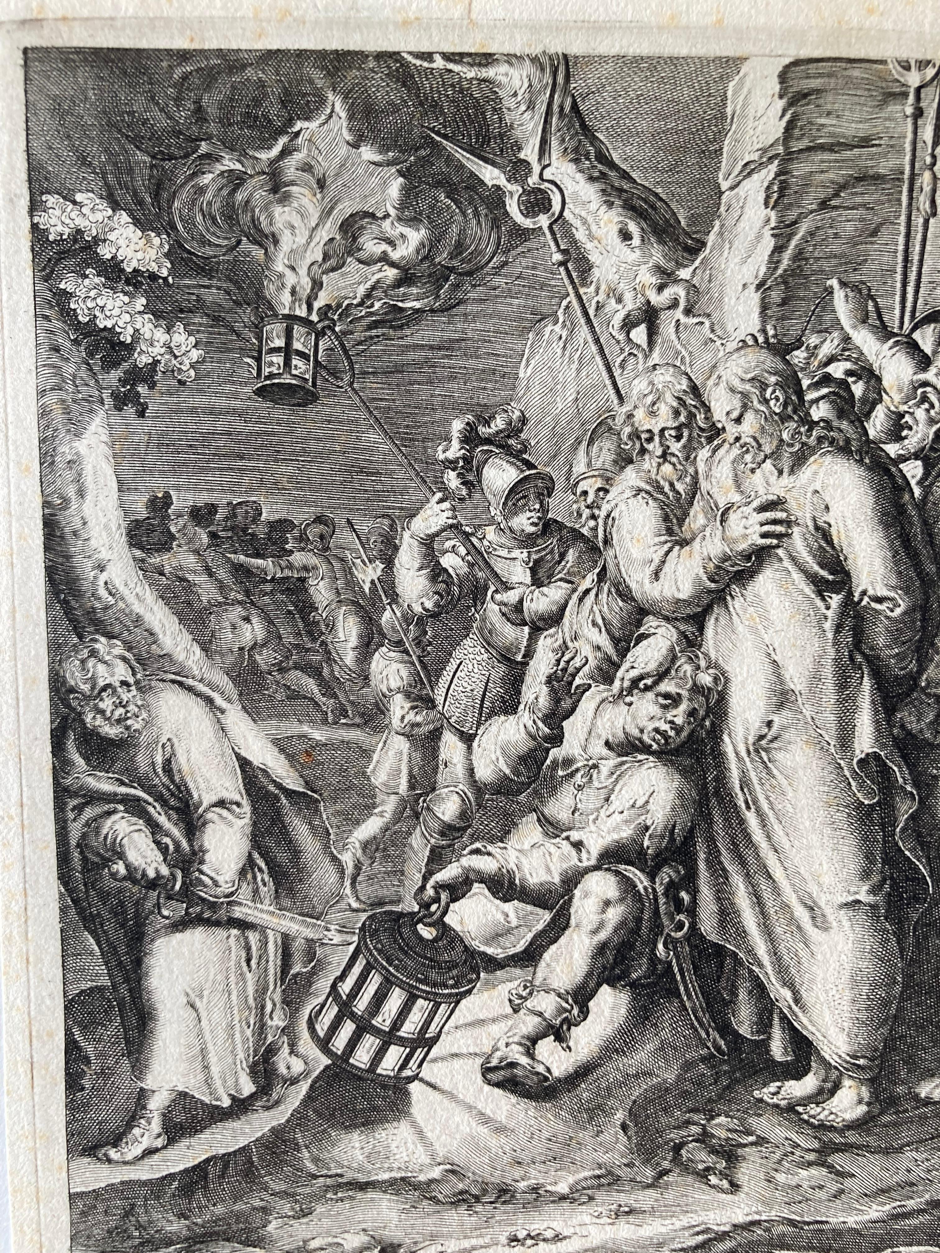
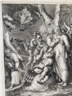
- Arrest of Christ, Engraving, a. Karel van Mander, p. by Gheyn, Passion of ChrisLocated in Greven, DEThe arrest of Christ; Judas embraces Christ as a group of soldiers apprehend Him; Christ places His hand on the fearful Malchus who sits on the ground holding a lamp; Peter grips his...Category
17th Century Northern Renaissance Figurative Prints
MaterialsEngraving
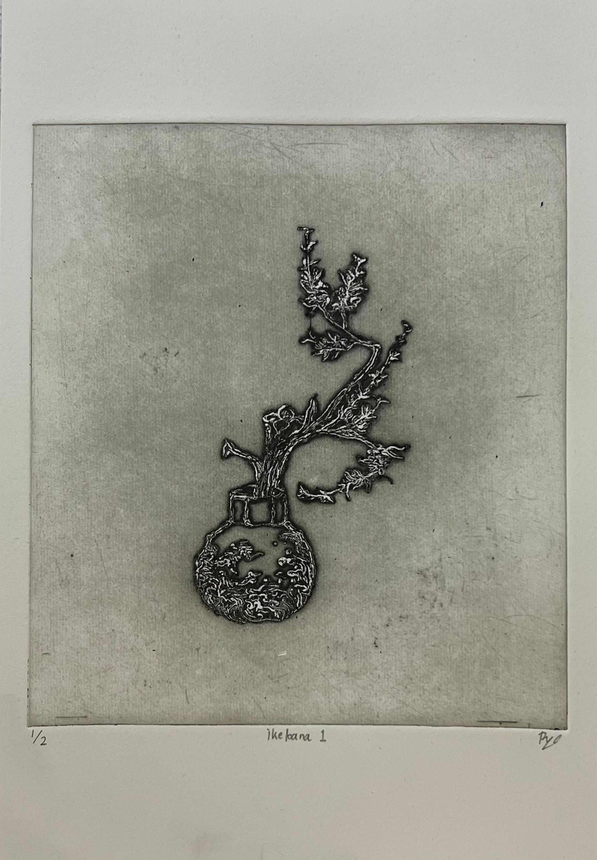
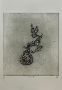
- Ikebana 1Located in Dallas, TXFor this work, the artist made a printing plate by tracing Ikebana images from Kōyō Ikebana Hyakuheizu, a book of illustrations dating to the late 1700s...Category
2010s Contemporary Still-life Prints
MaterialsInk, Archival Paper, Drypoint
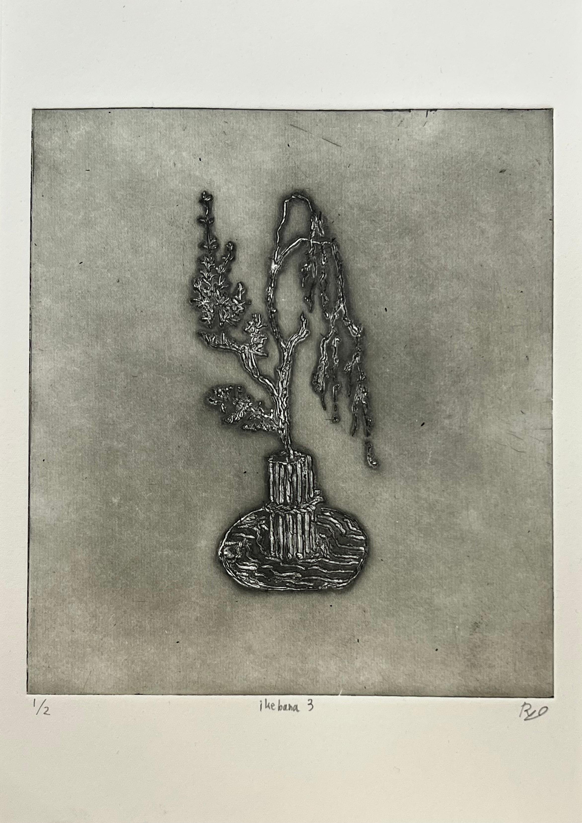
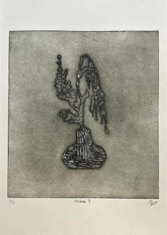
- Ikebana 3Located in Dallas, TXFor this work, the artist made a printing plate by tracing Ikebana images from Kōyō Ikebana Hyakuheizu, a book of illustrations dating to the late 1700s...Category
2010s Contemporary Still-life Prints
MaterialsInk, Archival Paper, Drypoint
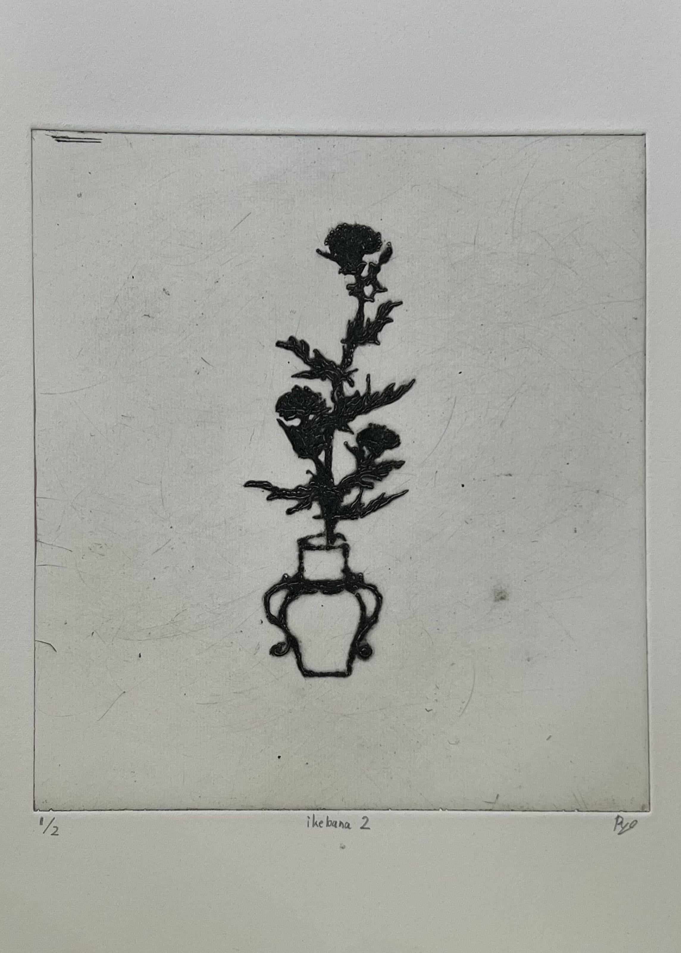
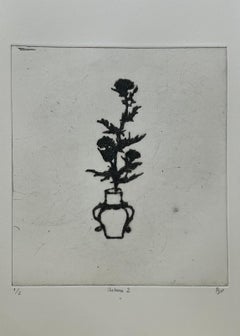
- Ikebana 2Located in Dallas, TXFor this work, the artist made a printing plate by tracing Ikebana images from Kōyō Ikebana Hyakuheizu, a book of illustrations dating to the late 1700s...Category
2010s Contemporary Still-life Prints
MaterialsInk, Archival Paper, Drypoint
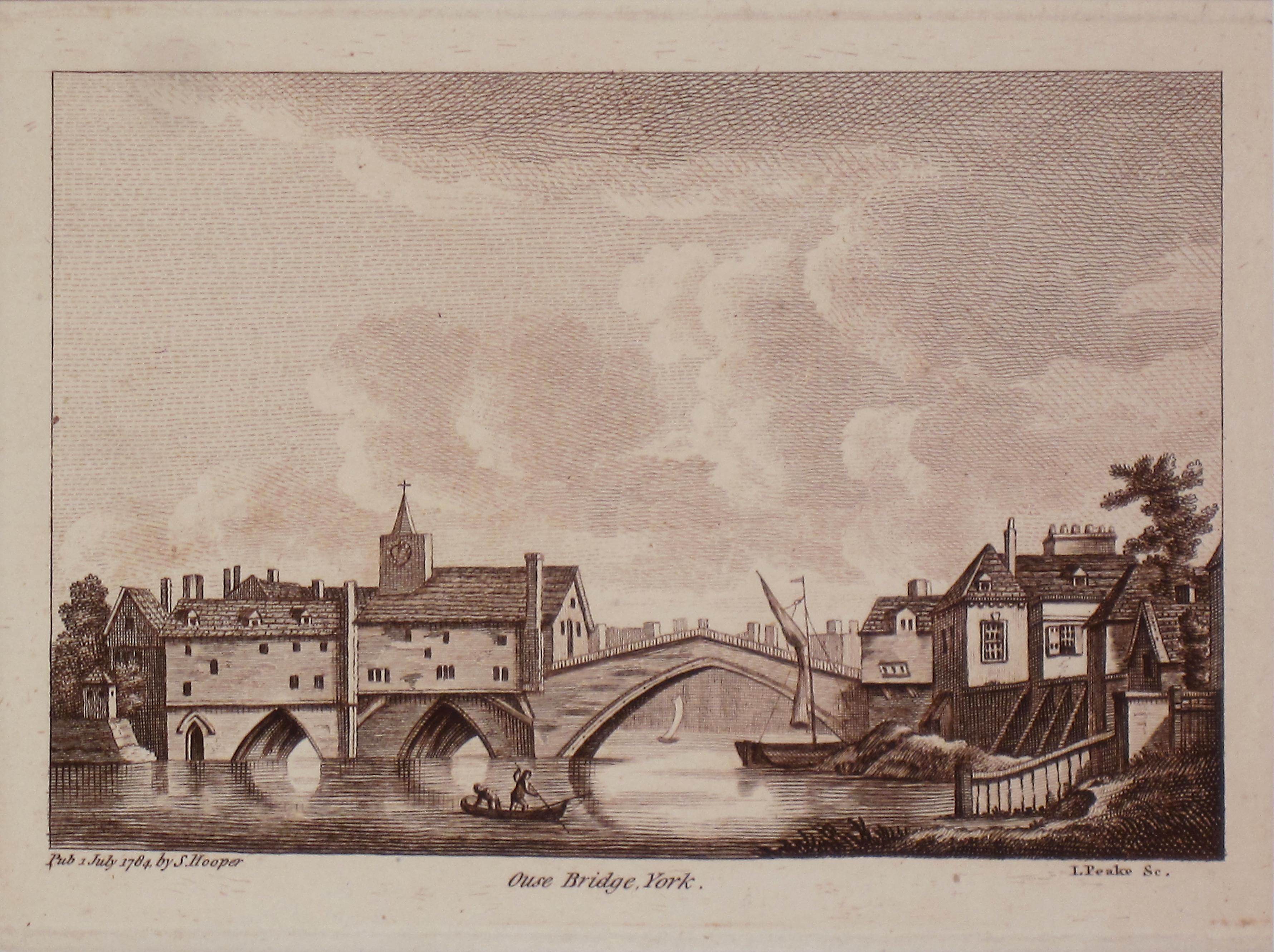
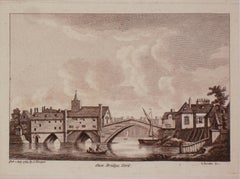
- Ouse Bridge, York. Antique PrintLocated in Sydney, NSWOuse Bridge York Antique Print Matt size 30cm x 33cm Image Size 12cm x 17 cmCategory
1780s Realist Landscape Prints
MaterialsEngraving
Recently Viewed
View AllMore Ways To Browse
Antique Brown Wood
Scotland And England
17th Century England
Coat Of Arms England
England Engraving Framed
Dutch 17th Century Large
Dutch 17th Century Print
17th Century Dutch Style
Hand Colored Map
Putti Art
Framed Banner
Little Angel
Cartouche Large Wood
British Royal Coat
British Royal Arms
Large Wood Angel
Gouda Holland
Dutch Gouda