Items Similar to Antique Map of the British Isles, Insets of the Shetland Islands and Hebrides

Want more images or videos?
Request additional images or videos from the seller
1 of 6
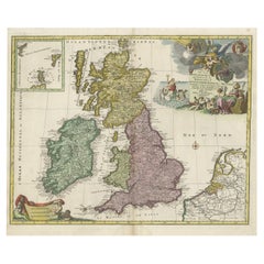
Antique Map of the British Isles, Insets of the Shetland Islands and Hebrides
About the Item
Antique map titled 'Great Britain and Ireland with ye Judges Circuits'. A scarce map of the British Isles, with inset maps of the Shetland Islands and The Hebrides. Large triangular distance chart titled "Distances of the Cities & Shire Towns in England & Wales". Artist assumed to be John Cary. This map originates from "Britannia: or, a chorographical description of the flourishing kingdoms of England, Scotland and Ireland, and the islands adjacent; from the earliest antiquity", by William Camden. Published 1789.
- Dimensions:Height: 16.82 in (42.7 cm)Width: 19.45 in (49.4 cm)Depth: 0.02 in (0.5 mm)
- Materials and Techniques:
- Period:
- Date of Manufacture:1789
- Condition:Wear consistent with age and use. General age-related toning. Original folding line, with splits. Shows some wear and a few tiny defects in margins. Blank verso. Please study image carefully.
- Seller Location:Langweer, NL
- Reference Number:
About the Seller
5.0
Platinum Seller
These expertly vetted sellers are 1stDibs' most experienced sellers and are rated highest by our customers.
Established in 2009
1stDibs seller since 2017
1,922 sales on 1stDibs
Typical response time: <1 hour
- ShippingRetrieving quote...Ships From: Langweer, Netherlands
- Return PolicyA return for this item may be initiated within 14 days of delivery.
More From This SellerView All
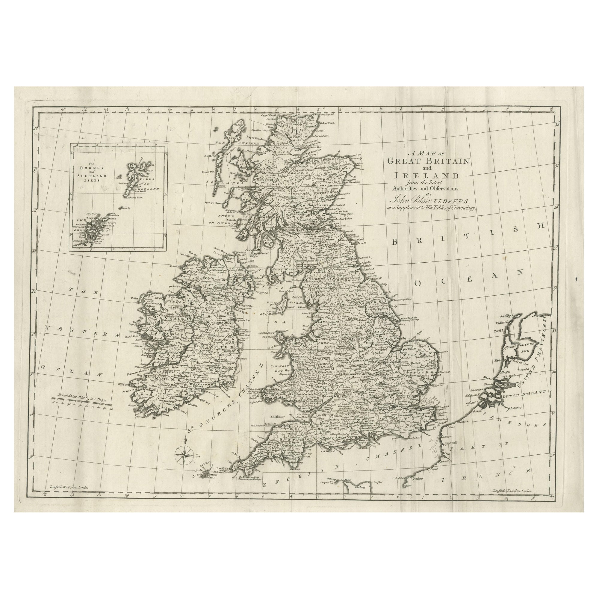
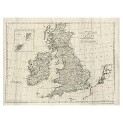
- Large Antique Map of the British Isles, with inset of the Orkneys and ShetlandsLocated in Langweer, NLAntique map titled 'A Map of Great Britain and Ireland (..)'. Large antique map of the British Isles, with part of the French and Dutch coasts, and an inset of the Orkneys and Shetla...Category
Antique Late 18th Century Maps
MaterialsPaper
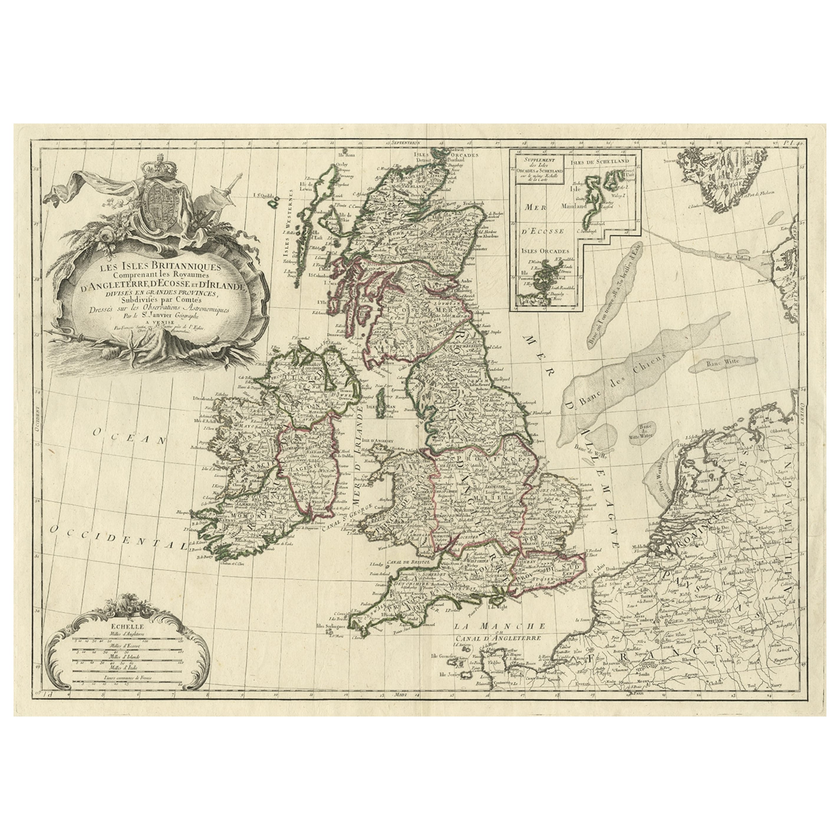
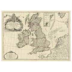
- Attractive Map of the British Isles with an Inset of the Shetland Islands, c1770Located in Langweer, NLAntique map titled 'Les Isles Britanniques Comprenant les Royaumes D'Angleterre D'Ecosse et D'Irlande, Divises en Grandes Provinces Subdivise par Comptes (…).' Attractive map of the British Isles. With inset map including the Orcade and Shetland Islands. Good detail throughout including coastal...Category
Antique 1770s Maps
MaterialsPaper
- Antique Map of Scotland With an Inset Map of the Shetland Islands, 1854Located in Langweer, NLStunning Map of Scotland that will look beautiful in any setting framed on the wall. Description: Large Antique map titled 'Scotland with its Islands, drawn from the Topographical surveys...Category
Antique 1850s Maps
MaterialsPaper
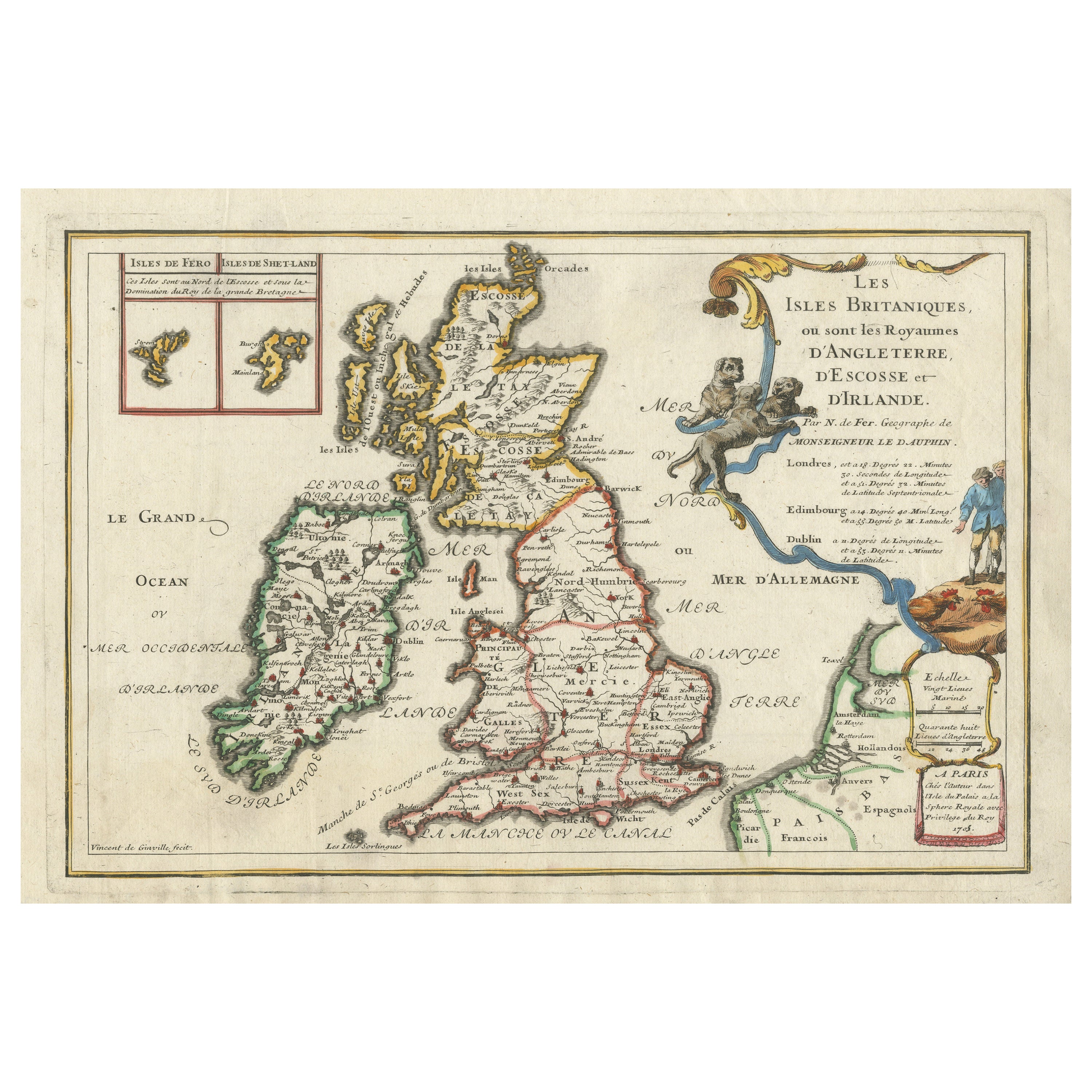
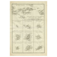
- Old Map of the British Isles with the Faroes and Shetlands, Showing Cock FightsLocated in Langweer, NLAntique map titled 'Les Isles Britaniques ou sont les Royaumes d'Angleterre (..)'. Original old map of the British Isles with inset maps of the Faroes and Shetlands. The title cartouche depicts dog...Category
Antique Early 18th Century Maps
MaterialsPaper
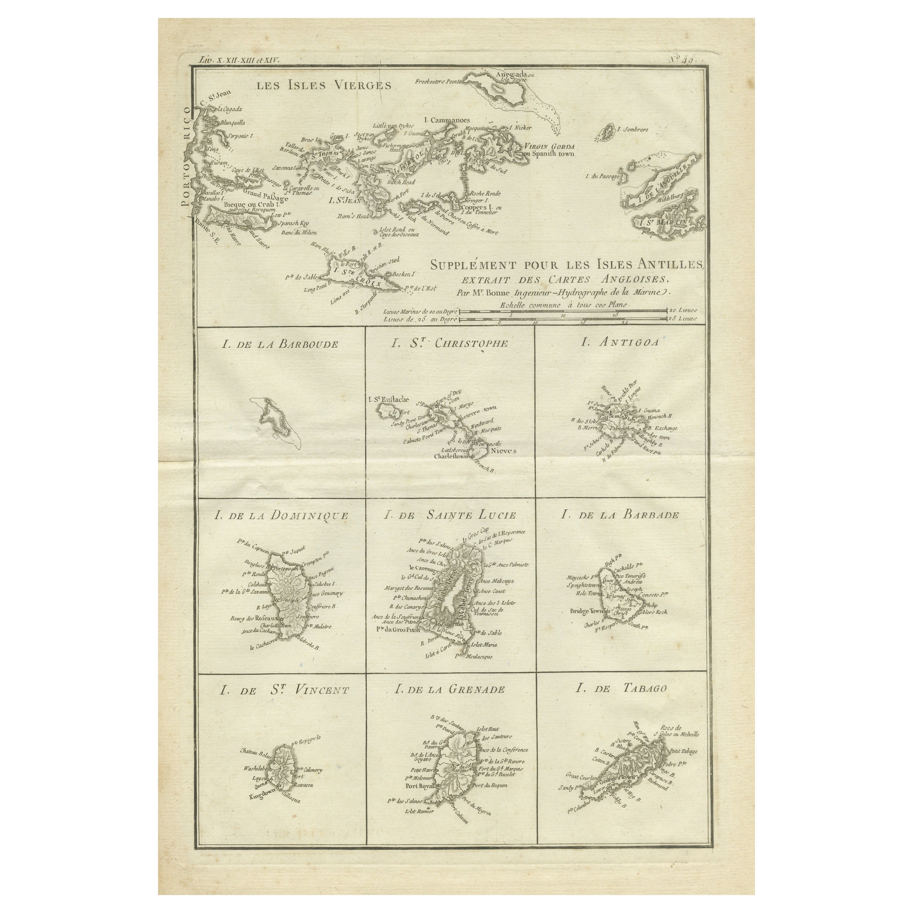
- Original Antique Map of the Virgin Islands with Insets of Caribbean Isles, 1787Located in Langweer, NLAntique map titled 'Supplément pour les Isles Antilles (..)'. Original old map of the Virgin Islands, with insets of Barbuda, St. Kits, Antigua, Dominica, St. Lucia, Barbados, St. Vi...Category
Antique Late 18th Century Maps
MaterialsPaper
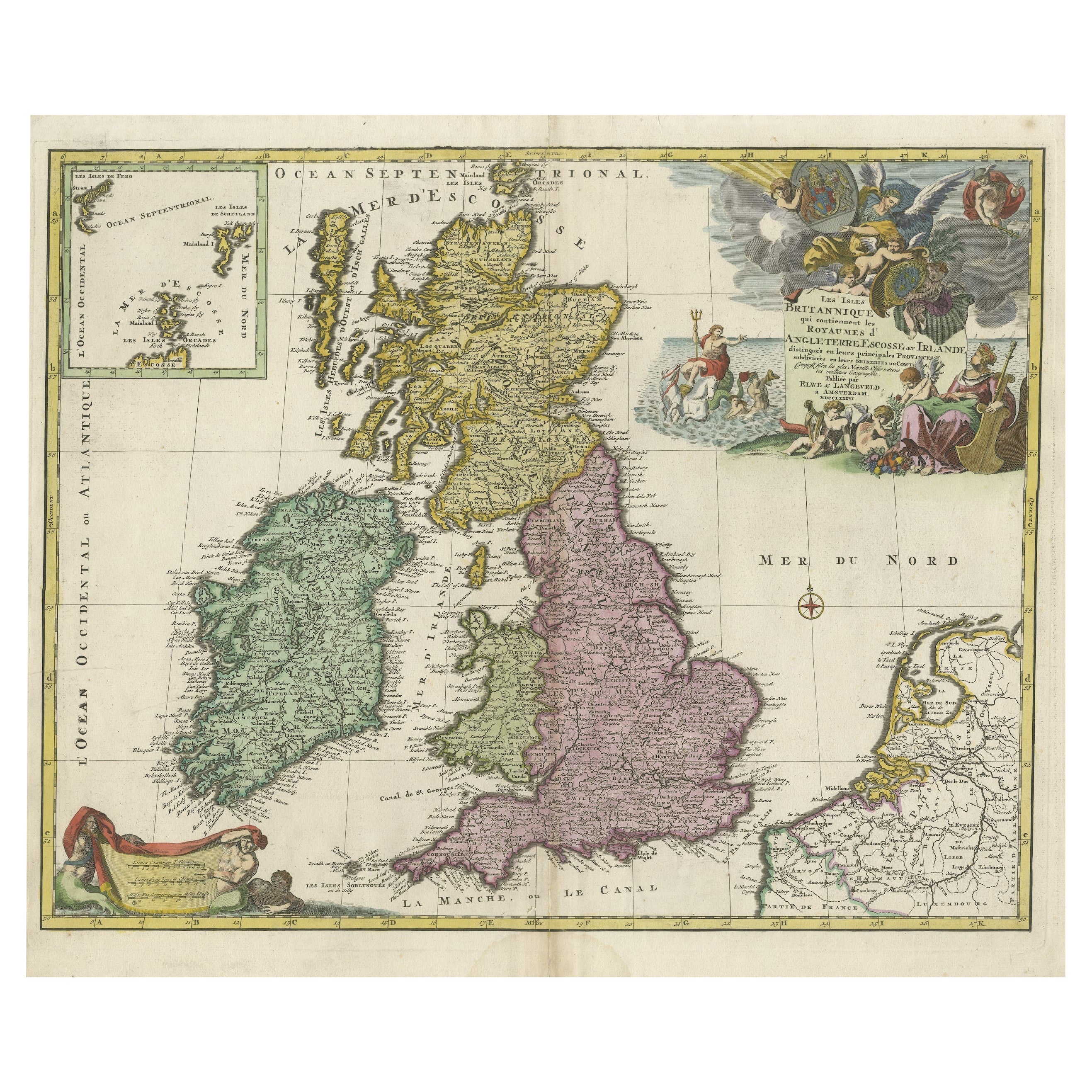
- Old Map of the UK & Ireland, Insets of Orkney, Shetland and Faroe Islands, 1786Located in Langweer, NLTitle: "Les Isles Britanniques qui contiennent les Royaumes d'Angleterre, Escosse, et Irlande". Hand-colored engraved map with 2 (large) decorative cartouches, inset map of the O...Category
Antique 1780s Maps
MaterialsPaper


You May Also Like
- Northwest Coast and Isle of Man MapLocated in Cheshire, GBGreenville Collins Northwest Coast and Isle of Man. hand coloured chart, encased in an ebonised frame. Dimensions Height 26.5 Inches Width 30 Inches Depth 1 InchesCategory
Early 20th Century British Maps
MaterialsPaper
- Large 17th Century Hand Colored Map of England and the British Isles by de WitBy Frederick de WitLocated in Alamo, CAA large hand colored 17th century map of England and the British Isles by Frederick de Wit entitled "Accuratissima Angliæ Regni et Walliæ Principatus", published in Amsterdam in 1680. It is a highly detailed map of England, Scotland, the Scottish Isles...Category
Antique Late 17th Century Dutch Maps
MaterialsPaper
- 1854 Map of Massachusetts, Connecticut and Rhode Island, Antique Wall MapLocated in Colorado Springs, COThis striking wall map was published in 1854 by Ensign, Bridgman & Fanning and has both full original hand-coloring and original hardware. This impression is both informative and highly decorative. The states are divided into counties, outlined in red, green, and black, and subdivided into towns. Roads, canals, and railroad lines are prominently depicted, although they are not all labeled. The mapmakers also marked lighthouses, banks, churches, and prominent buildings, with a key at right. The map is an informative and comprehensive overview of the infrastructural development of New England prior to the Civil War. Physical geographies depicted include elevation, conveyed with hachure marks, rivers and lakes. The impression features an inset map of Boston...Category
Antique 19th Century American Maps
MaterialsPaper
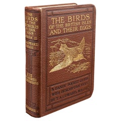
- Antique Book, Birds Of The British Isles, English, Ornithology Reference, C.1920Located in Hele, Devon, GBThis is an antique illustrated book of The Birds of the British Isles. An English, bound ornithology reference title, dating to the early 20th century, published 1920. Full Title - ...Category
Early 20th Century European Mid-Century Modern Books
MaterialsLeather, Paper
- Large Original Vintage Map of British Island Possessions, circa 1920Located in St Annes, LancashireGreat map of British Island Possessions Original color. Good condition Published by Alexander Gross Unframed.Category
Vintage 1920s English Maps
MaterialsPaper
- Antique Lithography Map, Isle of Wight, English, Framed, Engraving, CartographyLocated in Hele, Devon, GBThis is an antique lithography map of the Isle of Wight. An English, framed atlas engraving of cartographic interest, dating to the early 19th century and later. Superb lithography ...Category
Antique Early 19th Century British Regency Maps
MaterialsWood


Recently Viewed
View AllMore Ways To Browse
Shetland Map
Pakistan Antique Map
Armenia Map
Armenian Map
Antique Maps Uk
Antique Uk Map
Antique Uk Maps
Northumberland Map
Uk Antique Map
Ancient Map Of Jerusalem
Antique Jamaica Map
Antique Map Brooklyn
Antique Map Of Brooklyn
Antique Map Of Jamaica
Corse Antique
Map Of The Bahamas
Old Sicily Map
Saudi Arabia Antique Map