Items Similar to Antique Chart of The Spanish Coastline from Bilbao Eastwards, C.1720
Want more images or videos?
Request additional images or videos from the seller
1 of 5
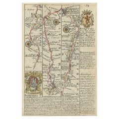
Antique Chart of The Spanish Coastline from Bilbao Eastwards, C.1720
About the Item
Antique map titled 'A Chart of the Sea Coasts Biscay and Gallicia Between Cape Machicaca and Cape de Pinas and from Cape de Pinas to Cape de Finisterre.' Map of the Spanish coastline from Bilbao eastwards. The depicted region ends with Fisterra/Finisterre. This includes the cities Santander, Gijon, Aviles, Ferrol and A Coruna. Rocks/islands and soundings are shown, as are harbours and bridges near the coast. Published by Mount and Page, London. Based on the map by Pieter Goos included in the nautical atlas "De Zee Atlas ofte Water-Weereld" (1666). Possibly from John Seller's "The English Pilot […] for Southern Navigation".
Artists and Engravers: Made by 'James Clark (?)' after 'John Seller'. James Clark (active 1681-ca. 1700) was an English engraver. We are not sure if this is the Ia. Clark mentioned on the map.
Condition: Good, given age. Original middle fold, as issued. A library punch (Brooklyn Public Library) in the right image edge and margin, backed. Middle fold and margins reinforced with Japanese paper on the rear. Some small tears and creasing in the margins. Few small professional repairs. Paper loss in the lower left margin corner, and a little in the top right margin corner. Image good and quite clean. General age-related toning and/or occasional minor defects from handling. Blank verso. Please study image carefully.
Date: c.1720
Overall size: 55.8 x 46 cm
Image size: 53.2 x 43 cm
We also offer thousands of antique prints covering fields of interest as diverse as architecture, natural history, religion, ethnology and many more. Antique prints have long been appreciated for both their aesthetic and investment value. They were the product of engraved, etched or lithographed plates. These plates were handmade out of wood or metal, which required an incredible level of skill, patience and craftsmanship. Whether you have a house with Victorian furniture or more contemporary decor an old engraving can enhance your living space.
- Dimensions:Height: 18.12 in (46 cm)Width: 21.97 in (55.8 cm)Depth: 0 in (0.01 mm)
- Materials and Techniques:
- Period:
- Date of Manufacture:circa 1720
- Condition:
- Seller Location:Langweer, NL
- Reference Number:
About the Seller
5.0
Platinum Seller
These expertly vetted sellers are 1stDibs' most experienced sellers and are rated highest by our customers.
Established in 2009
1stDibs seller since 2017
1,928 sales on 1stDibs
Typical response time: <1 hour
- ShippingRetrieving quote...Ships From: Langweer, Netherlands
- Return PolicyA return for this item may be initiated within 14 days of delivery.
More From This SellerView All
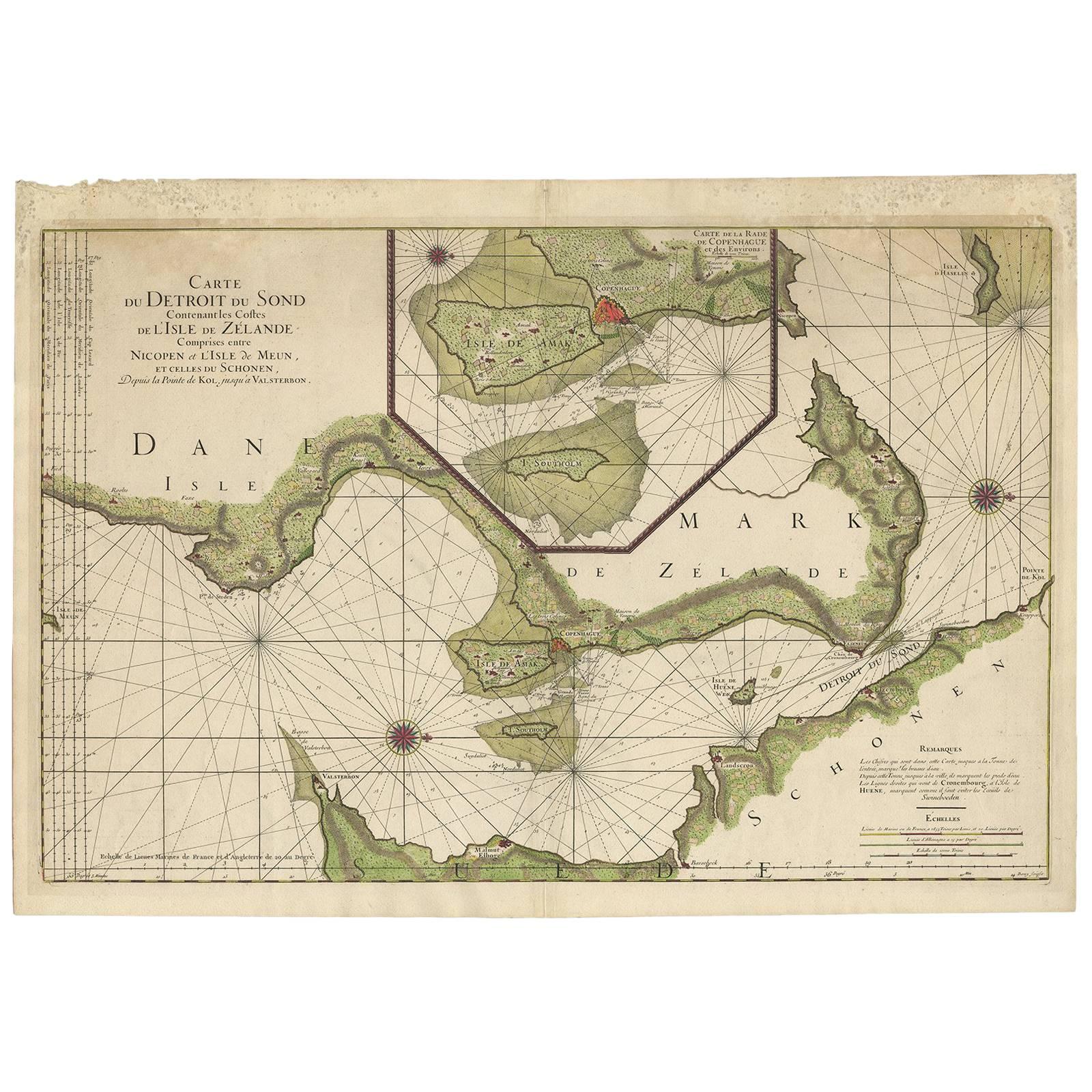
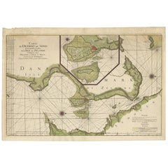
- Antique Sea Chart of the coasts of Denmark and Sweden by C.A. Berey, 1720Located in Langweer, NLThis beautiful large sea chart depicts the Oresund, which forms the border between Skane, Sweden and Sjaelland, Denmark. The chart is filled with navigational details and topographical information along the coastline. A large inset focuses on the area around Copenhagen and the islands of Amager and Saltholm. Two large compass...Category
Antique Early 18th Century Maps
MaterialsPaper
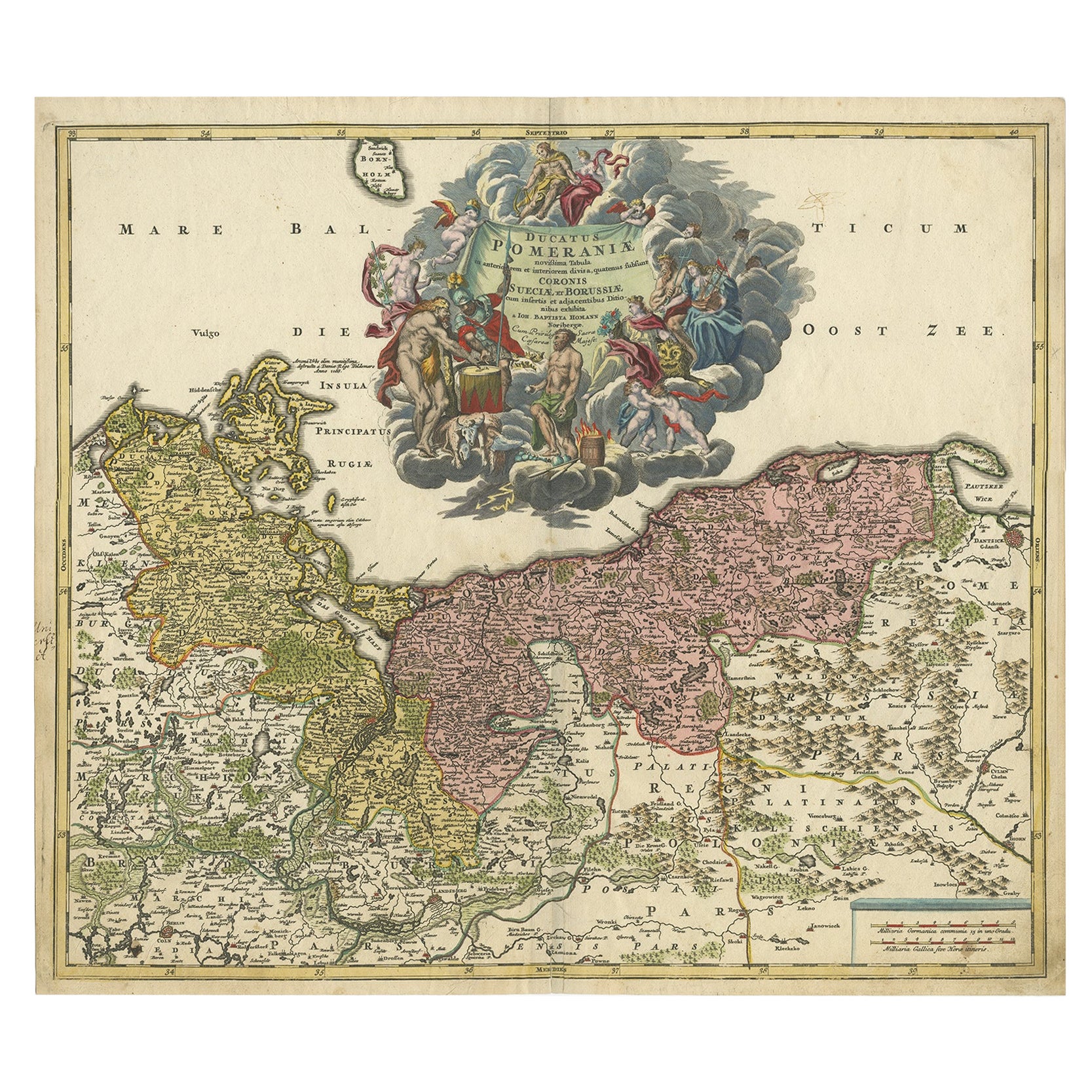
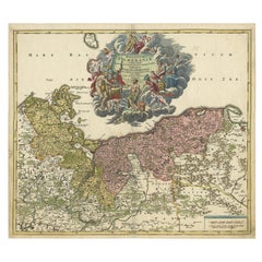
- Regional Antique Map of the Baltic, Extending from Stralsund to Dantzig, ca.1720Located in Langweer, NLAntique map titled 'Ducatus Pomeraniae (..)'. Regional map of the Baltic, extending from Stralsund and Rugia in the west to Dantzig and Culman on the Vistula in the east. Large carto...Category
Antique 1720s Maps
MaterialsPaper
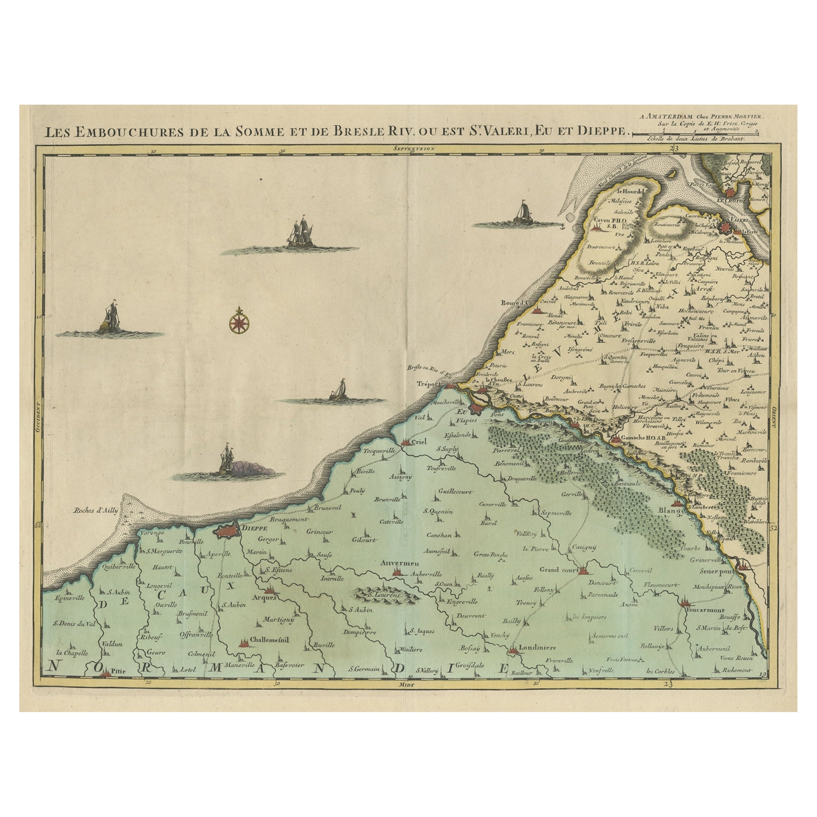
- Beautiful Antique Map of the French Coast, from St. Valeri to Dieppe, 1720Located in Langweer, NLAntique map France titled 'Les Embouchures de la Somme et de Bresle Riv. ou est St. Valeri, Eu et Dieppe'. Beautiful map of the French coast, fr...Category
Antique 1720s Maps
MaterialsPaper
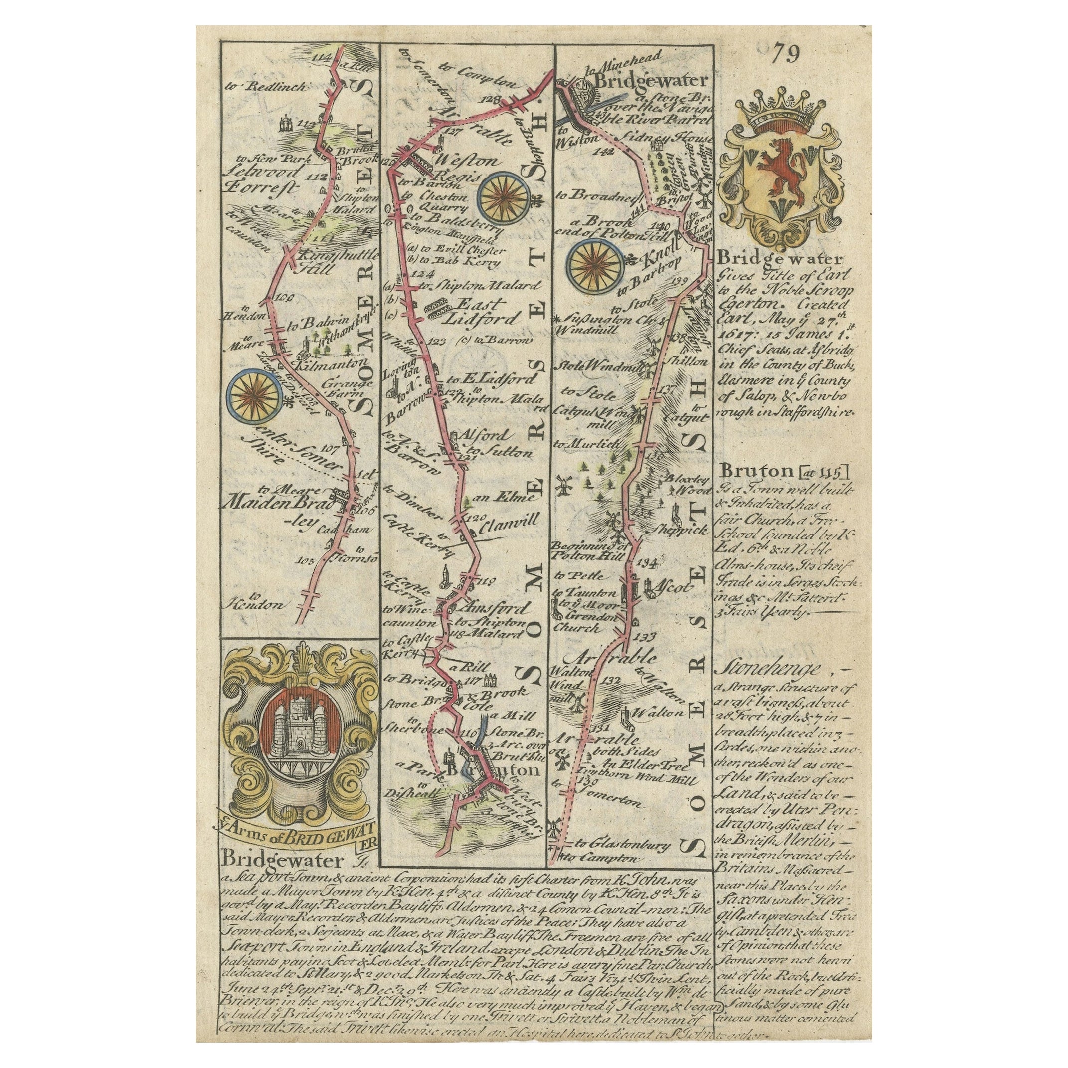
- Rare Antique Map of the Route from Maiden Bridge to Dulverton, England, c.1720By BowenLocated in Langweer, NLAntique map titled 'Bridgewater, Bruton'. Double sided road strip map showing the route from Maiden Bridge to Dulverton, via Bruton, Weston Regis, Bridgewater and Dulverton. This map originates from 'Britannia Depicta or Ogilby Improv'd' by J. Owen and E. Bowen. Artists and Engravers: The Owen and Bowen road strip maps were based on the far larger ones done by John Ogilby in the 1670s. Each map was finely engraved by Emanuel Bowen, who was one of the most renowned and prolific map makers of the 18th century. The maps also had the added feature of copius amounts of information, written by John Owen...Category
Antique 18th Century Maps
MaterialsPaper
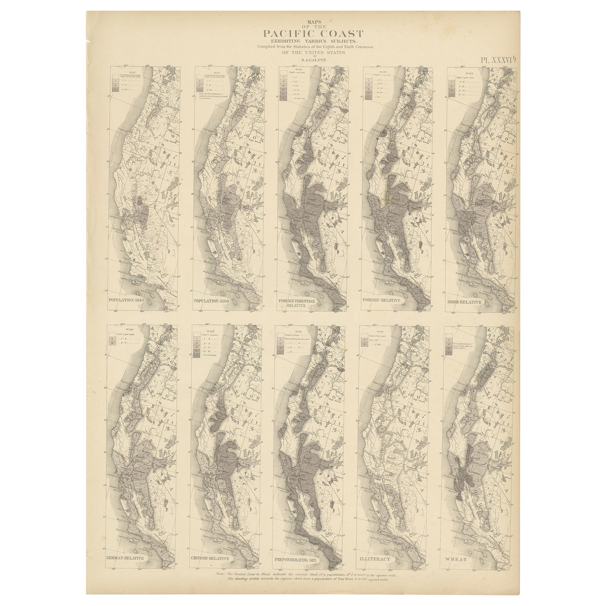
- Antique Chart of the Pacific Coast '1874'Located in Langweer, NLAntique chart titled 'Maps of the Pacific Coast exhibiting various subjects. Compiled from the statistics of the eight and ninth census of the United Sta...Category
Antique Late 19th Century Maps
MaterialsPaper
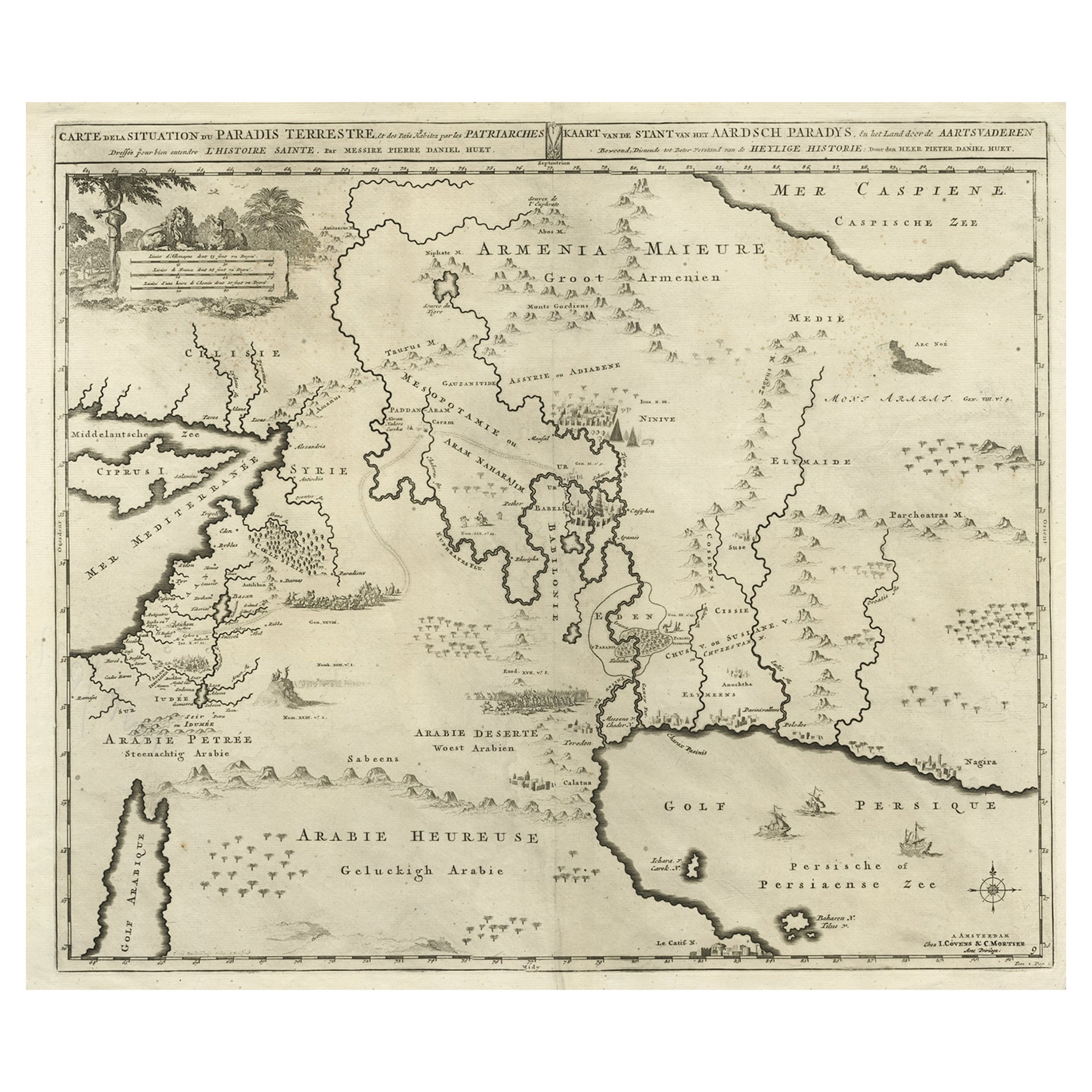
- Biblical Map of the Region from the Mediterranean through the Persian Gulf, 1720Located in Langweer, NLAntique map titled 'Carte de la Situation du Paradis Terrestre, Et des Pais Habitez par les Patriarches Dressee pour bien entendre l'Histoire Sainte, Par Messire Pierre Daniel Huet.' This interesting map covers the region from the Mediterranean through the Persian Gulf. Detail is omitted in favor of Biblical depictions including the Sermon on the Mount...Category
Antique 1720s Maps
MaterialsPaper


You May Also Like
- Antique Anatomical Wall Chart Depicting the Human SkeletonLocated in Berghuelen, DEA rare 19th century anatomical wall chart depicting the human skeleton. On the sides On the sides are detailed description in German language. The wall...Category
Early 20th Century German Victorian Prints
MaterialsPaper
- Antique Foldable Anatomical Wall Chart Depicting Human MusculatureLocated in Berghuelen, DEAntique Foldable Anatomical Wall Chart Depicting Human Musculature The rare 19th century anatomical wall chart depicts the human musculature and inter...Category
Early 20th Century German Victorian Prints
MaterialsWood, Paper
- Set of Twelve Colored Engravings of the Defeat of the Spanish Armada by J. PineLocated in Essex, MABy John Pine considered the foremost heraldic and decorative engraver of his generation. Depicting the defeat of the Spanish by the English Fleet in 1588. These are after a set of tapestries that hung in the House of Commons...Category
Antique 1740s English Prints
MaterialsPaper
- Anatomical Wall Chart Depicting the Human Lymphatic and Blood VesselsLocated in Berghuelen, DEA rare 19-carat anatomical wall chart depicting the human lymphatic and blood vessels. On the sides with detailed description in German language. Print...Category
Early 20th Century German Victorian Prints
MaterialsPaper
- Original Antique Map of Spain and Portugal, circa 1790Located in St Annes, LancashireSuper map of Spain and Portugal Copper plate engraving by A. Bell Published, circa 1790. Unframed.Category
Antique 1790s English Other Maps
MaterialsPaper
- Vintage "View of the Center of Paris Taken from the Air" Lithograph MapLocated in San Diego, CAA very stylish "View of the Center of Paris Taken from the Air" lithograph map published by the Paris Ministry of Tourism, circa early 1950s. The piece measures 27" x 43" and shows...Category
20th Century French Mid-Century Modern Prints
MaterialsPaper


Recently Viewed
View AllMore Ways To Browse
Antiques From Spain
Toner Chart
Antique Spanish Architecture
Spanish Furniture And Decor
City Of London Antiques
Spanish Occasional
Spanish Antiques Metal
Map Spain
Maps Spain
Map Of Spain
Chart Antique
Antique Maps And Charts
18th Century Southern Antiques
Long Island Map
Map Of Long Island
Maps Of Long Island
London City Map
Antique Spanish Plates