Items Similar to Beautiful Antique Map of the French Coast, from St. Valeri to Dieppe, 1720

Want more images or videos?
Request additional images or videos from the seller
1 of 5
Beautiful Antique Map of the French Coast, from St. Valeri to Dieppe, 1720
About the Item
Antique map France titled 'Les Embouchures de la Somme et de Bresle Riv. ou est St. Valeri, Eu et Dieppe'.
Beautiful map of the French coast, from St. Valeri to Dieppe.
Artists and engravers: Pieter und David Mortier were booksellers in Paris and have published a wide range of geographical works. After Pieter's death, his widow continued the business until their son Cornelius took over. Cornelius started a partnership with his brother-in-law Johannes Covens and established the famous publishing house "Covens and Mortier" in Amsterdam.
- Dimensions:Height: 19.69 in (50 cm)Width: 24.02 in (61 cm)Depth: 0 in (0.02 mm)
- Materials and Techniques:
- Period:1720-1729
- Date of Manufacture:1720
- Condition:Wear consistent with age and use. Condition: Very good, general age-related toning. Original/contemporary hand coloring, please study image carefully.
- Seller Location:Langweer, NL
- Reference Number:
About the Seller
5.0
Platinum Seller
These expertly vetted sellers are 1stDibs' most experienced sellers and are rated highest by our customers.
Established in 2009
1stDibs seller since 2017
1,922 sales on 1stDibs
Typical response time: <1 hour
- ShippingRetrieving quote...Ships From: Langweer, Netherlands
- Return PolicyA return for this item may be initiated within 14 days of delivery.
More From This SellerView All
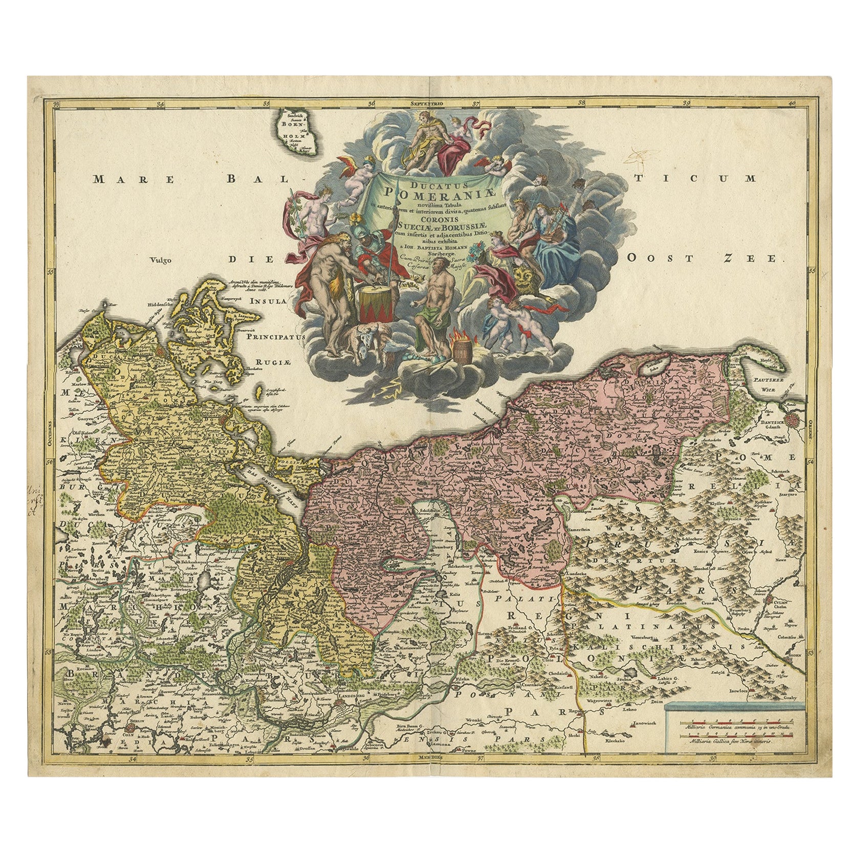
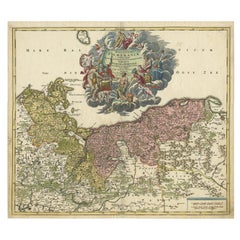
- Regional Antique Map of the Baltic, Extending from Stralsund to Dantzig, ca.1720Located in Langweer, NLAntique map titled 'Ducatus Pomeraniae (..)'. Regional map of the Baltic, extending from Stralsund and Rugia in the west to Dantzig and Culman on the Vistula in the east. Large carto...Category
Antique 1720s Maps
MaterialsPaper
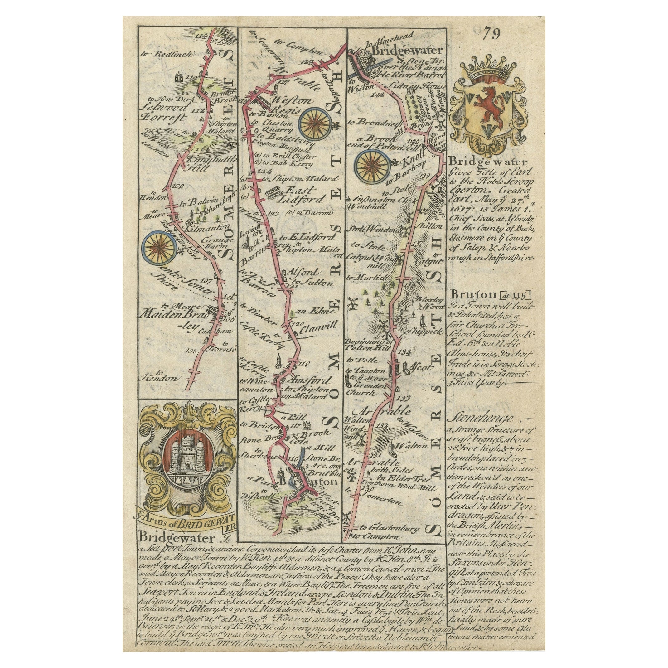
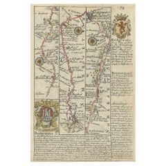
- Rare Antique Map of the Route from Maiden Bridge to Dulverton, England, c.1720By BowenLocated in Langweer, NLAntique map titled 'Bridgewater, Bruton'. Double sided road strip map showing the route from Maiden Bridge to Dulverton, via Bruton, Weston Regis, Bridgewater and Dulverton. This map originates from 'Britannia Depicta or Ogilby Improv'd' by J. Owen and E. Bowen. Artists and Engravers: The Owen and Bowen road strip maps were based on the far larger ones done by John Ogilby in the 1670s. Each map was finely engraved by Emanuel Bowen, who was one of the most renowned and prolific map makers of the 18th century. The maps also had the added feature of copius amounts of information, written by John Owen...Category
Antique 18th Century Maps
MaterialsPaper
- Antique Map of the Coast of France, 1710By Jacobus HarrewijnLocated in Langweer, NLAntique map titled 'Les Embouchures de la Somme et de Bresle'. Map of the coast of Northern France showing the estuaries of the Somme and the Bresle. This map is part of a serie of...Category
Antique Early 18th Century Maps
MaterialsPaper

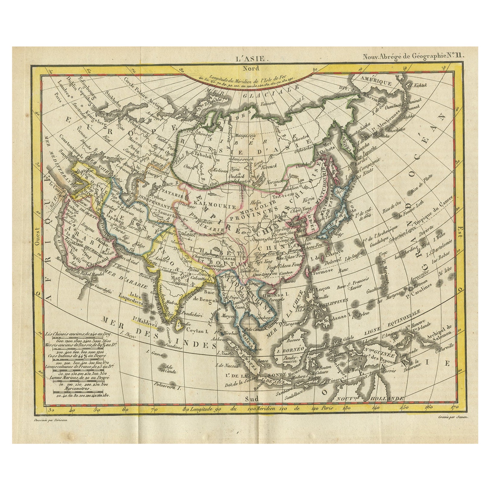
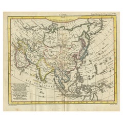
- Antique Map of Asia from the Middle East to the Coast of Alaska, 1816Located in Langweer, NLAntique map titled ‘L’Asie‘. This is an original antique map of Asia, by Hérisson, taken from atlas ""Nouv. Abrége de Géographie"". An engraved map with coloring of Asia from the Mid...Category
Antique 19th Century Maps
MaterialsPaper
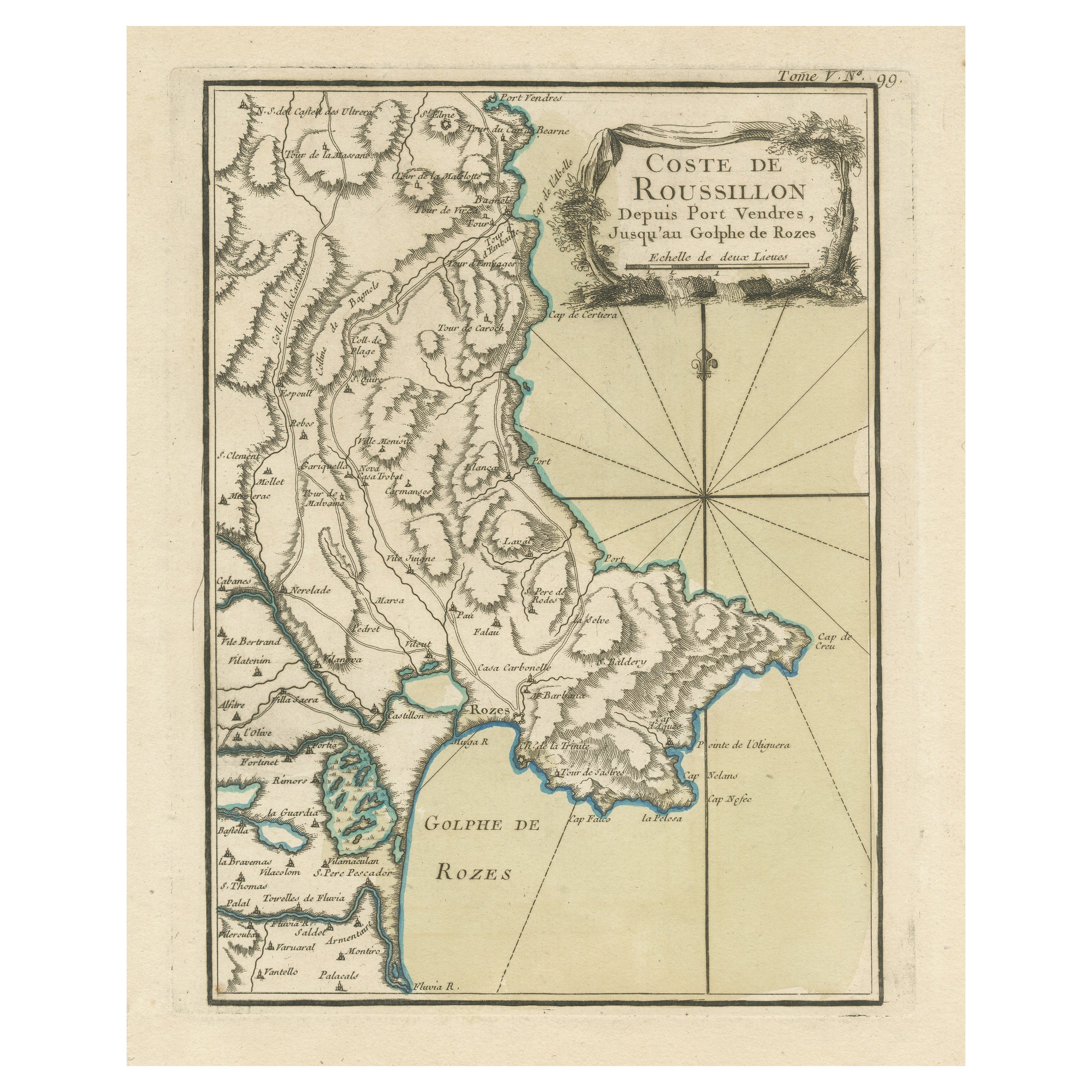
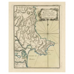
- Antique Map of the Coast of Roussillon, FranceLocated in Langweer, NLAntique map titled 'Coste de Roussillon depuis Port Vendres, jusqu'au golphe de Rozes'. Original map of the coast of Roussillon, France. This map originates from 'Le Petit Atlas Mari...Category
Antique Mid-18th Century Maps
MaterialsPaper
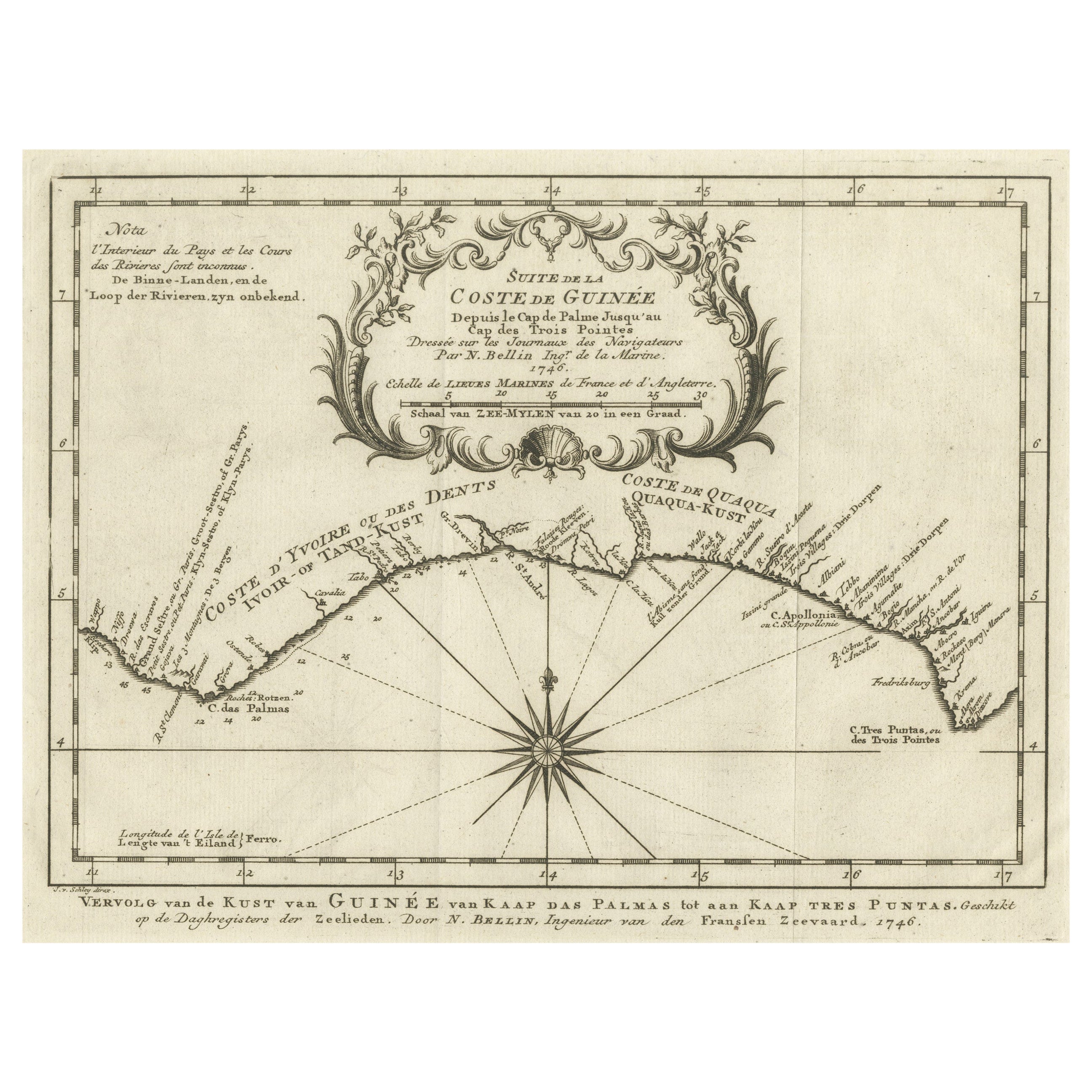
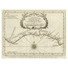
- Antique Map of the Coast of Guinea from, Cape Apollonia to the Volta RiverLocated in Langweer, NLAntique map titled 'Suite de la Coste de Guinée (..) - Vervolg van de Kust van Guinée (..)'. Decorative map of the coast of Guinea from, Cape Apollonia to the Volta River. Engraved b...Category
Antique Mid-18th Century Maps
MaterialsPaper
You May Also Like
- Original Antique Map of France, Arrowsmith, 1820Located in St Annes, LancashireGreat map of France Drawn under the direction of Arrowsmith. Copper-plate engraving. Published by Longman, Hurst, Rees, Orme and Brown, 1820 Unframed.Category
Antique 1820s English Maps
MaterialsPaper
- New Map of North America from the Latest Discoveries, 1763Located in Philadelphia, PAA fine antique 18th century map of the North American seaboard. Entitled "A New Map of North America from the Latest Discoveries 1763". By the Cartographer/Engraver - John Spil...Category
Antique Mid-18th Century English Georgian Maps
MaterialsPaper
- Vintage "View of the Center of Paris Taken from the Air" Lithograph MapLocated in San Diego, CAA very stylish "View of the Center of Paris Taken from the Air" lithograph map published by the Paris Ministry of Tourism, circa early 1950s. The piece measures 27" x 43" and shows...Category
20th Century French Mid-Century Modern Prints
MaterialsPaper
- Map of the Republic of GenoaLocated in New York, NYFramed antique hand-coloured map of the Republic of Genoa including the duchies of Mantua, Modena, and Parma. Europe, late 18th century. Dimension: 25...Category
Antique Late 18th Century European Maps
- Antique Map of Principality of MonacoBy Antonio Vallardi EditoreLocated in Alessandria, PiemonteST/619 - "Old Geographical Atlas of Italy - Topographic map of ex-Principality of Monaco" - ediz Vallardi - Milano - A somewhat special edition ---Category
Antique Late 19th Century Italian Other Prints
MaterialsPaper
- Original Antique Map of The World by Thomas Clerk, 1817Located in St Annes, LancashireGreat map of The Eastern and Western Hemispheres On 2 sheets Copper-plate engraving Drawn and engraved by Thomas Clerk, Edinburgh. Published by Mackenzie And Dent, 1817 ...Category
Antique 1810s English Maps
MaterialsPaper


