Items Similar to Antique Map of the Coast of Guinea from, Cape Apollonia to the Volta River
Want more images or videos?
Request additional images or videos from the seller
1 of 7
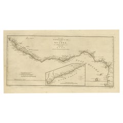
Antique Map of the Coast of Guinea from, Cape Apollonia to the Volta River
About the Item
Antique map titled 'Suite de la Coste de Guinée (..) - Vervolg van de Kust van Guinée (..)'. Decorative map of the coast of Guinea from, Cape Apollonia to the Volta River. Engraved by J. van Schley after J.N. Bellin. Published circa 1764.
Bellin was a French multifaceted hydrographer and geographer had an incredibly successful 50 year career producing maps. His illustrious career started at just 18 years of age when he was appointed Chief Cartographer to the French Navy in 1721. His attention to detail, accuracy and high standard of workmanship resulted in him playing an integral role to France’s leadership in European cartography. In addition to being the Chief Cartographer of France’s hydrographic office, he was also a member of the Académie de Marine, the Royal Society of London, and the Philosophes (French intellectual group).
- Dimensions:Height: 10.04 in (25.5 cm)Width: 15.28 in (38.8 cm)Depth: 0.02 in (0.5 mm)
- Materials and Techniques:Paper,Engraved
- Period:
- Date of Manufacture:circa 1764
- Condition:Wear consistent with age and use. General age-related toning, original folding lines. Minor wear, blank verso. Please study image carefully.
- Seller Location:Langweer, NL
- Reference Number:
About the Seller
5.0
Platinum Seller
These expertly vetted sellers are 1stDibs' most experienced sellers and are rated highest by our customers.
Established in 2009
1stDibs seller since 2017
1,928 sales on 1stDibs
Typical response time: <1 hour
- ShippingRetrieving quote...Ships From: Langweer, Netherlands
- Return PolicyA return for this item may be initiated within 14 days of delivery.
More From This SellerView All
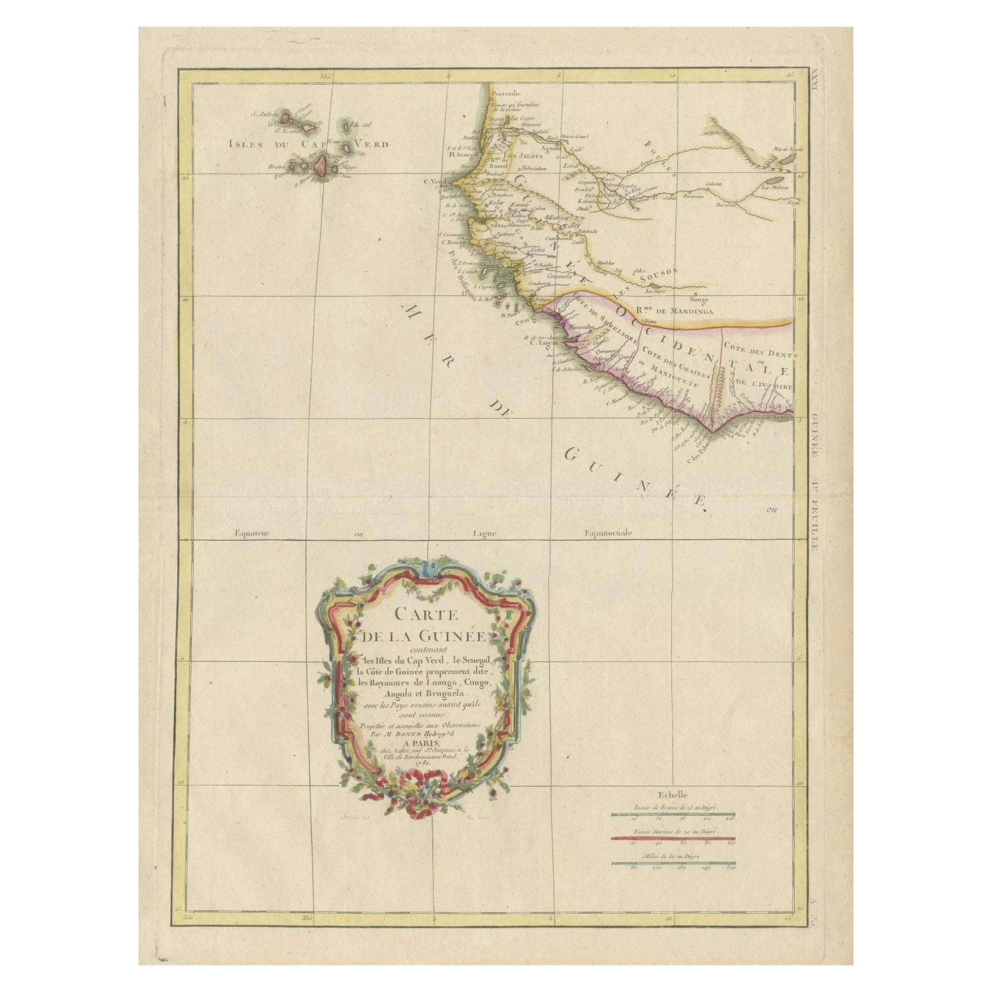
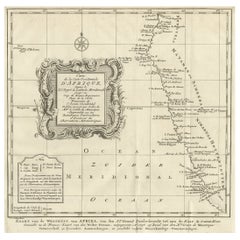
- Antique Map of the Coast of Guinea and the Cape Verde IslandsLocated in Langweer, NLAntique map titled 'Carte de la Guinée (..)'. This map was originally part of a 2 sheet larger map of Eastern Africa, showing the Cape Verde Islands and Senegal. This map originates ...Category
Antique Late 18th Century Maps
MaterialsPaper
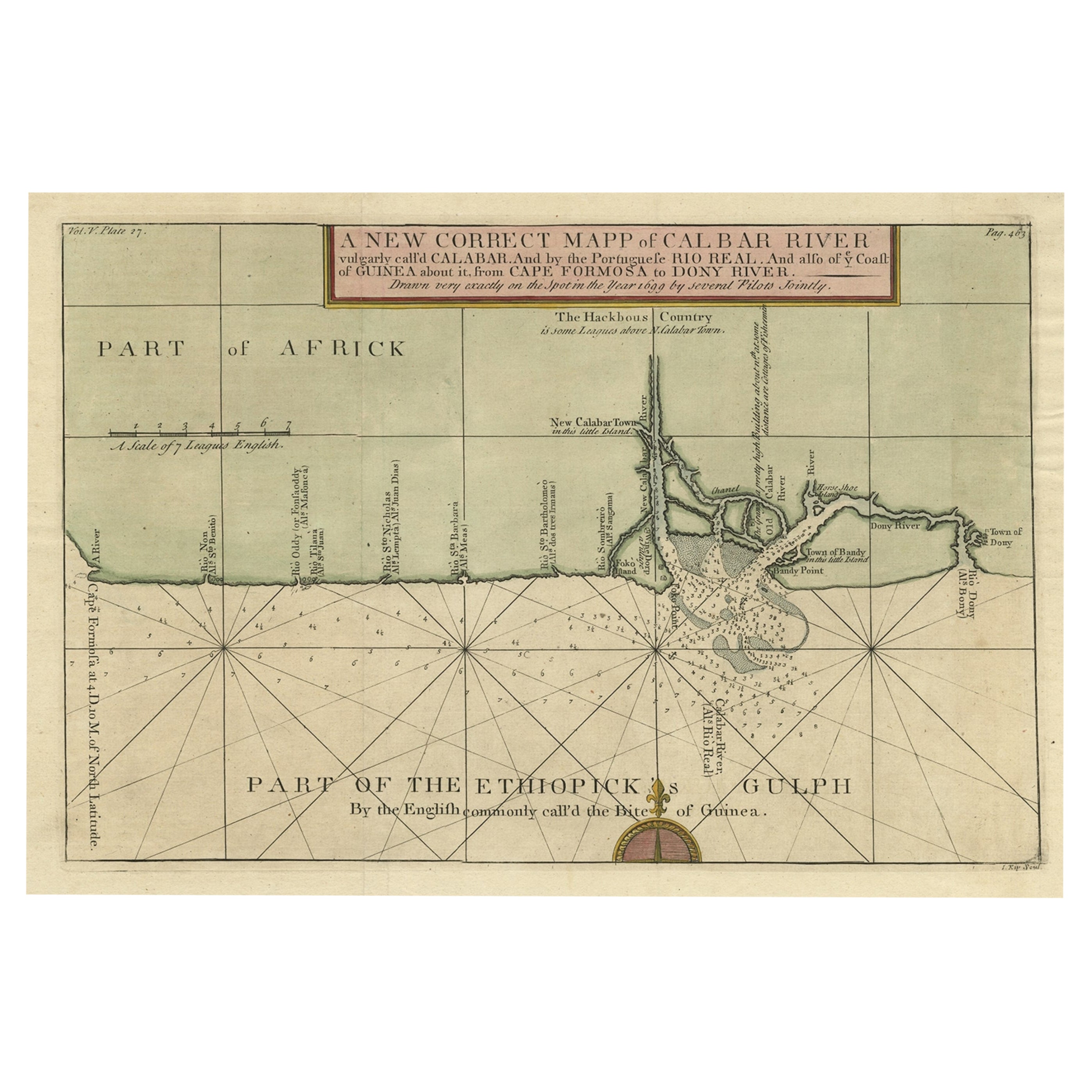
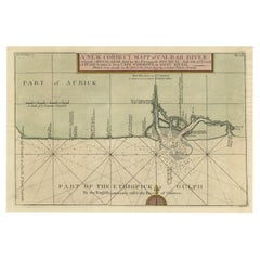
- Authentic Map of the Coast from Cape Formosa to the Dony River, Africa, 1732Located in Langweer, NLAntique map titled 'The New Correct Mapp of Calbar River vulgarly call'd Calabar (..)'. An interesting map of the coast from Cape Formosa to the Dony River stated on the map to be ...Category
Antique 1730s Maps
MaterialsPaper
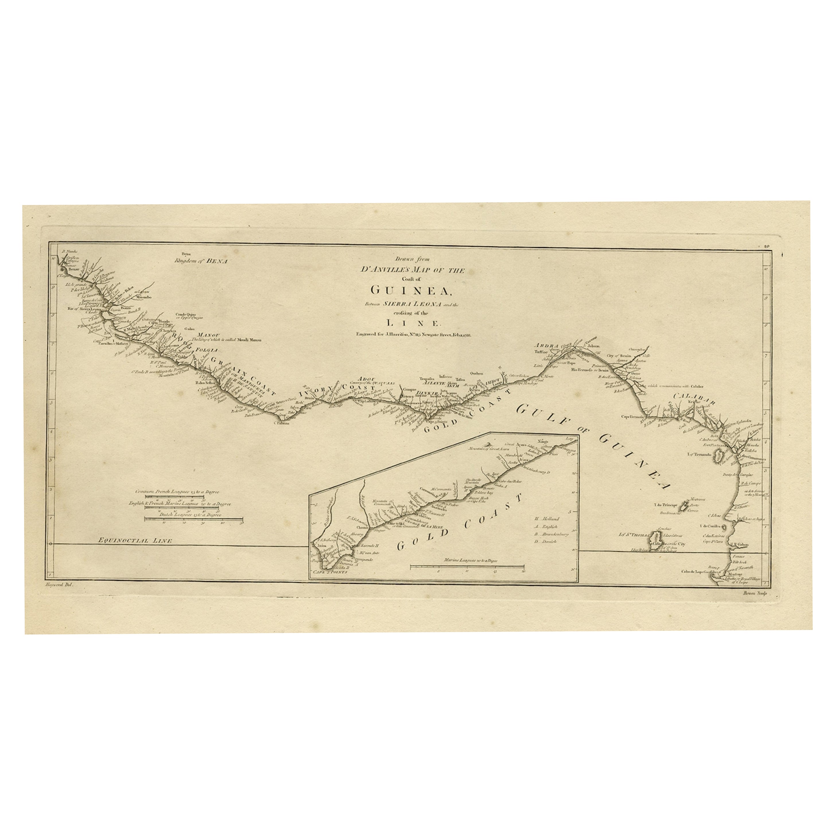
- Map of the African Coast, Gulf of Guinea, from Sierra Leone to Gabon, 1788Located in Langweer, NLAntique map titled 'Drawn from d'Anvilles Map of the Coast of Guinea, Between Sierra Leone and the crossing of the Line.' Map of the African coast, Gulf of Guinea, from Sierra Le...Category
Antique 1780s Maps
MaterialsPaper
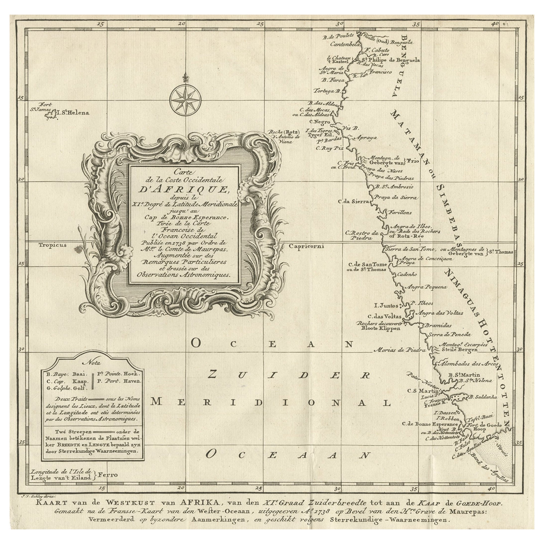
- Dutch Antique Map of the West Coast of Africa, to the Cape of Good Hope, 1747Located in Langweer, NLAntique map of the Coast of Africa titled 'Kaart van de West Kust van Afrika (..)'. Map of the west coast of Africa, from 11 degrees south latitude to the Cape of Good Hope. This...Category
Antique 1740s Maps
MaterialsPaper
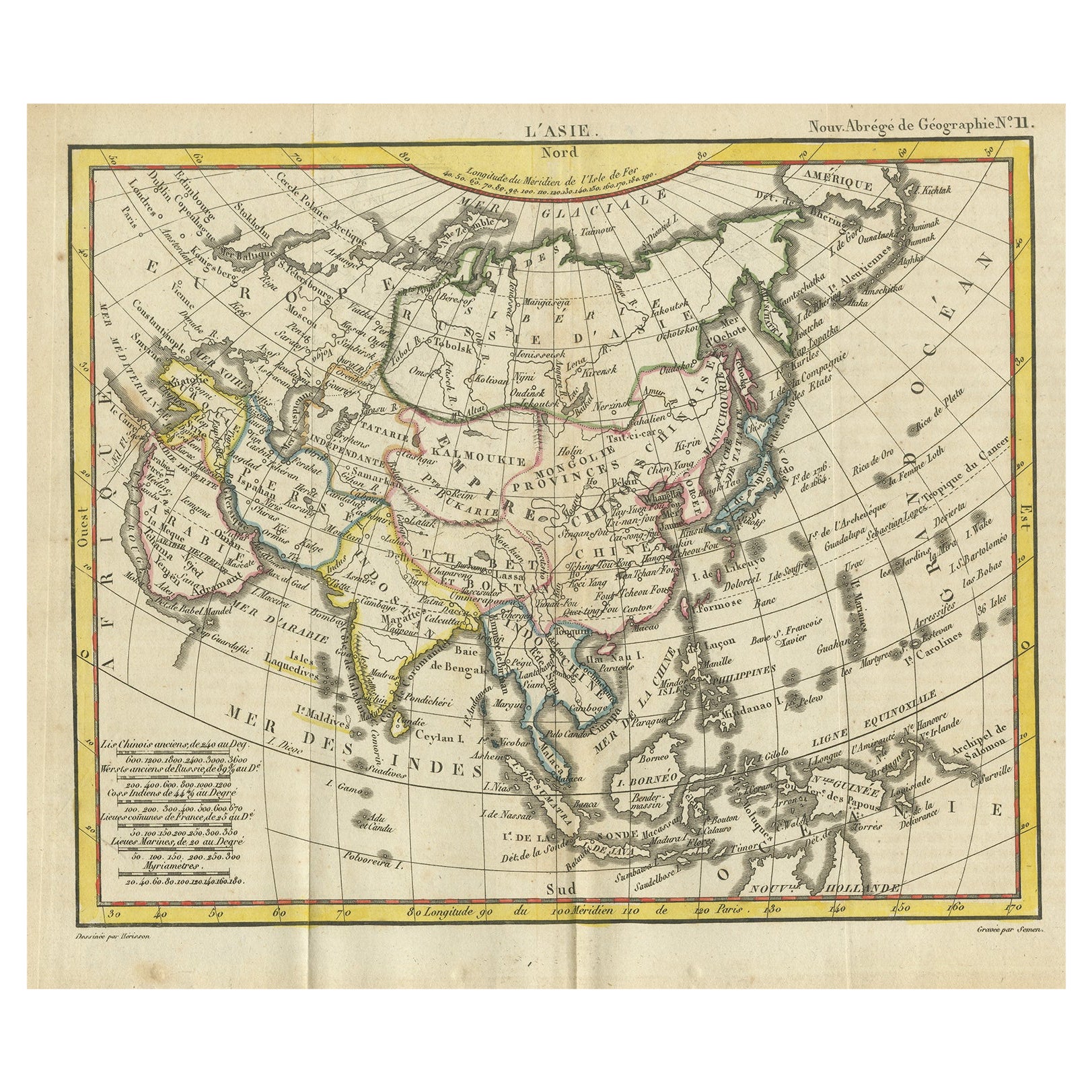
- Antique Map of Asia from the Middle East to the Coast of Alaska, 1816Located in Langweer, NLAntique map titled ‘L’Asie‘. This is an original antique map of Asia, by Hérisson, taken from atlas ""Nouv. Abrége de Géographie"". An engraved map with coloring of Asia from the Mid...Category
Antique 19th Century Maps
MaterialsPaper
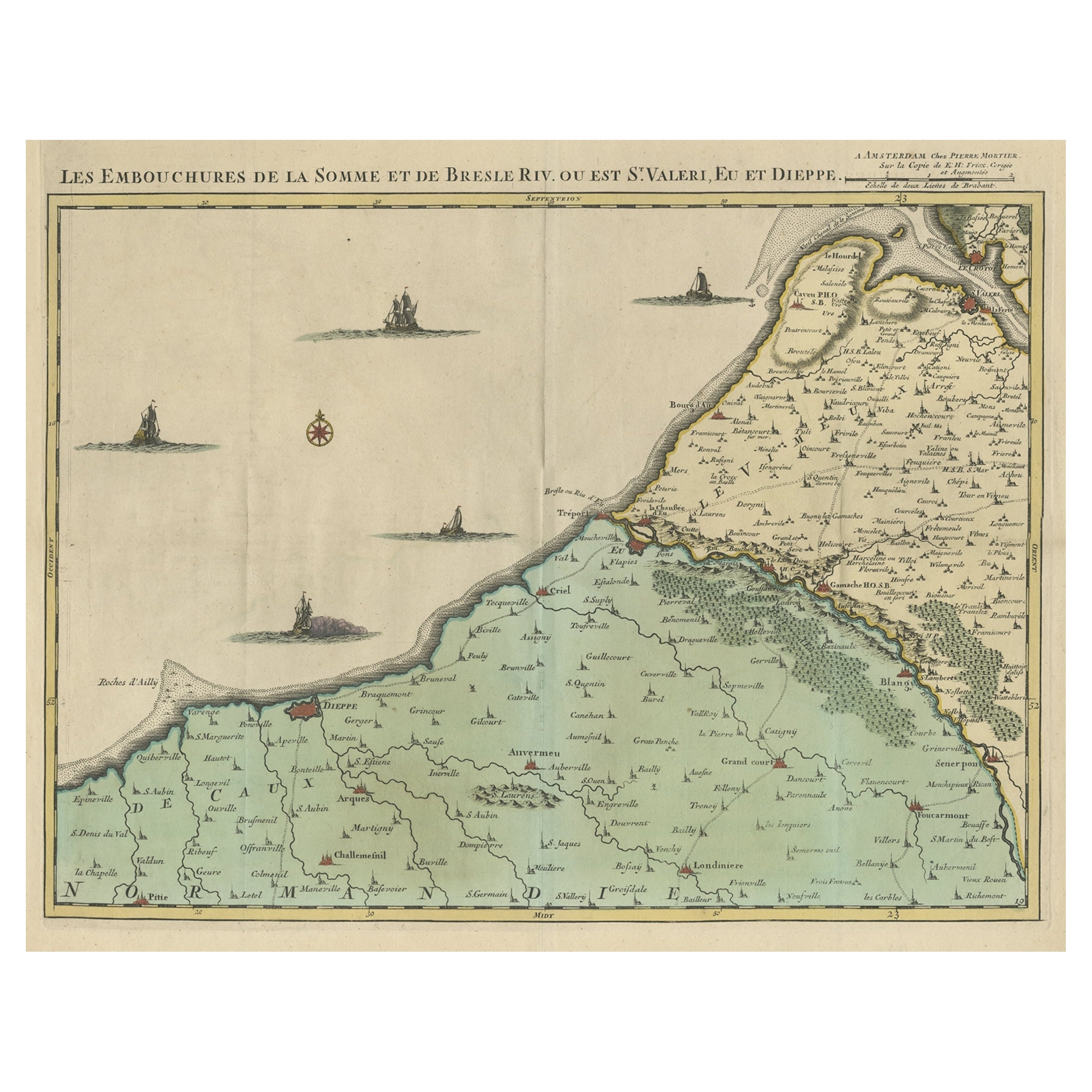
- Beautiful Antique Map of the French Coast, from St. Valeri to Dieppe, 1720Located in Langweer, NLAntique map France titled 'Les Embouchures de la Somme et de Bresle Riv. ou est St. Valeri, Eu et Dieppe'. Beautiful map of the French coast, fr...Category
Antique 1720s Maps
MaterialsPaper

You May Also Like
- West Coast of Africa, Guinea & Sierra Leone: An 18th Century Map by BellinBy Jacques-Nicolas BellinLocated in Alamo, CAJacques Bellin's copper-plate map entitled "Partie de la Coste de Guinee Dupuis la Riviere de Sierra Leona Jusquau Cap das Palmas", depicting the coast of Guinea and Sierra Leone in ...Category
Antique Mid-18th Century French Maps
MaterialsPaper
- Vintage "View of the Center of Paris Taken from the Air" Lithograph MapLocated in San Diego, CAA very stylish "View of the Center of Paris Taken from the Air" lithograph map published by the Paris Ministry of Tourism, circa early 1950s. The piece measures 27" x 43" and shows...Category
20th Century French Mid-Century Modern Prints
MaterialsPaper
- New Map of North America from the Latest Discoveries, 1763Located in Philadelphia, PAA fine antique 18th century map of the North American seaboard. Entitled "A New Map of North America from the Latest Discoveries 1763". By the Cartographer/Engraver - John Spil...Category
Antique Mid-18th Century English Georgian Maps
MaterialsPaper
- Antique Map of Principality of MonacoBy Antonio Vallardi EditoreLocated in Alessandria, PiemonteST/619 - "Old Geographical Atlas of Italy - Topographic map of ex-Principality of Monaco" - ediz Vallardi - Milano - A somewhat special edition ---Category
Antique Late 19th Century Italian Other Prints
MaterialsPaper
- Map of the Republic of GenoaLocated in New York, NYFramed antique hand-coloured map of the Republic of Genoa including the duchies of Mantua, Modena, and Parma. Europe, late 18th century. Dimension: 25...Category
Antique Late 18th Century European Maps
- Original Antique Map of The World by Thomas Clerk, 1817Located in St Annes, LancashireGreat map of The Eastern and Western Hemispheres On 2 sheets Copper-plate engraving Drawn and engraved by Thomas Clerk, Edinburgh. Published by Mackenzie And Dent, 1817 ...Category
Antique 1810s English Maps
MaterialsPaper


Recently Viewed
View AllMore Ways To Browse
Antique Office Suite
Cape Antique Furniture
Antique Marine Maps
Antique Furniture Missouri
Roman Map
Antique Marine Maps
Antique Indian Maps
Antique Africa Maps And Atlases Africa Maps
Antique Maps California
Antique Map California
Map Of Sweden
Antique Maps Of California
Antique Map Of California
Scottish Coat Of Arms
Expedition Map
Ocean Decor
California Antique Map
Antique New York City Maps