Items Similar to Map of the African Coast, Gulf of Guinea, from Sierra Leone to Gabon, 1788
Want more images or videos?
Request additional images or videos from the seller
1 of 5
Map of the African Coast, Gulf of Guinea, from Sierra Leone to Gabon, 1788
About the Item
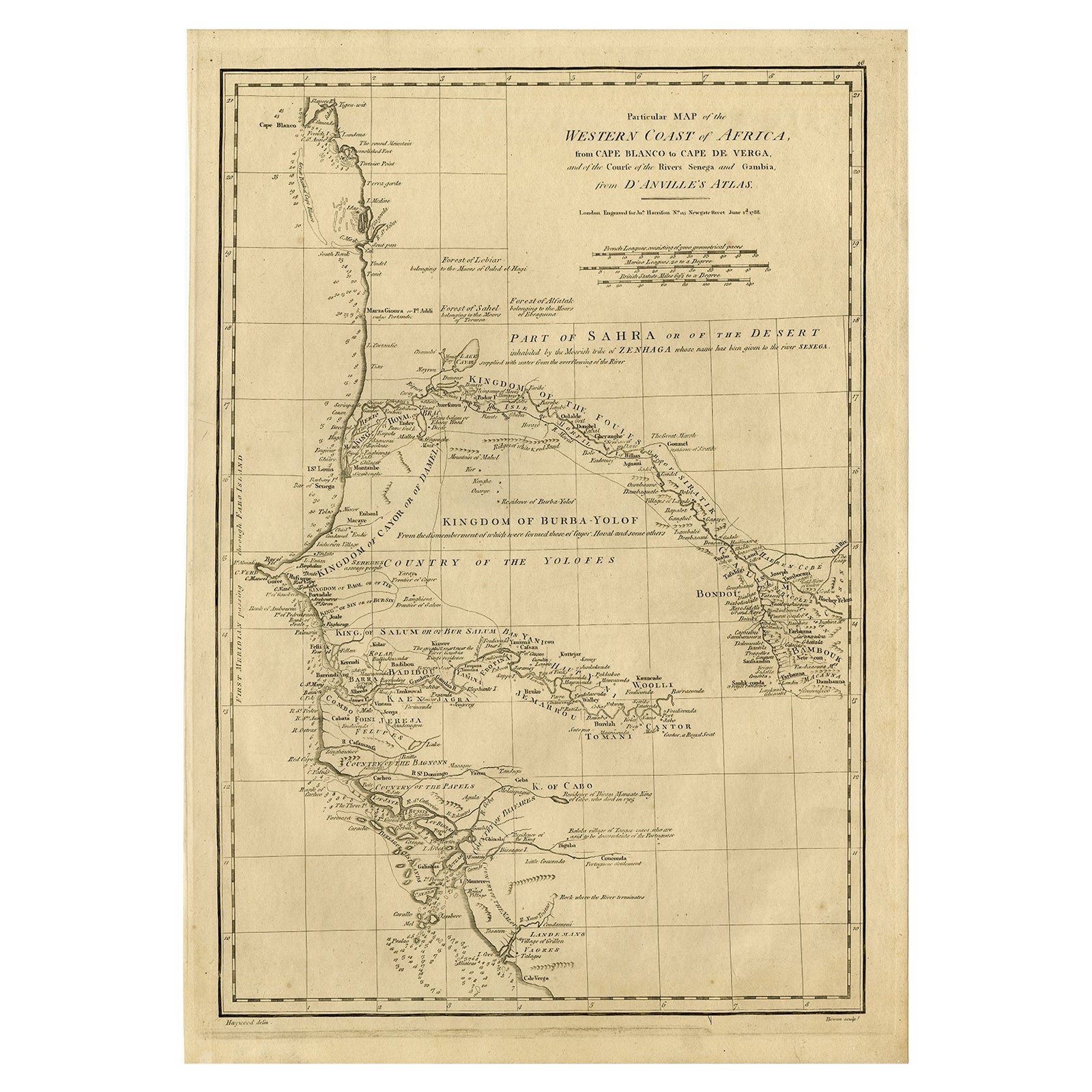
Antique map titled 'Drawn from d'Anvilles Map of the Coast of Guinea, Between Sierra Leone and the crossing of the Line.'
Map of the African coast, Gulf of Guinea, from Sierra Leone to Gabon (this includes Liberia, Ivory Coast, Ghana, Togo, Benin, Nigeria, Cameroon and Gabon). An inset repeats the part that is now Ghana (roughly between Takoradi and Accra), detailing which colonial power owned what. Published by J. Harrison, 1788.
Artists and Engravers: Made by 'Bowen' after 'Haywood'.
- Dimensions:Height: 14.26 in (36.2 cm)Width: 21.38 in (54.3 cm)Depth: 0 in (0.02 mm)
- Materials and Techniques:
- Period:1780-1789
- Date of Manufacture:1788
- Condition:Wear consistent with age and use. Condition: Very good, given age. Some scattered spots of foxing in the margins and map. Two tiny wormholes in the left margin. General age-related toning and/or occasional minor defects from handling. Please study image carefully.
- Seller Location:Langweer, NL
- Reference Number:
About the Seller
5.0
Platinum Seller
These expertly vetted sellers are 1stDibs' most experienced sellers and are rated highest by our customers.
Established in 2009
1stDibs seller since 2017
1,916 sales on 1stDibs
Typical response time: <1 hour
- ShippingRetrieving quote...Ships From: Langweer, Netherlands
- Return PolicyA return for this item may be initiated within 14 days of delivery.
More From This SellerView All
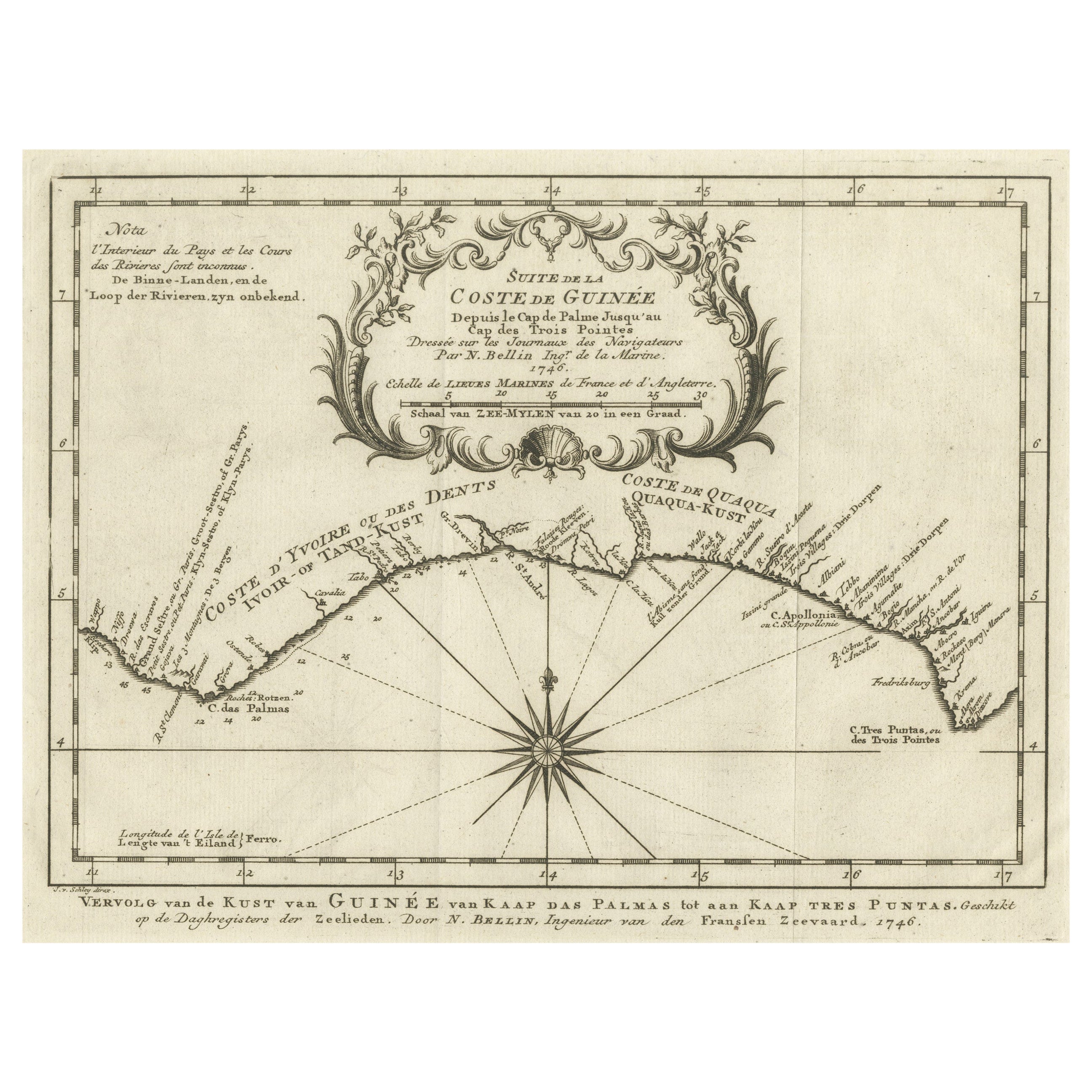
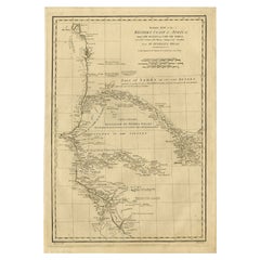
- Map of the West African coast from the North of Mauretania to Guinee, 1788Located in Langweer, NLAntique map titled 'Particular Map of the Western Coast of Africa, from Cape Blanco to Cape de Verga, and of the Course of the Rivers Senega and Gambia.' Map of the African coast...Category
Antique 1780s Maps
MaterialsPaper
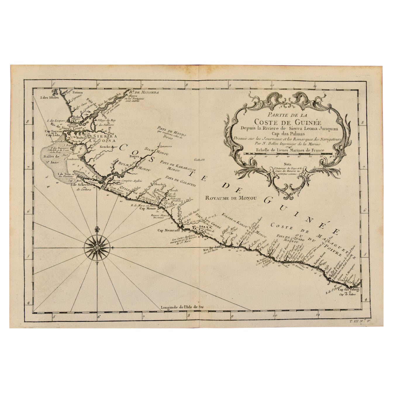
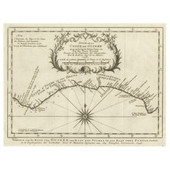
- Antique Map of the Coast of Guinea from, Cape Apollonia to the Volta RiverLocated in Langweer, NLAntique map titled 'Suite de la Coste de Guinée (..) - Vervolg van de Kust van Guinée (..)'. Decorative map of the coast of Guinea from, Cape Apollonia to the Volta River. Engraved b...Category
Antique Mid-18th Century Maps
MaterialsPaper
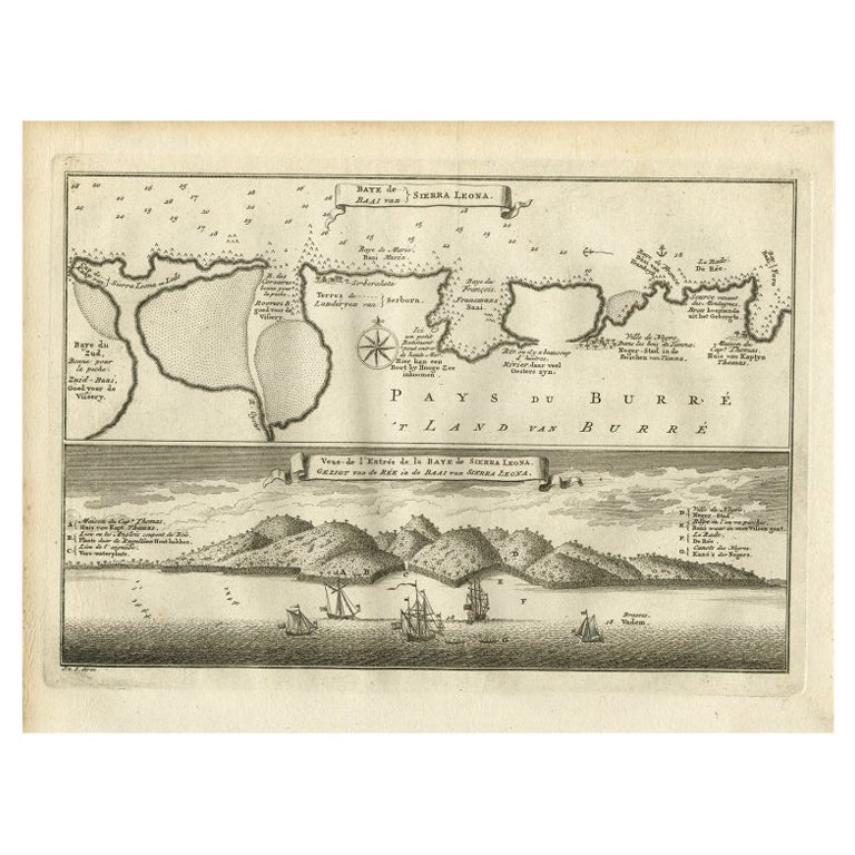
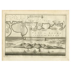
- Antique Map and View of the Bay of Sierra Leone in Africa, C.1750Located in Langweer, NLAntique print titled 'Baye de Sierra Leona (..) - Baai van Sierra Leona (..)'. Map and view of the bay of Sierra Leone. This print originates from 'Historische beschryving der Reizen...Category
Antique 18th Century Prints
MaterialsPaper
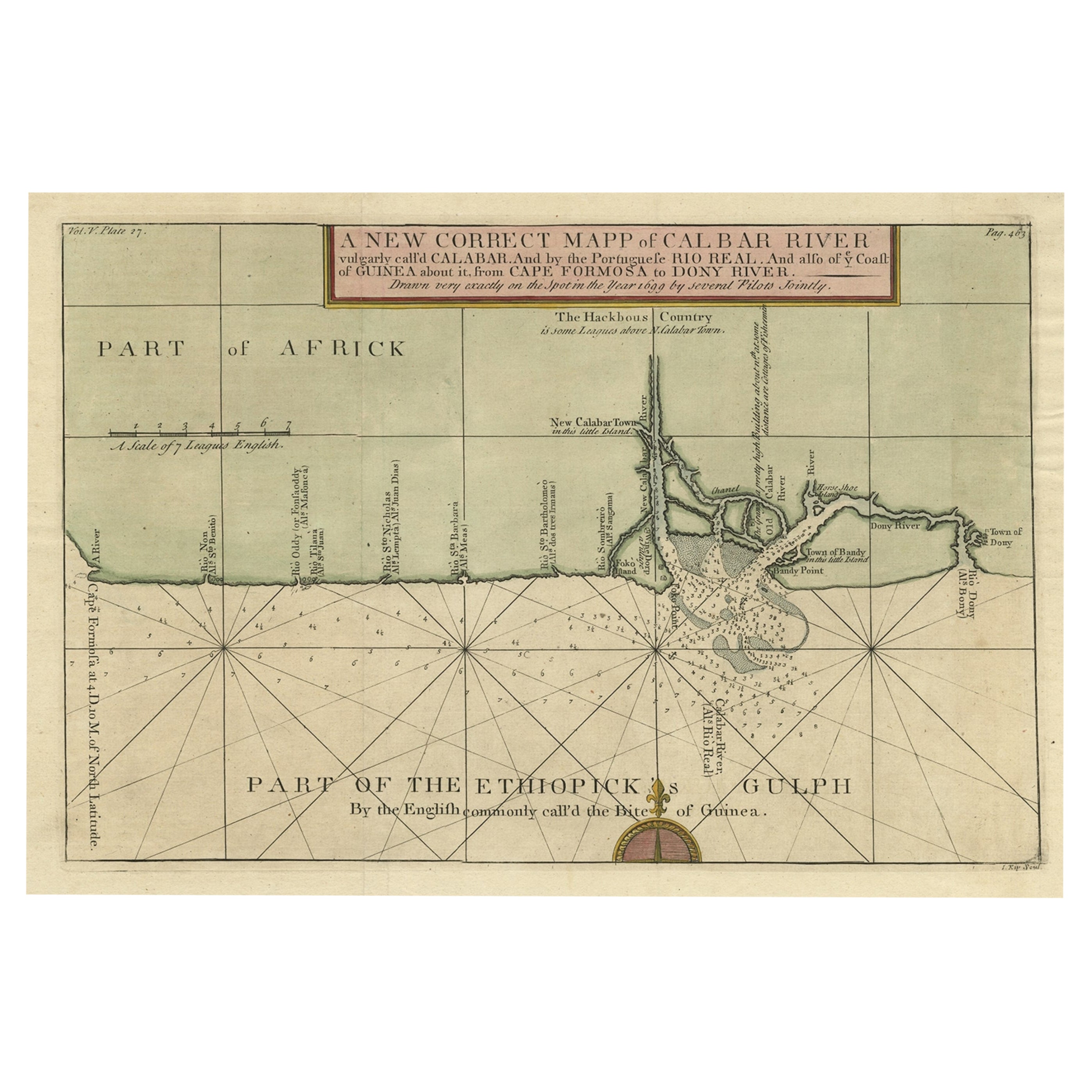
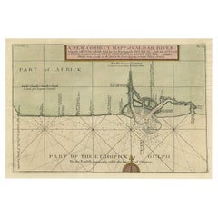
- Authentic Map of the Coast from Cape Formosa to the Dony River, Africa, 1732Located in Langweer, NLAntique map titled 'The New Correct Mapp of Calbar River vulgarly call'd Calabar (..)'. An interesting map of the coast from Cape Formosa to the Dony River stated on the map to be ...Category
Antique 1730s Maps
MaterialsPaper
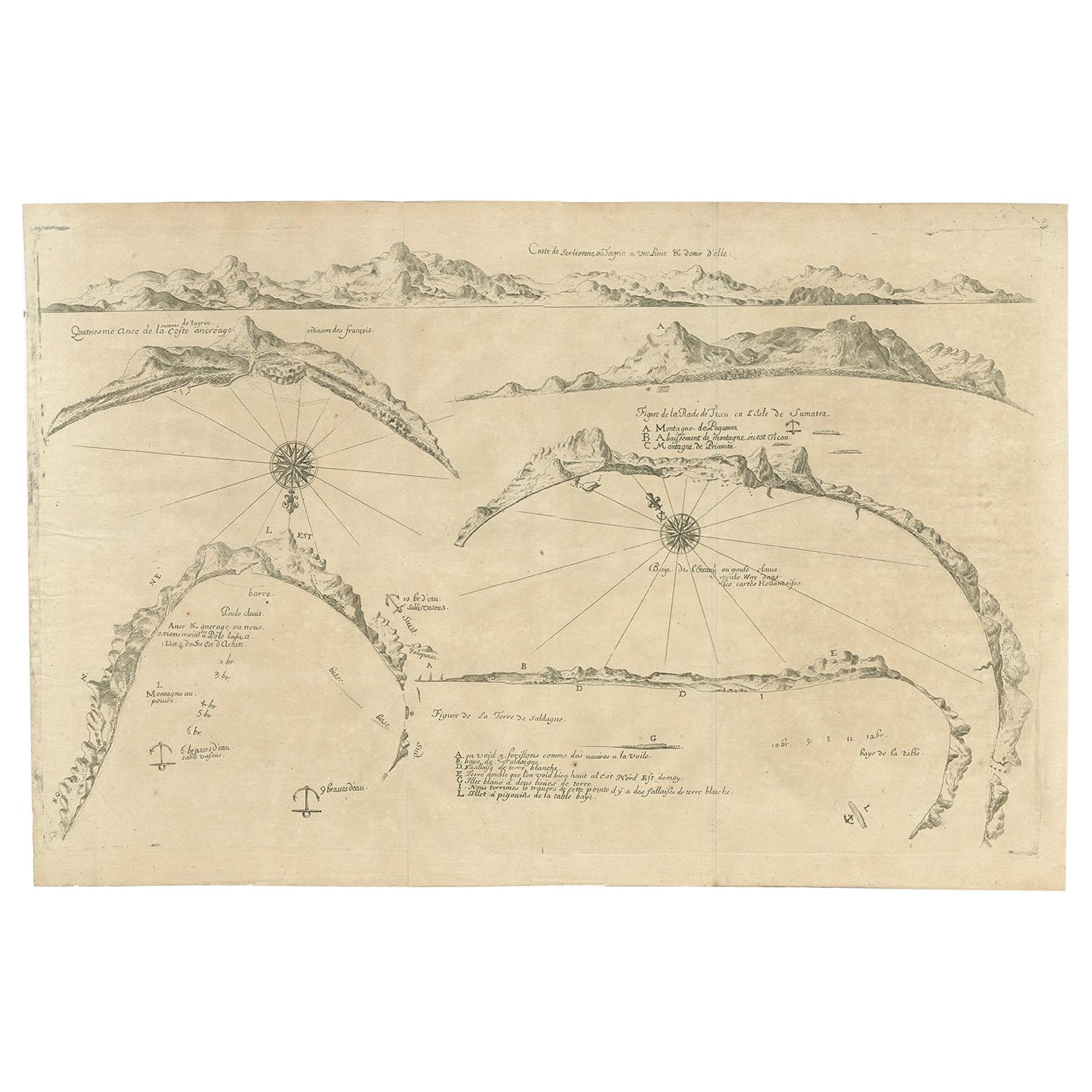
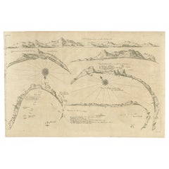
- Rare Map of Six Coast Views and Anchorages of Sierra Leone and Indonesia, 1660Located in Langweer, NLThis rare antique map includes six coastal elevation views of anchorages and bays favored by Dutch and French vessels on their way to Asia. Two views of the coast of Sierra Leone, Africa "Tagrin" opposite Freetown. A view of the coast of Aceh on the northern coast of Sumatra and a further unidentified anchorage "Baye de l'Encau". A view of the African coast including the Bay of Saldagne and Table Bay...Category
Antique 17th Century Maps
MaterialsPaper
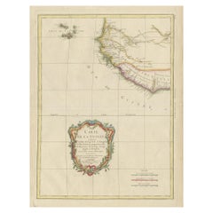
- Antique Map of the Coast of Guinea and the Cape Verde IslandsLocated in Langweer, NLAntique map titled 'Carte de la Guinée (..)'. This map was originally part of a 2 sheet larger map of Eastern Africa, showing the Cape Verde Islands and Senegal. This map originates ...Category
Antique Late 18th Century Maps
MaterialsPaper
You May Also Like
- West Coast of Africa, Guinea & Sierra Leone: An 18th Century Map by BellinBy Jacques-Nicolas BellinLocated in Alamo, CAJacques Bellin's copper-plate map entitled "Partie de la Coste de Guinee Dupuis la Riviere de Sierra Leona Jusquau Cap das Palmas", depicting the coast of Guinea and Sierra Leone in ...Category
Antique Mid-18th Century French Maps
MaterialsPaper
- West Africa Entitled "Guinea Propria": An 18th Century Hand Colored Homann MapBy Johann Baptist HomannLocated in Alamo, CAThis is a scarce richly hand colored copper plate engraved map of Africa entitled "Guinea Propria, nec non Nigritiae vel Terrae Nigrorum Maxima Pars" by Johann Baptist Homann (1664-1...Category
Antique Mid-18th Century German Maps
MaterialsPaper
- New Map of North America from the Latest Discoveries, 1763Located in Philadelphia, PAA fine antique 18th century map of the North American seaboard. Entitled "A New Map of North America from the Latest Discoveries 1763". By the Cartographer/Engraver - John Spil...Category
Antique Mid-18th Century English Georgian Maps
MaterialsPaper
- Vintage "View of the Center of Paris Taken from the Air" Lithograph MapLocated in San Diego, CAA very stylish "View of the Center of Paris Taken from the Air" lithograph map published by the Paris Ministry of Tourism, circa early 1950s. The piece measures 27" x 43" and shows...Category
20th Century French Mid-Century Modern Prints
MaterialsPaper
- Original Antique Map of South Africa, Arrowsmith, 1820Located in St Annes, LancashireGreat map of South Africa. Drawn under the direction of Arrowsmith. Copper-plate engraving. Published by Longman, Hurst, Rees, Orme and Br...Category
Antique 1820s English Maps
MaterialsPaper
- Map of the Republic of GenoaLocated in New York, NYFramed antique hand-coloured map of the Republic of Genoa including the duchies of Mantua, Modena, and Parma. Europe, late 18th century. Dimension: 25...Category
Antique Late 18th Century European Maps


Recently Viewed
View AllMore Ways To Browse
Antique Ivory Collectables
Africa Colonial
African Colonial
Africa Antique Map
Antique Map Africa
Antique Map Of Africa
Antique Maps Of Africa
Harrison Antique Furniture
Colonial Ivory
Harrisons Antiques
J Harrison
Togo Beige
African Benin
Antique African Ivory
Benin Nigeria
Benin Ivory
Sierra Leone Antique Map
Gabon Antique Map