Expedition Map
3
to
19
141
68
113
79
62
35
22
16
15
15
10
10
10
9
8
6
4
4
4
4
3
3
3
3
3
3
3
2
2
2
2
1
1
1
1
1
1
1
1
1
1
1
19
8
7
5
4
Sort By
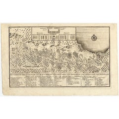
Antique Map of the Expedition of Govert Knol by Valentijn, 1726
Located in Langweer, NL
afhalinge van Pangerang Adepati Anom'. Map showing the expedition of Commissioner Govert Knol from Surabaya
Category
Antique 18th Century Maps
Materials
Paper
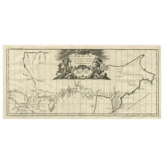
Antique Map with Details of Berings' Expedition into Russians' Far East, 1737
Located in Langweer, NL
impressively mapped given the difficult circumstances in which Bering operated. The First Kamchatka Expedition
Category
Antique 1730s Maps
Materials
Paper
H 12.96 in W 22.64 in D 0 in
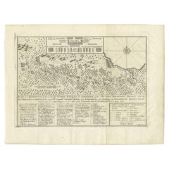
Antique Map of the Expedition of Govert Knol by Van Schley, 1765
By Jakob van der Schley
Located in Langweer, NL
Antique map titled 'Plan de l' expédition de Mr. le Commiss. re Govert Knol, forti de Soerabaja
Category
Antique 18th Century Maps
Materials
Paper
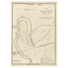
Map of Winter Harbour on Melville Island, Australia by Parry's Expedition, 1821
Located in Langweer, NL
harbor on Melville Island where William Parry's expedition spent the winter of 1819-20. This print
Category
Antique 1820s Maps
Materials
Paper
H 10.6 in W 8.27 in D 0 in
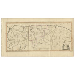
Antique Map of Surinam by Stedman '1813'
Located in Langweer, NL
Antique map titled 'A Map of Surinam'. Original antique map of Surinam, showing Dutch settlements
Category
Antique Early 19th Century Maps
Materials
Paper
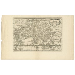
Antique Map of Asia by Sanson, circa 1705
By Nicolas Sanson
Located in Langweer, NL
Dutch edition of Sanson's map of Asia. Shows a large, dramatic version of Terre de Jesso, drawn
Category
Antique Early 18th Century Dutch Maps
Materials
Paper
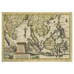
Striking Antique Map Centered on the Malay Peninsula
By Pieter Van Der Aa
Located in Langweer, NL
Antique map titled 'D'Indiaanze Landschappen Zeen en Eylanden, van Couchin af tot in de Moluccos
Category
Antique Early 18th Century Maps
Materials
Paper
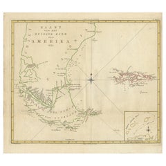
Antique Map of South America by J. Cook, 1775
Located in Langweer, NL
Antique map titled 'Kaart van het Zuidlyk Eind van Amerika'. Map of the sourthern part of South
Category
Antique Mid-18th Century Maps
Materials
Paper
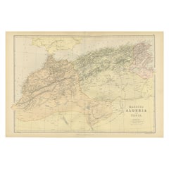
Antique Decorative Coloured Map Marocco, Algeria and Tunis, 1882
Located in Langweer, NL
military expeditions.
3. **Cultural Significance**: Maps like this one represent the knowledge and
Category
Antique 1880s Maps
Materials
Paper
Free Shipping
H 14.97 in W 22.45 in D 0 in
Antique Map of South America by J. Cook (1775)
Located in Langweer, NL
Antique map titled 'Kaart van het Zuidlyk Eind van Amerika'. Map of the sourthern part of South
Category
Antique Late 18th Century Maps
Materials
Paper
Antique Map of the North Pole by Fullarton, 1856
Located in Langweer, NL
Antique map titled 'The Arctic Regions showing the North-West Passage of Captain R. McClure'. Old
Category
Antique 19th Century Maps
Materials
Paper
Antique Map of the Low Countries by Brué, 1822
Located in Langweer, NL
Antique map titled 'Carte du Royaume des Pays-Bas'. Large format map of the Low Countries. This map
Category
Antique 19th Century Maps
Materials
Paper
Antique Map of Juan Fernandez Island, Chile, c.1750
Located in Langweer, NL
Antique map titled 'Plan de la Côte du N.E. de l 'Ile de Juan Fernandes'.
Map of the northeast
Category
Antique 18th Century Maps
Materials
Paper
Antique Map of the Bonin Islands by Hawks, 1856
Located in Langweer, NL
Antique map titled 'Chart of the Bonin Group of Islands.' The Bonin Islands, known in Japan as the
Category
Antique 19th Century Maps
Materials
Paper
Antique Map of the Banda Islands by Commelin, 1646
Located in Langweer, NL
Corneliszoon van Neck (1564-1638) was a Dutch naval officer and explorer, who led the second Dutch expedition
Category
Antique 17th Century Maps
Materials
Paper
Antique Exploration Map of Australia from Beltana to Perth, 1876
Located in Langweer, NL
Antique map titled 'Thomas Elders' Expedition durch Inner-Australien von Beltana im Osten bis Perth
Category
Antique 19th Century Maps
Materials
Paper
Antique Map of the Province of Kilan by Olearius '1662'
Located in Langweer, NL
Antique map titled 'A Map of ye Province of Kilan as it lies on ye Caspian Sea'. Rare map of the
Category
Antique Mid-17th Century Maps
Materials
Paper
Original Antique Map of Juan Fernandez by Van Schley, 1757
Located in Langweer, NL
Antique map titled 'Carte Particuliere de l'Isle de Juan Fernandez - Byzondere Kaart van 't Eiland
Category
Antique 18th Century Maps
Materials
Paper
Antique Map of Juan Fernandez Island by Anson, c.1740
Located in Langweer, NL
Antique map titled 'Plan de la Côte du N.E. de l 'Ile de Juan Fernandes'.
Map of the northeast
Category
Antique 18th Century Maps
Materials
Paper
Arctic Exploration: An Original Map of the North Circumpolar Regions, 1882
Located in Langweer, NL
This map, extracted from the 1882 atlas by Blackie & Son, presents the North Circumpolar Regions in
Category
Antique 1880s Maps
Materials
Paper
H 11.03 in W 14.97 in D 0 in
Antique Map of the region near Annesley Bay by Wagner, 1870
Located in Langweer, NL
Antique print titled 'Map of the Country between Annesley Bay and Senafe'. Map of the region near
Category
Antique Mid-19th Century Maps
Materials
Paper
Antique Map of the Bay of Terney by La Pérouse, 1797
Located in Langweer, NL
Antique map titled 'Plan de la Baie de Ternai'. Old map of the north eastern coast of Russia. This
Category
Antique 18th Century Maps
Materials
Paper
Uncommon Rare Map Showing The Louisiade Archipelago, Papua New Guinea, ca.1798
Located in Langweer, NL
Antique map titled 'Carte de la Partie Septentrionale de l'Archipel de la Louisiade'.
Uncommon
Category
Antique 1790s Maps
Materials
Paper
H 22.84 in W 33.47 in D 0 in
Very Attractive Antique Map of the World as Planisphere, Shows Cook's Voyages
Located in Langweer, NL
Antique map titled 'Chart of the World, according to Mercators Projection'. This world map shows
Category
Antique Late 18th Century Maps
Materials
Paper
No Reserve
H 16.15 in W 20.08 in D 0.02 in
Captain Cook's Exploration of Tahiti 18th C. Hand-Colored Map by Bellin
By Jacques-Nicolas Bellin
Located in Alamo, CA
This beautiful 18th century hand-colored copper plate engraved map is entitled "Carte de l'Isle de
Category
Antique Mid-18th Century French Maps
Materials
Paper
H 11.38 in W 17.5 in D 0.13 in
Antique Map of New Ireland Island in the Bismarck Archipelago, New Guinea, 1772
Located in Langweer, NL
Antique map titled 'Nova Hibernia'. Antique map of New Ireland, an island in the Bismarck
Category
Antique 18th Century Maps
Materials
Paper
H 17.52 in W 11.03 in D 0 in
Antique Map of Juan Fernandez Island and Cumberland Bay, Chile - c. '1749'
Located in Langweer, NL
Antique map titled 'Plan de la Côte du N.E. de l 'Ile de Juan Fernandes - Schets van den Noord-Oost
Category
Antique Mid-18th Century Maps
Materials
Paper
H 10.63 in W 16.74 in D 0.02 in
Small Map of Bantam with Dutch Ships and an Engraving of Portugese, 1614
Located in Langweer, NL
Dutch in Indonesia, the so-called 'Houtman expedition' and on the reverse Portugese welcoming them with
Category
Antique Early 17th Century Maps
Materials
Paper
Antique Map of Continental Asia, with Japan, Arabia, India, Russia, etc c.1702
Located in Langweer, NL
Antique map titled 'Totius Asiae Continens (..).' On this map of continental Asia and the adjacent
Category
Antique 18th Century Maps
Materials
Paper
H 10.75 in W 15.95 in D 0 in
Rare Map of Kildin Island in Russia Plus Engraving of Seal Hunting, 1614
Located in Langweer, NL
Insula Kilduyn. Orig. copper-engraving after details from J. H. van Linschoten's map taken from his
Category
Antique Early 17th Century Maps
Materials
Paper
Rare Antique Map with Timor and Nearby Islands Plus an Inset of Hawaii, 1825
Located in Langweer, NL
Antique map titled 'Essai sur la Geographie de l'Ile Timor.'
A map showing Timor and the
Category
Antique 1820s Maps
Materials
Paper
H 13.39 in W 19.69 in D 0 in
Antique Map of The Bay of D'Estaing located on the Russian island Sakhalin, 1798
Located in Langweer, NL
Antique map titled 'Plan of La Baie d'Estaing'.
This map shows the bay of D'Estaing located on
Category
Antique 1790s Maps
Materials
Paper
H 16.34 in W 14.38 in D 0 in
Map of The East Indies with the Route of Capt. William Dampier's Voyage, 1698
Located in Langweer, NL
Antique map titled 'Kaart van Oost Indie'.
Old map of the East Indies. It shows the routes of
Category
Antique 1690s Maps
Materials
Paper
H 7.88 in W 12.41 in D 0 in
Antique Map of the Coast of New Ireland, Earlier Part of German New Guinea, 1833
Located in Langweer, NL
Antique map titled 'Plan du Havre Carteret sur la Cote occidentale de la Nelle Irlande
Category
Antique 19th Century Maps
Materials
Paper
H 18.86 in W 25.44 in D 0 in
Large Antique Sea Chart of the South-Eastern Coast of Sumatra, Indonesia
Located in Langweer, NL
Antique map titled 'Carte pour aller du Détroit de la Sonde ou de Batavia, au Détroit de Banca
Category
Antique Late 18th Century Maps
Materials
Paper
H 30.2 in W 20.87 in D 0.02 in
Navigational Chart of Mexico's Coast, with Acapulco and Port Marquis, 1748
Located in Langweer, NL
Antique map titled 'The Form of cruising off Acapulca on the Coast of Mexico in the South Seas in
Category
Antique 1740s Maps
Materials
Paper
H 9.81 in W 17.52 in D 0.01 in
Antique Lithograph of a Japanese Junk, a Type of Sailing Ship, 1856
Located in Langweer, NL
. This print originates from 'Narrative of the expedition of an American squadron to the China seas and
Category
Antique 1850s Maps
Materials
Paper
Antique Print of Tokyo Bay 'or Edo Bay', Located in Southern Kantō, Japan, 1856
Located in Langweer, NL
Prefecture. This print originates from 'Narrative of the expedition of an American squadron to the China seas
Category
Antique 1850s Maps
Materials
Paper
H 8.27 in W 11.03 in D 0 in
Lafitte - 20th Century Oil, Expedition Planning
Located in Corsham, GB
a map on a table. The artist has signed to the lower left corner and the painting has been presented
Category
21st Century and Contemporary Interior Paintings
Materials
Oil
Traversing the Volcanic Frontier: A South Australian Expedition of 1844
Located in Langweer, NL
This is a historical document and part of a map and illustration from an expedition. The text
Category
Antique 1840s Prints
Materials
Paper
Free Shipping
H 8.39 in W 13.51 in D 0 in
Charting the West: Surveyor General Roe’s Western Australian Expedition , 1852
Located in Langweer, NL
This map is a historical document, focused on Western Australia. It illustrates the route of an
Category
Antique 1850s Prints
Materials
Paper
Free Shipping
H 8.47 in W 16.93 in D 0 in
Gregory's 1861 Expedition into the North West of Australia, 1862
Located in Langweer, NL
The map represents the route taken during F.T. Gregory's 1861 North West Australian Expedition
Category
Antique 1860s Prints
Materials
Paper
Free Shipping
H 8.39 in W 14.97 in D 0 in
A Rare ‘Adelie’ Penguin Egg from the Australian 1911-14 Expedition
Located in London, GB
egg, from the ‘Terra Nova’ expedition, see: Sotheby’s, Travel, Atlases, Maps and Natural History
Category
Early 20th Century Antarctican Historical Memorabilia
Materials
Eggshell
The Fateful Track of The Burke and Wills Expedition in Australia's Outback, 1862
Located in Langweer, NL
The map depicts the route of the Burke and Wills expedition, one of the most famous and tragic
Category
Antique 1860s Prints
Materials
Paper
Free Shipping
H 15.75 in W 7.68 in D 0 in
Keating, William. Narrative of an Expedition to the Source of St. Peter's River
Located in Middletown, NY
Keating William H
Narrative of an Expedition to the Source of St Peter's River Lake Winnipeek Lake
Category
Antique Early 19th Century English Books
Materials
Leather, Paper
H 8.75 in W 5.5 in D 3 in
Narrative of the Expedition of an American Squadron by M.C. Perry, '1857'
Located in Langweer, NL
'Narrative of the expedition of an American squadron to the China Seas and Japan; performed in the
Category
Antique Mid-19th Century Books
Materials
Paper
H 11.82 in W 9.85 in D 2.37 in
Antique Print of the Expedition of Govert Knol from Surabaya to Pangerang, 1750
Located in Langweer, NL
, tot afhalinge van Pangerang Adepati Anom'. Map showing the expedition of Commissioner Govert Knol from
Category
Antique Mid-18th Century Prints
Materials
Paper
H 8.86 in W 12.21 in D 0.02 in
Map of the World: An Original 18th Century Hand-colored Map by E. Bowen
Located in Alamo, CA
This is an original 18th century hand-colored map entitled "A New & Correct Chart of All The Known
Category
Mid-18th Century Old Masters Landscape Prints
Materials
Engraving
Bermuda: An Early 17th Century Hand-colored Map by Henricus Hondius
By Henricus Hondius
Located in Alamo, CA
This attractive and interesting map of Bermuda by Henricus Hondius in 1633 is entitled "Mappa
Category
Early 17th Century Old Masters Landscape Prints
Materials
Engraving
Captain Cook's Exploration of Tahiti: 18th C. Hand-colored Map by Bellin
By Jacques-Nicolas Bellin
Located in Alamo, CA
This beautiful 18th century hand-colored copper plate engraved map is entitled "Carte de l'Isle de
Category
Late 18th Century Landscape Prints
Materials
Engraving
Siberia as Explored by Behring: Original 18th Century Hand-colored Map by Bowen
Located in Alamo, CA
Second Kamchatka Expedition are not included on this map which preceded it.
The map is embellished by a
Category
Mid-18th Century Old Masters Landscape Prints
Materials
Engraving
The 4000km Exploration of Ernest Giles from Beltena to Perth, Australia in 1875
Located in Langweer, NL
particular expedition.
The map is a testament to the exploratory journeys that opened up the Australian
Category
Antique 1870s Prints
Materials
Paper
Free Shipping
H 8.27 in W 29.34 in D 0 in
Rare Hand Colored "Cabane Des Hold" - 1st Ed "Description de l’Univers" C. 1683
By Alain Manesson Mallet
Located in Soquel, CA
, page 281
This rare image depicts the Willem Barentsz expedition of 1597 to Novaya Zemlya, Russia. The
Category
1680s Realist Landscape Prints
Materials
Paper, Ink, Gouache
H 11.5 in W 9.07 in D 0.07 in
Antique Portrait of Dutch Navigator and Admiral Van Jakob Vanheemskerk, 1618
Located in Langweer, NL
part in two of Willem Barentz's expeditions to the far north in search of a northeast passage to Asia
Category
Antique 17th Century Prints
Materials
Paper
H 13.59 in W 8.08 in D 0 in
Antique Print of Fashion in September 1882 by Klemm & Weiss, circa 1900
Located in Langweer, NL
Antique print titled 'Der Beobachter - Expedition der Europaeischen Moden Zeitung'. Lithograph of
Category
Antique 19th Century Prints
Materials
Paper
Antique Print of Fashion in November 1889 by Klemm & Weiss, circa 1900
Located in Langweer, NL
Antique print titled 'Der Beobachter - Expedition der Europaeischen Moden Zeitung'. Lithograph of
Category
Antique 19th Century Prints
Materials
Paper
Antique Print of Fashion in November 1891 by Klemm & Weiss, circa 1900
Located in Langweer, NL
Antique print titled 'Der Beobachter - Expedition der Europaeischen Moden Zeitung'. Lithograph of
Category
Antique 19th Century Prints
Materials
Paper
Antique Print of Fashion in November 1890 by Klemm & Weiss, circa 1900
Located in Langweer, NL
Antique print titled 'Der Beobachter - Expedition der Europaeischen Moden Zeitung'. Lithograph of
Category
Antique 19th Century Prints
Materials
Paper
Antique Print of Fashion in November 1897 by Klemm & Weiss, c.1900
Located in Langweer, NL
Antique print titled 'Der Beobachter - Expedition der Europaeischen Moden Zeitung'. Lithograph of
Category
Antique 19th Century Prints
Materials
Paper
Antique Print of Fashion in February 1883 by Klemm & Weiss, circa 1900
Located in Langweer, NL
Antique print titled 'Der Beobachter - Expedition der Europaeischen Moden Zeitung'. Lithograph of
Category
Antique 19th Century Prints
Materials
Paper
- 1
Get Updated with New Arrivals
Save "Expedition Map", and we’ll notify you when there are new listings in this category.
Expedition Map For Sale on 1stDibs
With a vast inventory of beautiful furniture at 1stDibs, we’ve got just the expedition map you’re looking for. Frequently made of paper, animal skin and leather, every expedition map was constructed with great care. You’ve searched high and low for the perfect expedition map — we have versions that date back to the 18th Century alongside those produced as recently as the 20th Century are available. When you’re browsing for the right expedition map, those designed in Georgian and Victorian styles are of considerable interest. You’ll likely find more than one expedition map that is appealing in its simplicity, but F. Valentijn, Jacques-Nicolas Bellin and Maria Sybilla Merian produced versions that are worth a look.
How Much is a Expedition Map?
The average selling price for an expedition map at 1stDibs is $909, while they’re typically $71 on the low end and $150,000 for the highest priced.
