Items Similar to Map of the World: An Original 18th Century Hand-colored Map by E. Bowen


Want more images or videos?
Request additional images or videos from the seller
1 of 12
Emanuel BowenMap of the World: An Original 18th Century Hand-colored Map by E. Bowen1744
1744
About the Item
This is an original 18th century hand-colored map entitled "A New & Correct Chart of All The Known World Laid down according to Mercator's Projection" by Emanuel Bowen. It was published in 1744 in London in John Harris's "Navigantium atque Itinerantium Bibliotheca" or "A Complete Collection of Voyages and Travels". This highly detailed and colorful map depicts the world. as it was known in the mid 18th century. A majority of the northern and central portions of Canada and America are left blank due to the purity of knowledge at the time this map was published.
The map is embellished with four Compass Roses in the lower left, lower center, lower right and center, along with many rhumb lines. There a is a decorative title cartouche in the upper left. This colorful, attractive, historical and interesting 1744 map presents the entire world on Mercator's projection as it was understood in the middle part of the 18th century, before the landmark explorations of Captain’s Cook, Vancouver, Wilkes and others. It is an example of a nautical chart, a type of map that was designed specifically for use by mariners. The map is centered on the equator and includes both the Eastern and Western Hemispheres. The continents of North America, South America, Europe, Africa, and Asia are depicted, as well as various islands in the Atlantic, Pacific, and Indian Oceans. The map is laid out according to the Mercator projection, a type of cylindrical map projection that was developed in the 16th century by Flemish cartographer Gerardus Mercator. This projection has the advantage of preserving angles and shapes, making it useful for navigation. The map presents a paucity of inland detail, particularly for the Americas, but major cities, geographical landmarks, and regions are included. Ocean currents and Tradewinds are identified, as well as the magnetic declination lines or magnetic variance, which refers to the difference between true north and compass north. The continents are color coded, enhancing the beauty of this map. The three compass roses indicate the directions of the cardinal points.
The depiction of the western coast of America, the Pacific and Australia are interesting. There was very little exploration of Australia between the navigations of William Damper in 1699 and Tobias Furneaux in 1773. Most of the maps detail relies on the 17th century Dutch expeditions to Australia's western coast, by Abel Tasman and William Janszoon. Van Diemen's Land (Tasmania) and New Guinea appear connected to the Australian continent. New Zealand appears as a single landmass. North of New Zealand there is a landmass labelled 'Ter d' St. Esprit' which probably represents the New Hebrides Islands. This map precedes the accurate exploration of the South Pacific and east coast of Australia by Captain James Cook later in the 18th century. The map includes ‘Drakes' Port,' the site where Sir Francis Drake supposedly landed in 1579 during his 1579 circumnavigation of the globe. Here he claimed territory for England, restocked, and repaired his vessels. Drake named the region New Albion. The exact location of Drake's Port is a cartographic mystery. Drake's Harbor is believed to be in the region of San Francisco Bay, Bodega Bay, San Pablo Bay, and Pt. Reyes, but the definitive identification of the site was lost when the record and journals of Drake’s voyage were destroyed in the 1698 Whitehall Palace fire in London, where they were housed.
"A New & Correct Chart of All The Known World Laid down according to Mercator's Projection" is an important example of the development of cartography and the use of maps for navigation and exploration during the Age of Exploration. It is also interesting for all of it’s misconceptions of much of the world resulting from the limited explorations that had taken place in the early part of the “Golden Age of Discovery”.
This striking and beautifully hand-colored original 18th century map is printed on laid chain-linked paper with wide margins and a watermark. The sheet measures 15.75" high and 19.63" wide. There is a vertical center fold, as issued. There are reinforced losses the upper edge centrally and the lower edge on the left, as well as two reinforced tears of the left margin and one of the right margin and a short tear in the upper margin on the right, and blunting of the right lower corner. There is a pinhole collector's stamp from The Mechanic's Institute, San Francisco, which is only visible with back illumination. Other than the issues predominantly in the margins described above, the map is in very good condition.
Emanuel Bowen (1694-1767) was a prominent British engraver and cartographer. He was born in Wales and worked in London as a mapmaker and engraver for much of his career. Bowen was honored as a fellow of the Royal Society and as the Royal Mapmaker to both to King George II of England and Louis XV of France. Based in London, Bowen was highly regarded for producing some of the largest, most detailed, most accurate and most attractive maps of his era. He is known to have worked with some of the most prominent cartographic names of the period including Herman Moll, John Owen, and Thomas Kitchin. Bowen was known for his skill in combining information from various sources to create comprehensive and useful maps. Bowen produced a wide range of maps, including maps of the British Isles, Europe, North America, Africa, and Asia. He also created maps for several important atlases, including the "Complete Atlas" (1752) and "A Complete System of Geography" (1747). Despite his renown and success, Bowen, like many cartographers, died in poverty. Upon Emanuel Bowen's death, his cartographic work was taken over by his son, Thomas Bowen who also died in poverty. Bowen's legacy as one of the most influential cartographers of the 18th century lives on through his many important maps and atlases.
- Creator:Emanuel Bowen (1694 - 1767, British)
- Creation Year:1744
- Dimensions:Height: 15.75 in (40.01 cm)Width: 19.63 in (49.87 cm)
- Medium:
- Movement & Style:
- Period:
- Framing:Framing Options Available
- Condition:
- Gallery Location:Alamo, CA
- Reference Number:
About the Seller
5.0
Platinum Seller
These expertly vetted sellers are 1stDibs' most experienced sellers and are rated highest by our customers.
Established in 2011
1stDibs seller since 2019
233 sales on 1stDibs
Typical response time: 1 hour
- ShippingRetrieving quote...Ships From: Alamo, CA
- Return PolicyA return for this item may be initiated within 7 days of delivery.
More From This SellerView All
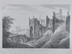
- Meissen, Germany : A Large Framed 18th Century Map by Petrus SchenkLocated in Alamo, CAThis is a hand-colored 18th century map of the Meissen region of Germany, entitled "Geographischer Entwurff Derer Aemmter Meissen als Creys-Procuratur-Schul-und Stiffts-Ammt benebst ...Category
Mid-18th Century Old Masters Landscape Prints
MaterialsEngraving
- Northern Italy: A 16th Century Hand-colored Map by Abraham OrteliusBy Abraham OrteliusLocated in Alamo, CAThis is a framed 16th century hand-colored copperplate map of northern Italy entitled "Veronae Urbis Territorium a Bernardo Bragnolo Descriptium" by Abraham Ortelius from his atlas "Theatrum Orbis Terrarum", which was the first modern atlas of the world, with the first volume published in 1570. This map was part of a subsequent volume, published in Antwerp in 1584. It was based on an earlier map by Bernardo Brognoli. This beautiful map of northern Italy is focussed on Verona and its environs, including Mantua. Lake Garda and the South Tyrol mountains are prominently depicted. There is a very large striking cartouche in the upper left and a decorative distance scale in the lower right. This striking hand-colored map of northern Italy is presented in a gold-colored wood frame and an olive green-colored mat. It is glazed with UV conservation glass. All mounting materials used are archival. The frame measures 21.5" high by 28" wide by 0.75" deep. There is a central vertical fold, as issued, with slight separation of the lower portion of the fold. There are faint spots in the upper and right margins, but the map is otherwise in very good condition. Abraham Ortelius (also known as Ortels, Orthellius, and Wortels) (1527-1598) was a Dutch cartographer, geographer, and cosmographer. He began his career as a map colorist. In 1547 he entered the Antwerp guild of St Luke as an "illuminator of maps". He had an affinity for business from an early age and most of his journeys before 1560, were for business. He was a dealer in antiques, coins, maps, and books. His business income allowed him to acquire an extensive collection of medals, coins, and antiques, as well as a large library of books...Category
16th Century Old Masters Landscape Prints
MaterialsEngraving
- Persia, Armenia & Adjacent Regions: A Hand-colored 17th Century Map by De WitBy Frederick de WitLocated in Alamo, CAThis colorful and detailed 17th century copperplate map by Frederick De Wit was published in Amsterdam between 1666 and 1690. It depicts the Caspian Se...Category
Late 17th Century Old Masters More Prints
MaterialsEngraving
- View of Pisaro, Italy: A 16th Century Hand-colored Map by Braun & HogenbergBy Franz HogenbergLocated in Alamo, CAThis is a 16th century original hand-colored copperplate engraved map of View of Pezaro (Pisaro), Italy entitled "Pisaurum vulgo Pezaro" by Georg Braun & Franz Hogenberg, from their famous city atlas "Civitates Orbis Terrarum", published in Augsberg, Germany in 1575. The map depicts a view of Pesaro, Italy from the west looking over the town to the Adriatic Sea. The River Foglia flows into the Adriatic in the foreground. The only identifiable building is the cathedral of San Domenico, which rises above the other roofs with its tall spire. Two women, dressed in styles of the 16th century are in conversation on a hill in the foreground on the left. Pesaro is in the province of Pesaro and Urbino and lies on the Adriatic and east of Florence. The city, which was founded by the Etruscans and named Pisaurum by the Romans, belonged from AD 754 onwards to the Papal States, and after 1285 was controlled by the princely families of Malatesta, Sforza and della Rovere. Today it is the capital of the province of Pesaro and Urbino and has a population of about 92,000. Pesaro's most famous resident, composer Gioacchino Rossini, was born here in 1792. The following is an English translation of an excerpt from Braun's description of the city: "We believe that the astonishingly short life of the inhabitants of Pesaro comes not only from the insalubrious air, but also from the great quantity of delectable and delicious fruits which they consume to excess. For this causes the production in their bodies of evil humours, which then lead to incurably fatal diseases. The area around the city is most charming and well planted with vineyards, fig trees, olive trees and other fruit-bearing trees." References: Van der Krogt 4, 3369, state 1; Taschen, Braun and Hogenberg...Category
16th Century Old Masters Landscape Prints
MaterialsEngraving
- L'Isle de France: A Hand-colored 17th Century Map by De WitBy Frederick de WitLocated in Alamo, CAThis colorful and detailed 17th century hand-colored copperplate map by Frederick De Wit was published in Amsterdam between 1666 and 1760. The map depicts the Île-de-France, which is one of the ancient provinces of France. Paris is located in the center of the map, with Versailles to the southwest The map extends from Rouen in the west to Reims in the east. The area around Paris, the Véxin Français, was the original domain of the king of France. Other areas were ruled by French feudal lords. For example, the Véxin Normand area was the domain of the Duke of Normandy...Category
Early 18th Century Old Masters More Prints
MaterialsEngraving
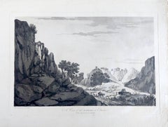
- Mediterranean and Adriatic Seas: Original 18th Century Hand-colored Map by BowenLocated in Alamo, CAThis is an original 18th century hand-colored map entitled "An Accurate Chart of The Mediterranean and Adriatic Sea's; with the Archipelago & Part of the Black Sea. Exhibiting all th...Category
Mid-18th Century Old Masters Landscape Prints
MaterialsEngraving


You May Also Like
- India William Hodges 'The East End of the Fort of Mongheer' India EngravingBy William HodgesLocated in Norfolk, GBAquatint with soft ground etching from the seminal publication, Selected Views in India, drawn on the Spot, in the Years 1780, 1781, 1782 and 1783, and Executed in Aquatint in 1786 -...Category
Late 18th Century Other Art Style Landscape Prints
MaterialsEngraving
- India William Hodges 'A View of the Ravines at Etana' Early India EngravingBy William HodgesLocated in Norfolk, GBWilliam Hodges Plate 27 'A View of the Ravines at Etawa' Published 20th May 1787 by J Wells, 22 Charing Cross. Page size, 16.5” x 22.5”, image 11.25 x 18” Aquatint with soft gro...Category
Early 2000s Other Art Style Landscape Prints
MaterialsEngraving
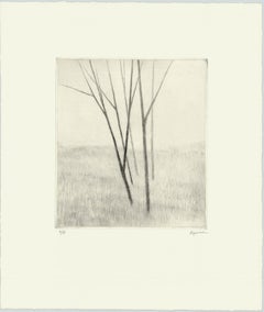
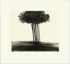
- Slope w.five treesBy Robert KipnissLocated in New York, NY“Slope w/five trees” is a drypoint engraving created by Robert Kipniss in 2020. The paper size is 12.50 x 10.50 inches and the printed image size is 6.75 x ...Category
21st Century and Contemporary Modern Landscape Prints
MaterialsEngraving, Drypoint
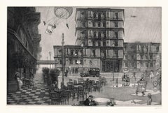
- Hidden Cities I / second stateBy Peter MiltonLocated in New York, NY“Hidden Cities I : The Ministry. Second State.” Contemporary artist Peter Milton created this etching and engraving in 2006. The printed image size is Image size 23.50 x 36.88 inches and the paper size is 31 x 42 inches. This impression is signed, dated, and titled in pencil and inscribed “11/75” – the 11th impression from the total printing of 75. “I do love to draw. I feel that I am being granted membership in the Brotherhood of Merlin, conjuring forth some apparition. As a drawing develops, I sense a vague presence coming more and more into focus, something in a white fog emerging and becoming increasingly palpable.” – P. Milton, “The primacy of touch. The Drawings of Peter Milton” “Working in layers, Milton begins with drawings based on people and places, with nods to Western art history and culture. He is a master of the appropriated image, a term that may conjure Andy Warhol and his Pop Art comrades. But Milton steps further back in history, avoiding the Pop sense of cool advertising and popular culture references. Instead, a broader cultural past is tapped through historical photographs of key players, architecture, and locales, which he reinvents by hand. He adds content drawn from his life as an avid reader – always with multiple possible interpretations – thus incorporating deeper meaning in his cinematic worlds. Elements of Greek mythology, classical music, art history, and history coalesce in his images, which embrace the messiness, sorrow, and elation that is life. One is hard-pressed to imagine a more erudite, skilled, passionate, and cheeky soul. In addition to a storied career in printmaking, since 2007 Milton has fearlessly produced artwork digitally. He now creates images using Adobe Photoshop in files consisting of more than two thousand layers, which are printed both as digital prints on paper and, for display on Led light boxes...Category
21st Century and Contemporary American Realist Landscape Prints
MaterialsEngraving, Etching
- A small copse in a field.By Robert KipnissLocated in New York, NYThe drypoint engraving entitled "A small copse in a field" was created by Robert Kipniss in 2016. Printed in an edition of 16 - this impression is signed in pencil and inscribed “12...Category
21st Century and Contemporary Modern Landscape Prints
MaterialsEngraving, Drypoint
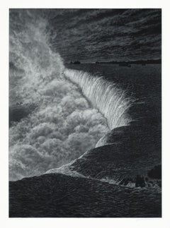
- NiagaraBy Frederick MershimerLocated in New York, NYNIAGARA Contemporary artist Frederick Mershimer created the mezzotint engraving entitled “Niagara” in 2021. This impression is signed, titled, dated, and inscribed “5/45”- the 5th ...Category
21st Century and Contemporary American Realist Landscape Prints
MaterialsMezzotint
Recently Viewed
View AllMore Ways To Browse
Original 18th Century
Map Of The World
Maps Of The World
18th Century Hand Color
Antique Map Of The World
Antique Maps Of The World
Map Of The World Antique
Landscape Maps
16th Century England
Upper Canada
European Mid Century Port
Antique Cartography
Early 18th Century New England
The Little King
18th Century Colored Engraving
Antique Colored Roses
18th Century Wales
Antique Mysteries