Items Similar to Meissen, Germany : A Large Framed 18th Century Map by Petrus Schenk

Want more images or videos?
Request additional images or videos from the seller
1 of 10
Petrus Schenk the YoungerMeissen, Germany : A Large Framed 18th Century Map by Petrus Schenk1750
1750
$1,175
£888.97
€1,026.01
CA$1,641.15
A$1,824.64
CHF 955.09
MX$22,378.64
NOK 12,160.72
SEK 11,481.16
DKK 7,656.40
Shipping
Retrieving quote...The 1stDibs Promise:
Authenticity Guarantee,
Money-Back Guarantee,
24-Hour Cancellation
About the Item
This is a hand-colored 18th century map of the Meissen region of Germany, entitled "Geographischer Entwurff Derer Aemmter Meissen als Creys-Procuratur-Schul-und Stiffts-Ammt benebst denen Aemmtern Nossen, Oschatz, und Wurtzen". It was published in Amsterdam in 1750 by the Dutch cartographer Petrus Schenk, also known as Pieter Schenk the Younger. The map depicts the city of Meissen, Germany and its environs, situated on the Elbe River. It is famous for the production of highly prized Meissen porcelain and pottery. The city of Dresden is seen in the lower right. There is a listing of towns in columns on the left and right sides with their location on the map. An ornate title cartouche is present in the right upper corner and an explanation of symbols in the lower left.
This large framed copperplate 18th century map of Meissen, Germany was printed on two sheets joined in middle. It is hand-colored in outline. The map is presented in an antiqued silver & gold colored wood frame. The frame measures 26 1/8' in height by 42 1/8' in width and 0.75 in depth. There are three horizontal folds as issued. There is a short oblique tear in the right lower margin & lower map, a short separation in the right margin of the lowest horizontal fold and faint discoloration in the right upper margin. The map is otherwise in very good condition.
Peter (Petrus, Pieter) Schenk, the Younger (1693-1775) was a Dutch engraver and map publisher initially from Amsterdam, but active in Leipzig, Germany. He was the son of the engraver and map publisher Peter Schenk, the Elder, who owned shops in Amsterdam and Leipzig. He was partnered with Gerard Valk. Valk and Schenk became well-known for their globe production and the re-issue of 17th century celestial maps by Andreas Cellarius. Peter Schenk, the Younger inherited his father's business in Leipzig. His two brothers were also engravers, as was his daughter, who married the son of Gerard Valk.
- Creator:Petrus Schenk the Younger (Dutch)
- Creation Year:1750
- Dimensions:Height: 26.13 in (66.38 cm)Width: 42.13 in (107.02 cm)Depth: 0.75 in (1.91 cm)
- Medium:
- Movement & Style:
- Period:
- Condition:
- Gallery Location:Alamo, CA
- Reference Number:Seller: # 10671stDibs: LU117329839902
About the Seller
5.0
Platinum Seller
Premium sellers with a 4.7+ rating and 24-hour response times
Established in 2011
1stDibs seller since 2019
285 sales on 1stDibs
Typical response time: 2 hours
- ShippingRetrieving quote...Shipping from: Alamo, CA
- Return Policy
Authenticity Guarantee
In the unlikely event there’s an issue with an item’s authenticity, contact us within 1 year for a full refund. DetailsMoney-Back Guarantee
If your item is not as described, is damaged in transit, or does not arrive, contact us within 7 days for a full refund. Details24-Hour Cancellation
You have a 24-hour grace period in which to reconsider your purchase, with no questions asked.Vetted Professional Sellers
Our world-class sellers must adhere to strict standards for service and quality, maintaining the integrity of our listings.Price-Match Guarantee
If you find that a seller listed the same item for a lower price elsewhere, we’ll match it.Trusted Global Delivery
Our best-in-class carrier network provides specialized shipping options worldwide, including custom delivery.More From This Seller
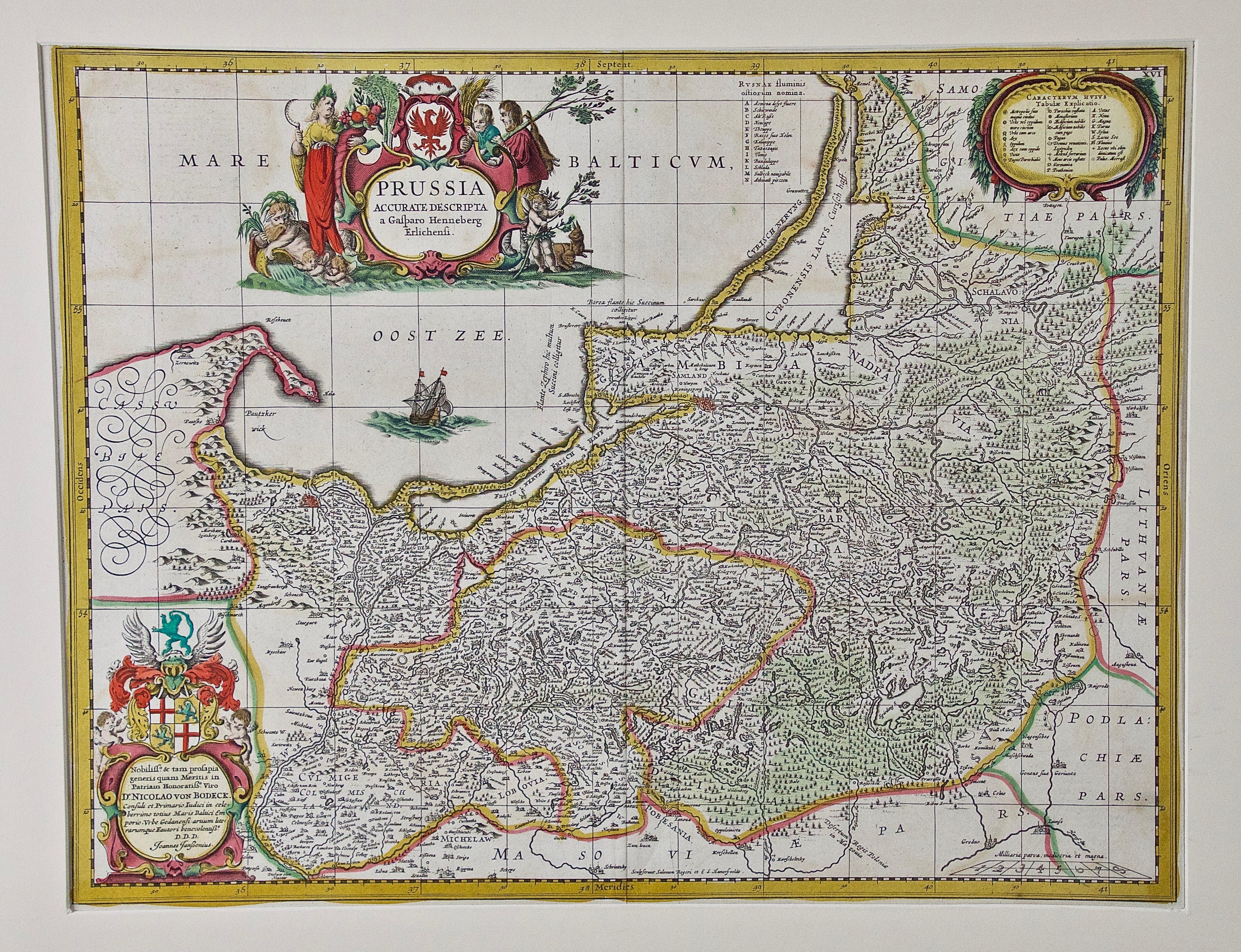
View AllA Hand Colored 17th Century Janssonius Map of Prussia: Poland, N. Germany, etc.
By Johannes Janssonius
Located in Alamo, CA
An attractive hand-colored copperplate engraved 17th century map of Prussia entitled "Prussia Accurate Descripta a Gasparo Henneberg Erlichensi", published in Amsterdam by Joannes Janssonius in 1664. This very detailed map from the golden age of Dutch cartography includes present-day Poland, Latvia, Lithuania, Estonia and portions of Germany. This highly detailed map is embellished by three ornate pink, red, mint green and gold...
Category
Mid-17th Century Old Masters Landscape Prints
Materials
Engraving

L'Isle de France: A Hand-colored 17th Century Map by De Wit
By Frederick de Wit
Located in Alamo, CA
This colorful and detailed 17th century hand-colored copperplate map by Frederick De Wit was published in Amsterdam between 1666 and 1760. The map depicts the Île-de-France, which is one of the ancient provinces of France. Paris is located in the center of the map, with Versailles to the southwest The map extends from Rouen in the west to Reims in the east. The area around Paris, the Véxin Français, was the original domain of the king of France. Other areas were ruled by French feudal lords. For example, the Véxin Normand area was the domain of the Duke of Normandy...
Category
Early 18th Century Old Masters More Prints
Materials
Engraving

Southern Holland: An Original 17th C. Hand-colored Visscher Map "Hollandiae"
By Nicolaus Visscher
Located in Alamo, CA
This a beautiful framed hand colored 17th century map of the southern portions of Holland by Nicolaus (Nicolas) Visscher II entitled "Hollandiae pars Meridionalis, vulgo Zuyd-Holland", published in Amsterdam in 1678. The map shows the region between Breda, Heusden, Gornichem, Gouda, Dordrecht, and Willemstad. It includes a decorative cartouche in the lower left corner.
The map is presented in an attractive maple colored wood frame with gold trim and a fabric mat. There is a central vertical fold, as issued. There are small areas of discoloration consistent with age. The map is otherwise in very good condition.
The Visscher family were one of the great cartographic families of the 17th century. Begun by Claes Jansz Visscher...
Category
Late 17th Century Other Art Style Landscape Prints
Materials
Engraving

West Germany: Original Hand Colored 17th Century Map by Johannes Janssonius
By Johannes Janssonius
Located in Alamo, CA
An original hand colored copperplate engraved map entitled in Latin "Archiepiscopatus Maghdeburgensis et Anhaltinus Ducatus cum terris adjacentibus", published in Amsterdam in 1640 i...
Category
Mid-17th Century Old Masters More Prints
Materials
Engraving

17th Century Dutch Map of the Holy Land at the Time of Jesus by Visscher
By Nicolaus Visscher
Located in Alamo, CA
This detailed Dutch map entitled "Het Beloofe de Landt Canaan door wandelt van onsen Salichmaecker Iesu Christo, nessens syne Apostelen" by Nicolaes Visscher (1610-1679), published i...
Category
1660s Prints and Multiples
Materials
Engraving

Northern Italy: A 16th Century Hand-colored Map by Abraham Ortelius
By Abraham Ortelius
Located in Alamo, CA
This is a framed 16th century hand-colored copperplate map of northern Italy entitled "Veronae Urbis Territorium a Bernardo Bragnolo Descriptium" by Abraham Ortelius from his atlas "Theatrum Orbis Terrarum", which was the first modern atlas of the world, with the first volume published in 1570. This map was part of a subsequent volume, published in Antwerp in 1584. It was based on an earlier map by Bernardo Brognoli.
This beautiful map of northern Italy is focussed on Verona and its environs, including Mantua. Lake Garda and the South Tyrol mountains are prominently depicted. There is a very large striking cartouche in the upper left and a decorative distance scale in the lower right.
This striking hand-colored map of northern Italy is presented in a gold-colored wood frame and an olive green-colored mat. It is glazed with UV conservation glass. All mounting materials used are archival. The frame measures 21.5" high by 28" wide by 0.75" deep. There is a central vertical fold, as issued, with slight separation of the lower portion of the fold. There are faint spots in the upper and right margins, but the map is otherwise in very good condition.
Abraham Ortelius (also known as Ortels, Orthellius, and Wortels) (1527-1598) was a Dutch cartographer, geographer, and cosmographer. He began his career as a map colorist. In 1547 he entered the Antwerp guild of St Luke as an "illuminator of maps". He had an affinity for business from an early age and most of his journeys before 1560, were for business. He was a dealer in antiques, coins, maps, and books.
His business income allowed him to acquire an extensive collection of medals, coins, and antiques, as well as a large library of books...
Category
16th Century Old Masters Landscape Prints
Materials
Engraving

You May Also Like
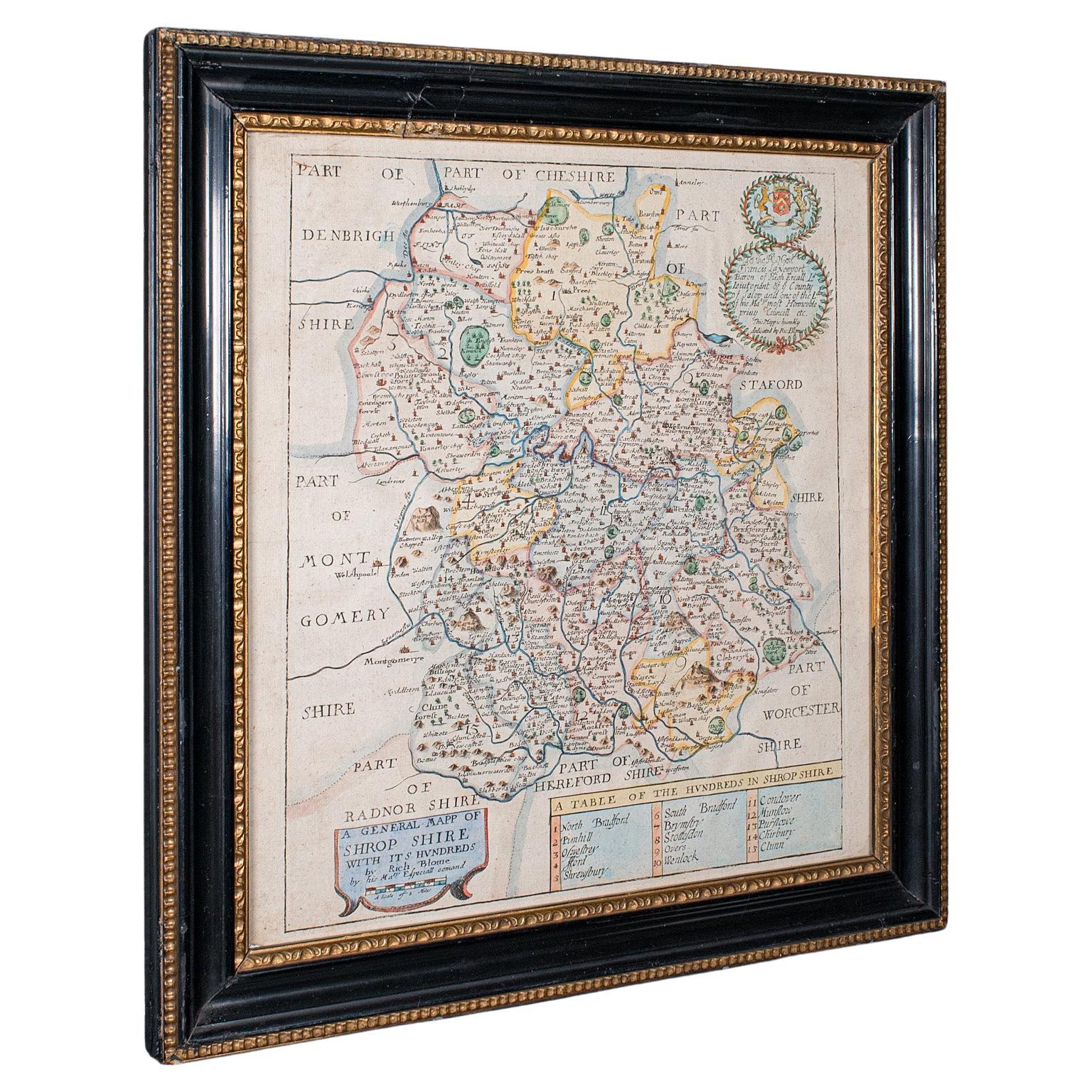
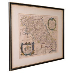
Antique County Map, Shropshire, English, Atlas Engraving, Richard Blome, C.1673
Located in Hele, Devon, GB
This is an antique county map of Shropshire. An English, framed atlas engraving by Richard Blome, dating to the 17th century and later.
A treat for the collector or county native, ...
Category
Antique 17th Century British Restauration Maps
Materials
Glass, Wood, Paper

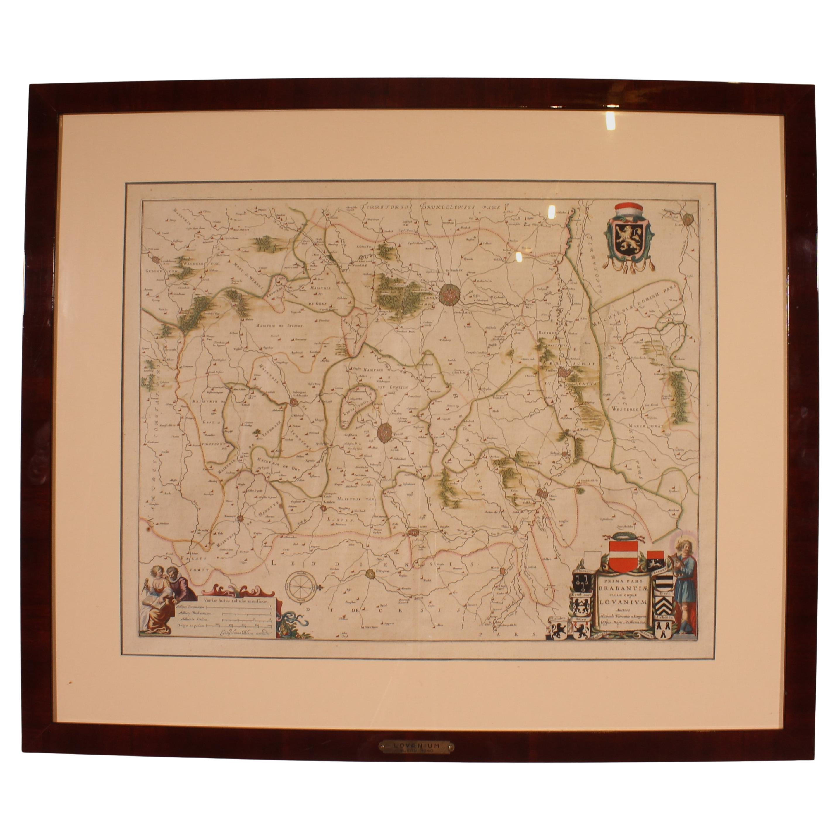
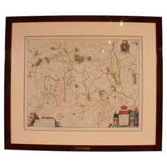
Antique Map Of Lovanium By Bleau Circa 1640
Located in Brussels, Brussels
map of the brabent of leuven (Belgium) circa 1640 by Bléau. Bléau was well known for antique atlas that he draw during the 17 century
beautiful map, double page folded in the middle,...
Category
Antique 17th Century French Renaissance Prints
Materials
Paper
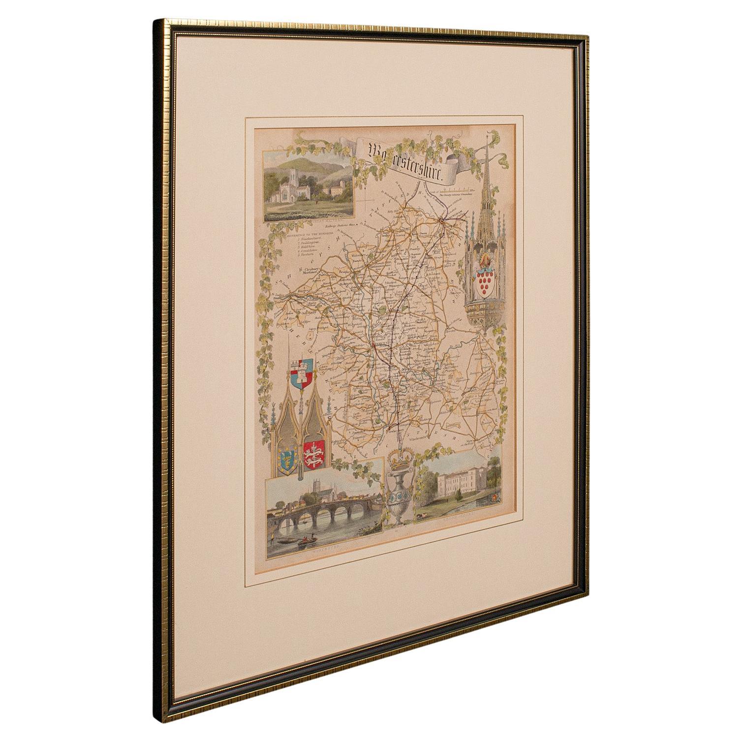
Antique Lithography Map, Worcestershire, English, Framed Engraving, Cartography
Located in Hele, Devon, GB
This is an antique lithography map of Worcestershire. An English, framed atlas engraving of cartographic interest, dating to the early 19th centur...
Category
Antique Early 19th Century British Regency Maps
Materials
Wood

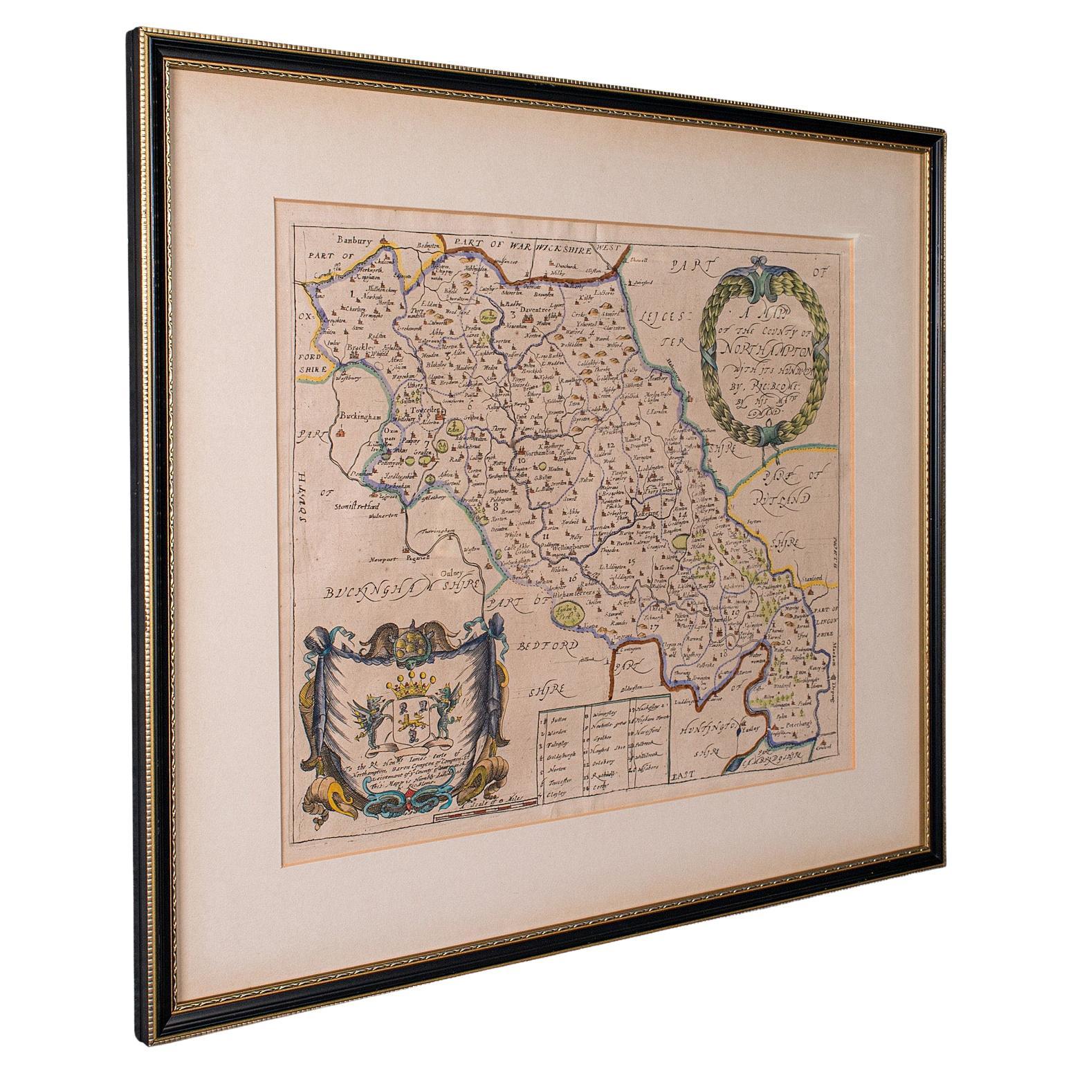
Antique County Map, Northamptonshire, English, Framed Cartography, Richard Blome
Located in Hele, Devon, GB
This is an antique county map of Northamptonshire. An English, framed atlas engraving by Richard Blome, dating to the 17th century and later.
Fascinating cartography, oriented 90 d...
Category
Antique Late 17th Century British Charles II Maps
Materials
Glass, Wood, Paper
Antique Lithography Map, Bedfordshire, English, Framed Engraving, Cartography
Located in Hele, Devon, GB
This is an antique lithography map of Bedfordshire. An English, framed atlas engraving of cartographic interest, dating to the mid 19th century and...
Category
Antique Mid-19th Century British Victorian Maps
Materials
Wood

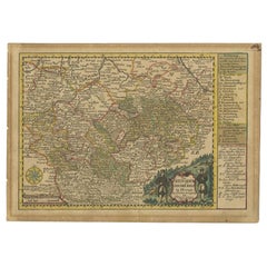
Antique Map of the Region of Meissen by Schreiber, 1749
Located in Langweer, NL
Antique map titled 'Der Ertz-Gebürgische Creis in Meissen (..)'. Map of the region of Meissen, Germany. This map originates from 'Atlas Selectus von allen Ko...
Category
Antique 18th Century Maps
Materials
Paper
$88 Sale Price
20% Off
More Ways To Browse
Frame Print 18th Century
Antique German 18th Century
18th Century Dutch Frame
Meissen 18th Century
Large Ornate Wood Frame
17th Century German Engravings
Mid Century Holland Pottery
Antique German Pottery
17th Century German Silver
17th Century German Silver
Antique Celestial Globe
Antique Celestial Maps
Dresden Pottery
Shorter And Sons Pottery
Yermia Pierre
John Richard Chairs
Marble Female Torso
Barber Shop Art