Mid-18th Century Landscape Prints
3
to
2
70
57
23
64
89
41
61
42
23
4
2
Overall Height
to
Overall Width
to
49
7
62
52
27
15
10
10
10
8
8
8
8
7
7
7
7
7
7
6
5
5
962
1,839
7,444
4,209
101
118
430
423
408
723
1,025
1,320
749
446
603
30
12
10
6
5
66
65
12
12
7
Period: Mid-18th Century
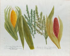
Corn, Maize: An 18th Century Hand-colored Botanical Engraving by J. Weinmann
Located in Alamo, CA
This is a striking original antique colored botanical mezzotint and line engraving of two varieties of corn or maize, which is finished with hand-coloring. It is entitled "Frumentum ...
Category
Naturalistic Mid-18th Century Landscape Prints
Materials
Engraving, Mezzotint
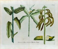
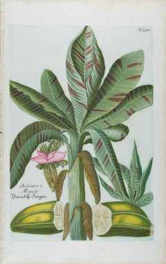
Banana Plants: An 18th Century Hand-colored Botanical Engraving by J. Weinmann
Located in Alamo, CA
This is a striking original antique colored botanical mezzotint and line double page engraving of banana plants, which is finished with hand-coloring. It is entitled "Banana 1. Musa,...
Category
Naturalistic Mid-18th Century Landscape Prints
Materials
Engraving, Mezzotint
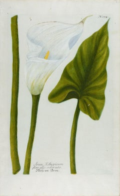
Calla Lily: An 18th Century Hand-colored Botanical Engraving by J. Weinmann
Located in Alamo, CA
This is a beautiful original antique colored botanical mezzotint and line engraving of a flowering Calla Lily, which is finished with hand-coloring. It is entitled "Arum Aethiopicum ...
Category
Naturalistic Mid-18th Century Landscape Prints
Materials
Engraving, Mezzotint
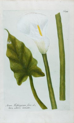
Calla Lily 2: An 18th Century Hand-colored Botanical Engraving by J. Weinmann
Located in Alamo, CA
This is a beautiful original antique colored botanical mezzotint and line engraving of a flowering Calla Lily, which is finished with hand-coloring. It is entitled "Arum Aethiopicum ...
Category
Naturalistic Mid-18th Century Landscape Prints
Materials
Mezzotint, Engraving
Banana Plant: An 18th Century Hand-colored Botanical Engraving by J. Weinmann
Located in Alamo, CA
This is an original antique colored botanical mezzotint and line engraving of banana plants, which is finished with hand-coloring. It is entitled "Banana 2. Mauze, Baradis-feigen", p...
Category
Naturalistic Mid-18th Century Landscape Prints
Materials
Mezzotint, Engraving
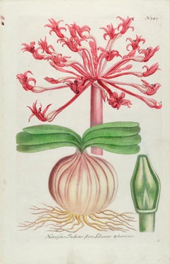
Narcissus Lily: An 18th Century Hand-colored Botanical Engraving by J. Weinmann
Located in Alamo, CA
This is an original antique colored botanical mezzotint and line engraving of a flowering Red Narcissus Lily plant, which is finished with hand-coloring. It is entitled "Narcissus In...
Category
Naturalistic Mid-18th Century Landscape Prints
Materials
Engraving, Mezzotint
Betel Nut Palm: An 18th Century Hand-colored Botanical Engraving by J. Weinmann
Located in Alamo, CA
This is an original antique colored botanical mezzotint and line engraving of a flowering Betel Nut Palm plants, which is finished with hand-coloring. It is entitled "Fagus Fau Buch,...
Category
Naturalistic Mid-18th Century Landscape Prints
Materials
Engraving, Mezzotint
Red Sweet Pea: An 18th Century Hand-colored Botanical Engraving by J. Weinmann
Located in Alamo, CA
This is an original antique colored botanical mezzotint and line engraving of flowering Red Sweet Peas which is finished with hand-coloring. It is entitled "Lathyrus Flore Majore Pur...
Category
Naturalistic Mid-18th Century Landscape Prints
Materials
Engraving, Mezzotint
Burning Bush: An 18th Century Hand-colored Botanical Engraving by J. Weinmann
Located in Alamo, CA
This is an original antique colored botanical mezzotint and line engraving of flowering Gas Plants or Burning Bush and Fraxinella, which is finished with hand-coloring. It is entitle...
Category
Naturalistic Mid-18th Century Landscape Prints
Materials
Engraving, Mezzotint
Suite of 12 Views of Italy
By Franz Weirotter
Located in New York, NY
Franz Weirotter (1730-1771), Suite of 12 Views of Italy, etchings, 1759 [most signed in the plate by Weirotter]. Reference: Nagel 5. 10 printed in pairs on one sheet; one on a small...
Category
Old Masters Mid-18th Century Landscape Prints
Materials
Etching
Edo Period Ukiyo-e Color Woodcut of Sanjusangendo at Fukagawa
Located in Soquel, CA
Edo period Utagawa Toyohara color woodcut print on paper of Sanjusangendo at Fukagawa
Wonderful Utagawa School woodcut print of Buddhist temple Sanjusangendo by great Japanese artis...
Category
Edo Mid-18th Century Landscape Prints
Materials
Paper, Ink
Butterflies & Moths: A 1st Ed. Hand-colored 18th C. Engraving by M. Harris
By Moses Harris
Located in Alamo, CA
This is a rare, original first edition hand-colored engraving depicting the natural history of butterflies and moths, which is plate 10 from Moses Harris' publication "The Aurelian: ...
Category
Mid-18th Century Landscape Prints
Materials
Engraving
Peacock Butterfly & Moth: A 1st Ed. Hand-colored 18th C. Engraving by M. Harris
By Moses Harris
Located in Alamo, CA
This is a rare, original first edition hand-colored engraving of Water Betony Moths and Peacock Butterflies, which is plate 8 from Moses Harris's publication "The Aurelian: or Natura...
Category
Mid-18th Century Landscape Prints
Materials
Engraving
The South East Prospect of Westminster Bridge
By Alfred Benjamin Cole
Located in Middletown, NY
After Giovanni Antonio Canal, called Canaletto
Copper plate engraving with hand coloring on cream laid paper with the Arms of France watermark (a crown in shield topped by a fleur-de-lys and the letters GR), 22 3/4 x 15 3/4 inches (576 x 400 mm), wide to full margins. Multiple vertical and horizontal creases from folding and rolling; none appear to be particularly hard, there is however some associated cockeling. While there is some minor mat tone visible around the perimeter of the sheet, the extensive handcoloring remains extremely fresh and saturated in the intended areas. There are edge tears at each the right and left sheet edge (outside of the image area) due to an improper effort to mount the sheet to a mat. Otherwise in very good condition with all issues being consistent with age.
The print is wrongly titled "The South East Prospect of Westminster Bridge...
Category
English School Mid-18th Century Landscape Prints
Materials
Engraving, Watercolor, Laid Paper
The Royal Exchange of London
Located in Middletown, NY
London: A. Churchill & J. Knapton, 1754
Engraving on fibrous laid paper with a "C" watermark, 9 3/4 x 11 3/4 inches (246 x 297 mm), full margins. Significant edge wear including mul...
Category
French School Mid-18th Century Landscape Prints
Materials
Engraving, Laid Paper, Handmade Paper
The plan of St. Martin's Church, St. Martin in the Fields
Located in Middletown, NY
London: Society of Antiqauries London, 1744. Engraving on buff wove paper with a large heraldic watermark with Strasbourg lily with a crown and shied and the letters LVG, 9 1/2 x 14 ...
Category
English School Mid-18th Century Landscape Prints
Materials
Handmade Paper, Engraving
The Temple of Asclepius with the Chariot - Etching by Giuseppe Vasi - 1753
Located in Roma, IT
The architect is Paolo Posi, and the image is engraved by Giuseppe Vasi.
The title: Prospetto della prima machina de fuochi d'artifizio, rappresentante il Tempio di Esculapio figl...
Category
Modern Mid-18th Century Landscape Prints
Materials
Etching
The Royal Militia District - Etching by Giuseppe Vasi - 1753
Located in Roma, IT
The architect is Paolo Posi, and the image is engraved by Giuseppe Vasi. Etching on paper.
Good condition.
The title: Celebratasi colla Machina della precedente sera la beneficenz...
Category
Modern Mid-18th Century Landscape Prints
Materials
Etching
XXXIII Fig. I Avanzo del Tempio di Castore e Polluce
Located in Fairlawn, OH
XXXIII Fig. I Avanzo del Tempio di Castore e Polluce .View of the Remains of the Peristyle of the House of Nero,
Etching, 1756
Signed in the plate (see photo)
From: Le Antichità Roma...
Category
Old Masters Mid-18th Century Landscape Prints
Materials
Etching
Bindon Abbey, Dorset engraving after Samuel and Nathaniel Buck
Located in London, GB
To see more, scroll down to "More from this Seller" and below it click on "See all from this Seller."
after Samuel Buck (1696 - 1779) and Nathaniel Buck (active 1724 - 1759)
The South View of Bindon Abbey, in the County of Dorset (1733)
Engraving
20 x 37 cm
An engraved view of Bindon Abbey, a Cistercian monastery on the River Frome in Dorset. The monastery was founded in 1149 by William de Glastonia on the site since known as Little Bindon near Bindon Hill. In 1172 the monastery moved to a site near Wool, and was supported by the house of Plantagenet. The abbey was scheduled for Dissolution in 1536, and finally dissolved in 1539. Only ruins remain.
Samuel and Nathaniel Buck...
Category
Mid-18th Century Landscape Prints
Materials
Engraving
Winchester Palace, Southwark, London engraving after Samuel and Nathaniel Buck
Located in London, GB
To see more, scroll down to "More from this Seller" and below it click on "See all from this Seller."
after Samuel Buck (1696 - 1779) and Nathaniel Buck (active 1724 - 1759)
The East View of Winchester Palace (1733)
Engraving
20 x 37 cm
An engraved view of Winchester Palace, a bishop's palace built in the 12th century. It served as the London townhouse of the Bishops of Winchester and remained in use until around 1700, when it was divided up into tenements and warehouses. The building was largely destroyed by fire in 1814.
Samuel and Nathaniel Buck...
Category
Mid-18th Century Landscape Prints
Materials
Engraving
Veduta dell'esterno della gran Basilica di S. Pietro in Vaticano
Located in Fairlawn, OH
Veduta dell'esterno della gran Basilica di S. Pietro in Vaticano (View of the Exterior of St. Peter's Basilica in the Vatican)
Etching, 1748
From the first printing of the "Vedute di...
Category
Old Masters Mid-18th Century Landscape Prints
Materials
Etching
Map of Oxfordshire coloured 18th century engraving by Thomas Kitchin
Located in London, GB
To see our other original maps, scroll down to "More from this Seller" and below it click on "See all from this Seller" - or send us a message if you cannot find the poster you want....
Category
Mid-18th Century Landscape Prints
Materials
Engraving
The Monument of London in Remembrance of the Dreadful Fire of 1666
Located in Middletown, NY
Bowles, Thomas III (after John Donowell)
John Bowles & Richard Wilkinson, 1751.
Steel engraving with extensive hand coloring in watercolor on cream wove paper, 10 1/4 x 16 inches (...
Category
English School Mid-18th Century Landscape Prints
Materials
Watercolor, Handmade Paper, Engraving
The Ponte and Castel S. Angelo (Veduta del Ponte e Castello Sant' Angelo)
Located in Fairlawn, OH
The Ponte and Castel S. Angelo
Veduta del Ponte e Castello Sant' Angelo
Etching, 1754
Signed in the plate lower right above the caption
From: Vedute di Roma
A proper Roman printing with the price in the lower right corner. Printed on a Double Circle Fleur de Lys watermark paper, c. 1760, with full margins.
A brilliant impression .
Note: A view of the Tiber River, Castello Sant' Angelo and St. Peter's Basilica in the distance.
Watermark: Double Circle Fleur de Lys
References: Robison c/g
Hind 29 ii/VII
Foclllon 793
Condition: A Roman printing before the numbers added in Paris. Printed on a Double Circle Fleur-de-Lys watermark paper.
Right margin folded over 5/8 inches for framing.
Usual centerfold as issued in the album.
Slight aging to the sheet.
Binding holes at the left margin edge
Framed with plexi.
Plate size: 14 7/8 x 22 7/8 inches
Sheet size: 21 5/8 x 30 5/16 inches
Frame size: 22 3/4 x 33 1/2 inches
Sant’Angelo Bridge, Italian Ponte Sant’Angelo, ancient (Latin) Pons Aelius, ancient Roman bridge, probably the finest surviving in Rome itself, built over the Tiber by the emperor Hadrian (reigned 117–138 AD) to connect the Campus Martius with his mausoleum (later renamed Castel Sant’Angelo). The bridge was completed about AD 135. It consists of seven stone arches and five main spans of about 60 feet (18 m) each, supported on piers 24 feet (7 m) high.
In the 13th century Pope Clement IV installed an iron balustrade and in the 16th century Pope Clement VII placed statues of Saints Peter and Paul...
Category
Old Masters Mid-18th Century Landscape Prints
Materials
Etching
The First Map of Oxford engraving by William Williams after Ralph Agas
Located in London, GB
To see our other views of Oxford and Cambridge, scroll down to "More from this Seller" and below it click on "See all from this Seller" - or send us a message if you cannot find the view you want.
William Williams (active 1724 - 1733) after Ralph Agas (c. 1540 - 1621)
The First Map of Oxford (1733)
Engraving
47 x 54 cm
In 1578, Ralph Agas drew the first ever map of Oxford, studded with the first colleges of the University. In 1733 it was engraved by William Williams for publication in the Oxonia Depicta, a book of illustrations depicting similar views as David Loggan's volume of engravings.
Ralph Agas was an English surveyor and cartographer. He was born in Suffolk and lived there throughout his life, although he travelled regularly to London. He began to practise as a surveyor in about 1566, and has been described as "one of the leaders of the emerging body of skilled land surveyors". regular work consisted of drawing up local estate maps...
Category
Mid-18th Century Landscape Prints
Materials
Engraving
Veduta del Ponte e Castello Sant' Angelo
Located in New York, NY
Castello Sant Angelo from "Vedute di Roma" by Giovanni Battista Piranesi.
2nd Roman state, 1754. Etching on laid paper with a watermark of a Fleur-de-Lys in a double circle with CB a...
Category
Mid-18th Century Landscape Prints
Materials
Laid Paper
The Arch of Constantine and the Colosseum
Located in Fairlawn, OH
The Arch of Constantine and the Colosseum
Vedute dell' Arco di Costantino, e dell' Anfiteatro Flavio il Colosseo
From: "Vedute di Roma" (Roman Views), part II
An early Paris edition,...
Category
Old Masters Mid-18th Century Landscape Prints
Materials
Etching
The Windmill by François Vivares, after Rembrandt
Located in Middletown, NY
Engraving on cream laid paper, 8 x 5 7/8 inches (202 x 149 mm), trimmed at the platemark. Adhered at each corner to a small sheet of archival laid paper. Horizontal edge loss at the ...
Category
Old Masters Mid-18th Century Landscape Prints
Materials
Handmade Paper, Laid Paper, Etching
Map of the World: An Original 18th Century Hand-colored Map by E. Bowen
Located in Alamo, CA
This is an original 18th century hand-colored map entitled "A New & Correct Chart of All The Known World Laid down according to Mercator's Projection" by Emanuel Bowen. It was published in 1744 in London in John Harris's "Navigantium atque Itinerantium Bibliotheca" or "A Complete Collection of Voyages and Travels". This highly detailed and colorful map depicts the world. as it was known in the mid 18th century. A majority of the northern and central portions of Canada and America are left blank due to the purity of knowledge at the time this map was published.
The map is embellished with four Compass Roses in the lower left, lower center, lower right and center, along with many rhumb lines. There a is a decorative title cartouche in the upper left. This colorful, attractive, historical and interesting 1744 map presents the entire world on Mercator's projection as it was understood in the middle part of the 18th century, before the landmark explorations of Captain’s Cook, Vancouver, Wilkes and others. It is an example of a nautical chart, a type of map that was designed specifically for use by mariners. The map is centered on the equator and includes both the Eastern and Western Hemispheres. The continents of North America, South America, Europe, Africa, and Asia are depicted, as well as various islands in the Atlantic, Pacific, and Indian Oceans. The map is laid out according to the Mercator projection, a type of cylindrical map projection that was developed in the 16th century by Flemish cartographer Gerardus Mercator. This projection has the advantage of preserving angles and shapes, making it useful for navigation. The map presents a paucity of inland detail, particularly for the Americas, but major cities, geographical landmarks, and regions are included. Ocean currents and Tradewinds are identified, as well as the magnetic declination lines or magnetic variance, which refers to the difference between true north and compass north. The continents are color coded, enhancing the beauty of this map. The three compass roses indicate the directions of the cardinal points.
The depiction of the western coast of America, the Pacific and Australia are interesting. There was very little exploration of Australia between the navigations of William Damper in 1699 and Tobias Furneaux in 1773. Most of the maps detail relies on the 17th century Dutch expeditions to Australia's western coast, by Abel Tasman and William Janszoon. Van Diemen's Land (Tasmania) and New Guinea appear connected to the Australian continent. New Zealand appears as a single landmass. North of New Zealand there is a landmass labelled 'Ter d' St. Esprit' which probably represents the New Hebrides Islands. This map precedes the accurate exploration of the South Pacific and east coast of Australia by Captain James Cook later in the 18th century. The map includes ‘Drakes' Port,' the site where Sir Francis Drake supposedly landed in 1579 during his 1579 circumnavigation of the globe. Here he claimed territory for England, restocked, and repaired his vessels. Drake named the region New Albion. The exact location of Drake's Port is a cartographic mystery. Drake's Harbor is believed to be in the region of San Francisco Bay, Bodega Bay, San Pablo Bay...
Category
Old Masters Mid-18th Century Landscape Prints
Materials
Engraving
L'automne, by Franz Edmond Weirotter, after van Goyen
Located in Middletown, NY
Etching and engraving on cream laid paper, 11 3/4 x 8 1/8 inches (297 x 205 mm), margins trimmed. Scattered light surface soiling, minor loose handling creases, rubbed edges, and sma...
Category
Old Masters Mid-18th Century Landscape Prints
Materials
Etching, Handmade Paper, Laid Paper, Engraving
Fabricius (Ponte Cestio) Bridge : Framed 18th C. Piranesi Architectural Etching
Located in Alamo, CA
This framed 18th century etching by Giovanni Battista Piranesi is entitled "Dimostransi nella Tav. presente la Pianta, ed Elevazione del Ponte, oggi detto Quattro Capi egli è antichissimo, e chiamavasi Fabrizio da L. Fabrizio Presid. delle Strade, che lo fabbrico' nel fine della Repubblica. "(The Plan and Elevation of the Bridge, today called Quattro Capi. The architect is very ancient, and was called Fabrizio da L. Fabrizio Presid. delle Strade, who built it at the end of the Republic). This is plate 18 in volume 4 of Piranesi's "Le antichita romane opera di Giambatista Piranesi architetto veneziano" (Roman antiquities by Giambatista Piranesi Venetian architect). It was published in Rome in 1756-1757.
This etching depicts the plan and elevation of the bridge now called the Ponte dei Quattoro Capi or Ponte Cestio (Bridge of the Four Heads), which in antiquity was called the Bridge of Fabricius after L. Fabricius, the Superintendant of the Streets who built it at the end of the Republic, around 62 BC. It was also been known in the Middle Ages as ‘Ponte Giudeo’ (Bridge of the Jews). The bridge crossed from the left bank or northeast side of the Tiber River to Tiber Island...
Category
Old Masters Mid-18th Century Landscape Prints
Materials
Etching
View of the Ancient Structure built by Tarquinius Superbus called the Bel Lido
Located in Fairlawn, OH
View of the Ancient Structure built by Tarquinius Superbus called the Bel Lido, and like others built by Marcus Agrippa in the time of Augustus when he ...
Category
Old Masters Mid-18th Century Landscape Prints
Materials
Etching
Mediterranean and Adriatic Seas: Original 18th Century Hand-colored Map by Bowen
Located in Alamo, CA
This is an original 18th century hand-colored map entitled "An Accurate Chart of The Mediterranean and Adriatic Sea's; with the Archipelago & Part of the Black Sea. Exhibiting all th...
Category
Old Masters Mid-18th Century Landscape Prints
Materials
Engraving
Europe: An Original 18th Century Hand-colored Map by E. Bowen
Located in Alamo, CA
This is an original 18th century hand-colored map entitled "A New & Accurate Map of Europe Drawn from the Best Authorities Assisted by the Most Improved Modern Charts and Maps." by E...
Category
Old Masters Mid-18th Century Landscape Prints
Materials
Engraving
Map of the East Indies: An Original 18th Century Hand-colored Map by E. Bowen
Located in Alamo, CA
This is an original 18th century hand-colored map entitled "An Accurate Map of the East Indies Exhibiting the Course of the European Trade both on the Continent and Islands" by Emanu...
Category
Old Masters Mid-18th Century Landscape Prints
Materials
Engraving
Map of the Russian Empire: An Original 18th Century Hand-colored Map by E. Bowen
Located in Alamo, CA
This is an original 18th century hand-colored map entitled "A New & Accurate Map of The Whole Russian Empire, As Contain'd Both In Europe and Asia, Drawn from Authentic Journals, Sur...
Category
Old Masters Mid-18th Century Landscape Prints
Materials
Engraving
Countryside - Etching by Pierre-François Laurent - 18th Century
Located in Roma, IT
Countryside is an etching realized by Pierre-François Laurent in 18th Century.
Good conditions.
Signed on plate.
The artwork is depicted through confident strokes.
Category
Modern Mid-18th Century Landscape Prints
Materials
Etching
Landscape - Etching by Pierre Quentin Chedel - 1755
Located in Roma, IT
Landscape is an etching realized by Pierre Quentin Chedel in 1755.
Good conditions.
Signed on Plate.
The artwork is depicted through confident strokes.
The etching was realized f...
Category
Mid-18th Century Landscape Prints
Materials
Etching
Landscape - Etching by Nicholas Cochin - 1755
Located in Roma, IT
Landscape is an etching realized by Nicholas Cochin in 1755.
Good conditions.
The artwork is depicted through confident strokes.
The etching was rea...
Category
Modern Mid-18th Century Landscape Prints
Materials
Etching
Landscape - Etching by Pierre-François Laurent - 1755
Located in Roma, IT
Landscape is an etching realized by Pierre-François Laurent in 1755.
Good condition.
Signed on Plate.
The artwork is depicted through confident strokes.
The etching was realized ...
Category
Modern Mid-18th Century Landscape Prints
Materials
Etching
China: An Original 18th Century Hand-colored Map by E. Bowen
Located in Alamo, CA
This is an original 18th century hand-colored map entitled "A New & Accurate Map of China, Drawn from Surveys made by the Jesuit Missionaries, by order of the Emperor. The whole bein...
Category
Old Masters Mid-18th Century Landscape Prints
Materials
Engraving
Siberia as Explored by Behring: Original 18th Century Hand-colored Map by Bowen
Located in Alamo, CA
This is an original 18th century hand-colored map entitled "An Exact Chart of all the Countries through which Capt. Behring Travelled from Tobolski, Capital of Siberia to the Country...
Category
Old Masters Mid-18th Century Landscape Prints
Materials
Engraving
Landscape - Etching by Pierre Quentin Chedel - 1755
Located in Roma, IT
Landscape is an etching realized by Pierre Quentin Chedel in 1755.
Good conditions.
Signed on Plate.
The artwork is depicted through confident strokes.
The etching was realized f...
Category
Mid-18th Century Landscape Prints
Materials
Etching
Europa Regnorum Provinciarum: 18th Century Hand-colored Map of Europe by Lotter
By Tobias Conrad Lotter
Located in Alamo, CA
This is an 18th century hand-colored copperplate engraved map entitled "Europa Regnorum Provinciarum Regionum" created by the German cartographer Tobias Conrad Lotter. It was publish...
Category
Mid-18th Century Landscape Prints
Materials
Engraving
Oxford Christ Church and Carfax 18th century engraving by John Donowell
Located in London, GB
To see our other views of Oxford and Cambridge, scroll down to "More from this Seller" and below it click on "See all from this Seller" - or send us a message if you cannot find the ...
Category
Mid-18th Century Landscape Prints
Materials
Engraving
A View of London as it was in the Year 1647 pub. by Boydell 1756
Located in Paonia, CO
A View of London as it was in the Year 1647 is a hand colored copper engraving published by the well known British publisher and engraver John Boydell (1720-1804) and engraved by R.Benning sold at Cheapside London 1756. Panoramic view on two sheets conjoined as issued linen mounted. Lettered with title in French and English along the base of the image including a numbered key to the structures. In very good condition except for one 1/8 inch tear in the sky to the left of the middle seam that is barely noticeable. This is a large very detailed panorama of London...
Category
Other Art Style Mid-18th Century Landscape Prints
Materials
Etching
Basilica of San Lorenzo in Rome: A Framed 18th Century Etching by Piranesi
Located in Alamo, CA
This large framed 18th century etching by Giovanni Battista Piranesi entitled "Veduta della Basilica di S. Lorenzo fuor della mura" (Basilica of San Lorenzo Outside the Walls), published in Rome in 1750 in Piranesi's Vedute di Roma (Views of Rome), This etching depicts the Basilica of San Lorenzo Outside the Walls, which is a Roman Catholic papal basilica and parish church, located in Rome, Italy. The Basilica is one of the Seven Pilgrim Churches of Rome and one of the five "papal basilicas". It was built as a shrine to the martyred Roman deacon St. Lawrence.
This Piranesi etching is held by many museums and institutions, including: The Metropolitan Museum, The British Museum, The National Gallery of Art, The Yale University Art Gallery, and The Harvard Museum of Art.
This magnificent etching is presented in a brown-colored wood frame and a tan French...
Category
Old Masters Mid-18th Century Landscape Prints
Materials
Etching
A Falkland Island Quail: An 18th Century Hand-colored Engraving by Martinet
Located in Alamo, CA
This is a hand-colored engraving of a Falkland Island Quail ("Caille des Isles Malouines") by Francois Nicolas Martinet, plate 222 from 'Histoire Naturelle des Oiseaux' in associatio...
Category
Naturalistic Mid-18th Century Landscape Prints
Materials
Engraving
VEDUTA DEGLI AVANZI De’MAUSOLEI E DELLE FABBRICHE…...
Located in Santa Monica, CA
GIOVANNI BATTISTA PIRANESI (Italian 1720-1778)
VEDUTA DEGLI AVANZI De’MAUSOLEI E DELLE FABBRICHE…c 1756 (Hind 83; Focillon 20.A.293; Giesecke 116; Wilton-E...
Category
Old Masters Mid-18th Century Landscape Prints
Materials
Etching
A Greenfinch & A Sparrow: An 18th Century Hand-colored Engraving by Martinet
Located in Alamo, CA
This is a hand-colored engraving of a Greenfinch bird and a tree sparrow ("1, Le Friquet, 2. Le Verdier") by Francois Nicolas Martinet, plate 227 from 'Histoire Naturelle des Oiseaux...
Category
Naturalistic Mid-18th Century Landscape Prints
Materials
Engraving
An Icelandic GyrFalcon: An 18th Century Hand-colored Engraving by Martinet
Located in Alamo, CA
This is a hand-colored engraving of an Icelandic Ger Falcon entitled "Gerfault d''Islande" by Francois Nicolas Martinet, plate 210 from 'Histoire Naturelle des Oiseaux' in associatio...
Category
Naturalistic Mid-18th Century Landscape Prints
Materials
Engraving
Al Dolo - Etching by Giovanni Antonio Canal - 1735/44
By Giovanni Antonio Canal (Canaletto)
Located in Roma, IT
Al Dolo is an original Artwork realized by Giovanni Antonio Canal, commonly known as Canaletto (Venice, 1697 - 1768).
Original Etching on Laid paper...
Category
Modern Mid-18th Century Landscape Prints
Materials
Etching
Meissen, Germany : A Large Framed 18th Century Map by Petrus Schenk
Located in Alamo, CA
This is a hand-colored 18th century map of the Meissen region of Germany, entitled "Geographischer Entwurff Derer Aemmter Meissen als Creys-Procuratur-Schul-und Stiffts-Ammt benebst ...
Category
Old Masters Mid-18th Century Landscape Prints
Materials
Engraving
The Monumental Tablet
Located in Fairlawn, OH
The Monumental Tablet
Etching, engraving, drypoint and burnishing, c. 1748
Series: Grotteschi (Grotesques, 4 plates)
Original, unwashed condition. Excellent.
Second edition first is...
Category
Old Masters Mid-18th Century Landscape Prints
Materials
Etching
Southwark Cathedral engraving c. 1753 for Stow's Survey of London
Located in London, GB
To see our other views and maps of England - including London, Oxford and Cambridge, scroll down to "More from this Seller" and below it click on "See all from this Seller" - or send...
Category
Realist Mid-18th Century Landscape Prints
Materials
Engraving
South Prospect of Somerset House engraving c. 1753 for Stow's Survey of London
Located in London, GB
To see our other views and maps of England - including London, Oxford and Cambridge, scroll down to "More from this Seller" and below it click on "See all from this Seller" - or send...
Category
Realist Mid-18th Century Landscape Prints
Materials
Engraving
Recently Viewed
View AllMore Ways To Browse
Horse 1981
Horse Jockey Painting
Retro Mexican Dress
Roman Historical Paintings
London Panorama
Old Luxembourg
St Louis China
Russian Farm
Antique Rose On Canvas
New Harbor Maine
Painting Of Abraham Lincoln
Retro Mexican Dresses
Horse Hounds
Nude Female Torso Sculpture
Mountains Of The Moon
Sporting Dog Art
Square Painting 15x15
Redwood Frame
