Items Similar to 17th Century Dutch Map of the Holy Land at the Time of Jesus by Visscher


Want more images or videos?
Request additional images or videos from the seller
1 of 14
Nicolaus Visscher17th Century Dutch Map of the Holy Land at the Time of Jesus by Visscher1663
1663
About the Item
This detailed Dutch map entitled "Het Beloofe de Landt Canaan door wandelt van onsen Salichmaecker Iesu Christo, nessens syne Apostelen" by Nicolaes Visscher (1610-1679), published in Amsterdam in 1663. The map depicts the Holy Land from the Mediterranean Sea to just beyond the Jordan River as it appeared at the time of Jesus. It has an orientation to the west with north to the right and presents details of the cities, towns, rivers, roads, and holy sites associated with the Apostles. The elaborate title cartouche is encircled on three sides by religious figures, which are in turn flanked by two engraved vignettes of New Testament scenes depicting the life of Jesus and a fishermen in each lower corner. Cherubs hold cartouches in the form of banners in the each upper corner. Seven ships sail the Mediterranean (Groote Zee) in the upper portions of the map. Three of these ships trace the voyage of the Apostle Paul.
The map is presented in an ornate brown wood frame embellished by gold-colored leaves and gold inner trim with a double mat; the outer mat is cream-colored and the inner mat is black. There is a central fold, as issued. There is some text offset from the text on the verso and scattered areas of focal discoloration. The map is otherwise in excellent condition.
Another map of the "Holy Land" (a city view of Jaffa (Tel Aviv) as it appeared in 1668 by Sanson) with an identical style frame and mat is available. This pair of maps would make a wonderful display grouping. Please see Reference #LU117324709942.
- Creator:Nicolaus Visscher (1618 - 1679)
- Creation Year:1663
- Dimensions:Height: 22.75 in (57.79 cm)Width: 28.5 in (72.39 cm)Depth: 1.13 in (2.88 cm)
- Medium:
- Period:1660-1669
- Condition:
- Gallery Location:Alamo, CA
- Reference Number:

Nicolaus Visscher
The Visscher family were one of the great cartographic families of the 17th century. Begun by Claes Jansz Visscher (1587-1652) and continued by his son Nicolaes (1618-1679), grandson Nicolaes II (1649-1702) and then by his grandson’s widow, Elizabeth until her death in 1726. The Visschers were prolific publishers, producing individual maps and also atlases made up to their customers’ specifications. They are commonly regarded as second only to the Blaeu family, among Dutch mapmakers, for the high quality of engraving and decoration, and the geographical accuracy of their many maps.
About the Seller
5.0
Vetted Seller
These experienced sellers undergo a comprehensive evaluation by our team of in-house experts.
Established in 2011
1stDibs seller since 2019
233 sales on 1stDibs
Typical response time: 1 hour
- ShippingRetrieving quote...Ships From: Alamo, CA
- Return PolicyA return for this item may be initiated within 7 days of delivery.
More From This SellerView All
- L'Isle de France: A Hand-colored 17th Century Map by De WitBy Frederick de WitLocated in Alamo, CAThis colorful and detailed 17th century hand-colored copperplate map by Frederick De Wit was published in Amsterdam between 1666 and 1760. The map depicts the Île-de-France, which is one of the ancient provinces of France. Paris is located in the center of the map, with Versailles to the southwest The map extends from Rouen in the west to Reims in the east. The area around Paris, the Véxin Français, was the original domain of the king of France. Other areas were ruled by French feudal lords. For example, the Véxin Normand area was the domain of the Duke of Normandy...Category
Early 18th Century Old Masters More Prints
MaterialsEngraving
- Map of the Russian Empire: An Original 18th Century Hand-colored Map by E. BowenLocated in Alamo, CAThis is an original 18th century hand-colored map entitled "A New & Accurate Map of The Whole Russian Empire, As Contain'd Both In Europe and Asia, Drawn from Authentic Journals, Sur...Category
Mid-18th Century Old Masters Landscape Prints
MaterialsEngraving
- Ulysses Deriding Polyphemus: A Framed 19th C. Engraving After J. M. W. TurnerBy J.M.W. TurnerLocated in Alamo, CAThis beautiful 19th century framed hand-colored engraving/etching entitled "Ullyses Deriding Polyphemus" by Edward Goodall is based on an original 1829 painting by the renowned Briti...Category
Mid-19th Century Romantic Landscape Prints
MaterialsEngraving, Etching
- Marquis de Marigny: An 18th C. Wille Engraved Portrait after a Tocque PaintingBy Louis TocquéLocated in Alamo, CAThis is a mid 18th century engraved portrait of Abel François Poisson de Vandières, Marquis de Marigny by Jean Georges Wille after a painting by Louis Tocque...Category
Mid-18th Century Portrait Prints
MaterialsEngraving
- View of Emden, Germany: A 16th Century Hand-colored Map by Braun & HogenbergBy Franz HogenbergLocated in Alamo, CAThis is a 16th century original hand-colored copperplate engraved map of a bird's-eye View of Embden, Germany entitled " Emuda, vulgo Embden vrbs Frisia orientalis primaria" by Georg Braun & Franz Hogenberg, in volume II of their famous city atlas "Civitates Orbis Terrarum", published in Cologne, Germany in 1575. This is a beautifully colored and detailed map of Emden, a seaport in northwestern Germany, along the Ems River and perhaps portions of over Dollart Bay, near the border with the Netherland. The map depicts a bird's-eye view of the city from the southwest, as well as a view of the harbor and an extensive system of canals. Numerous ships of various sizes, as well as two rowboats containing numerous occupants are seen in the main waterway in the foreground and additional boats line two canals in the center of the city. Two men and two women are shown on a hill in the foreground on the right, dressed in the 16th century style of nobility. Two ornate crests are included in each corner. A title strap-work cartouche is in the upper center with the title in Latin. The crest on the right including Engelke up de Muer (The Little Angel on the Wall) was granted by Emperor Maximilian I in 1495. This is an English translation of an excerpt of Braun's description of Embden: "In Emden, the capital of East Frisia, rich merchants live in very fine houses. The city has a broad and well-situated harbour, which in my opinion is unique in Holland. Frisia and the whole of the Netherlands, for the ships can anchor here right under the city walls. They have also extended the harbour as far as the New Town, so that up to 400 ships can now find shelter here when the sea is rough." The emphasis on the harbor and waterways within the city highlights the importance of Emden's place as a seaport at this time. Embden developed from a Dutch/Flemish trading settlement in the 7th-8th centuries into a city as late as late 14th century. In 1494 it was granted staple rights, and in 1536 the harbour was extended. In the mid-16th century Emden's port was thought to have the most ships in Europe. Its population then was about 5,000, rising to 15,000 by the end of the 16th century. The Ems River flowed directly under the city walls, but its course was changed in the 17th century by the construction of a canal. Emden has canals within its city limits, a typical feature of Dutch towns, which also enabled the extension of the harbor. In 1744 Emden was annexed by Prussia and is now part of Germany. It was captured by French forces in 1757 during the Seven Years' War, but recaptured by Anglo-German forces in 1758. During the Napoleonic French era, Emden and the surrounding lands of East Frisia were part of the short-lived Kingdom of Holland. References:Van der Krogt 4, 1230, State 2; Taschen, Braun and Hogenberg...Category
16th Century Old Masters Landscape Prints
MaterialsEngraving
- Ireland: A Framed 17th Century Hand-colored Map by Jan JannsonBy Johannes JanssoniusLocated in Alamo, CAThis is a 17th century hand-colored map entitled "Hibernia Regnum Vulgo Ireland" by Johannes Janssonius's (Jan Jansson), published in Amsterdam in 1640. This highly detailed map depicts the Emerald Isle with an extensive display of towns, roads, mountains, rivers, lakes and county borders, etc. It includes two decorative cartouches on the left. The title cartouche includes the Irish harp and the second, in the upper left, includes a lion wearing a crown on the left, a unicorn on the right and a coat-of-arms in the middle, which includes another Irish harp. A distance scale is seen in the lower right, augmented with two putti. The map is embellished with three sailing ships and a sea monster. Western portions of Scotland and England...Category
Mid-17th Century Old Masters Landscape Prints
MaterialsEngraving


You May Also Like
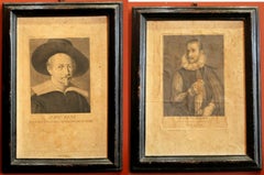
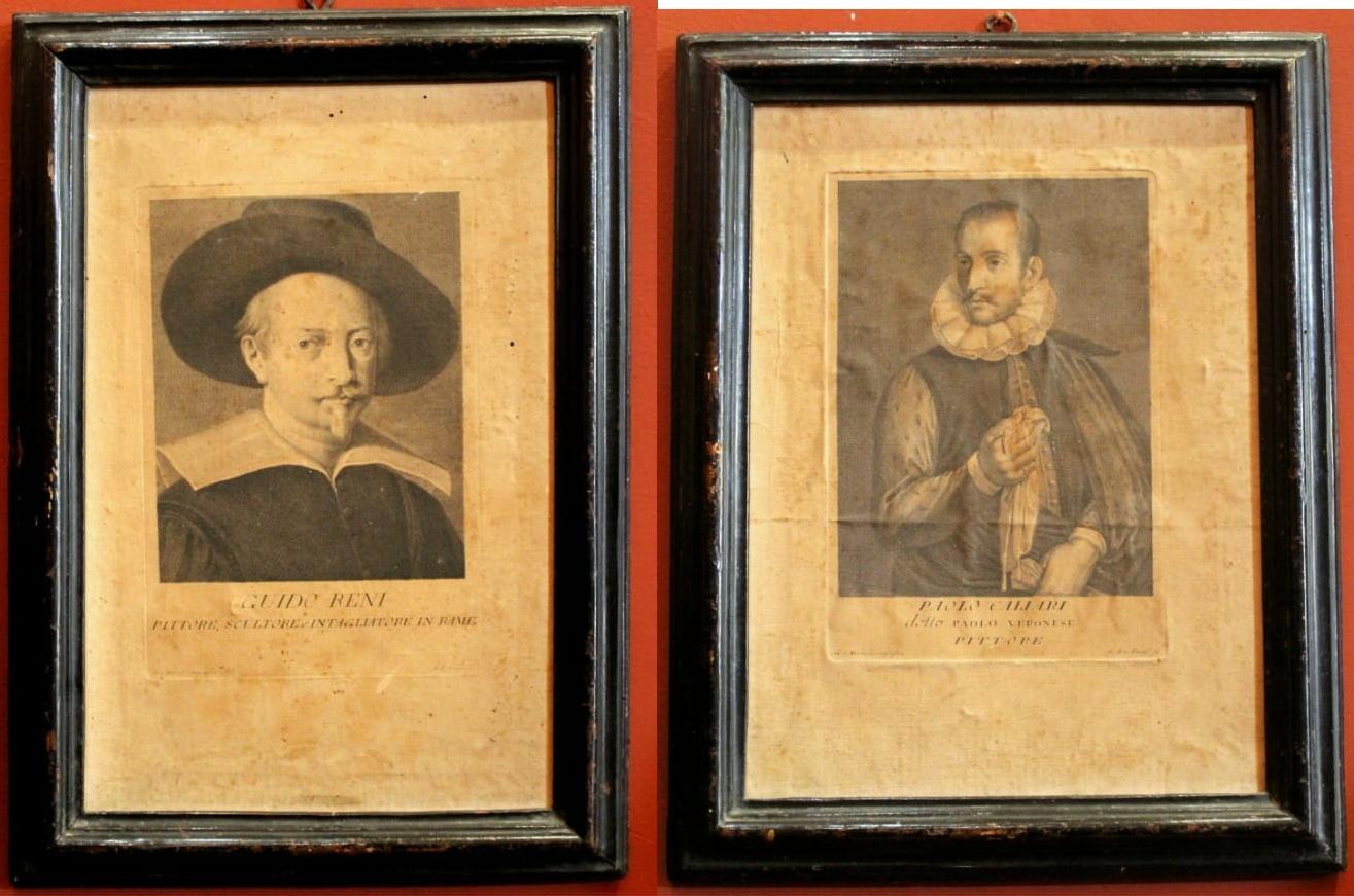
- Italian Painter’s Portrait Engravings on Laid Paper on Canvas in Ebonized FramesLocated in Firenze, ITThese beautiful Italian 18th Centruy engravings on laid paper feature the portrait of two famous Italian painters: Veronese and Guido Reni. They were engraved by Pier Antonio Pazzi a...Category
18th Century Baroque Portrait Prints
MaterialsLaid Paper, Cotton Canvas, Engraving
- Chasseur Fortune, Engraving, Van Falenz / Le Bas, Hunter, Decorative PieceLocated in Greven, DELe Chasseur Fortune Engraving framed Bez.: C. Van Falenz pinixit // Jac. Ph. Le Bas Sculp. // a Paris chez Le Bas graveur du Cabinet du Roy au bas de la rue de la Harpe...Category
18th Century Rococo Animal Prints
MaterialsEngraving
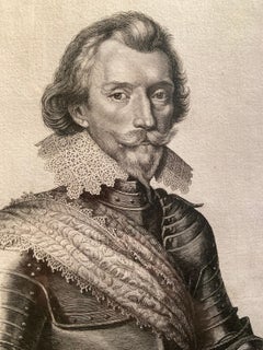
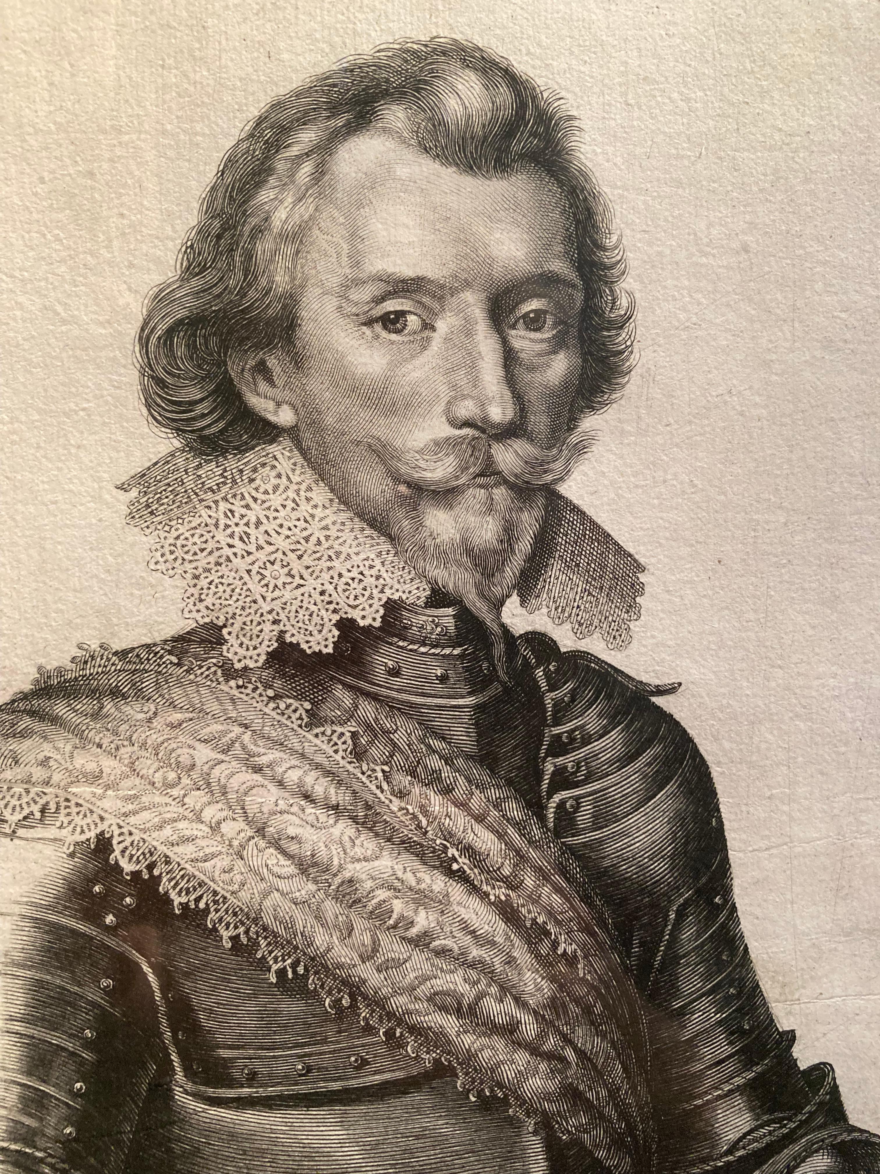
- Anthony van Dyck, Engraving Ernest de Mansfeld, c. 1654, Portrait, IconographieBy (After) Anthony Van DyckLocated in Greven, DEA wonderfully detailed and charismatic portrait, this exquisite work illustrates the technical mastery and artistic vision of Van Dyck. Ernest de Mansfeld's stately yet approachable expression reflects Van Dyck's refined ability to comfort and relax his subjects, resulting in a realistic and acute portrait. Ernest de Mansfeld was a German military commander during the early years of the Thirty Years War. Donning his armor and an ornate, lace collar, de Mansfeld appears as a strong commander. Without a hint of a smile, he calmly gazes out, the definition of cool and collected. Van Dyck accurately captures the sense that de Mansfeld is a man who takes his job seriously, a man worthy of commanding an army in battle. This portrait is a Mauquoy-Hendrickx State II (of II), engraved by Robertus van Voerst in collaboration with Anthony van Dyck (Antwerp, 1559 - London, 1641) as part of his Iconographie series of engraved portraits of famous people...Category
17th Century Baroque Portrait Prints
MaterialsEngraving
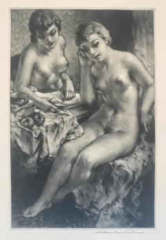
- Morning PaperLocated in Saugatuck, MIPrinted in 1941, this work entitled Morning Paper is a mezzotint and was the 32nd Presentation Print of the Chicago Society of Etchers. Founded by Chicago artist Bertha Jacques in 19...Category
1940s Art Deco Figurative Prints
MaterialsMezzotint
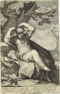
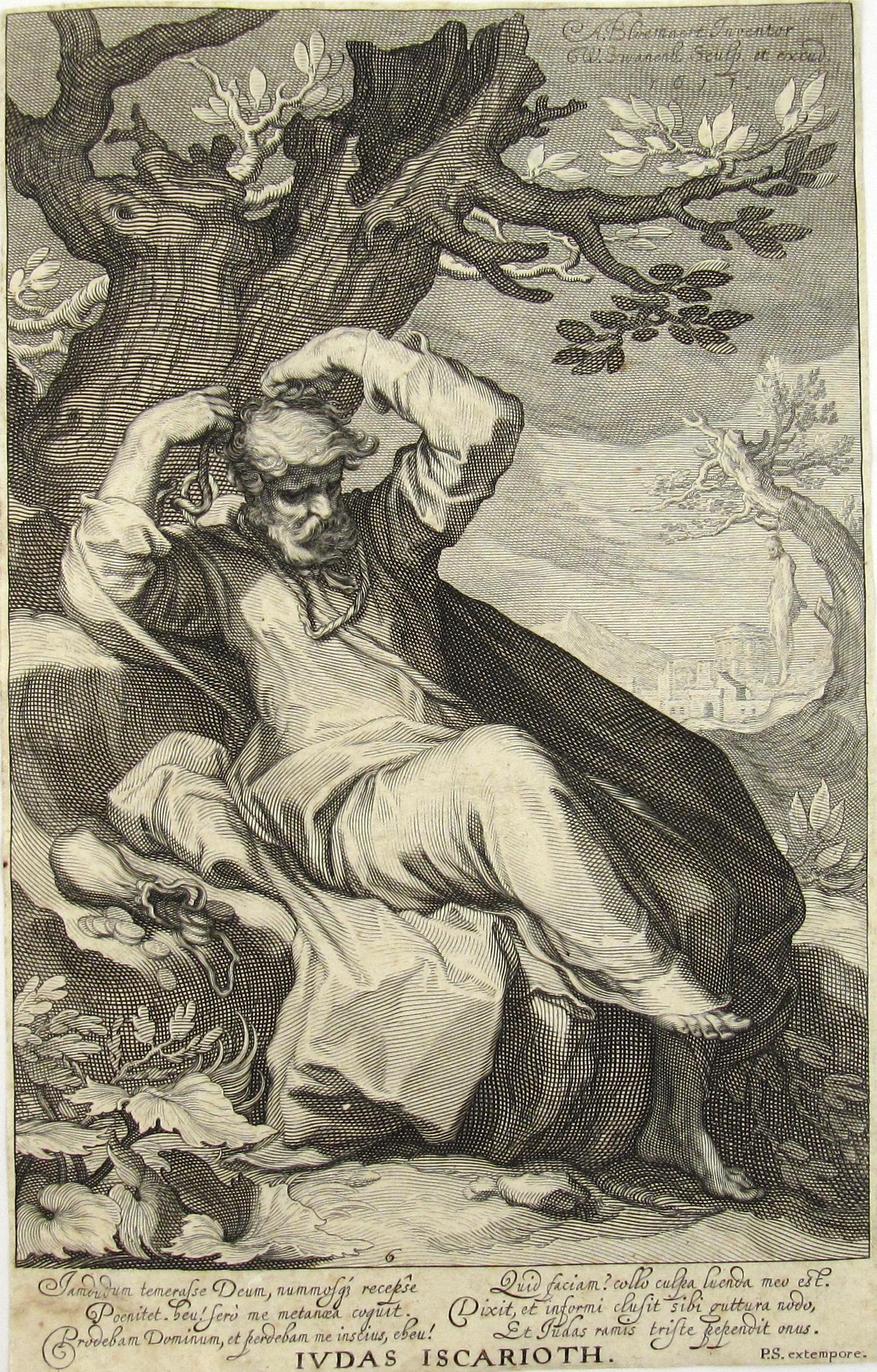
- Judas Iscarioth after Abraham Bloemaert (1564/66-1651), orig. published in 1611Located in Meinisberg, CHJudas Iscarioth - Judas hangs himself Engraved and published by Willem van Swanenburg (Dutch, 1580 - 1612) after designs by Abraham Bloemaert (1564...Category
1610s Realist Figurative Prints
MaterialsInk, Laid Paper, Engraving
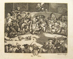
- Royal Sports PIT TICKET - 18thC Entry Ticket to Cock Fight in Georgian EnglandBy William HogarthLocated in Meinisberg, CHAfter William Hogarth (British, 1697–1764) Royal Sports PIT TICKET • Engraving by William Dent (British), active from 1783 to 1793 • Inscribed bottom right: Dent sculp • Plate ca. 7.6 x 9.1cm • Image ca. 6.3 x 7.9 cm • Sheet ca. 23.5 x 15 cm Fantastic imagery full of detail and symbolism – For example discover the cast shadow of the dept collector with his truncheon, looming over the winner, whose fast gained riches are being stolen by a thief as we watch. This well know subject was originally created by the famous British artist William Hogarth and then reproduced over time by many contemporary artists as prints of various formats and as paintings. Here we have a rendition engraved by William Dent, who was active from 1783 to 1793 and signed his work in the plate bottom right. I think this impression would date to the late 18th or then to the very early 19th Century. I was told, that these small prints, served as entry tickets to cock fights in Georgian England...Category
Late 18th Century Naturalistic Animal Prints
MaterialsPaper, Ink, Engraving