Dutch Map
28
to
226
1,530
259
1,291
739
506
221
215
187
175
169
120
105
89
50
47
36
34
31
31
26
26
24
23
22
20
20
19
18
18
17
16
16
16
15
15
14
14
12
10
8
8
7
6
6
6
5
5
5
5
5
5
3
3
3
2
2
2
2
2
1
1
1
1
107
70
54
31
23
Sort By
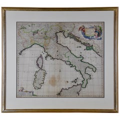
Italy, Sicily, Sardinia, Corsica and Dalmatian Coast: A 17th Century Dutch Map
By Theodorus Danckerts
Located in Alamo, CA
This hand colored 17th century Dutch map entitled "Novissima et Accuratissima totius Italiae
Category
Antique Late 17th Century Dutch Maps
Materials
Paper
H 18.13 in W 31.25 in D 1.38 in
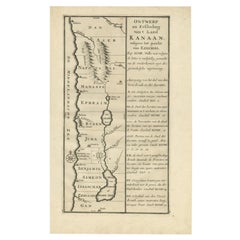
Antique Uncommon Dutch Map of Ancient Israel, c.1730
Located in Langweer, NL
Antique map titled 'Ontwerp en Erfdeeling van't Land Kanaan, volgens het gezicht van Ezechiel
Category
Antique 18th Century Maps
Materials
Paper
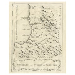
Old Dutch Map of Part of Syria and Phoenicia, 1773
Located in Langweer, NL
Antique print titled 'Gedeelte van Syriën en Phenicië'.
Old map of part of Syria and Phoenicia
Category
Antique 1770s Maps
Materials
Paper
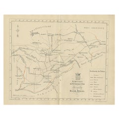
Antique Dutch Map of The Opsterland Township in Friesland, 1861
Located in Langweer, NL
Antique map titled 'Gemeente Opsterland'. Old map depicting the Opsterland township including
Category
Antique 19th Century Maps
Materials
Paper
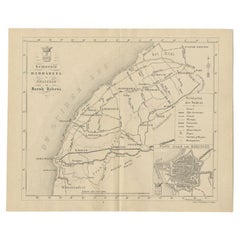
Antique Dutch Map of The Barradeel Township by Behrns, 1861
Located in Langweer, NL
Antique map titled 'Gemeente Barradeel'. Old map depicting the Barradeel township including cities
Category
Antique 19th Century Maps
Materials
Paper
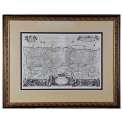
The Holy Land at the Time of Jesus: A 17th Century Dutch Map by Visscher
By Nicolaes Visscher II
Located in Alamo, CA
This detailed Dutch map entitled "Het Beloofe de Landt Canaan door wandelt van onsen Salichmaecker
Category
Antique Mid-17th Century Dutch Maps
Materials
Paper
H 22.75 in W 28.5 in D 1.13 in
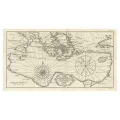
Old Dutch Map of the Region Around the Mediterranean Sea, 1773
Located in Langweer, NL
Antique map titled 'Kaart van een Deel der Middelandsche Zee (..)'.
Old map of the region
Category
Antique 1770s Maps
Materials
Paper
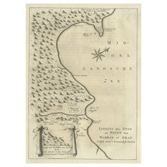
Old Dutch Map of the City of Oran 'Warran', Algeria, 1773
Located in Langweer, NL
Antique print titled 'Ligging der Stad en Haven van Warran of Oran'.
Old map of the city of
Category
Antique 1770s Maps
Materials
Paper
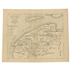
Antique Dutch Map of The Region of Leeuwarden by Behrns, 1861
Located in Langweer, NL
Antique map titled 'Arrondissement Leeuwarden'. Old map depicting the region of Leeuwarden
Category
Antique 19th Century Maps
Materials
Paper
Old Dutch Map of the City of Carthage and the Bay of Carthage, 1773
Located in Langweer, NL
Antique print titled 'Kaart van de Legging van het Oude Karthago'. Old map of the city of Carthage
Category
Antique 1770s Maps
Materials
Paper
Dutch Map and City Plan of La Roche-sur-Foron, France, 17th Century Hand Colored
By Coenraet Decker
Located in Alamo, CA
"Rupes Allobrogum vulgo La Roche" by Dutch engraver Coenraet Decker (1650-1685) is from the atlas
Category
Antique Late 17th Century Dutch Maps
Materials
Paper
H 27.75 in W 32.5 in D 0.07 in
17th Century Dutch Map of Italy, Sicily, Sardinia, Corsica and Dalmatian Coast
By Theodorus Danckerts
Located in Alamo, CA
This hand colored 17th century Dutch map entitled "Novissima et Accuratissima totius Italiae
Category
1690s Prints and Multiples
Materials
Engraving
H 18.13 in W 31.25 in D 1.38 in
Antique Map of the Dutch Province of Noord-Holland, 1883
Located in Langweer, NL
Antique map titled 'Noord-Holland'. Map of Noord-Holland, a province of the Netherlands. This map
Category
Antique 19th Century Maps
Materials
Paper
Rare Antique Map of Noord-Holland, Province in The Netherlands, c.1750
Located in Langweer, NL
Antique map titled 'Kaart van Noord-Holland'. Map of the province of Noord-Holland, the Netherlands
Category
Antique 18th Century Maps
Materials
Paper
Antique Map of The Province Noord-Holland in The Netherlands, 1864
Located in Langweer, NL
Antique map titled 'De Provincie Noord-Holland'. Map of the province of Noord-Holland, the
Category
Antique 19th Century Maps
Materials
Paper
17th Century Dutch Map of the Holy Land at the Time of Jesus by Visscher
By Nicolaus Visscher
Located in Alamo, CA
This detailed Dutch map entitled "Het Beloofe de Landt Canaan door wandelt van onsen Salichmaecker
Category
1660s Prints and Multiples
Materials
Engraving
H 22.75 in W 28.5 in D 1.13 in
Antique Map of Noord-Holland and the Island Texel in The Netherlands, c.1870
Located in Langweer, NL
Antique map titled 'De Provincie Noord-Holland'. Map of the province of Noord-Holland, the
Category
Antique 19th Century Maps
Materials
Paper
H 9.65 in W 12.41 in D 0 in
18th Century Noordt Holland Map by Johannes Covens and Cornelius Mortier
By Johannes Covens
Located in Hallowell, ME
This antique map of The Netherlands from the 18th Century is titled Noordt Holland, by the
Category
Mid-18th Century Landscape Prints
Materials
Archival Paper, Engraving
Scarce Antique Map of Greece, the Aegean, Crete and part of Asia Minor
Located in Langweer, NL
.
Among the many great Dutch map publishers active in the seventeenth century were the Visscher family
Category
Antique Late 17th Century Maps
Materials
Paper
H 21.15 in W 24.49 in D 0.02 in
Antique Map of Java and Batavia of nowadays Indonesia, '1818'
Located in Langweer, NL
Antique map titled 'Kaart van het Eiland Java'. A rare and attractive early 19th century Dutch map
Category
Antique Early 19th Century Maps
Materials
Paper
Original Antique Map of Zuid-Holland by Brugsma, 1864
Located in Langweer, NL
Antique map titled 'De Provincie Zuid-Holland'. Map of the province of Zuid-Holland, the
Category
Antique 19th Century Maps
Materials
Paper
Antique Map of the Dutch Gold Coast in Africa by Van den Bosch '1818'
Located in Langweer, NL
century Dutch map of the Dutch Gold Coast. The Dutch Gold Coast or Dutch Guinea, was a portion of
Category
Antique Early 19th Century Maps
Materials
Paper
H 18.12 in W 22.84 in D 0.02 in
Antique Map of Bavaria with many details, Germany
Located in Langweer, NL
(..)'. Dutch map of Bavaria, showing the many cities, towns, and other features of this historically
Category
Antique Late 17th Century Maps
Materials
Paper
Dutch Map and City Plan of La Roche-sur-Foron, France, 17th Century Hand Colored
By Coenraet Decker
Located in Alamo, CA
"Rupes Allobrogum vulgo La Roche" by Dutch engraver Coenraet Decker (1650-1685) is from the atlas
Category
1680s Prints and Multiples
Materials
Engraving
H 27.75 in W 32.5 in D 0.75 in
Original Very Old Hand-Colored Map of Limousin or Limoges, France, ca.1600
Located in Langweer, NL
century Dutch map publishing family. Hondius, along with sons Jodocus II and Henricus and son-in-law Jan
Category
Antique Early 1600s Maps
Materials
Paper
H 15.75 in W 21.07 in D 0 in
Authentic Old Map of Arabia with Original Border Coloring, 1745
Located in Langweer, NL
cartography and geographic knowledge of the time.
Fun fact on this Dutch map: Arabia is named 'Gelukkig
Category
Antique 1740s Maps
Materials
Paper
Antique Map of Kuinderschans, Part of the Frisian Defense Line, Netherlands 1649
Located in Langweer, NL
Antique Dutch map titled 'Kuynder-Schans'. Old map of the 'Kuinderschans', a rampart to block
Category
Antique 17th Century Maps
Materials
Paper
H 12.41 in W 20.87 in D 0 in
Antique Map of Luzon of Luconia in the Philippines, 1726
Located in Langweer, NL
Dutch maps to focus on the region. This map originates from 'Oud en Nieuw Oost-Indiën' by F. Valentijn
Category
Antique 1720s Maps
Materials
Paper
Original Antique Map of the Western Part of NEW MEXICO & CALIFORNIA
Located in Langweer, NL
the Jesuits and Others"
Description:
This exquisite original Dutch map, titled "KAART van het
Category
Antique 1760s Maps
Materials
Paper
Original Antique Detailed Map of the Rhine and Moselle River Regions, ca.1680
Located in Langweer, NL
the leading Dutch map makers of the late 17th and early 18th Centuries. Fully engraved to show
Category
Antique 1680s Maps
Materials
Paper
H 20.87 in W 24.02 in D 0 in
Old Map of the Dutch City of Megen in Holland, 1916
Located in Langweer, NL
Antique map Megen titled 'Megen'. Antique map depicting the city of Megen, Noord-Brabant, The
Category
20th Century Maps
Materials
Paper
Antique Map of Holland with Colorful Vignettes, 1851
Located in Langweer, NL
Antique map titled 'Holland'.
Decorative map of Holland. Includes vignettes of Rotterdam, Dutch
Category
Antique 19th Century Maps
Materials
Paper
Antique Map of The Dutch Smallingerland Township, 1861
Located in Langweer, NL
Antique map titled 'Gemeente Smallingerland'. Old map depicting the Smallingerland township
Category
Antique 19th Century Maps
Materials
Paper
Antique Map of Doniawerstal in Friesland, Holland, 1868
Located in Langweer, NL
Antique map titled 'Provincie Friesland - Doniawerstal'. Map of the township Doniawerstal including
Category
Antique 19th Century Maps
Materials
Paper
Antique Map of the Dutch Township Baarderadeel, 1861
Located in Langweer, NL
Antique map titled 'Gemeente Baarderadeel'. Old map depicting the Baarderadeel township including
Category
Antique 19th Century Maps
Materials
Paper
Antique Map of the Dutch Dantumadeel Township, 1861
Located in Langweer, NL
Antique map titled 'Gemeente Dantumadeel'. Old map depicting the Dantumadeel township including
Category
Antique 19th Century Maps
Materials
Paper
Antique Map of the Dutch Township Aengwirden, 1861
Located in Langweer, NL
Antique map titled 'Gemeente Aengwirden'. Old map depicting the Aengwirden township including
Category
Antique 19th Century Maps
Materials
Paper
Antique Map of The Dutch Township Rauwerderhem, 1861
Located in Langweer, NL
Antique map titled 'Gemeente Rauwerderhem'. Old map depicting the Rauwerderhem township including
Category
Antique 19th Century Maps
Materials
Paper
Antique Map of the Rhine and Moselle River Region in Germany and France, c.1680
Located in Langweer, NL
the leading Dutch map makers of the late 17th and early 18th Centuries. Fully engraved to show
Category
Antique 17th Century Maps
Materials
Paper
H 20.4 in W 23.94 in D 0 in
Antique Map of Holland and Belgium by Lowry, '1852'
Located in Langweer, NL
Antique map titled 'Holland and Belgium'. Original map of the Netherlands and Belgium. This map
Category
Antique Mid-19th Century Maps
Materials
Paper
Antique Map of the Dutch Province of Gelderland, 1725
Located in Langweer, NL
Antique map titled 'Frisiae Haereditariae seu Trajectini Episcopatus Gelria?. Map of the province
Category
Antique 18th Century Maps
Materials
Paper
Hand Colored 17th Century Visscher Map "Hollandiae" Southern Holland
By Nicolaes Visscher II
Located in Alamo, CA
A hand colored 17th century map of the southern portions of Holland by Nicolaus (Nicolas) Visscher
Category
Antique Early 18th Century Dutch Maps
Materials
Paper
Rare Map of Dutch Municipality Noorddijk Near Groningen, 1865
Located in Langweer, NL
Groningen: Gemeente Engelbert, Middelbert, Noorddijk. These scarse detailed maps of Dutch Towns
Category
Antique 19th Century Maps
Materials
Paper
Antique Nicely Colored Map of Holland and Belgium, 1846
Located in Langweer, NL
Antique map titled 'Holland and Belgium'. Old map of the Netherlands and Belgium. This map
Category
Antique 19th Century Maps
Materials
Paper
Antique Map of Friesland, A Dutch Province, c.1780
Located in Langweer, NL
Antique map titled 'Dominii Frisiae (..)'. Original antique map of Friesland. 3rd state, most
Category
Antique 18th Century Maps
Materials
Paper
Antique Map of Noord-Holland, Province of The Netherlands, 1902
Located in Langweer, NL
Antique map titled 'Noord-Holland'. Lithographed map of the province of Noord-Holland, the
Category
20th Century Maps
Materials
Paper
Decorative Dutch Antique Map of North and South America, 1841
Located in Langweer, NL
Junior (1796-1868) was a Dutch engraver and map-engraver, pupil of his father Daniel Veelwaard
Category
Antique 1840s Maps
Materials
Paper
Rare Antique Map of the Dutch East Indies 'Indonesia', 1774
Located in Langweer, NL
Rare decorative engraved map of the Dutch East Indies, or nowadays Indonesia.
Title (in old
Category
Antique 1770s Maps
Materials
Paper
Antique Map of the Dutch Provinces Groningen and Friesland, 1902
Located in Langweer, NL
Antique map titled 'Groningen en Friesland'. Lithographed map of the provinces of Groningen and
Category
20th Century Maps
Materials
Paper
Antique Map of the Dutch Utingeradeel Township by Behrns, 1861
Located in Langweer, NL
Antique map titled 'Gemeente Utingeradeel'. Old map depicting the Utingeradeel township including
Category
Antique 19th Century Maps
Materials
Paper
Antique Map of The Dutch Achtkarspelen Township by Behrns, 1861
Located in Langweer, NL
Antique map titled 'Gemeente Achtkarspelen'. Old map depicting the Achtkarspelen township including
Category
Antique 19th Century Maps
Materials
Paper
Antique Map of Zuid-Holland and Utrecht in The Netherlands, 1902
Located in Langweer, NL
Antique map titled 'Zuid-Holland en Utrecht'. Lithographed map of the provinces of Zuid-Holland and
Category
20th Century Maps
Materials
Paper
1859 Vintage Map of Holland and Belgium: Blackie's Imperial Geographic Insight
Located in Langweer, NL
The "Antique Map of Holland and Belgium" from 'The Imperial Atlas of Modern Geography', published
Category
Antique Mid-19th Century Maps
Materials
Paper
H 21.26 in W 14.57 in D 0.02 in
Original Old Map of Leeuwarden, European Cultural Capital 2018, Holland, 1649
Located in Langweer, NL
. Around 1649 Joan Blaeu published a collection of Dutch city maps named Tooneel der Steeden (Views of
Category
Antique 1640s Maps
Materials
Paper
H 20.87 in W 25.79 in D 0 in
Antique Colourful Map of the Dutch East Indies 'Indonesia', ca.1806
Located in Langweer, NL
Antique map titled 'Les Isles de la Sonde Moluques Philippines, Carolines et Marianes'. Old map of
Category
Antique 19th Century Maps
Materials
Paper
Antique Map of Hindelopen, Picturesque Harbour City in Friesland, Holland, 1868
Located in Langweer, NL
Antique map titled 'Provincie Friesland - Gemeente Hindeloopen'.
Map of the township of
Category
Antique 19th Century Maps
Materials
Paper
H 7.49 in W 9.45 in D 0 in
Antique Map of France from an Old Dutch School Atlas, 1852
Located in Langweer, NL
Antique map titled 'Frankrijk'. Map of France. This map originates from 'School-Atlas van alle
Category
Antique 19th Century Maps
Materials
Paper
Antique Map of Europe from an Old Dutch School-Atlas, 1852
Located in Langweer, NL
Antique map titled 'Europa'. Map of Europe. This map originates from 'School-Atlas van alle deelen
Category
Antique 19th Century Maps
Materials
Paper
Antique Map of Northern Africa from a Rare Dutch Atlas, 1825
Located in Langweer, NL
Antique map titled 'Africa'. Old map of the African continent originating from 'Atlas der Oude
Category
Antique 19th Century Maps
Materials
Paper
Antique Map of Groningen from a 19th Century Dutch Atlas, 1864
Located in Langweer, NL
Antique map titled 'De Provincie Groningen'. Map of the province of Groningen, the Netherlands
Category
Antique 19th Century Maps
Materials
Paper
- 1
- ...
Get Updated with New Arrivals
Save "Dutch Map", and we’ll notify you when there are new listings in this category.
Dutch Map For Sale on 1stDibs
With a vast inventory of beautiful furniture at 1stDibs, we’ve got just the Dutch map you’re looking for. A Dutch map — often made from paper, wood and fabric — can elevate any home. Whether you’re looking for an older or newer Dutch map, there are earlier versions available from the 18th Century and newer variations made as recently as the 20th Century. A Dutch map, designed in the Art Deco or Mid-Century Modern style, is generally a popular piece of furniture. A well-made Dutch map has long been a part of the offerings for many furniture designers and manufacturers, but those produced by Nicolaes Visscher II, Captain Greenvile Collins and Coenraet Decker are consistently popular.
How Much is a Dutch Map?
Prices for a Dutch map start at $79 and top out at $26,107 with the average selling for $389.
More Ways To Browse
Tunisia Antique Map
Antique Packard
Jordan Antique Map
Batavia Ware
Brown Jordan Folding
Antiques Oran Map
Ruben Benjamin
Rei K
Panama Antique Map
Uruguay Antique Map
Victor Levasseur On Sale
Colombia Map Antique
Ecuador Antique Map
Buenos Ayres
Antique Iowa Map
Antique Vermont Maps
Wisconsin Map
Antique Map Of Bermuda
