Items Similar to Antique Map of Doniawerstal in Friesland, Holland, 1868


Want more images or videos?
Request additional images or videos from the seller
1 of 5
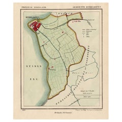
Antique Map of Doniawerstal in Friesland, Holland, 1868
About the Item
Antique map titled 'Provincie Friesland - Doniawerstal'. Map of the township Doniawerstal including Langweer, Boornzwaag, Idskenhuizen and many other villages. This map originates from 'Gemeente-Atlas van Nederland' by J. Kuyper.
Artists and Engravers: Published by H. Suringar.
Condition: Good, general age-related toning. Minor wear, blank verso. Please study image carefully.
Date: 1868
Overall size: 20 x 26.5 cm.
Image size: 15 x 18.5 cm.
We sell original antique maps to collectors, historians, educators and interior decorators all over the world. Our collection includes a wide range of authentic antique maps from the 16th to the 20th centuries. Buying and collecting antique maps is a tradition that goes back hundreds of years. Antique maps have proved a richly rewarding investment over the past decade, thanks to a growing appreciation of their unique historical appeal. Today the decorative qualities of antique maps are widely recognized by interior designers who appreciate their beauty and design flexibility. Depending on the individual map, presentation, and context, a rare or antique map can be modern, traditional, abstract, figurative, serious or whimsical. We offer a wide range of authentic antique maps for any budget.
- Dimensions:Height: 10.44 in (26.5 cm)Width: 7.88 in (20 cm)Depth: 0 in (0.01 mm)
- Materials and Techniques:
- Period:
- Date of Manufacture:1868
- Condition:
- Seller Location:Langweer, NL
- Reference Number:
About the Seller
5.0
Platinum Seller
These expertly vetted sellers are 1stDibs' most experienced sellers and are rated highest by our customers.
Established in 2009
1stDibs seller since 2017
1,916 sales on 1stDibs
Typical response time: <1 hour
- ShippingRetrieving quote...Ships From: Langweer, Netherlands
- Return PolicyA return for this item may be initiated within 14 days of delivery.
More From This SellerView All
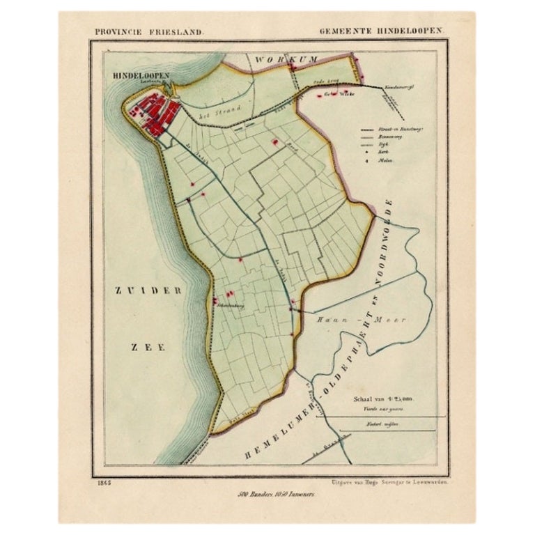
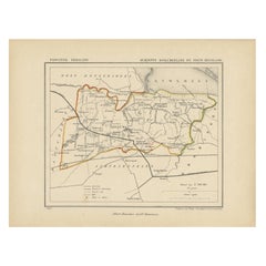
- Antique Map of Hindelopen, Picturesque Harbour City in Friesland, Holland, 1868Located in Langweer, NLAntique map titled 'Provincie Friesland - Gemeente Hindeloopen'. Map of the township of Hindeloopen, Friesland. This map originates from 'Gemeente-Atlas van Nederland' by J. Kuyp...Category
Antique 19th Century Maps
MaterialsPaper
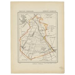
- Antique Map of Leeuwarderadeel in Friesland, The Netherlands, 1868Located in Langweer, NLAntique map titled 'Provincie Friesland - Gemeente Leeuwarderadeel'. Map of the township of Leeuwarderadeel including Friesland's Capital Leeuwarden and furthermore: Wirdum, Wytg...Category
Antique 19th Century Maps
MaterialsPaper
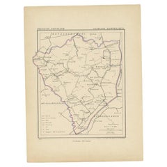
- Antique Map of Gaasterland, Friesland in the Netherlands, 1868Located in Langweer, NLAntique map titled 'Provincie Friesland - Gemeente Gaasterland'. Map of the township of Gaasterland including Balk, Bakhuizen, Wijckel, Sloten and many other villages. This map origi...Category
Antique 19th Century Maps
MaterialsPaper
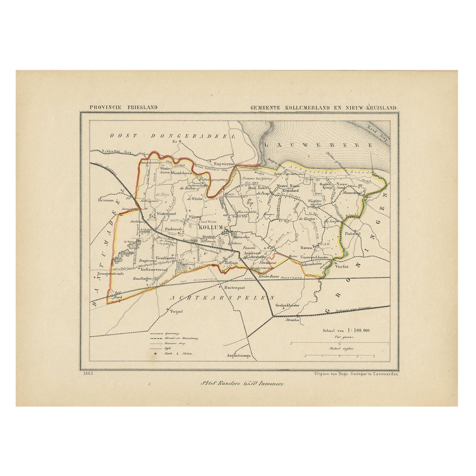
- Antique Map of Kollumerland in Friesland, The Netherlands, 1868Located in Langweer, NLAntique map titled 'Provincie Friesland - Gemeente Kollumerland en Nieuw-Kruisland'. Map of the township of Kollumerland including Kollum, Westergeest, Burum and many other villa...Category
Antique 19th Century Maps
MaterialsPaper
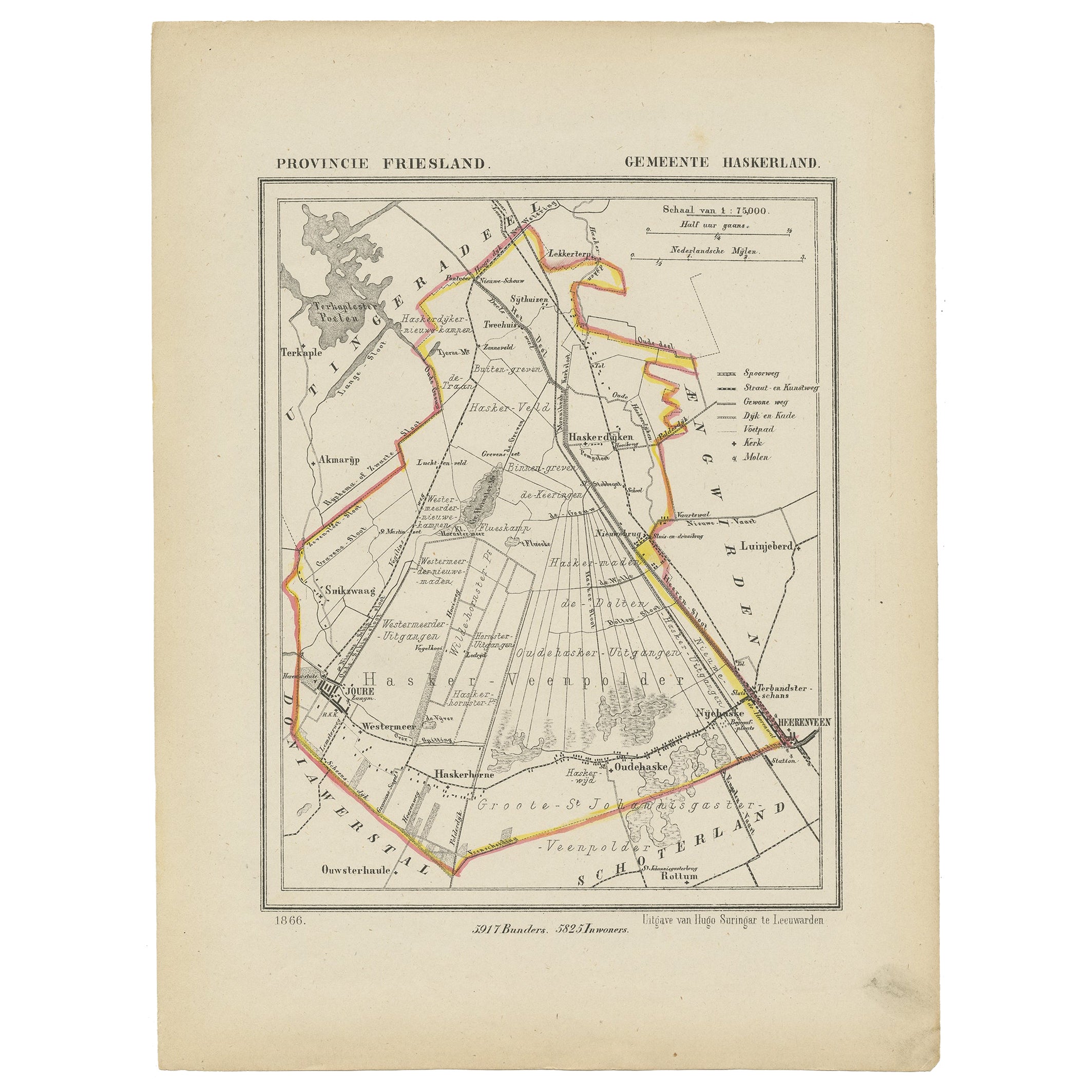
- Antique Map of Haskerland in Friesland, The Netherlands, 1868Located in Langweer, NLAntique map titled 'Provincie Friesland - Gemeente Haskerland'. Map of the township of Haskerland including Haskerhorne, Joure, Oudehaske and many other villages. This map origin...Category
Antique 19th Century Maps
MaterialsPaper
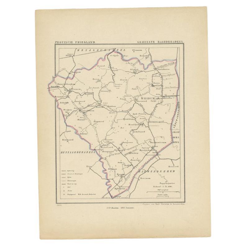
- Antique Map of Baarderadeel in Friesland, The Netherlands, 1868Located in Langweer, NLAntique map titled 'Provincie Friesland - Gemeente Baarderadeel'. Map of the township Baarderadeel including Weidum, Oosterlittens and many other villages. This map originates from '...Category
Antique 19th Century Maps
MaterialsPaper


You May Also Like
- 1868 Map of the Upper Part of the Island of Manhattan Above 86th StreetBy Wm. Rogers Mfg. Co.Located in San Francisco, CAThis wonderful piece of New York City history is over 150 years old. It depicts 86th street and above. It was lithographed by WC Rogers and company. It was made to show what was the Battle of Harlem during the Revolutionary war...Category
Antique 1860s American American Colonial Maps
MaterialsPaper
- Antique Map of Principality of MonacoBy Antonio Vallardi EditoreLocated in Alessandria, PiemonteST/619 - "Old Geographical Atlas of Italy - Topographic map of ex-Principality of Monaco" - ediz Vallardi - Milano - A somewhat special edition ---Category
Antique Late 19th Century Italian Other Prints
MaterialsPaper
- Geographical Antique Map of Principality of MonacoBy Bruno SantiniLocated in Alessandria, PiemonteST/609 - Interesting antique color map of Monaco Principality in French language : "Carte qui contient le Principauté de Piémont, le Monferrat et la comté de...Category
Antique Late 18th Century Italian Other Maps
MaterialsPaper
- 1861 Topographical Map of the District of Columbia, by Boschke, Antique MapLocated in Colorado Springs, COPresented is an original map of Albert Boschke's extremely sought-after "Topographical Map of the District of Columbia Surveyed in the Years 1856 ...Category
Antique 1860s American Historical Memorabilia
MaterialsPaper
- 1907 Map of Colorado, Antique Topographical Map, by Louis NellLocated in Colorado Springs, COThis highly detailed pocket map is a topographical map of the state of Colorado by Louis Nell from 1907. The map "has been complied from all availabl...Category
Antique Early 1900s American Maps
MaterialsPaper
- Original Antique Map of Italy. C.1780Located in St Annes, LancashireGreat map of Italy Copper-plate engraving Published C.1780 Unframed.Category
Antique Early 1800s English Georgian Maps
MaterialsPaper


Recently Viewed
View AllMore Ways To Browse
Dutch 16th Century Furniture
Antique Furniture Long Island
London Antique Map
London Map Antique
Antique Maps London
Antique London Maps
Antique London Map
Antique Map London
London Antique Maps
Ship Map
Map Of Britain
Antique Law Office Furniture
Antique Maps Of London
Antique Map Of London
Antique Maps Amsterdam
Antique And Collectable Fairs
Antique Furniture South London
Antique Map England