Items Similar to Old Dutch Map of the City of Oran 'Warran', Algeria, 1773
Want more images or videos?
Request additional images or videos from the seller
1 of 5
Old Dutch Map of the City of Oran 'Warran', Algeria, 1773
About the Item
Antique print titled 'Ligging der Stad en Haven van Warran of Oran'.
Old map of the city of Oran (Warran), Algeria. Originates from the first Dutch editon of an interesting travel account of Northern Africa titled 'Reizen en Aanmerkingen door en over Barbaryen en het Ooste'.
Artists and Engravers: Author: T. Shaw. Translated by P. Boddaert and published by J. van Schoonhoven.
Condition:
Very good, general age-related toning. Please study image carefully.
- Dimensions:Height: 10.24 in (26 cm)Width: 8.27 in (21 cm)Depth: 0 in (0.02 mm)
- Materials and Techniques:
- Period:1770-1779
- Date of Manufacture:1773
- Condition:Wear consistent with age and use.
- Seller Location:Langweer, NL
- Reference Number:
About the Seller
5.0
Platinum Seller
These expertly vetted sellers are 1stDibs' most experienced sellers and are rated highest by our customers.
Established in 2009
1stDibs seller since 2017
1,916 sales on 1stDibs
Typical response time: <1 hour
- ShippingRetrieving quote...Ships From: Langweer, Netherlands
- Return PolicyA return for this item may be initiated within 14 days of delivery.
More From This SellerView All
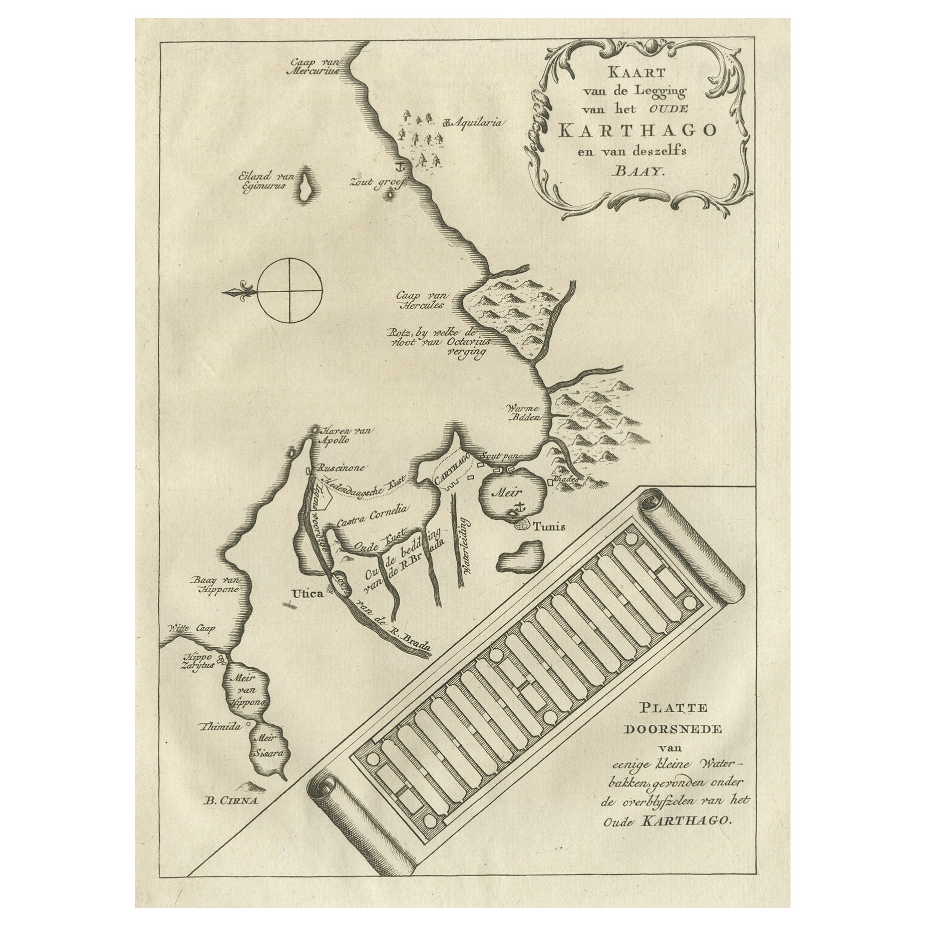
- Old Dutch Map of the City of Carthage and the Bay of Carthage, 1773Located in Langweer, NLAntique print titled 'Kaart van de Legging van het Oude Karthago'. Old map of the city of Carthage and the Bay of Carthage. It was the center or capital city of the ancient Carthagin...Category
Antique 1770s Maps
MaterialsPaper
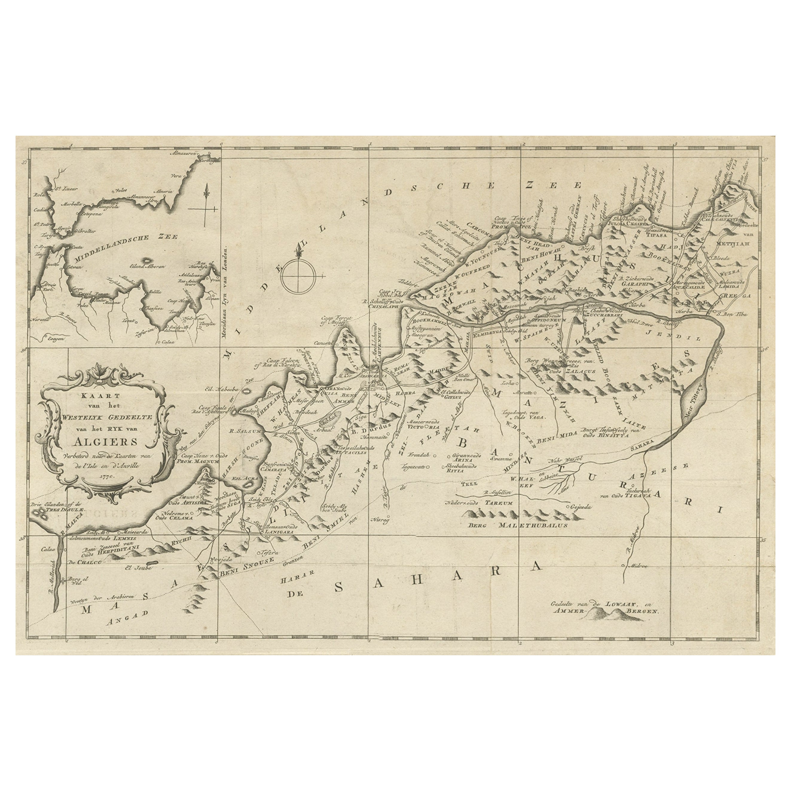
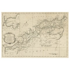
- Old Map of the Western Region of the Kingdom of Algiers, Algeria, 1773Located in Langweer, NLAntique map titled 'Kaart van het Westelyk Gedeelte van het Ryk van Algiers'. Old map of the western region of the Kingdom of Algiers, Algeria. Originates from the first Dutch ed...Category
Antique 1770s Maps
MaterialsPaper
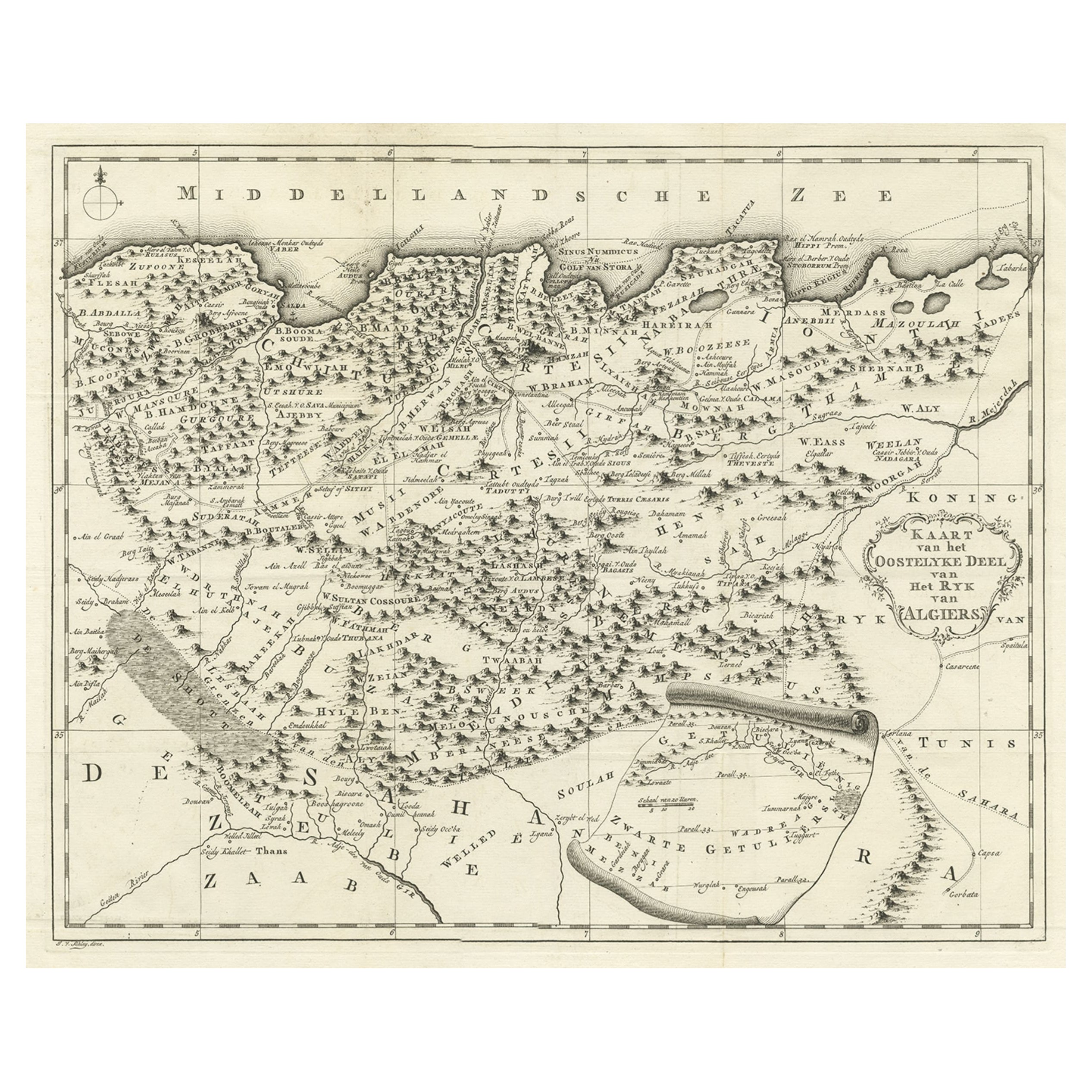
- Old Map of the Eastern Region of the Kingdom of Algiers, Algeria, 1773Located in Langweer, NLAntique map titled 'Kaart van het Oostelyke Deel van het Ryk van Algiers'. Old map of the eastern region of the Kingdom of Algiers, Algeria. Originates from the first Dutch edito...Category
Antique 1770s Maps
MaterialsPaper
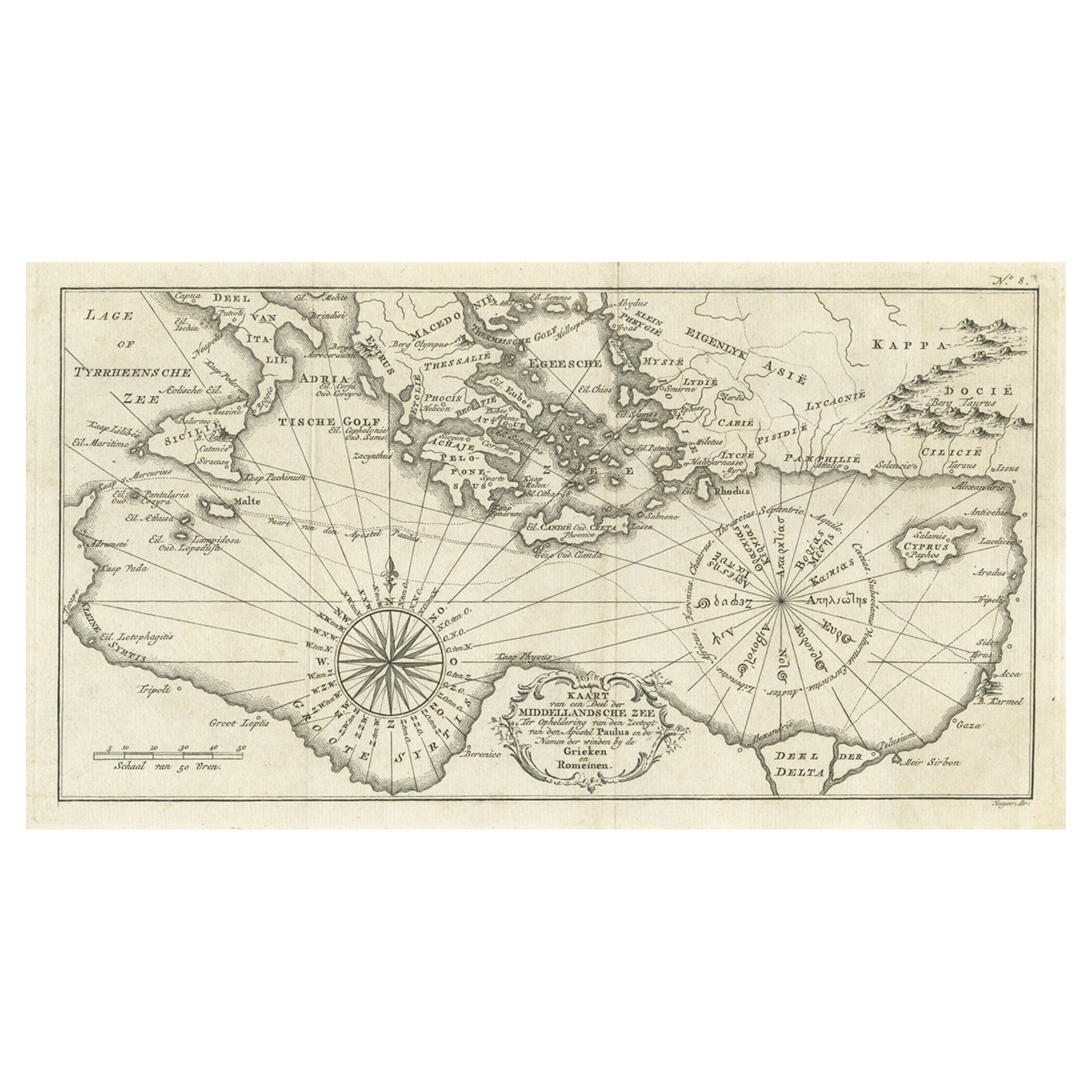
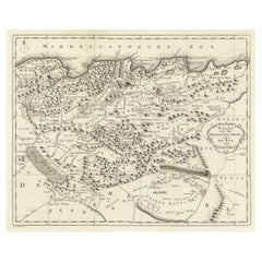
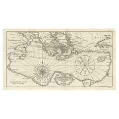
- Old Dutch Map of the Region Around the Mediterranean Sea, 1773Located in Langweer, NLAntique map titled 'Kaart van een Deel der Middelandsche Zee (..)'. Old map of the region around the Mediterranean Sea. Originates from the first Dutch editon of an interesting t...Category
Antique 1770s Maps
MaterialsPaper
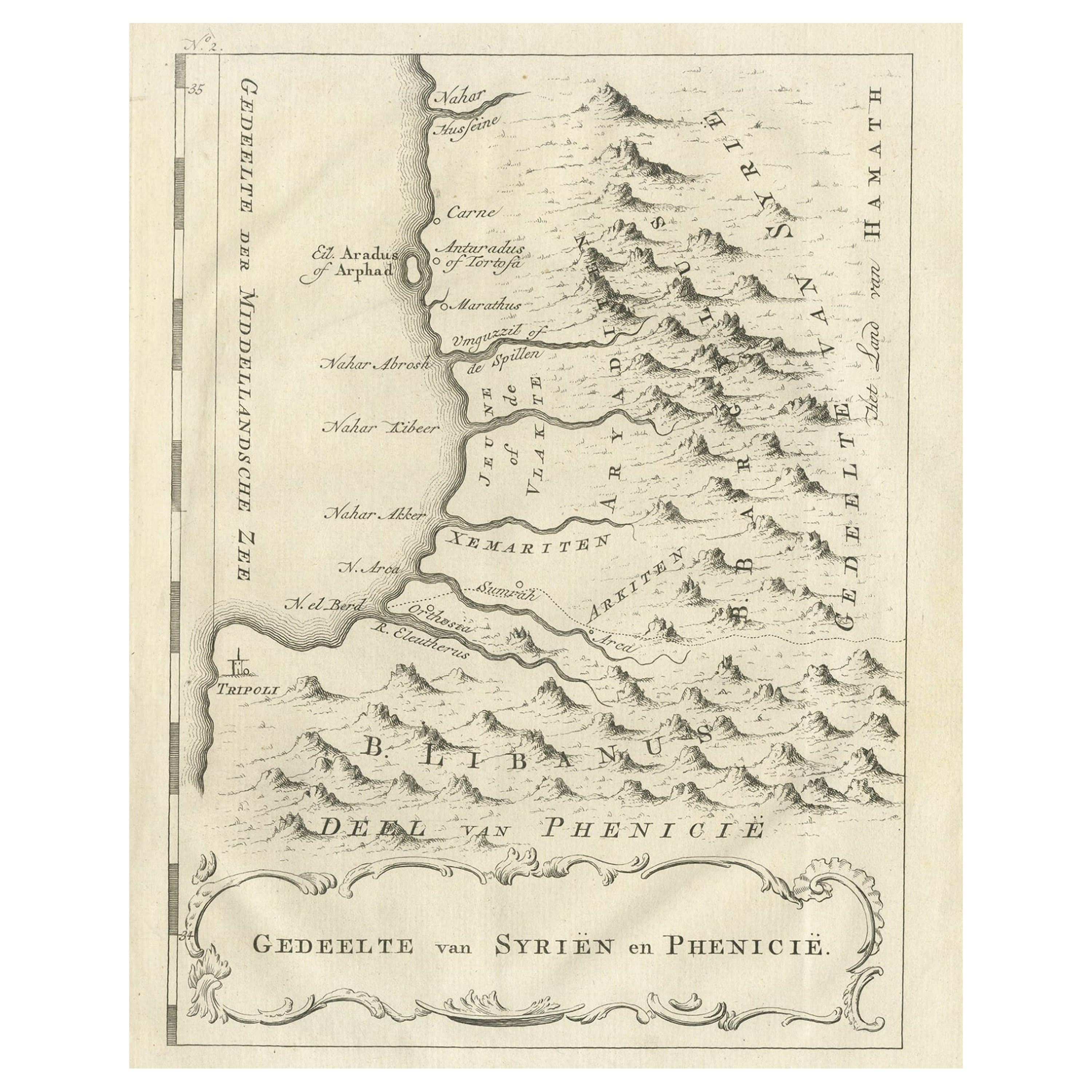
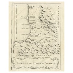
- Old Dutch Map of Part of Syria and Phoenicia, 1773Located in Langweer, NLAntique print titled 'Gedeelte van Syriën en Phenicië'. Old map of part of Syria and Phoenicia. Originates from the first Dutch editon of an interesting travel account of Norther...Category
Antique 1770s Maps
MaterialsPaper
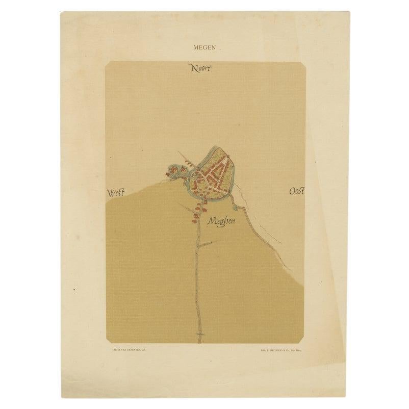
- Old Map of the Dutch City of Megen in Holland, 1916Located in Langweer, NLAntique map Megen titled 'Megen'. Antique map depicting the city of Megen, Noord-Brabant, The Netherlands. Artists and Engravers: Lithograph by J. Smulders & Co, Den Haag. Con...Category
20th Century Maps
MaterialsPaper


You May Also Like
- Italian Parchment Map of the City of Pisa Dated, 1640By Matthäus Merian the ElderLocated in Roma, ITAn antique map of the Tuscan city of Pisa engraved for The 'Itinerarium Italiæ Nov-antiquæ' by Matthäus Merian the Elder and printed in 1640....Category
Antique 1640s Italian Maps
MaterialsPaper
- Italian Parchment Map of the City of Lucca Dated 1640By Matthäus Merian the ElderLocated in Roma, ITAn antique map of the Tuscan city of Lucca engraved for The 'Itinerarium Italiæ Nov-antiquæ' by Matthäus Merian the Elder and printed in 1640...Category
Antique 1640s Italian Maps
MaterialsParchment Paper, Paper
- Old Nautical Map of CorsicaLocated in Alessandria, PiemonteST/556/1 - Old map of Corsica isle, surveyed by Captain Hell, of the French Royal Navy in 1824, engraved and published on 1874, with additions and corre...Category
Antique Early 19th Century English Other Prints
MaterialsPaper
- Old Horizontal Map of EnglandBy TassoLocated in Alessandria, PiemonteST/520 - Old rare Italian map of England, dated 1826-1827 - by Girolamo Tasso, editor in Venise, for the atlas of M.r Le-Sage.Category
Antique Early 19th Century Italian Other Prints
MaterialsPaper
- 1840 Map of the City of Washington Published by William M. MorrisonLocated in Colorado Springs, COThis map, printed in 1840, is a detailed representation of Washington, D.C. in the mid-19th century. The map shows block numbers, wards, and government buildings as well as details o...Category
Antique 1840s American Federal Maps
MaterialsPaper
- Antique Map of American Cities, Vignette of New York City, circa 1920Located in St Annes, LancashireGreat maps of American Cities Unframed Original color By John Bartholomew and Co. Edinburgh Geographical Institute Published, circa 1920Category
Vintage 1920s British Maps
MaterialsPaper


Recently Viewed
View AllMore Ways To Browse
Old Dutch Antique
African P
Antique Travel Map
Antique African Door
First Editon
Algeria Antique Map
City Of Oran
Antiques Oran Map
Antique House Plans
Antique Metal Window
Antique Metal Windows
Antique Furniture Rollers
Antiques Compasses
Antique Map Book
Antique Maps Book
Italy Map Antique
Antique Admiral
Antique Maps Of Italy