Items Similar to Scarce Antique Map of Greece, the Aegean, Crete and part of Asia Minor


Want more images or videos?
Request additional images or videos from the seller
1 of 7
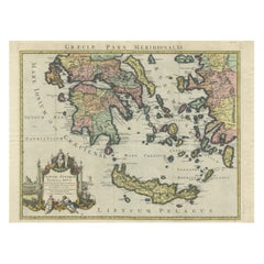
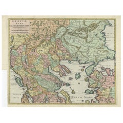
Scarce Antique Map of Greece, the Aegean, Crete and part of Asia Minor
About the Item
Original antique map titled 'Exactissima totius Archipelagi nec non Graeciae Tabula'. Visscher's scarce map of the Greek Islands, the Aegean, Crete and part of Asia Minor. Published circa 1680.
Among the many great Dutch map publishers active in the seventeenth century were the Visscher family; the firm was begun by Claes Jansz Visscher (1587-1652), and subsequently included his son Nicolaas (1618-1679), grandson Nicolaas II (1649-1702) and then his grandson’s widow, Elizabeth, until her death in 1726.
Although mainly art dealers, the Visschers were prolific publishers, producing individual maps and also atlases made up to their customers’ specifications. Indeed, they are commonly regarded as second only to the Blaeus among Dutch map-makers for the high quality of engraving and decoration and the geographical accuracy of their many maps. Particularly outstanding - not only as maps but as works of art - are their world maps.
- Dimensions:Height: 21.15 in (53.7 cm)Width: 24.49 in (62.2 cm)Depth: 0.02 in (0.5 mm)
- Materials and Techniques:Paper,Engraved
- Period:Late 17th Century
- Date of Manufacture:c.1680
- Condition:Repaired: Repair on split of folding line (bottom). Wear consistent with age and use. General age-related toning. Original / contemporary hand coloring. Original folding line. Repair on split of folding line (bottom). Blank verso. Please study image carefully.
- Seller Location:Langweer, NL
- Reference Number:
About the Seller
5.0
Platinum Seller
These expertly vetted sellers are 1stDibs' most experienced sellers and are rated highest by our customers.
Established in 2009
1stDibs seller since 2017
1,916 sales on 1stDibs
Typical response time: <1 hour
- ShippingRetrieving quote...Ships From: Langweer, Netherlands
- Return PolicyA return for this item may be initiated within 14 days of delivery.
More From This SellerView All
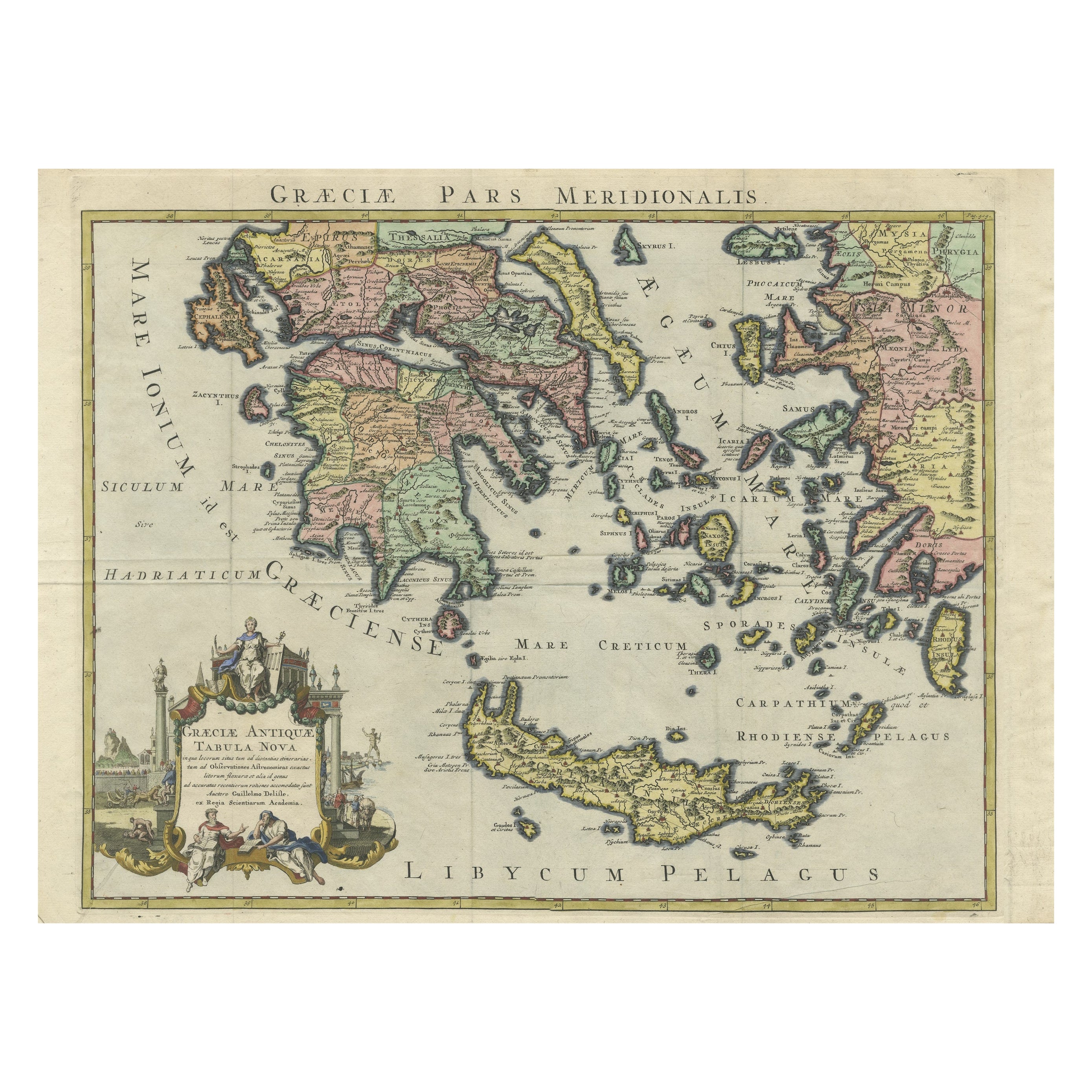
- Antique Map of Greece and Crete, Rhodus and A Part of Asia Minor , ca. 1730Located in Langweer, NLAntique engraved map of Greece. Title: "GRÆCIÆ ANTIQUÆ Tabula Nova". Year: c. 1730. Coloured engraved map by G. Delisle of Greece and Part of the Aegean. Condition is good. Sm...Category
Antique 1720s Maps
MaterialsPaper
- Antique Engraved Map of the Northern Part of Greece and the Aegean Sea, Ca.1730Located in Langweer, NLTitle: "GRÆCIÆ PARS Septentrionalis". Hand Coloured Engraved map by G. Delisle of the northern part of the Aegean. In the top left corner a distance scale included. Condition...Category
Antique 1730s Maps
MaterialsPaper
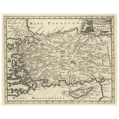
- Antique Map of Asia Minor, Cyprus, and the Eastern MediterraneanLocated in Langweer, NLAntique map titled 'Natoliae quae olim Asia Minor nova descriptio'. Original antique map of Asia Minor, Cyprus, and the eastern Mediterranean. Originally published on one sheet toget...Category
Antique Early 17th Century Maps
MaterialsPaper
- Original Antique Map of Turkey, Asia Minor and CyprusBy Gerard MercatorLocated in Langweer, NLAntique map titled 'Natoliae sive Asia Minor'. Original old map of Turkey, Asia Minor and Cyprus. Includes a decorative cartouches, sailing ship, sea mon...Category
Antique Early 17th Century Maps
MaterialsPaper
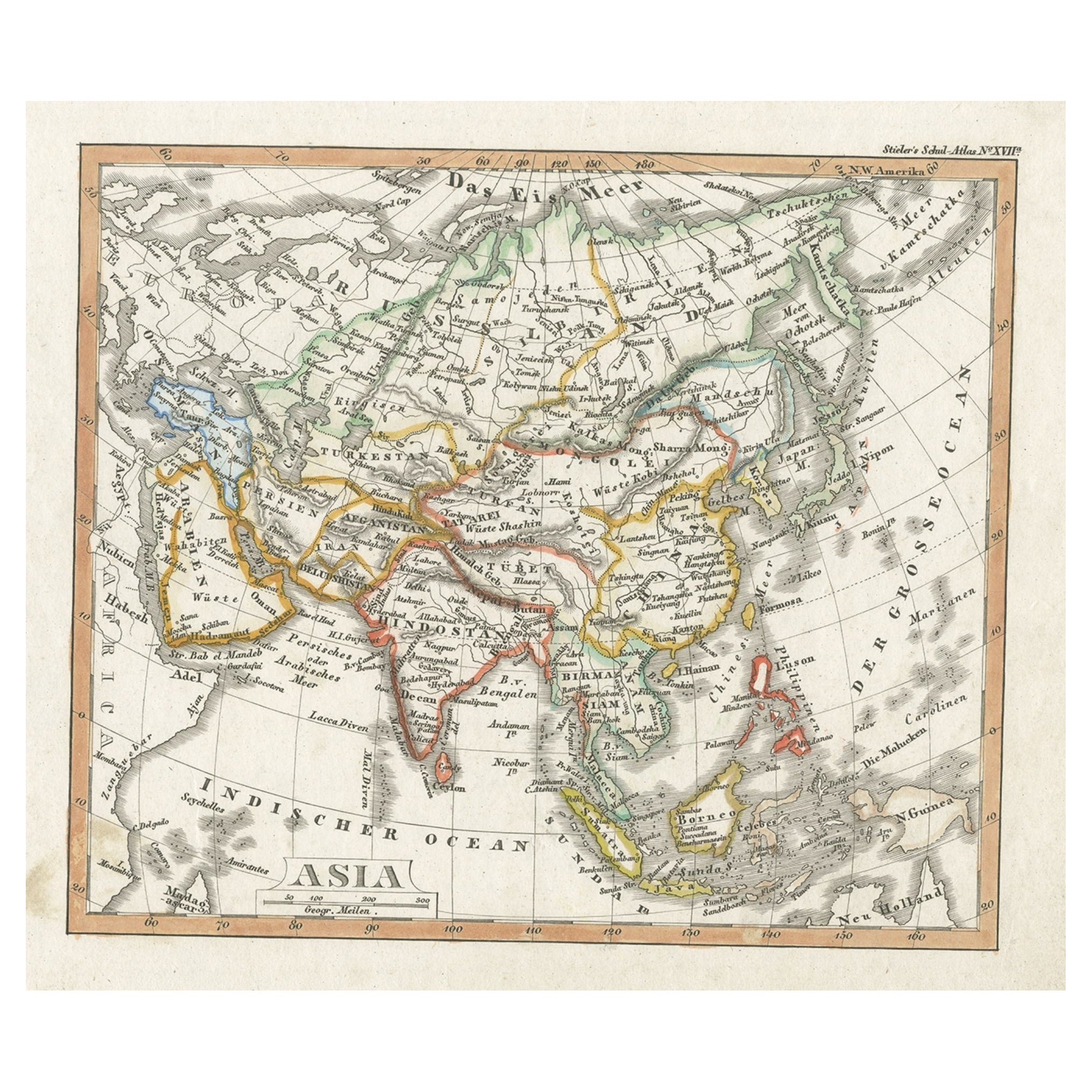
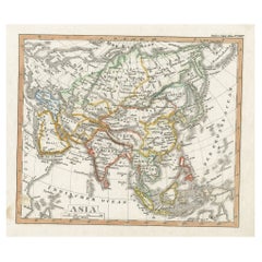
- Charming Scarce Small Antique Map of Asia, 1837Located in Langweer, NLAntique map titled ‘Asia‘. Scarce and charming little mid-19th century antique map of Asia. Noteworthy for the early date and scarcity factor, from a small pocket sized school atlas ...Category
Antique 19th Century Maps
MaterialsPaper
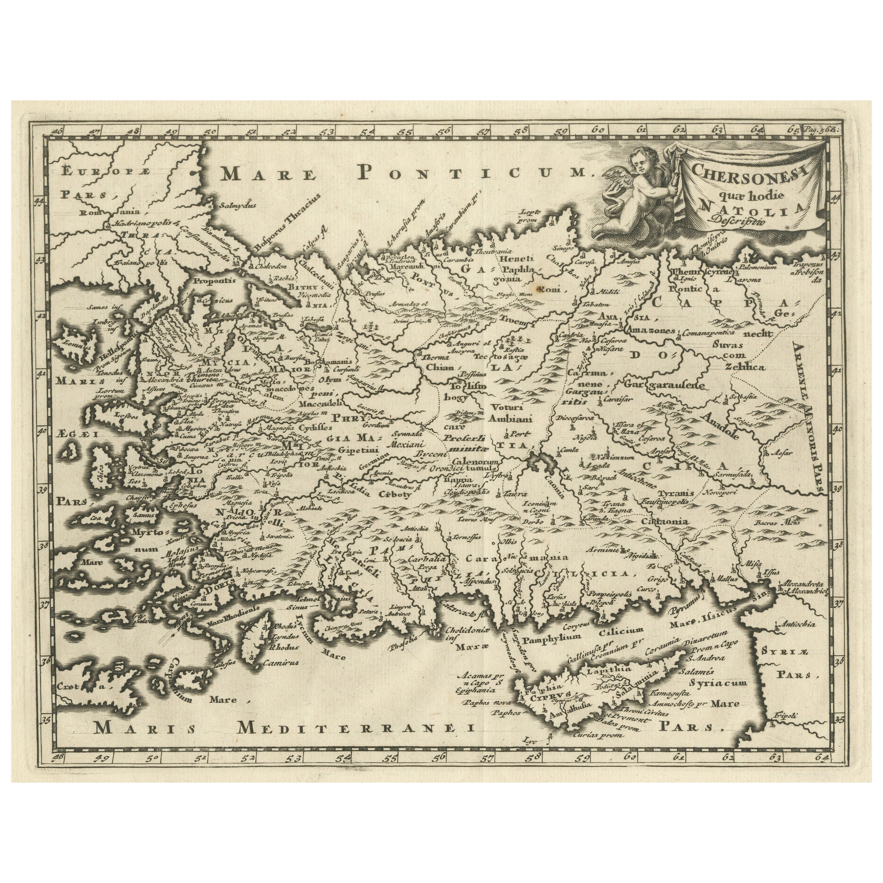
- Antique Map of Asia Minor including part of the Greek Archipelago and CyprusLocated in Langweer, NLAntique map titled 'Chersonesi quae hodie Natolia Descriptio'. Decorative, smaller map of Asia Minor including part of the Greek Archipelago and Cyprus. The drape-style title cartouc...Category
Antique Mid-18th Century Maps
MaterialsPaper


You May Also Like
- Hand-Colored 18th Century Homann Map of the Black Sea, Turkey and Asia MinorBy Johann Baptist HomannLocated in Alamo, CAAn attractive original early 18th century hand-colored map of the Black Sea and Turkey entitled "Carte de L'Asie Minevre ou de la Natolie et du Pont Evxin Tiree des Voyages et des Ob...Category
Antique Early 18th Century German Maps
MaterialsPaper
- Original Antique Map of Asia. C.1780Located in St Annes, LancashireGreat map of Asia Copper-plate engraving Published C.1780 Two small worm holes to right side of map Unframed.Category
Antique Early 1800s English Georgian Maps
MaterialsPaper

- Original Antique Map of South East Asia, Arrowsmith, 1820Located in St Annes, LancashireGreat map of South East Asia Drawn under the direction of Arrowsmith Copper-plate engraving Published by Longman, Hurst, Rees, Orme and Brown, 1820 Unframed.Category
Antique 1820s English Maps
MaterialsPaper
- Original Antique Map of Ancient Greece, Phocis, Gulf of Corinth, 1787Located in St Annes, LancashireGreat map of Ancient Greece. Showing the region of Phocis, including the Gulf of Corinth Drawn by J.D. Barbie Du Bocage Copper plate engraving by P.F Tardieu Original hand c...Category
Antique 1780s French Other Maps
MaterialsPaper
- Original Antique Map of South East Asia by Becker, circa 1840Located in St Annes, LancashireGreat map of South East Asia Steel engraving with original color outline Engraved by Becker Published by Virtue, circa 1840. Unframed.Category
Antique 1840s English Other Maps
MaterialsPaper
- Hand-Colored 18th Century Homann Map of the Danube, Italy, Greece, CroatiaBy Johann Baptist HomannLocated in Alamo, CA"Fluviorum in Europa principis Danubii" is a hand colored map of the region about the Danube river created by Johann Baptist Homann (1663-1724) in his 'Atlas Novus Terrarum', publish...Category
Antique Early 18th Century German Maps
MaterialsPaper


Recently Viewed
View AllMore Ways To Browse
Antique Crete
Greece Aegean
Antique Map Art Collectibles
Antique Maps Art Collectibles
Greek Asia Minor
Blaeu World Map
Claes Jansz Visscher
Antique Furniture Missouri
Roman Map
Antique Indian Maps
Antique Marine Maps
Antique Africa Maps And Atlases Africa Maps
Antique Maps California
Antique Map California
Map Of Sweden
Antique Maps Of California
Antique Map Of California
Scottish Coat Of Arms