Items Similar to 1859 Vintage Map of Holland and Belgium: Blackie's Imperial Geographic Insight
Want more images or videos?
Request additional images or videos from the seller
1 of 6
1859 Vintage Map of Holland and Belgium: Blackie's Imperial Geographic Insight
About the Item
The "Antique Map of Holland and Belgium" from 'The Imperial Atlas of Modern Geography', published by W. G. Blackie in 1859, is a significant historical map that offers a detailed portrayal of Holland (now commonly referred to as the Netherlands) and Belgium as they were understood in the mid-19th century.
**Key Features of the Map:**
1. **Geographical Detail**: The map covers the entirety of Holland and Belgium, showcasing their unique geographic features. This includes the intricate network of rivers and canals, the low-lying polders of Holland, and the rolling hills and valleys of Belgium.
2. **Political Boundaries**: During this period, Holland and Belgium were distinct entities, and the map likely delineates their national borders with precision. It provides a historical perspective on the boundaries and territorial divisions of the two countries.
3. **Urban Centers**: Major cities like Amsterdam, Rotterdam, Brussels, and Antwerp are prominently marked. The map provides insights into the urban landscape, highlighting key economic and cultural centers in both countries.
4. **Transportation Networks**: Given the era's burgeoning industrialization and trade, the map might illustrate the developing network of roads and railways, as well as the major ports that were central to commerce in Holland and Belgium.
5. **Hydrography**: The map likely details the complex hydrographic systems, including the Rhine, Meuse, and Scheldt rivers, which are crucial to both countries' geography and were vital trade routes.
6. **Artistic and Aesthetic Elements**: In keeping with the Victorian era's cartographic style, the map is likely adorned with ornate borders, an elegant title script, and possibly other artistic flourishes, enhancing its visual appeal.
7. **Educational and Historical Value**: As a historical document, this map is invaluable for educational purposes, offering a glimpse into the geographical knowledge and perceptions of Holland and Belgium in the mid-19th century.
This antique map is not only a treasure for collectors of historical cartography but also an important resource for historians, geographers, and anyone interested in the historical landscape and development of the Netherlands and Belgium. It captures a pivotal moment in the history of these nations and is a testament to the cartographic skills of the era.
- Dimensions:Height: 21.26 in (54 cm)Width: 14.57 in (37 cm)Depth: 0.02 in (0.5 mm)
- Materials and Techniques:
- Period:
- Date of Manufacture:1859
- Condition:Wear consistent with age and use. General age-related toning. some foxing, Please study image carefully.
- Seller Location:Langweer, NL
- Reference Number:
About the Seller
5.0
Platinum Seller
These expertly vetted sellers are 1stDibs' most experienced sellers and are rated highest by our customers.
Established in 2009
1stDibs seller since 2017
1,933 sales on 1stDibs
Typical response time: <1 hour
- ShippingRetrieving quote...Ships From: Langweer, Netherlands
- Return PolicyA return for this item may be initiated within 14 days of delivery.
More From This SellerView All
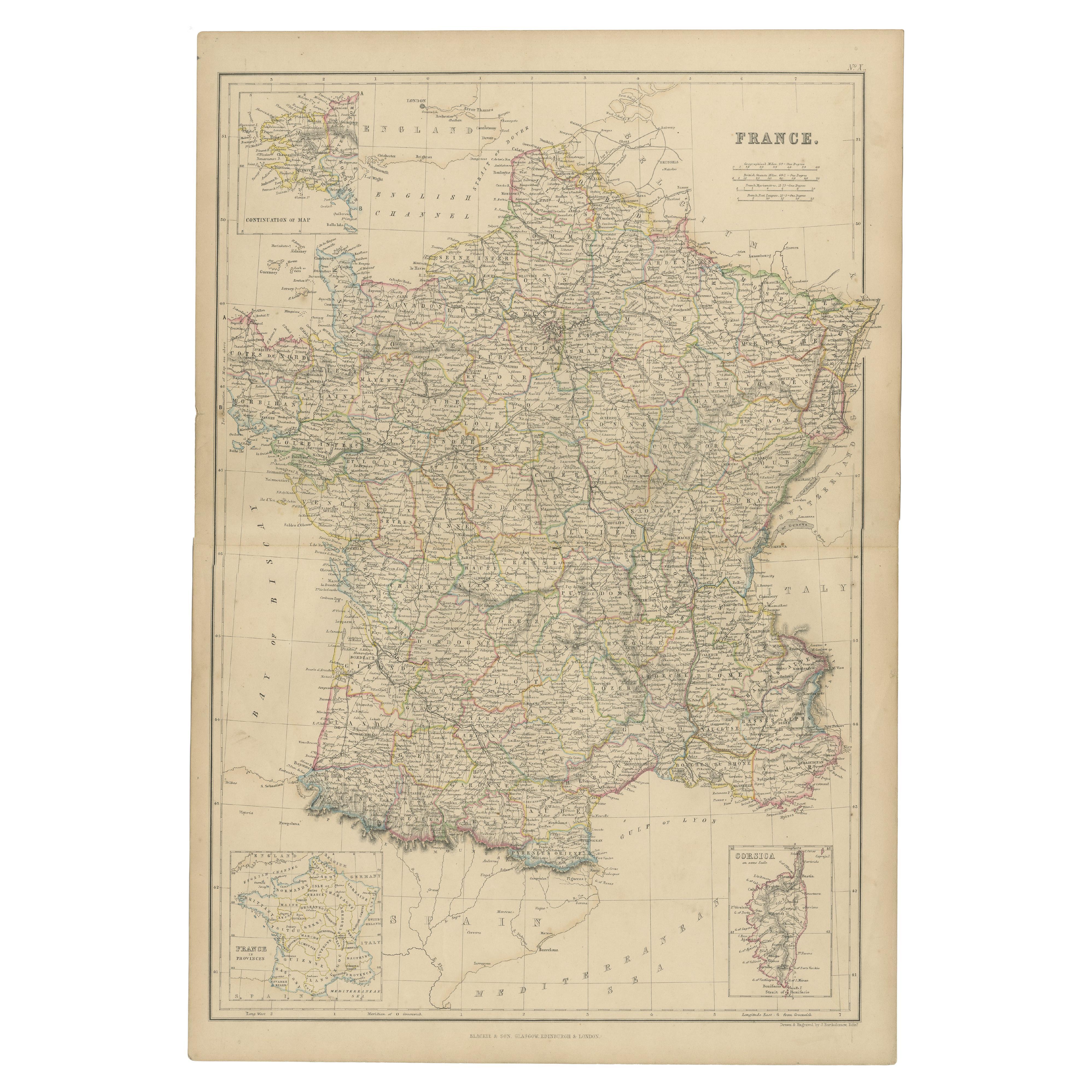
- 1859 Classic Map of France: Blackie's Imperial Geographic MasterpieceLocated in Langweer, NLThe "Antique Map of France" from 'The Imperial Atlas of Modern Geography', published in 1859 by W. G. Blackie, is a historically valuable cartographic work that offers a comprehensiv...Category
Antique Mid-19th Century Maps
MaterialsPaper
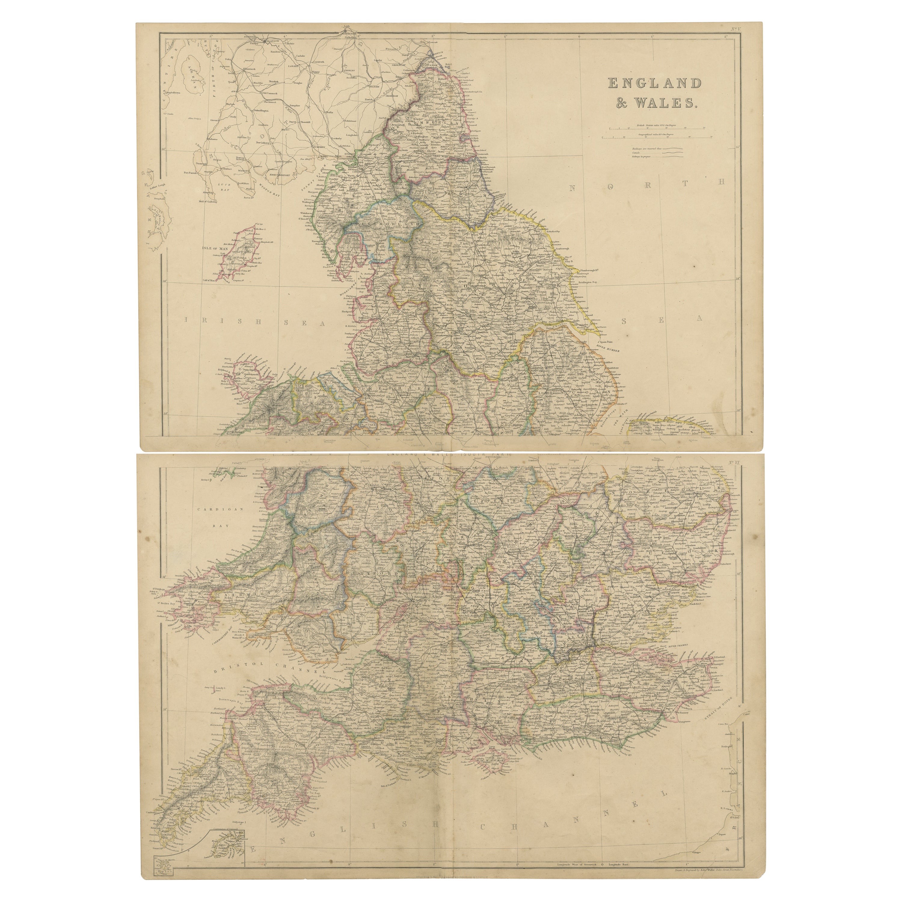
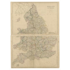
- 1859 Vintage Maps of England and Wales: Blackie's Imperial Geographic DetailLocated in Langweer, NLThe "Antique Map of England & Wales" from 'The Imperial Atlas of Modern Geography', published by W. G. Blackie in 1859, is an original antique map that provides a detailed depiction ...Category
Antique Mid-19th Century Maps
MaterialsPaper
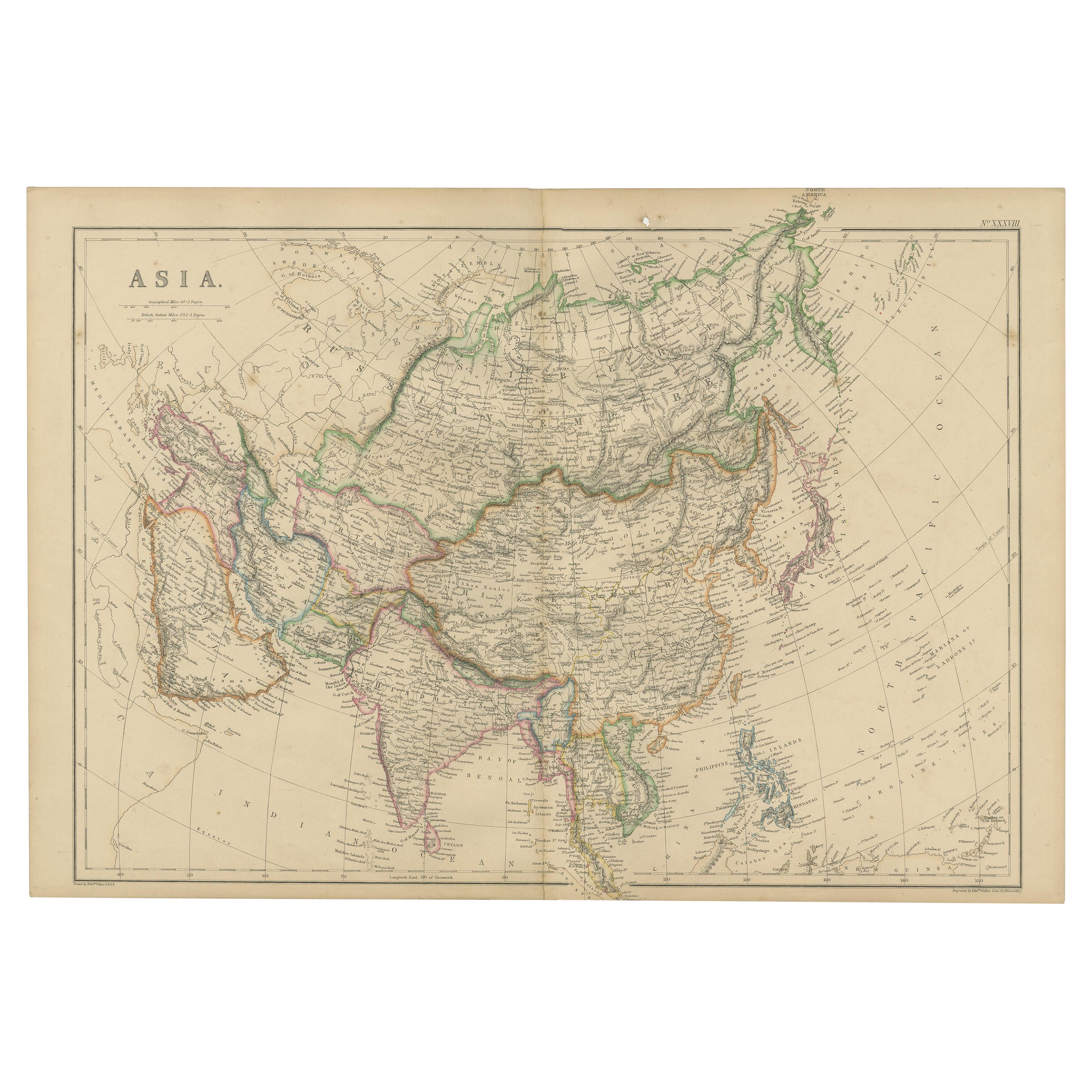
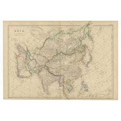
- Original 1859 Map of Asia from W.G. Blackie's Imperial Atlas of Modern GeographyLocated in Langweer, NLAntique map titled 'Asia'. Original antique map of Asia. This map originates from ‘The Imperial Atlas of Modern Geography’. Published by W. G. Blackie, 1859. The "Classic Cartograph...Category
Antique Mid-19th Century Maps
MaterialsPaper
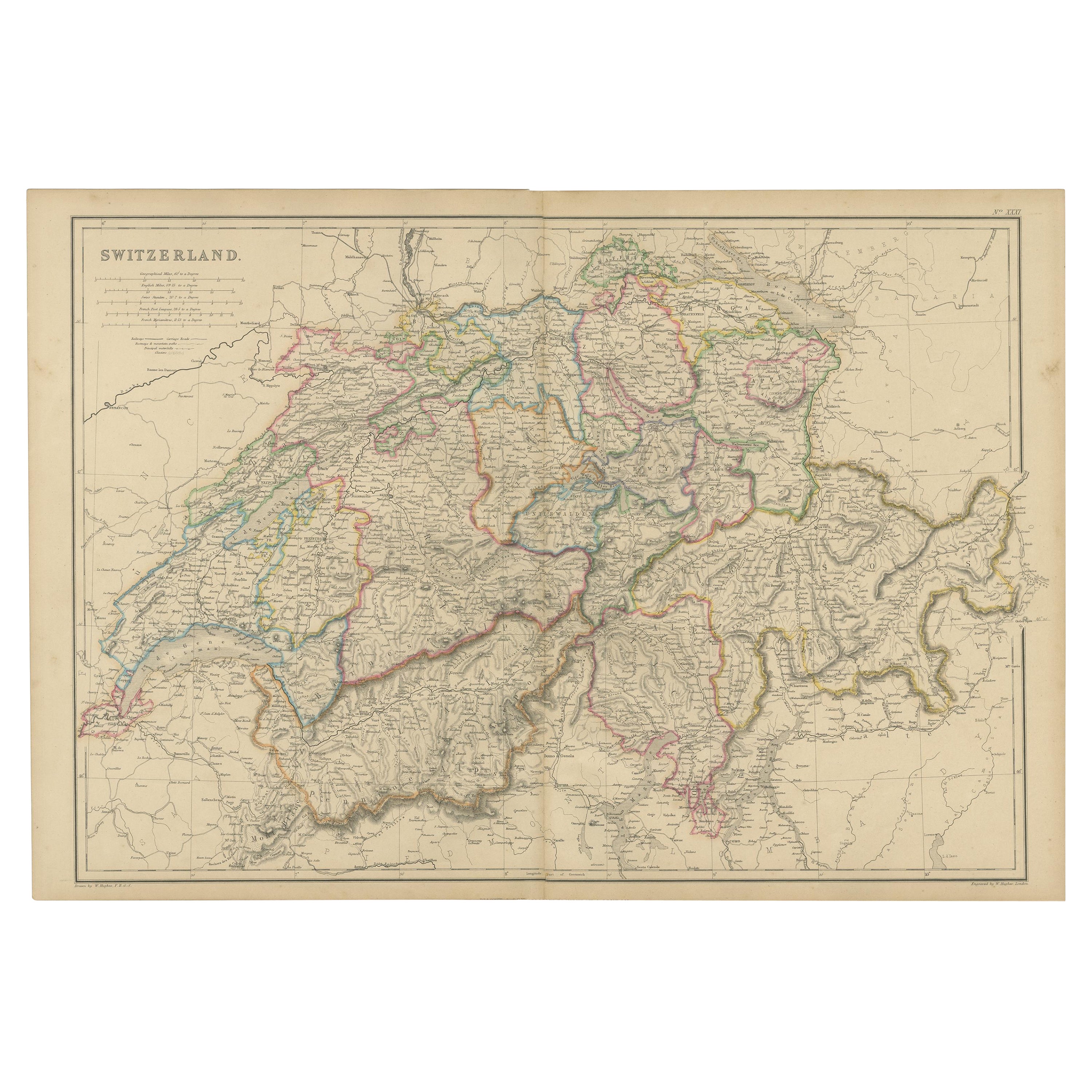
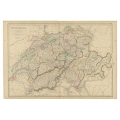
- 1859 Antique Swiss Panorama: Blackie's Detailed Map of SwitzerlandLocated in Langweer, NLThe "Antique Map of Switzerland" is a distinguished piece from 'The Imperial Atlas of Modern Geography', published in 1859 by the renowned cartographer W. G. Blackie. This map presen...Category
Antique Mid-19th Century Maps
MaterialsPaper
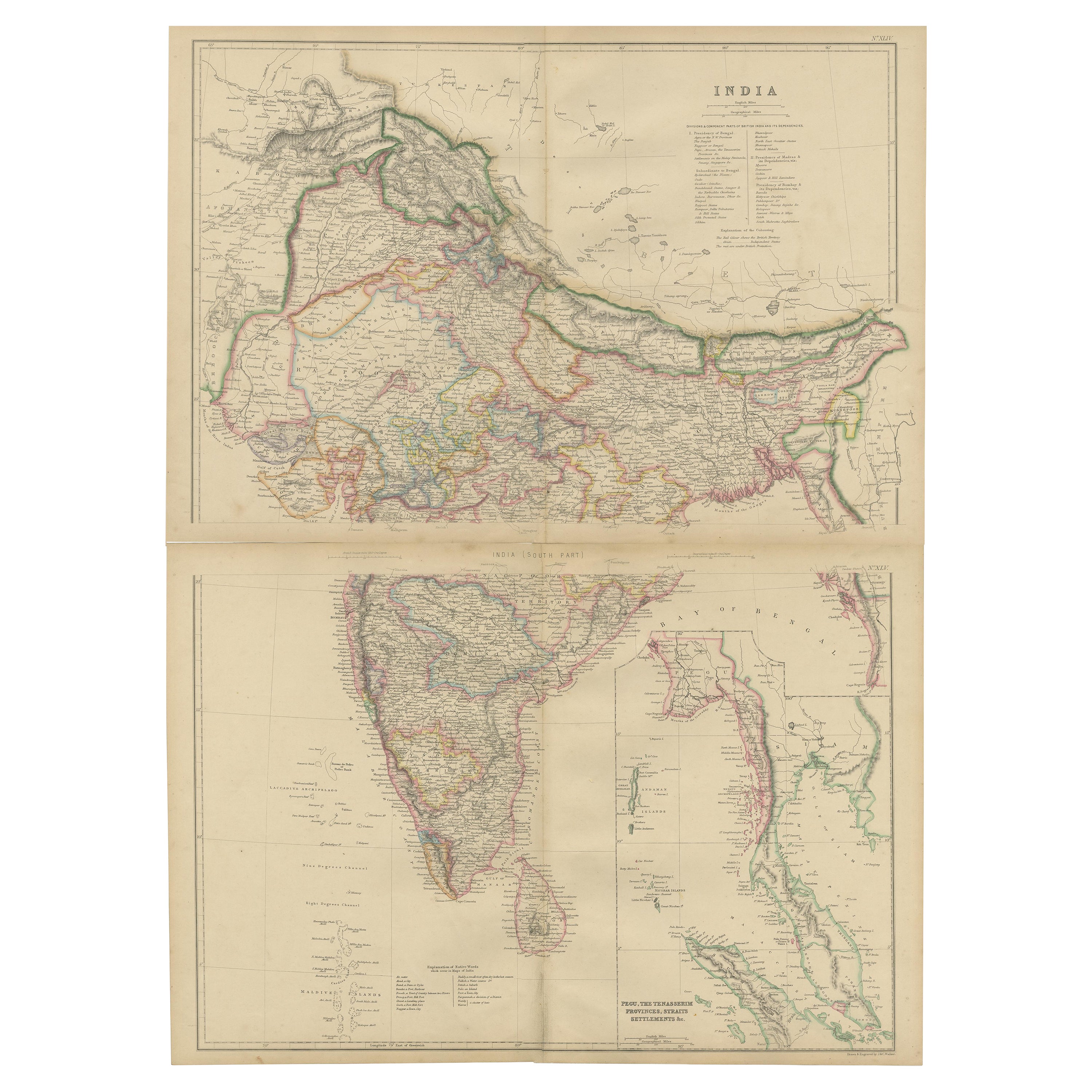
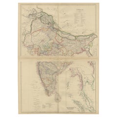
- Vintage Cartographic Collection Set of India Explored - W. G. Blackie's 1859Located in Langweer, NLAntique map titled 'India'. Original antique map of India with inset maps of Pegu, the Tenasserim Provinces, straits settlements. This map originate...Category
Antique Mid-19th Century Maps
MaterialsPaper
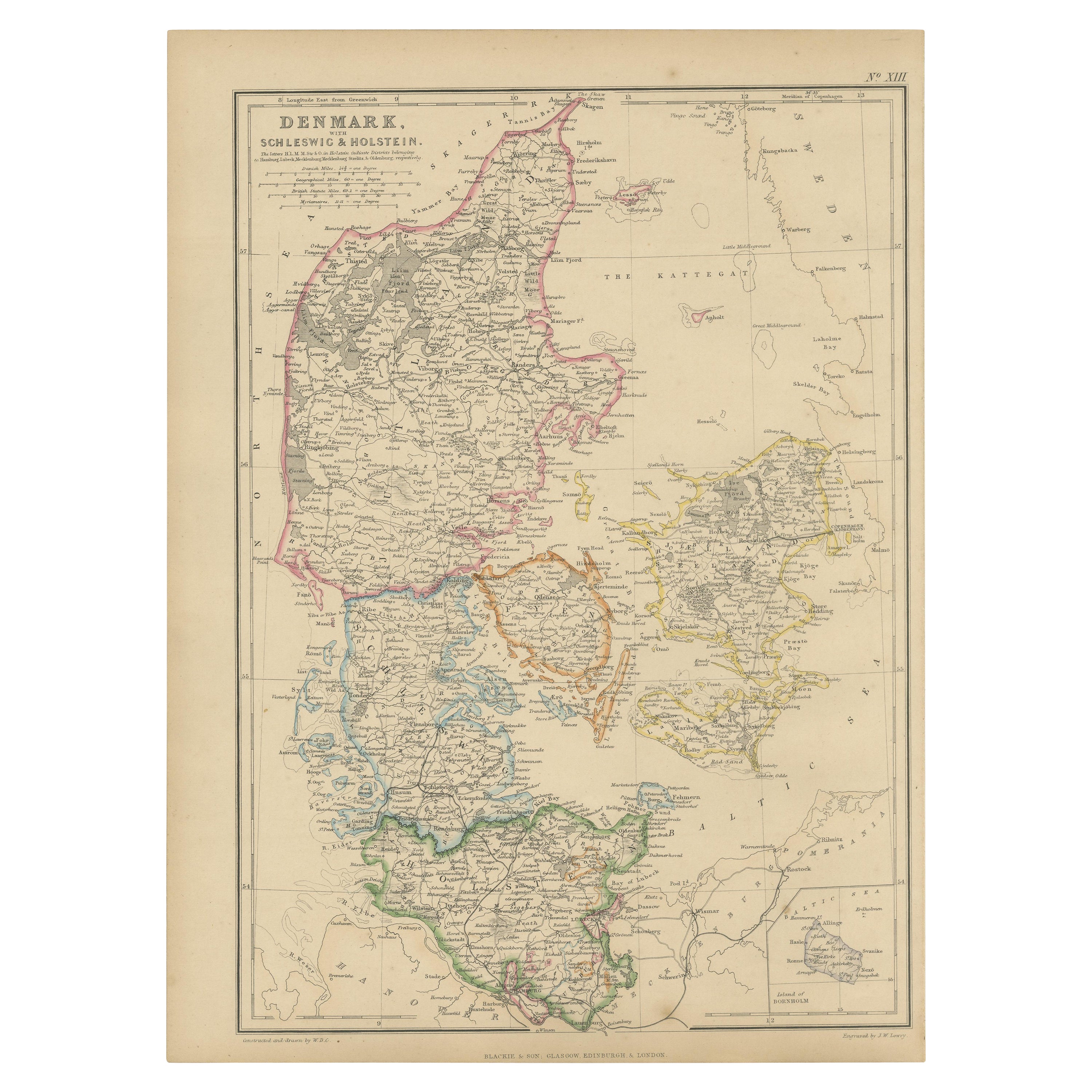
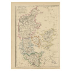
- 1859 Denmark and Schleswig-Holstein Map: A Historical View from Blackie's AtlasLocated in Langweer, NLThe "Antique Map of Denmark with Schleswig & Holstein" from 'The Imperial Atlas of Modern Geography', published by W. G. Blackie in 1859, is a valuable historical document that provi...Category
Antique Mid-19th Century Maps
MaterialsPaper

You May Also Like
- Large Antique 1859 Map of North AmericaLocated in Sag Harbor, NYThis Map was made by Augustus Mitchell in 1859 It is in amazing condition for being 163 years old. This price is for the rolled up easy to ship version of this piece. I will be Frami...Category
Antique Mid-19th Century American Maps
MaterialsCanvas, Paper

- Original Antique Map of Belgium by Tallis, Circa 1850Located in St Annes, LancashireGreat map of Belgium Steel engraving Many lovely vignettes Published by London Printing & Publishing Co. ( Formerly Tallis ), C.1850 Origin...Category
Antique 1850s English Maps
MaterialsPaper
- Italy, Sicily, Sardinia, Corsica and Dalmatian Coast: A 17th Century Dutch MapBy Theodorus DanckertsLocated in Alamo, CAThis hand colored 17th century Dutch map entitled "Novissima et Accuratissima totius Italiae Corsicae et Sardiniae Descriptio" by Theodore Danckerts depicts the Italian Peninsula in ...Category
Antique Late 17th Century Dutch Maps
MaterialsPaper
- Dutch Map and City Plan of La Roche-sur-Foron, France, 17th Century Hand ColoredBy Coenraet DeckerLocated in Alamo, CA"Rupes Allobrogum vulgo La Roche" by Dutch engraver Coenraet Decker (1650-1685) is from the atlas Theatrum Statuum Regiae Celestudinis Sabaudiae Ducis, published in 1682. This richly...Category
Antique Late 17th Century Dutch Maps
MaterialsPaper
- Antique 1630 Colored Belgium Map Flandria Gallica Flanders Henricus HondiusLocated in Dayton, OH"Antique hand colored map of Flanders, Belgium, circa 1630, engraved by Henricus Hondius. “Henricus Hondius II (1597 – 16 August 1651) was a Dutch eng...Category
Antique Early 17th Century Renaissance Maps
MaterialsPaper
- 17th Century Hand Colored Map of the Liege Region in Belgium by VisscherBy Nicolaes Visscher IILocated in Alamo, CAAn original 17th century map entitled "Leodiensis Episcopatus in omnes Subjacentes Provincias distincté divisusVisscher, Leodiensis Episcopatus" by Nicolaes Visscher II, published in Amsterdam in 1688. The map is centered on Liege, Belgium, includes the area between Antwerp, Turnhout, Roermond, Cologne, Trier and Dinant. This attractive map is presented in a cream-colored mat measuring 30" wide x 27.5" high. There is a central fold, as issued. There is minimal spotting in the upper margin and a tiny spot in the right lower margin, which are under the mat. The map is otherwise in excellent condition. The Visscher family were one of the great cartographic families of the 17th century. Begun by Claes Jansz Visscher...Category
Antique Late 17th Century Dutch Maps
MaterialsPaper


Recently Viewed
View AllMore Ways To Browse
Antique Maps Of Holland
Belgium Map
Map Of Belgium
Belgium Antique Map
Old Maps Of World
16th Century Dutch
Orient Antique
Used House Windows
World Map Vintage Maps
World Map Vintage Map
Antique Maps Of Islands
18th Russian
Antique Maps Of Holland
B C Antiques
Antique Map America
Antique American Maps
Antique American Map
America Antique Map