Belgium Antique Map

3
to
21
174
24
125
61
55
53
19
19
13
13
12
10
8
8
8
7
5
5
4
4
3
3
3
2
2
2
2
1
1
1
1
1
1
1
1
1
3
2
2
2
2
Sort By
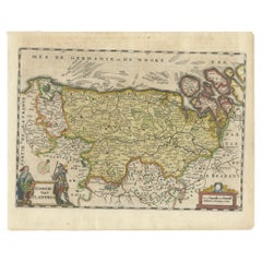
Antique 1630 Colored Belgium Map Flandria Gallica Flanders Henricus Hondius
Located in Dayton, OH
"Antique hand colored map of Flanders, Belgium, circa 1630, engraved by Henricus Hondius. “Henricus
Category

Early 17th Century Renaissance Belgium Antique Map

Materials

Paper

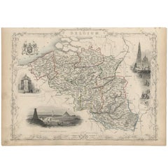
Antique Map of Belgium by J. Tallis, circa 1851
Located in Langweer, NL
A highly decorative and detailed mid-19th century map of Belgium which was drawn and engraved by J
Category

Mid-19th Century Belgium Antique Map

Materials

Paper

Antique Map of Flanders, Belgium, 1630
Located in Langweer, NL
Antique map titled 'Comitatus Flandria'. Original antique map of Flanders, Belgium. This map
Category

17th Century Belgium Antique Map

Materials

Paper

Antique Map of Flanders, Belgium, 1630
H 8.27 in W 10.04 in D 0 in
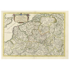
Antique Map of Belgium and Surroundings, 1692
Located in Langweer, NL
Paesi Bassi Cattolici con li confini di Francia di Allemagna et di Hollanda'. Uncommon map of Belgium
Category

17th Century Belgium Antique Map

Materials

Paper

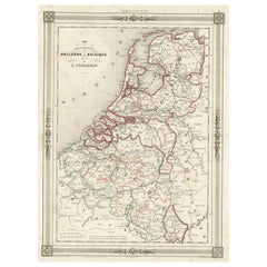
Antique Map of the Netherlands, Belgium and Luxembourg
Located in Langweer, NL
, Belgium and Luxembourg. This map originates from Maison Basset's 1852 edition of 'Atlas Illustre Destine a
Category

Mid-19th Century Belgium Antique Map

Materials

Paper

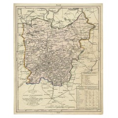
Antique Map of East Flanders, Belgium, c.1840
Located in Langweer, NL
Antique map titled 'Kaart van Oost Vlaanderen'. Original antique map of East Flanders, Belgium
Category

19th Century Belgium Antique Map

Materials

Paper

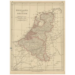
Antique Map of Holland and Belgium by Lowry, '1852'
Located in Langweer, NL
Antique map titled 'Holland and Belgium'. Original map of the Netherlands and Belgium. This map
Category

Mid-19th Century Belgium Antique Map

Materials

Paper

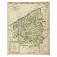
Antique Map of West Flanders in Belgium, c.1840
Located in Langweer, NL
Antique map titled 'Kaart van West Vlaanderen'. Original antique map of West Flanders, Belgium
Category

19th Century Belgium Antique Map

Materials

Paper

Antique Map of the Netherlands and Belgium, circa 1880
Located in Langweer, NL
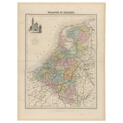
Antique map titled 'Hollande et Belgique'. Old map of the Netherlands and Belgium. With decorative
Category

19th Century Belgium Antique Map

Materials

Paper

Original Antique Map of Belgium by Tallis, Circa 1850
Located in St Annes, Lancashire
Great map of Belgium Steel engraving Many lovely vignettes Published by London Printing
Category

1850s English Belgium Antique Map

Materials

Paper

Original Antique Map of Belgium by Tallis, Circa 1850
No Reserve
H 13.75 in W 10.75 in D 0.07 in
Antique Nicely Colored Map of Holland and Belgium, 1846
Located in Langweer, NL
Antique map titled 'Holland and Belgium'. Old map of the Netherlands and Belgium. This map
Category

19th Century Belgium Antique Map

Materials

Paper

Antique Map of Belgium by J.C. Weigel, 1723
Located in Langweer, NL
Antique map titled 'Des Burgundischen Creisses Südlicher theil oder Oesterreichische Niederlande
Category

Early 18th Century Belgium Antique Map

Materials

Paper

Antique Map of Belgium by J.C. Weigel, 1723
H 8.67 in W 7.41 in D 0.02 in
Antique Map of Belgium and the Netherlands by Johnston '1909'
Located in Langweer, NL
Antique map titled 'Belgium and The Netherlands'. Original antique map of Belgium and the
Category

Early 20th Century Belgium Antique Map

Materials

Paper

Decorative Antique Map of the Netherlands and Belgium, ca.1875
Located in Langweer, NL
Antique map titled 'Pays-Bas Belgique (..)'. Large map of the Netherlands and Belgium. This map
Category

Late 19th Century Belgium Antique Map

Materials

Paper

Antique Map of the Netherlands and Belgium by Bowen, 1747
By Emanuel Bowen
Located in Langweer, NL
Antique map Belgium titled 'A New and Accurate Map of the Netherlands or Low Countries'. Detailed
Category

18th Century Belgium Antique Map

Materials

Paper

Antique Map of the Netherlands and Belgium by Hérisson, 1829
Located in Langweer, NL
shortly before Belgium's independence in 1830. The map is sectionalised and laid on linen, a common
Category

Mid-19th Century Belgium Antique Map

Materials

Paper

Antique Map of Belgium and the Netherlands by Johnston, 1882
By Alexander Keith Johnston
Located in Langweer, NL
Antique map titled 'Belgium and the Netherlands'. Old map of Belgium and the Netherlands. This map
Category

19th Century Belgium Antique Map

Materials

Paper

Antique Map of the Region of Flanders in Belgium, 1737
Located in Langweer, NL
Untitled map of the region of Flanders, Belgium. This map originates from 'Nieuw en beknopt Kaart
Category

18th Century Belgium Antique Map

Materials

Paper

Antique Map of the Netherlands and Belgium by Lapie, 1842
By Pierre M. Lapie
Located in Langweer, NL
Belgium. This map originates from 'Atlas universel de géographie ancienne et moderne (..)' by Pierre M
Category

18th Century Belgium Antique Map

Materials

Paper

Antique Map of Belgium and Luxembourg by Homann Heirs, 1747
Located in Langweer, NL
Antique map titled 'Belgium Catholicum seu Decem provinciae Germaniae Inferioris cum confiniis
Category

18th Century Belgium Antique Map

Materials

Paper

Antique Map of Belgium and Luxembourg by Homann Heirs, 1747
Located in Langweer, NL
Antique map titled 'Belgium Catholicum seu Decem provinciae Germaniae Inferioris cum confiniis
Category

18th Century Belgium Antique Map

Materials

Paper

Antique Map of Flanders, Belgium by Homann Heirs, c.1735
Located in Langweer, NL
antique map of Flanders, Belgium. This map details the coastline from Grevelingen to Zeeland at de Hont
Category

18th Century Belgium Antique Map

Materials

Paper

Matthaus Seutter, Framed 1730 Color Engraving Map of "Belgium Fonderatum"
Located in Bridgeport, CT
Label on verso. From Grosser Atlas. The name Belgium comes from the ancient designation "Gallis
Category

18th Century European Renaissance Belgium Antique Map

Materials

Brass

1859 Vintage Map of Holland and Belgium: Blackie's Imperial Geographic Insight
Located in Langweer, NL
The "Antique Map of Holland and Belgium" from 'The Imperial Atlas of Modern Geography', published
Category

Mid-19th Century Belgium Antique Map

Materials

Paper

Antique Map of Flanders 'Belgium' by F. de Wit, circa 1680
Located in Langweer, NL
Antique map titled 'Comitatus Flandriae Tabula, in Lucem Edita'. Large map of Flanders, Belgium
Category

Late 17th Century Belgium Antique Map

Materials

Paper

Antique Map of Belgium and Part of the Southern Netherlands, 1810
Located in Langweer, NL
Antique map titled 'Belgium, or the Netherlands divided into Departments'. Original antique map of
Category

19th Century Belgium Antique Map

Materials

Paper

Original Antique Map of the Ancient Netherlands and Belgium, c.1750
Located in Langweer, NL
antique map of the Netherlands and Belgium. This map originates from 'Vaderlandsche historie' by J
Category

1750s Belgium Antique Map

Materials

Paper

Detailed Regional Antique Map of Northwestern France and Catholic Belgium, 1648
Located in Langweer, NL
Antique map titled 'Picardie et les Pays Bas Catholiques (..)'. Detailed regional map of
Category

1640s Belgium Antique Map

Materials

Paper

Antique Map of the Namen or Namur Region in Wallonia, Belgium
Located in Langweer, NL
Description: Antique map titled 'Namurcum Comitatus' A map of the Namen/Namur region in Wallonia
Category

1610s Belgium Antique Map

Materials

Paper

Antique Map of the Seventeen Provinces of Netherlands, Belgium, Luxembourg, 1748
By Homann Heirs
Located in Langweer, NL
Antique map titled 'Belgii Universi seu Inferioris Germaniae quam XVII Provinciae (..)'. Map of
Category

18th Century Belgium Antique Map

Materials

Paper

Decorative Original Antique Map of the North of Flanders, Belgium, 1697
Located in Langweer, NL
Antique map titled 'Fiandra Parte Occidentale (..)'. Depicts northern part of Flanders, from
Category

1690s Belgium Antique Map

Materials

Paper

Antique Map of the Netherlands and Belgium by Homann, circa 1710
By Johann Baptist Homann
Located in Langweer, NL
Antique map titled 'Tabula Generalis Totius Belgii Provinciae XVII. Infer. Germaniae (..)'. Map of
Category

Early 18th Century German Belgium Antique Map

Materials

Paper

Antique Map of the Netherlands and Belgium by Homann, circa 1710
Free Shipping
H 20.87 in W 24.02 in D 0.02 in
Antique Map of The Netherlands and Belgium by A & C, Black, 1870
Located in Langweer, NL
Antique map titled 'Holland & Belgium'. Original antique map of Map of The Netherlands and Belgium
Category

Late 19th Century Belgium Antique Map

Materials

Paper

Antique Map of the City of Leuven, Belgium, with Original Coloring, 1609
Located in Langweer, NL
An original antique map titled "Lovanium Brabantiarum," which depicts the city of Leuven in Belgium
Category

Early 17th Century Belgium Antique Map

Materials

Paper

1752 Vaugoundy Map of Flanders : Belgium, France, and the Netherlands, Ric.a002
Located in Norton, MA
Large Vaugoundy Map of Flanders: Belgium, France, and the Netherlands Colored -1752 Ric.a002
Category

17th Century Unknown Belgium Antique Map

Materials

Paper

Antique Map of Belgium and The Netherlands by A.K. Johnston, 1865
Located in Langweer, NL
Antique map titled 'Belgium and The Netherlands'. This map originates from the ‘Royal Atlas of
Category

Mid-19th Century Belgium Antique Map

Materials

Paper

Detailed Antique Map of Western Belgium and Eastern France by Coronelli, 1690
By Vincenzo Coronelli
Located in Langweer, NL
Antique map titled 'Contado d'Hannonia (..)'. Map of western Belgium and eastern France, from south
Category

17th Century Belgium Antique Map

Materials

Paper

Antique Map of the Netherlands, Belgium and Luxembourg by Petri, c.1873
Located in Langweer, NL
, Luxembourg and Belgium. With an inset map of Amsterdam. This map originates from 'School-Atlas van alle
Category

19th Century Belgium Antique Map

Materials

Paper

Antique Map of the Netherlands and Belgium by Keizer & De Lat, 1788
Located in Langweer, NL
Holland and Belgium. This map originates from 'Nieuwe Natuur- Geschied- en Handelkundige Zak- en Reisatlas
Category

18th Century Belgium Antique Map

Materials

Paper

Antique Map of Dutch & Belgium Provinces Limburg, Namen and Ardennes, ca.1635
Located in Langweer, NL
Antique print, titled: 'Leodiensis Dioecesis.' Detailed map including the Dutch and Belgium
Category

1630s Belgium Antique Map

Materials

Paper

Beautiful Original Antique Map of Antwerp, Belgium by Mapmaker Blaeu, ca.1652
Located in Langweer, NL
Description: Antique map titled 'Antverpia; Gallis Anvers. Vernacule Antwerpen.' A very nicely
Category

1650s Belgium Antique Map

Materials

Paper

Antique Map of the City of Antwerpen ‘Belgium’ by A. Deur, 1729
Located in Langweer, NL
title-cartouches and explanatory notes, several ships on the Scheldt river and inset map of "Marquisat
Category

Early 18th Century Belgium Antique Map

Materials

Paper

Antique Map of Belgium and Northern France by F. de Wit, circa 1680
Located in Langweer, NL
Antique map titled 'Belgii Regii Accuratissima Tabula Pluribus Locis Recens Emen'. Large map of
Category

Late 17th Century Belgium Antique Map

Materials

Paper

Antique Map of the Province of Brabant in Belgium by Veelwaard, C.1840
Located in Langweer, NL
Antique map titled 'Kaart van Zuid Braband (..).' Uncommon map showing the province of Zuid-Brabant
Category

19th Century Belgium Antique Map

Materials

Paper

17th Century Hand Colored Map of the Liege Region in Belgium by Visscher
By Nicolaes Visscher II
Located in Alamo, CA
. The map is centered on Liege, Belgium, includes the area between Antwerp, Turnhout, Roermond, Cologne
Category

Late 17th Century Dutch Belgium Antique Map

Materials

Paper

Antique Map of Part of Flanders 'Belgium' by F. de Wit 'circa 1680'
Located in Langweer, NL
Antique map titled 'Marchionatus Sacri Imperii et Dominii Mechelini Tabula'. Large folio size map
Category

Late 17th Century Belgium Antique Map

Materials

Paper

Detailed Old Map of the Seven Provinces of the Belgian/Dutch Federation, ca.1748
Located in Langweer, NL
Antique map titled 'Septem Provinciae seu Belgium Foederatum quod generliter Hollandia
Category

18th Century Belgium Antique Map

Materials

Paper

Map of Duchy of Brabant Centered on Fortress of Louvain or Leuven, Belgium, 1720
Located in Langweer, NL
Antique map titled 'Ducatus Brabantiae Nova Tabula in qua Lovanii Bruxellarum March S. Impreii
Category

1720s Belgium Antique Map

Materials

Paper

Detailed Map of the South of the The Netherlands & The North of Belgium, ca.1680
Located in Langweer, NL
Antique map titled 'Tabula Ducatus Brabantiae.' - Detailed map of the southern part of The
Category

1680s Belgium Antique Map

Materials

Paper

Antique Map of Mexico by Ortelius, circa 1602
By Abraham Ortelius
Located in Langweer, NL
Antique map titled 'Hispaniae Novae Sivae Magnae Recens Et Vera Descriptio 1579'. Map of western
Category

Early 17th Century Belgian Belgium Antique Map

Materials

Paper

Antique Map of Mexico by Ortelius, circa 1602
H 16.93 in W 20.87 in D 0.02 in
Antique Map of Overijssel by Bachiene, 1758
Located in Langweer, NL
Antique map titled 'Over-Yssel'. Map of the Overijssel, the Netherlands. This map originates from
Category

18th Century Belgium Antique Map

Materials

Paper

Antique Map of Stavoren by Priorato, 1673
Located in Langweer, NL
Antique map titled 'Staveren'. Original antique map of the city of Stavoren, Friesland, the
Category

17th Century Belgium Antique Map

Materials

Paper

Antique Map of Stavoren by Priorato, 1673
H 13.51 in W 18.12 in D 0 in
Antique Map of Stavoren by Priorato, 1673
Located in Langweer, NL
Antique map titled 'Staveren'. Original antique map of the city of Stavoren, Friesland, the
Category

17th Century Belgium Antique Map

Materials

Paper

Antique Map of Germany by Hederichs 'circa 1740'
Located in Langweer, NL
Venice and from Holland and Belgium to Poland. This map originates from 'Anleitung Zu den fürnehmsten
Category

Mid-18th Century Belgium Antique Map

Materials

Paper

Antique Map of Southern Palestine by Bachiene, 1763
Located in Langweer, NL
"Antique map of the south part of Palestine. This simplified map shows the most important cities of
Category

18th Century Belgium Antique Map

Materials

Paper

Antique Map of the Rhine centered on Cologne, Germany
Located in Langweer, NL
, centered on Cologne and north to Wesel. The map extends into The Netherlands and Belgium. Loaded with
Category

Early 18th Century Belgium Antique Map

Materials

Paper

Antique Map of Flanders by Keizer & de Lat, 1788
Located in Langweer, NL
, Belgium. This map originates from 'Nieuwe Natuur- Geschied- en Handelkundige Zak- en Reisatlas' by Gerrit
Category

Late 18th Century Belgium Antique Map

Materials

Paper

Detailed Antique Map of Northern Sumatra, Indonesia, circa 1825
Located in Langweer, NL
Antique map titled 'Partie de l'Ile de Sumatra'. Chart showing the northern part of Sumatra
Category

19th Century Belgium Antique Map

Materials

Paper

Detailed Orginal Antique Map of Bengal, India, c.1825
Located in Langweer, NL
Antique map titled 'No. 95 Bengale'. Detailed map of Bengal, Bangladesh. With text about the Ganges
Category

19th Century Belgium Antique Map

Materials

Paper

Antique Map of Germany by J.B. Elwe, 1792
Located in Langweer, NL
Antique map titled 'Germanie vulgo Duitschland (..)'. Decorative map of Germany with Silesia
Category

Late 18th Century Belgium Antique Map

Materials

Paper

Antique Map of Germany by J.B. Elwe, 1792
H 21.26 in W 25.79 in D 0.02 in
  • 1
Get Updated with New Arrivals
Save "Belgium Antique Map", and we’ll notify you when there are new listings in this category.

Belgium Antique Map For Sale on 1stDibs

At 1stDibs, there are many versions of the ideal Belgium antique map for your home. Frequently made of paper, fabric and canvas, every Belgium antique map was constructed with great care. You’ve searched high and low for the perfect Belgium antique map — we have versions that date back to the 18th Century alongside those produced as recently as the 20th Century are available. A Belgium antique map, designed in the Louis XVI style, is generally a popular piece of furniture. Many designers have produced at least one well-made Belgium antique map over the years, but those crafted by Abraham Ortelius, Emanuel Bowen and Gerard van Keulen are often thought to be among the most beautiful.

How Much is a Belgium Antique Map?

The average selling price for a Belgium antique map at 1stDibs is $478, while they’re typically $102 on the low end and $150,000 for the highest priced.

Read More

Pamela Shamshiri Shares the Secrets behind Her First-Ever Book and Its Effortlessly Cool Interiors

The sought-after designer worked with the team at Hoffman Creative to produce a monograph that beautifully showcases some of Studio Shamshiri's most inspiring projects.

Moroccan Artworks and Objects Take Center Stage in an Extraordinary Villa in Tangier

Italian writer and collector Umberto Pasti opens the doors to his remarkable cave of wonders in North Africa.

Montecito Has Drawn Royalty and Celebrities, and These Homes Are Proof of Its Allure

Hollywood A-listers, ex-pat aristocrats and art collectors and style setters of all stripes appreciate the allure of the coastal California hamlet — much on our minds after recent winter floods.

Whaam! Blam! Pow! — a New Book on Pop Art Packs a Punch

Publishing house Assouline and writer Julie Belcove have teamed up to trace the history of the genre, from Roy Lichtenstein, Andy Warhol and Yayoi Kusama to Mickalene Thomas and Jeff Koons.

The Sparkling Legacy of Tiffany & Co. Explained, One Jewel at a Time

A gorgeous new book celebrates — and memorializes — the iconic jeweler’s rich heritage.

What Makes a Gem-Encrusted Chess Set Worth $4 Million?

The world’s most opulent chess set, weighing in at 513 carats, is literally fit for a king and queen.

Tauba Auerbach’s Geometric Pop-Up Book Is Mighty Rare, Thanks to a Hurricane

This sculptural art book has an epic backstory of its own.

Step inside the Storied Mansions of Palm Beach’s Most Effervescent Architect

From Spanish-style courtyards to fanciful fountains, these acclaimed structures abound in surprising and elegant details.