Items Similar to Antique Map of Belgium by J.C. Weigel, 1723


Want more images or videos?
Request additional images or videos from the seller
1 of 5
Antique Map of Belgium by J.C. Weigel, 1723
About the Item
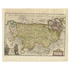
Antique map titled 'Des Burgundischen Creisses Südlicher theil oder Oesterreichische Niederlande'. This map originates from 'Continuirter Atlas Portatilis Germanicus (..)' by Johann Gottfried, Nürnberg, 1723.
- Dimensions:Height: 8.67 in (22 cm)Width: 7.41 in (18.8 cm)Depth: 0.02 in (0.5 mm)
- Materials and Techniques:
- Period:
- Date of Manufacture:1723
- Condition:Please study image carefully.
- Seller Location:Langweer, NL
- Reference Number:
About the Seller
5.0
Platinum Seller
These expertly vetted sellers are 1stDibs' most experienced sellers and are rated highest by our customers.
Established in 2009
1stDibs seller since 2017
1,933 sales on 1stDibs
Typical response time: <1 hour
- ShippingRetrieving quote...Ships From: Langweer, Netherlands
- Return PolicyA return for this item may be initiated within 14 days of delivery.
More From This SellerView All
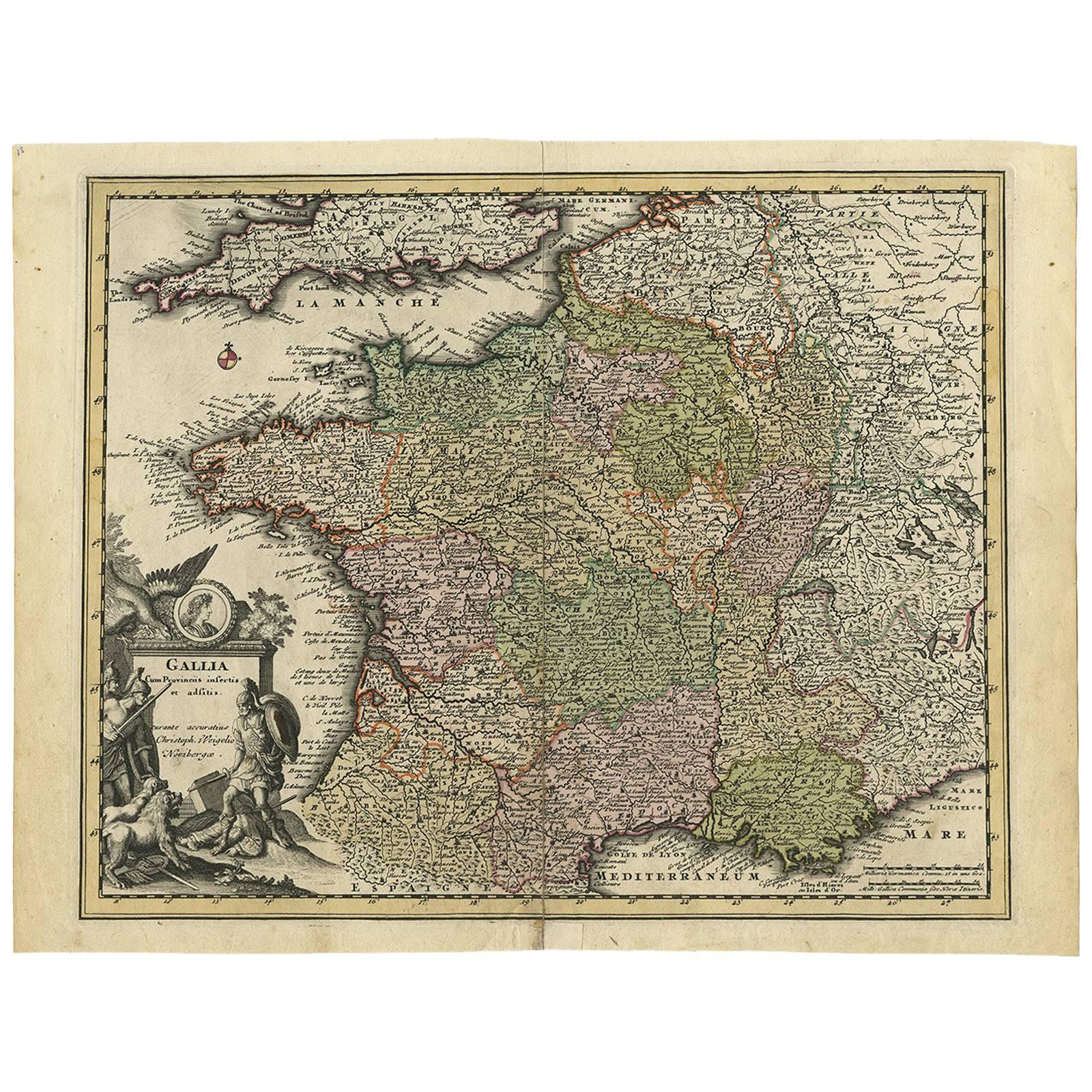
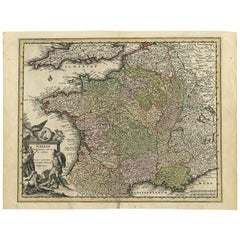
- Original High Detailed Antique Map of France by C. Weigel, 1719By Christoph WeigelLocated in Langweer, NLAntique map titled 'Gallia'. This highly detailed map shows France divided up into its provinces. The map provides a lot of information on place names, rivers, mountains, etc. The ...Category
Antique Early 18th Century Maps
MaterialsPaper
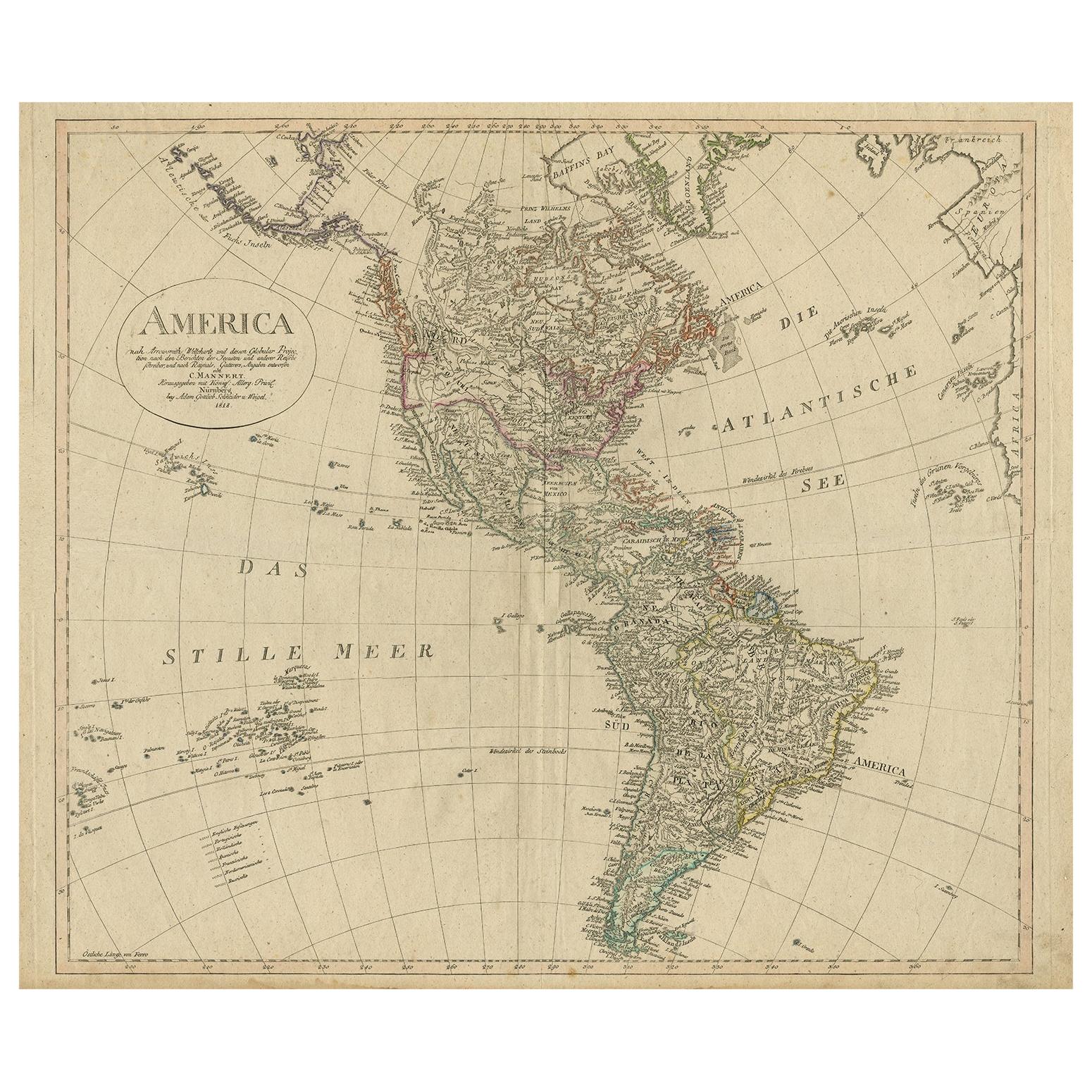
- Antique Map of North and South America by Schneider and Weigel, 1818Located in Langweer, NLAntique map titled 'America nach Arrowsmiths Weltcharte und dessen Globular Projection (..)'. Map of North and South America. Published by Schneider and Weigel, 1818.Category
Antique Early 19th Century Maps
MaterialsPaper
- Antique Map of Belgium by J. Tallis, circa 1851Located in Langweer, NLA highly decorative and detailed mid-19th century map of Belgium which was drawn and engraved by J. Rapkin (vignettes by J. Marchant and J. B. Allen) an...Category
Antique Mid-19th Century Maps
MaterialsPaper
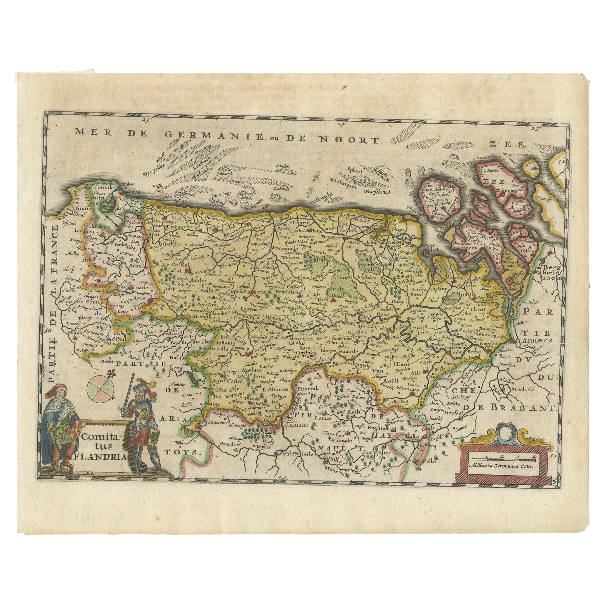
- Antique Map of Flanders, Belgium, 1630Located in Langweer, NLAntique map titled 'Comitatus Flandria'. Original antique map of Flanders, Belgium. This map originates from 'Vyerige Colom verthonende de 17 Nederlandsche Provintien' published 1630...Category
Antique 17th Century Maps
MaterialsPaper
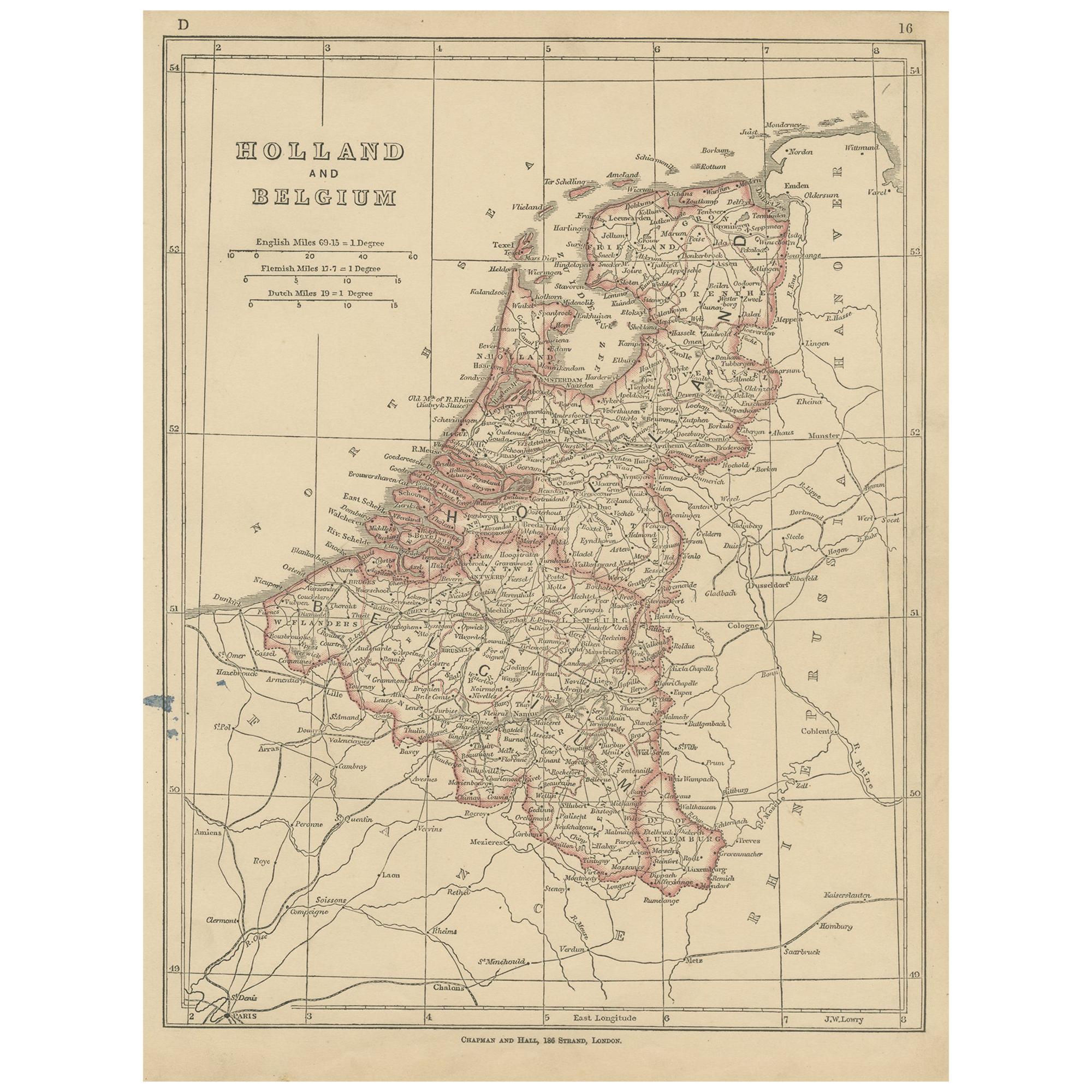
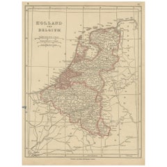
- Antique Map of Holland and Belgium by Lowry, '1852'Located in Langweer, NLAntique map titled 'Holland and Belgium'. Original map of the Netherlands and Belgium. This map originates from 'Lowry's Table Atlas constructed and engraved from the most recent Aut...Category
Antique Mid-19th Century Maps
MaterialsPaper
- Antique Map of Belgium and Surroundings, 1692Located in Langweer, NLAntique map titled 'Provincie Meridionali de Paesi Bassi Intese sotto nome di Fiandra overo Li Paesi Bassi Cattolici con li confini di Francia di Allemagna et di Hollanda'. Uncommon map of Belgium...Category
Antique 17th Century Maps
MaterialsPaper


You May Also Like
- Original Antique Map of Belgium by Tallis, Circa 1850Located in St Annes, LancashireGreat map of Belgium Steel engraving Many lovely vignettes Published by London Printing & Publishing Co. ( Formerly Tallis ), C.1850 Origin...Category
Antique 1850s English Maps
MaterialsPaper
- Antique 1630 Colored Belgium Map Flandria Gallica Flanders Henricus HondiusLocated in Dayton, OH"Antique hand colored map of Flanders, Belgium, circa 1630, engraved by Henricus Hondius. “Henricus Hondius II (1597 – 16 August 1651) was a Dutch eng...Category
Antique Early 17th Century Renaissance Maps
MaterialsPaper
- Antique Map of Italy by Andriveau-Goujon, 1843By Andriveau-GoujonLocated in New York, NYAntique Map of Italy by Andriveau-Goujon, 1843. Map of Italy in two parts by Andriveau-Goujon for the Library of Prince Carini at Palazzo Carini i...Category
Antique 1840s French Maps
MaterialsLinen, Paper
- Antique Map of Principality of MonacoBy Antonio Vallardi EditoreLocated in Alessandria, PiemonteST/619 - "Old Geographical Atlas of Italy - Topographic map of ex-Principality of Monaco" - ediz Vallardi - Milano - A somewhat special edition ---Category
Antique Late 19th Century Italian Other Prints
MaterialsPaper
- Original Antique Map of Russia By Arrowsmith. 1820Located in St Annes, LancashireGreat map of Russia Drawn under the direction of Arrowsmith Copper-plate engraving Published by Longman, Hurst, Rees, Orme and Brown, 1820 Unframed.Category
Antique 1820s English Maps
MaterialsPaper
- Original Antique Map of Sweden, Engraved by Barlow, 1806Located in St Annes, LancashireGreat map of Sweden Copper-plate engraving by Barlow Published by Brightly & Kinnersly, Bungay, Suffolk. 1806 Unframed.Category
Antique Early 1800s English Maps
MaterialsPaper


