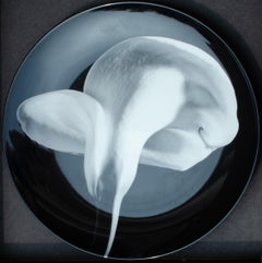
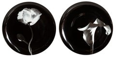
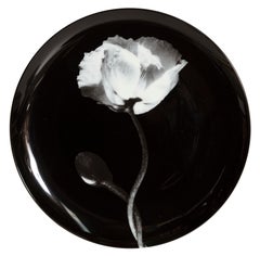
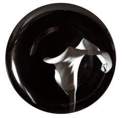
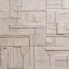
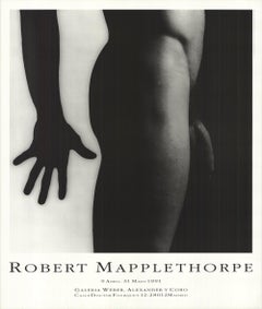
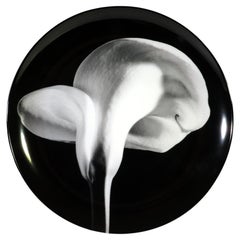
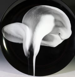
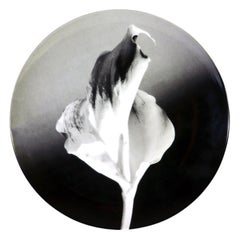
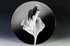
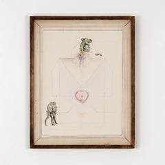
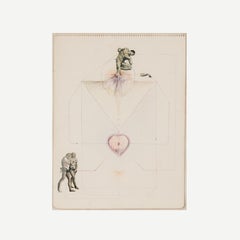
You are likely to find exactly the mapplethorpe plate you’re looking for on 1stDibs, as there is a broad range for sale. Making the right choice when shopping for a mapplethorpe plate may mean carefully reviewing examples of this item dating from different eras — you can find an early iteration of this piece from the 20th Century and a newer version made as recently as the 21st Century. On 1stDibs, the right mapplethorpe plate is waiting for you and the choices span a range of colors that includes
black. Artworks like these — often created in
ceramic and
porcelain — can elevate any room of your home. A large mapplethorpe plate can be an attractive addition to some spaces, while smaller examples are available — approximately spanning 8.25 high and 12 wide — and may be better suited to a more modest living area.
The first decades of the 20th century were a period of artistic upheaval, with modern art movements including Cubism, Surrealism, Futurism and Dadaism questioning centuries of traditional views of what art should be. Using abstraction, experimental forms and interdisciplinary techniques, painters, sculptors, photographers, printmakers and performance artists all pushed the boundaries of creative expression.
Major exhibitions, like the 1913 Armory Show in New York City — also known as the “International Exhibition of Modern Art,” in which works like the radically angular Nude Descending a Staircase by Marcel Duchamp caused a sensation — challenged the perspective of viewers and critics and heralded the arrival of modern art in the United States. But the movement’s revolutionary spirit took shape in the 19th century.
The Industrial Revolution, which ushered in new technology and cultural conditions across the world, transformed art from something mostly commissioned by the wealthy or the church to work that responded to personal experiences. The Impressionist style emerged in 1860s France with artists like Claude Monet, Paul Cézanne and Edgar Degas quickly painting works that captured moments of light and urban life. Around the same time in England, the Pre-Raphaelites, like Edward Burne-Jones and Dante Gabriel Rossetti, borrowed from late medieval and early Renaissance art to imbue their art with symbolism and modern ideas of beauty.
Emerging from this disruption of the artistic status quo, modern art went further in rejecting conventions and embracing innovation. The bold legacy of leading modern artists Georges Braque, Pablo Picasso, Frida Kahlo, Salvador Dalí, Henri Matisse, Joan Miró, Marc Chagall, Piet Mondrian and many others continues to inform visual culture today.
Find a collection of modern paintings, sculptures, prints and other fine art on 1stDibs.
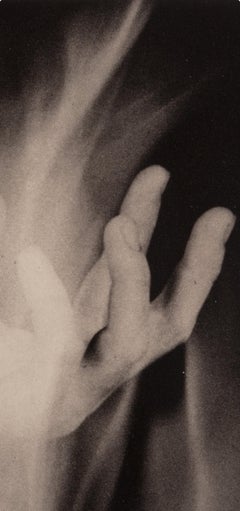
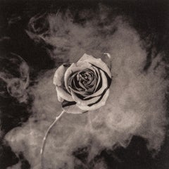
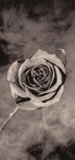
When it comes to accenting a home or collection with visual art, still-life photography complements all design aesthetics. And there are numerous ways to arrange your still-life photography and other wall art in your home. A salon-style gallery wall, for example, presents the opportunity to intersperse photographs and prints with such items as wall sculptures, baskets, plates, mirrors and sconces. For a harmonious mix, however, choose still-life photos with the same general palette as the other artworks.
Ranging from minimalist scenes to lavish, campy arrangements, still-life photography encompasses multiple genres to fit any taste. Following the tradition of still-life painting, still-life photography elevates often ordinary, inanimate objects. When photography was a new medium in the 19th century, daguerreotype and salt-print still lifes frequently mimicked the arrangements that had been popular in painting. In the 20th century, still-life photographs evolved, reshaped by the experimentation of modernism.
Far more versatile than the name implies, still-life photography involves numerous styles and themes. Photographers like Stefanie Schneider use still lifes to capture their subjects in their most raw state. They can also create hyperreal scenes that border on Pop art, such as in the work of Giuliano Bekor.
Find still-life photographs on 1stDibs by artists including Dora Franco, Allan Forsyth, Stuart Möller and many more.