

Want more images or videos?
Request additional images or videos from the seller
1 of 6
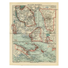
German Antique Map of Oceania, 1895
About the Item
Antique map titled 'Oceanie.' Map of Oceania. This attractive original old antique print / plate / map originates from 1885-1907 editions of a famous German encyclopedia: 'Meyers grosses Konversations-Lexikon.', published in Leipzig and Vienna. Meyers Konversations-Lexikon was a major German encyclopedia that existed in various editions from 1839 until 1984, when it merged with the Brockhaus encyclopedia. Several of the plates were also used in Dutch Encyclopedia's like Winkler Prins.
Artists and Engravers: The original founder and publisher who initiated this famous enxyclopedia was Joseph Meyer (1796-1856, Hildburghausen, Germany).
Condition: Good. General age related toning and occasional light staining from handling as visible on image. Please study scan carefully.
Date: 1895
Overall size: 31 x 25 cm.
Image size: 28 x 22.2 cm.
We sell original antique maps to collectors, historians, educators and interior decorators all over the world. Our collection includes a wide range of authentic antique maps from the 16th to the 20th centuries. Buying and collecting antique maps is a tradition that goes back hundreds of years. Antique maps have proved a richly rewarding investment over the past decade, thanks to a growing appreciation of their unique historical appeal. Today the decorative qualities of antique maps are widely recognized by interior designers who appreciate their beauty and design flexibility. Depending on the individual map, presentation, and context, a rare or antique map can be modern, traditional, abstract, figurative, serious or whimsical. We offer a wide range of authentic antique maps for any budget.
- Dimensions:Height: 9.85 in (25 cm)Width: 12.21 in (31 cm)Depth: 0 in (0.01 mm)
- Materials and Techniques:
- Period:
- Date of Manufacture:1895
- Condition:Condition: Good. General age related toning and occasional light staining from handling as visible on image. Please study scan carefully.
- Seller Location:Langweer, NL
- Reference Number:
About the Seller
5.0
Platinum Seller
These expertly vetted sellers are 1stDibs' most experienced sellers and are rated highest by our customers.
Established in 2009
1stDibs seller since 2017
1,929 sales on 1stDibs
Typical response time: <1 hour
- ShippingRetrieving quote...Ships From: Langweer, Netherlands
- Return PolicyA return for this item may be initiated within 14 days of delivery.
More From This SellerView All
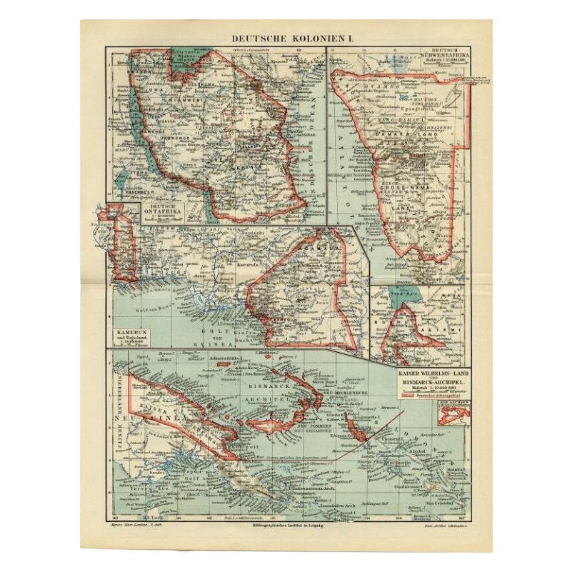
- Antique Map of German Colonies by Meyer, 1895Located in Langweer, NLAntique map titled 'Deutsche Kolonien.' Lithographed map of the German Colonies. German East-Africa, German Southeast-Africa, Cameroon, Marshall-Islands, German Colonies in the Pacif...Category
Antique 19th Century Maps
MaterialsPaper
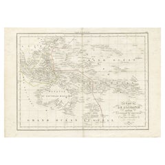
- Antique Map of Oceania by Levasseur, '1875'Located in Langweer, NLAntique map titled 'Carte générale de l'Océanie'. Large map of Oceania. This map originates from 'Atlas de Géographie Moderne Physique et Politique' by A. Levasseur. Published 1875.Category
Antique Late 19th Century Maps
MaterialsPaper
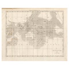
- Antique Map of Oceania by Balbi '1847'Located in Langweer, NLAntique map titled 'Océanie'. Original antique map of Oceania. This map originates from 'Abrégé de Géographie (..)' by Adrien Balbi. Published 1847.Category
Antique Mid-19th Century Maps
MaterialsPaper
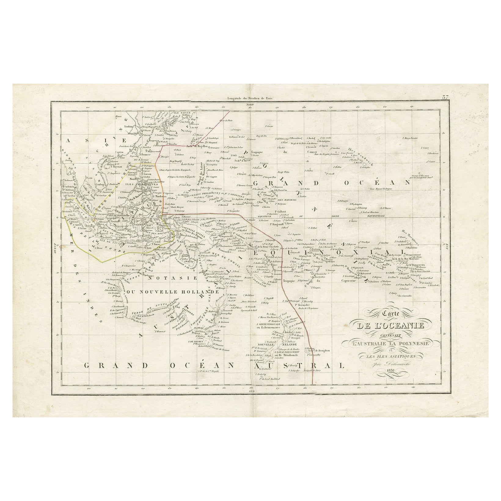
- Antique Map of Oceania by Delamarche, 1836Located in Langweer, NLAntique map titled 'Carte de l'Oceanie contenant l'Australie la Poynesie et les iles Asiatiques.' Antique map of Oceania comprising Australia and Polynesia, New Zealand and Indonesia...Category
Antique 19th Century Maps
MaterialsPaper
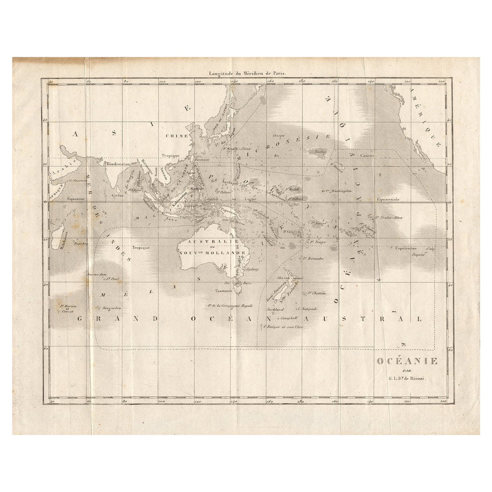
- Antique Map of Oceania by Didot, 1836Located in Langweer, NLAntique map titled 'Oceanie par G.L.Dy. De Rienzi'. Map of the Oceania region, around Australia. This print originates from M.G.L. Domeny de Rienzi's 'Oceanie, ou Cinquieme Partie du...Category
Antique 19th Century Maps
MaterialsPaper
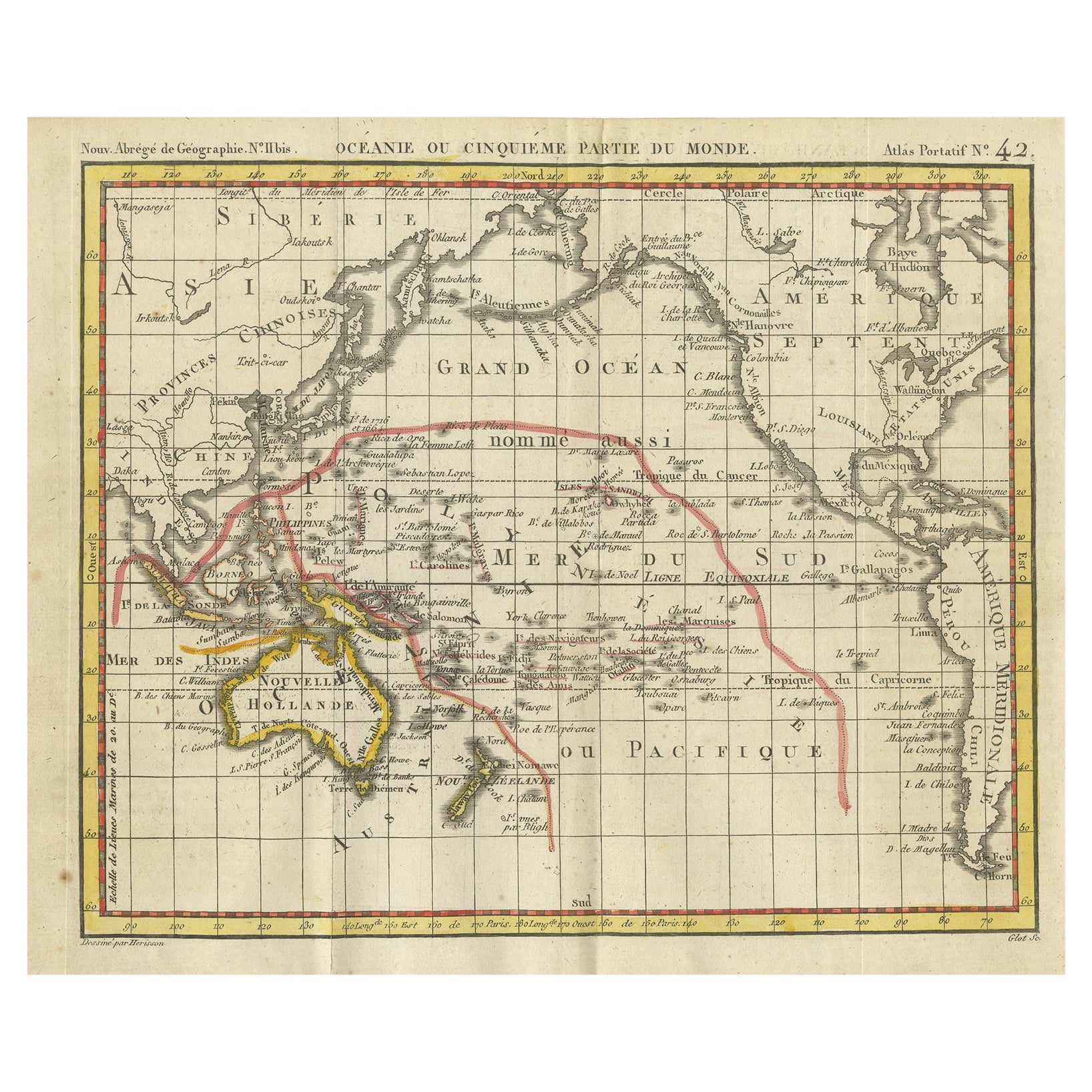
- Antique Map of Oceania by Hérisson, 1816Located in Langweer, NLAntique map titled "Océanie ou cinquième partie du monde". This is an original antique map of Oceania, the 5th continent, by Herisson taken from atlas "Nouv. Abrége de Géographie". A...Category
Antique 19th Century Maps
MaterialsPaper


You May Also Like
- East German MapBy VEB Hermann HaackLocated in Baltimore, MDA brilliantly colourful map of the Leipzig, Karl Marx Stadt and Dresden area in the former German Democratic Republic by VEB Hermann Haack of Gotha.Category
Vintage 1970s German Maps
- Set of 4 Antique Geographical Maps French-German War 1870-71Located in Casale Monferrato, ITElegant late 19th century set of four antique geographical maps relating to the positioning of the armies in the Franco-German War 1870-71. A...Category
Antique 1890s Italian Maps
MaterialsPaper
- Antique Map of Principality of MonacoBy Antonio Vallardi EditoreLocated in Alessandria, PiemonteST/619 - "Old Geographical Atlas of Italy - Topographic map of ex-Principality of Monaco" - ediz Vallardi - Milano - A somewhat special edition ---Category
Antique Late 19th Century Italian Other Prints
MaterialsPaper
- Geographical Antique Map of Principality of MonacoBy Bruno SantiniLocated in Alessandria, PiemonteST/609 - Interesting antique color map of Monaco Principality in French language : "Carte qui contient le Principauté de Piémont, le Monferrat et la comté de...Category
Antique Late 18th Century Italian Other Maps
MaterialsPaper
- 1907 Map of Colorado, Antique Topographical Map, by Louis NellLocated in Colorado Springs, COThis highly detailed pocket map is a topographical map of the state of Colorado by Louis Nell from 1907. The map "has been complied from all availabl...Category
Antique Early 1900s American Maps
MaterialsPaper
- Original Antique Map of Missouri, 1889Located in St Annes, LancashireGreat map of Missouri Drawn and Engraved by W. & A.K. Johnston Published By A & C Black, Edinburgh. Original colour Unframed.Category
Antique 1880s Scottish Victorian Maps
MaterialsPaper


Recently Viewed
View AllMore Ways To Browse
Leicestershire Antique Map
Alabama Antique Map
Antique Alabama Map
Berkshire Antique Map
Ontario Map
Warwickshire Antique Map
Antique Map Of Alabama
Heinrich Kiepert On Sale
Hertfordshire Antique Map
Poired Metal
Ruscelli Map
Antique Map Kentucky
Antique Map Tennessee
Antique Maps Of Tennessee
Huntingdonshire Antique Map
Mappemonde Antique
Tennessee Map
Antique Bermuda Maps