
16th Century World Map

19
to
190
2,359
50
1,294
943
748
390
149
149
86
27
23
18
16
8
8
7
4
4
4
3
2
2
2
2
2
1
1
1
1
1
1
1
1
88
42
42
31
19
Sort By
16th Century Map of Saudi Arabia, the Persian Gulf and Red Sea, ca. 1574
Located in Langweer, NL
Ptolemaic map of the Arabian Peninsula based on the 1548 map of Giacomo Gastaldi. It covers nearly
Category

Antique 16th Century Maps

Materials

Paper

Antique World Map by Johnston, 1882
Located in Langweer, NL
over the world. Our collection includes a wide range of authentic antique maps from the 16th to the
Category

Antique 19th Century Maps

Materials

Paper

Antique World Map by Johnston, 1882
H 16.74 in W 24.18 in D 0 in
Antique Map of the World by Stoopendaal, c.1714
Located in Langweer, NL
decorators all over the world. Our collection includes a wide range of authentic antique maps from the 16th
Category

Antique 18th Century Maps

Materials

Paper

Antique Physical Map of the World by Reynolds, 1849
Located in Langweer, NL
maps from the 16th to the 20th centuries. Buying and collecting antique maps is a tradition that goes
Category

Antique 19th Century Maps

Materials

Paper

Antique Mercator Projection World Map by Petri, c.1873
Located in Langweer, NL
collection includes a wide range of authentic antique maps from the 16th to the 20th centuries. Buying and
Category

Antique 19th Century Maps

Materials

Paper

Antique Detailed World Map Drawn on Mercator's Projection, 1700
Located in Langweer, NL
the 16th to the 20th centuries. Buying and collecting antique maps is a tradition that goes back
Category

Antique 17th Century Maps

Materials

Paper

Antique World Map before the Voyages of Christopher Columbus, 1880
Located in Langweer, NL
decorators all over the world. Our collection includes a wide range of authentic antique maps from the 16th
Category

Antique 19th Century Maps

Materials

Paper

Antique Map of the World on Mercator Projection by Anson, 1749
Located in Langweer, NL
collection includes a wide range of authentic antique maps from the 16th to the 20th centuries. Buying and
Category

Antique 18th Century Maps

Materials

Paper

Small Antique World Map in Decorative Old Hand-Colouring, circa 1840
Located in Langweer, NL
the 16th to the 20th centuries. Buying and collecting antique maps is a tradition that goes back
Category

Antique 19th Century Maps

Materials

Paper

Original Engraved Antique Map of the World, Colorful and Decorative, C.1780
By Pierre François Tardieu
Located in Langweer, NL
antique maps from the 16th to the 20th centuries. Buying and collecting antique maps is a tradition that
Category

Antique 18th Century Maps

Materials

Paper

Antique Map of the Old World Projection, Entitled Orbis Terrarum Ad Mentem, 1825
Located in Langweer, NL
antique maps from the 16th to the 20th centuries. Buying and collecting antique maps is a tradition that
Category

Antique 19th Century Maps

Materials

Paper

Very Decorative Original Antique Map of the World, Published in France in c.1780
By Rigobert Bonne
Located in Langweer, NL
authentic antique maps from the 16th to the 20th centuries. Buying and collecting antique maps is a
Category

Antique 18th Century Maps

Materials

Paper

Antique Map of the Netherlands by Guicciardini, 1582
Located in Langweer, NL
collection includes a wide range of authentic antique maps from the 16th to the 20th centuries. Buying and
Category

Antique 16th Century Maps

Materials

Paper

Antique Map of the Low Countries by Ortelius, 1584
By Abraham Ortelius
Located in Langweer, NL
collection includes a wide range of authentic antique maps from the 16th to the 20th centuries. Buying and
Category

Antique 16th Century Maps

Materials

Paper

Charming 18th Century Miniature Map of Greece, 1685
Located in Langweer, NL
antique maps from the 16th to the 20th centuries. Buying and collecting antique maps is a tradition that
Category

Antique 17th Century Maps

Materials

Paper

Antique Map Made After a Roman Papyrus Travel Map, Known as Peutinger Map, 1773
Located in Langweer, NL
century that contained a copy of the world map originally prepared by Agrippa during the reign of the
Category

Antique 18th Century Maps

Materials

Paper

Antique Map of East Frisia by Ortelius, c.1595
Located in Langweer, NL
antique maps from the 16th to the 20th centuries. Buying and collecting antique maps is a tradition that
Category

Antique 16th Century Maps

Materials

Paper

Antique Map of the Spice Islands by Van Linschoten, 1598
Located in Langweer, NL
that the source maps contained the results of Portuguese and Spanish exploration in the mid-16th
Category

Antique 16th Century Maps

Materials

Paper

Antique Zoological Map, 1843
Located in Langweer, NL
decorators all over the world. Our collection includes a wide range of authentic antique maps from the 16th
Category

Antique 19th Century Maps

Materials

Paper

Antique Zoological Map, 1843
H 11.23 in W 8.94 in D 0 in
Antique Map of Westfalia, Germany by Mercator/Hondius, circa '1620'
Located in Langweer, NL
by Mercator/Hondius, circa '1620' 17th Century antique detailled map of Westphalia, East Friesland
Category

Antique 16th Century Maps

Materials

Paper

1592 Abraham Ortelius Map "Lorraine: Lotharingiae Nova Descripti, Ric.A005
Located in Norton, MA
1592 Abraham Ortelius map entitled "Lorraine: Lotharingiae Nova Descripti Ric.a005
Category

Antique 16th Century Dutch Maps

Materials

Paper

Antique Map of Greece with an Inset Map of Corfu, 1854
Located in Langweer, NL
the 16th to the 20th centuries. Buying and collecting antique maps is a tradition that goes back
Category

Antique 19th Century Maps

Materials

Paper

Antique Map of Denmark with an Inset Map of Iceland, 1832
Located in Langweer, NL
the 16th to the 20th centuries. Buying and collecting antique maps is a tradition that goes back
Category

Antique 19th Century Maps

Materials

Paper

Very Old Antique Map of the Persian Empire by Magini, c.1597
Located in Langweer, NL
authentic antique maps from the 16th to the 20th centuries. Buying and collecting antique maps is a
Category

Antique 16th Century Maps

Materials

Paper

Coloured Antique Map of Sicily, Sardinia, Corfu, Elba, Malta and Zerbi (Jerba)
By Abraham Ortelius
Located in Langweer, NL
Antique map titled 'Insularum Aliquot Maris Mediterranei Descriptio'. A very attractive example of
Category

Antique 16th Century Maps

Materials

Paper

Antique Map of Northern Ireland by Mercator/Hondius, Early 1600's
Located in Langweer, NL
Antique map titled 'Ultoniae Orientalis Pars'. Original antique map of Northern Ireland. Published
Category

Antique 16th Century Maps

Materials

Paper

1597 Abraham Ortelius Map Burgundy, France Entitled "Bvrgvndiae dvcatvs Ric.a010
Located in Norton, MA
1597 Abraham Ortelius map of Burgundy, France entitled "Bvrgvndiae dvcatvs Ric.a010
Category

Antique 16th Century Dutch Maps

Materials

Paper

Antique Map of the City of Hindeloopen by Braun & Hogenberg, c.1598
Located in Langweer, NL
world. Our collection includes a wide range of authentic antique maps from the 16th to the 20th
Category

Antique 16th Century Maps

Materials

Paper

Old Antique Map of the Province of Friesland, the Netherlands, c.1580
Located in Langweer, NL
maps from the 16th to the 20th centuries. Buying and collecting antique maps is a tradition that goes
Category

Antique 16th Century Maps

Materials

Paper

Antique Map of Friesland with Elaborate Cartouche by Mapmaker Ortelius, c.1570
Located in Langweer, NL
the world. Our collection includes a wide range of authentic antique maps from the 16th to the 20th
Category

Antique 16th Century Maps

Materials

Paper

Large Scale Map of Greece with Inset Map of Macedonia, c.1786
Located in Langweer, NL
the 16th to the 20th centuries. Buying and collecting antique maps is a tradition that goes back
Category

Antique 18th Century Maps

Materials

Paper

Antique Map of Eastern Canada with an inset Map of Newfoundland, 1882
Located in Langweer, NL
the 16th to the 20th centuries. Buying and collecting antique maps is a tradition that goes back
Category

Antique 19th Century Maps

Materials

Paper

Antique Map of the Region of Boulogne and Peronne, France 'C.1590'
Located in Langweer, NL
Antique map titled 'Caletensium et Bononiensium (..)'. Two detailed regional maps on one sheet
Category

Antique 16th Century Maps

Materials

Paper

Antique Map of France in the 5th Century by Zannoni, 1765
Located in Langweer, NL
collection includes a wide range of authentic antique maps from the 16th to the 20th centuries. Buying and
Category

Antique 18th Century Maps

Materials

Paper

Antique Map of France in the 7th Century by Zannoni, 1765
Located in Langweer, NL
authentic antique maps from the 16th to the 20th centuries. Buying and collecting antique maps is a
Category

Antique 18th Century Maps

Materials

Paper

Map of East Frisian Islands & Northwestern Tip of Germany, Ostfriesland, c.1595
Located in Langweer, NL
8 sheet world map in the year 1564, but only three copies have survived. In 1570 he issued the
Category

Antique 16th Century Maps

Materials

Paper

Antique Map of Friesland Also Know as the Peacock Map, C.1580
Located in Langweer, NL
the 16th to the 20th centuries. Buying and collecting antique maps is a tradition that goes back
Category

Antique 18th Century Maps

Materials

Paper

Antique Map of Groningen from a 19th Century Dutch Atlas, 1864
Located in Langweer, NL
the 16th to the 20th centuries. Buying and collecting antique maps is a tradition that goes back
Category

Antique 19th Century Maps

Materials

Paper

Superb Antique Map of the Province of Gelderland, the Netherlands, ca.1575
Located in Langweer, NL
remarkable map was a 8 sheet world map in the year 1564, but only three copies have survived. In 1570 he
Category

Antique 16th Century Maps

Materials

Paper

Antique Map of Germany from a 17th Century Pocket Atlas, 1685
Located in Langweer, NL
authentic antique maps from the 16th to the 20th centuries. Buying and collecting antique maps is a
Category

Antique 17th Century Maps

Materials

Paper

Antique Map of Germany from an American 19th Century Atlas, 1846
Located in Langweer, NL
collection includes a wide range of authentic antique maps from the 16th to the 20th centuries. Buying and
Category

Antique 19th Century Maps

Materials

Paper

Antique Map of China, 1874
Located in Langweer, NL
the 16th to the 20th centuries. Buying and collecting antique maps is a tradition that goes back
Category

Antique 19th Century Maps

Materials

Paper

Antique Map of China, 1874
H 21.26 in W 14.77 in D 0 in
Antique Map of the City of Leeuwarden and Franeker by Braun & Hogenberg, 1580
Located in Langweer, NL
over the world. Our collection includes a wide range of authentic antique maps from the 16th to the
Category

Antique 16th Century Maps

Materials

Paper

Antique Map of the City of Bolsward, Friesland in The Netherlands, c.1598
Located in Langweer, NL
the world. Our collection includes a wide range of authentic antique maps from the 16th to the 20th
Category

Antique 16th Century Maps

Materials

Paper

Antique Map of The Frisian Cities Leeuwarden and Franeker in Friesland, 1580
Located in Langweer, NL
-eye views and maps of cities from all around the world. He was the principal editor of the work, he
Category

Antique 16th Century Maps

Materials

Paper

Antique Map of Asia, 1846
Located in Langweer, NL
decorators all over the world. Our collection includes a wide range of authentic antique maps from the 16th
Category

Antique 19th Century Maps

Materials

Paper

Antique Map of Asia, 1846
H 9.85 in W 12.41 in D 0 in
Antique Map of Greece with Two Small Inset Maps of Athens, c.1870
Located in Langweer, NL
collection includes a wide range of authentic antique maps from the 16th to the 20th centuries. Buying and
Category

Antique 19th Century Maps

Materials

Paper

Antique Map of France with Inset Map of the Island of Corsica, 1820
Located in Langweer, NL
authentic antique maps from the 16th to the 20th centuries. Buying and collecting antique maps is a
Category

Antique 19th Century Maps

Materials

Paper

Antique Map of Friesland after the Floods of the 13th Century, 1718
Located in Langweer, NL
collection includes a wide range of authentic antique maps from the 16th to the 20th centuries. Buying and
Category

Antique 18th Century Maps

Materials

Paper

Antique Map of Friesland after the Floods of the 13th Century, 1718
Located in Langweer, NL
includes a wide range of authentic antique maps from the 16th to the 20th centuries. Buying and collecting
Category

Antique 18th Century Maps

Materials

Paper

Old Ptolemaic Map of the Region Between the Persian Gulf and Caspian Sea, 1598
Located in Langweer, NL
increased with the explorations of Columbus, Magellan, Cabot and others, maps of the New World were added
Category

Antique 16th Century Maps

Materials

Paper

Antique Map of Germany During the Mid-18th Century, Published in 1747
Located in Langweer, NL
antique maps from the 16th to the 20th centuries. Buying and collecting antique maps is a tradition that
Category

Antique 18th Century Maps

Materials

Paper

Antique Map of Asia in the 12th, 13th and 14th Century, 1877
Located in Langweer, NL
collection includes a wide range of authentic antique maps from the 16th to the 20th centuries. Buying and
Category

Antique 19th Century Maps

Materials

Paper

Attractive Antique Map of Italy with Inset of Maps Showing The Regions, c.1870
Located in Langweer, NL
over the world. Our collection includes a wide range of authentic antique maps from the 16th to the
Category

Antique 19th Century Maps

Materials

Paper

Antique Map of Asia by with an Inset Map of Turkey in Asia, 1868
Located in Langweer, NL
authentic antique maps from the 16th to the 20th centuries. Buying and collecting antique maps is a
Category

Antique 19th Century Maps

Materials

Paper

Antique Map of Africa and Arabia with Inset Map of Ethiopia and Eritrea, 1845
Located in Langweer, NL
decorators all over the world. Our collection includes a wide range of authentic antique maps from the 16th
Category

Antique 19th Century Maps

Materials

Paper

Antique Map of Denmark with Inset Maps of Iceland, Copenhagen and the Elbe, 1882
Located in Langweer, NL
authentic antique maps from the 16th to the 20th centuries. Buying and collecting antique maps is a
Category

Antique 19th Century Maps

Materials

Paper

Antique Political Map of France, 1880
By J. Migeon
Located in Langweer, NL
collection includes a wide range of authentic antique maps from the 16th to the 20th centuries. Buying and
Category

Antique 19th Century Maps

Materials

Paper

Antique Political Map of France, 1880
H 13.59 in W 18.71 in D 0 in
Antique Map of New Zealand, 1895
Located in Langweer, NL
range of authentic antique maps from the 16th to the 20th centuries. Buying and collecting antique maps
Category

Antique 19th Century Maps

Materials

Paper

Antique Map of New Zealand, 1895
H 9.65 in W 6.3 in D 0 in
German Antique Map of Oceania, 1895
Located in Langweer, NL
decorators all over the world. Our collection includes a wide range of authentic antique maps from the 16th
Category

Antique 19th Century Maps

Materials

Paper

German Antique Map of Oceania, 1895
H 9.85 in W 12.21 in D 0 in
  • 1
  • ...
Get Updated with New Arrivals
Save "16 Th Century World Map", and we’ll notify you when there are new listings in this category.

16th Century World Map For Sale on 1stDibs

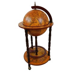
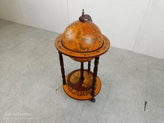
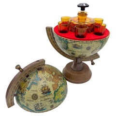
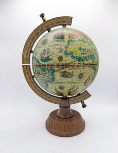
Choose from an assortment of styles, material and more with respect to the 16th century world map you’re looking for at 1stDibs. Frequently made of paper, animal skin and carrara marble, every 16th century world map was constructed with great care. There are 1543 variations of the antique or vintage 16th century world map you’re looking for, while we also have 1 modern editions of this piece to choose from as well. Your living room may not be complete without a 16th century world map — find older editions for sale from the 18th Century and newer versions made as recently as the 21st Century. When you’re browsing for the right 16th century world map, those designed in Victorian styles are of considerable interest. A well-made 16th century world map has long been a part of the offerings for many furniture designers and manufacturers, but those produced by Johannes Janssonius, Jacques-Nicolas Bellin and Schreiber are consistently popular.

How Much is a 16th Century World Map?

A 16th century world map can differ in price owing to various characteristics — the average selling price 1stDibs is $269, while the lowest priced sells for $56 and the highest can go for as much as $16,959.