Items Similar to Superb Antique Map of the Province of Gelderland, the Netherlands, ca.1575


Want more images or videos?
Request additional images or videos from the seller
1 of 6
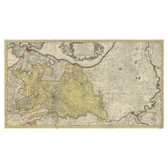
Superb Antique Map of the Province of Gelderland, the Netherlands, ca.1575
About the Item
Antique map titled 'Gelriae, Cliviae, Finitimorumque Locorum Verissima Descriptio Christiano Schrot. Auctore'.
This superb map is Ortelius' first plate covering Gelderland. It is based on Christiaan Sgrothen's map of 1567 and is richly engraved with fine detail particularly along the rivers. The map is oriented with north to the left with ribbon cartouches marking the cardinal directions. A single large ship sails in the Zuyder Zee, a bowl of fruit sits atop the distance scales, and a painter's implements adorn the large title cartouche. Latin text on verso. Source unknown, to be determined.
Artists and Engravers: Abraham Ortelius was born 1528 in Antwerp. He studied mathematics, Greek and Latin and travelled a lot across Europe. He established a business in dealing with books and drawing maps. His first remarkable map was a 8 sheet world map in the year 1564, but only three copies have survived. In 1570 he issued the "Theatrum Orbis Terrarum", the first modern "Atlas" with uniformly sized maps in a systematic collection. The term "Atlas" was not used until Mercator introduced it 20 years later. Most of the maps in Theatrum have been engraved by Frans Hogenberg. At the time of publication, the atlas was the most expensive book ever printed. Nevertheless it was a big success and around 7000 copies have been printed until 1612 in many editions and six different languages. Beside the Theatrum, Ortelius compiled a series of historical maps and published it in the "Parergon Theatri" which was bound with the Theatrum from 1579 onwards or published separately.
Condition: Good, given age. Edges reinforced on verso with acid free tape. Slight browning in the margins near plate borders. One unobtrusive brown spot in image. Original middle fold as issued. General age-related toning and/or occasional minor defects from handling. Latin text on verso. Please study image carefully.
- Dimensions:Height: 16.86 in (42.8 cm)Width: 21.97 in (55.8 cm)Depth: 0 in (0.02 mm)
- Materials and Techniques:
- Period:
- Date of Manufacture:circa 1575
- Condition:Additions or alterations made to the original: Edges reinforced on verso with acid free tape. Wear consistent with age and use.
- Seller Location:Langweer, NL
- Reference Number:
About the Seller
5.0
Platinum Seller
These expertly vetted sellers are 1stDibs' most experienced sellers and are rated highest by our customers.
Established in 2009
1stDibs seller since 2017
1,928 sales on 1stDibs
Typical response time: <1 hour
- ShippingRetrieving quote...Ships From: Langweer, Netherlands
- Return PolicyA return for this item may be initiated within 14 days of delivery.
More From This SellerView All
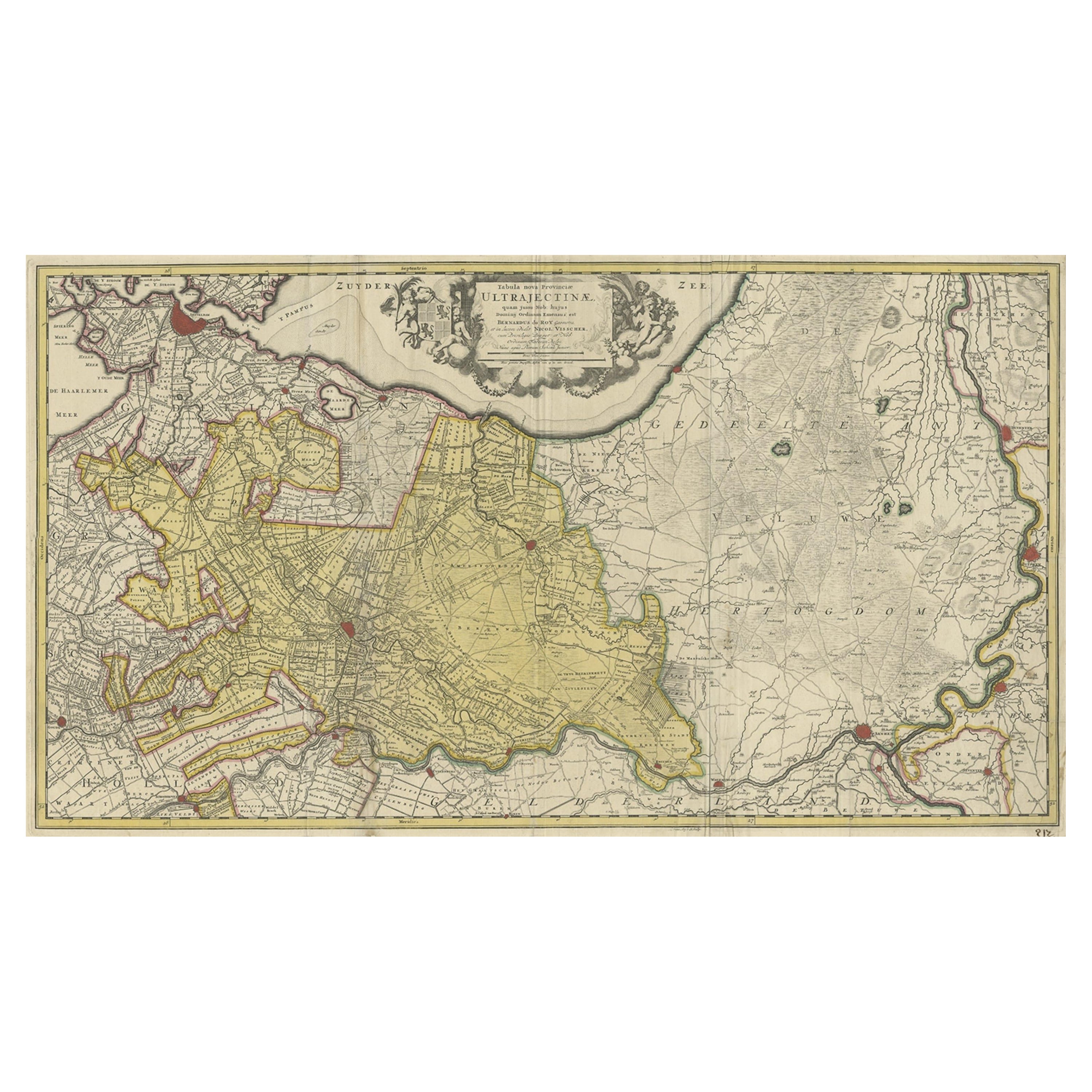
- Original Antique Map of the Province of Utrecht, the Netherlands, ca.1720Located in Langweer, NLAntique map titled ‘Tabula Nova Provinciae Ultrajectinae (..)’. Original antique map of the province of Utrecht, the Netherlands. It shows the region of Amsterdam, Utrecht, Gouda, ...Category
Antique 1720s Maps
MaterialsPaper
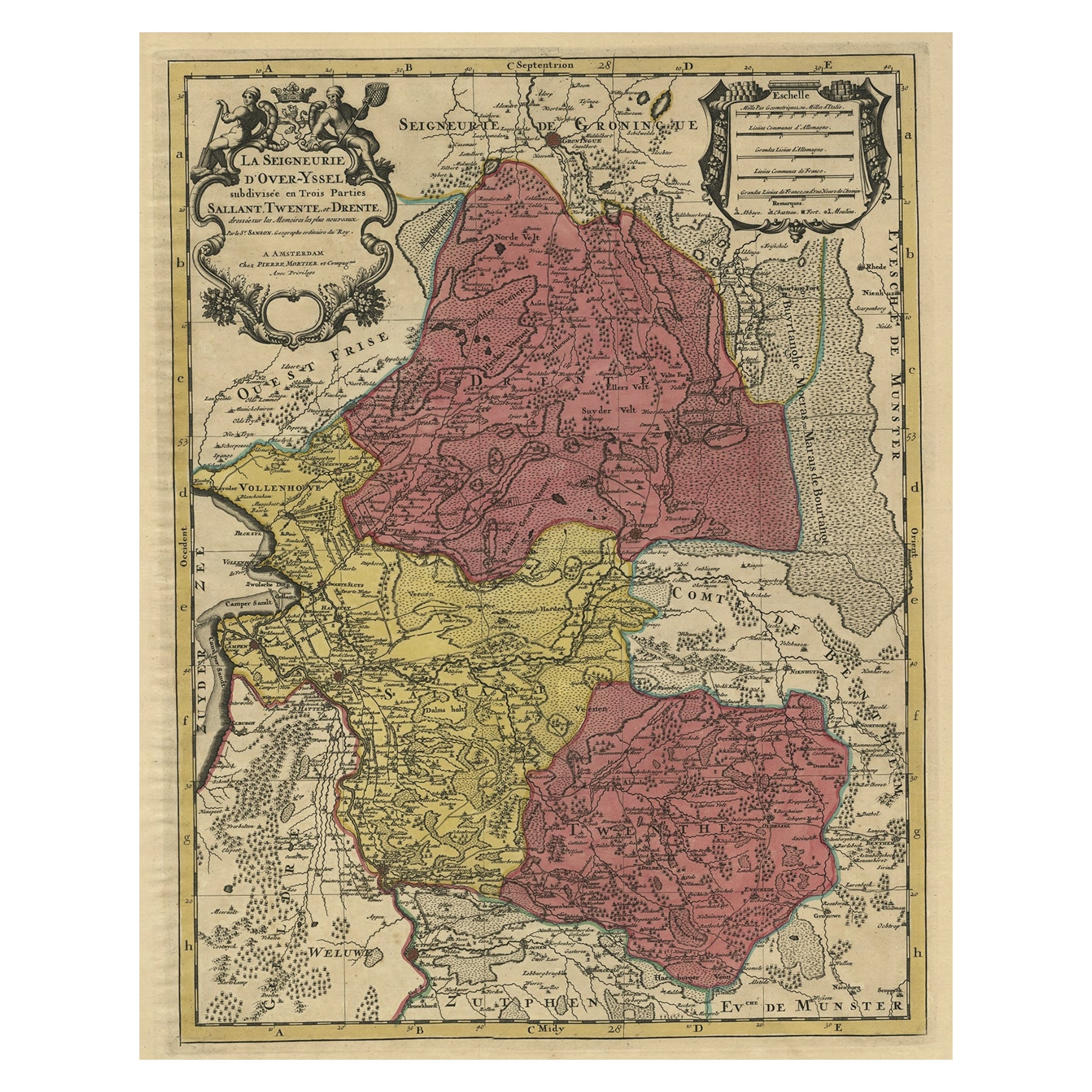
- Detailed Antique Map of the Province of Overijssel in the Netherlands, ca.1700Located in Langweer, NLAntique map titled 'La Seigneurie d'Over-Yssel subdivisee en Trois Parties, Sallant, Twente, et Drente.' Detailed map of the province of Overijssel in the Netherlands. From Jaill...Category
Antique Early 1700s Maps
MaterialsPaper
- Antique Map of the Province of Overijssel, the NetherlandsLocated in Langweer, NLOriginal antique map titled 'Ditio Trans-Isulana'. Original old map of the province of Overijssel, the Netherlands. With coat of arms and two decorative cartouches. Published by J. J...Category
Antique Mid-17th Century Maps
MaterialsPaper
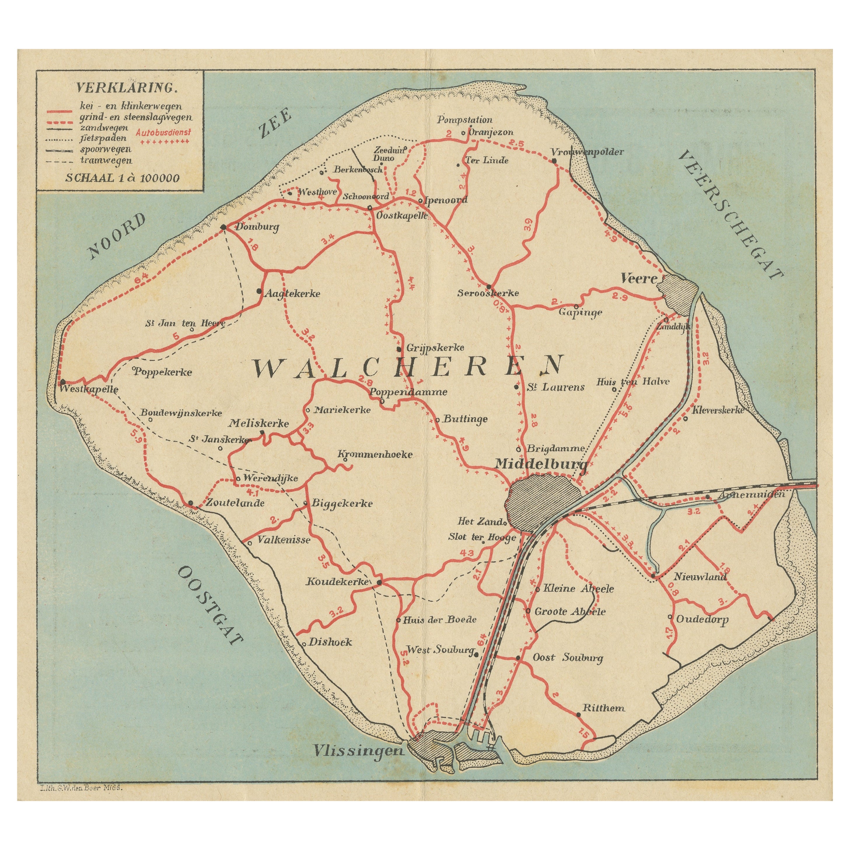
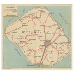
- Antique Map of Walcheren in the Province of Zeeland, the Netherlands, ca.1910Located in Langweer, NLAntique map of Walcheren, part of the province of Zeeland, the Netherlands. Shows the cities of Veere, Middelburg, Vlissingen and others. Source unknown, to be determined. Publis...Category
Vintage 1910s Maps
MaterialsPaper
- Beautiful Antique Map of the Province of Noord-Holland, the Netherlands, Ca.1730Located in Langweer, NLAntique map titled 'Kennemaria et Westfrisia vulgo et vernaculé Noord-Holland'. Beautiful original antique map of the province of Noord-Holland, the Netherlands. Two large elaborat...Category
Antique 1730s Maps
MaterialsPaper
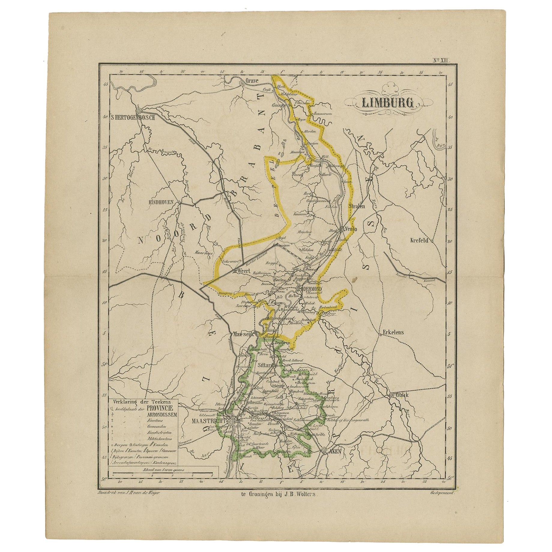
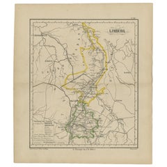
- Antique Map of the Province Limburg, The Netherlands, 1864Located in Langweer, NLAntique map titled 'De Provincie Limburg'. Map of the province of Limburg, the Netherlands. This map originates from 'F. C. Brugsma's Atlas van het Koninkrijk der Nederlanden (..)'. ...Category
Antique 19th Century Maps
MaterialsPaper

You May Also Like
- Antique 18th Century Map of the Province of Pensilvania 'Pennsylvania State'Located in Philadelphia, PAA fine antique of the colony of Pennsylvania. Noted at the top of the sheet as a 'Map of the province of Pensilvania'. This undated and anonymous map is thought to be from the Gentleman's Magazine, London, circa 1775, although the general appearance could date it to the 1760's. The southern boundary reflects the Mason-Dixon survey (1768), the western boundary is placed just west of Pittsburgh, and the northern boundary is not marked. The map has a number of reference points that likely refer to companion text and appear to be connected to boundaries. The western and southern boundaries are marked Q, R, S, for example. A diagonal line runs from the Susquehanna R to the Lake Erie P. A broken line marked by many letters A, B, N, O, etc., appears in the east. There are no latitude or longitude markings, blank verso. Framed in a shaped contemporary gilt wooden frame and matted under a cream colored matte. Bearing an old Graham Arader Gallery...Category
Antique 18th Century British American Colonial Maps
MaterialsPaper
- Original Antique Map of The Netherlands, Engraved by Barlow, Dated 1807Located in St Annes, LancashireGreat map of Netherlands Copper-plate engraving by Barlow Published by Brightly & Kinnersly, Bungay, Suffolk. Dated 1807 Unframed.Category
Antique Early 1800s English Maps
MaterialsPaper
- Original Antique Map of The Netherlands, Sherwood, Neely & Jones, Dated 1809Located in St Annes, LancashireGreat map of The Netherlands Copper-plate engraving by Cooper Published by Sherwood, Neely & Jones. Dated 1809 Unframed.Category
Antique Early 1800s English Maps
MaterialsPaper
- Map of the Republic of GenoaLocated in New York, NYFramed antique hand-coloured map of the Republic of Genoa including the duchies of Mantua, Modena, and Parma. Europe, late 18th century. Dimension: 25...Category
Antique Late 18th Century European Maps
- Antique Map of Principality of MonacoBy Antonio Vallardi EditoreLocated in Alessandria, PiemonteST/619 - "Old Geographical Atlas of Italy - Topographic map of ex-Principality of Monaco" - ediz Vallardi - Milano - A somewhat special edition ---Category
Antique Late 19th Century Italian Other Prints
MaterialsPaper
- Original Antique Map of The World by Thomas Clerk, 1817Located in St Annes, LancashireGreat map of The Eastern and Western Hemispheres On 2 sheets Copper-plate engraving Drawn and engraved by Thomas Clerk, Edinburgh. Published by Mackenzie And Dent, 1817 ...Category
Antique 1810s English Maps
MaterialsPaper


Recently Viewed
View AllMore Ways To Browse
Scale Map
Large Scale Map
Uniform Antique
Fine Antique Maps
Book Of Antique Maps
Antique Map Border
Large World Map
Antique Fruit Plates
Antique 16th Century Plates
Map Of Orient
Orient Map
Large Antique World Map
Antique World Map Large
Large Antique World Maps
Large Antique Map Of The World
Map Of Antique Province
Antique Province Map
Antique Province Map Of Antique