Orient Map
3
to
21
191
121
119
107
107
94
59
54
35
28
26
25
20
16
14
11
10
7
6
6
5
5
4
4
3
3
3
3
3
2
2
2
1
1
1
1
1
1
1
1
1
1
1
42
42
32
21
16
Sort By
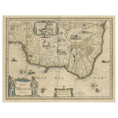
Old Color Engraving of Blaeu's first Map of Brazil, North Oriented to the Right
By Willem Blaeu
Located in Langweer, NL
, with north oriented to the right. Includes inset map of Baya de todos Santos, elaborate cartouche, 2
Category
Antique Mid-17th Century Maps
Materials
Paper
H 19.3 in W 22.84 in D 0.02 in
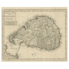
Old Map of Ceylon 'Sri Lanka' with The North Oriented to The Left, 1731
Located in Langweer, NL
Description: Antique map Ceylon titled 'Nieuwe Kaart van t Eland Ceilon'.
Old map of present
Category
Antique 1730s Maps
Materials
Paper
Antique Map of Westphalia, West Orientation
Located in Langweer, NL
Antique map titled 'Nova totius Westphaliae Descriptio'. Detailed map of Westphalia, Northern
Category
Antique Late 17th Century Maps
Materials
Paper
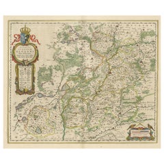
Antique Map of Silesia centered on Glogau
Located in Langweer, NL
River valley based on the Silesian cartographer, Jonas Scultetus. The map is oriented with north to the
Category
Antique Mid-17th Century Maps
Materials
Paper
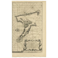
Antique Map of Anjouan Island by Valentijn, 1726
By F. Valentijn
Located in Langweer, NL
situated between Madagascar and Africa. The map is oriented with north to the left with the King's Palace
Category
Antique Early 18th Century Dutch Maps
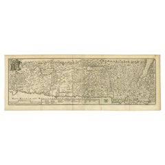
Antique Map of the Holy Land, c.1717
Located in Langweer, NL
Holy Land by J. Bonfrerius. The map is oriented with north at top left and divided into the twelve
Category
Antique 18th Century Maps
Materials
Paper
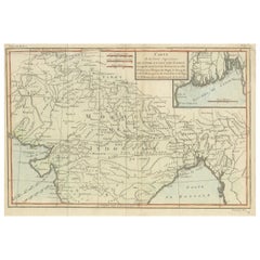
Antique Map of part of Central and Southern Asia
Located in Langweer, NL
Antique map titled 'Carte de la Partie Superieure de l'Inde en deca du Gange. Comprise entre la
Category
Antique Late 18th Century Maps
Materials
Paper
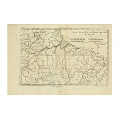
Antique Map of Northern Brazil by Bonne, c.1780
Located in Langweer, NL
oriented and practical aesthetic. With regard to the rendering of terrain Bonne maps bear many stylistic
Category
Antique 18th Century Maps
Materials
Paper
Antique Map of Northern Europe by Bonne, c.1780
Located in Langweer, NL
Antique map titled 'Le Nord de L'Europe, Contenant Le Danemark, La Norwege; La Suede et La Laponie
Category
Antique 18th Century Maps
Materials
Paper
Antique Map of Peru by van der Aa, 'circa 1720'
Located in Langweer, NL
Antique map titled 'Le Perou, Grand Pays de l Amerique Meridionale (..)'. Decorative map of Peru
Category
Antique Early 18th Century Maps
Materials
Paper
Antique Map of Italy, Corsica, Sardinia and Sicily, ca.1780
Located in Langweer, NL
Description: Antique map titled 'L'Italie.'
Map of Italy, Corsica, Sardinia and Sicily. Highly
Category
Antique 1780s Maps
Materials
Paper
Antique Map of the Spice Islands by Van Linschoten, 1598
Located in Langweer, NL
the map by the beautiful engravings of these expensive and desirable exotic products of the Orient
Category
Antique 16th Century Maps
Materials
Paper
Antique Map of Northern Europe and European Russia, ca.1780
Located in Langweer, NL
Antique map titled 'Le Nord de L'Europe, Contenant Le Danemark, La Norwege; La Suede et La Laponie
Category
Antique 1780s Maps
Materials
Paper
Antique Map of Sri Lanka with an unusual five-sided shape
Located in Langweer, NL
Antique map titled 'Ins. Ceilan quae incolis Tenarisin dicitur'. This exquisite, early map of Sri
Category
Antique Early 17th Century Maps
Materials
Paper
1616 Bertius Map of Sumatra, Singapore and the Straits of Malacca
Located in Langweer, NL
Title: "1616 Bertius Map of Sumatra and the Straits of Malacca"
Description: This is an exquisite
Category
Antique Early 17th Century Maps
Materials
Paper
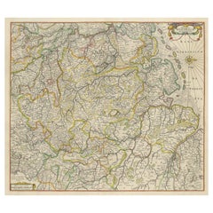
1656 Jansson Map Metz Region of France Entitled "Territorium Metense" Ric0014
Located in Norton, MA
" - Map of the historical region surrounding Metz, in Lorraine, France.
Oriented with north to the right
Category
Antique 17th Century Dutch Maps
Materials
Paper
H 18.31 in W 22.96 in D 0.4 in
Original Antique Map of Brasil, Published in the 16th Century, 1561
Located in Langweer, NL
fascinating map.
Oriented west, the map reveals some interesting topographical misconceptions and/or lack of
Category
Antique 1660s Maps
Materials
Paper
No Reserve
H 8.67 in W 11.82 in D 0 in
Antique Map of Israel Filled with Biblical Scenes, Published in 1748
Located in Langweer, NL
orients the map with north in the top right corner. The large decorative title cartouche at bottom is
Category
Antique 1740s Maps
Materials
Paper
Superb, Large Map of British India, Chinese Empire, Indochina, Malaysia, 1860
Located in Langweer, NL
Antique map titled 'Indes, colonies Anglaises.'
Large map of the East Indies, British Colonies
Category
Antique 1860s Maps
Materials
Paper
H 22.8 in W 31.07 in D 0 in
Antique Map of the Empire of China by Bonne, c.1780
By Rigobert Bonne
Located in Langweer, NL
Antique map titled 'Carte de L'Empire de la Chine.' Decorative map of the Empire of China
Category
Antique 18th Century Maps
Materials
Paper
Old Map of the Western Part of Central Europe, c.1680
Located in Langweer, NL
Antique map titled 'Carta nova accurate del Passagio et strada dalli Paesi Bassi'. Old map of the
Category
Antique 17th Century Maps
Materials
Paper
Antique Map of the Moluccas in Indonesia by Janssonius, C.1650
By Johannes Janssonius
Located in Langweer, NL
Antique map titled 'Insularum Moluccarum Nova Descriptio.' Old map of the Moluccas. The famous
Category
Antique 17th Century Maps
Materials
Paper
Orignal Hand-Colored Antique Map of Chili by W. Blaeu, 1658
By Willem Blaeu
Located in Langweer, NL
Very decorative antique map of Chili published by W. Blaeu, 1658. This map depicts Chile from
Category
Antique Mid-17th Century Maps
Materials
Paper
Free Shipping
H 21.86 in W 25.99 in D 0.02 in
Antique Map of Part of Southern Asia by Bonne, c.1780
Located in Langweer, NL
Antique map titled 'Carte de la Partie Superieure de l'Inde en deca du Gange. Comprise entre la
Category
Antique 18th Century Maps
Materials
Paper
Antique Map of Southern Brazil and Uruguay by Bonne, c.1780
Located in Langweer, NL
"Antique map titled 'Carte de la Partie Meridional du Bresil avec les Possessions Espagnoles
Category
Antique 18th Century Maps
Materials
Paper
Antique Map of Manilla Bay Philippines by P. van der Aa, 1719
Located in Langweer, NL
Rare antique map titled 'La Baie de Manille (..)'. Map of Manilla Bay, the map is oriented with
Category
Antique Early 18th Century Maps
Materials
Paper
Three Antique Maps on One Folio: Turkey, Northern Egypt, and Ancient Carthage
Located in Langweer, NL
**:
- Orientation: The map is oriented with the east at the top, which is a common practice in historical maps
Category
Antique 16th Century Maps
Materials
Paper
H 12.72 in W 19.49 in D 0 in
Antique Map of the Seine-et-Marne / Champagne Region by Janssonius, 1657
By Johannes Janssonius
Located in Langweer, NL
Antique map of France titled 'Valesium Ducatus Valois'. Oriented to the north of the Picardy region
Category
Antique 17th Century Maps
Materials
Paper
H 19.69 in W 23.63 in D 0 in
Beautiful Antique Map of the Moluccas or Spice Islands, Indonesia, ca.1650
Located in Langweer, NL
Antique map titled 'Insularum Moluccarum Nova Descriptio.'
Beautiful map of the Moluccas. The
Category
Antique 1650s Maps
Materials
Paper
H 20.87 in W 22.64 in D 0 in
Superb Antique Map of the Province of Gelderland, the Netherlands, ca.1575
Located in Langweer, NL
Antique map titled 'Gelriae, Cliviae, Finitimorumque Locorum Verissima Descriptio Christiano Schrot
Category
Antique 16th Century Maps
Materials
Paper
H 16.86 in W 21.97 in D 0 in
Antique Map of Asia, Showing Tradewinds, Silke Route Cities Etc, c.1780
Located in Langweer, NL
Antique map titled 'L'Asie.' Map of Asia. Offers considerable detail considering the size, showing
Category
Antique 18th Century Maps
Materials
Paper
Antique Map of Africa with Ocean Currents and Other Details, C.1780
Located in Langweer, NL
oriented and practical aesthetic. With regard to the rendering of terrain Bonne maps bear many stylistic
Category
Antique 18th Century Maps
Materials
Paper
Decorative Map of the French Regions of Picardy, Artois & French Flanders, c1780
Located in Langweer, NL
oriented and practical aesthetic. With regard to the rendering of terrain Bonne maps bear many stylistic
Category
Antique 1780s Maps
Materials
Paper
H 14.57 in W 19.49 in D 0 in
Detailed Antique Map of Santa Domingo, Puerto Rico, Eastern Bahamas, ca. 1780
Located in Langweer, NL
oriented and practical aesthetic. With regard to the rendering of terrain Bonne maps bear many stylistic
Category
Antique 1780s Maps
Materials
Paper
H 11.42 in W 15.12 in D 0 in
Map of Spain & Portugal Incl. the islands of Ibiza, Minorque & Majorque, 1780
Located in Langweer, NL
Antique map titled 'Les Royaumes d'Espagne et de Portugal.'
Map of Spain and Portugal. Includes
Category
Antique 1780s Maps
Materials
Paper
H 10.24 in W 15.16 in D 0 in
Antique Map of Picardy, Aroits and French Flanders by Bonne, c.1780
Located in Langweer, NL
oriented and practical aesthetic. With regard to the rendering of terrain Bonne maps bear many stylistic
Category
Antique 18th Century Maps
Materials
Paper
Original Antique Map of Martinique Island In The West Indies by Bonne, circa1780
Located in Langweer, NL
towards a more detail oriented and practical aesthetic. With regard to the rendering of terrain Bonne maps
Category
Antique 18th Century Maps
Materials
Paper
H 13.59 in W 10.04 in D 0 in
Antique Map of the Course of the Rhine River by Blaeu, circa 1640
Located in Langweer, NL
depictions of mountains and forests. Oriented with north to the right, the map is embellished with a large
Category
Antique Mid-17th Century Maps
Materials
Paper
Antique Map of Ancient Jerusalem, depicting The Temple of Solomon, c.1725
Located in Langweer, NL
Solomon and the royal palace and gardens. The map is oriented with west at top, with the Calvary outside
Category
Antique 18th Century Maps
Materials
Paper
H 19.49 in W 15.56 in D 0 in
Beautiful Original Antique Map of Antwerp, Belgium by Mapmaker Blaeu, ca.1652
Located in Langweer, NL
Description: Antique map titled 'Antverpia; Gallis Anvers. Vernacule Antwerpen.'
A very nicely
Category
Antique 1650s Maps
Materials
Paper
H 19.1 in W 24.53 in D 0 in
Copper Engraved Map of Tierra del Fuego and the Strait of Magellan, c1780
Located in Langweer, NL
Antique map titled 'Extremite Meridionale de l'Amerique.'
Copper engraved map of Tierra del
Category
Antique 1780s Maps
Materials
Paper
H 12.21 in W 18.51 in D 0 in
1837 Mitchell's "Tourist's Pocket Map of the State of Virginia" by J.H. Young
Located in Colorado Springs, CO
map includes an inset of the District of Columbia and Alexandria at upper left. The DC map is oriented
Category
Antique 1830s American Maps
Materials
Paper
H 24.25 in W 25.75 in D 1.75 in
Decorative Map of the Empire of China, Korea, Japan, Taiwan, Lucon, Macau, 1780
Located in Langweer, NL
Antique map titled 'Carte de L'Empire de la Chine.'
Decorative map of the Empire of China
Category
Antique 1780s Maps
Materials
Paper
H 14.97 in W 10.24 in D 0 in
Antique Map of Mozambique Channel with Madagascar and Inset of Cape Region, 1780
Located in Langweer, NL
towards a more detail oriented and practical aesthetic. With regard to the rendering of terrain Bonne maps
Category
Antique 18th Century Maps
Materials
Paper
H 14.97 in W 10.24 in D 0 in
Rare Antique Bird's-eye View Map of The Island of Malta, 1729
Located in Langweer, NL
map is oriented with north in the lower right corner. Saint Paul stayed in Malta for three months and
Category
Antique 18th Century Maps
Materials
Paper
Antique Map of South American, The West Indies & Most of Africa, Ca.1775
Located in Langweer, NL
oriented and practical aesthetic. With regard to the rendering of terrain Bonne maps bear many stylistic
Category
Antique 1770s Maps
Materials
Paper
H 15.04 in W 19.77 in D 0 in
Old Map of the Great Lakes and Upper Mississippi Valley, Northern America, c1780
Located in Langweer, NL
oriented and practical aesthetic. With regard to the rendering of terrain Bonne maps bear many stylistic
Category
Antique 1780s Maps
Materials
Paper
H 10.32 in W 14.85 in D 0 in
17th Century Hand-Colored Map of Valencia and Murcia, Spain by Mercator/Hondius
By Gerard Mercator
Located in Alamo, CA
Valencia and Murcia the Mediterranean coast of eastern Spain. The map is oriented with the east to the
Category
Antique Mid-17th Century Dutch Maps
Materials
Paper
H 12 in W 16 in D 0.13 in
Authentic Map of the Coast from Cape Formosa to the Dony River, Africa, 1732
Located in Langweer, NL
of shoals and oriented by a compass rose and rhumb lines. This map originates from volume 5 of 'A
Category
Antique 1730s Maps
Materials
Paper
No Reserve
H 12.76 in W 17.25 in D 0 in
Antique Map of Mozambique and Cape of Good Hope with Kingdom Monomotapa, 1780
Located in Langweer, NL
Antique map titled 'Carte Du Canal De Mozambique.' The main map, on the right, covers from the Cape
Category
Antique 18th Century Maps
Materials
Paper
H 14.69 in W 10.44 in D 0 in
Old Map of the Moluccas, Known as the Famous Spice Islands, Indonesia, ca.1730
Located in Langweer, NL
Antique map titled 'Insularum Moluccarum Nova Descriptio.'
Old map of the Moluccas. The famous
Category
Antique 1730s Maps
Materials
Paper
H 17.33 in W 23 in D 0 in
Antique Map of Guadeloupe with Les Saintes, Grand Bourg and La Désirade, c.1780
Located in Langweer, NL
oriented and practical aesthetic. With regard to the rendering of terrain Bonne maps bear many stylistic
Category
Antique 18th Century Maps
Materials
Paper
Free Shipping
H 10.24 in W 14.97 in D 0 in
Map of the Western Coast of South America from Ecuador into Chili, ca.1780
Located in Langweer, NL
oriented and practical aesthetic. With regard to the rendering of terrain Bonne maps bear many stylistic
Category
Antique 1780s Maps
Materials
Paper
H 15.16 in W 10.24 in D 0 in
Original Rare Map of the Holy Land Showing the Twelve Tribes of Israel's, 1782
Located in Langweer, NL
Antique map titled 'Carte des Douze Tribus D'Israel (..).'
Map of the Holy Land showing the
Category
Antique 1780s Maps
Materials
Paper
H 14.77 in W 21.58 in D 0 in
Print of Maps of Islands of the South Pacific, Incl. Pitcairn & Dusky Bay, 1788
Located in Langweer, NL
Antique map titled 'Esquisse de la Bay Dusky, Dans La Nouvelle Zeelande / I. Pitcairn / Isles de
Category
Antique 1780s Maps
Materials
Paper
No Reserve
H 12.21 in W 18.31 in D 0 in
Map Holy Land La Terre Sainte Engraved van Loon Published N de Fer 1703 French
Located in BUNGAY, SUFFOLK
Majeste Catoliq et de Monseigneur le Dauphin. Avec Privil du Roi 1703
Detailed map of the Holy Land
Category
Antique Early 1700s French Louis XIV Maps
Materials
Paper
H 11.03 in W 13.78 in D 0.4 in
Decorative Rare Map of the French Regions of Isle De France and Orleans, ca.1780
Located in Langweer, NL
Antique map titled 'Carte du Gouvernment de L'Isle de France et de edlui de L'Orleanois
Category
Antique 1780s Maps
Materials
Paper
H 19.3 in W 14.57 in D 0 in
Antique Detailed Map of Papua New Guinea and the Regions to the West, ca.1780
Located in Langweer, NL
Antique map titled 'Carte des Decouvertes du Capite. Carteret dans La Nlle. Bretagne avec une parte
Category
Antique 1780s Maps
Materials
Paper
H 11.46 in W 15.24 in D 0 in
Old Map of the Kingdom of Tonga, Also Known as the Friendly Islands, ca.1780
Located in Langweer, NL
Antique print, titled: 'Carte des Isles des Amis.'
Map of the Kingdom of Tonga, also known as
Category
Antique 1780s Maps
Materials
Paper
H 11.42 in W 15.24 in D 0 in
Original Hand-Coloured Nautical Chart of West-Africa, c.1680
Located in Langweer, NL
. Blanco tot C. Verde (...). Amsterdam, Johannus van Keulen, c. 1680.
Large folio coloured map in passe
Category
Antique 17th Century Maps
Materials
Paper
- 1
Get Updated with New Arrivals
Save "Orient Map", and we’ll notify you when there are new listings in this category.
Orient Map For Sale on 1stDibs
Choose from an assortment of styles, material and more with respect to the orient map you’re looking for at 1stDibs. Each orient map for sale was constructed with extraordinary care, often using paper, brass and cotton. There are 70 variations of the antique or vintage orient map you’re looking for, while we also have 15 modern editions of this piece to choose from as well. Your living room may not be complete without a orient map — find older editions for sale from the 18th Century and newer versions made as recently as the 21st Century. Gerard Mercator, Johannes Janssonius and F. Valentijn each produced at least one beautiful orient map that is worth considering.
How Much is a Orient Map?
A orient map can differ in price owing to various characteristics — the average selling price 1stDibs is $1,448, while the lowest priced sells for $130 and the highest can go for as much as $67,500.
More Ways To Browse
Sri Lankan Map
Lanka Map
Sri Lanka Maps
Philippines Map
Vintage Pan Am Poster
Vintage French Cycling Poster
Vintage French Cycling Posters
Grain Silo Used
Bordeaux Map
Galleon Painting
Map Of Vietnam
Korea Antique Map
Barge Board
Map Of Peru
South Pacific Map
Antique Maps Of Sicily
Antique Canadian Maps
Colleen Browning
