Items Similar to Old Color Engraving of Blaeu's first Map of Brazil, North Oriented to the Right


Want more images or videos?
Request additional images or videos from the seller
1 of 6
Old Color Engraving of Blaeu's first Map of Brazil, North Oriented to the Right
About the Item
Antique map titled 'Novus Brasiliae Typus'. Fine old color example of Blaeu's first map of Brazil, with north oriented to the right. Includes inset map of Baya de todos Santos, elaborate cartouche, 2 compass roses and richly embellished vignettes of native Brazilian life and animals.
The interior of the map includes vignettes of indigenous animals and native scenes, including cannibalism. Inset within a decorative border is a small map of "Baya de todos Sanctos". In the sea are monsters, a galleon and two compass roses. The large title cartouche features a male and female Brazilian, both of whom are shown naked.
Willem Janszoon Blaeu (1571-1638) was a prominent Dutch geographer and publisher. Born the son of a herring merchant, Blaeu chose not fish but mathematics and astronomy for his focus. He studied with the famous Danish astronomer Tycho Brahe, with whom he honed his instrument and globe making skills. Blaeu set up shop in Amsterdam, where he sold instruments and globes, published maps, and edited the works of intellectuals like Descartes and Hugo Grotius. In 1635, he released his atlas, Theatrum Orbis Terrarum, sive, Atlas novus.
- Creator:Willem Blaeu (Artist)
- Dimensions:Height: 19.3 in (49 cm)Width: 22.84 in (58 cm)Depth: 0.02 in (0.5 mm)
- Materials and Techniques:Paper,Engraved
- Period:Mid-17th Century
- Date of Manufacture:circa 1640
- Condition:Wear consistent with age and use. Original/contemporary hand coloring. Shows wear and soiling. Original folding line, Latin text on verso. Please study image carefully.
- Seller Location:Langweer, NL
- Reference Number:
About the Seller
5.0
Platinum Seller
These expertly vetted sellers are 1stDibs' most experienced sellers and are rated highest by our customers.
Established in 2009
1stDibs seller since 2017
1,948 sales on 1stDibs
Typical response time: <1 hour
- ShippingRetrieving quote...Ships From: Langweer, Netherlands
- Return PolicyA return for this item may be initiated within 14 days of delivery.
More From This SellerView All
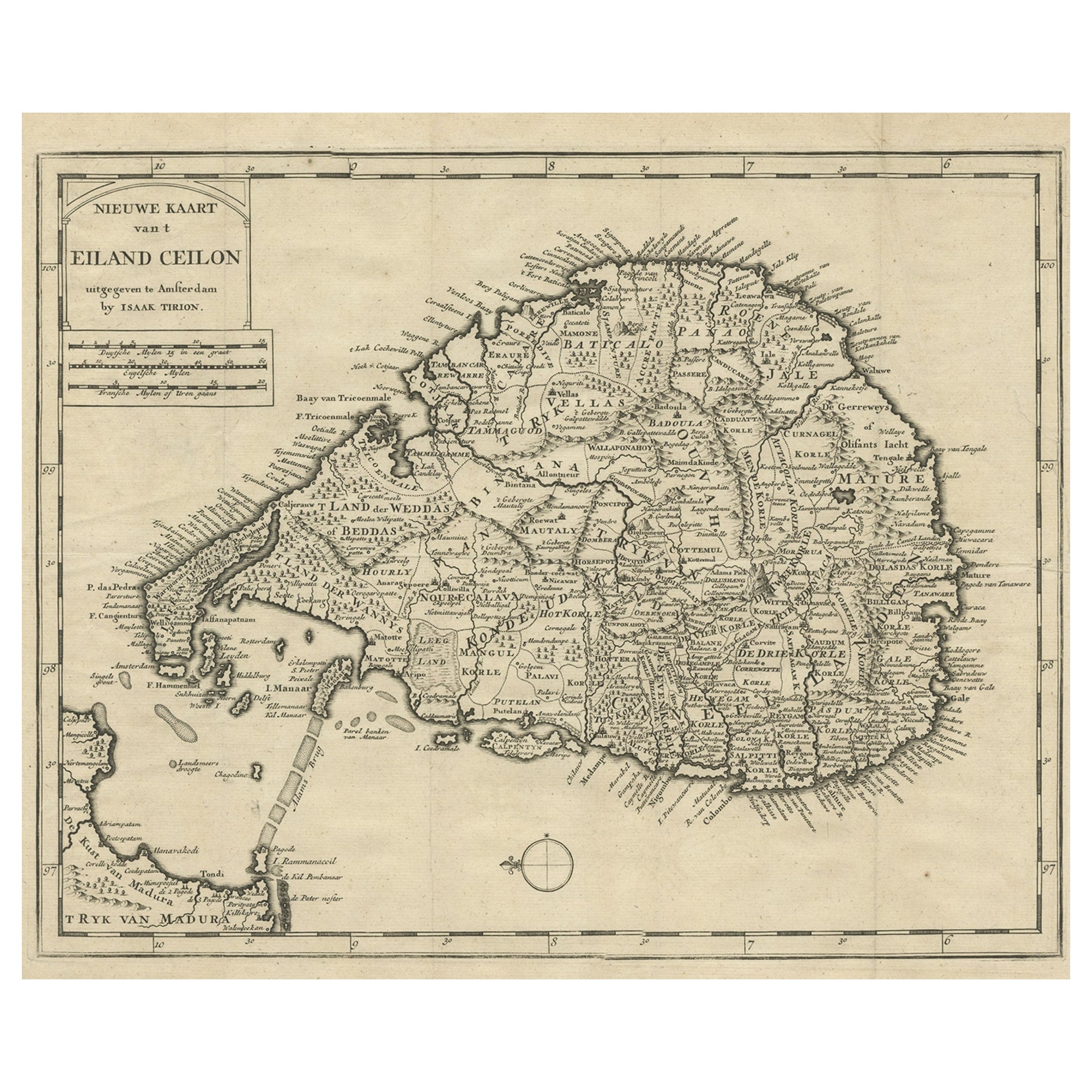
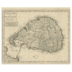
- Old Map of Ceylon 'Sri Lanka' with The North Oriented to The Left, 1731Located in Langweer, NLDescription: Antique map Ceylon titled 'Nieuwe Kaart van t Eland Ceilon'. Old map of present-day Sri Lanka with north oriented to the left. The ...Category
Antique 1730s Maps
MaterialsPaper
- Antique Map of Prussia by Blaeu, circa 1635By Willem BlaeuLocated in Langweer, NLAntique map titled 'Prussiae Nova Tabula'. Rare early edition of Blaeu's map of Prussia, embellished with a gorgeous large format cartouche, compass ros...Category
Antique Mid-17th Century Maps
MaterialsPaper
- Antique Map of the Region of Le Mans 'France' by Blaeu, circa 1640By Willem BlaeuLocated in Langweer, NLAntique map titled 'Cenomanorum Galliae regionis typus vulgo le Mans'. This lovely map of the historical province of Maine is centered on the famous city of Le Mans. This region witn...Category
Antique Mid-17th Century Maps
MaterialsPaper
- Antique Map of the Spice Islands 'Moluccas', Indonesia by W. Blaeu, circa 1640By Willem BlaeuLocated in Langweer, NLAntique map titled 'Moluccae Insulae Celeberrimae'. Highly decorative antique map of the Spice Islands (Moluccas) published by W. Blaeu (circa 1640). This map features a large inset ...Category
Antique Mid-17th Century Maps
MaterialsPaper
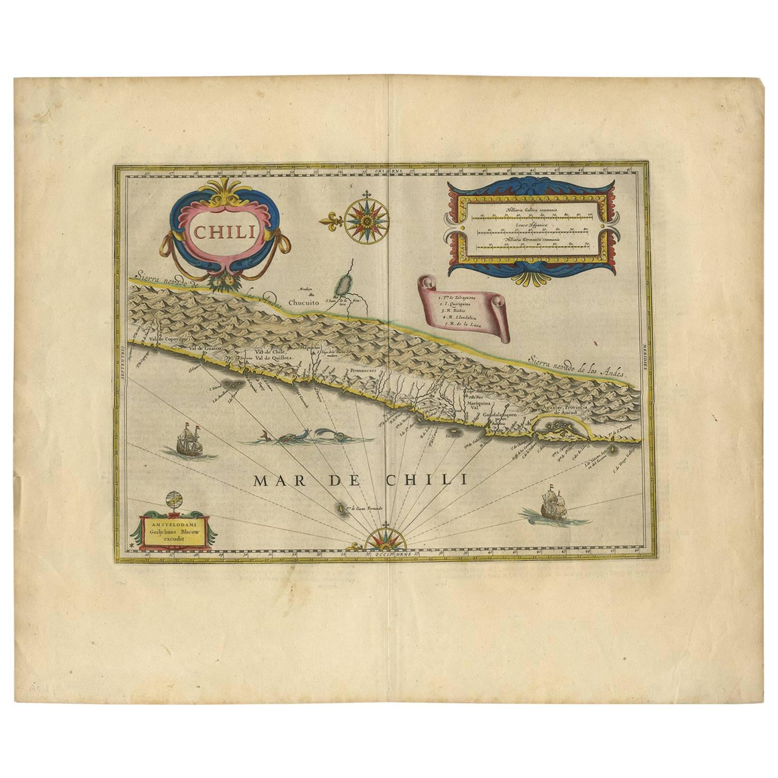
- Orignal Hand-Colored Antique Map of Chili by W. Blaeu, 1658By Willem BlaeuLocated in Langweer, NLVery decorative antique map of Chili published by W. Blaeu, 1658. This map depicts Chile from Copiapo southward to the island of Chiloé with ships and sea monsters adorning the sea. ...Category
Antique Mid-17th Century Maps
MaterialsPaper
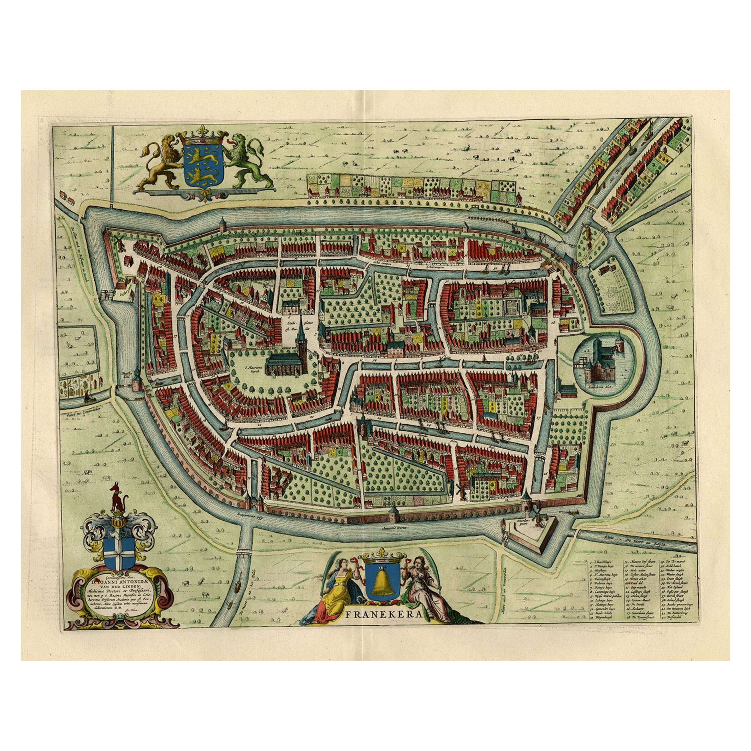
- Old Map by Blaeu of the City of Franeker, Friesland, The Netherlands, 1649Located in Langweer, NLAntique map titled 'Franekera'. Old map of the city of Franeker, Friesland. Also shows two cartouches, coats of arms and legend. This map originates from a Latin edition of the t...Category
Antique 1640s Maps
MaterialsPaper


You May Also Like
- New Map of North America from the Latest Discoveries, 1763Located in Philadelphia, PAA fine antique 18th century map of the North American seaboard. Entitled "A New Map of North America from the Latest Discoveries 1763". By the Cartographer/Engraver - John Spil...Category
Antique Mid-18th Century English Georgian Maps
MaterialsPaper
- Large Antique 1859 Map of North AmericaLocated in Sag Harbor, NYThis Map was made by Augustus Mitchell in 1859 It is in amazing condition for being 163 years old. This price is for the rolled up easy to ship version of this piece. I will be Frami...Category
Antique Mid-19th Century American Maps
MaterialsCanvas, Paper

- Old Nautical Map of CorsicaLocated in Alessandria, PiemonteST/556/1 - Old map of Corsica isle, surveyed by Captain Hell, of the French Royal Navy in 1824, engraved and published on 1874, with additions and corre...Category
Antique Early 19th Century English Other Prints
MaterialsPaper
- Old Horizontal Map of EnglandBy TassoLocated in Alessandria, PiemonteST/520 - Old rare Italian map of England, dated 1826-1827 - by Girolamo Tasso, editor in Venise, for the atlas of M.r Le-Sage.Category
Antique Early 19th Century Italian Other Prints
MaterialsPaper
- Map of the Republic of GenoaLocated in New York, NYFramed antique hand-coloured map of the Republic of Genoa including the duchies of Mantua, Modena, and Parma. Europe, late 18th century. Dimension: 25...Category
Antique Late 18th Century European Maps
- Map "Estuary- Mouth of the Thames"Located in Alessandria, PiemonteST/426 - Antique French Map of the estuary of the Thames, map dated 1769 - "Mape of the entrance of the Thames. Designed by filing of Navy cards fo...Category
Antique Mid-18th Century French Other Prints
MaterialsPaper


